Planetary rover update: January 22, 2019

Summary: Curiosity begins journey off of Vera Rubin Ridge. Opportunity’s silence is now more than seven months long, with new dust storms arriving. Yutu-2 begins roving the Moon’s far side.

Before providing today’s update, I have decided to provide links to all the updates that have taken place since I provided a full list in my February 8, 2018 update. As I noted then, this allows my new readers to catch up and have a better understanding of where each rover is, where each is heading, and what fascinating things they have seen in the past few years.

These updates began when I decided to figure out the overall context of Curiosity’s travels, which resulted in my March 2016 post, Pinpointing Curiosity’s location in Gale Crater. Then, when Curiosity started to travel through the fascinating and rough Murray Buttes terrain in the summer of 2016, I stated to post regular updates. To understand the press releases from NASA on the rover’s discoveries it is really necessary to understand the larger picture, which is what these updates provide. Soon, I added Opportunity to the updates, with the larger context of its recent travels along the rim of Endeavour Crater explained in my May 15, 2017 rover update.

Now an update of what has happened since November!
» Read more
1 comment

Gale Crater dunes: dry and volcanic in origin

Using data from orbit and from the rover Curiosity, scientists have determined that the material in the dunes in Gale Crater that Curiosity has visited are very dry and volcanic in origin.

This dryness is in contrast with the underlying ground, which shows evidence of water. The data also suggests that the material either came from multiple volcanic sources producing different compositions, or some of the sand was somehow changed at a later time.

In other words, the sand in the dunes came from elsewhere.

0 comments

Curiosity’s future travels

MRO image of Curiosity's future travels

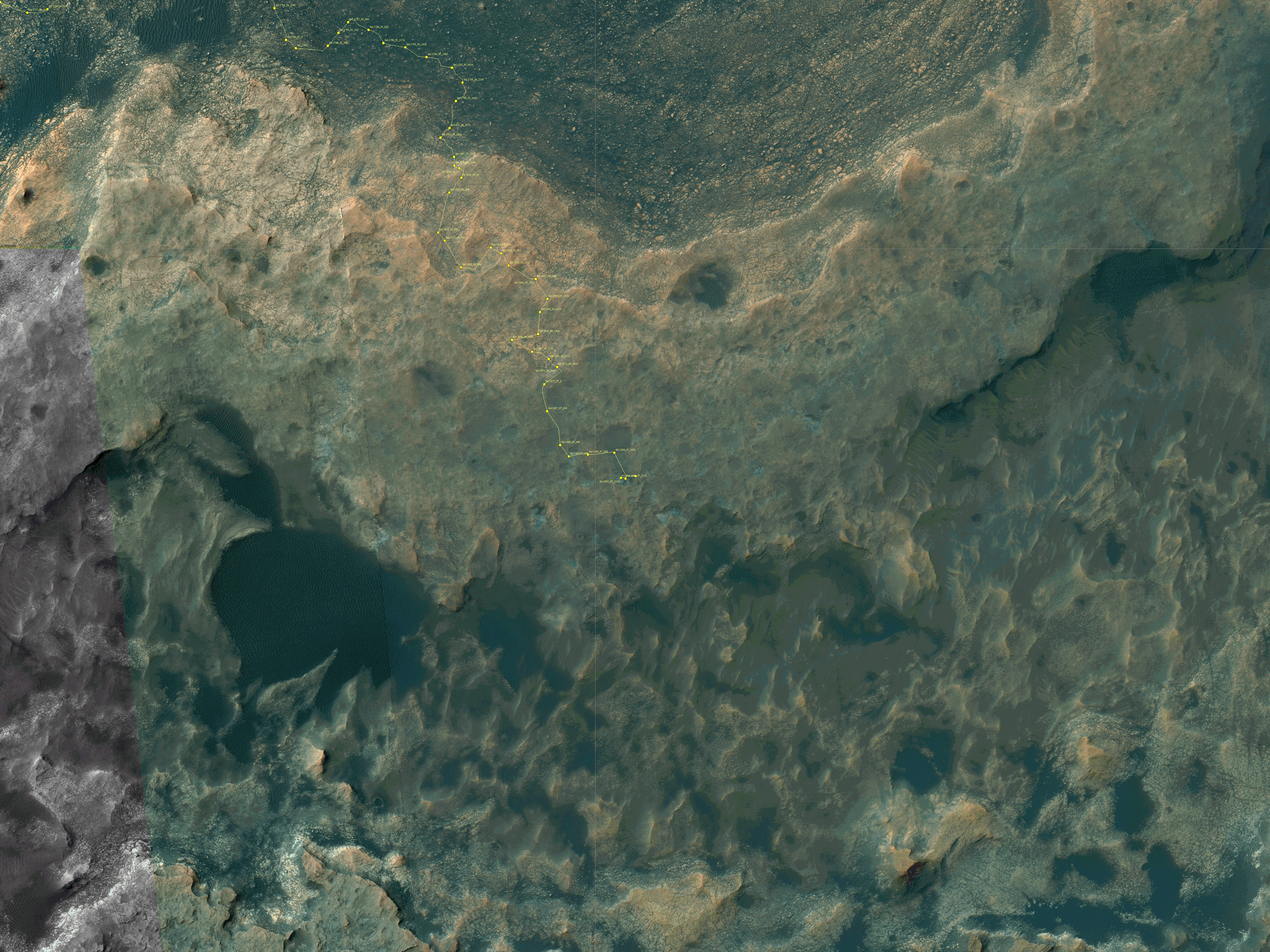
In the December release of images from the high resolution camera on Mars Reconnaissance Orbiter (MRO), there was one image entitled “Monitor Region Near Curiosity Rover.” To the right is a reduced, cropped, and rotated section of that image, annotated by me to show Curiosity’s future planned route (indicated by the yellow line). If you click on the image you can see the untouched full resolution version.

Curiosity’s journey has not yet brought it onto the terrain shown in this image. (For the overall context of Curiosity’s travels, see Pinpointing Curiosity’s location in Gale Crater.) The rover is right now just off the left edge of the photograph, on the white ridge dubbed Vera Rubin Ridge visible in the uppermost left. This week it completed the last planned drill sampling on that ridge, and it will soon descend off the ridge and begin heading along the yellow route up the mountain. The white dots along its future route are the locations of recurring slope lines, believed to be seasonal seeps of brine coming from below and causing gentle landslides that darken the surface. As you can see, they hope to get very close to the first seep, and will observe the second from across the canyon from a distance of about 1,200 feet.

The peak of Mount Sharp is quite a distance to the south, far beyond the bottom of the photograph. Even in these proposed travels the rover will remain in the mountain’s lowest foothills, though the terrain will be getting considerably more dramatic.

Below is a full resolution section of the image showing the spectacular canyon to the south of that second seep. This is where Curiosity will be going, a deep canyon about 1,500 feet across and probably as deep, its floor a smooth series of curved layers, reminiscent of The Wave in northern Arizona. The canyon appears to show evidence of water flow down its slopes, but that is unproven.
» Read more

0 comments

Sunset/sunrise on Mars

The sun on Mars's horizon

Cool image time! The image on the right, reduced to post here, was taken by Curiosity during a photo campaign this week to monitor Mars’s atmosphere. It looks out to the horizon at the Sun. I think the view is eastward, at Mount Sharp, as the Sun rises, but I am not sure. It might be looking west across the crater rim at sunset.

If you click on the image you can see it at full resolution. The haziness in the atmosphere might be left over from this summer’s global dust storm, but probably not, as I have read numerous reports in connection with Opportunity saying the storm is completely over and the atmosphere has now cleared. More likely it is from the windy conditions that are simply present these days at Gale Crater.

Regardless, it is quite cool because it illustrates how far we have come since the first planetary missions half a century ago. We can now routinely watch a sunset on Mars.

0 comments

Mars rover update: July 17, 2018

Summary: Curiosity climbs back up onto Vera Rubin Ridge to attempt its second drillhole since drill recovery, this time at a spot on the ridge with the highest orbital signature for hematite. Opportunity remains silent, shut down due to the global dust storm.

For a list of past updates beginning in July 2016, see my February 8, 2018 update.

Curiosity

Curiosity's travels on and off Vera Rubin Ridge

For the overall context of Curiosity’s travels, see Pinpointing Curiosity’s location in Gale Crater.

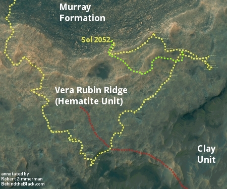
In the almost two months since my May 23, 2018 update, a lot has happened, much of which I covered in daily updates. Curiosity found a good drill spot to once again test the new drilling techniques designed by engineers to bypass its stuck drill feed mechanism, and was successful in getting its first drill sample in about a year and a half. The rover then returned uphill, returning to a spot on Vera Rubin Ridge that, according to satellite data, has the highest signature for hematite on the entire ridge. The light green dotted line in the traverse map to the right shows the route Curiosity has taken back up onto Vera Rubin Ridge. The red dotted line shows the original planned route off the ridge and up Mount Sharp.
» Read more

3 comments

Curiosity finds methane fluctuates seasonally in Gale Crater

Seasonal methane on Mars

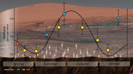
In its second significant science release yesterday (the first relating to the discovery of organics), the Curiosity science team revealed that they have found over almost three Martian years the amount of methane in the atmosphere appears to fluctuate seasonally. The graph on the right illustrates this change.

[The data] show methane rises from just above 0.2ppb in the northern hemisphere winter to a fraction over 0.6ppb in the summer. The team’s best explanation is that methane is seeping up from underground, perhaps from stored ices, and is then being released when surface soils are warmed.

The team cannot positively identify the origin of the methane, but the researchers think they can close down one particular mechanism for its production. This involves sunlight breaking up carbon-rich (organic) molecules that have fallen to the planet’s surface in meteorites.

The variation in ultraviolet light over the course of the seasons is not big enough to drive the scale of the change seen in the methane concentration, says Dr Webster. “We know the intensity of the Sun and this mechanism should produce only a 20% increase in methane during the summer, but we’re seeing it increase by a factor of three,” he explained.

The change could be caused by either a chemical or a biological process. At this time there is no way to determine which.

18 comments

Mars rover update: May 23, 2018

Summary: Curiosity drives down off of Vera Rubin Ridge to do drilling in lower Murray Formation geology unit, while Opportunity continues to puzzle over the formation process that created Perseverance Valley in the rim of Endeavour Crater.

For a list of past updates beginning in July 2016, see my February 8, 2018 update.

Curiosity

Curiosity's travels on and off Vera Rubin Ridge

For the overall context of Curiosity’s travels, see Pinpointing Curiosity’s location in Gale Crater.

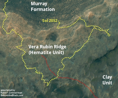
Since my April 27, 2018 update, Curiosity has continued its downward trek off of Vera Rubin Ridge back in the direction from which it came. The annotated traverse map to the right, cropped and taken from the rover’s most recent full traverse map, shows the rover’s recent circuitous route with the yellow dotted line. The red dotted line shows the originally planned route off of Vera Rubin Ridge, which they have presently bypassed.

It appears they have had several reasons for returning to the Murray Formation below the Hematite Unit on Vera Rubin Ridge. First, it appears they wanted to get more data about the geological layers just below the Hematite Unit, including the layer immediately below, dubbed the Blunts Point member.

While this is certainly their main goal, I also suspect that they wanted to find a good and relatively easy drilling candidate to test their new drill technique. The last two times they tested this new technique, which bypasses the drill’s stuck feed mechanism by having the robot arm itself push the drill bit against the rock, the drilling did not succeed. It appeared the force applied by the robot arm to push the drill into the rock was not sufficient. The rock was too hard.

In these first attempts, however, they only used the drill’s rotation to drill, thus reducing the stress on the robot arm. The rotation however was insufficient. Thus, they decided with the next drill attempt to add the drill’s “percussion” capability, where it would not only rotate but also repeatedly pound up and down, the way a standard hammer drill works on Earth.

I suspect that they are proceeding carefully with this because this new technique places stress the operation of the robot arm, something they absolutely do not want to lose. By leaving Vera Rubin Ridge they return to the more delicate and softer materials already explored in the Murray Formation. This is very clear in the photo below, cropped from the original to post here, showing the boulder they have chosen to drill into, dubbed “Duluth,” with the successful drill hole to the right.
» Read more

0 comments

Mars Odyssey looks down at Curiosity

Gale Crater

The Mars Odyssey team today released an image the spacecraft took of Gale Crater on January 16, 2018. This image, reduced in resolution, is posted on the right and captures the entire region that the rover Curiosity has been traversing for the past six years. If you click on the image you can view the full resolution original.

I have placed Curiosity’s full route since its landing on this image so that we can see where the rover has been. The actual peak of Mount Sharp is a considerable distance to the south and is not visible in this image. (For the full context of the crater and Curiosity’s travels see my March 2016 post, Pinpointing Curiosity’s location in Gale Crater)

The river-like flow feature cutting through the north rim is called Peace Vallis. Scientists think this was formed by water flowing into the crater when the climate of Mars was wetter and there was a lake inside the crater floor.

You can get another perspective of this same view by looking at the panorama looking north that Curiosity took once it climbed up onto Vera Rubin Ridge.

I have said this before, but this Mars Odyssey image once again illustrates how little of Mars we have so far seen. Curiosity has barely begun its climb into the foothills of Mount Sharp. The mile-high mountains that form the rim of Gale Crater are far away, and will not be walked for probably generations. I do not expect any space probe or explorer to enter Peace Vallis for at least a hundred years, since there are so many other places on Mars to visit and Gale Crater has already gotten its first reconnaissance by Curiosity.

The image also gives as a view of Curiosity’s future travels. Based on this October 3, 2016 press release, Curiosity will eventually head into the mouth of the large canyon directly to the south of its present position. Whether the mission will continue up this canyon wash, using it as the route up Mount Sharp, will depend on many things, including the roughness of the terrain in that canyon and the simple question of whether the rover will be able to operate that long.

If it does, the views then from inside that canyon should be quite breathtaking.

6 comments

Mars rover update: April 27, 2018

Summary: Curiosity’s exploration of Vera Rubin Ridge is extended, while an attempt by Opportunity to climb back up Perseverance Valley to reach an interesting rock outcrop fails.

For a list of past updates beginning in July 2016, see my February 8, 2018 update.

Curiosity

Curiosity's traverse map, Sol 2030

For the overall context of Curiosity’s travels, see Pinpointing Curiosity’s location in Gale Crater.

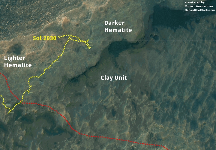
Since my March 21, 2018 update, it has become apparent that the Curiosity science team has decided to extend the rover’s research on Vera Rubin Ridge far beyond their original plans. They have continued their travels to the northeast well past the original nominal route off the ridge, as indicated by the dotted red line on the traverse map above. Along the way they stopped to inspect a wide variety of geology, and have now moved to the north and have actually begun descending off the ridge, but in a direction that takes the rover away from Mount Sharp and its original route. As noted in their April 25 update,
» Read more

1 comment

Mars rover update: March 21, 2018

Summary: Curiosity continues its exploration of Vera Rubin Ridge, including several drilling attempts. Opportunity is halfway down Perseverance Valley.

For a complete list of all past updates going back to July 2016, see my February 8, 2018 update.

Curiosity

Curiosity's traverse map, Sol 1993

For the overall context of Curiosity’s travels, see Pinpointing Curiosity’s location in Gale Crater.

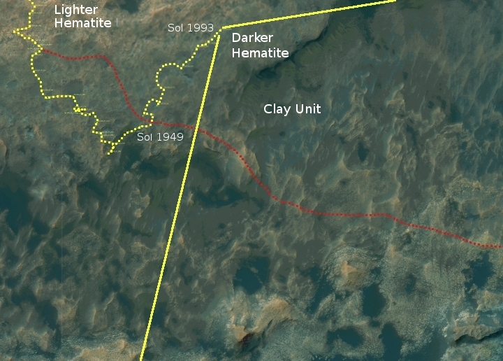
Since my February 8, 2018 update, the Curiosity science team has apparently been loath to leave Vera Rubin Ridge. They had begun the trek to the northeast that would take them towards the exit ridge heading to the southeast, as indicated by the dotted red line on the traverse map above, but then continued past that planned route to continue to the northeast. Along the way they attempted to drill twice using an improvised approach that they hoped would bypass the drill’s stuck feed mechanism, without apparent success.

The panorama below is looking to the west and south, as indicated by the yellow lines in the image above.
» Read more

4 comments

Curiosity science team to attempt first drilling in a year

After a year of tests and engineering rethinking, the Curiosity science team has decided to attempt drilling its first hole in more than a year.

From yesterday’s Curiosity mission update:

Because there is only so much data volume and rover power to go around, performing drill activities must temporarily come at the expense of scientific investigations (although you’d be pressed to find a disappointed science team member this week, as the drilling campaign will bring loads of new scientific data!). As a result, with the exception of some environmental observations by the Rover Environmental Monitoring Station (REMS) instrument, today’s plan does not have any targeted scientific observations within it. Today will instead be dedicated to drill preload activities and imaging for engineering and rover planning purposes in preparation for a full test of the revised drilling operations.

The problem with the drill has been its feed mechanism, the equipment that moves the drill downward into the hole. As designed the robot arm would get planted on the surface to provide stability for the drill, which as it drilled would be pushed downward that that feed mechanism. Last year they found something had clogged that mechanism so that it would not retract properly.

From what I understand, what they have tested and have decided to try instead is to place the drill against the surface in an extended position, and use the arm itself to push the bit downward. The concern is whether the arm can hold the drill steady. They have done some tests and think it can. We shall soon find out.

1 comment

Mars rover update: February 8, 2018

Summary: Curiosity remains on Vera Rubin Ridge, though it has begun moving toward the point where it will move down off the ridge. Opportunity remains in Perseverance Valley, though it has finally taken the north fork down.

Before providing today’s update, I have decided it is time to provide links to all previous updates, in chronological order. This will allow my new readers to catch up and have a better understanding of where each rover is, where each is heading, and what fascinating things they have seen in the past year and a half.

These updates began when I decided to figure out the overall context of Curiosity’s travels, which resulted in my March 2016 post, Pinpointing Curiosity’s location in Gale Crater. Then, when Curiosity started to travel through the fascinating and rough Murray Buttes terrain in the summer of 2016, I stated to post regular updates. To understand the press releases from NASA on the rover’s discoveries it is really necessary to understand the larger picture, which is what these updates provide. Soon, I added Opportunity to the updates, with the larger context of its recent travels along the rim of Endeavour Crater explained in my May 15, 2017 rover update.

Now to talk about the most recent news from both rovers!
» Read more

1 comment

Curiosity takes a panorama that shows its entire journey so far

Cool image time! The Curiosity science team has released a panorama taken in October 2017 that looks north across the floor of Gale Crater and shows the rover’s entire journey since it landed in 2012.

Rather than post the image here, I have posted below the fold a video produced by the science team that pans across the entire panorama, and then shows where Curiosity has traveled in that panorama. Look close, and you will realize how truly little of Mars we have so far explored.
» Read more

1 comment

Mars rover update: January 16, 2018

Summary: Both rovers have moved little in the past month, Opportunity because it is in a good science location and because it must save energy during the winter and Curiosity because it is in a geological location so good the scientists appear to almost be going ga-ga over it.

Curiosity

null

For the overall context of Curiosity’s travels, see Pinpointing Curiosity’s location in Gale Crater.

In the month since my December 18 update, Curiosity has continued to head south rather than east as originally planned (as indicated by the dotted yellow line in the traverse map to the right). Moreover, the rover has not moved very much, because the science team has decided that there is just too much significant geology in this area on Vera Rubin Ridge, also part of a geological unit they have dubbed the Hematite Unit.

Right now the rover is located at an area they call “Region e,” one of the three patches I have also indicated on the image to the right. From the second update below:

This location is a slight depression with exposed fractured bedrock that appears more “blue” from orbit than the surrounding region. In addition, the orbital evidence and observations from the ground suggest that this location is similar to “Region 10” that we visited just last week, which was shown to have some pretty spectacular small-scale features that were of particular interest to many on the science team. As a result, the team was very excited to reach “Region e” and begin our scientific investigation!

The last few updates on the Curiosity mission update page indicate the excitement the geologists have for this site:
» Read more

3 comments

Curiosity images small tubelike rock features on Vera Rubin Ridge

tubes on Mars

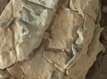
During Curiosity’s extended science observations in the past month on Vera Rubin Ridge the rover has found a number of rocks with strange tubelike features that remind some scientists of fossils. The image on the right, taken by the rover’s Mars Hand Lens Imager (MAHLI) and cropped and reduced to post here, shows some of these weird tubes.

The origin of these odd features — geological or biological processes — is in TBD limbo at the moment. Regarding trace fossils on Mars, “we don’t rule it out,” Vasavada said, “but we certainly won’t jump to that as our first interpretation.”

Close-up looks at these features show them to be angular in multiple dimensions. That could mean that they are related to crystals in the rock, perhaps “crystal molds” that are also found here on Earth, Vasavada added. Crystals in rock that are dissolved away leave crystal molds, he said.

Still, that’s just one of a few possibilities, Vasavada explained. “If we see more of them … then we begin to say that this is an important process that’s going on at Vera Rubin Ridge,” he said.

The article outlines a number of other possible explanations, including fossil remains. None are convincing at this time, based on the limited data. Nor does Curiosity have the equipment to clarify things much.

7 comments

Mars rover update: December 18, 2017

Summary: The scientists and engineers of both Curiosity and Opportunity have route decisions to make.

Curiosity

null

For the overall context of Curiosity’s travels, see Pinpointing Curiosity’s location in Gale Crater.

Since my November 16 update, Curiosity’s travels crossing Vera Rubin Ridge, a geological bedding plain dubbed the Hematite Unit, has continued apace. They however have not been following the route that had been planned beforehand, as shown by the yellow dotted line on the right. Instead, they have headed south, along the red dotted line. For the past week or so they have been doing a variety of research tasks in the same area, analyzing samples taken months before, studying sand deposits, and taking many images of some interesting rock layers.

I also suspect that the lack of movement in the past week is partly because they need to make some route-finding decisions. The planned yellow route shown above appears to be somewhat rough in the full resolution orbital image. While I suspect they will still head in that direction, I also think they are doing some very careful analysis of this route and beyond, to make sure they will not end up in a cul de sac where the rover will not be able to continue its climb of Mount Sharp.

Opportunity

For the context of Opportunity’s recent travels along the rim of Endeavour Crater, see my May 15, 2017 rover update.
» Read more

3 comments

Mars rover update: November 16, 2017

Summary: Curiosity does drill tests, crosses Vera Rubin Ridge. Opportunity finds evidence of either ice or wind scouring on rocks in Perseverance Valley.

Curiosity

For the overall context of Curiosity’s travels, see Pinpointing Curiosity’s location in Gale Crater.

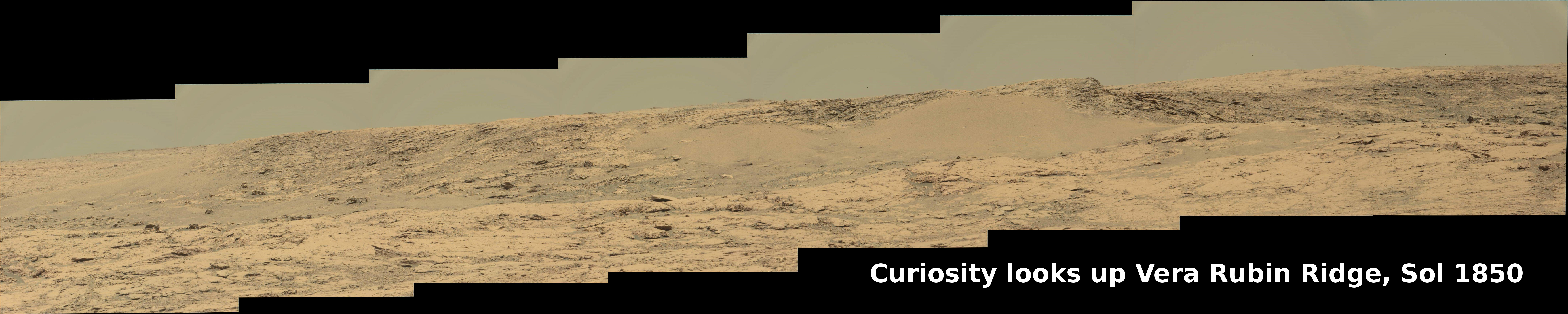
Curiosity looks up Vera Rubin Ridge, Sol 1850

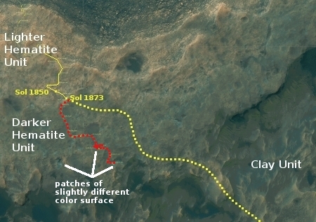
Since my last update on September 6, Curiosity has continued its travels up and across Vera Rubin Ridge, a geological bedding plain dubbed the Hematite Unit. The panorama above, created by reader Phil Veerkamp, shows the view looking up the ridge slope. If you click on it you can see the full resolution image, with lots of interesting geological details.

The panorama below, also created by Veerkamp, shows the view on Sol 1866, two weeks later, as the slope begins to flatten out and the distant foothills of Mount Sharp become visible. (If you click on the image you can see a very slightly reduced version of the full resolution panorama.) This image also shows the next change in geology. From orbit the Hematite Unit darkens suddenly at its higher altitudes, and Curiosity at this point was approaching that transition. The rover is now, on Sol 1876, sitting on that boundary, where they will spend a few days making observations before moving on.

Curiosity on the Hematite Unit, Sol 1866

null

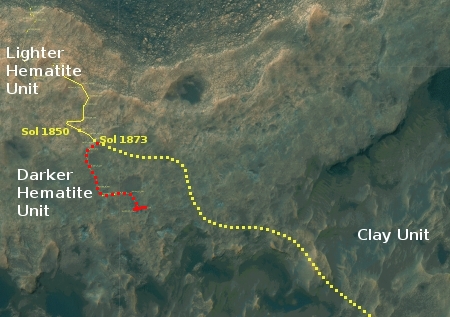
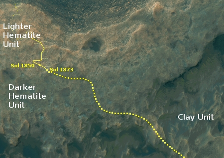
The image on the right shows Curiosity’s approximate position, about halfway across the Hematite Unit and with the rover’s approximate future route indicated, as shown in this October 3, 2016 press release.

In the two months since my last rover update the Curiosity engineering team has spent a lot of time imaging and studying the Hematite Unit. They have also spent a considerable amount of time doing new tests on the rover’s drill in an effort to get around its stuck feed mechanism in order to drill again. Only yesterday they took another series of close-up images of the drill in this continuing effort.

As indicated by the October 3 2016 press release, the rover still has a good way to go before it begins entering the distant canyons and large foothills. While they should leave the Hematite Unit and enter the Clay Unit beyond in only a few more months, I expect it will be at least a year before they pass through the Clay Unit and reach the much more spectacular Sulfate Unit, where the rover will explore at least one deep canyon as well as a recurring dark feature on a slope that scientists think might be a water seep.

Opportunity

For the context of Opportunity’s recent travels along the rim of Endeavour Crater, see my May 15, 2017 rover update.
» Read more

0 comments

Curiosity tops Vera Rubin Ridge

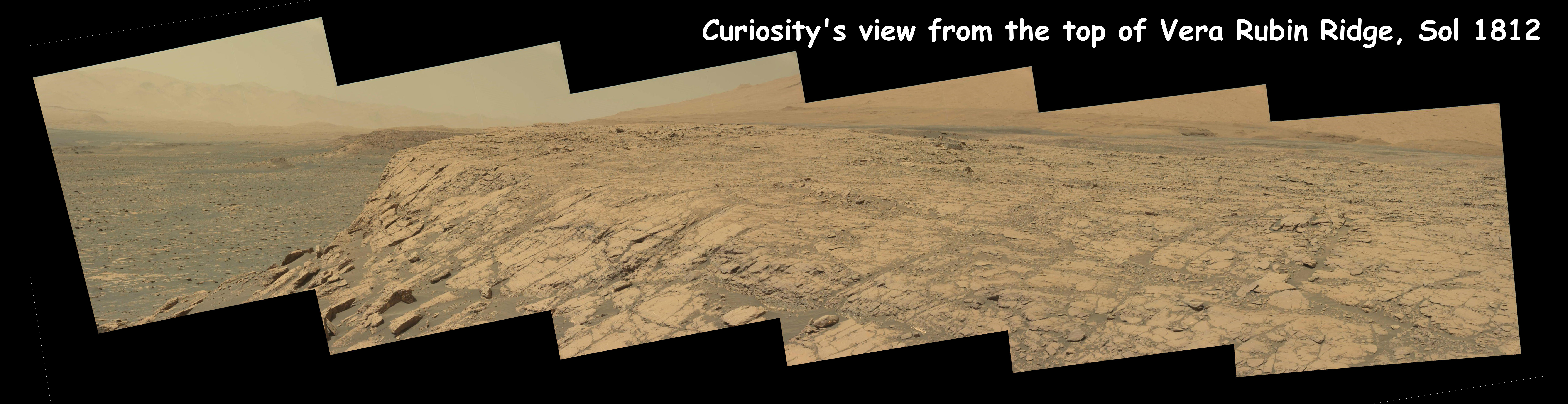
Curiosity's view from on top of Vera Rubin Ridge, sol 1812

The image above is a reduced resolution version of a panorama created by reader Phil Veerkamp of images downloaded today from Curiosity. If you click on the image you can see the full resolution image. It looks to more to the east than the panorama shown in my September 6 rover update, revealing more of the type of surface the rover will have to cross on its drive forward on this new geological layer called the Hematite Unit.

Curiosity has now topped Vera Rubin Ridge, but the plateau above is really not as flat as the image implies. The Hematite Unit that the rover is now traversing still climbs upward, and they will continue to gain altitude now with almost every drive.

1 comment

Mars rover update: August 11, 2017

Summary: After a two week hiatus because the Sun was between the Earth and Mars and blocking communications, both rovers are once again on the move.

Curiosity

For the overall context of Curiosity’s travels, see Pinpointing Curiosity’s location in Gale Crater.

Curiosity panorama, Sol 1782

Vera Rubin Ridge close-up

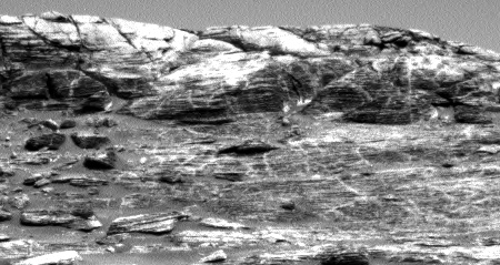
Since my last update on July 12,, Curiosity spent most of the month waiting out the solar conjunction that placed the Sun between the Earth and Mars and blocked communications. In the past few days, however, the rover has begun to send down images again while resuming its journey up Mt. Sharp. The panorama above, reduced to show here, was taken by the rover’s left navigation camera, and shows the mountain, the ridge, and the route the rover will take to circle around the steepest sections to get up onto the ridge. To see the full resolution panorama click on the picture.

To the right is a full resolution section of the area in the white box. As you can see, the geology of the ridge is many-layered, with numerous vertical seams or cracks. In order to track the geological changes across these layers as the rover climbs, the science team is as expected taking a systematic approach.

Lately, one of our biggest science objectives is to conduct bedrock APXS measurements with every 5-meter climb in elevation. This allows us to systematically analyze geochemical changes in the Murray formation as we continue to climb Mount Sharp. Yesterday’s drive brought us 6 meters higher in elevation, so another touch and go for today it is!

Below is a cropped and reduced resolution image of the most recent orbital traverse image, dated sol 1754. The dotted line shows where I think the rover’s has traveled in the last 28 sols. I have also annotated what I think is the point of view of the panorama above.
» Read more

3 comments

Mars rover update: July 12, 2017

Summary: Curiosity looks at some big dune ripples, then creeps up hill. Opportunity tests its wheels.

Curiosity

For the overall context of Curiosity’s travels, see Pinpointing Curiosity’s location in Gale Crater.

The interior of a dune ripple

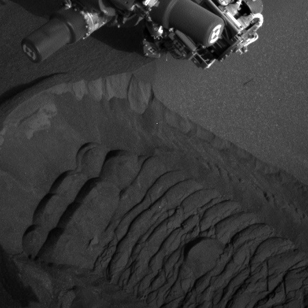
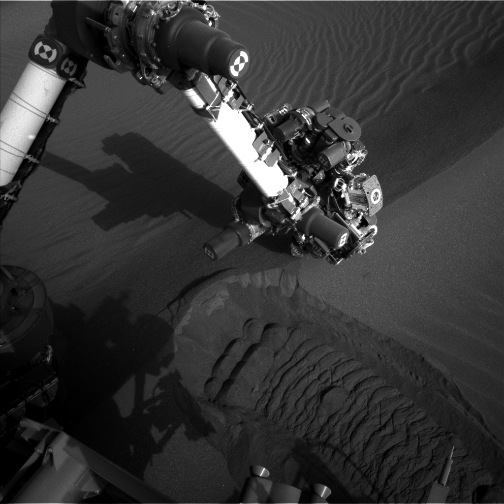
Since my last update on June 23,, Curiosity has worked its way around and, for a few days, even into the small sandy field at the base of Vera Rubin ridge. The scientists noticed that the sandy here had a series of large ripples, and they wanted to take a close look at at least one. The image on the right, cropped to show here, was taken shortly after they had the rover drive through one ripple in order to expose its interior. You can see the robot arm directly above the cut created by the rover’s wheels. On the cut’s wall several distinctly different toned layers are visible. A close look reveals that they are wavy, and probably indicate numerous and repeated overlays as the wind brushes a new layer of dust on top of old layers, time after time. The different tones indicate a change in the material’s composition, which could reveal something about some past events in either Mars’ weather or geology.

In order to decipher this information, however, they will need to be able to date the layers, and figure out when each tonal change happened. I am not sure Curiosity can do this, especially since they have not scooped up any of this dust for later analysis.

They are now approaching Vera Rubin Ridge, and should climb up onto in the coming weeks. At that point they will move off the Murray Formation, where they have been since March 2016, made up of dried and ancient crushed mud, and up onto a lighter, yellowish layer of rock, dubbed the Hematite Unit. This October 3, 2016 press release. gives a good outline of the geology of these regions.
» Read more

0 comments
1 8 9 10 11 12 13