Confirmed: Martian glacial features are ice

Lobate glacial flows on Mars
Click for full image.

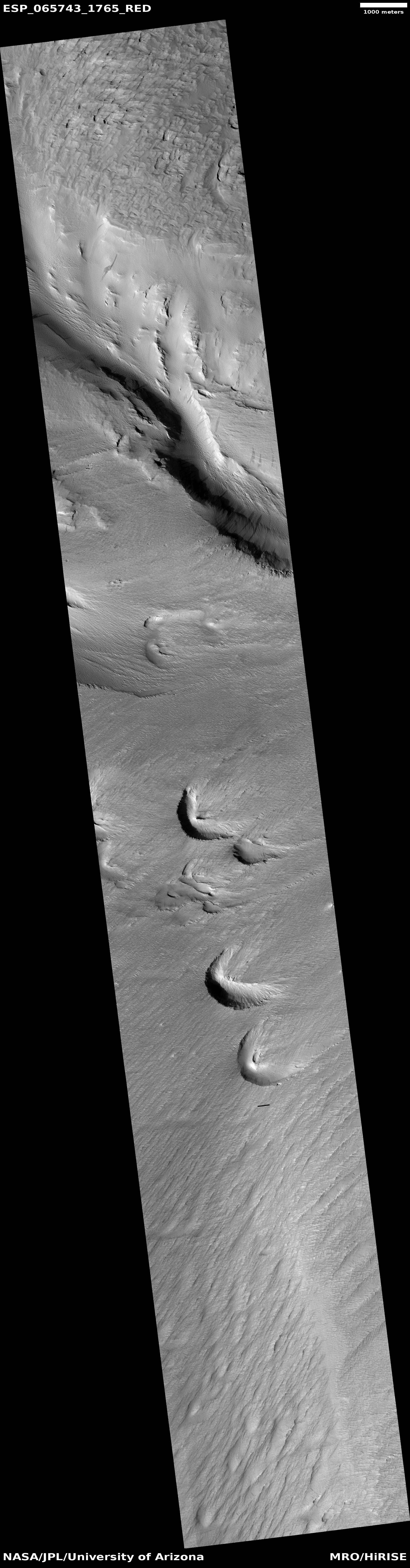
Scientists using the radar instrument on Mars Reconnaissance Orbiter (MRO) have now confirmed that the Martian glacial features that most resemble the glaciers seen on Earth are made of substantial amounts of ice, and were possibly active and growing only a few million years ago.

“Our radar analysis shows that at least one of these features is about 500 meters thick and nearly 100 percent ice, with a debris covering at most ten meters thick,” said Berman, lead author of “Ice-rich landforms of the southern mid-latitudes of Mars: A case study in Nereidum Montes” published online in Icarus at https://doi.org/10.1016/j.icarus.2020.114170. PSI scientists Frank C. Chuang, Isaac B. Smith and David A. Crown are co-authors on the paper.

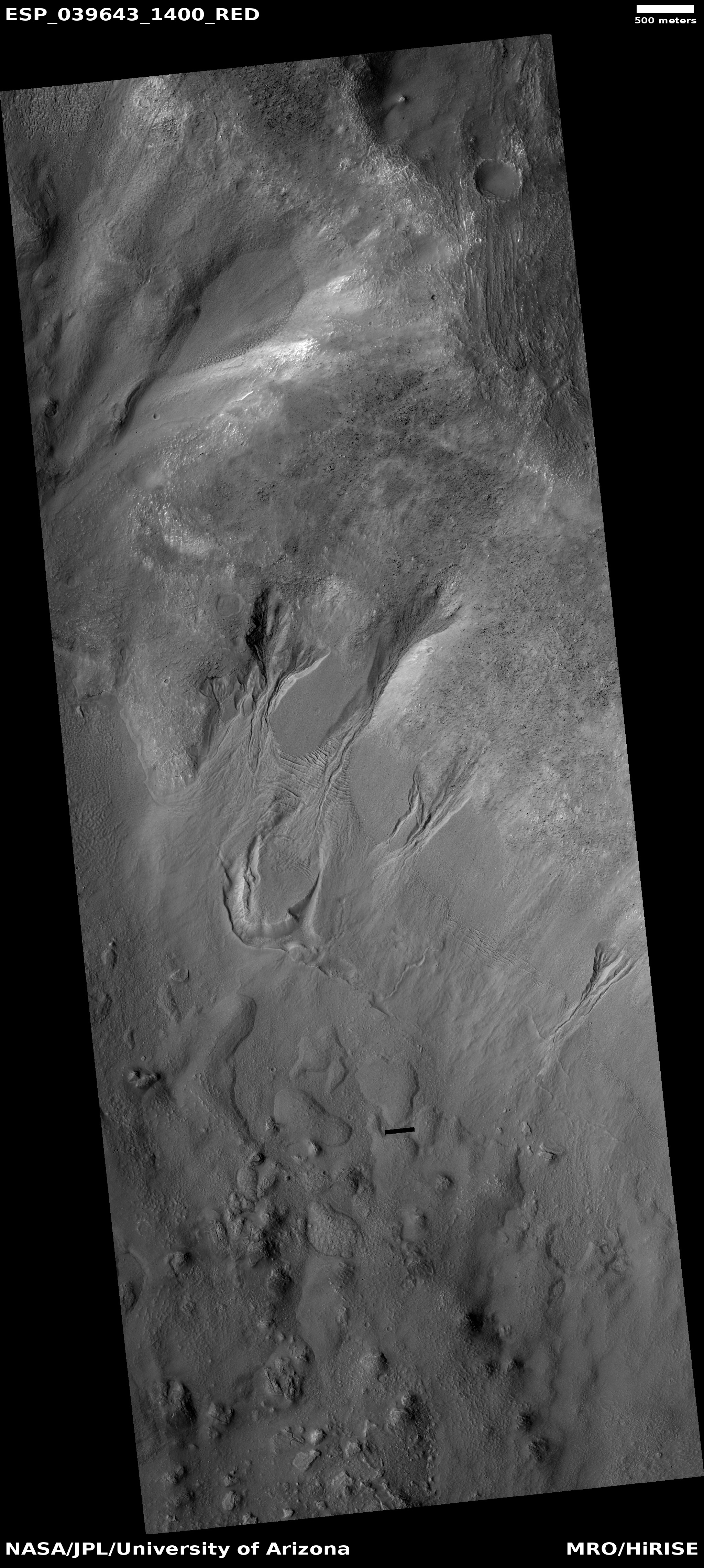
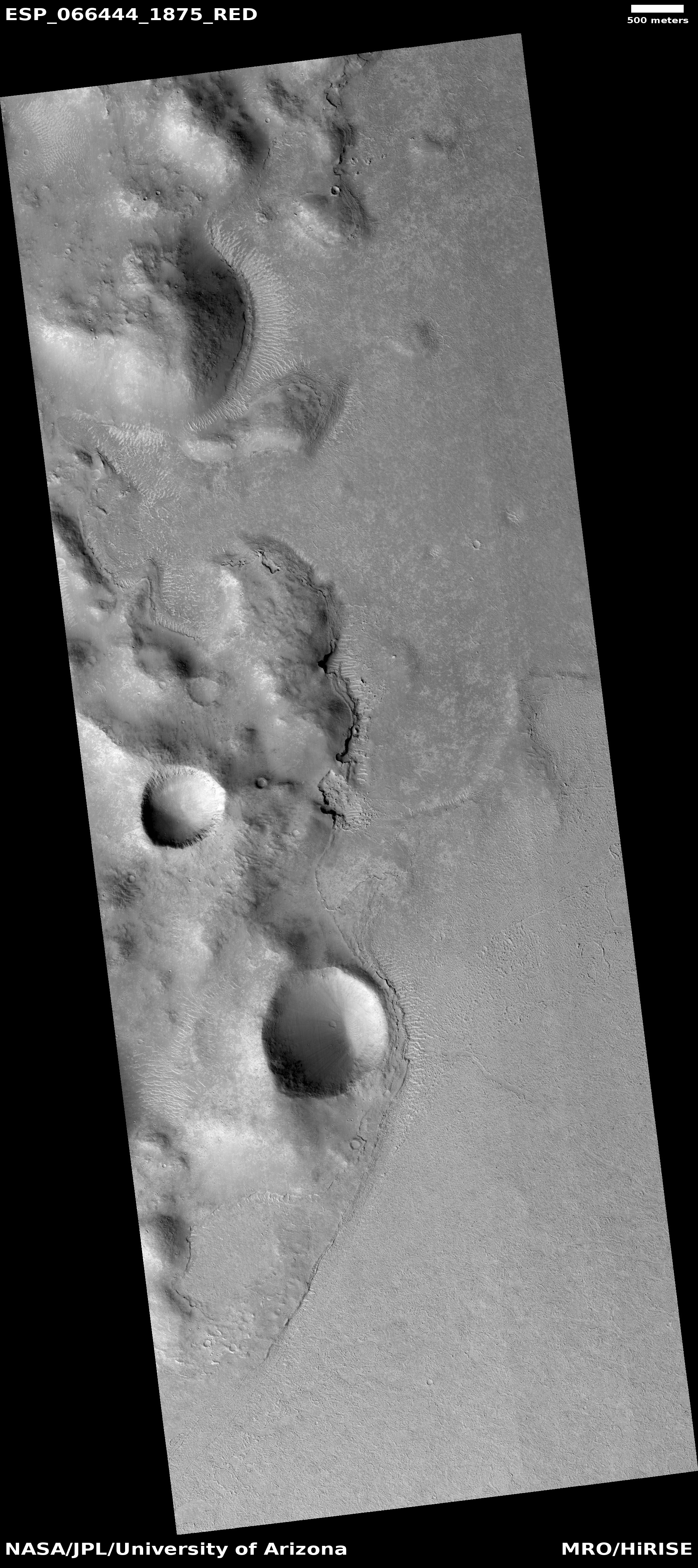
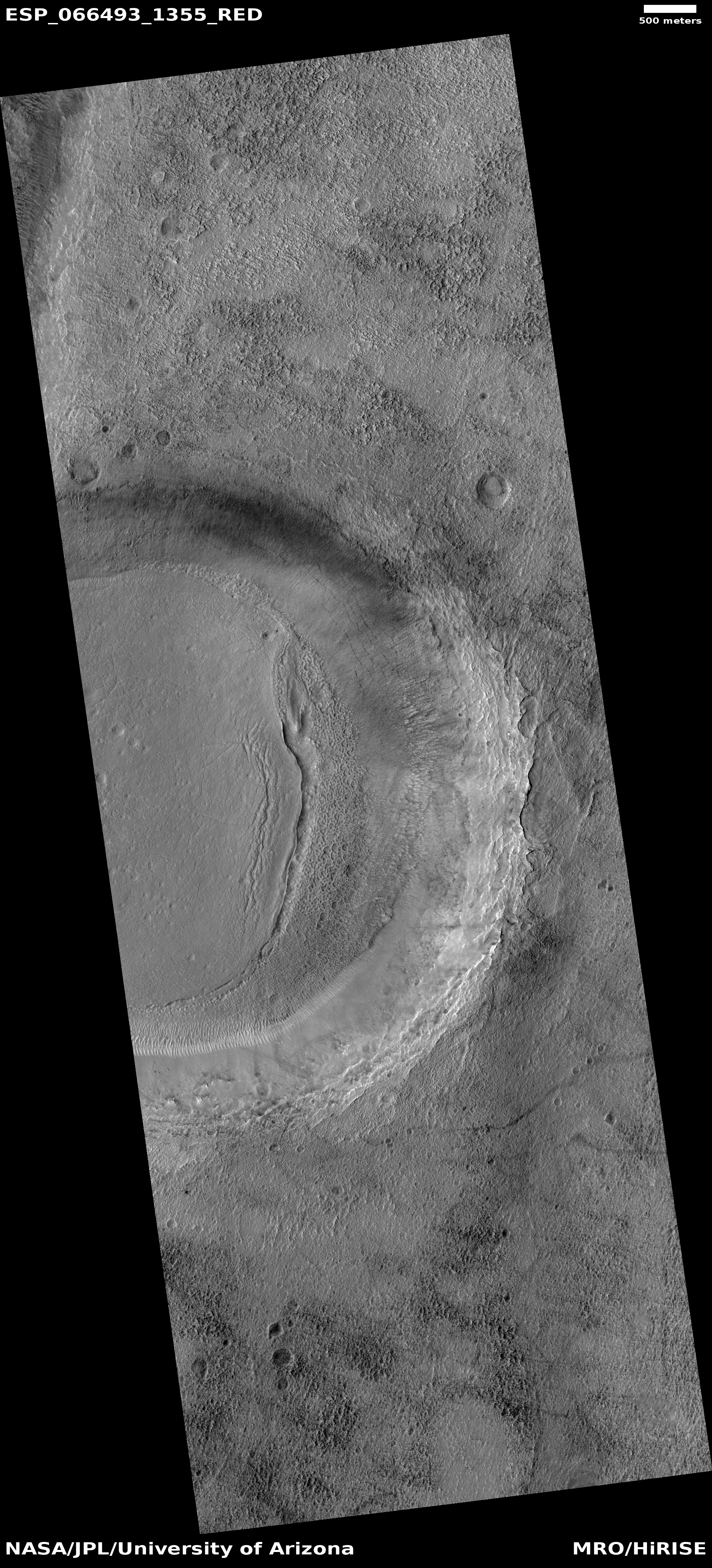
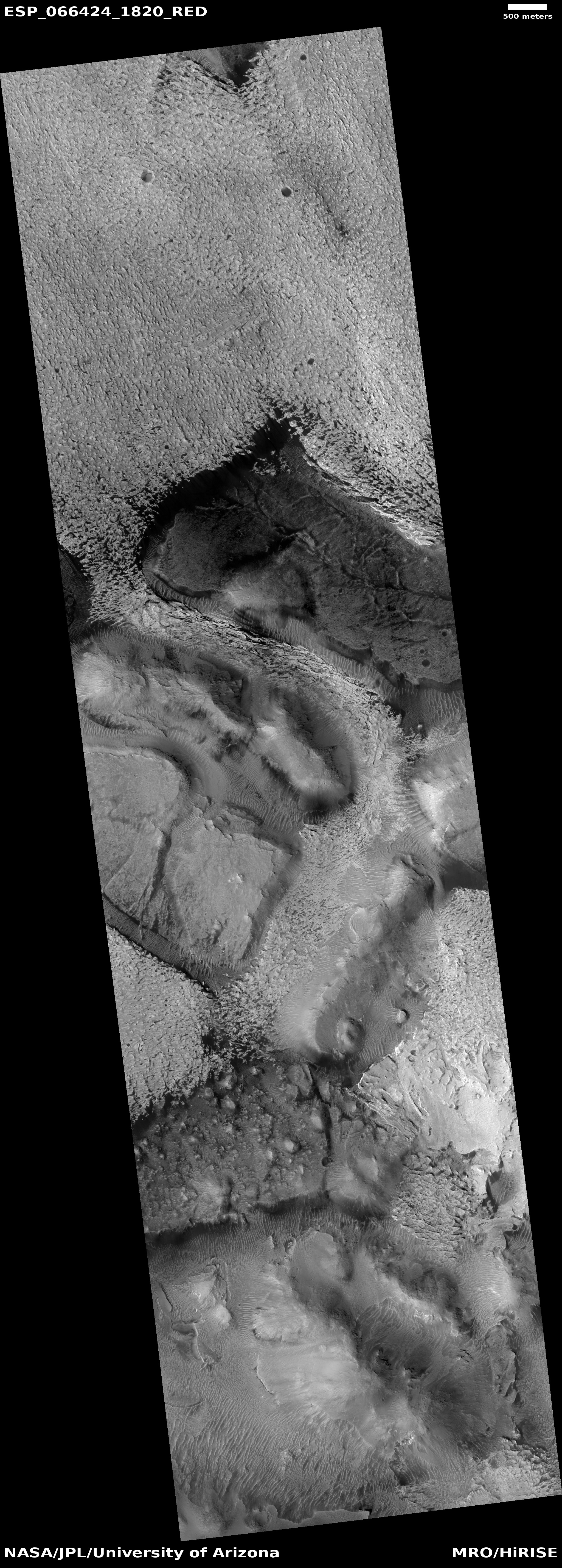
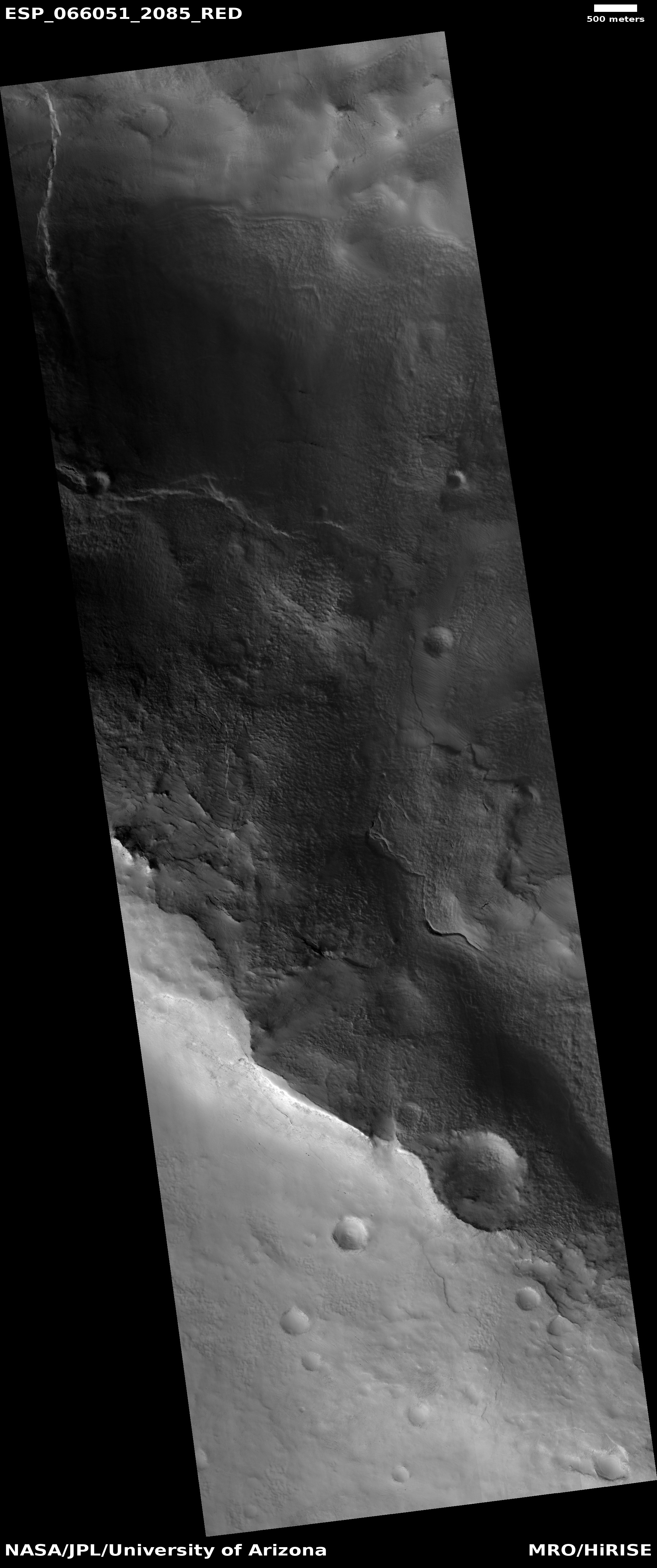
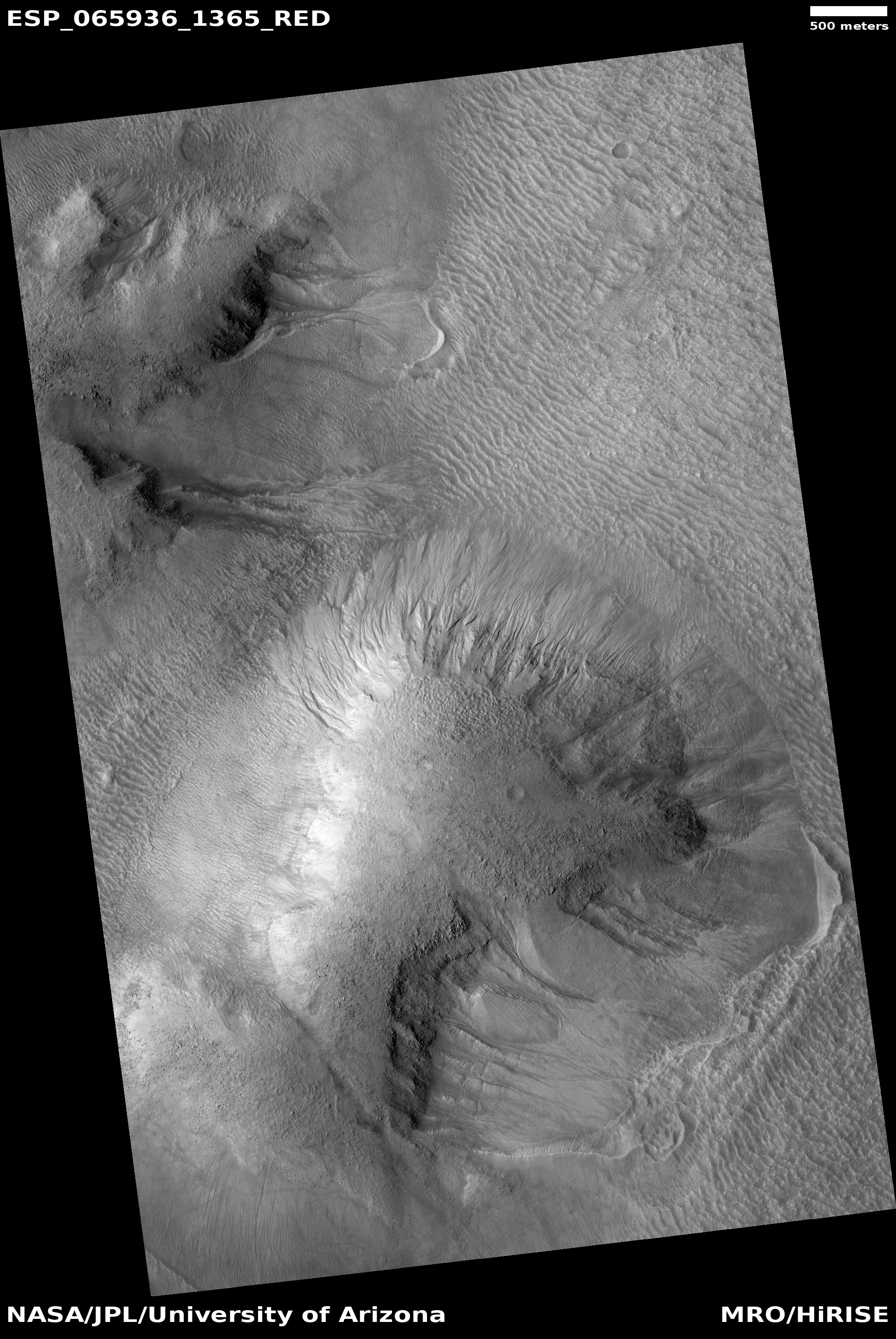
Global mapping of Viscous Flow Features (VFFs), a general grouping of ice-rich flow features in the southern hemisphere of Mars shows a dense concentration in Nereidum Montes, along the northern rim of Argyre basin. Located within a northwestern subregion of Nereidum Montes is a large number of well-preserved VFFs and ice-rich mantling deposits, the paper says, potentially the largest concentrations of any non-polar region in the southern hemisphere.

…Processed data from the Shallow Radar (SHARAD) instrument aboard NASA’s Mars Reconnaissance Orbiter spacecraft were used to search for basal reflections across VFFs within the region. For one in particular, these observations and analysis indicate that it is composed of nearly pure water ice. Model ages obtained from crater counts and their associated size-frequency distributions (SFDs) on both ice-rich mantling deposits and small lobate VFFs suggest that the deposits stabilized several to tens of millions of years ago in the Late Amazonian Epoch, and that small lobate VFFs likely formed due to the mobilization of mantling deposits.

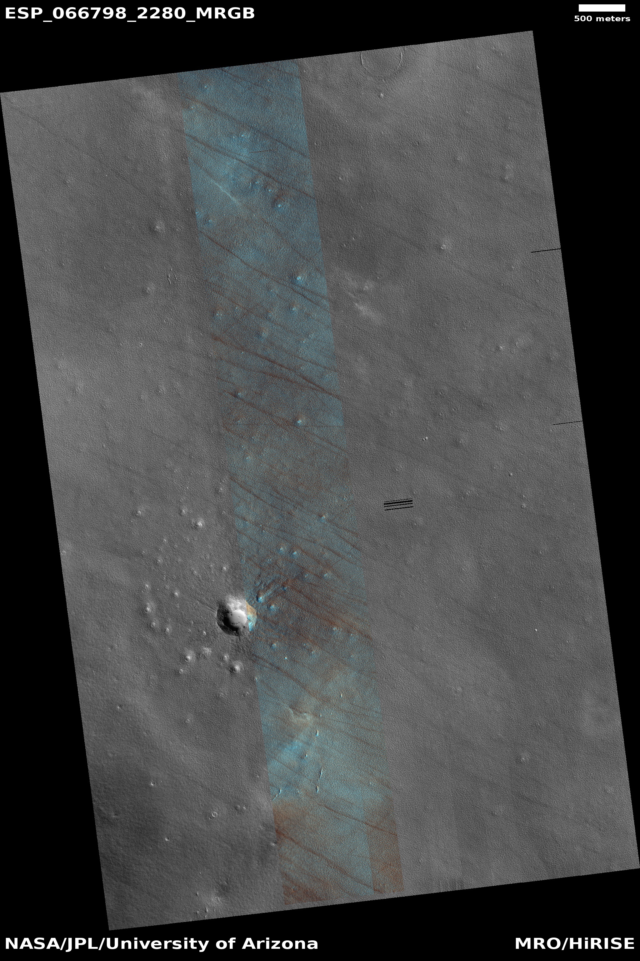
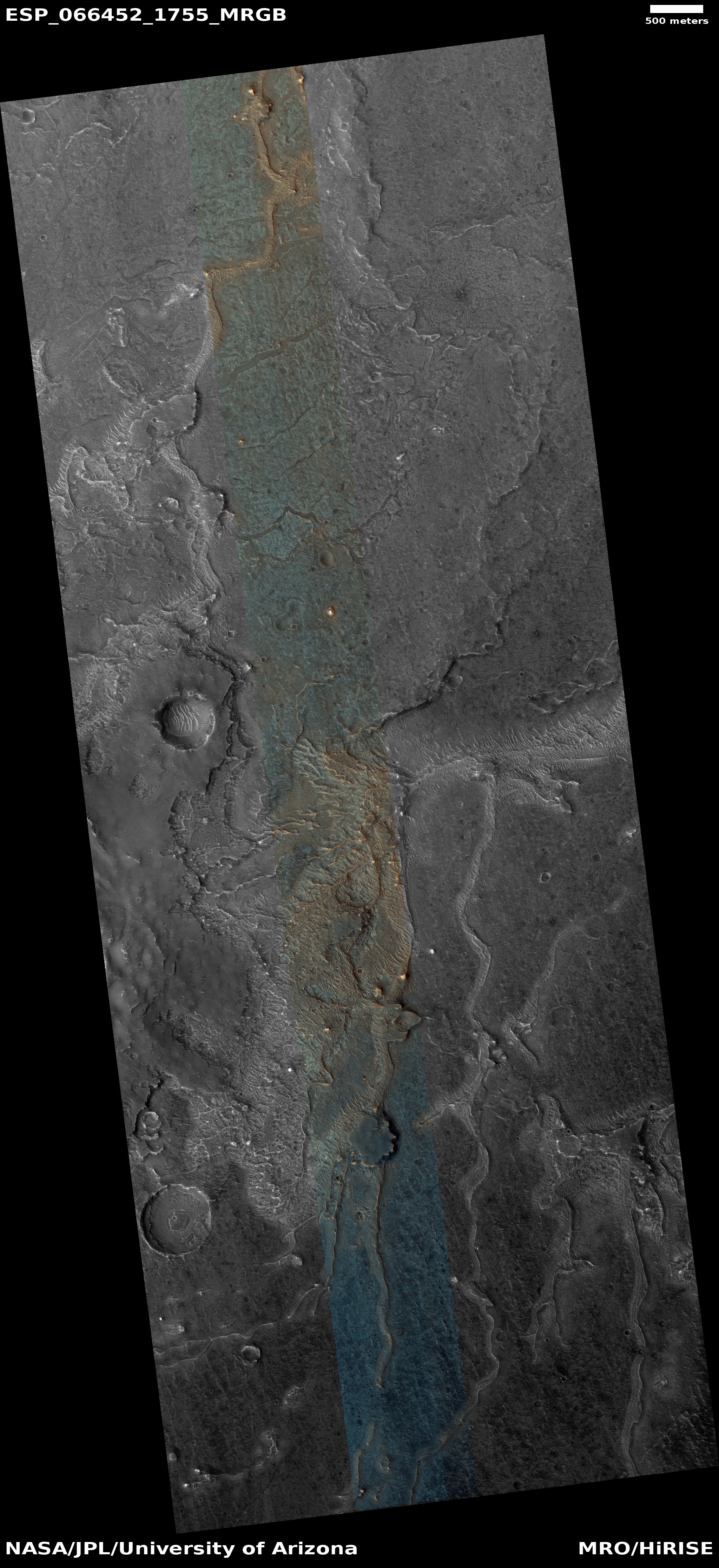
This data here reinforces the impressions from many other places within the 30-60 degree latitude bands on Mars where many such features are found.

Mars might be a desert, but it is a desert like Antarctica, not the Sahara. Any settlement there must use the Earth’s south pole as its guide for construction and design.

6 comments

Strange crater in the basement of Mars

Strange crater in Hellas Basin
Click for full image.

Today’s cool image to the right, cropped and reduced to post here, is intriguing for a number of reasons. Taken on September 11, 2020 by the high resolution camera on Mars Reconnaissance Orbiter (MRO), it shows a partially buried crater found in the middle of Hellas Basin, the lowest point on Mars and what I like to call the red planet’s basement.

What makes this crater intriguing is the layered pile of material filling its interior. If I didn’t know any better, I would think some construction crew has used a bulldozer to push debris from the crater’s right half in order to smooth the ground in preparation for building a strip mall, office building, or housing development.

This of course is not what happened. Then what did create those layered piles in the crater’s left half?
» Read more

1 comment

Cryptic Terrain on Mars

Cryptic terrain near Mars' south polar ice cap
Click for full image.

Cool image time! The photo to the right, rotated and cropped to post here, was taken on September 27, 2020 by the high resolution camera on Mars Reconnaissance Orbiter (MRO). It shows what is likely a crater that is partly buried by ice and dust and sand near or on the edge of Mars’s south polar ice cap.

It also shows an example of what planetary scientists have dubbed “cryptic terrain,” found generally on the margins of that ice cap. In this case, the location is on a plateau adjacent to the ice cap dubbed Promethei Planum. Despite a lot of searching, I could not locate any research papers describing Promethei Planum, though data outlined in one Mars Express press release from 2008 suggested it was part of the polar ice cap more than two miles thick that is covered by a thin mantle of dry ice each winter.

The strange curlicue cliffs and plateaus seen here are thought to form as part of the arrival and then sublimation away of that seasonal dry ice mantle, but how that process exactly works to create these particular geological features remains I think a mystery. North is to the top. The general grade is also downhill away from the icecap to the north.

Moreover, the overview map below, with the location of this image indicated by the blue cross, illustrates more mysteries.
» Read more

1 comment

Landslides on the edge of Mars’ youngest lava field

Landslides on the edge of Mars' youngest lava field
Click for full image.

Cool image time! The photo to the right, cropped to post here, was taken by the high resolution camera on Mars Reconnaissance Orbiter (MRO) on September 28, 2020. It shows several indentations in a north-south cliff face, with debris apparently falling down into a flat plain to the east.

The scientific history of this picture is very interesting. The first photo of these landslides was taken in 2006 and was titled, “Landslides on Flat Topography in Elysium Planitia”. The second, taken a few months later in 2007 to produce a stereoscopic view, was labeled “Landslides Along Shoreline in Elysium Planitia.” This most recent 2020 image is merely labeled “Landslides in Elysium Planitia.”

Is the flat terrain to the west a seabed to an ancient ocean, as suggested by the title for the 2007 image, with these landslides erosion caused in the far past by water lapping up against these cliffs?
» Read more

2 comments

Terby Crater and its drainages into Mars’ basement

Channels in Terby Crater on Mars
Click for full image.

Cool image time! Over the past few years, in my endless rummaging through the archive of high resolution images from Mars Reconnaissance Orbiter (MRO) I have posted a lot of photos of meandering channels of all kinds, most of which evoke to Earth eyes canyons eroded by flowing water. (This September 2020 cool image is just one of the more recent examples.)

Today’s cool image is another example, but in this case it is only a very small part of a very large drainage basin that is more than a hundred miles across and extends at least that far southward into the basement of Mars, Hellas Basin, the place on Mars with the lowest elevation.

The photo to the right, rotated and reduced to post here, was taken on September 12, 2020 by the high resolution camera on MRO. I normally wouldn’t post the whole image, but to crop it would mean you wouldn’t get the sense of extensive nature of this drainage. Downhill is to the south. The channel apparently passes through three or four stages. First, its northernmost section is in a wide canyon, the floor of which resembles glacial debris (though with a latitude of 27 degrees south this is a bit too close to the equator for ice). More likely we are looking at wind-blown sand and dunes being pulled downhill in the floor of the canyon.

This first canyon is also actually a gap in the rim of a 13-mile-wide unnamed crater. See this MRO context camera image for a wider view.

Next, the drainage becomes a series of meandering small interweaving channels, resembling the channels often seen in beach mud as the tide goes out.

Finally, the channels head into a gap to fall over a sloping cliff into lower terrain.

Nor these stages entirely linked. The first glacial-like stage exiting the gap in the crater appears to drain to the southeast, while the second seems to emanate from what appears to be a very faint small crater now partly buried. Both head south toward the gap, but the path of the eastward drainage appears less obvious. Some of it flowed westward to join the meandering channels but some also appears to work its way south more to the east.

This one image shows a lot of channels, but it is only a very small slice of this whole drainage system. In fact, we are looking here at only one strip of the interior slope of the northern rim of 108-mile-wide Terby Crater.

The overview map below gives the larger context. Terby Crater sits on the northern border of Hellas Basin, which in itself extends another 1,500 miles to the south. From this point the drop in elevation into Hellas is almost four miles.
» Read more

0 comments

Ice-filled crater on Mars?

Crater in southern mid-latitudes
Click for full image.

Time for another of the many cool images from Mars that suggest the presence of buried glacial ice. The photo to the right, rotated, cropped, and reduced to post here, shows an unnamed crater in the cratered southern highlands of Mars at about 44 degrees south latitude. Taken on October 2, 2020 by the high resolution camera on Mars Reconnaissance Orbiter (MRO), the crater sits at the very southernmost point of the Tharsis Bulge where the Red Planet’s four more distinctive giant volcanoes are located.

The crater is also in the middle of the 30 to 60 degree mid-latitude bands where scientists have detected many features that suggest glaciers, including a large number of craters that appear to have ice filling their interior.

Does the material in this crater’s floor suggest eroding and sublimating ice to you? It does to me. The second image below zooms in at full resolution at the north-south trench and the strange patterned terrain to its east.
» Read more

0 comments

Aram Chaos: Illustrating the puzzle of Mars

Aram Chaos
Click for full image.

The geological history of Mars is incredibly complex, and we really don’t know much about it. What we do know right now is based on a limited number of tiny fragments of a much larger story, with those fragments allowing scientists to only make educated guesses on how they fit together.

Many of those guesses will certainly turn out right. Just as many will turn out wrong. At this moment in our exploration of the Red Planet we can only grasp at straws while always keeping an open mind, as later data is surely going to change any conclusions we presently have.

The photo to the right is a good illustration of this struggle. Rotated, cropped, and reduced to post here, it was taken on September 27, 2020 by the high resolution camera on Mars Reconnaissance Orbiter (MRO), and shows what at first glance looks like a stream of white frost or ice descending down a canyon to the south.

That first impression however is entirely wrong. When I asked Chris Okubo of the U.S. Geological Survey, who requested this image from MRO, what it was, he explained,

The white material is not frost. Instead, these are sedimentary rocks comprised primarily of sulfates. The texture to me suggests these are lithified dunes.

Lithified merely means that the dunes have hardened into rock. Sulfates are a salt formed from sulfuric acid, and are on Mars often linked to some complex mineralogy. If you stood there the colors would be white and red, quite beautiful. As Okubo explained,

The sulfates are white to tan in color, but there would also be a lot of red/brown Mars dust on top of it. It would be similar to walking around some of the playas in the desert southwest.

Though these white sulfate deposits have their root in sulfuric acid, Okubo added that they “are in the form of minerals similar to gypsum and so they would be safe to touch.”

What is going on here? As is usually the case, we need to first take a wider view to get some context.
» Read more

0 comments

Sagging cliffs on Mars

Sagging escarpment on Mars
Click for full image.

Cool image time! On Mars things change, but not like on Earth because the atmosphere is not as thick and there is no flowing water. The photo to the right, rotated, cropped, reduced, and annotated to post here, gives a good example of that slow change. The image was taken on August 29, 2020 by the high resolution camera on Mars Reconnaissance Orbiter (MRO), and shows the high escarpment that in this one place separates the planet’s southern cratered highlands from the transition zone down to northern lowland plains.

In this spot that escarpment, approximately 4,000 feet high, shows signs of avalanches and sagging. In the upper steep section, I point to what looks like a dust avalanche that wiped the slope clear of rough terrain as it rolled downhill. At the bottom of the cliff a large section has separated away. Since this cliff is located at 28 degrees north latitude and is in the midst of the chaos terrain regions I like to dub glacier country, it is very possible that this large section is actually buried glacial ice that in shifting down slope cracked, separating the lower section from the upper.

This particular location is east of an area dubbed Nilosyrtis Mensae (where there is a lot of evidence of glaciers and frozen ice), and about 650 miles north of Jezero Crater, where the rover Perseverance will land on February 18, 2021.

0 comments

A spray of Martian meteorites

A spray of small secondary impacts
Click for full image.

Cool image time! The photo to the right, cropped and reduced to post here, was taken on October 26, 2020 by the high resolution camera on Mars Reconnaissance Orbiter (MRO). It is what the camera team calls a “terrain sample,” meaning it was not specifically requested by a researcher but was instead chosen by the camera team because they need to regularly take images to maintain the camera’s temperature. When they do this, they try to pick a location that hasn’t been photographed in high resolution previously, and that might have some interesting features. Sometimes the photo is boring. Sometimes they hit pay dirt.

In this case, the photo captured an small impact crater, about 1,300 feet across, surrounded by a spray of secondary impacts. The color portion of the image shows what I suspect are dust devil tracks cutting across a surface that, because of its blue tint, is either rough or has frost or ice within it. At 48 degrees north latitude, the possibility of the latter is high, especially because this location is northwest of the Erebus mountains, where SpaceX has its prime Starship candidate landing zone and where scientists suspect ice is readily available very close to the surface. The overview map below shows this context.
» Read more

2 comments

A place on Mars where lakes, snowfall, and rivers once existed

Inverted channels near Juventae Chasma
Click for full image.

Cool image time! The photo to the right, cropped and enhanced to post here, attracted my immediate interest when I was going through the November image dump from Mars Reconnaissance Orbiter (MRO) because of its meandering sharp ridges, estimated to be about sixty feet high on average. While I have previously posted MRO images of inverted channels such as these, their particular sharpness, plus their large number in this localized single image, aroused my curiosity. What is their history? Does this illustrate an particularly interesting place on Mars?

The picture itself was taken was on September 29, 2020 by MRO’s high resolution camera. The blue areas in the color strip probably indicate coarser-grained surface. This makes sense, as these ridges are believed to have been initially carved as channels by flowing water or ice, which compressed their riverbed and thus made it resistant to erosion. Over time, the surrounding terrain eroded away, leaving that channel behind now as a upstanding ridge. The surrounding eroded terrain should thus be expected to be rougher.

Where did the water for these rivers come from, however? As always, the overview maps below give the context, and a possible explanation.
» Read more

2 comments

Eroded and possibly wet Lohse Crater

Gully flow near central peak of Lohse Crater on Mars
Click for full image.

Cool image time! Today we take a look at one particular 100-mile-wide crater, Lohse Crater, located in the southern cratered highlands on Mars. The photo to the right, cropped and reduced to post here, focuses in on one of the many eroding gullies found in the mountainous region surrounding the crater’s central peak. Taken on August 20, 2020 by the high resolution camera on Mars Reconnaissance Orbiter (MRO), the full image is centered on that central peak, just off the south edge of this cropped section. This new image is part of a long monitoring campaign, begun in 2007, of this central peak region. For more than six Martian years, scientists have been tracking the numerous gullies found throughout the central peak region to see if there have been any changes.

I focused on this specific gully because I think it illustrates well why planetary scientists are monitoring these gullies. Whatever flowed down from the cliff on the left hit the material on the right hard enough and fast enough to imprint a curve into the material on the crater floor. Moreover, it does not appear to have simply been a landslide, for several reasons. First, the cliff does not appear cut back at the flow’s head, as you would expect if a section had broken off. Second, the material in the flow does not look like debris from an avalanche. In fact, there does not appear to be very much debris in the gully at all.

Third, and most important, the flow appears to originate at the cliff base, kind of what you’d expect if there was seepage coming out of a layer in that cliff face. Kind of what you’d expect on Earth, at a spring!

Was that flow water? This is the big question. Lohse Crater is significant in that it was one of the first locations on Mars [pdf] spotted by Mars Global Surveyor in the late 1990s where gullies were found suggesting some form of regular erosion possibly caused by flowing water. As this 2005 paper then concluded,
» Read more

3 comments

Giant wind eddies in the sands of Mars

Wind eddies on Mars
Click for full image.

Cool image time! The image to the right, cropped and reduced to post here, was photographed by the high resolution camera on Mars Reconnaissance Orbiter (MRO) on August 5, 2020. It shows a cluster of the crescent-shaped gullies, apparently carved from desert sand by the prevailing winds.

Those prevailing winds here are from the southwest to the northeast. As the wind blows the sand to the east, it hits a more solid object, such as a mountain buried in the sand, which forces the wind and the blown sand to go around, much as water passes a boulder in river rapids. That solid object also causes an eddy to form at its face, the wind forced downward and then around and up, carving out the gullies by lifting the sand at the base of that solid object. The result are these crescent gullies, dubbed blow-outs.

The overview map helps explain why there is so much sand here, enough apparently to bury whole mountains.
» Read more

3 comments
1 102 103 104 105 106 157