
The alien surface of Mars
Click for original image.
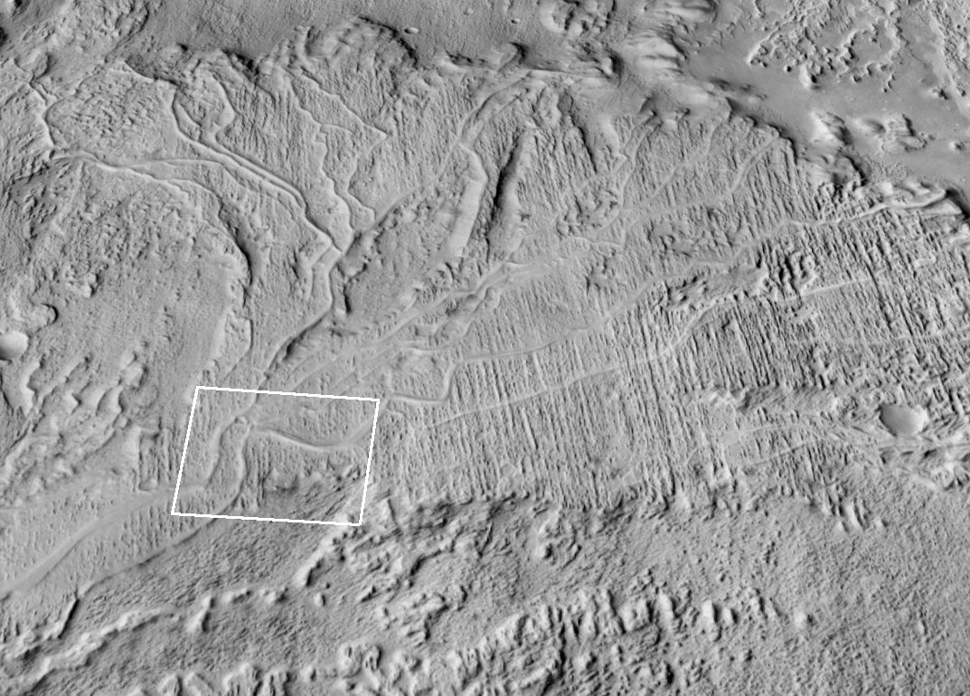
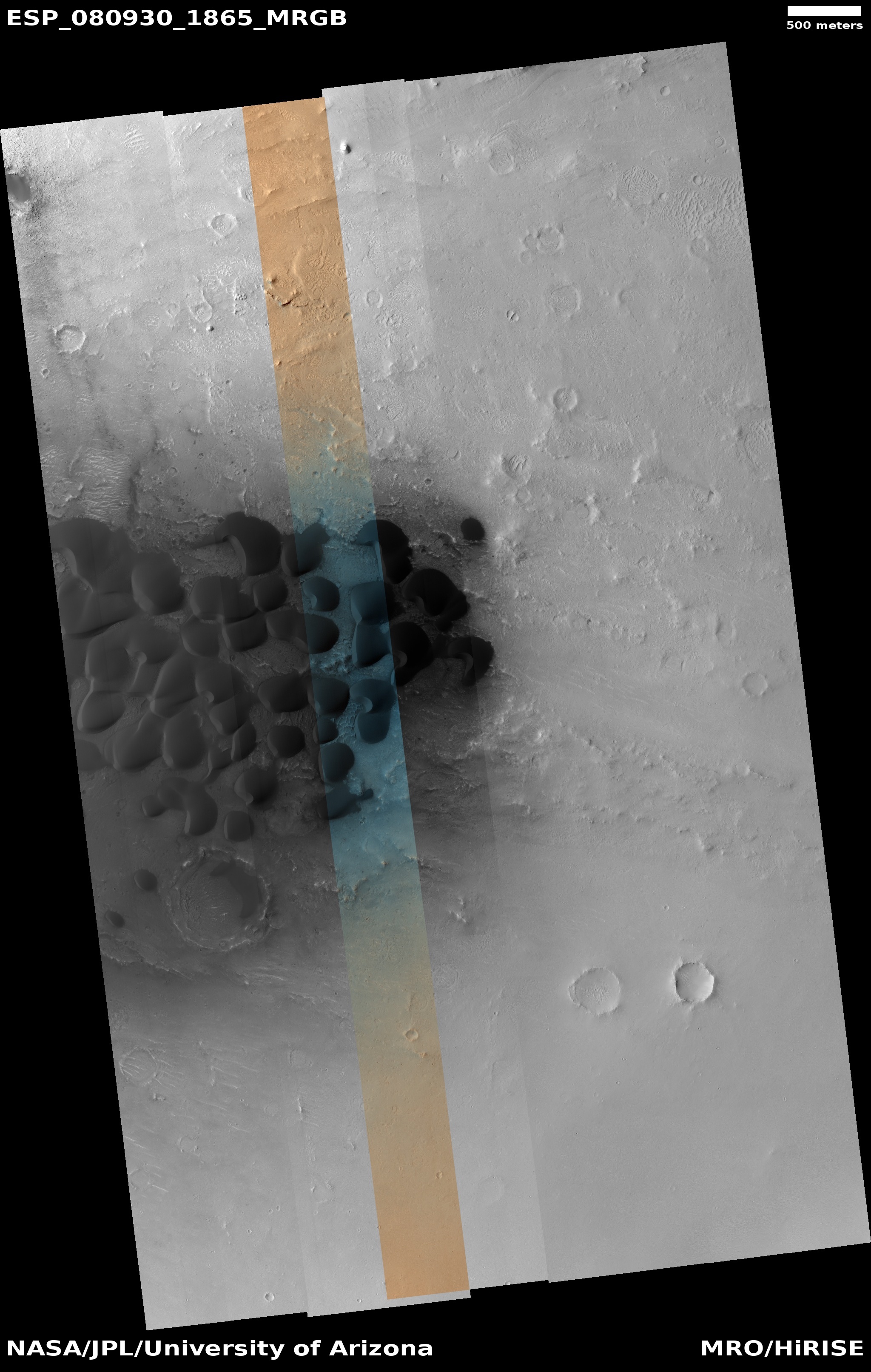
Click for interactive map.
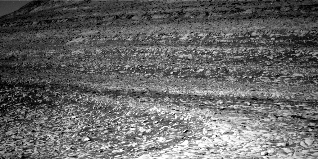
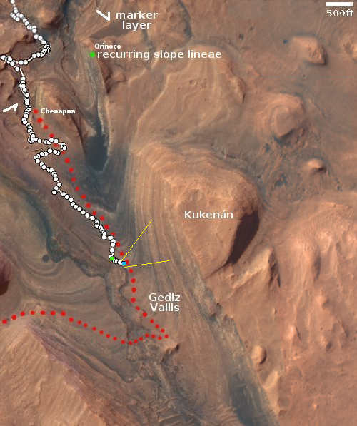
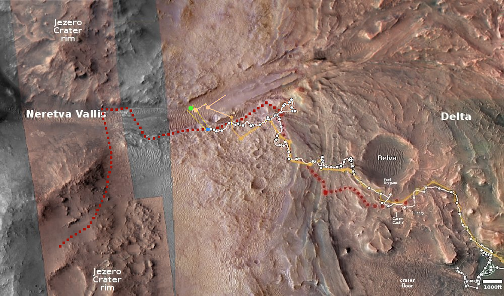
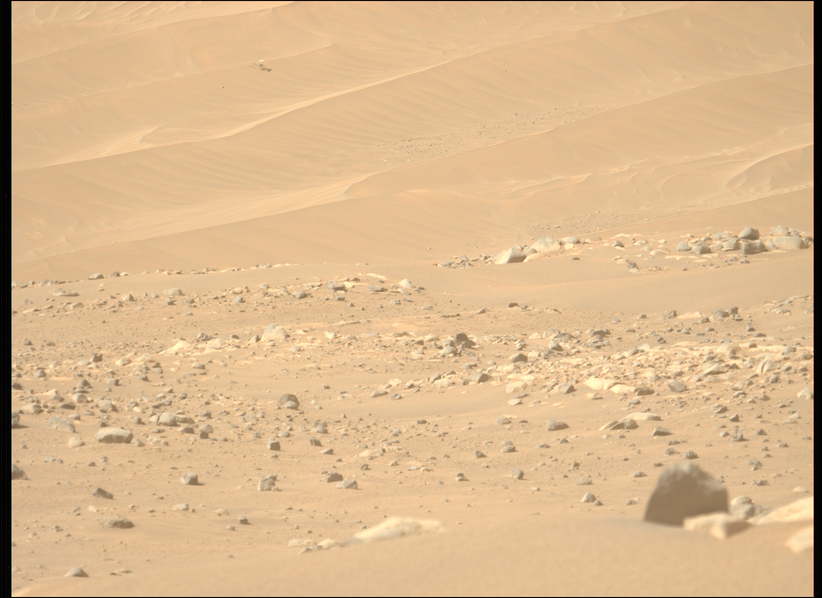
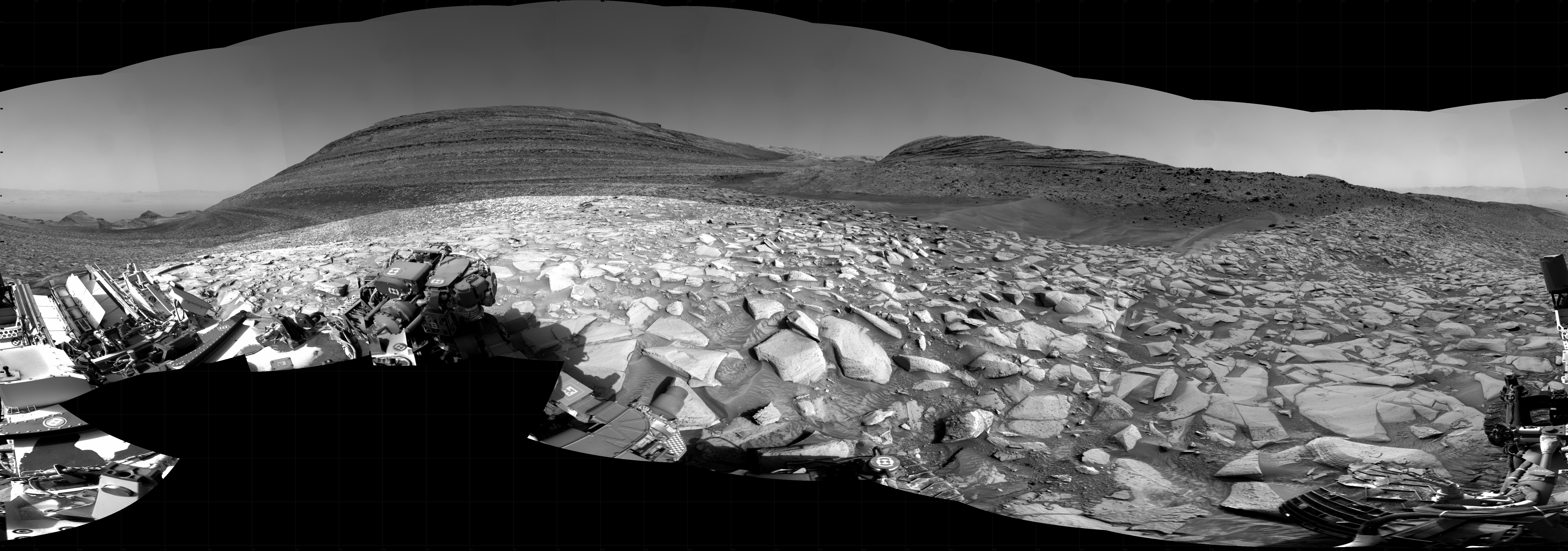
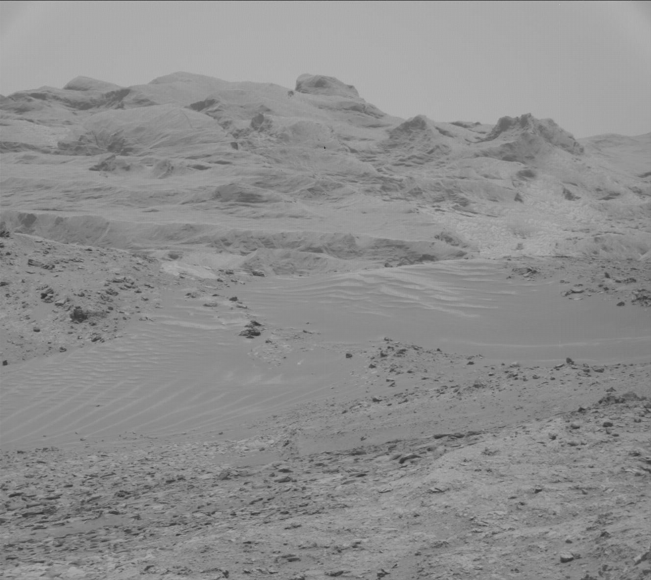
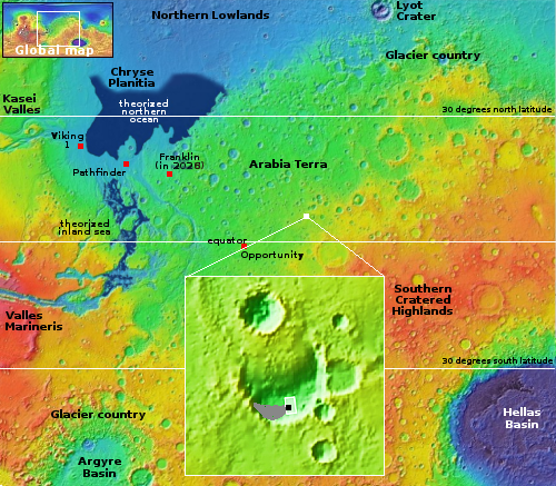
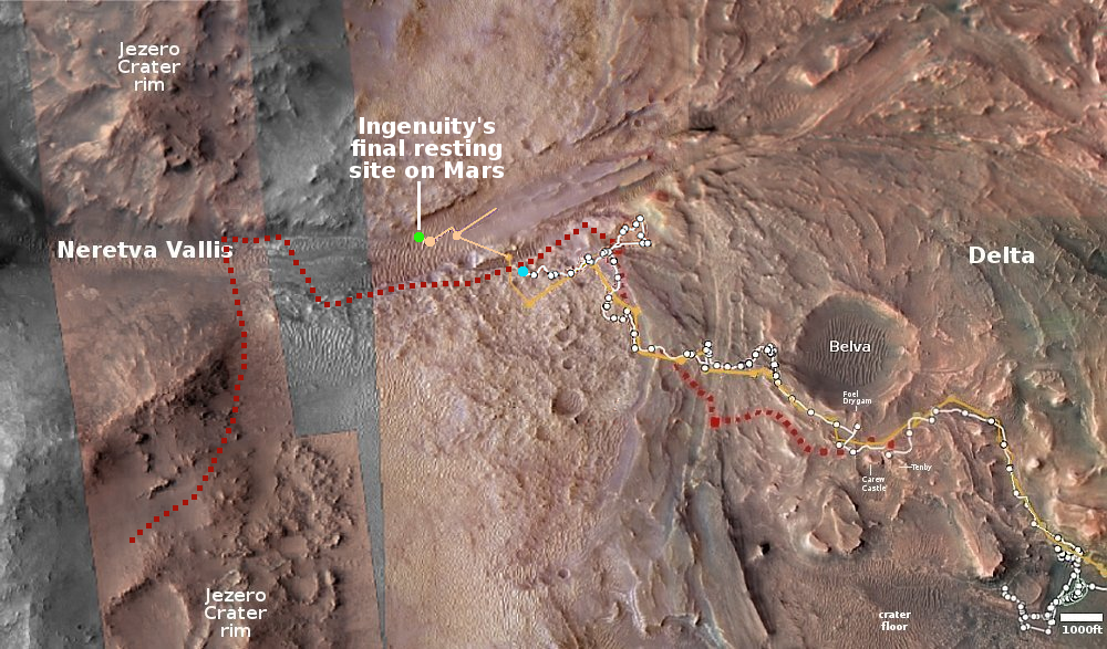
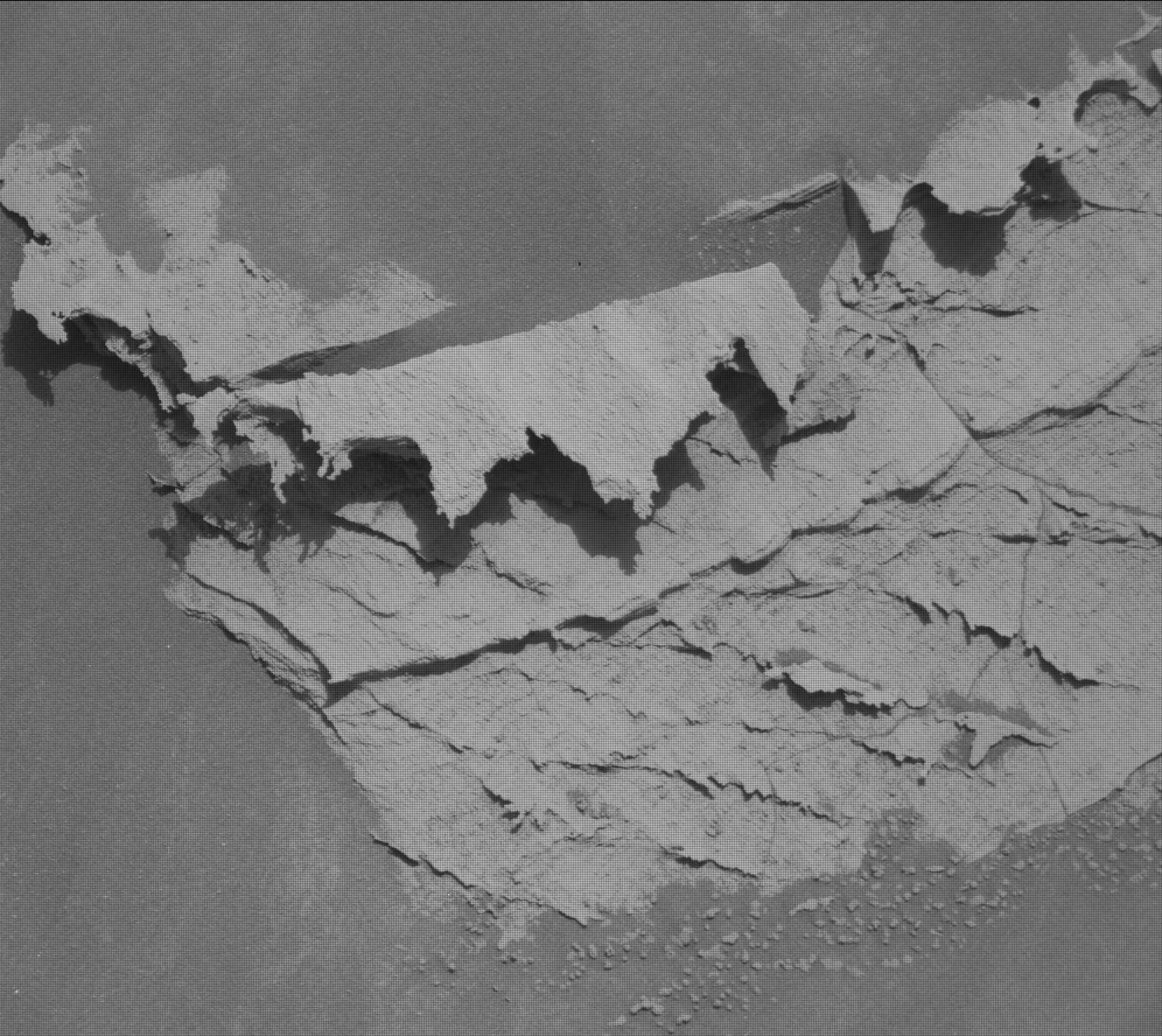
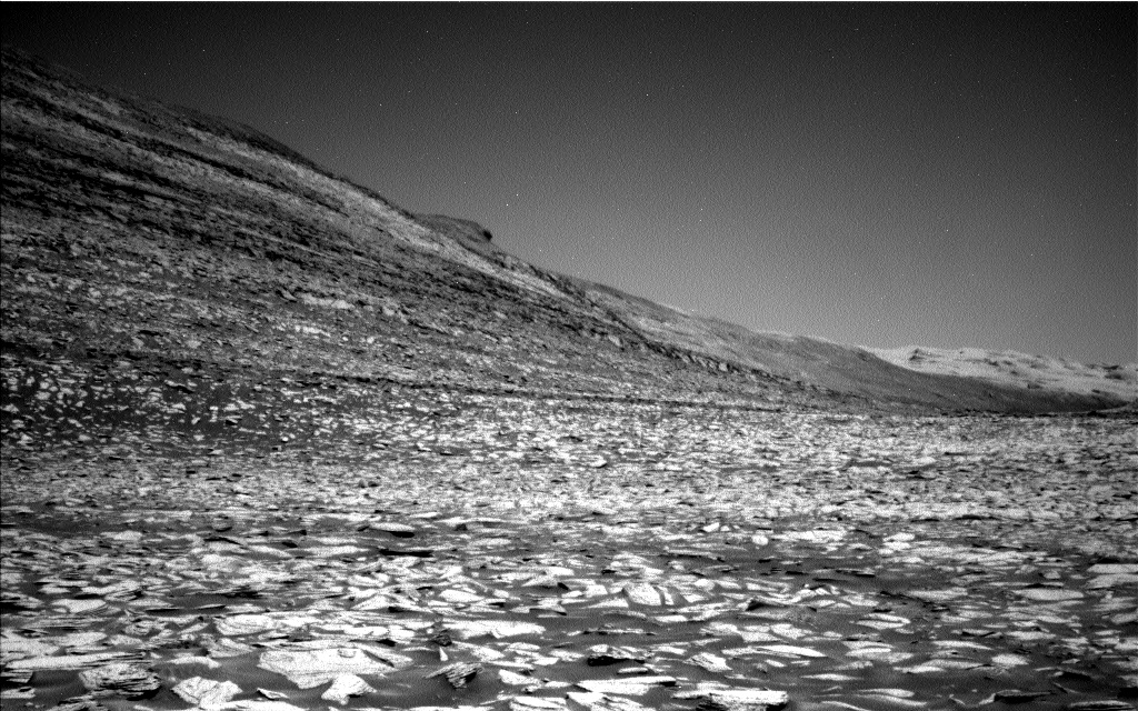
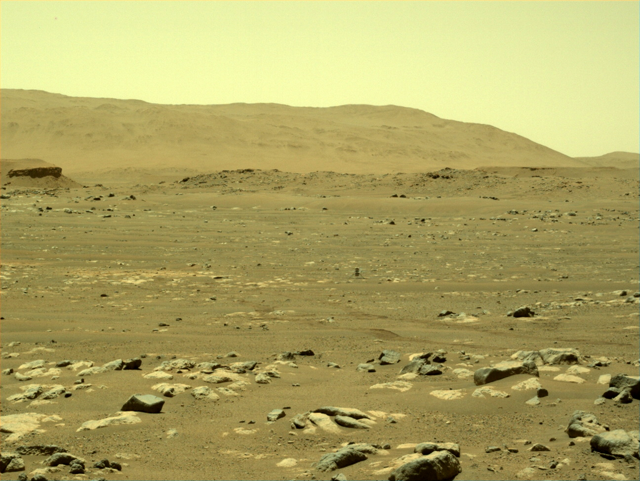
Cool image time! The picture above, brightened slightly to post here, was taken on February 15, 2024 by the right navigation camera on the Mars rover Curiosity. It looks east at the looming cliff face of the mountain Kukenan that the rover has been traveling beside for the last six months. On the overview map to the right the yellow lines indicate roughly the area covered by this picture. The blue dot marks Curiosity’s present position, while the green dot marks its position on February 5, 2024. As you can see, the rover is making slow but steady progress uphill into Gediz Vallis.
This image illustrates the alien landscape of Mars quite beautifully. First, there is absolutely no life in this picture. On Earth you would be hard pressed to find any spot on the surface that doesn’t have at least some plant life.
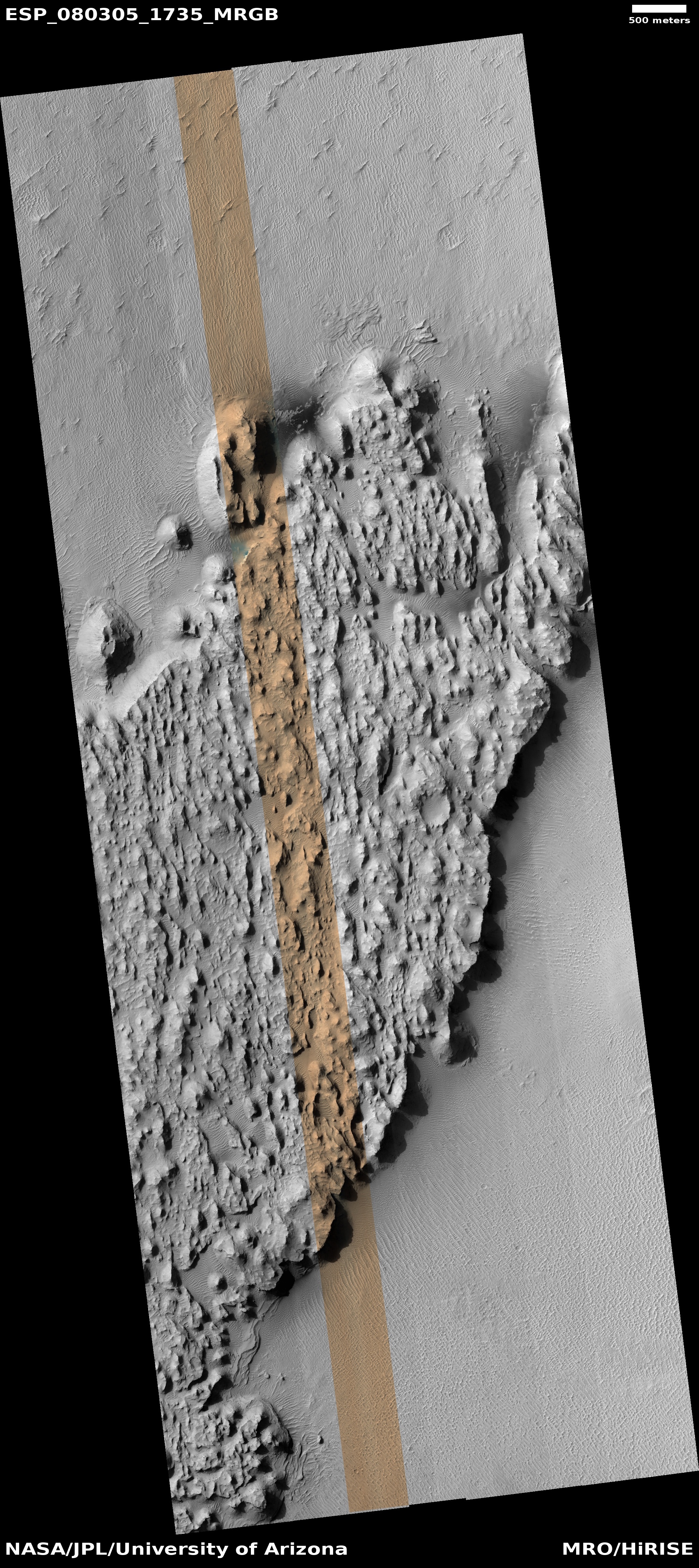
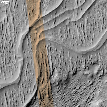
Second, there is the rocky layered nature of this mountain. When the Curiosity science team first announced its future route plans (the red dotted line) to drive into this canyon back in 2019, the orbital images of these layers from Mars Reconnaissance Orbiter (MRO) had suggested the terrain here would be reminiscent of The Wave in northern Arizona, a smooth series of curved layers smoothed nicely over time by the wind.
As you can see, there is no smoothness here. Instead, every single layer here is infused with broken rock, suggesting that each layer is structurally weak. As erosion exposes each, the layer breaks up, crumbling into the chaos in this picture. The curved nature of the terrain at the bottom of the picture however does suggest that some sort of flow once percolated down this canyon, either liquid water or glacial ice, carving the layers into this curved floor.


