The unbelievably rough and wind-swept surface of Mars’ Greenheugh pediment

Gator-back terrain on Mars
Click for full image.
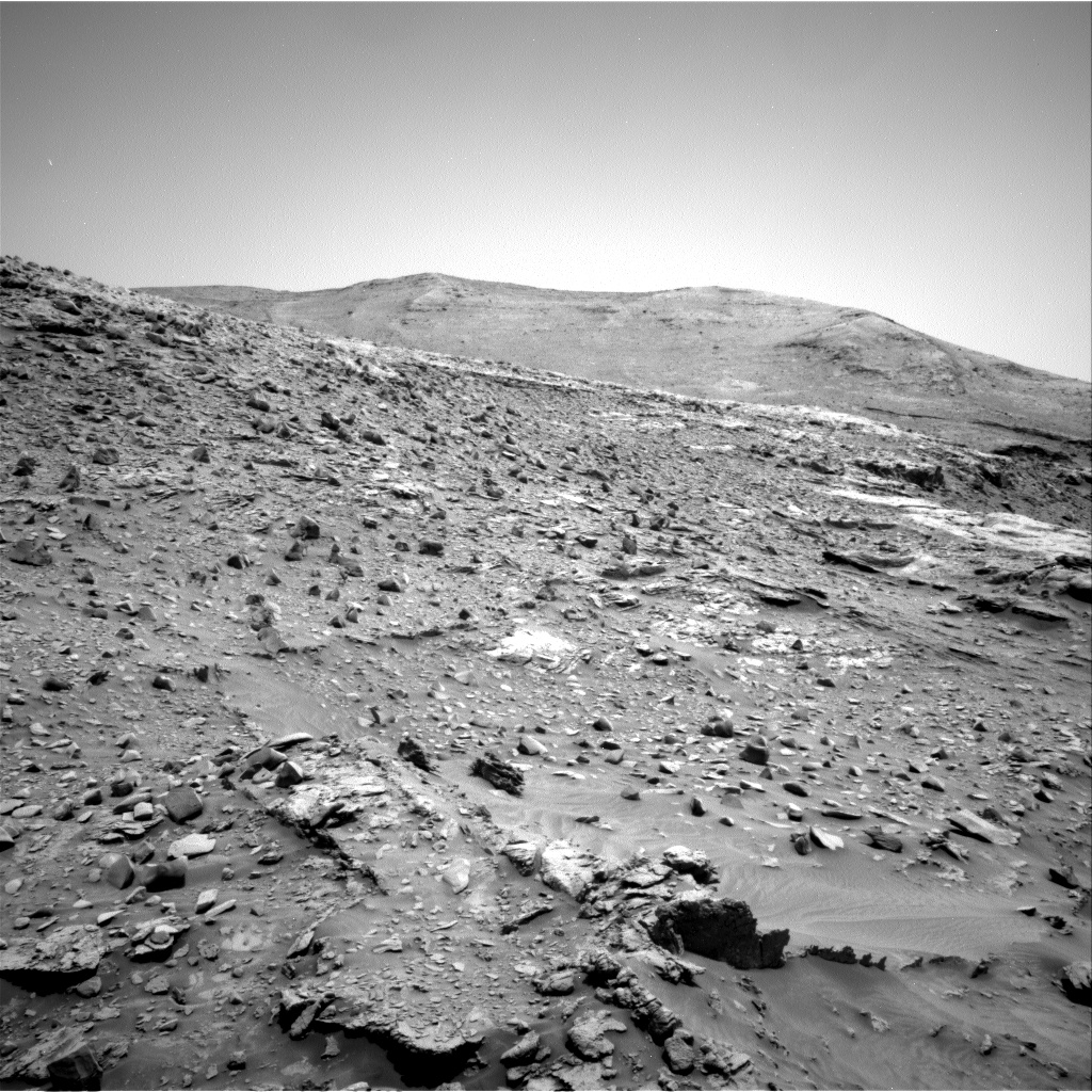
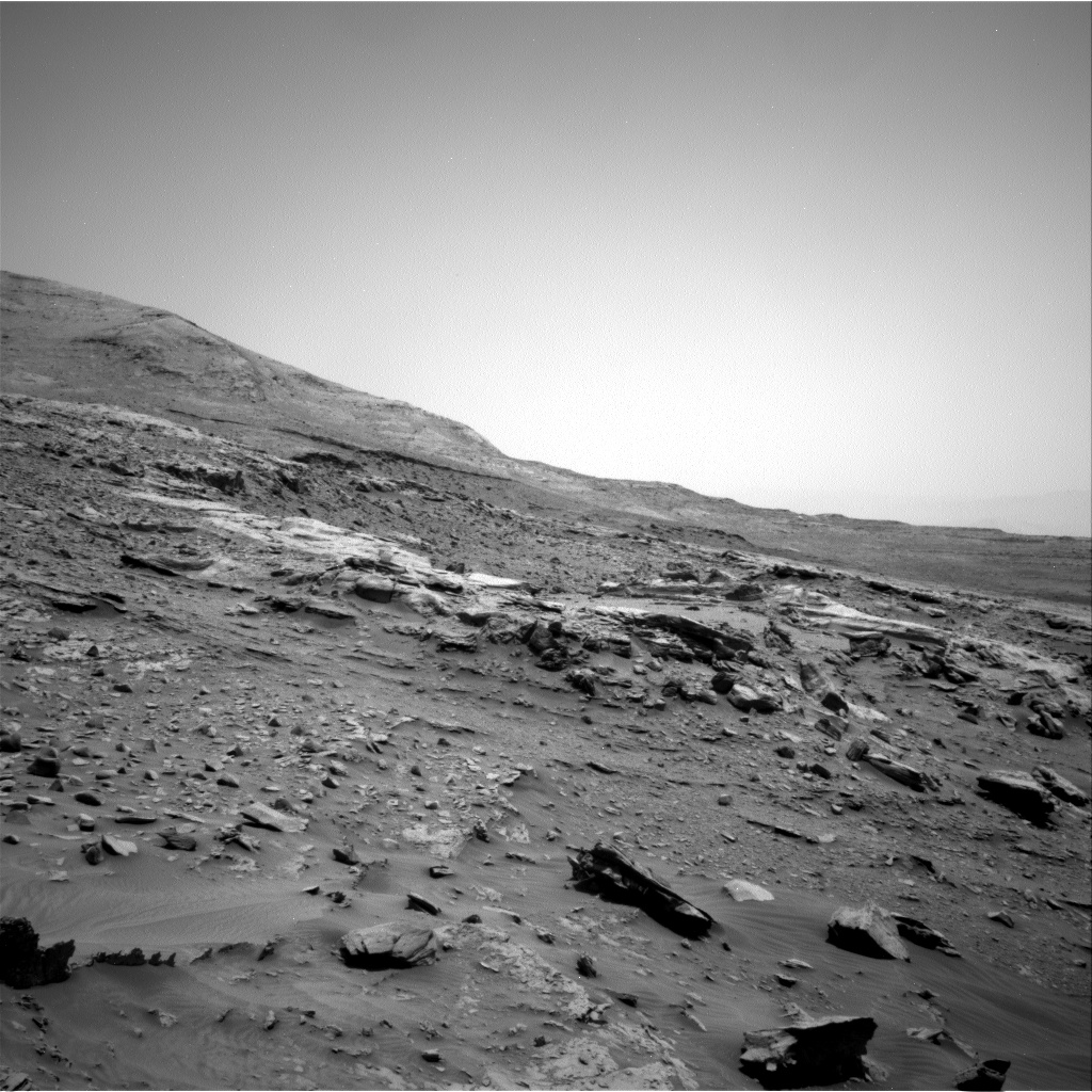
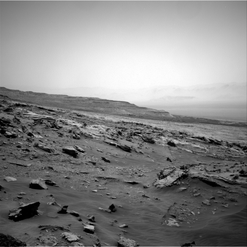
Since my last update on the travels of the Mars rover Curiosity on February 22, 2022, the rover has been been creeping ever so slowly westward across a plateau that scientists have dubbed the Greenheugh pediment.

Scientists have known for years that the surface of the pediment was going to be rough going. This panorama taken by Curiosity when it first climbed up to the pediment in March 2020 to take a peek before retreating revealed that roughness starkly.

In truth, since beginning its traverse of that pediment in February, the Curiosity team has found the ground not only as rough as expected, but beautiful in a strange sort of way, as illustrated by the March 20, 2022 photo to the right, reduced to post here. As Lauren Edgar, Planetary Geologist at USGS Astrogeology Science Center, noted yesterday in a Curiosity update that featured this image:
» Read more

4 comments

The journey so far of China’s Zhurong Mars rover

Zhurong's journey on Mars, as seen by MRO
Click for full image.

Elevation map and wider overview
Click for full image.

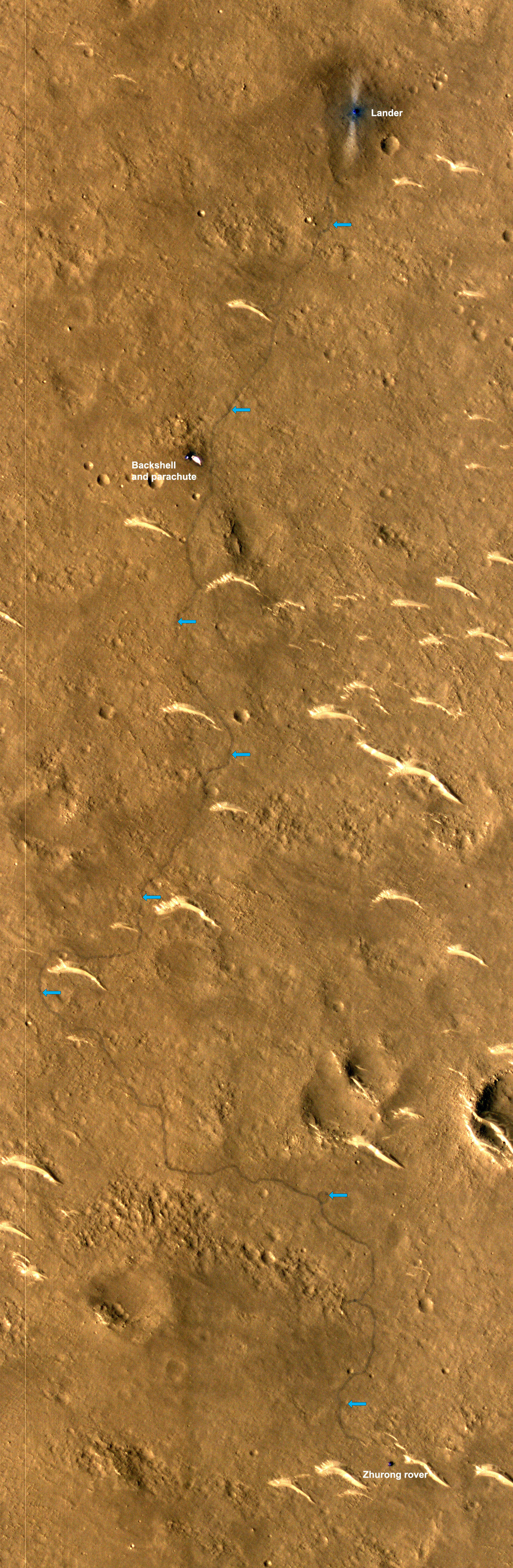
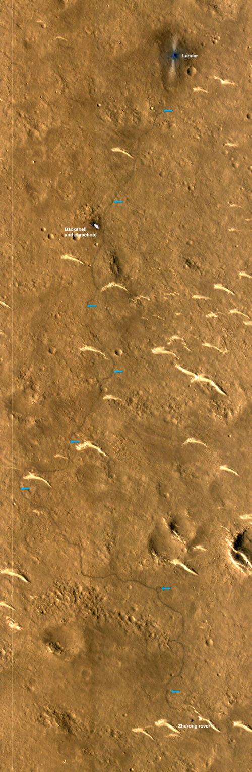
Cool image time! The science team for the high resolution camera on Mars Reconnaissance Orbiter (MRO) today released a new orbital photo that shows the entire journey on Mars of China’s Zhurong rover, since it landed in May 2021. That image, reduced to post here, is to the right. From the caption, written by Alfred McEwen of the Lunar & Planetary Laboratory in Arizona:

This HiRISE image, acquired on 11 March 2022, shows how far the rover has traveled in the 10 months since it landed.

In fact, its exact path can be traced from the wheel tracks left on the surface. It has traveled south for roughly 1.5 kilometers (about 1 mile). This cutout highlights the rover and the rover’s path (with contrast enhanced to better reveal the tracks).

The white curves that the rover has apparently been inspecting as it moved south are called megaripples, mid-size sand dunes from three to six feet in height that are generally found to be inactive, though not always. From a recent report about Zhurong’s findings:

“The examples Zhurong has visited appear very bright-toned in satellite images taken from orbit, and the team thinks that this is because the megaripples are covered with a layer of very fine dust,” says Matt Balme at the Open University, UK, who wasn’t involved in the analysis. “This means these features are probably currently inactive, as any present-day windblown sand would tend to remove the dust.”

That report used data from the rover’s first sixty days on Mars, after it had passed its first megaripple and had just reached the parachute and backshell. It does not include any later data in the past eight months, as Zhurong rolled past another nine megaripples and several small craters.

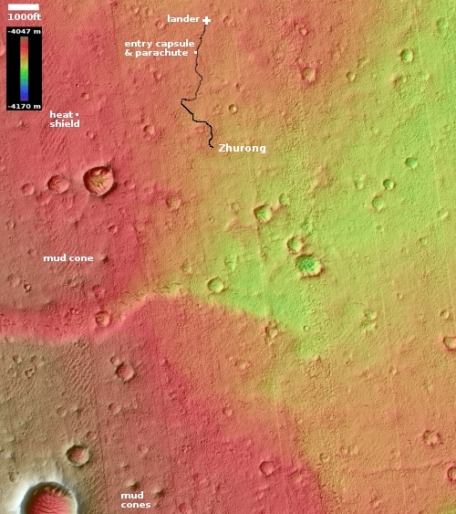
It also doesn’t include any data obtained as the rover skirted the wide apron that surrounds the large depression in the lower left. That depression looks like a crater at first glance, but because it appears to be on top of a mound it could instead by an old pitted cone. There are a lot of these cones in this region of the northern lowland plains of Mars, and planetary scientists really want to know whether they were formed from erupting ice, lava, or mud.

The Chinese have so far not released any data on what they have found in these later travels. We shall have to wait for further published papers.

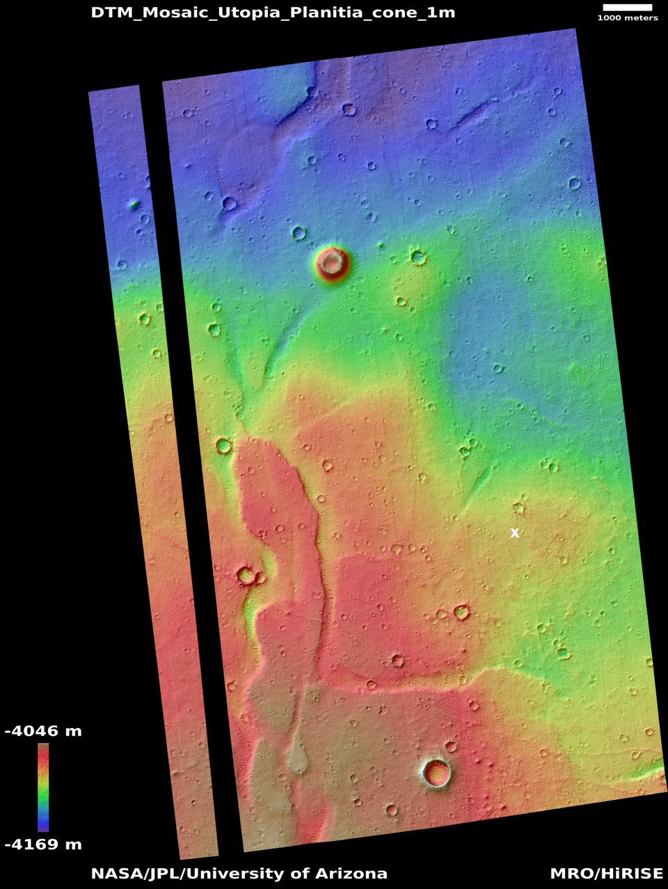
The wider elevation overview map to the right, first published on August 24, 2021 and cropped and annotated to post here, shows Zhurong’s future potential geological targets to the south. The cone to the southwest as well as the nearest scarp to the south are probably the rover’s primary goals.

Though the released results have hinted that the geology here was shaped by both wind and water, direct evidence for water has not been found, or revealed by the Chinese. Zhurong has a radar sensor that could detect evidence of near surface underground ice, if it was there. As far as I know at this point, no results from that instrument have as yet been published.

2 comments

ESA makes official the split with Russia

At a press conference yesterday officials from the European Space Agency (ESA) officially announced that the partnership with Russia to launch its Franklin rover to Mars has ended, and the launch will not happen in ’22.

The program is not cancelled, but “suspended.” ESA is looking for alternatives to get its Rosalind Franklin rover to the Red Planet. Earth and Mars are correctly aligned for launches only every 26 months, so the next opportunities are in 2024, 2026, and 2028. Aschbacher said it is not feasible to be ready by 2024, so it will be one of the later dates.

Since Russia had been providing both the launch rocket and Mars lander, ESA cannot simply find a different rocket. It needs to come up with its own lander, or find someone else to build it. For example, one of many new private American companies building lunar landers for NASA might be able do it, though ESA would likely prefer a European company. If it did decide to go with an American company, it would certainly not hire one until it succeeds in completing successfully at least one planetary landing.

The officials also outlined ESA’s need to find new launch rockets for many other missions it had planned to launch on Russia’s Soyuz-2 rocket. That need will also be an opportunity for American rocket companies, but more significantly it could be a blessing for Arianespace’s Ariane 6 rocket. The Ariane 6 has struggled to find customers because of its high cost. The loss of Russia as a launch option will likely drive some ESA business to it.

Roscosmos’ head Dmitry Rogozin in turn announced that it will go ahead with its own Mars mission, using the lander on an Angara rocket

“True, we will lose several years, but we will replicate our landing module, make an Angara rocket for it and carry out this research mission from the newly-built Vostochny spaceport on our own. Without inviting any ‘European friends’, who prefer to keep their tails between their legs the moment they hear their American master’s angry voice,” Rogozin said on his Telegram channel.

Whether Russia will actually do this is questionable. For the last two decades Roscosmos has promised all kinds of numerous planetary missions and new rockets and new manned capsules, none of which has ever seen the light of day. To make such a thing happen now seems even more doubtful.

4 comments

Elon Musk targets 2029 for first Starship manned mission to Mars

Capitalism in space: In a tweet today Elon Musk announced 2029 as his present target date for the first Starship manned mission to Mars.

This target date should not be considered firm, though it must be taken seriously. Musk’s past predictions tended to be optimistic, but also not unrealistic. If Starship development proceeds at the pace SpaceX is presently maintaining, this date is wholly doable.

The article at the link also said that the first Starship orbital test flight “is expected to take place within the next month.” That certainly matches with Musk’s previous statements, but ignores the bureaucratic delays from the FAA that at the moment prevent it from happening.

5 comments

Recent avalanche on Mars

Close-up comparison of slump
Click for full image.

Wide view comparison of slump
For full images go here and here.

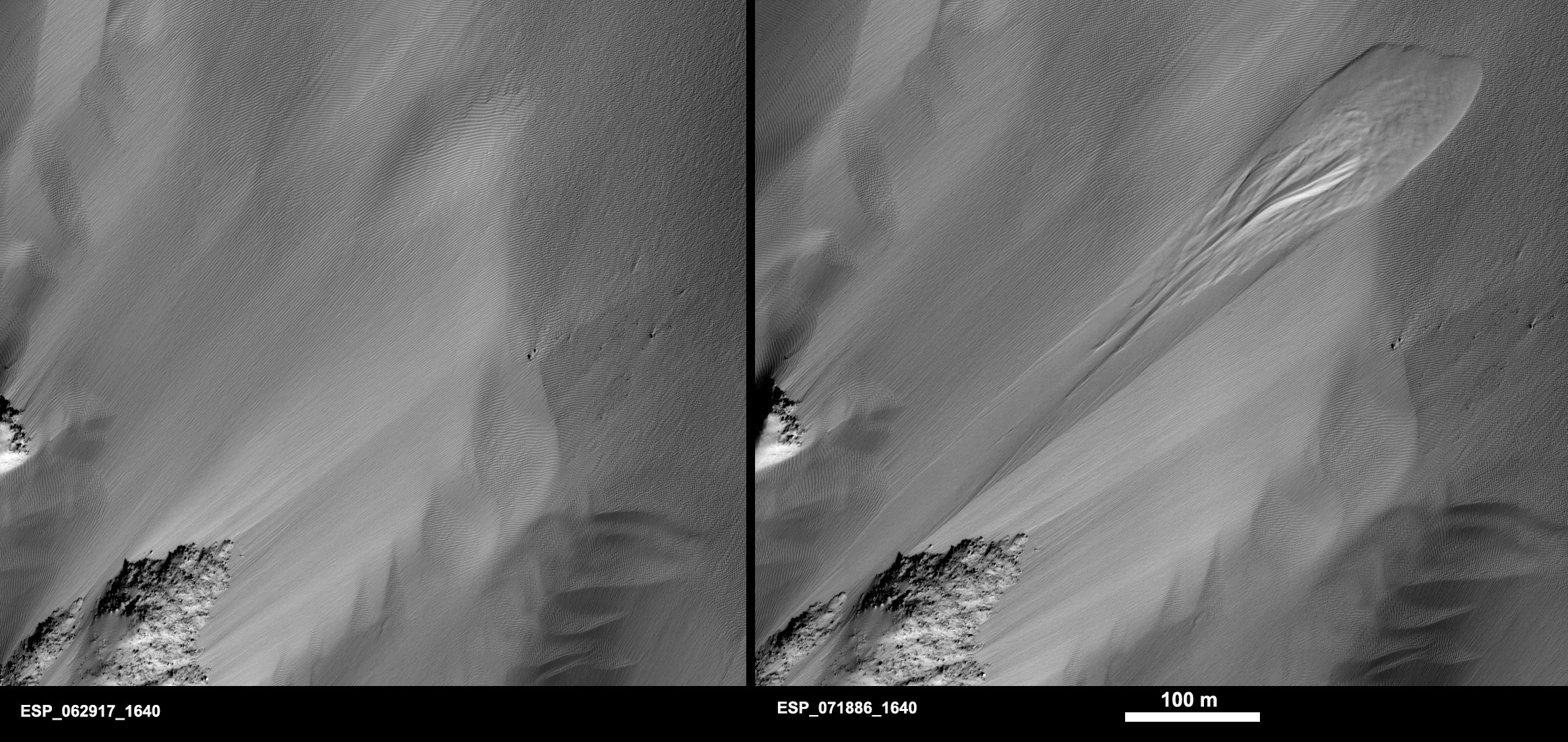
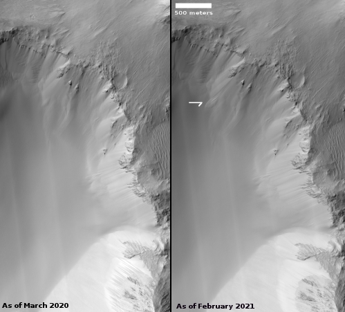
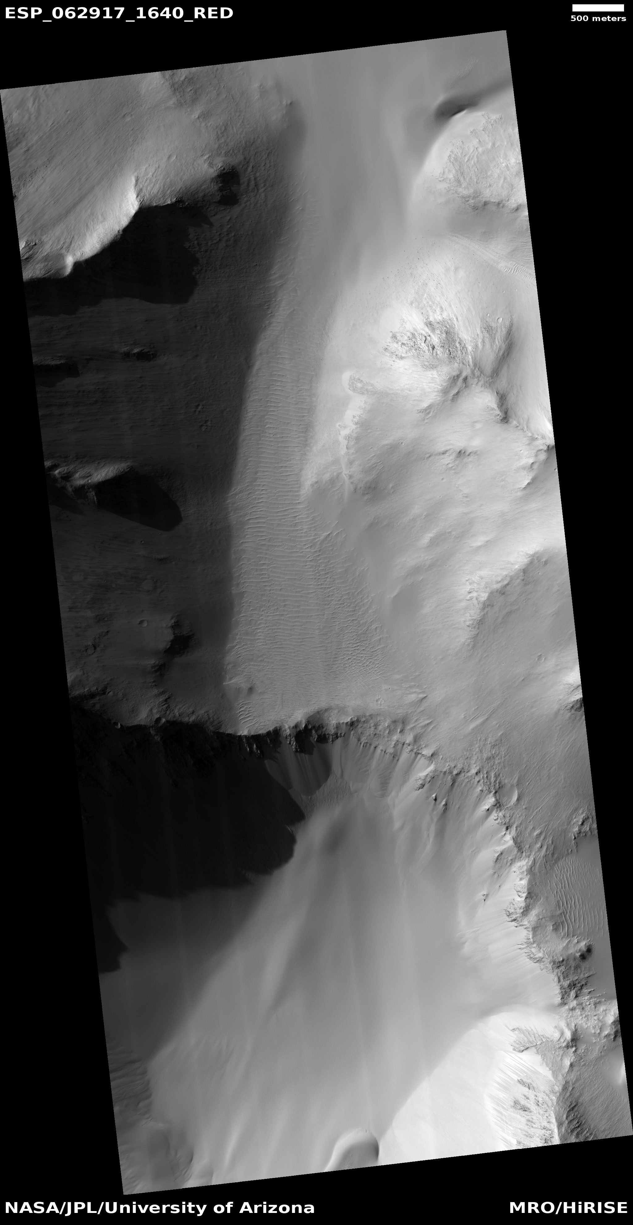
Cool image time! Today the science team for the high resolution camera on Mars Reconnaissance Orbiter (MRO) released images showing a very recent avalanche, or slumping, on the interior slopes of what looks like a small three-mile-wide crater inside the easternmost reaches of the giant canyon Valles Marineris.

The comparison above, reduced and rotated to post here, is their close-up showing the change, which occurred sometime between March 2021 and February 2022. The wider comparison on the right, cropped, reduced, and annotated by me, shows a wider view to help place this slumping in the context of the crater.

Calling this an avalanche is not really accurate, as it isn’t really the fall of boulders and rocks, but the quick slumping downward of an entire section of what looks like dust or sand. As Alfred McEwen of the Lunar & Planetary Laboratory in Arizona writes in the caption:
» Read more

1 comment

NASA extends Ingenuity’s mission through September ’22

Overview map
Click for interactive map.

NASA yesterday officially extended Ingenuity’s flight operations on Mars at least through September 2022, outlining in detail the helicopter’s hoped-for flight targets.

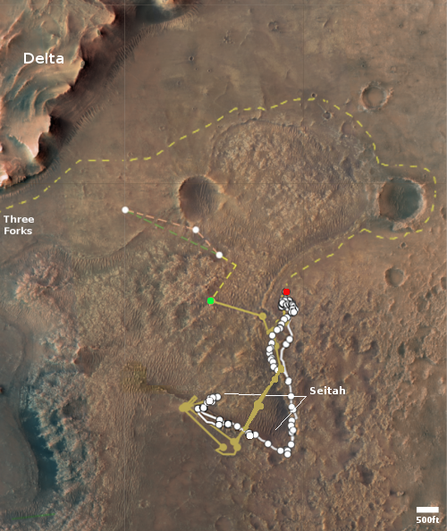
The map to the right shows the helicopter’s present location with the green dot, with its two possible future routes proceeding from this location indicated by dashed lines. The red dot indicates Perseverance’s present location, with its planned route from this spot indicated by the dashed lines.

Scheduled for no earlier than March 19, Ingenuity’s next flight will be a complex journey, about 1,150 feet (350 meters) in length, that includes a sharp bend in its course to avoid a large hill. After that, the team will determine whether two or three more flights will be required to complete the crossing of northwest Séítah.

Once Ingenuity crosses the rough terrain and reaches the delta, it will then be used to do more route scouting for the rover.

Upon reaching the delta, Ingenuity’s first orders will be to help determine which of two dry river channels Perseverance should take when it’s time to climb to the top of the delta. Along with routing assistance, data provided by the helicopter will help the Perseverance team assess potential science targets. Ingenuity may even be called upon to image geologic features too far afield (or outside of the rover’s traversable zone), or perhaps scout landing zones and caching sites for the Mars Sample Return program.

This ambitious plan exists because both the helicopter and its engineering team have far exceeded expectations. At the moment, there is no obvious reason why Ingenuity cannot continue to operate for years, an expectation that no one predicted.

0 comments

Mesa in the Martian northern lowlands

Mesa in the dry northern lowlands
Click for full image.

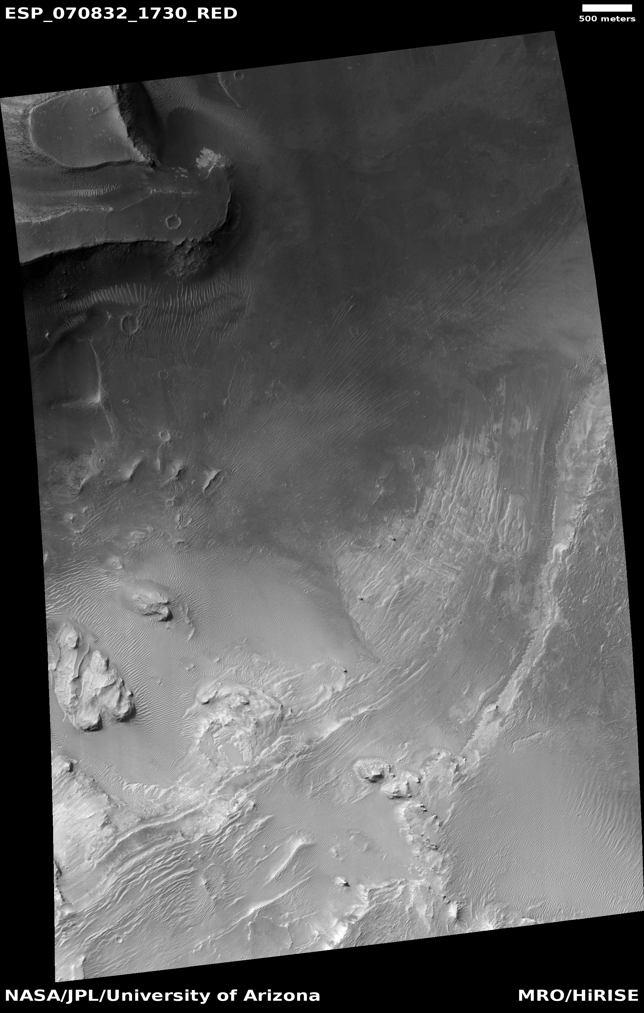
Cool image time! The photo to the right, cropped and reduced to post here, was taken on February 2, 2022 by the high resolution camera on Mars Reconnaissance Orbiter (MRO) and shows a mesa sticking up on the relatively flat and featureless northern lowland plains in Utopia Planitia, the second largest impact basin on Mars.

The full image shows three such mesas. Though pictures taken in the northern lowlands of Utopia tend to show evidence of buried ice or glaciers, the impression I get from this picture is one of dryness. If there is any ice here, it is below ground. And even that seems unlikely. The surface surrounding nearby craters does not have that squishy and slushy look that is seen in the north when an impact occurred on near surface ice. Instead, the ground looks solid.

The overview map below reinforces this impression.
» Read more

0 comments

Ingenuity completes 21st flight on Mars

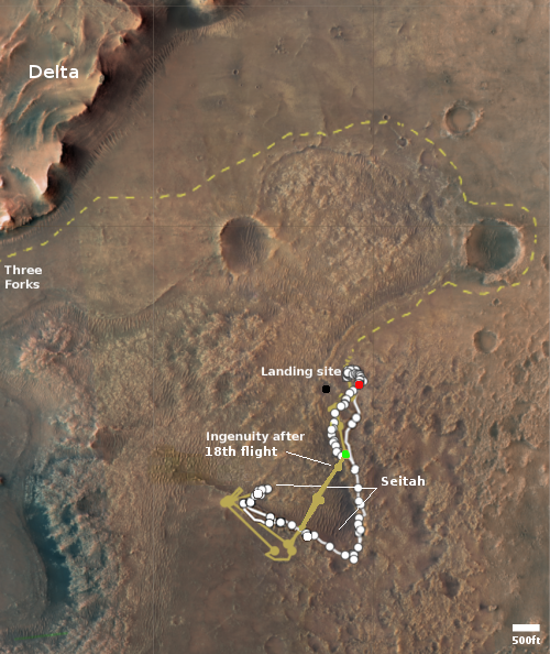
Overview map
Click for interactive map.

According to a tweet today from JPL, the Mars helicopter Ingenuity has successfully completed its 21st flight on Mars, traveling 1,214 feet in two minutes and nine seconds at an average speed of 12.6 feet per second.

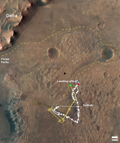
The red dot on the map to the right shows Perseverance’s location as of today. The green dot indicates Ingenuity’s position before the 21st flight. Since neither the Perseverance nor the helicopter teams have posted any updates describing the 21st flight, it is difficult to indicate a precise location for its landing site. All we know is that the helicopter is supposed to fly to the northwest, cutting across the rougher region while the rover follows the tan dotted line around that rough region, with both targeting the delta to the northwest.

As a guess, I have placed a black dot about 1,200 feet to the northwest.

0 comments

More thumbprints on Mars!

Thumbprints on Mars
Click for full image.

Cool image time! Among the many strange and unexplained geological features that scientists have identified on Mars, the thumbprint feature is one of the most intriguing. The photo to the right, cropped and reduced to post here, is a fine example, and was taken on September 10, 2021 by the high resolution camera on Mars Reconnaissance Orbiter (MRO).

The thumbprints are the lighter splotches, and are generally found near curved ridges located mostly in Martian lowlands. All appear to have crater-like features in them, though these craters are not impact craters, but likely (though not confirmed) caused by some form of underground eruption, be it mud, ice, lava or something else. Though scientists do not yet really understand the process that formed the thumbprints, the data strongly suggests that they formed in connection with glacial events. From this 2003 paper [pdf]:

TT [thumbprint terrain] as well as the associated trough systems were formed by a glacial mechanism. [Elevation] data show that the trough systems consistently lie topographically above the TT; this implies that if they were they formed by the same glacier, the troughs must have formed before the glacier retreated and formed the TT.

The splash apron around the crater near the bottom of the photo supports the glacial theory, implying the presence here of underground ice.

Scientists have also theorized wind processes and cinder cones as explanations for these features.

These particular thumbprints are located, as shown in the overview map below, in the same general area as a previous cool image of thumbprints, from April 2019.
» Read more

1 comment

Monitoring one glacier flowing off a mesa in Mars’ glacier country

Vicous glacial flow on Mars
Click for full image.

Today’s cool image takes us back to the mesa in Mars’ glacier country that first clued me in on the prevalence of ice in the Martian mid-latitudes. The photo to the right, rotated, cropped, and reduced to post here, was taken on November 13, 2021 by the high resolution camera on Mars Reconnaissance Orbiter (MRO), and shows a viscous flow coming down from a hollow on that mesa’s southern wall.

The new image has likely been taken to see if anything has changed since the previous image was taken in 2014. Based on the resolution published at the MRO website, nothing seems to have changed, though with more sophisticated software higher resolution versions of the images are available that might show some changes.

In my first post about Mars’ glacier country in December 2019, this flow was one of four that I featured coming off this same 30-mile wide mesa, as shown by the first overview map below.
» Read more

0 comments

Fractured terrain on Mars

Fractures on Mars
Click for full image.

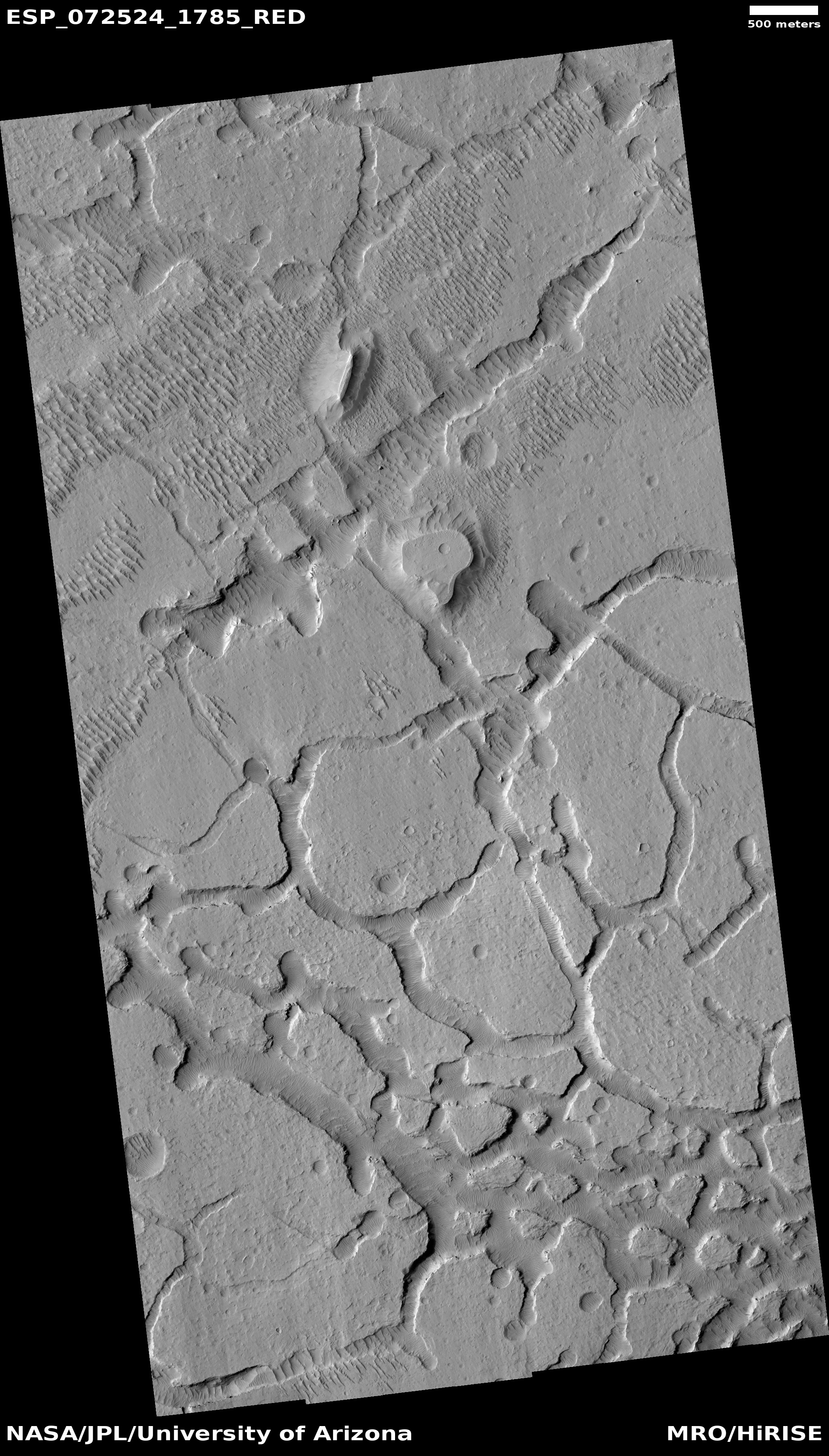
Today’s cool image, which at first glance does not seem so puzzling, actually falls into my “What the heck?” category of baffling Martian geology. The picture to the right, cropped and reduced to post here, was taken on January 15, 2022 by the high resolution camera on Mars Reconnaissance Orbiter (MRO). Labeled “Avernus Cavi fractures”, it shows what resembles the well-documented chaos terrain seen in many places on Mars, where erosion over eons along fault lines creates mesas with random criss-crossing canyons.

The problem is that this location is practically on the Martian equator, and chaos terrain tends to be found in the mid-latitude bands where there are many glaciers, suggesting the cyclical waxing and waning of those glaciers is what causes the erosion. Here at the Martian equator the terrain is very dry. No glaciers.

Moreover, note the higher mesa near the top center. Its flat top suggests that once this terrain was covered with an even higher layer of material, almost all of which was stripped away evenly everywhere, except where that mesa sits. As an amateur geologist I can’t think of any sequence of events that would do such a thing. I suspect professionals might have problems themselves.

Then there are the small parallel ridges. They suggest dunes, especially inside the depressions where sand and dust can get trapped. On the mesa tops however these ridges are more mysterious. Why for example are they aligned with the small ridge in some hollows, but not others? They in many ways remind me of the ridges in this earlier “What the heck?” cool image, also right on the equator.

The overview map below provides some help, though not much.
» Read more

2 comments

The layered Martian history exposed in Valles Marineris

Overview map

The layers in Valles Marineris
Click for full image.

Cool image time! Like the Grand Canyon in the United States, Mars’ largest canyon, Valles Marineris, appears to have been carved out of a layered terrain, thus exposing those many layers in the walls of the canyon.

Valles Marineris, however, is much much larger than the Grand Canyon. You could fit dozens of Grand Canyons inside it and hardly fill it. Yet, its walls have the same layered look, suggesting that in Mars’ long geological history, first came many events that laid down new layers time after time, followed by a long period when the laying ceased and other events carved out the canyon to its almost 30,000 foot depth (which by the way is also about six times deeper than the Grand Canyon).

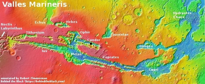
Today’s cool image to the right, cropped and reduced to post here, was taken on September 5, 2021 and shows a terraced terrain on the floor of Candor Chasma, one small side canyon of Valles Marineris that is still much larger than the Grand Canyon. The black dot in the overview map above indicates its location. I roughly estimate the elevation difference between the high and low spots in the picture is about 3,000 feet, a difference that while two-thirds that of the depth of the Grand Canyon is almost unnoticeable within the depths of Valles Marineris.

This layering is probably the canyon’s most important geological feature. See these previous cool images here and here for other examples. When geologists finally arrive on Mars and can begin dating these layers in detail they will likely reveal the planet’s entire geological history, going back five to six billion years.

Most of the layers are probably volcanic flood lava laid down by repeated eruptions from the giant volcanoes to the west. In between and within however will be deposits from the Martian atmosphere, telling us its composition and thickness. All told, the layers of Valles Marineris will likely unlock almost all of the most basic secrets of Martian geology.

We merely have to go there to find out.

0 comments

Martian crater overwhelmed by glacier?

Martian crater overwhelmed by glacier?
Click for full image.

Cool image time! The photo to the right, rotated, cropped, and reduced to post here, was taken on January 28, 2022 by the high resolution camera on Mars Reconnaissance Orbiter. It shows what the science team labels a “modified crater.”

What I see is an old crater almost completely covered by glacial material. That material however is also very old, as there are numerous small craters on its surface, enough that it must have been here for a long time. Its cracked surface also suggests this glacier is very old.

Thus, while we might have ice here, buried by a thin layer of dust and debris to prevent it from sublimating away, it must be very old ice. The many climate cycles caused by the extreme swings in Mars’ rotational tilt, from 11 to 60 degrees, have apparently not caused this ice to ebb and flow very much.

Might it therefore not be ice, but hardened lava?

The location, as shown by the overview map below, provides some context, but only makes this mystery more puzzling.
» Read more

2 comments

ESA: ExoMars launch in ’22 “very unlikely” due to Russian invasion of the Ukraine

In a statement yesterday condemning Russia’s invasion of the Ukraine and responding to the Russians’ decision to suspend cooperation with Arianespace in French Guiana, the European Space Agency (ESA) also admitted, almost as an aside, that the ExoMars launch in ’22 to Mars is now “very unlikely.”

That mission is a partnership with Russia, where the Russians provide the rocket and the lander that will put Europe’s Franklin rover on the surface.

For the scientists running ExoMars, this delay only adds to their frustration, as the mission has already been delayed several times, most recently from a ’20 launch because the lander parachutes — being built by ESA — were not ready.

12 comments

Ingenuity’s 20th flight a success

According to a tweet released tonight by JPL, the 20th flight of Ingenuity on Mars was a success, lasting 130 seconds and traveling about 1,283 feet.

The tweet includes a short video showing the helicopter taking off and then landing, at the same spot, which I am sure is not of this flight but from a previous test that simply went up and down. The flight just completed took off and headed mostly to the north, slightly west, and landed in a different spot entirely.

Expect more information to follow.

2 comments

Scientists: Martian topography in one region suggests the past existence of lakes and river networks, but not a large single ocean

Based on a just published paper, scientists using orbital topography data and imagery have concluded that more than three billion years ago on Mars ancient rivers in the transition zone between the southern cratered highlands and the northern lowland plains fed into numerous lakes in the lowlands, not a single large ocean as some scientists posit.

From their abstract:

The northern third of Mars contains an extensive topographic basin, but there is conflicting evidence to whether it was once occupied by an ocean-sized body of water billions of years ago. At the margins of this basin are the remnants of deltas, which formed into water, but the size and nature of this water body (or water bodies) is unclear, and detailed investigations of different regions of the basin margins are necessary.

In this study, we use high-resolution image and topographic datasets from satellites orbiting Mars to investigate a series of water-formed landforms in the Memnonia Sulci region, set along the boundary of Mars’s northern basin. These landforms likely formed billions of years ago, providing evidence for ancient rivers and lakes in this region. The geologic evolution of these rivers and lakes was complicated, likely influenced by water-level fluctuations, changes in sediment availability, and impact cratering. Our topographic analysis of these rivers and lakes suggests that they terminated in a series of ancient lake basins at the boundary of Mars’s northern basin, rather than supplying a larger, ocean-sized body of water. [emphasis mine]

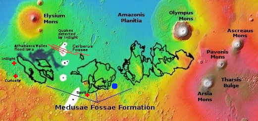
Overview map

The Memnonia Sulci region is in the cratered highlands just south of the Medusae Fossae Formation, the largest volcanic ash deposit on Mars. The region of study in it is marked by the blue dot in the overview map to the right.

The study does not preclude the possible existence of a northern ocean on Mars, but it says that at least in this region at the equator, it did not exist. Instead, the various river valleys drained into separate smaller and relatively short-lived lakes.

7 comments

Curiosity images the Martian version of a cave formation

An helictite on Mars?
Click for full image.

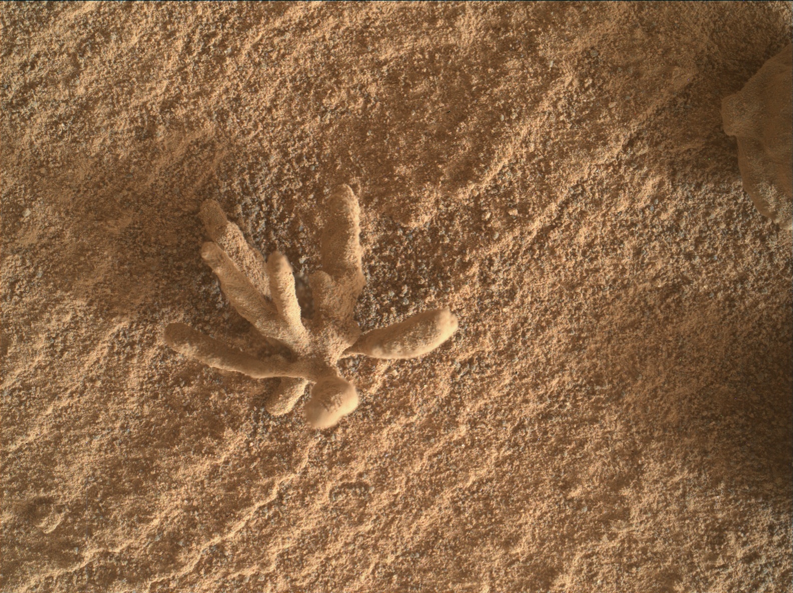
Cool image time! The photo to the right, cropped and reduced to post here, was taken today by Curiosity’s Mars Hand Lens Imager (MAHLI), a camera designed to get close high resolution images of very small features on the surface.

The Curiosity image site does not provide a scale, but MAHLI, located at the end of the rover’s robot arm, is capable of resolutions as small as 14 microns per pixel. Since a micron is one thousandth of a millimeter, and the original image was 1584 by 1184 pixels in size, that means the entire image is likely only slightly larger than 18 to 25 millimeters across, or slightly less than an inch.

This feature, which closely resembles a cave helictite, is thus about a quarter inch in size. Helictites, which in caves often resemble wildly growing roots, are nonetheless made of calcite, not organic material. They grow wildly because the water is being pushed out from their center is under pressure, so that as it drips away from the formation it leaves its calcite deposits randomly, causing the formation to grow randomly.

MAHLI also took what looks to be an infrared or heat image of the formation, which appears to show that the tips of the branches are at a different temperature, I think cooler, than the rest of the formation.

While seeping water causes helictites on Earth, what formed this thing on Mars is beyond my guess. It sure looks cool however.

4 comments

Ingenuity update: Dust storm caused issues; 20th flight upcoming

Overview map
Click for interactive map.

According to the Ingenuity engineering team in an update today, the Mars helicopter is getting ready for its 20th flight, scheduled for no earlier than today, even as the team successfully dealt with dust that settled on the helicopter’s various parts prior to flight 19.

The dust storm did, however, leave the Ingenuity team with two additional challenges to deal with: a dirty navigation camera window and dust in the swashplate assemblies.

Comparing navigation camera images taken before and after the dust storm revealed that the storm deposited debris on the ground-facing navigation camera window, specifically around the periphery of the camera’s field of view. Debris on the navigation camera window is problematic because Ingenuity’s visual navigation software may confuse the debris with the actual ground features that it tries to track during flight, which can cause navigation errors. Fortunately, Ingenuity’s software provides a tool for dealing with this issue: The team can provide an updated image mask file that tells the visual navigation software to ignore certain regions of the image. The operations team made use of this feature and performed an image mask update late last month.

The dust storm also deposited dust and sand in Ingenuity’s swashplate assemblies. On Mars as well as on Earth, a helicopter’s swashplates are very important because they control the pitch (angle from horizontal) of the rotor blades, which is essential for stable and controlled flight. Ingenuity’s swashplate issue was first detected when the rotorcraft reported a failure during its first automated swashplate actuator self-test since the dust storm on Jan. 28, 2022 (Sol 335 of the Perseverance mission). Data revealed that all six swashplate servo actuators were experiencing unusual levels of unusual levels of resistance while moving the swashplates over their range of motion.

The engineers subsequently tested a procedure, planned before launch, for cleaning the swashplates, and found that it worked.

The data from that activity showed a significant improvement – a reduction in servo loading, so the team followed it up with seven back-to-back servo wiggles on Sol 341. Remarkably, by the end of that activity, Ingenuity’s servo loads appeared nearly identical to nominal loads seen prior to the dust storm.

After dealing with both dust issues, flight 19 proceeded successfully, as planned.

The overview map above shows the present location of Perseverance as the red dot, the present location of Ingenuity by the green dot, and the approximate landing site for the helicopter’s 20th flight by the black dot. The tan dotted line shows Perseverance’s planned route.

Perseverance itself has been traveling fast since Ingenuity’s last flight on February 9th, almost completely retracing its steps to return almost to its landing site.

4 comments

Dry barren ground in Martian northern lowlands?

Dry barren ground in the Martian northern lowlands?
Click for full image.

Today’s cool image is intriguing because of what appears to not be there, rather than what is there. The photo to the right, cropped and reduced to post here, was taken on November 3, 2021 by the high resolution camera on Mars Reconnaissance Orbiter (MRO).

At first glance it appears to show a very dry, barren surface. At its base are many parallel grooves running from the southwest to the northeast. On top of these grooves are several more recent crater impacts, as well as several patches of higher bedrock that appears to have been hard enough to resist whatever erosion process caused the groves.

Yet, based on the overview map below, the location of this photo should not be dry and barren, but instead home to a near-surface ice sheet covering everything.
» Read more

0 comments

Curiosity’s coming travels across the rocky Greenheugh Pediment

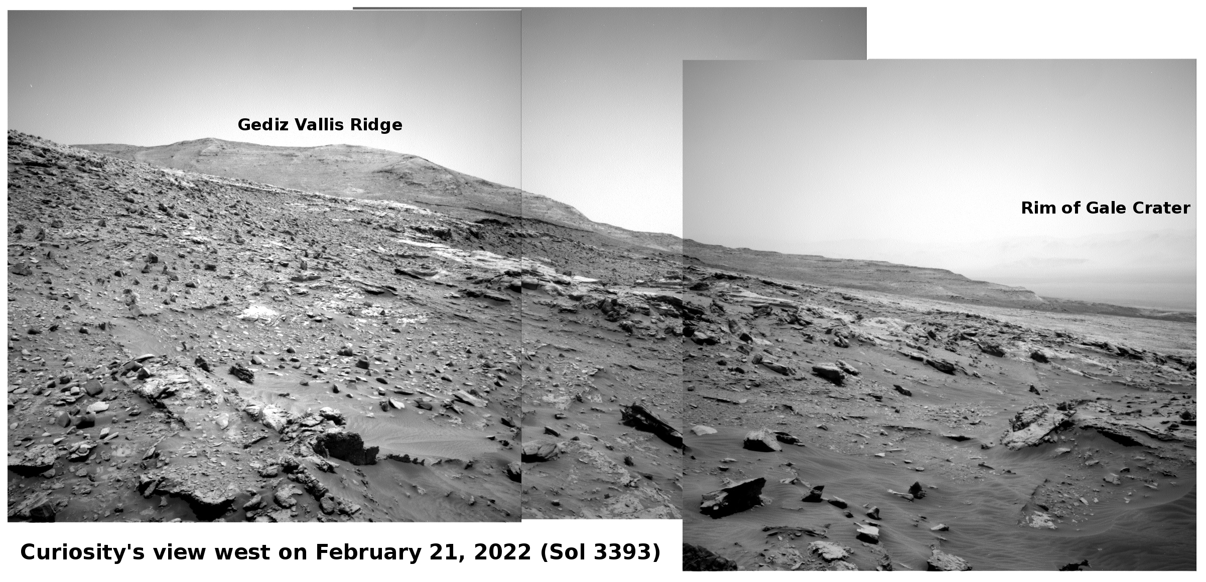
Curiosity's view west on February 21, 2022 (Sol 3393)
Click for full resolution panorama. Original images can be found here, here, and here.

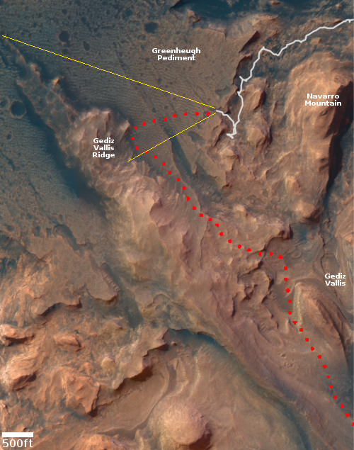
Overview map
Click for interactive map.

Curiosity, having successfully climbed up and out of Gordon Notch, was able to aim its navigation cameras forward yesterday and get its first views from this position across the very rocky Greenheugh Pediment to its next major goal, Gediz Vallis Ridge. The panorama above, taken by the rover’s right navigation camera, shows this view. The ridge is about 1,500 feet away, at its closest point. The rim of Gale Crater, barely visible in the haze, is about 20-30 miles away.

The overview map to the right indicates the area covered in this panorama by the yellow lines. The red dotted line indicates Curiosity’s planned future route.

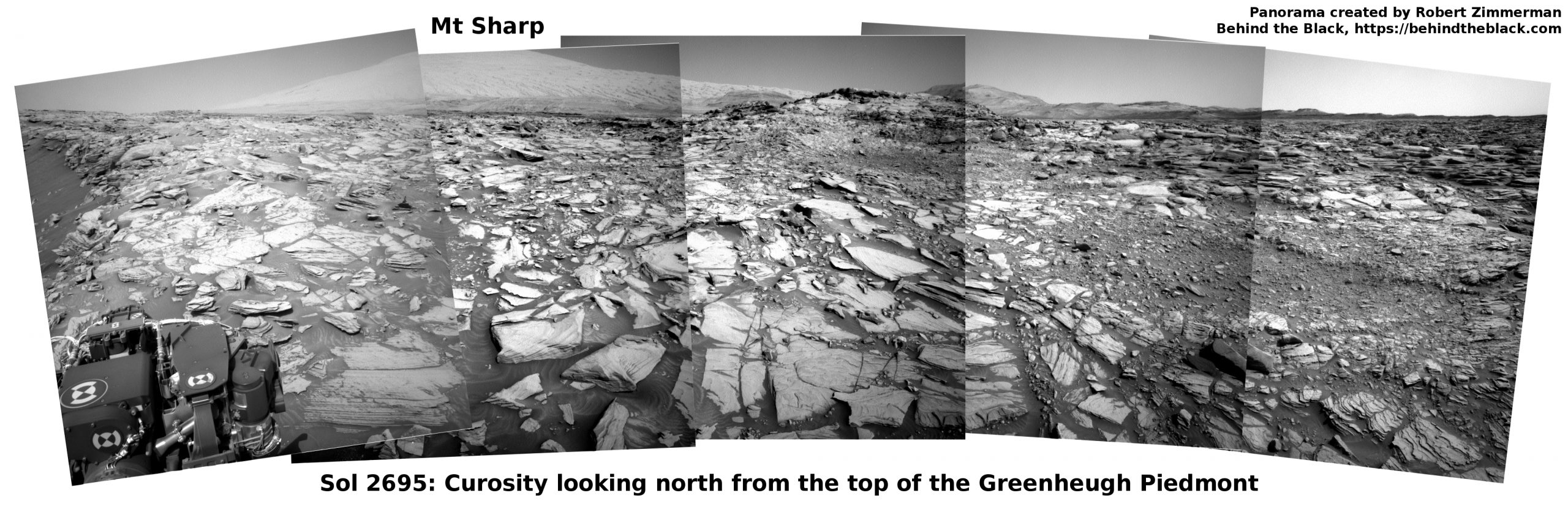
Curiosity’s first view of the pediment was made in March 2020, from a point on its northern border, just beyond the top edge of the map. The panorama taken then showed what appeared to be a very treacherous and rough surface, possibly too rough for Curiosity to traverse.

According to the science team’s most recent update from before the holiday weekend, the plan had been to spend February 19-20 studying the ground, then drive a short distance yesterday to get a better view ahead.

This will give us a good vantage point to look into the valley ahead and try to scope out our future route. … We chose to drive about 10m total, in order to get the rover oriented at a good heading and parked in a good spot. We expect a similarly beautiful view from our post-drive imaging.

That view is the panorama above. Though still very rough, the ground ahead appears far more traversable than the surface seen in 2020.

1 comment
1 47 48 49 50 51 128