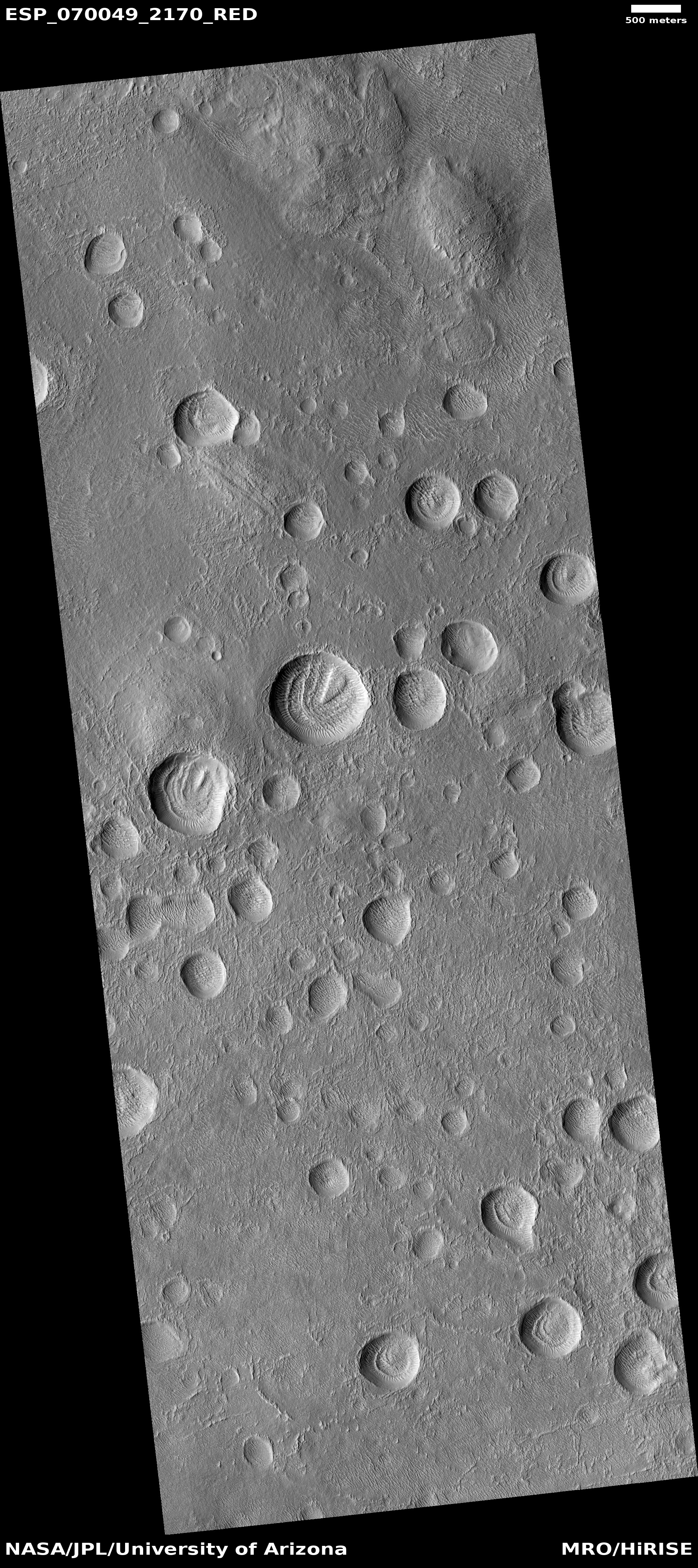
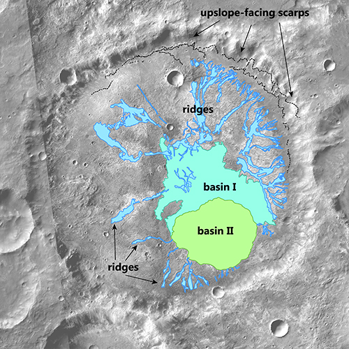
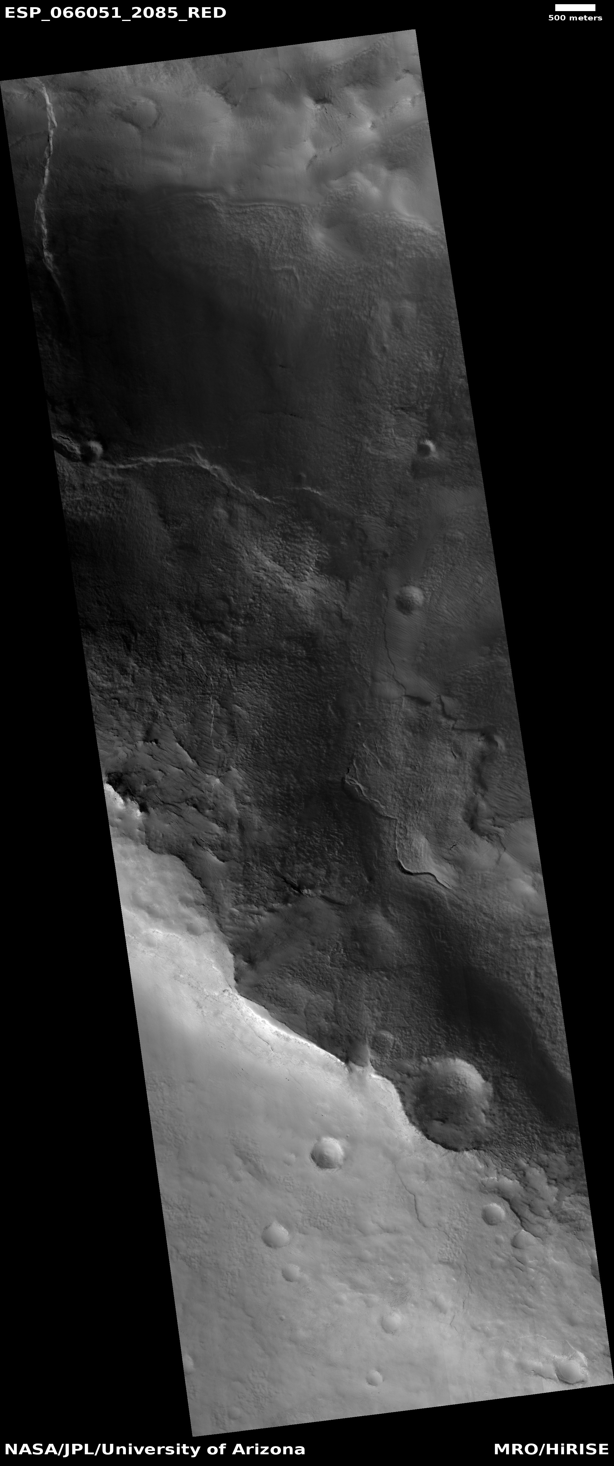
New orbital radar data confirms large ice deposits in Phelgra Mountains near Starship landing zone
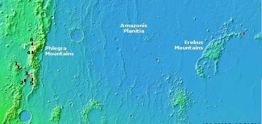
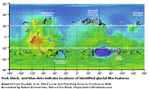
Overview map

A new paper published this week used the SHARAD radar instrument on Mars Reconnaissance Orbiter (MRO) to confirm that the glacial features found everywhere within the Phlegra Mountains where one of Starship’s four prime landing sites is located contains significant quantities of very accessible pure water ice.

The red dots on the map to the right mark two of those prime landing sites, with one inside the Phelgra Mountains in a region directly studied by this paper. The numbered black dots were other images taken by MRO for SpaceX, reported here in 2020. From the paper’s abstract:

We examined mid-latitude landforms on Mars that resemble Earth’s debris-covered glaciers in a region called Phlegra Montes. Our study site is a 1,400-km-long mountain range in the northern hemisphere of Mars that houses numerous debris-covered glaciers also called Viscous Flow Features (VFFs). Using data from the SHallow Radar (SHARAD) instrument, we detected eight new glaciers and estimated the thickness and volume of ice within them as well as the thickness of the debris on top insulating the ice. Our findings suggest that the region holds around 1.2 trillion cubic meters of ice below the surface. We detected two notable types of glaciers for the first time on Mars using SHARAD: (a) a glacier system with terrace-like steps and (b) a perched “hanging” glacier on the eastern side of the mountains

The study also found that the layer of dust and debris that covers these glaciers and protects them from sublimating away ranges from 6 to 25 feet in thickness, well within reach of any future colonists.

This study only confirms what all the orbital data for the past two decades has suggested, that Mars is an icy world like Antarctica, not a dry desert like the Sahara. As the researchers themselves note in the very first line of their paper, “Mars is a frozen world where water ice is abundant above, at, and under the surface.”

Their research also confirms that SpaceX has made a good choice for its Starship prime landing sites. Though it will likely not make its first landing at site #3, because it is inside the mountains and thus more risky, expect a landing there not long thereafter.
7 comments

New research confirms the steady decline of Martian ice with each glacial cycle

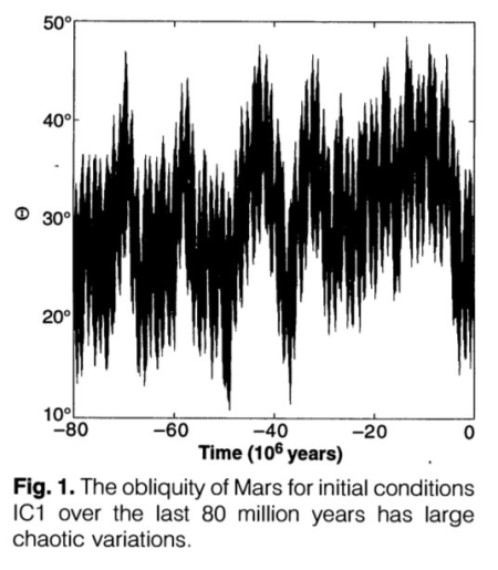
The obliquity cycles of Mars

Using orbital data from Mars Reconnaissance Orbiter (MRO) of glaciers inside mid-latitude craters, scientists have concluded that there was a steady decline in the growth of those glaciers with each new glacial cycle.

They focused on craters with indicative signs of glaciation, such as ridges, moraines (piles of debris left behind by glaciers), and brain terrain (a pitted, maze-like surface formed by ice-rich landforms). By comparing the shapes and orientations of these features with climate models, they found that ice consistently clustered in the colder, shadowed southwestern walls of craters. This trend was consistent across various glacial periods, ranging from approximately 640 million to 98 million years ago.

The results show that Mars didn’t just freeze once—it went through a series of ice ages driven by shifts in its axial tilt, also known as obliquity. Unlike Earth, Mars’ tilt can swing dramatically over millions of years, redistributing sunlight and triggering cycles of ice build-up and melting. These changes shaped where water ice could survive on the planet’s surface. Over time, however, each cycle stored less ice, pointing to a gradual planetary drying. [emphasis mine]

You can read the paper here [pdf]. This result is not new. Based on the orbital data scientists have theorized now for almost a decade that as Mars’ rotational tilt (its obliquity) swings from 11 to 60 degrees, it produces extreme climate cycles on the planet. Those swings are shown on the graph to the right, taken from this 1993 paper [pdf]. When the obliquity is low, the mid-latitudes are warm and the glaciers there shrink, with the snow falling at the poles. When obliquity is high, the poles are warmer and its ice sublimates away to fall as snow in the mid-latitudes, thus causing those glaciers to grow instead.

The orbital data has consistently shown that with each new cycle, the glaciers grew less, suggesting that less global water was available on the planet. This new study further confirms these conclusions.

One last point: Though the amount of water ice on Mars has declined, we mustn’t think the red planet now has none. The orbital data shows that there is a lot of near surface ice on Mars, covering the planet from 30 degrees latitude poleward. As I’ve noted numerous times, Mars is a desert like Antarctica.

9 comments

New study finds ice is better at dissolving iron than liquid water

In a result that could have a direct bearing on trying to understand the inexplicable geology of Mars, a new study has found that ice actually does a better job at releasing iron from mineral deposits than liquid water.

It was once believed that when iron-rich mineral deposits were locked in ice, the iron would stay put, but a new study from Sweden’s Umeå University shows that the ice itself is actually working better than permafrost melt to release the iron. The study showed that ice at -10 °C (14 °F) releases more iron from mineral deposits than liquid water at 4 °C (39.2 °F). “It may sound counterintuitive, but ice is not a passive frozen block,” says study co-author Jean-François Boily. “Freezing creates microscopic pockets of liquid water between ice crystals. These act like chemical reactors, where compounds become concentrated and extremely acidic. This means they can react with iron minerals even at temperatures as low as minus 30 degrees Celsius.”

The researchers also found that the seasonal freeze/thaw cycle helped this process, and that brackish fresh water did better in dissolving the iron than seawater.

The significance for Mars geology is that this suggests glacial ice in the alien Mars climate might be the catalyst for creating its meandering canyons that so much resemble features on Earth produced by liquid water. On Mars however no model yet has been convincingly successful in creating past conditions where liquid water could flow on the surface. Mars has either been is too cold or its atmosphere too thin to allow it.

This study suggests ice however could do the work. It also fits with other Martian data that suggests the same, that at the base of the Martian glaciers pockets of liquid water could exist that act to shape the canyons.

All of this is speculation on my part, but it seems that the planetary scientists who are studying Mars should take a close look at this research.

0 comments

The glaciers on Mars are almost pure ice with only a thin cover of dust and debris

A map of glaciers on Mars
A map of glaciers on Mars.

According to new research, scientists now think that the glaciers on Mars are almost pure ice, protected from sublimation by a thin cover of dust and debris.

Work over the last 20 years has demonstrated that at least some of these glaciers are mostly pure ice with only a thin cover of rock and dust, but according to a new paper published in Icarus, glaciers all over the planet actually contain more than 80% water ice, a significant finding. Ultimately, this means that Mars’s glacial ice deposits are nearly pure across the globe, providing a clearer understanding of Mars’ climate history and a possible resource for future utilization.

The researchers analyzed mid-latitude glaciers at five different locations in both the north and south hemispheres, and found that at every location the data suggested almost pure ice.

The map to the right, from earlier research, shows the prevalence of near-surface ice once you get above 30 degrees latitude. From the poles to the mid-latitudes it appears there is an ice sheet or “ice table” just below the surface. In the mid-latitudes glaciers dominate, as this appears to be the region where that ice is beginning to dissipate. In the equatorial regions little or no near-surface ice has been detected, though there has been some evidence in some places of ice at deeper depths.

This data once again demonstrates that Mars is not a desert like the Sahara, as we once believed. Instead, it more resembles Antarctica, where there is ice everywhere that simply needs to be processed for use.

0 comments

What a Martian impact looks like on a sheet of slushy ice

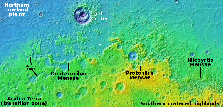
Overview map

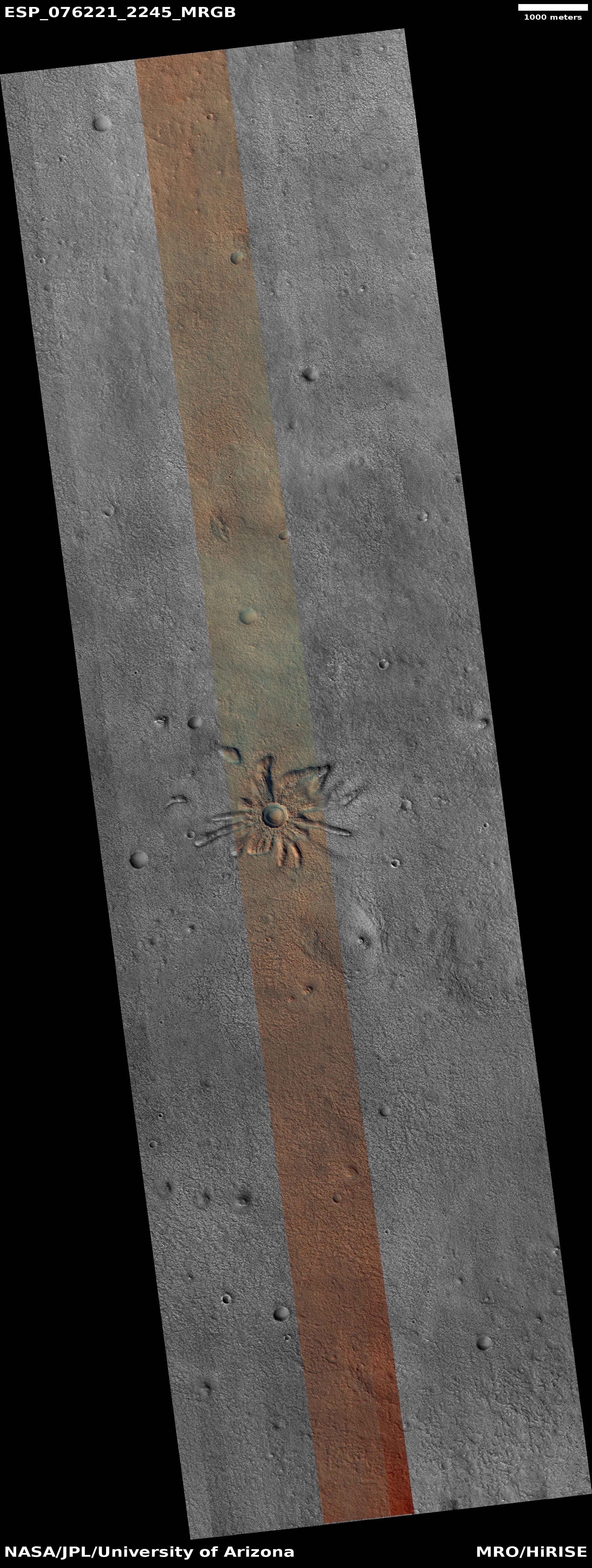
What a Martian impact looks like on a sheet of ice
Click for full image.

My headline is a bit of a guess, but it is an educated guess for today’s cool image. The photo to the right, cropped, reduced, and sharpened to post here, was taken on October 30, 2022 by the high resolution camera on Mars Reconnaissance Orbiter (MRO).

The location, as indicated by the white dot in the overview map above, puts this impact in a relatively flat area of Deuteronilus Mensae, the westernmost chaos region of the 2,000 mile long mid-latitude strip I call glacier country.

In other words, there is likely a lot of near surface ice here, as this impact makes very plain. If you imagine dropping a pebble into a thick layer of soft ice cream, you might get a crater reminiscent of this. I use for comparison ice cream on Earth because the lighter Martian gravity probably makes Martian ice softer and more slushy.

As I have said many times before, Mars is strange, Mars is mysterious, and above all Mars is alien.

1 comment

Computer model: Glaciers move slower in Mars’ gravity

Using a computer model that compared glacier flows on Earth and Mars, scientists have concluded that past glaciers on Mars flowed more slowly than on Earth, and produced different types of erosion features that might explain the red planet’s many riverlike geological features.

The new study modeled how Mars’ low gravity would affect the feedback between how fast an ice sheet slides and how water drains below the ice, finding under-ice channels would be likely to form and persist. Fast water drainage would increase friction at the interface of rock and ice. This means ice sheets on Mars likely moved, and eroded the ground under them, at exceedingly slow rates, even when water accumulated under the ice, the authors said.

From the paper [pdf]:

We show quantitatively that the lower surface gravity on Mars should alter the behavior of wet-based ice masses by modifying the subglacial drainage system, making efficient, channelized drainage beneath Martian ice both more likely to form and more resilient to closure. Using as an example the case of the ancient southern circumpolar ice sheet, we demonstrate that the expected finger-print of wet-based Martian ice sheets is networks of subglacial channels and eskers, consistent with the occur-rence of valley networks and inverted ridges found on the Martian highlands.

This paper confirms the sense I have gotten from the planetary community about glaciers on Mars, that it could be the flow of glaciers that formed its many meandering canyons, not liquid water. The case however is not yet proven, as this is only a computer model.

0 comments

New paper: Glaciers on Mars could have been extensive, despite the lack of expected subsequent landforms

glacial drainage patterns as expected on Mars
Click for full figure.

According to a new paper published this week, scientists now posit that glaciation could have been much more extensive in the geological history of Mars than presently believed, despite the lack of the expected subsequent landforms as seen on Earth.

From the abstract:

The lack of evidence for large-scale glacial landscapes on Mars has led to the belief that ancient glaciations had to be frozen to the ground. Here we propose that the fingerprints of Martian wet-based glaciation should be the remnants of the ice sheet drainage system instead of landforms generally associated with terrestrial ice sheets. We use the terrestrial glacial hydrology framework to interrogate how the Martian surface gravity affects glacial hydrology, ice sliding, and glacial erosion. …[W]e compare the theoretical behavior of identical ice sheets on Mars and Earth and show that, whereas on Earth glacial drainage is predominantly inefficient, enhancing ice sliding and erosion, on Mars the lower gravity favors the formation of efficient subglacial drainage. The apparent lack of large-scale glacial fingerprints on Mars, such as drumlins or lineations, is to be expected. [emphasis mine]

In other words, on Earth the higher gravity causes glaciers and ice sheets to slide, with the liquid water at the base acting as a lubricant. On Mars, the lower gravity slows that slide, so that the water at the glacier’s base drains away instead, causing erosion and the formation of a drainage pattern in the ground beneath the glacier or ice sheet.

The image above, from figure 1 of the paper, shows on the left a graphic of the two types of drainage patterns expected, and on the right two examples found on Earth (D1: Devon Island; D2: Northwest Territories). Orbiter images of Mars have found variations of these types of drainage patterns in numerous places in Mars’ mid-latitude glacial bands, as shown below.
» Read more

1 comment

Monitoring one glacier flowing off a mesa in Mars’ glacier country

Vicous glacial flow on Mars
Click for full image.

Today’s cool image takes us back to the mesa in Mars’ glacier country that first clued me in on the prevalence of ice in the Martian mid-latitudes. The photo to the right, rotated, cropped, and reduced to post here, was taken on November 13, 2021 by the high resolution camera on Mars Reconnaissance Orbiter (MRO), and shows a viscous flow coming down from a hollow on that mesa’s southern wall.

The new image has likely been taken to see if anything has changed since the previous image was taken in 2014. Based on the resolution published at the MRO website, nothing seems to have changed, though with more sophisticated software higher resolution versions of the images are available that might show some changes.

In my first post about Mars’ glacier country in December 2019, this flow was one of four that I featured coming off this same 30-mile wide mesa, as shown by the first overview map below.
» Read more

0 comments

Mars: Glaciers on top of glaciers on top of glaciers

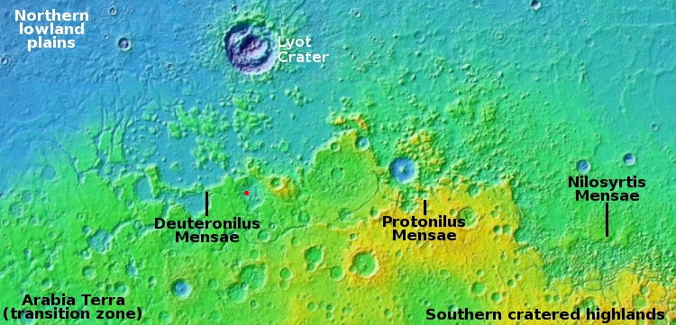
Overview map
Mars’ glacier country.

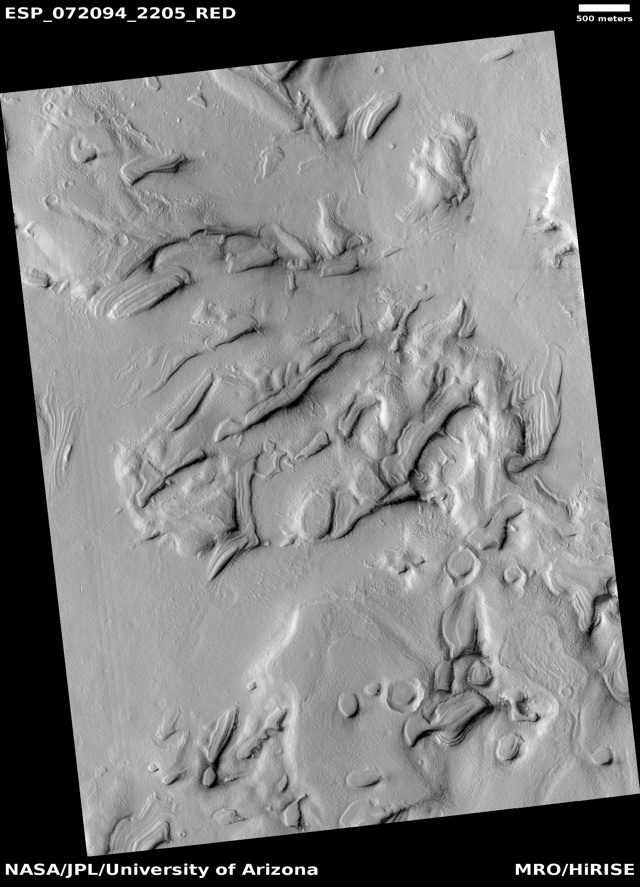
glaciers on top of glaciers on top of glaciers
Click for full image.

Cool image time! The photo to the right, rotated, cropped, and reduced to post here, was taken on December 12, 2021 by the high resolution camera on Mars Reconnaissance Orbiter (MRO). It shows a small patch of layered glacial features flowing in all directions. The overview map above marks its location by the red dot, at 40 degrees north latitude in the region dubbed Deuteronilus Mensae, on the western end of the 2,000 long strip from 30 to 60 degrees north latitude that I dub Mars’s glacier country because practically every image in this region shows glacial features.

What makes the glacial features in this picture so remarkable is their number, their somewhat chaotic nature, and the evidence of many layers, suggesting a cyclical process of ebb and flow over the eons.

Below I zoom into one section of this photo, showing that section at full resolution.
» Read more

1 comment

Craters in the soft Martian northern lowland plains

Craters in the soft Martian northern lowland plains
Click for full image.

Cool image time! The photo to the right, cropped and reduced to post here, was a featured image today from the high resolution camera on Mars Reconnaissance Orbiter (MRO).

The caption, written by Carol Weitz of the Planetary Science Institute in Arizona, focused on the wind patterns created within these craters.

These impact craters in the northern middle latitudes have interesting interiors: all of them have wind-blown (aeolian) ripples.

Outside of the craters and along the crater floors, the ripples are all oriented in the same direction. However, along the walls of some of the larger craters, the ripples are situated radially away from the center, indicating the winds moving inside the larger craters can be influenced by the topography of the crater wall.

Additionally, many of the larger craters have layered mesas along their floors that are likely sedimentary deposits laid down after the craters formed but prior to the development of the aeolian ripples.

I am further intrigued by the rimless nature of these craters, as well as the lack of significant rocky debris at their edges. They all look like the bolides that created them impacted into a relatively soft surface that, rather than break up into rocks and boulders, melted, flowed, and then quickly refroze into these depressions.

The location, as always, provides us a possible explanation.
» Read more

2 comments

Layered glaciers in Mars’ glacier country

Layered glacier in Mars' glacier country
Click for full image.

Cool image time. The photo to the right, cropped and reduced to post here, was taken on August 30, 2021 by the high resolution camera on Mars Reconnaissance Orbiter (MRO). It shows two different impact craters in a glacial region dubbed Nilosyrtis Mensae, located in the northern mid-latitudes in the 2,000 mile long strip chaos terrain that I have labeled glacier country because practically every image finds them there.

The splash apron surrounding the larger crater is typical of craters in Martian regions where ice is thought to be near the surface.

What makes this picture interesting is that the glaciers appear layered. You can see evidence of this in the mounds inside both craters. Those mounds appear to represent earlier periods when there was more ice here. Since then the mounds have partly sublimated away.

You can also see evidence of layers in the material surrounding the nearby larger mounds.

The map below shows us where this image is, relative to all of glacier country as well as the rover Perseverance in Jezero Crater.
» Read more

0 comments

Glaciers in the Martian south latitudes

Glaciers in Mars' southern hemisphere
Click for full image.

Most of the glacier cool images I have posted in the past few years from the high resolution camera on Mars Reconnaissance Orbiter (MRO) have shown the obvious glacial features found in the northern hemisphere in that 2,000 mile long strip of chaos terrain at about 40 degrees latitude I dub “Glacier Country.”

Today’s glacier image to the right, cropped and reduced to post here, takes us instead to the southern hemisphere, into Hellas Basin, the death valley of Mars. The picture was taken on April 8, 2021, and in the full picture gives us a myriad of examples of glacial features. The section featured to the right focuses in on what appears to be an ice covered south facing slope, which in the southern hemisphere will get the least sunlight.

Think of the last bits of snow that refuse to melt after a big blizzard. They are always found in shadowed areas, which in the southern hemisphere would be this south-facing slope.

The overview map below shows how this location, marked by the small white rectangle, is inside Hellas Basin, at a low altitude comparable to the northern lowland plains. The feature is also a comparable latitude, 43 degrees south, to the glacier country of the north.
» Read more

0 comments

Spring arrives on the northern polar cap of Mars

Buzzell dunes and pedestal crater near the Martian north polar ice cap
Click for full image.

Cool image time! It is now spring in the northern hemisphere of Mars, and the first bits of sunlight are finally reaching its north polar ice cap. During the winter, as happens each Martian year, that polar cap of water ice gets covered by a thin mantle of dry ice no more than six feet thick. Moreover, this mantle doesn’t just cover the ice cap, it extends south as far as about 60 degrees latitude, covering the giant sea of dunes that surrounds the ice cap.

When spring comes that mantle begins sublimate away, with its base first turning to gas. When the pressure builds up enough, the gas breaks out through the frozen mantle’s weakest points, usually the crest or base of dunes or ridges, leaving behind a dark splotch caused by the material thrown up from below that contrasts with the bright translucent dry ice mantle.

Each year for the past decade scientists have been using the high resolution camera on Mars Reconnaissance Orbiter (MRO) to monitor this sublimation process. The photo above, taken on February 24, 2021 and cropped, enlarged, and brightened to post here, marks the start of this year’s monitoring program. Dubbed informally “Buzzell” by Candice Hansen of the Planetary Science Institute in Arizona, it shows dunes with a round pedestal crater just right of center. Though almost everything when this picture was taken is still covered by that dry ice mantle, in the lower left is a single splotch, the first breakout of CO2 gas that marks the beginning of the annual disappearance of this dry ice.

Last Martian year I repeatedly posted images of Buzzell to illustrate this annual process. The second image below was taken on April 4, 2019, at about the same comparable time in spring.
» Read more

0 comments

Study: a Martian crater lake fed by glacial run-off

Map of crater lake and run-offs
From figure 1 on the research paper.

A new study of a 33-mile-wide Martian crater in its southern cratered highlands has found evidence that a lake had once existed on the crater floor, and was fed entirely by glacial run-off in a cold climate, coming from its interior walls, not from outside the crater.

In a study published in Planetary Science Journal, a research team led by Brown Ph.D. student Ben Boatwright describes an as-yet unnamed crater with some puzzling characteristics. The crater’s floor has unmistakable geologic evidence of ancient stream beds and ponds, yet there’s no evidence of inlet channels where water could have entered the crater from outside, and no evidence of groundwater activity where it could have bubbled up from below.

So where did the water come from?

The researchers conclude that the system was likely fed by runoff from a long-lost Martian glacier. Water flowed into the crater atop the glacier, which meant it didn’t leave behind a valley as it would have had it flowed directly on the ground. The water eventually emptied into the low-lying crater floor, where it left its geological mark on the bare Martian soil.

You can read the full paper here. The crater is considered very old, which means this evidence dates from a very early Mars when the climate was very different. As the scientists note in their conclusion:
» Read more

2 comments

A cracking Martian glacier?

A cracking Martian glacier?
Click for entire image.

Cool image time! The photo to the right, cropped to post here, was taken on December 4, 2020 by the high resolution camera on Mars Reconnaissance Orbiter (MRO)

I have cropped it to show at full resolution the area that contains what the scientists apparently consider the most interesting feature in this image, which they have labeled as “pits forming lines.” These are the vertical cracks and strings of holes that can be seen in this glacier-like flow. In addition, you can see that the cracking is not just vertical, but also extends out in horizontal directions, though the widest cracks are all vertical.

The next image below, which is a lower resolution crop of the full photo, shows a wider view to provide a better picture of the glacier itself.
» Read more

2 comments

Mars: Planet of many glaciers

Moraines on Mars
Click for full image.

Today’s cool image more than simply cool, it reveals a wider picture of Mars that should be quite exciting to future colonists. The photo to the right, rotated, cropped, and reduced to post here, was taken on January 30, 2021 by the high resolution camera on Mars Reconnaissance Orbiter (MRO). What drew my attention to it was the title given to this uncaptioned photo: “Moraine-Like Ridges in Nereidum Montes.”

Moraines are the debris pile pushed ahead of any glacier. The picture shows what appear to be a series of moraines, likely caused by different periods of glacier activity when the glacier was growing. It also suggests that past active periods were more active than later ones, as with each active period the moraine did not get pushed out quite as far.

The location, Nereidum Montes, intrigued me, as I am not that familiar with it. I emailed the scientist who requested the image, Dan Berman, senior scientist at the Planetary Science Institute in Arizona, and asked him for more information. He suggested I read a very recent paper he co-wrote entitled “Ice-rich landforms of the southern mid-latitudes of Mars: A case study in Nereidum Montes.” From that paper I was able to produce the map of Mars below that shows the regions on the planet where scientists now think hold the greatest concentrations of glaciers.
» Read more

0 comments

Scientists: Gale Crater never had flowing surface water and was always cold

The uncertainty of science: According to a new analysis of the data from Curiosity and Martian orbiters, scientists now propose that the climate in Gale Crater was never warm, but ranged from Icelandic conditions to far colder.

More importantly, the data suggests that none of chemistry there that required the presence of water was formed by fluvial processes, or flowing water. From the abstract:

We show that the geochemistry and mineralogy of most of the fine‐grained sedimentary rocks in Gale crater display first order similarities with sediments generated in climates that resemble those of present‐day Iceland, while other parts of the stratigraphy indicate even colder baseline climate conditions. None of the lithologies examined at Gale crater resemble fluvial sediments or weathering profiles from warm (temperate to tropical) terrestrial climates. [emphasis mine]

As must be repeated, the mineralogy found by Curiosity points to the presence of water once in Gale Crater, now gone. The initial assumption has always been that this water must have been liquid, as found on Earth. This new research is noting that the conditions show little evidence that liquid water ever existed, but was instead held in frozen lakes and glaciers.

In the coming years I think we are going to learn a lot about the glaciers and ice on Mars, both past and present, and how they reshaped Mars in ways that are alien to processes found on Earth.

1 comment

Antarctica data adds weight to hypothesis that glaciers shaped Mars

New data from an Antarctica ice core strengthens the hypothesis that the flow of glaciers, not liquid water, helped shape the meandering canyons on Mars.

The data was the discovery of the mineral jarosite deep within the south pole ice-cap. Jarosite needs water to form. Previously it was generally believed it formed in conjunction with liquid flowing water. On Mars, which appears to have lots of jarosite, scientists have struggled for decades to figure out how enough liquid water could have existed on the surface of Mars to produce it.

The discovery of jarosite deep inside the Antarctic ice cap now suggests that it can form buried in ice, not liquid water. According to the scientists,

the jarosite was born within massive ice deposits that might have blanketed [Mars] billions of years ago. As ice sheets grew over time, dust would have accumulated within the ice—and may have been transformed into jarosite within slushy pockets between ice crystals.

From the paper’s conclusions:

The occurrence of jarosite in TALDICE [in Antarctica] supports the ice-weathering model for the formation of Martian jarosite within large ice-dust deposits. The environment inside the Talos Dome ice [in Antarctica] is isolated from the Earth atmosphere and its conditions, including pressure, temperature, pH and chemistry, provides a suitable analogue for similar Martian settings. Dust deposited at Talos Dome is also similar to Martian atmospheric dust, being both mostly basaltic. Within thick ice deposits it is likely that the environment would be similar at Talos Dome and under Mars-like conditions since both settings would contain at cryogenic temperatures basaltic dust and volcanogenic and biogenic (for Antarctic only) sulfur-rich aerosols. … Considering this context, it is reasonable that the formation of jarosite on Mars involves the interaction between brines and mineral dust in deep ice, as observed in TALDICE. This mechanism for Martian jarosite precipitation is paradigm changing and strongly challenges assumptions that the mineral formed in playa settings.

Playa settings are places where there is standing liquid water, slowing drying away.

This result is another piece of evidence that ice and glaciers were the cause of the Martian terrain that to Earth eyes for decades was thought to have formed by flowing water. It also continues what appears to be a major shift on-going in the planetary science community, from the idea of liquid water on Mars to that of a planet dominated by glacial and ice processes.

3 comments

More evidence Mars’s glaciers formed across many ice ages

The uncertainty of science: New research using the boulders found on the top of Martian glaciers has now strengthened the evidence that Mars must have undergone many previous ice age cycles going back as much as 800 million years, with those glaciers waxing and waning during each cycle.

This new data helps map the cycles earlier than 20 million years ago, which have been difficult to map out based solely on the orbital data available from Earth and from Mars orbit. The results suggest that before then there were from six to twenty additional cycles during the last 300 to 800 million years.

These numbers are decidedly uncertain. It is likely that there were many more cycles, as suggested by the many layers seen at the edges of the north and south polar ice caps.

Be aware as well that if you read the press release you should know that it falsely implies that this research is the first to map out these ice age cycles. This is not true. All this research has done is provide more evidence for cycles prior to 20 million years ago, cycles that scientists have long believed must have happened based on other data.

In the end, for us to map out the full climate history of Mars will require numerous ice core samples at the planet’s poles, something that will not be possible until people are living and working on Mars routinely.

3 comments

Sagging cliffs on Mars

Sagging escarpment on Mars
Click for full image.

Cool image time! On Mars things change, but not like on Earth because the atmosphere is not as thick and there is no flowing water. The photo to the right, rotated, cropped, reduced, and annotated to post here, gives a good example of that slow change. The image was taken on August 29, 2020 by the high resolution camera on Mars Reconnaissance Orbiter (MRO), and shows the high escarpment that in this one place separates the planet’s southern cratered highlands from the transition zone down to northern lowland plains.

In this spot that escarpment, approximately 4,000 feet high, shows signs of avalanches and sagging. In the upper steep section, I point to what looks like a dust avalanche that wiped the slope clear of rough terrain as it rolled downhill. At the bottom of the cliff a large section has separated away. Since this cliff is located at 28 degrees north latitude and is in the midst of the chaos terrain regions I like to dub glacier country, it is very possible that this large section is actually buried glacial ice that in shifting down slope cracked, separating the lower section from the upper.

This particular location is east of an area dubbed Nilosyrtis Mensae (where there is a lot of evidence of glaciers and frozen ice), and about 650 miles north of Jezero Crater, where the rover Perseverance will land on February 18, 2021.

0 comments
1 2 3