
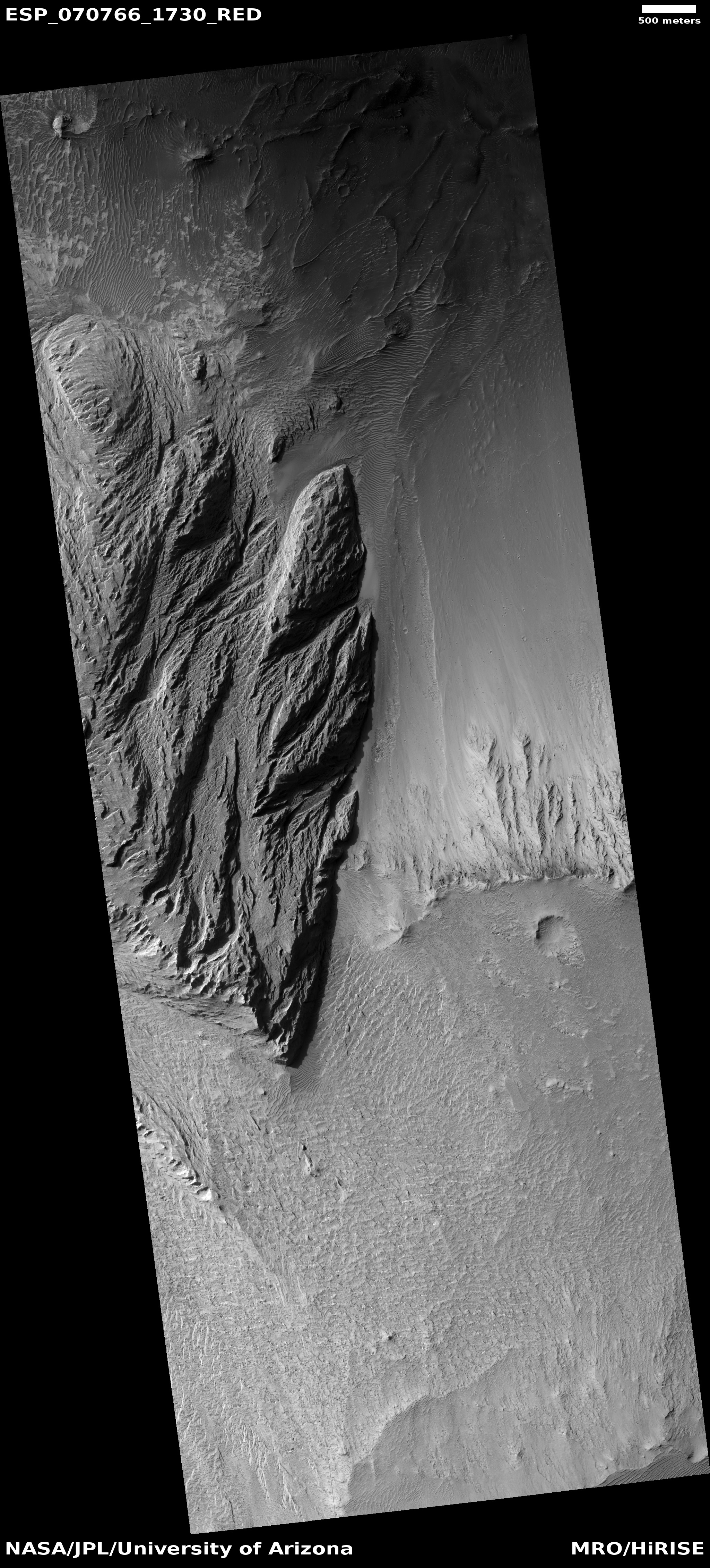
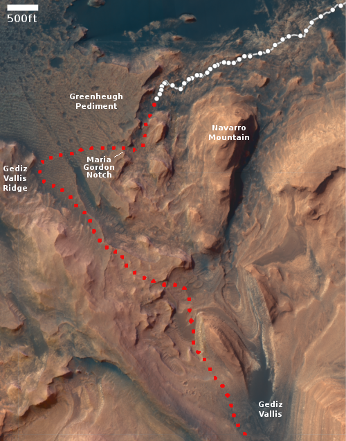
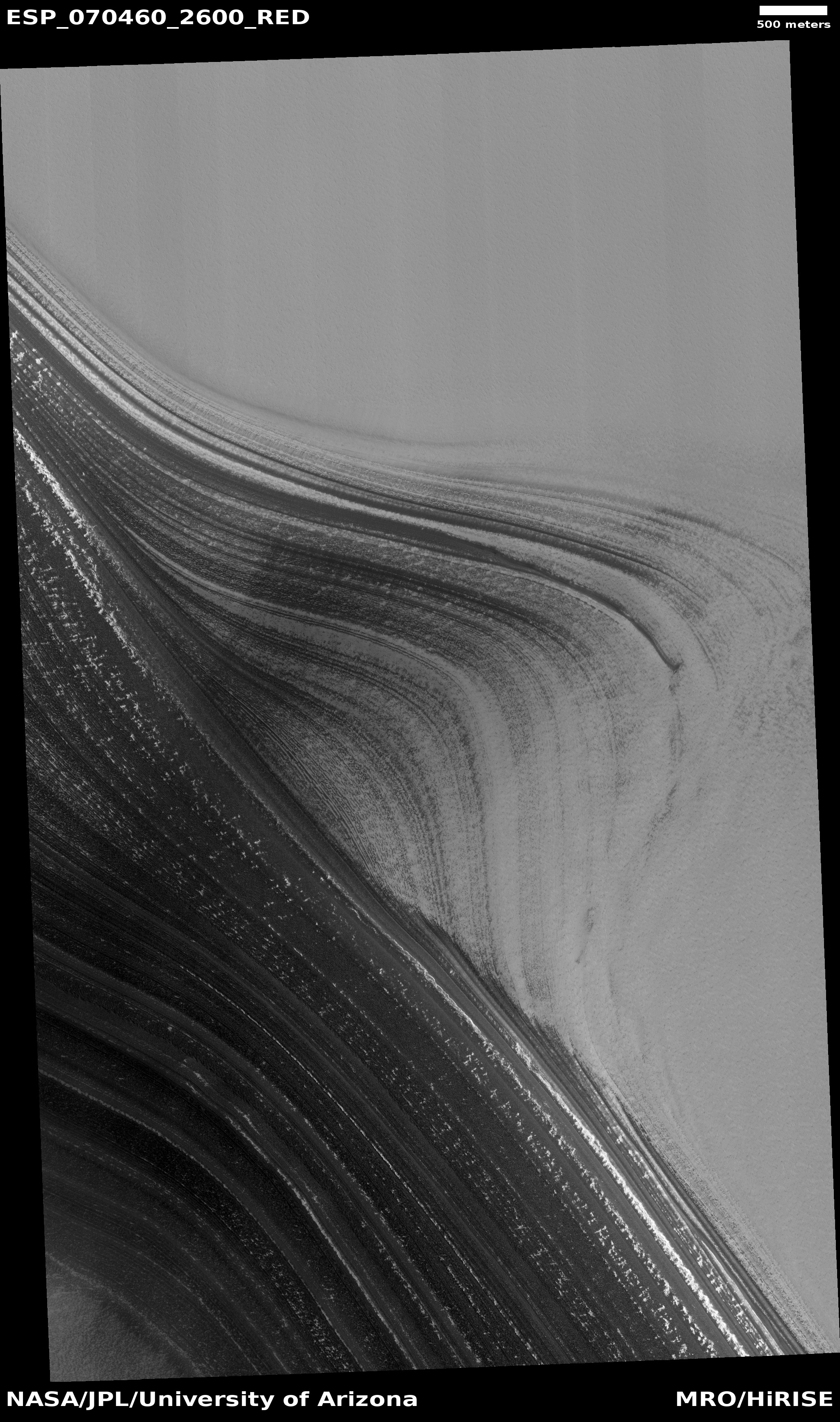
UAE Al-Amal Mars orbiter finds surprising variations in Mars atmosphere
Click for full graphic.
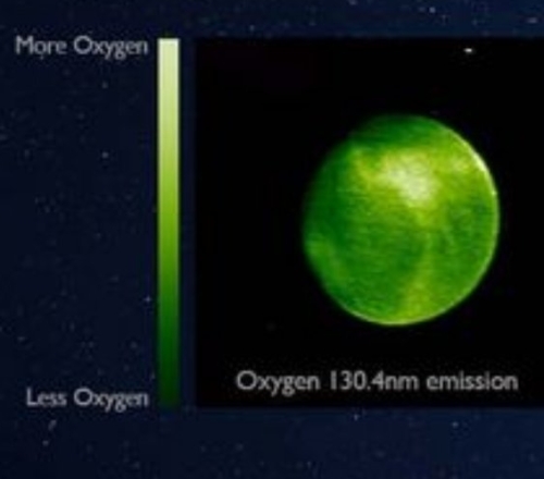
The United Arab Emirates Al-Amal (“hope” in English) Mars orbiter has discovered unexpected variations of oxygen and carbon monoxide in the Martian atmosphere.
The EMM team had expected to observe a relatively uniform emission from oxygen at 130.4 nm across the planet and yet here we are, faced with unpredicted variations of 50% or more in the brightness.
The image to the right, cropped and reduced to post here, shows the variations in oxygen on Mars’s dayside. Though the map does not indicate the geography below, the concentration of oxygen in the northern latitudes appears to correspond to the planet’s northern lowland plains. In fact, the variations should not have been a surprise, since the surface of Mars has such a stark dichotomy between its northern and southern hemispheres.

Click for full graphic.
The United Arab Emirates Al-Amal (“hope” in English) Mars orbiter has discovered unexpected variations of oxygen and carbon monoxide in the Martian atmosphere.
The EMM team had expected to observe a relatively uniform emission from oxygen at 130.4 nm across the planet and yet here we are, faced with unpredicted variations of 50% or more in the brightness.
The image to the right, cropped and reduced to post here, shows the variations in oxygen on Mars’s dayside. Though the map does not indicate the geography below, the concentration of oxygen in the northern latitudes appears to correspond to the planet’s northern lowland plains. In fact, the variations should not have been a surprise, since the surface of Mars has such a stark dichotomy between its northern and southern hemispheres.


