On the rim of Mars’ Grand Canyon

The rim of Valles Marineris
Click for full image.

Cool image time! Mars has many grand geological features that will surely attract tourists in the far future, when the planet has been successfully colonized and humans live there with the same ease that we today live in what was the New World wilderness several hundred years ago.

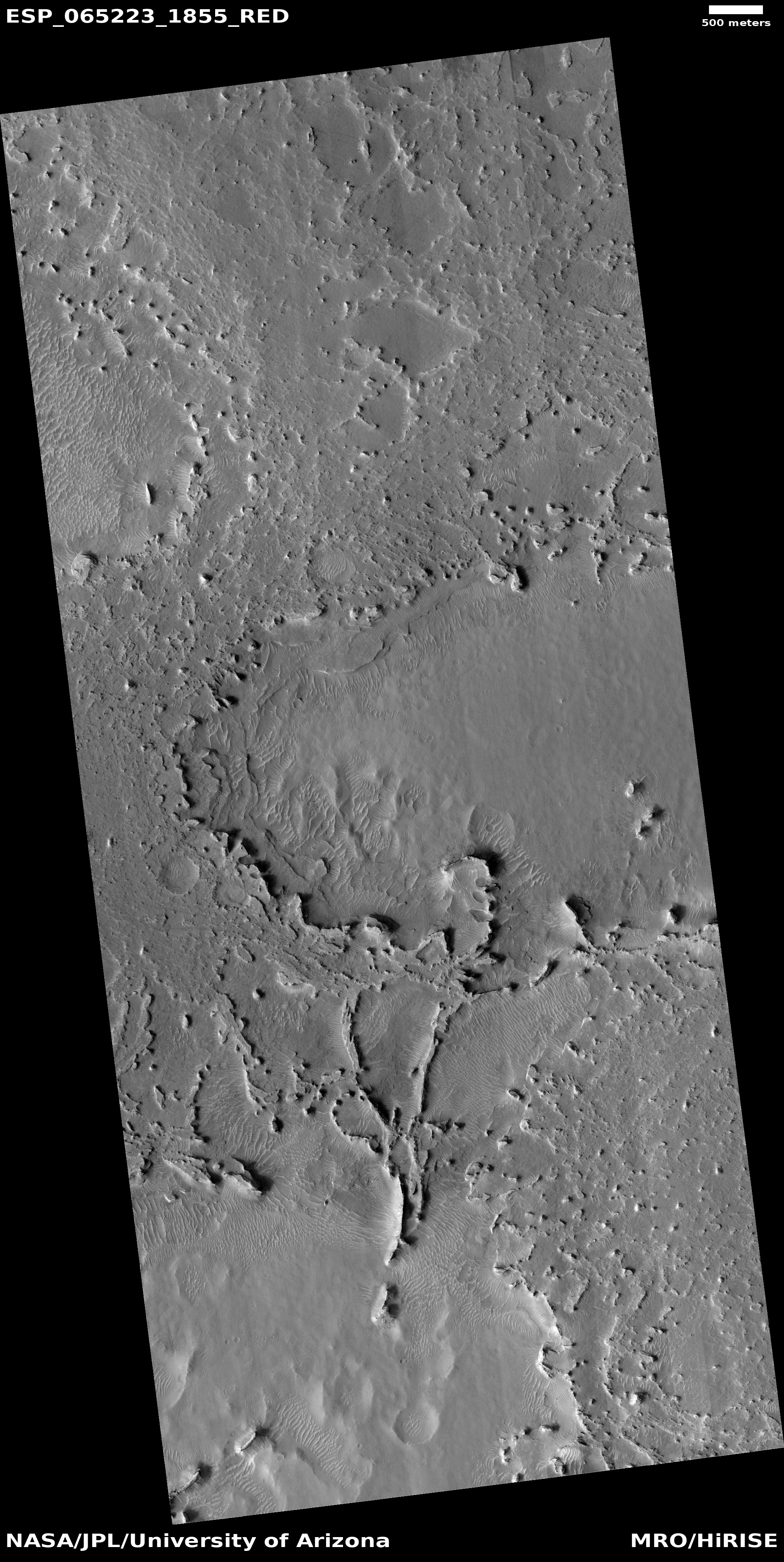
Of those features, none probably compare with Valles Marineris, the largest known canyon in the solar system. When compared to it, the Grand Canyon — at about a mile deep, about ten miles wide, and about 280 miles long — is a mere pothole, hardly noticeable. Valles Marineris averages a depth of five miles, a width of 370 miles, and a length of 1,900 miles. You could fit many Grand Canyons within it.

The photo to the right, cropped to post here, was taken on July 13, 2020 by the high resolution camera on Mars Reconnaissance Orbiter (MRO). It shows only a tiny section of this gigantic canyon’s rim. At this spot the depth from rim to floor is about 4.3 miles, or about 22,700 feet. In the image itself I estimate the cliff at the rim to be somewhere between 6,000 to 8,000 feet high, more than the depth of the entire Grand Canyon. And that’s only this top cliff.

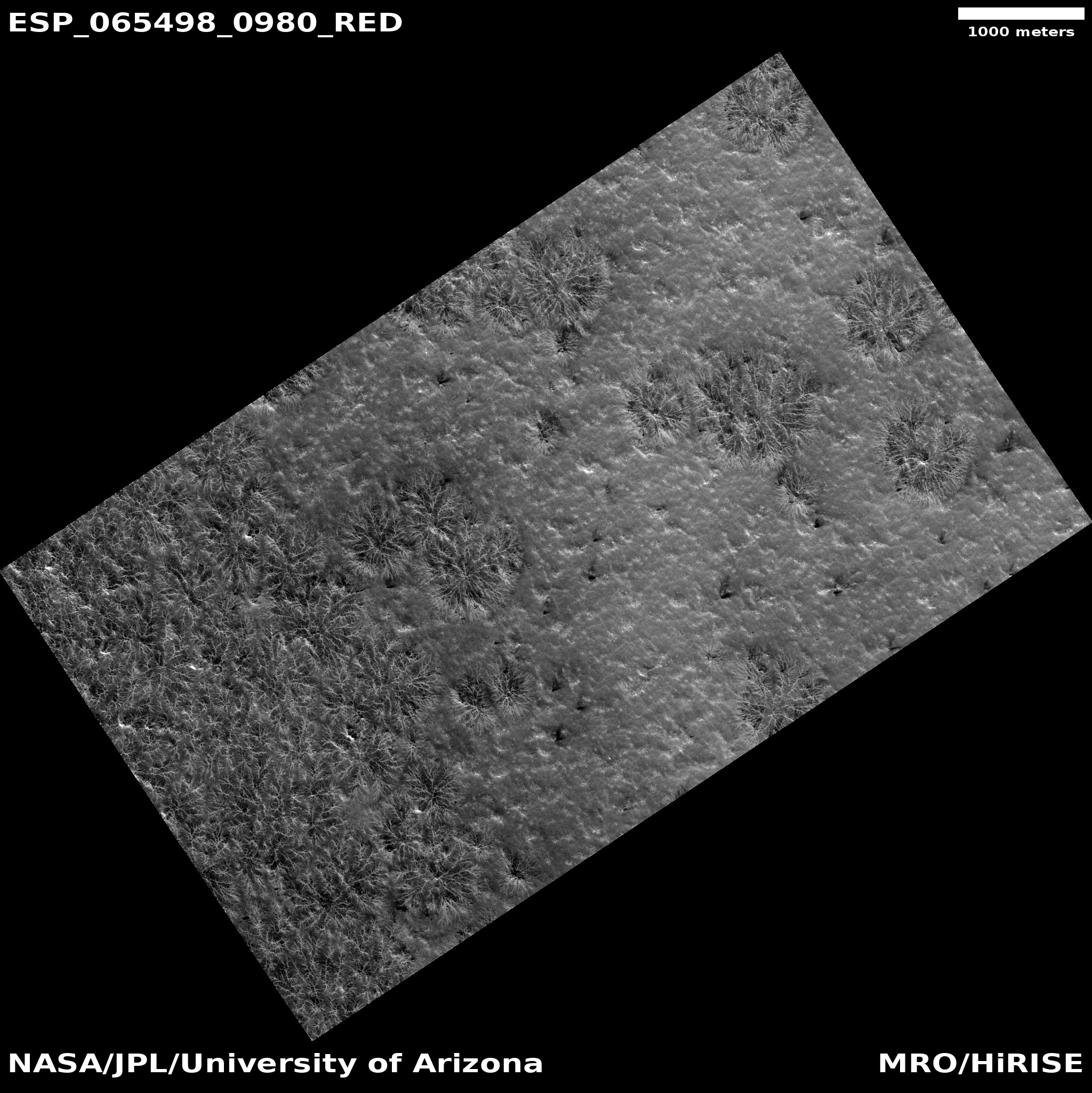
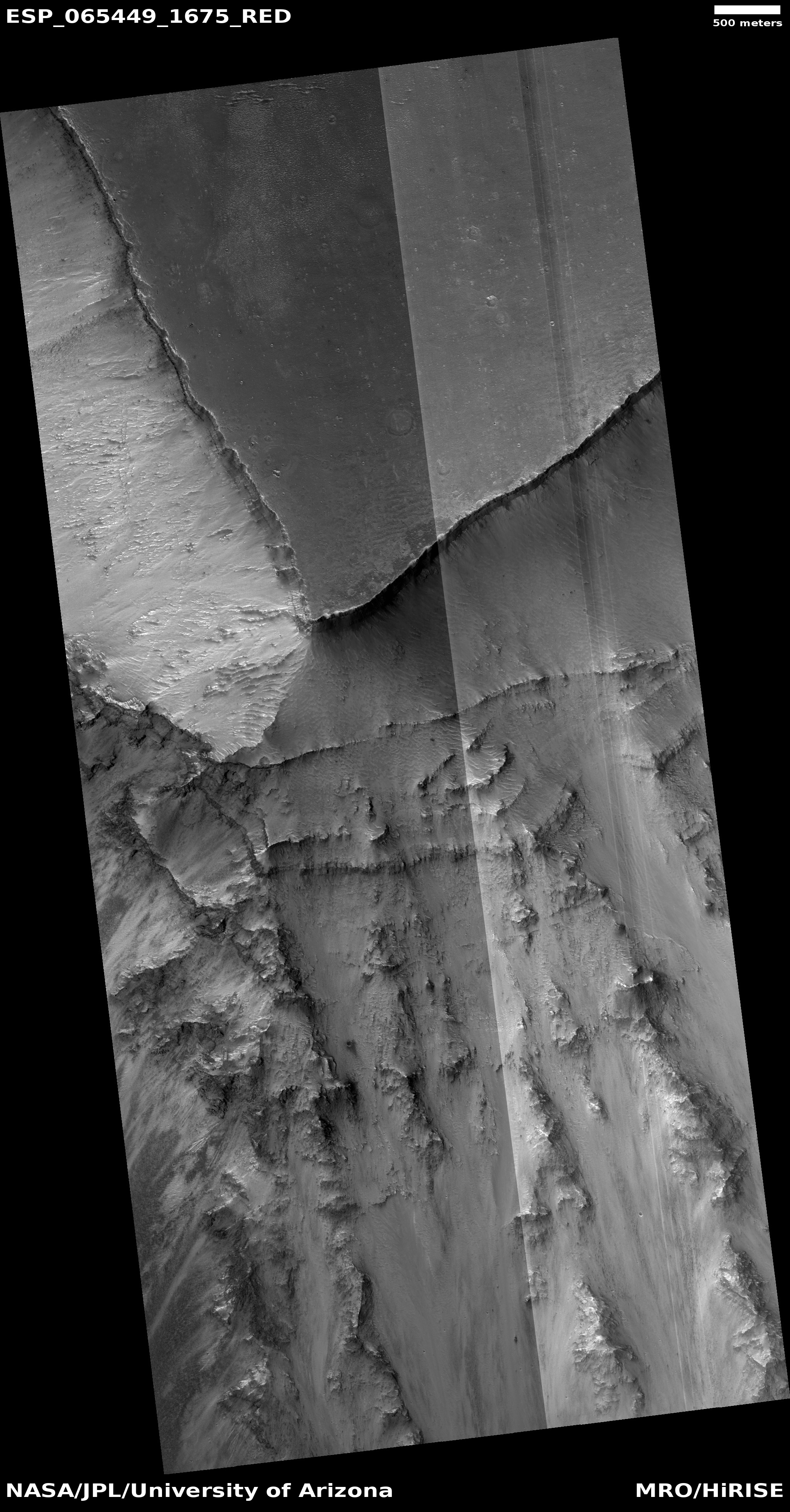
The three overview maps below show the context of this location within Valles Marineris.
» Read more

3 comments

Big scallops in the Martian southern latitudes

Big scallops on Mars
Click for full image.

Cool image time! The photo to the right, rotated, cropped, and reduced to post here, shows an example of some large scalloped depressions in the high southern latitudes of Mars.

Taken by the high resolution camera on Mars Reconnaissance Orbiter (MRO) on June 27, 2020, these scallops resemble in many ways the ice scarps that scientists have previously found at this same latitude, both to the east and west of where these scallops are located. With those scarps, the data suggests that a very pure layer of ice is visible in the cliff face, and that over time the cliff retreats northward due to sublimation of that ice.

The scallops in the photo to the right suggest the same process, though the differences raise questions. As explained by Colin Dundas of the U.S. Geological Surveyโ€™s Astrogeology Science Center in Arizona,
» Read more

0 comments

Martian channels formed by water? by ice? by lava?

Meandering channels on Mars
Click for full image.

Many of the pictures from Mars show meandering channels, all of which suggest an erosion process related to some form of flow. For most of the last half century, since the first images of these channels were beamed back by Mariner 9 in 1972, scientists had believed that liquid water must have caused them. The accumulating recent photos from Mars now tentatively suggest that these channels might have instead been caused by glacial processes, creeping frozen water instead of liquid.

The image to the right, rotated, cropped, and reduced to post here, was taken on July 17, 2020 by the high resolution camera on Mars Reconnaissance Orbiter. The channels suggest some form of flow going downhill to the northwest, but was it caused by water or ice? There is no obvious visual evidence of glaciers in this image, nor is there any such evidence that I can spot in any of the nearby high resolution images of this same region, despite the fact that at 35 degrees north latitude it is in the mid-latitude band where scientists have identified many glacial features.

The region itself is called Mareotis Fossae, an area of southwest-to-northeast trending parallel fissures and ridges, as shown in the two overview maps below.
» Read more

1 comment

An ice-covered mountain on Mars?

Ice-covered mountain on Mars?
Click for full image.

Grinnell Crater in Glacier National Park in 2017

Today’s cool image, taken on July 1, 2020 by the high resolution camera on Mars Reconnaissance Orbiter, is of a mound-like mountain on Mars that to all intents and purposes appears covered by glacial ice, some eroded, some not.

The image to the right, rotated, cropped, and reduced to post here, shows this mound. Both the flow coming down from the mountain top down the north slope as well as the flow in the north that appears to begin in a small crater suggest glacial features.

Even more convincing are what appear to be patches of glacial ice on the southern slopes, resembling the kind of glacial patches you see everywhere in Glacial National Park. The second photo to the right, taken by me on our visit to Glacier National Park in 2017, shows similar patches hugging the mountainside at Grinnell Glacier.

This Martian mountain is located in the southern hemisphere inside Hellas Basin on its eastern interior rim. (See the overview map below, with the location of this photo the small white box south of Harmakhis Valles.) Thus, you would expect the north-facing slope to get more sunlight (and more heat) than the south-facing slopes. Yet, from this image there appears to be greater erosion on the south-facing slopes. A puzzle indeed.
» Read more

5 comments

Corroding glacier in crater rim gully?

Gully in crater rim
Click for full image.

Today’s cool image to the right, rotated and cropped to post here, shows a gully flowing down the north facing rim of a 30-mile-wide crater in the southern cratered highlands. It was taken on June 30, 2020 by the high resolution camera on Mars Reconnaissance Orbiter (MRO).

To my eye the corroded ridges and pits running down the western side of this gully look like a corroded ice, as if we are looking at a glacier that the light of the Sun, which in the southern hemisphere hits this north-facing slope more directly and for longer periods of time, is causing it to sublimate away with time.

The wider shot below shows the entire rim, flowing downhill from the south to the north.
» Read more

0 comments

A patch of chaos in the Martian cratered southern highlands

A patch of chaos in the southern cratered highlands of Mars
Click for full image.

Today’s cool image, rotated, cropped, and reduced to post here, takes us to the cratered southern highlands of Mars. Taken by the context wide angle camera on Mars Reconnaissance Orbiter, this image shows us a strange isolated patch of what appears to be chaos terrain, which on Mars generally means an area of random knobs and mesas cut by canyons and channels.

The large bulk of chaos terrain on Mars is found near or in the transition zone between the lowland northern plains and the southern cratered highlands, and is thought to have been created by slow erosion, possibly by glaciers. This erosion process is aided by the gradient downhill from those highlands to the lowlands.

This location however is in the middle of the cratered highlands, and shows no obvious slope in any direction. And though the location is in the mid-southern latitudes, there is no obvious evidence of glaciers among these knobs and mesas. Furthermore, the mesas are not all the same height. Instead, a large portion appear to have been shaved off, as if some giant came in with a putty knife and scrapped away at them.

This can be clearly seen by the close-up below, taken by MRO’s high resolution camera on July 16, 2002 of the area indicated by the white box, which for scale is about 2 1/4 miles square.
» Read more

3 comments

Martian channels within Martian channels

Channels within channels on Mars
Click for full image.

Whatever caused the meandering canyons on Mars, whether glaciers or liquid water, it was a process that was long-lived and multi-staged, as indicated by today’s cool image to the right, rotated, cropped, and reduced to post here. This photo, taken on June 28, 2020 by the high resolution camera on Mars Reconnaissance Orbiter (MRO), shows a large canyon cutting downward from a high ridgeline to the north. As that canyon begins to flow out out of the mountains and into the plains to the south, a secondary inner channel appears, meandering down the center of the larger canyon.

This canyon is located at 35 degrees south latitude, in the mid-latitude region where scientists have found evidence of a lot of glaciers. In fact, there are some hints of eroded glacial material in the small channels to the west of this main canyon. Also, there appear to be patches of corroding glacial ice on the south-facing slopes of the east and west hills that define the main channel. In the canyon itself however there appear to be few if any glacial-type features.

The overview map below gives the location context.
» Read more

0 comments

Martian crater filled with lava

Lava filled Martian crater
Click for full image.

Cool image time! Unlike most of the recent images I’ve posted from Mars, today’s has nothing glacial about it. Instead, the photo to the right, cropped to post here, shows us a crater where lava broke through the southern rim to fill its interior.

The picture was taken on July 15, 2020 by the high resolution camera on Mars Reconnaissance Orbiter (MRO). The crater is located within what I call volcano country on Mars, just inside the Athabasca Valles lava field, what some scientists believe [pdf] is the youngest lava field on Mars, estimated have occurred less than 600 million years ago.

The overview map below provides context.

Overview map

The tiny white box south of Elysium Mons indicates the location of this crater. The dark blue areas indicate the extent of the Athabasca lava field. The Medusae Fossae Formation is the largest volcanic ash deposit on Mars.

The Athabasca lava field is about the size of Great Britain, and is thought to have been laid down in only a matter of a few weeks. When it spread it clearly reached this crater, the lava pushing through to fill it. If you look at the full image you can see that the north-trending lava flow even continued past the crater a considerable distance on both sides, the crater acting like a big rock in a stream, blocking the flow.

Since this happened more than half a billion years ago, a lot of erosion has occurred, mostly between the crater’s rim and the edge of the ponded but now solidified lava.

0 comments

The frozen and changing mid-latitudes of Mars

Glacial erosion on Mars
Click for full image.

Using “frozen” and “changing” to describe any single location might seem contradictory, but when it comes to the mid-latitudes of Mars, high resolution images keep telling us that both often apply, at the same time and at the same place.

The photo to the right, rotated, cropped, and reduced to post here, is a typical example. Taken on May 8, 2020 by the high resolution camera on Mars Reconnaissance Orbiter (MRO), it shows what the scientists label as “mesas and ridges.” Drainage is to the south, and it sure looks like some sort of glacial flow is working its way downward within the canyons between those mesas.

Overall the terrain has the appearance of a frozen ice sheet, or at least terrain that has a shallow ice table close to the surface. It also looks like chaos terrain in its infancy, the erosion process not yet cutting down enough to make the mesas stand out fully.

The location of these mesas and ridges is shown in the context map below, which also shows that this location is at the same latitude as SpaceX’s Starship prime Martian landing site, and only about 400 to 500 miles to the east.
» Read more

0 comments

The alien Red Planet and the scientific method

Spiders, dunes, and strange terrain in high latitude southern Martian crater
Click for full image.

As a child growing up in the 1950s and 1960s and an avid reader of science fiction, I was constantly presented with stories about Mars and what people imagined it was like. At the time no spacecraft had as yet gotten a close look at the planet, so the theories of a desert planet, with many canals built by an alien race attempting to stave off death as the planet’s water disappeared, were still considered possible. So were theories that the changing colors across its surface seen seasonally in ground-based telescopes suggested the possibility of some form of lichen-like life that came and went with the seasons.

None of those fantasies have turned out to be true. All attempted to create an alien planet in the model of Earth, and thus were guaranteed to get it wrong. After a half century of increasingly sophisticated research, we now know a bit more about what Mars is like, and have learned that it is much stranger than we had imagined, an icy world quite possibly shaped by slowly shifting glaciers and ice sheets, creating surface features in ways so alien from what we are familiar with on Earth that even now scientists struggle to figure those processes out.

The photo above and to the right, taken on May 25, 2020 by the high resolution camera on Mars Reconnaissance Orbiter (MRO), is a perfect example. At first glance it fits what I call a “what the heck?” image. Without knowing more, it is impossible to figure out what we see here.

The wider image below, taken by context camera on MRO, provides our first clue.
» Read more

4 comments

Sharp Martian ridges sticking up from the dust

Sharp ridges sticking up from Martian dust
Click for full image.

Today’s cool image brings us back to the region of Mars where the rover Opportunity journeyed. Taken on June 25, 2020 by the high resolution camera on Mars Reconnaissance orbiter (MRO), the photo to the right, cropped and reduced to post here, focuses on some sharp but low ridges that appear to stick up out of the Martian dust, hinting that they are the tops of some larger feature buried over the eons and only now revealed partly by recent erosion. I estimate that their height is roughly one to two hundred feet or so.

This image is in Arabia Terra, the widest and largest transitional zone region between the northern lowland plains and the southern cratered highlands. It is also only about 200 miles north of where Opportunity landed, and about 230 miles from where it died after almost fifteen years of operation, on the west rim of Endeavour Crater. The overview map below gives the context.
» Read more

2 comments

A Martian starburst spider

A Martian starburst spider
Click for full image.

Cool image time! The photo to the right, cropped to post here, illustrates an example of a wholly unique Martian phenomenon, that is not only unique to Mars but is also found only in its south polar regions. The image was taken on July 17, 2020 by the high resolution camera on Mars Reconnaissance Orbiter (MRO).

What we are looking at is a permanent spider formation etched into the layered deposits of ice and dirt that cover the widest area surrounding Mars’ south pole. The blue dot just north of Chasma Australe on the overview map below shows the location of these starbursts, on those layered deposits.

Each winter the poles of Mars are blanketed with a thin mantle of dry ice, generally less than six feet thick. When spring arrives and sunlight hits this mantle, it heats the ice and sand on which the mantle lies, and that warmth causes the mantle’s base to sublimate back into gas. Eventually gas pressure causes the mantle to crack at its weak points so the gas can escape. By the time summer arrives that mantle is entirely gone, all of it returning to the atmosphere as CO2 gas.

This sublimation process differs between the north and south pole, due to the different terrain found at each. In the north the mantle mostly lies on ice or sand dunes, neither of which is stable over repeated years. Thus, the mantle weak points do not occur at the exact same place each year, even though they occur at the same type of locations, such as the base and crests of dunes.
» Read more

8 comments
1 65 66 67 68 69 90