Another pit on Mars!

Isolated small pit on Mars
Click for full image.

It has been several months since my last Martian pit update, mostly caused by the lack of new pit images coming down from the high resolution camera on Mars Reconnaissance Orbiter (MRO). I think this lack is not because of a lack of additional pits or caves but instead signals the completion of a first high resolution survey of the known pits so far found on Mars. A full list of all past pit updates can be found at the bottom of this post.

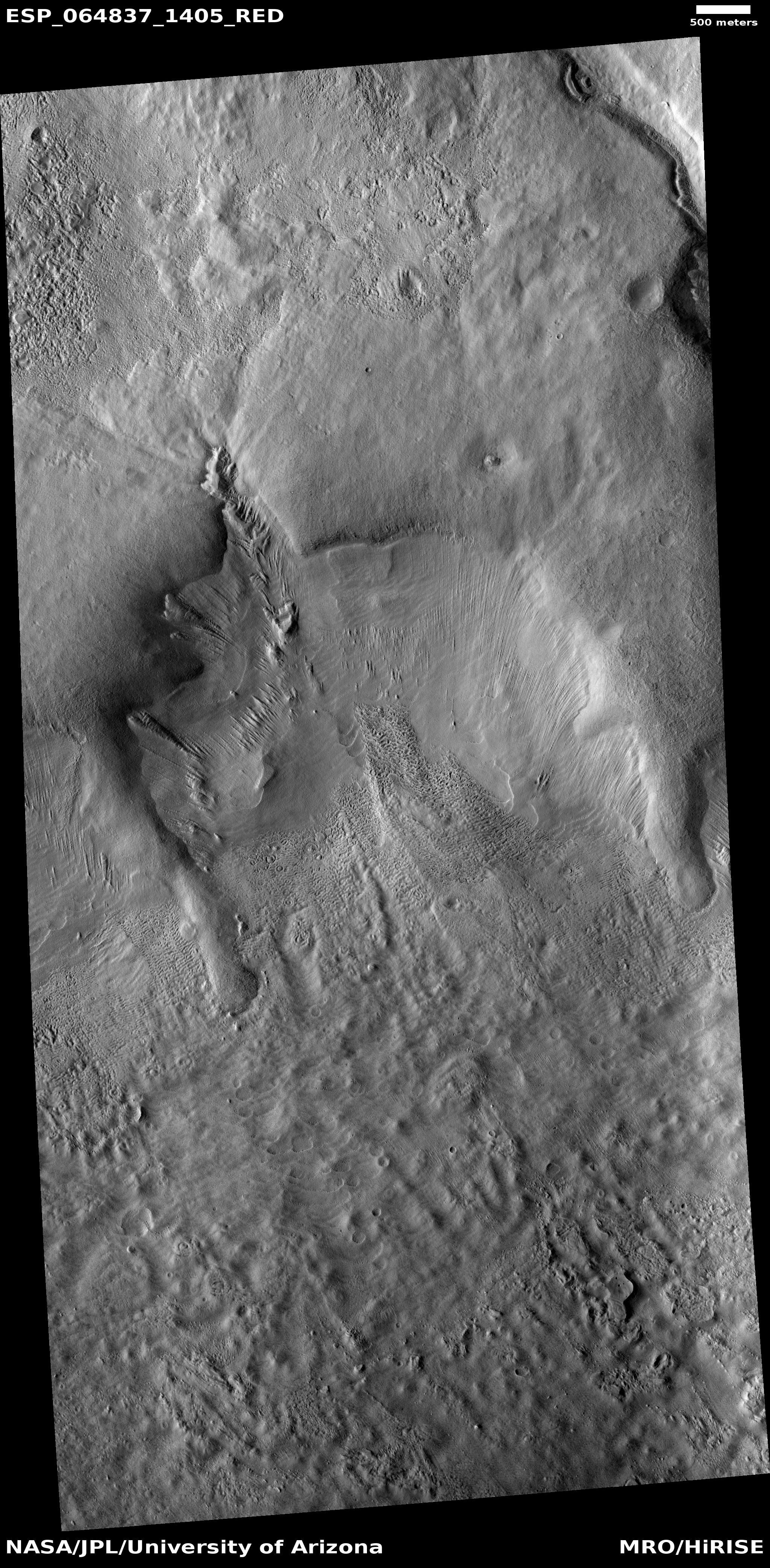
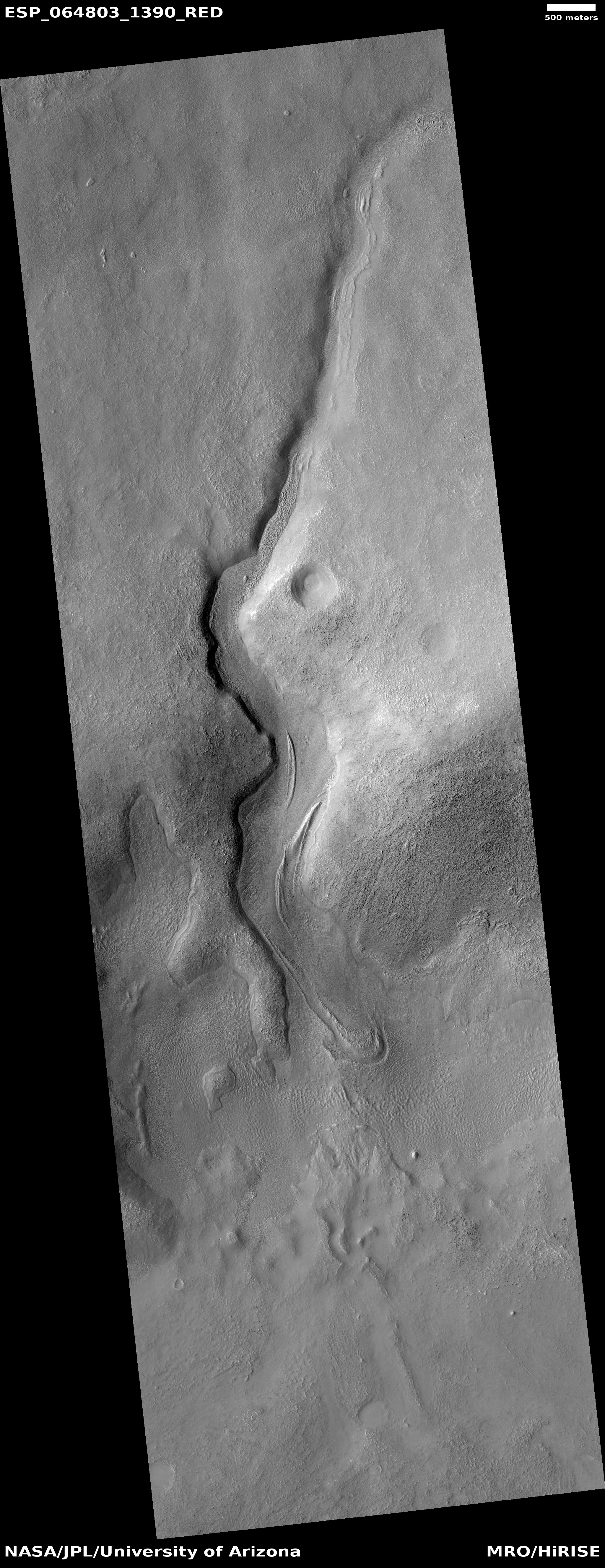
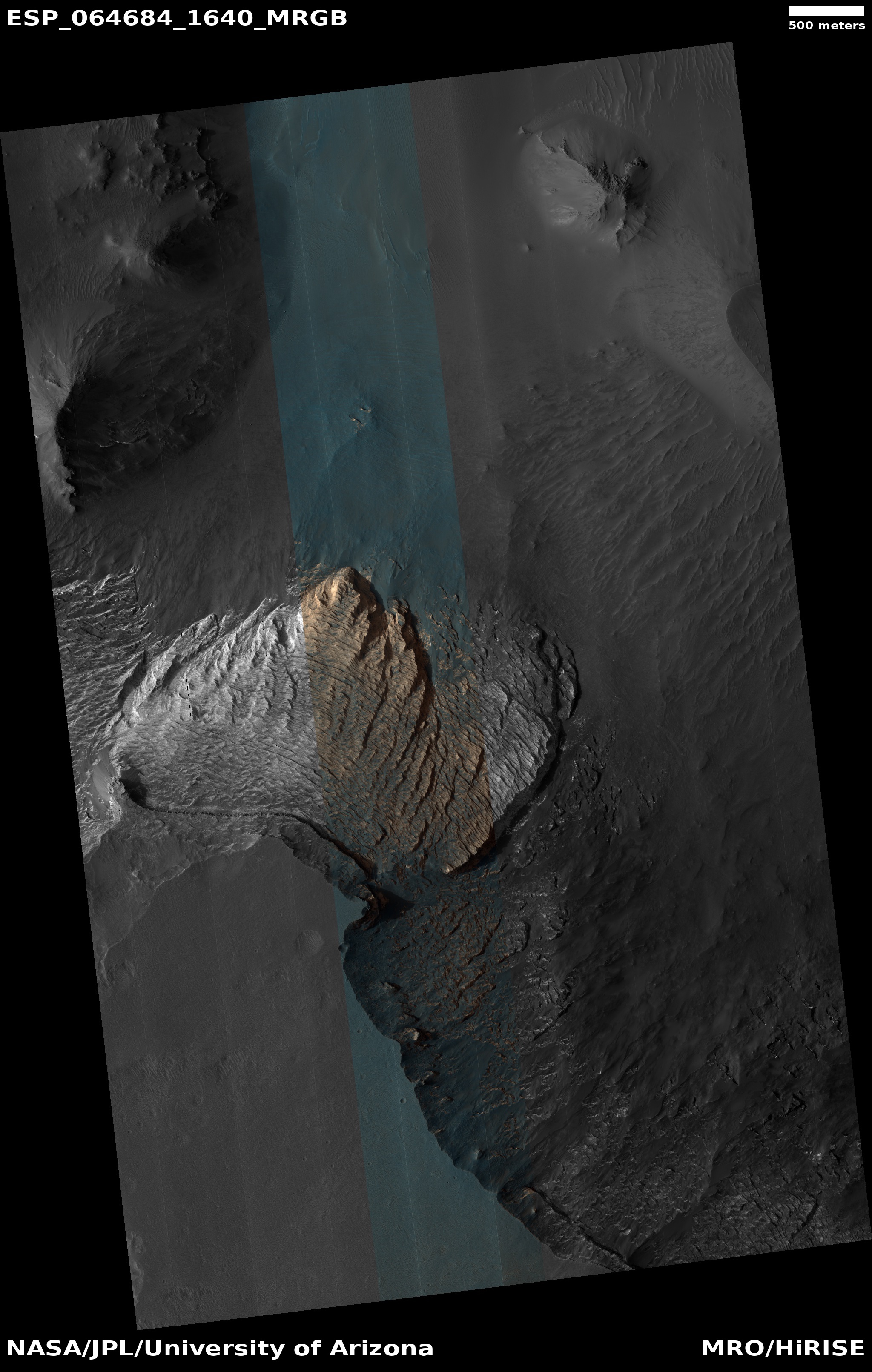
Regardless, the image to the right, cropped to post here, is the only such image in months, taken on April 14, 2020, and shows a small isolated pit in the lava slopes between the giant volcanoes Arsia and Pavonis Mons. In the full photograph you can see how isolated is this pit. To the limits of the image there are no other such features, the terrain a relatively smooth plain with only some small ridges and and a scattering of what seem to be partly obscured or eroded small craters.

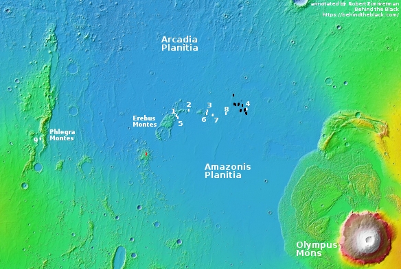
The overview below map shows this pit’s relationship to the volcanoes as well as to all other known nearby pits.
» Read more

1 comment

Strange glacial flow features on Mars?

Flow features in Reull Vallis
Click for full image.

Cool image time! The photo to the right, rotated, cropped, and reduced to post here, was taken by the high resolution camera on Mars Reconnaissance Orbiter (MRO) on May 26, 2020, and shows what the scientists dub “Flow features in Reull Vallis.”

These features are typical in the mid-latitudes, and once again suggest the presence of buried glacial ice. The two lobes on the left and right both evoke such flows, as does the material in the drainage channel near the top of the photo.

What is more intriguing however are the strange features in the box. Below is that section, at full resolution.
» Read more

0 comments

The icy Erebus Mountains near where Starship will land on Mars

Overview of all SpaceX images in Arcadia Planitia

Glacial filled crater in Erebus Montes
Click for full image.

It has been several months since I posted any new photos of the region on Mars which SpaceX considers its prime candidate landing site for its Starship spacecraft/rocket, now under development. The map to the right shows the location of all the images that SpaceX has obtained from the high resolution camera on Mars Reconnaissance Orbiter (MRO) of this landing region, located in the northern lowland plains at the border between Arcadia and Amazonis and to the east of the Erebus Mountains. (See my post on November 13, 2019 for an analysis of the reasoning for SpaceX to choose this region, along with links to each of the numbered images.)

Time to take another look, this time at the very center of the southern cluster of the Erebus mountains. The crater to the right, its location indicated by the tiny red rectangle on the map above, was taken by MRO on May 6, 2020, and shows the typical glacial features scientists find in mid-latitude Martian craters. The floor appears filled with glacial material, with the repeated cyclical flows repeatedly coming down off the north-facing interior rim. That rim would generally be colder and get less sunlight, so snowfall is more likely to pile up there and then flow downward like a glacier, only to sublimate away once it moves out of shadow.

What makes these mountains enticing, only about 400 miles from the Starship landing zone, is not simply what is inside this crater, but what surrounds it. Below is the wider view provided by MRO’s context camera.
» Read more

1 comment

Bright-tipped perplexing terrain on Mars

Perplexing terrain on Mars
Click for full image.

The photo to the right, rotated, cropped, and reduced to post here, was taken by the high resolution camera on Mars Reconnaissance Orbiter (MRO) on June 24, 2020, and shows a bit of inexplicable country in Arabia Terra, the widest and largest transition zone region on Mars between the northern lowland plains and southern cratered highlands.

The stuff visible in this image falls into what I call “What the heck?” geology. It is very clear we are looking at a collection of straight and curved ridges and mesas, all of which for some reason are bright at their tips and edges. Some of the curved ridges might be the rims of craters, but only some. Other ridge lines look more like leftovers following a strange erosion process. The problem is that to my uneducated eye I can find little rhyme or reason to these shapes. The mesas and canyon on the image’s right edge might be explained by the erosion processes that create chaos terrain on Mars, but that process does not do a good job of explaining anything else in the photo.

That this uncaptioned image is merely labeled “Arabia Terra” suggests that the scientists involved in getting this image were equally perplexed by it, and could not give it a better description.

The overview map below provides some location context, including how this geology relates to the landing site of Europe’s Rosalind Franklin rover, now scheduled for a 2022 launch.
» Read more

2 comments

The longest lava tube in the solar system?

A lava tube on Mars
Click for full image.

Before I delve into today’s cool image, I think it important to explain to my readers why I seem to post so many cool images from Mars. The simple explanation is that Mars right now is where almost all the cutting edge planetary research is taking place, and as a science journalist focused on space exploration I must go to that cutting edge. My dear readers know that I love variety (just consider the evening pauses on Behind the Black), but you can’t ignore the reporting of real discoveries simply to increase the diversity of one’s posts. This is too often what modern news outlets do, which is also why they often miss the real story.

Anyway, today’s cool image to the right, rotated, cropped, and reduced to post here, shows only a small section of what might be the longest lava tube in the entire solar system. Taken on May 5, 2020 by the high resolution camera on Mars Reconnaissance Orbiter (MRO), it shows a string of pits along a meandering depression coming down the northwest flank of the giant volcano Arsia Mons. The image was a follow-up to a July 2014 photo of the same location, and was taken to produce a stereo pair.

The feature strongly suggests a lava tube, with the pits being skylights into the meandering underground void. From top to bottom this section of the tube is a little over three miles long. Since there are lava tubes on Earth far longer, this one image hardly makes this the longest tube in the solar system.

The tube, however, extends off the image both at the bottom and at the top. Not many high resolution images have been taken in this area, so it is therefore hard to say how far the tube extends. Other nearby high resolution images in this area however have found similar lava tubes, which conceivably could be part of the same tube. The overview map below shows the relationship.
» Read more

3 comments

Revisiting Mars’ glacier country

Glacial cracks or pits on Mars
Click for full image.

With today’s cool image we return to what I have labeled glacier country on Mars, though this time the image shows a Martian glacial feature that while resembling vaguely such features seen on Earth, has an alienness to it that requires some explanation.

The photo to the right, cropped to post here, was taken on March 24, 2020 by the high resolution camera on Mars Reconnaissance Orbiter (MRO). The section I have focused on is the floor of a depression with a number of parallel pits, more or less aligned with the packed north-south ridges that cover the entire floor.

Normally, the north-south ridges would suggest repeated glacial flows moving to either the west or to the east. Such movement could over time, cause the ridges to separate, creating the cracks or pits that we see here. The trouble is that the slope of this depression is very unclear. In fact, the wider view below shows that this depression appears mostly enclosed, or if not it does not seem to be flowing in any particular direction.
» Read more

0 comments

Cracks and scallops on the lowland plains of Mars

Utopia Basin cracks and scallops
Click for full image.

Cool image time! To the right is some of the strange terrain seen in the northern lowland plains of Mars. The photo, cropped to post here, was taken on May 4, 2020 by the high resolution camera of Mars Reconnaissance Orbiter (MRO) of an area in the northwest part of Utopia Planitia.

Next year China’s first attempt to soft land a rover on Mars will occur somewhere in Utopia Planitia. Utopia Planitia, also called Utopia Basin, is quite large, however, and in fact is the largest recognizable impact basin on Mars, with a diameter of more than 2,000 miles or about two thirds the width of the United States. If this strange spot was put near Seattle, Tianwen-1 is expected to touch down somewhere near Houston, Texas.

The MRO science team labeled the image “Scalloped terrain in Utopia Planitia.” The curved cliffs in the image illustrate those scallops, found frequently in Utopia. Their formation is believed related to the sublimation of underground ice, changing directly from ice to gas. The theories of this process however are somewhat uncertain at this time.

What stuck me about the image were the north-south oriented cracks. They extend through the full image, all oriented in the same direction. I haven’t the faintest idea what caused them, but they are intriguing, are they not?

This terrain is also different than most Utopia Planitia images I have previously posted. Most look squishy and blobby and distorted, suggesting the presence of soft slush and underground ice. This image instead suggests hard bedrock, even though it is farther north than the previous images and should thus be expected to have more ice underground. Quite mysterious.

I suspect the ice is here, but is simply not made obvious by any surface event. Then again, who knows? The geology of Mars is definitely not obvious, no matter how obvious it sometimes seems.

0 comments

More glaciers and eroding gullies on Mars

Crater with gullies and glacial fill
Click for full image.

Cool image time! The photo to the right, cropped and reduced to post here, shows the interior south-facing rim of a small crater in the southern cratered highlands of Mars. Taken on May 30, 2020 by the high resolution camera on Mars Reconnaissance Orbiter (MRO), the image release is merely labeled “Gullied Slope”. The photo was taken as part of regular monitoring of these gullies since 2011 to see if they change from season to season. The 2011 image was captioned by planetary scientist Alfred McEwen, who wrote the following about the gullies:

These are erosional features with depositional fans. Some of the gully fans have a bluish color: these are probably quite recent deposits, less than a few tens of years old.

Since they were considered so very young, it makes great sense to look at them frequently. In making a quick comparison between the 2011 and 2020 images however I could not spot any changes, but that might be because the versions I downloaded are not at the fullest resolution.

This crater, at 39 degrees south latitude, is also worthwhile because its floor appears covered with glacial material, what scientists have dubbed concentric crater fill. As McEwen noted in his 2011 caption,

On the floor of the crater (bottom of this image) are ridges that likely formed from the flow of ice, perhaps a few million years ago.

Those glaciers, generally protected by thin layers of dust and debris, are considered inactive at this time in Martian geological history. The many ridges however hint at the many many cycles in the Martian climate, fluctuating between periods when these mid-latitude glaciers were growing while the polar ice caps were shrinking, and periods when the mid-latitude glaciers were shrinking while the polar ice caps were growing.

0 comments

Wormlike glacier on Mars

Glacial flow in the mid-latitude southern cratered highlands
Click for full image.

Cool image time! The image to the right, cropped and reduced to post here, shows a very typical glacial-type feature found frequently in the mid-latitudes of Mars. Taken on May 23, 2020 by the high resolution camera on Mars Reconnaissance Orbiter (MRO), it is labeled a “Lobate Flow Feature within Channel in Nereidum Montes.” Nereidum Montes is a rough mountainous region along the northwestern margin of Argyre Basin, the second largest impact basin on Mars, after Hellas Basin.

Scientists using Europe’s Mars Express orbiter have already found a great deal of glacial evidence in these mountains. I have also posted images of other glacial features on the north edge of Argyre. This image just reinforces that data.

This particular glacier however resembles the kind of glaciers one sees on Earth more than most Martian glaciers. As it meanders down its valley, large cracks form near its edges as friction slows their passage and drags them apart. In fact, the glacier itself might have very well carved the canyon. According to Dan Berman, senior scientist at the Planetary Science Institute in Arizona, who had requested this image,

While I canโ€™t say for sure, the canyon was likely formed by a glacier. Whether or not the ice that remains today is part of that glacier, or one that formed later, is impossible to say.

» Read more

3 comments

The colors of Mars

The different colors of Mars
Click for full image.

Actually today’s cool image tells us less about the real colors on Mars and much about the colors captured by the high resolution camera on Mars Reconnaissance Orbiter (MRO). The photo on the right was taken on May 2, 2020, and shows a relatively featureless area to the east of 80-mile wide Byrd Crater in the high southern latitude of Mars.

The only major features seen on this photo are a series of rounded ridges that in the larger context map at the image site look almost like drainage hollows coming down from the crater’s rim about twenty miles away.

The colors, though exaggerated and not entirely as the eye would see them, still tell us something very real about the surface. As explained here [pdf]:

In spite of the variable level of color enhancement for the Extras products, we can make some generalizations to better understand what the stretched color images are showing. Dust (or indurated dust) is generally the reddest material present and looks reddish in the RGB color. … Coarser-grained materials (sand and rocks) are generally bluer … but also relatively dark, except where coated by dust. Frost and ice are also relatively blue, but bright, and often concentrated at the poles or on pole-facing slopes. Some bedrock is also relatively bright and blue, but not as much as frost or ice, and it has distinctive morphologies.

Thus, this photo is telling us that the lower areas are covered with dust (the red), while the rounded ridgelines are covered with coarser and bigger rocks. The brightest blue, which is facing towards the south pole, might also indicate frost or ice.
» Read more

1 comment

Mars: On the floor of Valles Marineris

Strange flow (?) on floor of Valles Marineris
Click for full image.

Cool image time! The image to the right, rotated and cropped to post here, was taken by the high resolution camera on Mars Reconnaissance Orbiter (MRO) on May 14, 2020, and shows a very strange bright outcrop on the floor of Valles Marineris, the largest canyon on both Mars and in the entire solar system.

MRO has photographed this spot a few times since 2007. The first image was posted with a detailed caption by Colin Dundas of the U.S. Geological Surveyโ€™s Astrogeology Science Center in Arizona, who described the feature like so:

Most of the material is light and shows many small scarps or benches. In places these appear to indicate boundaries between layers, but they are often discontinuous. The light material is buried by a thin mantle of dark material in places; the dark material is from other rock layersโ€”possibly those above the outcropโ€”and has fallen or been blown over the light rock.

Near the top of the outcrop, there is a distinctive layer that appears as a dark band at low resolution. At the full resolution of HiRISE, this appears to be a layer breaking up into angular boulders, indicating different rock properties than the underlying light rock. There does appear to be some light material above this layer, suggesting that the process that deposited the light material continued for some time.

Dundas also added that the lighter material is theorized to have “formed by a variety of processes. Proposed deposition mechanisms for light-toned sediments on Mars include those from rivers or lakes, volcanic ash or wind-blown sand or dust.”

Since this lighter colored outcrop has remained as bright as it has now for more than six Martian years, I doubt it is brighter because of the surface deposit of ash, sand, or dust (though it might be made of these materials which have now become hardened). My guess is that the brightness is inherent to the outcrop. Moreover, note the plateau to the southwest. Its rim is cut sharply, suggesting erosion revealed this outcrop, and that the outcrop is made of more resistant material.

The overview map provides some context that also might help explain the geology at this location.
» Read more

2 comments

Majestic dunes on Mars

Beautiful dunes on Mars
Click for full image.

Cool image time! The photo to the right, rotated, cropped, and reduced to post here, was taken by the high resolution camera on Mars Reconnaissance Orbiter on May 10, 2020, and shows the dune field inside a large unnamed sixty-mile-wide crater in the highlands of Mars.

Scientists have been using MRO to monitor this site to track both dust devils and dune changes since at least 2009. In 2009 the focus was on the numerous dust devil tracks, and in fact I posted in March 2020 a comparison of an earlier image with a more recent picture, showing how the earlier tracks had vanished in recent pictures, probably wiped clean by the global dust storm in 2018.

This time however I am less interested in the science, which I covered in detail in that previous post, but in the beauty of these dunes. They are large and majestic, and the color strip tells us that they exhibit striking colors of green, gold, and tan. Is there a place on Earth with dunes of such colors? If so, it is rare.

Make sure you click on the image to see the full resolution photograph. It is even more breath-taking.

4 comments
1 66 67 68 69 70 90