Land of Martian slope streaks

Land of Martian slope streaks
Click for full image.

Cool image time! The photo to the right, cropped and reduced to post here, was taken on May 21, 2021 by the high resolution camera on Mars Reconnaissance Orbiter (MRO). It shows a typical example of the many slope streaks found in the rough and very broken region north of the Martian volcano Olympus Mons, the largest in the solar system.

See this May 2019 post for a detailed explanation of slope streaks. While they appear to be avalanches, they do not change the topography of the ground, sometimes flow over rises, and appear to be a phenomenon entirely unique to Mars. While no theory as yet explains them fully, the two most favored postulate that they are either dust avalanches or the percolation of a brine of chloride and/or perchlorate in a thin layer several inches thick close to the surface. In both cases the streak is mostly only a stain on the surface that fades with time.

The location of this cool image however tells us something more about them.
» Read more

1 comment

Inactive volcano vent on Mars

Inactive volcanic vent on Mars
Click for full image.

Overview map

Cool image time! The photo to the right, cropped, reduced and annotated to post here, was taken on July 30, 2021 by the high resolution camera on Mars Reconnaissance Orbiter (MRO). The left image shows a pit that the scientists label a “vent” near the giant volcano Pavonis Mons. The right image is identical, except that I have brightened it considerably to bring out the details in the shadowed area.

As you can see, this pit is filled, and does not appear to have any existing openings into more extensive underground passages.

The white dot on the overview map on the right shows this vent’s location, to the south of Pavonis Mons, and in line with the giant crack that splits three of Mars’ four largest volcanoes. The vent is even aligned the same as that crack, from the northeast to the southwest. The black dots mark the locations of the many cave pits found in this region.

Was this a volcanic vent? If you look at the full image you will see that this pit aligns with a shallower pit to the southwest, with a depression linking the two. Visually this suggests this is a faultline which in turn makes for a good outlet point for lava flow.

Though the data suggests this is a volcanic vent, that supposition is as yet unproven. The full image does not show much evidence of a flow from the pit, which suggests instead that we are merely looking at a spot where the ground cracked along fault lines.

0 comments

A Mars mesa carved by floods and lava?

Overview map of Kasei Valles

With today’s cool image we once again start our journey from afar, and zoom in. The overview map to the right focuses in on the thousand-mile-long Kasei Valley on Mars.

The blue area is where scientists postulate a lake once existed, held there by an ice dam (indicated by the white line). At some point that ice dam burst, releasing the water in a catastrophic flood that created the braided flow features that continue down Kasei Valles to the northern lowland plain of Chryse Planitia.

The black area marks a giant lava flow that scientists believe came later, following the already carved stream channels for a distance of 1,000 miles, traveling at speeds of 10 to 45 miles per hour.

The red dot near the Kasei Valles resurgence is today’s cool image.
» Read more

1 comment

Perseverance as seen from orbit

Perseverance as seen from orbit
Click for full image.

Overview map
Click for interactive map.

The science team for the high resolution camera on Mars Reconnaissance Orbiter (MRO) have snapped a picture of Perseverance at its present location in Jezero Crater.

The first image to the right, cropped to post here, shows the rover as a white dot to the right of the two long sand dunes. If you look close image, you can see the rover’s tracks near the bottom of the image.

Ingenuity is likely also in the full image, but is likely too small for MRO’s high resolution camera to pick out.

The second image is a overview map. The green dot marks the rover’s position, with the red dot Ingenuity’s present position. The dotted white line shows the route the rover has taken so far. The light brown line indicates the flight paths for all of Ingenuity’s flights. The yellow dotted line indicates the future planned route of Perseverance.

With Mars about to slip behind the Sun, communications with both rovers, Perseverance and Curiosity, as well as all the orbiters, will shortly go silent for about two weeks.

When that pause ends, the question will be where Perseverance goes next. The original plan was to retreat back along its previous path, going to the southeast before heading north past the landing site. I strongly suspect that they will instead head directly to the landing site, going to the northeast across the rough terrain, both to see something new as well as further test the rover’s ability to travel tougher ground.

They avoided that area initially because they were still in the rover’s check out period. Now that they know it works, there is no reason to avoid that ground, especially because it will be ground they have not viewed before. They could even use Ingenuity to scout it out more thoroughly.

0 comments

Rivulets in Martian lava

Overview map

Today’s cool image is another example of scientists finding cool things hidden within distant pictures. The small white rectangle on the overview map to the right shows us where we are heading, to the severely eroded lava plains to the southwest of Mars’ largest volcano, Olympus Mons.

The white spot is about 500 miles from the caldera of Olympus Mons. In elevation it sits about 58,000 feet below that caldera, more than twice the height of Mt. Everest. Yet, despite these great distances, the material at that white rectangle was almost certainly laid down during an eruption from Olympus Mons, thus illustrating the gigantic scale of volcanic events on Mars. Because of the red planet’s light gravity, about 38% of Earth’s, not only can lava flow farther, it does so much faster.

The second image below is a wide angle photo taken by the context camera on Mars Reconnaissance Orbiter (MRO) in January, 2012, rotated, cropped, expanded, and enhanced to post here.
» Read more

1 comment

Glaciers in the Martian south latitudes

Glaciers in Mars' southern hemisphere
Click for full image.

Most of the glacier cool images I have posted in the past few years from the high resolution camera on Mars Reconnaissance Orbiter (MRO) have shown the obvious glacial features found in the northern hemisphere in that 2,000 mile long strip of chaos terrain at about 40 degrees latitude I dub “Glacier Country.”

Today’s glacier image to the right, cropped and reduced to post here, takes us instead to the southern hemisphere, into Hellas Basin, the death valley of Mars. The picture was taken on April 8, 2021, and in the full picture gives us a myriad of examples of glacial features. The section featured to the right focuses in on what appears to be an ice covered south facing slope, which in the southern hemisphere will get the least sunlight.

Think of the last bits of snow that refuse to melt after a big blizzard. They are always found in shadowed areas, which in the southern hemisphere would be this south-facing slope.

The overview map below shows how this location, marked by the small white rectangle, is inside Hellas Basin, at a low altitude comparable to the northern lowland plains. The feature is also a comparable latitude, 43 degrees south, to the glacier country of the north.
» Read more

0 comments

A clue to the Martian history of volcanic eruptions

Dark layers in Medusae Fossae Formation
Click for full image.

Anyone who has taken even a single glance at a map of Mars cannot help but recognize that the red planet was once engulfed with repeated gigantic volcanic eruptions able to build numerous volcanoes larger than anything seen anywhere else in the solar system.

The cool image to the right, rotated, cropped, and enlarged to post here, provides a clue into those past eruptions, now thought to have been active for more than several billion years, with the most recent large activity ending several tens of millions of years ago. The photo was taken on May 7, 2021 by the high resolution camera on Mars Reconnaissance Orbiter (MRO), and shows just one tiny portion of the vast Medusae Fossae Formation, the largest thick volcanic ash deposit on Mars, about the size of India and what scientists think is the source of most of the planet’s dust.

What makes this picture interesting are the dark layers in the lower hollows. They indicate that this deposit was placed down in multiple eruptions, some of which produced material that appears dark blue in MRO images, and suggest that eruption was different than previous and subsequent eruptions.

The white cross on the overview map below notes the location of this picture in the Medusae Fossae Formation.
» Read more

3 comments

How to discover interesting things on Mars

Overview map

Today’s cool image will do something a little different. We are going to begin in orbit, and by step-by-step zooming in we will hopefully illustrate the great challenge of finding cool geological features on the surface of Mars.

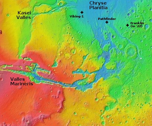
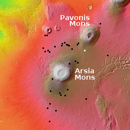
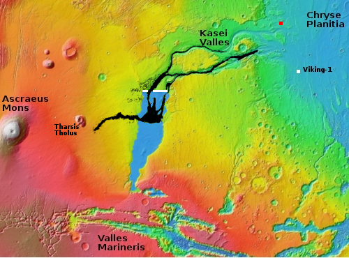
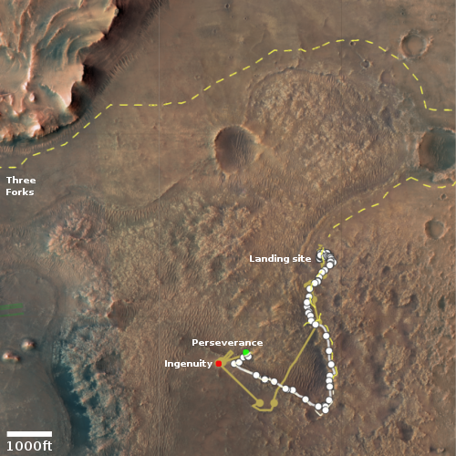
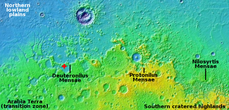
The first image to the right is an overview map of the Valles Marineris region. To its east, centered at the white dot, is a vast region of chaos terrain, endless small buttes and mesas and criss-crossing canyons. Travel in this region will always be difficult, and will likely always require some form of helicopter to get from point to point.

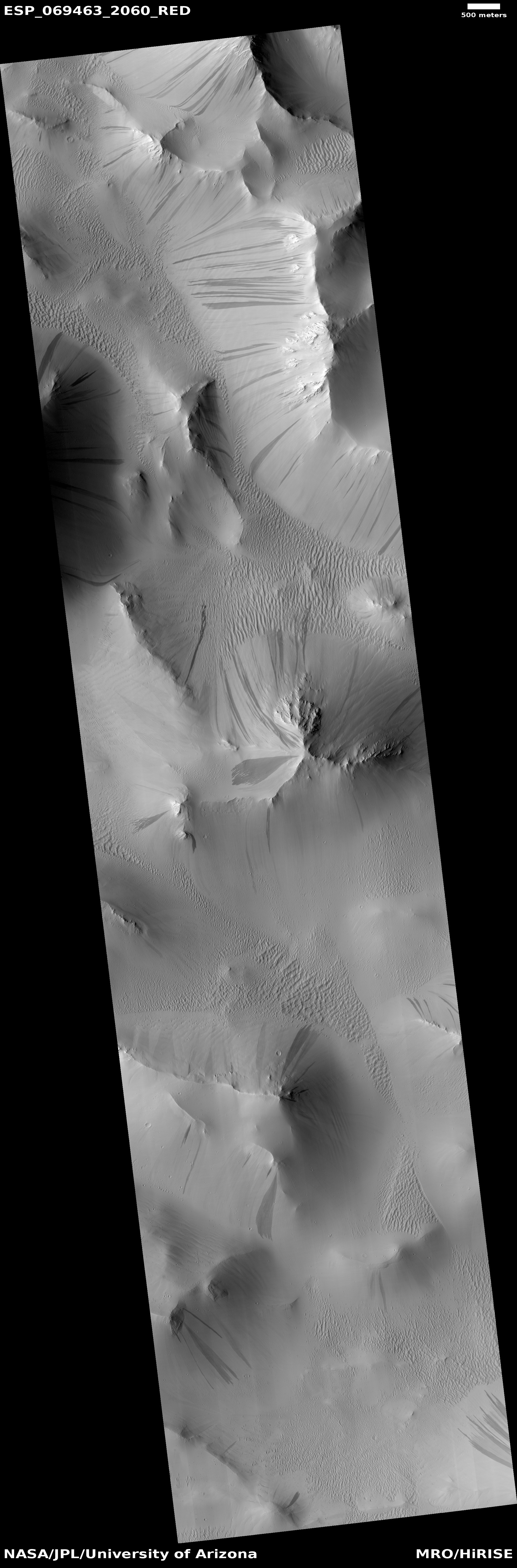
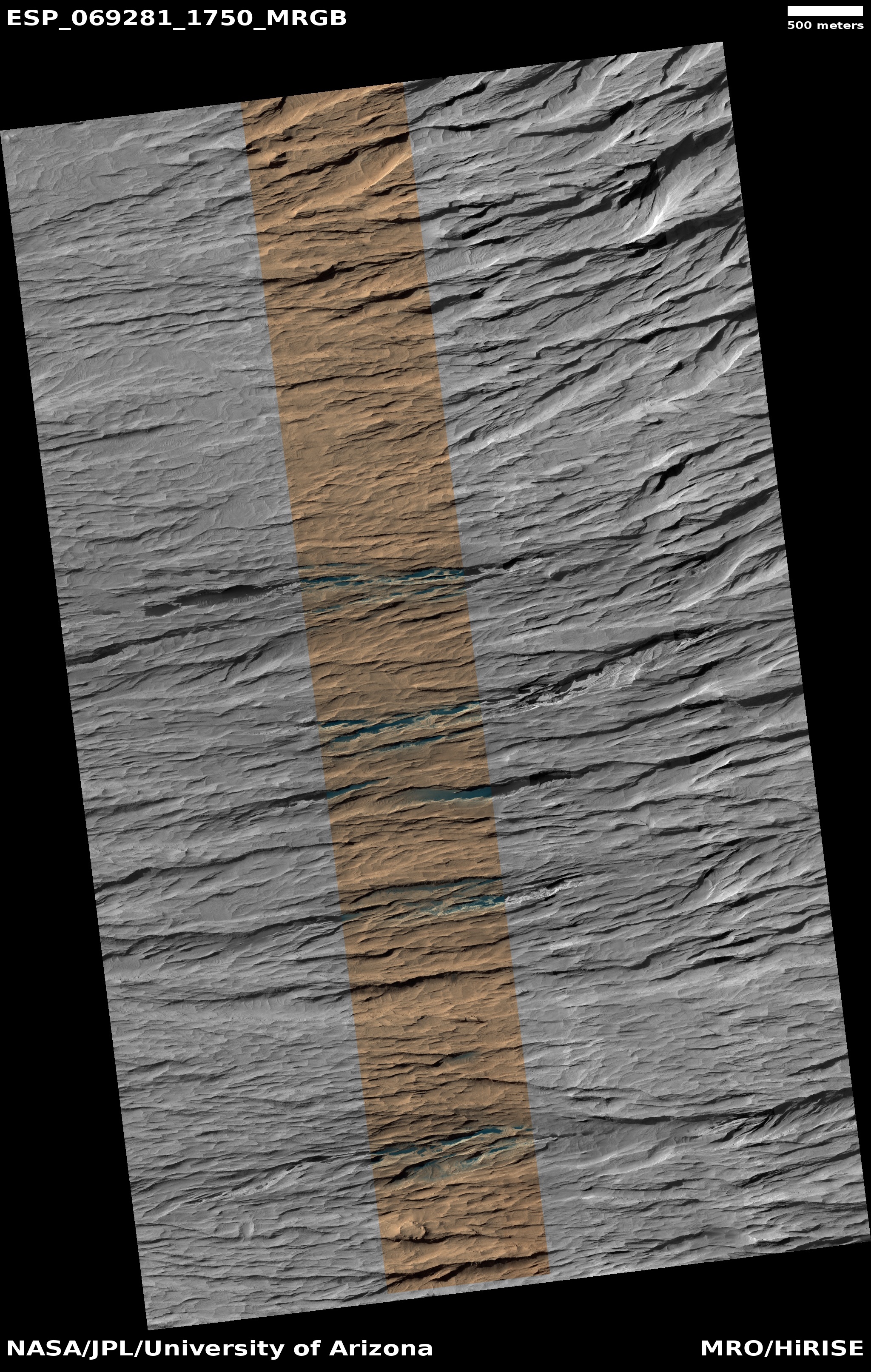
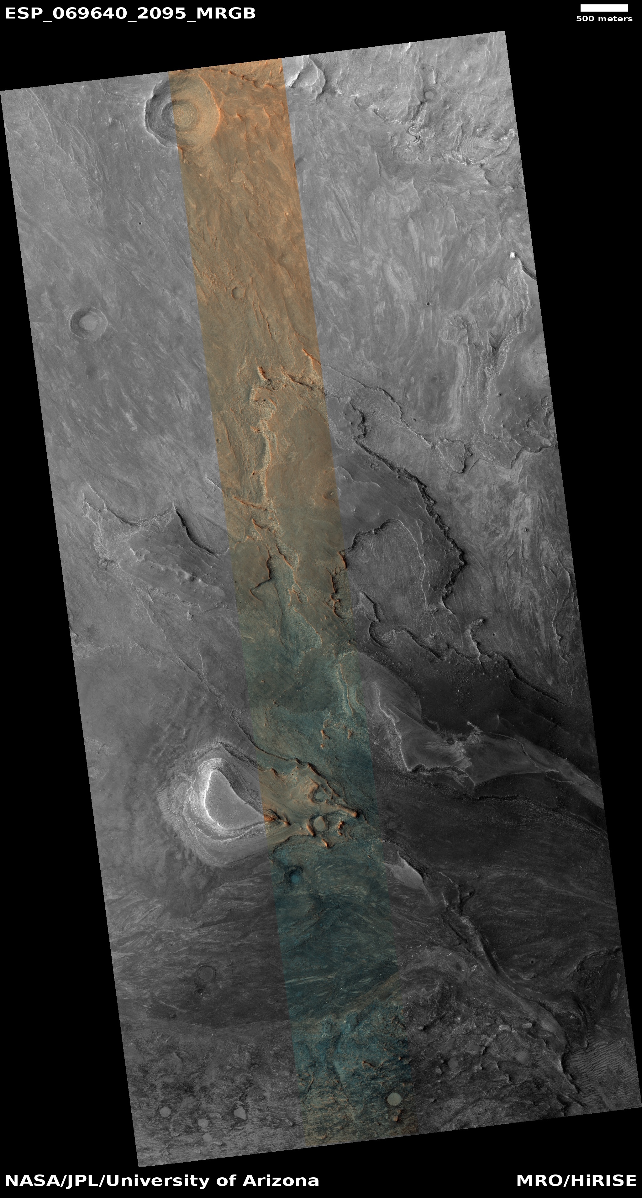
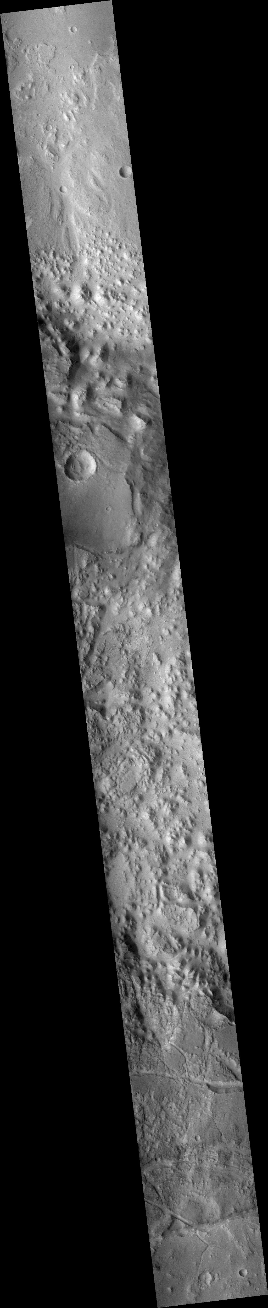
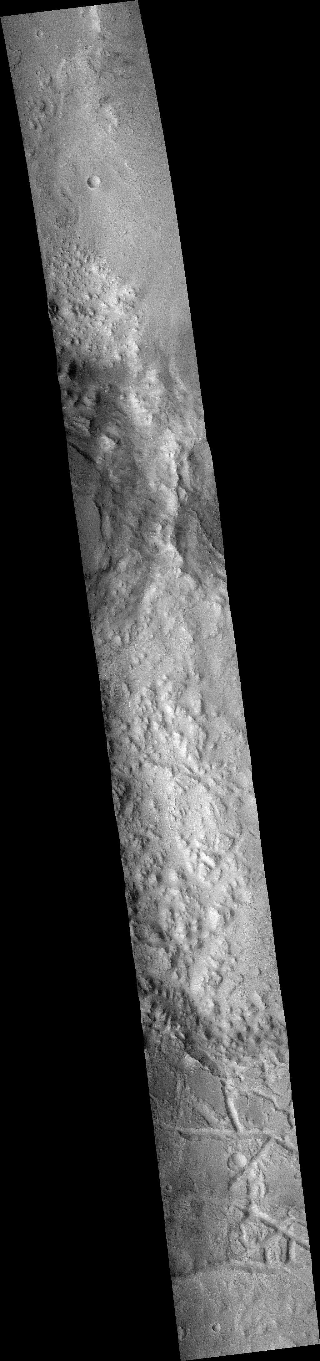
What is hidden in that terrain? Well, to find out you need to take a global survey from orbit with a good enough resolution to reveal some details. Below is a mosaic made from two wide angle context camera pictures taken by Mars Reconnaissance Orbiter (MRO).

Context mosaic of chaos terrain
For full images go here and here.

This mosaic, rotated, cropped, and reduced to post here, only captures a small section of the long north-south strips taken by MRO. The orbiter has taken tens of thousands of these strips, in its effort to produce a global map of Mars that shows some reasonable detail.

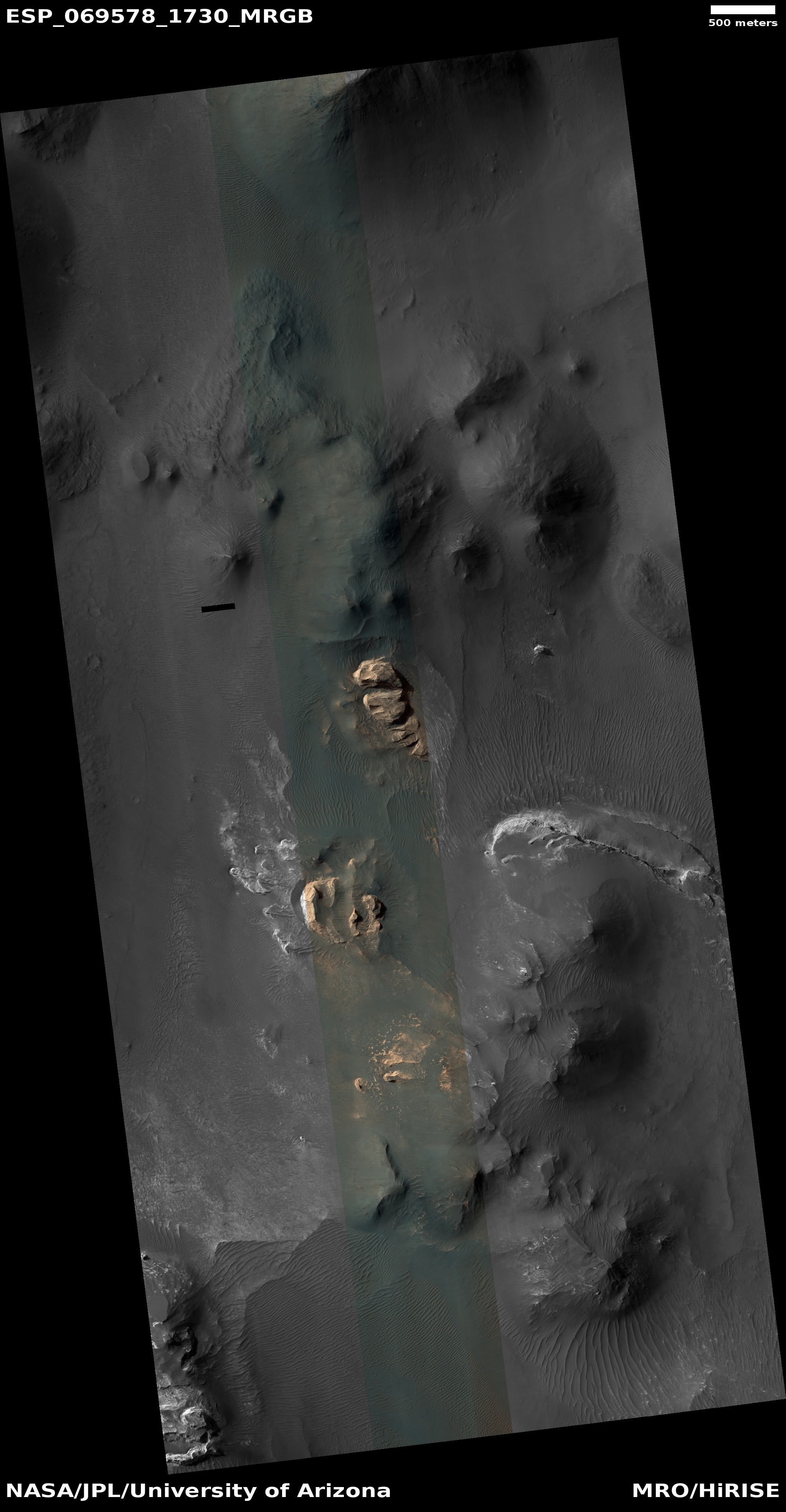
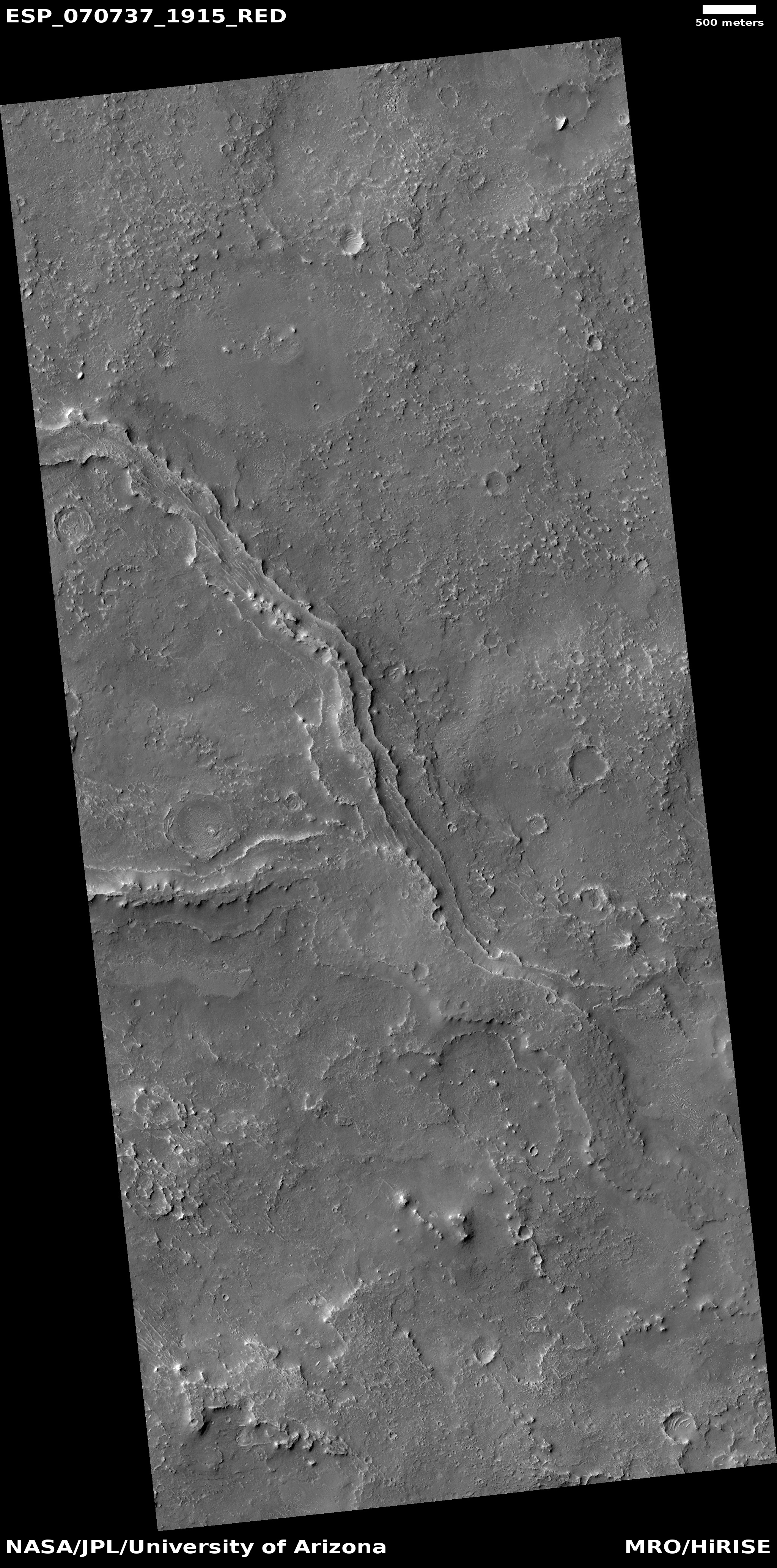
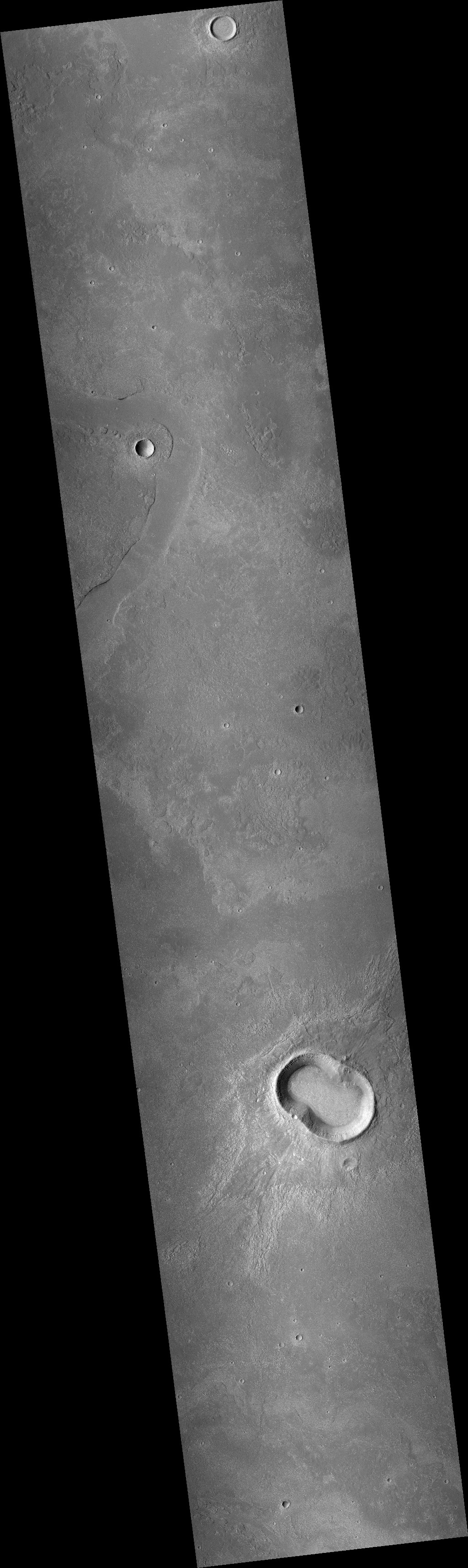
Do you see anything in this mosaic that looks interesting? Scientists need to pore over such images, one by one, searching for geology that is both puzzling and revealing. Sometimes the features are obvious, such as a single blobby crater in the flat relatively featureless northern lowlands.

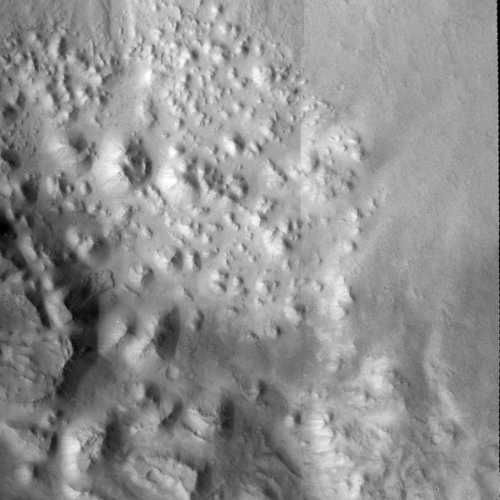
Sometimes however the search can be slow and time-consuming because the terrain is complex, as is the example to the right. The many mesas and canyons can hide many interesting features. Since MRO can’t possibly take high resolution photos of everything, scientists have to pick and choose.

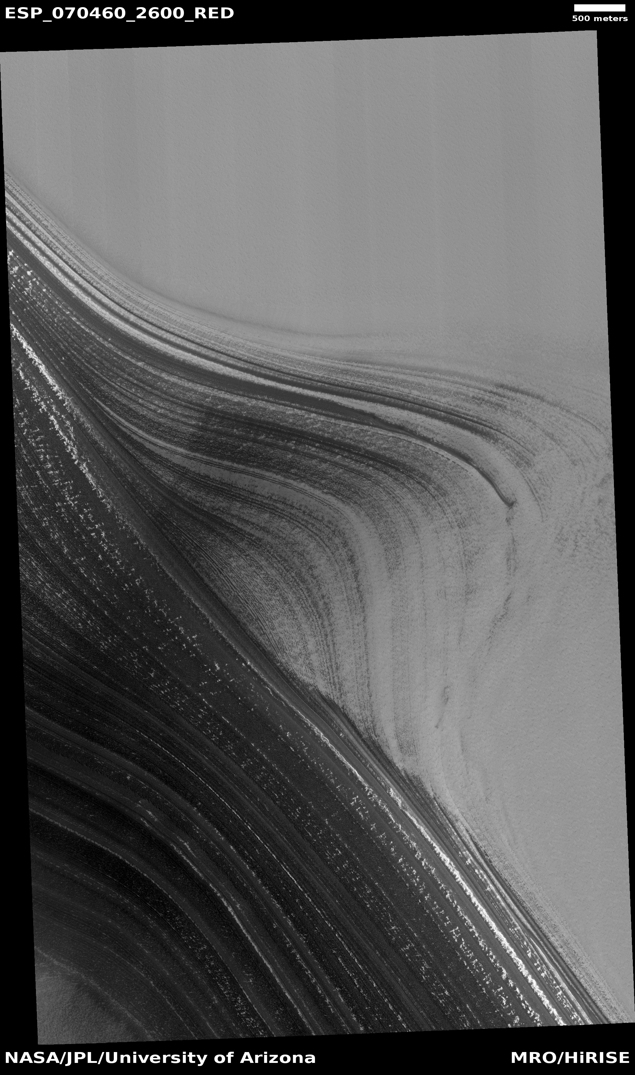
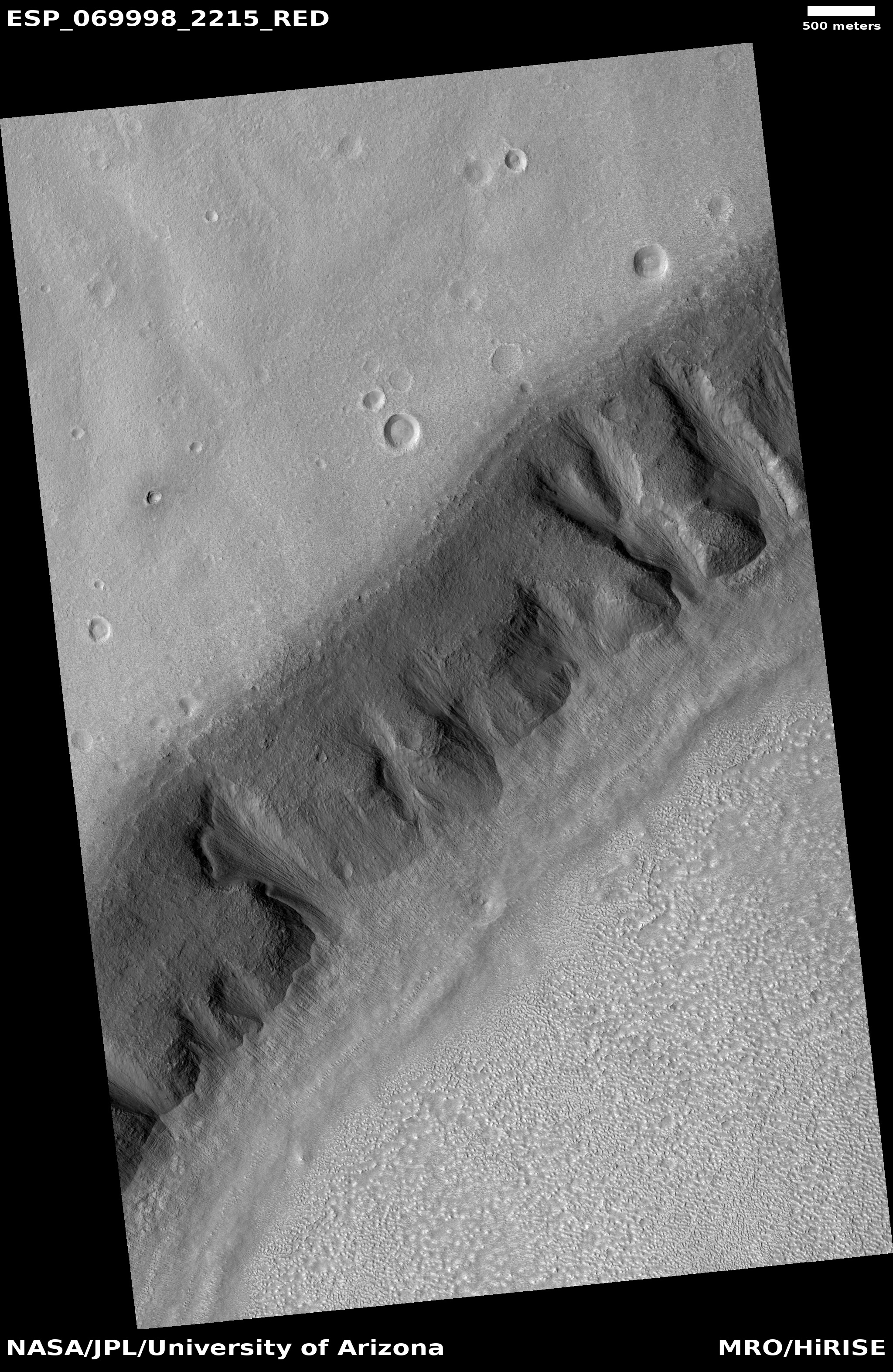
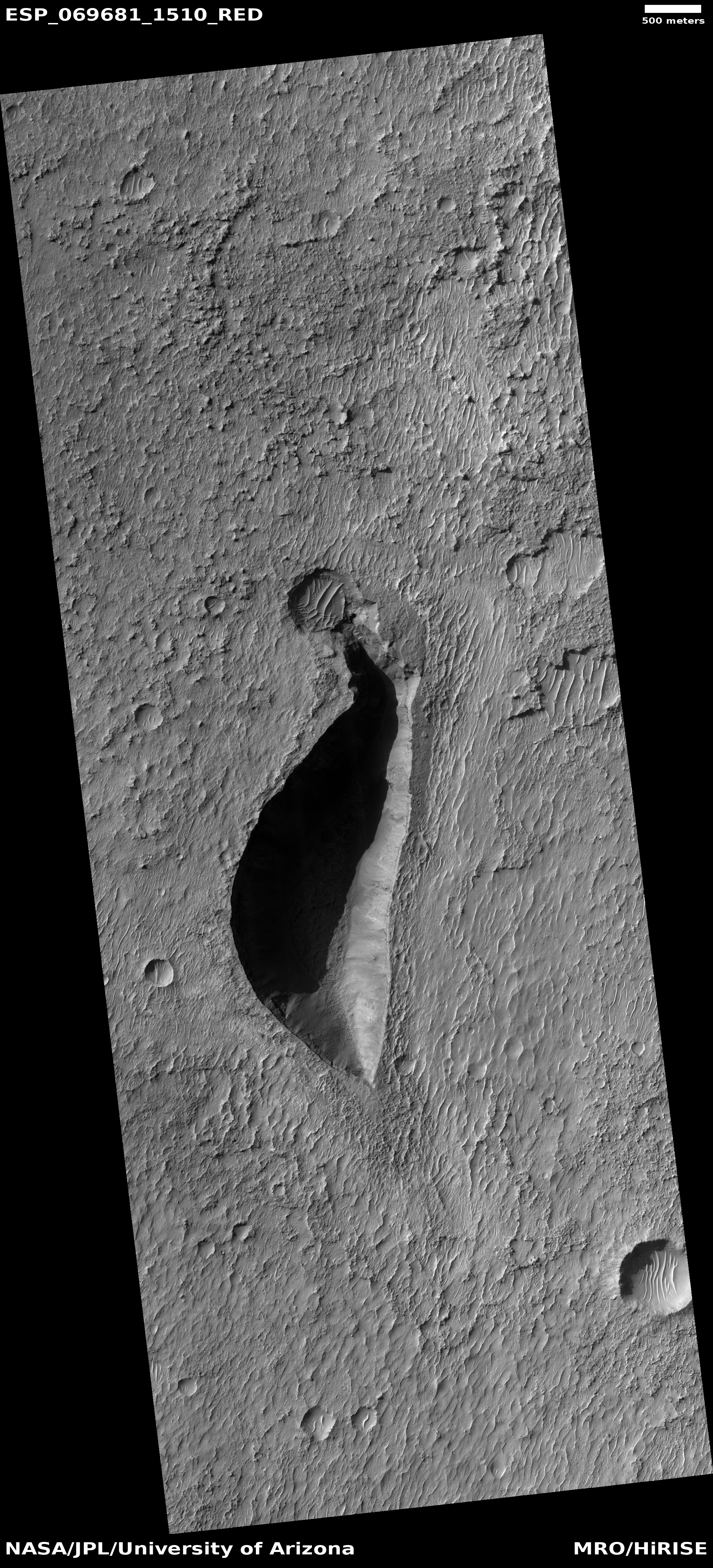
The planetary scientists who use MRO did find something here worth looking at in high resolution. Can you find it? Normally I’d provide a box to indicate it, but this time I’d thought I’d challenge my readers. Before you click below to see the feature, see if you can find it yourself in this mosaic. What would you want to photograph in high resolution?
» Read more

5 comments

Glacial falls on Mars

A glacial falls on Mars
Click for full image.

Cool image time! The photo to the right, cropped and reduced to post here, was taken on July 2, 2021 by the high resolution camera on Mars Reconnaissance Orbiter (MRO). It provides us just one more clear example of the many glaciers found in that 2,000-mile-long strip of chaos terrain at 30 to 47 degrees north latitude that runs between the northern lowland plains and the southern cratered highlands, a region I like to call Mars’ glacier country.

What makes this glacial feature interesting is that these ice-filled alcoves are south-facing, which in the northern hemisphere means they get the most sunlight. Yet, the ice here remains, well-protected by its layer of dust and debris. Think of the dirty ice slush that manages to survive the longest on city streets in the spring. The dirt acts as protection so that the ice takes more time to melt.

The overview map as always provides our context.
» Read more

0 comments

Badlands on the floor of a Martian crater

Badlands on the floor of a Martian crater
Click for full image.

Cool image time! The photo to the right, rotated, cropped, and reduced to post here, shows one small section of a 30-mile-wide unnamed crater in the cratered equatorial regions of Mars northeast of Hellas Basin. Taken on July 21, 2021 by the high resolution camera on Mars Reconnaissance Orbiter (MRO), the science team labeled merely as “Rocky crater fill.”

Being at 17 degrees south latitude, there shouldn’t be any ice features in this crater, and the high resolution image to the right seems to confirm this. All we see is an endless plain made up of innumerable small sharp rock ridges interspersed with small low areas filled with sand dunes. This is bed rock, and if its strange stucco-like appearance was caused by a past glacial era, that era is long gone.

Below is a mosaic showing the entire crater, created from two MRO context camera images.
» Read more

0 comments

Lozenge-shaped hole in Martian crater

Hole in crater floor
Click for full image.

Cool image time! The photo to the right, rotated, cropped, reduced, and enhanced to post here, was taken on June 7, 2021 by the high resolution camera on Mars Reconnaissance Orbiter (MRO).

The left image shows what the scientists have dubbed a “lozenge-shaped depression” in the middle of an unnamed 60-mile-wide crater in the southern cratered highlands of Mars. The right image shows the same exact depression, but I have brightened the photo in order to see the details in the shadowed depression.

Though the image is inconclusive, the bottom of the darkest spot in that depression cannot be seen, suggesting it could be an entrance into a larger void below.

Even if there is no voids below, why is this depression here? What caused it? The wider view of MRO’s context camera below might give us a hint.
» Read more

1 comment

An example why scientists think there were catastrophic floods on Mars

Broken mesas on Mars
Click for full image.

Today’s cool image provides a nice illustration why scientists have long assumed that in the distance past there had been catastrophic floods of liquid water on Mars. The photo to the right, rotated, cropped, and reduced to post here, was taken on July 6, 2021 by the high resolution camera on Mars Reconnaissance Orbiter (MRO). It shows an east-west gully cutting between mesas to the north and south.

Because the highest mesas seem to be aligned, this suggests they were once part of the same formation, and something came along to carve that gap and gully between them.

What made the break? The overview map below as usual provides some context, which also provides a possible explanation.
» Read more

4 comments

Data from Opportunity suggests surface dew periodically appears even in the dry equatorial regions

Using data from the rover Opportunity, scientists now think that the renewal of Martian salt crusts on rock surfaces on the rim of Endeavour Crater could possibly by caused by the appearance of rare thin wetting events, and that such events could have even occurred very recently and be on-going..

The scientists looked at the rate of erosion and renewal of the salt crusts, and found them to be in a steady state. The erosion is slow, taking from 200,000 to 2,000,000 years to remove 1 to 2 millimeters. However, periodically a thin film of water or wetting occurs, not unlike dew on Earth, which quickly acts to renew the crust. As David Mittlefehldt of the Astromaterials Research Office at the Johnson Space Center and the lead author of the paper explained to me,

Taken together, the data leaves open the possibility the salt mobilization has occurred within the last few thousand years. It could be ongoing in the sense that over a period of thousands? or hundreds? of years it might happen again.

In other words, the evidence suggests that every few hundred or thousand years the surface of these rocks gets wet, which results in the placement of a new thin layer of salt crusts.

Mittlefehldt also emphasized to me that these wetting events are rare, and “there is also the case that such an event may never come again because of changing conditions.”

The situation is essentially like on Earth, where in some places hydrologists measure the size of floods by how rare they are. A 1,000 year flood is big, but it happens very rarely. At Endeavour Crater these wetting events are comparably rare, but they do not involve big floods, but a mere moistening of the ground.

The location of Endeavour Crater is about 2 degrees south latitude, so it sits in the dry equatorial regions where no surface or near surface ice has so far been found. However, the cyclic nature of Mars’ orbit and obliquity could have changed this in the past, and could change this again in the future. At this time we simply don’t have enough information to know.

0 comments

On the edge of Mars’ glacier country

Color dry mesas on Mars
Click for full image.

Today’s cool image sits right on the southern edge of Mars’ northern glacier country, at 29 degrees north latitude. The picture to the right, cropped and reduced to post here, was taken of this location on June 4, 2021 by the high resolution camera on Mars Reconnaissance Orbiter (MRO). It shows what appears to be the exposed and scraped bedrock and mesas on the floor of an unnamed 60-mile-wide crater.

That scraped bedrock is quite beautiful, reminiscent of the bare carved mesas and bedrock one sees throughout the southwest of the United States. To hike from that central valley to the top of the bright mesa would be a fine experience, especially because of the suggested change in colors in the color strip.

The overview map below gives more context.
» Read more

0 comments

Glaciers and mesas on Mars

Overview map

Cool image time! Today we return to glacier country on Mars, that band of mensae mesas and glaciers that stretches more than 2,000 miles in the northern mid-latitudes, as shown on the overview map above.

No rovers or landers have yet visited this region, nor are any planned. To the west just beyond the map’s left edge is the planned landing site of Europe’s Franklin rover. To the east and south and just beyond the map’s right edge is where America’s Perseverance rover presently travels in Jezero Crater.

Our journey today begins from afar, and will steadily zoom into the area of the red cross and a most intriguing feature seen in a recent picture taken by the high resolution camera on Mars Reconnaissance Orbiter (MRO).

Before we look at that high resolution image, it is better to view the area using MRO’s context camera, as what it shows helps make sense of the features in the close-up.
» Read more

4 comments

Perseverance’s 2nd drill attempt to get sample appears successful

It appears that Perseverance’s second drill attempt on Mars has successfully obtained sample material in its core.

Data received late Sept. 1 from NASA’s Perseverance rover indicate the team has achieved its goal of successfully coring a Mars rock. The initial images downlinked after the historic event show an intact sample present in the tube after coring. However, additional images taken after the arm completed sample acquisition were inconclusive due to poor sunlight conditions. Another round of images with better lighting will be taken before the sample processing continues.

Once they know for sure if they have a sample, they will store it and then move on, heading to the area that Ingenuity scouted for them in mid-August.

Posted halfway to Las Vegas.

4 comments

A peanut-shaped crater in the northern plains of Mars

Context camera image of peanut-shaped crater
Click for full image.

Cool image time! The photo to the right, rotated, cropped and reduced to post here, was taken in May 2008 by the wide angle context camera on Mars Reconnaissance Orbiter (MRO). It shows what the scientists have since labeled a “peanut-shaped crater.”

What caused this unusual shape? The obvious and most likely explanation is that this was a double impact that occurred simultaneously. Imagine the ground being hit either by an asteroid with two lobes or by two similar-sized asteroids falling side-by-side.

Fast forward thirteen years to 2021. In the fifteen years since 2006 when MRO begin science operations in orbit around Mars no high resolution images were taken of this crater. Finally, on July 30, 2021, scientists finally decided to take a high resolution image of this crater’s western half. You can see that image below, rotated, cropped, and reduced to post here.
» Read more

3 comments

Stucco on Mars!

Stucco on Mars
Click for full image.

Cool image time! The picture to the right, cropped to post here, was taken on June 8, 2021 by the high resolution camera on Mars Reconnaissance Orbiter (MRO). It shows a strangely flat plain with a complex stucco-type surface of ridges and depressions. The sunlight is coming from the west, which makes the smoother flat areas depressions.

What are we looking at? What causes this strange surface? Make sure you look at the full image, because the section I cropped out doesn’t give a true sense of the terrain’s vastness.

The MRO science team labeled the photo “volcanic terrain,” but that tells only part of the story, since this volcanic terrain is actually part of Mars’ most interesting lava plains, as the overview map below shows.
» Read more

2 comments

An ancient curving channel on Mars

Context image of curving channels
Click for full image.

Cool image time! The photo to the right, rotated, cropped, and reduced to post here, was taken by the wide angle context camera on Mars Reconnaissance Orbiter (MRO) in April 2019. It shows an area on Mars where a number of meandering curving channels flow downhill from the west to the east.

Earlier MRO images had already spotted these channels, so when this context image was taken the scientists also took a high resolution image of the same channels, with the white box indicating the area covered by the rotated, cropped, and reduced image below.

Both images are today’s MRO image of the day, where the MRO team notes that “The objective of this observation is to examine a complex network of channels. Some parts of the channels are quite curved.”
» Read more

1 comment

New cracks across old Martian lava flows

New cracks across an old lava flow
Click for full image.

Cool image time! The photo to the right, cropped and reduced to post here, was taken on June 4, 2021 by the high resolution camera on Mars Reconnaissance Orbiter (MRO). It captures one of the many deep straight fissure canyons that make up the feature dubbed Cerberus Fossae in the center of Mars’ volcano country.

The crack is called a graben, and happens when the ground is either stretched from pressure from below, or when two adjacent large blocks of material move sideways relative to each other.

What makes this particular graben interesting are two features. First, the overlapping break suggests something complex took place at this spot when the crack separated. Second, the crack cut across the foot of an older frozen lava flow, meaning it has to be younger than that flow.

The overview map below provides a clue when that lava flow might have occurred, while also suggesting this crack in Cerberus Fossae might be much younger than expected.
» Read more

6 comments
1 30 31 32 33 34 54