Exploring the cratered southern highlands of Mars, part 1

Click for original image.
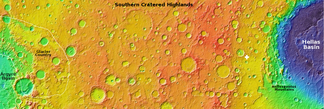
Today and for the next three days the cool images that I will post from Mars will explore a region that I have not covered very much in depth, the cratered southern highlands between the giant basins Argyre and Hellas. The map above is an overview of this 7,000-mile-long region, all of which is inside the 30 to 60 degree south latitude band where scientists have found much evidence of buried glaciers. In this region the bulk of that evidence is most obvious inside craters.
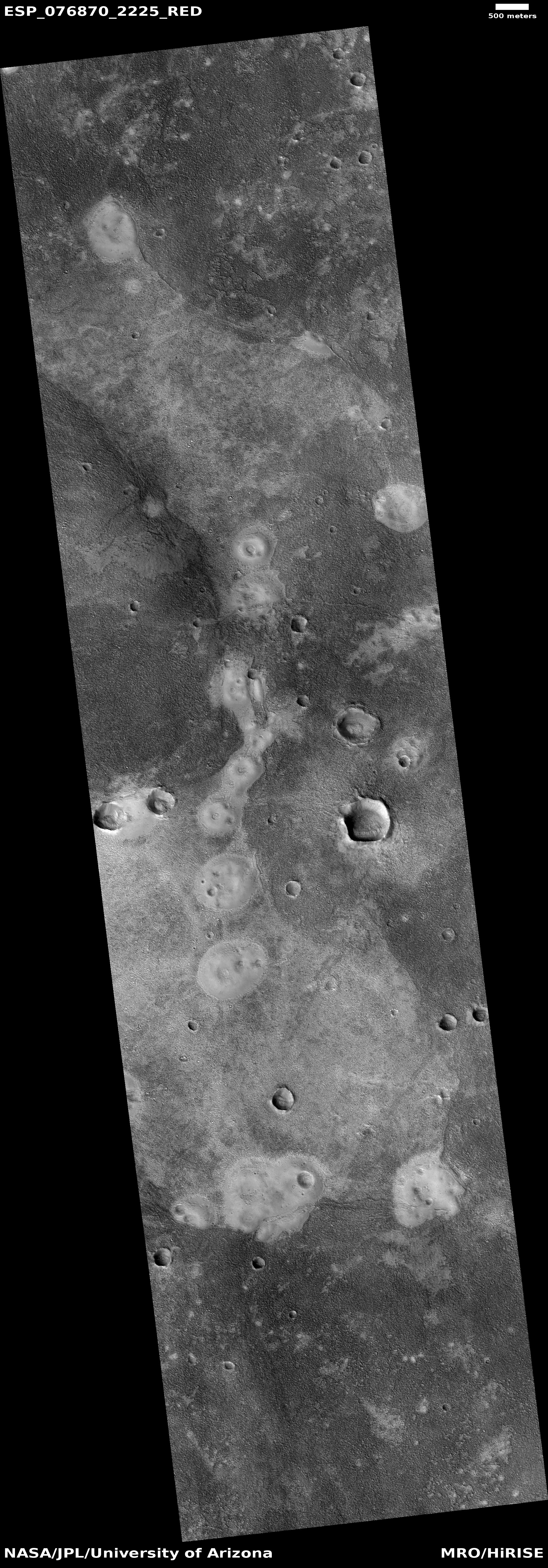
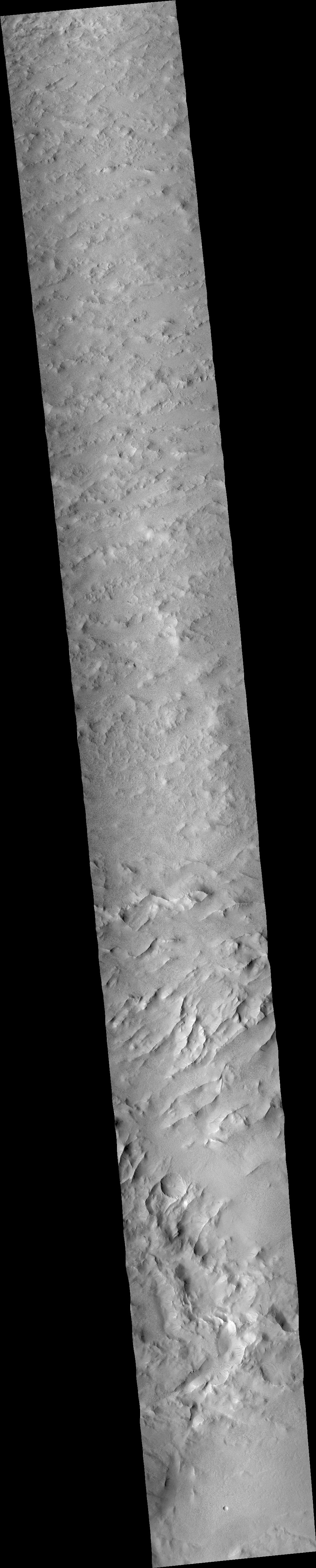
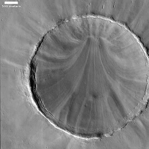
The picture to the right, cropped, reduced, and sharpened to post here, was taken on December 21, 2022 by the high resolution camera on Mars Reconnaissance Orbiter (MRO), and shows a typical example of the kind of glacial feature found. The white cross on the map marks its location, west of the Hellespontus Mountains that form the western rim of Hellas Basin.
Scientists have dubbed this feature concentric crater fill, a purposely vague term because — though it looks like glacial fill — until there is data to confirm it the scientists would quite properly rather not commit themselves. The concentric rings suggest multiple layers, each of which likely marks a different climate cycle in Mars’ geological history.
In this case the glacier features also appear to cover the entire plain surrounding the crater as well as its rim. The small crater to the west is similar, and both give the appearance that the ice sheet that covers them came after the impact, draping itself over everything, with the craters only visible because the ice sheet sags within their interiors.
More crazy features from the cratered highlands to come.