
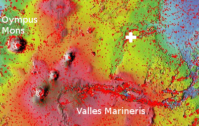
The soft landslides of Mars
The light gravity of Mars, combined with different materials, a lot of dust, and a geological history different from Earth, produces events that — though reminiscent of similar geological events on Earth — are definitely not the same.
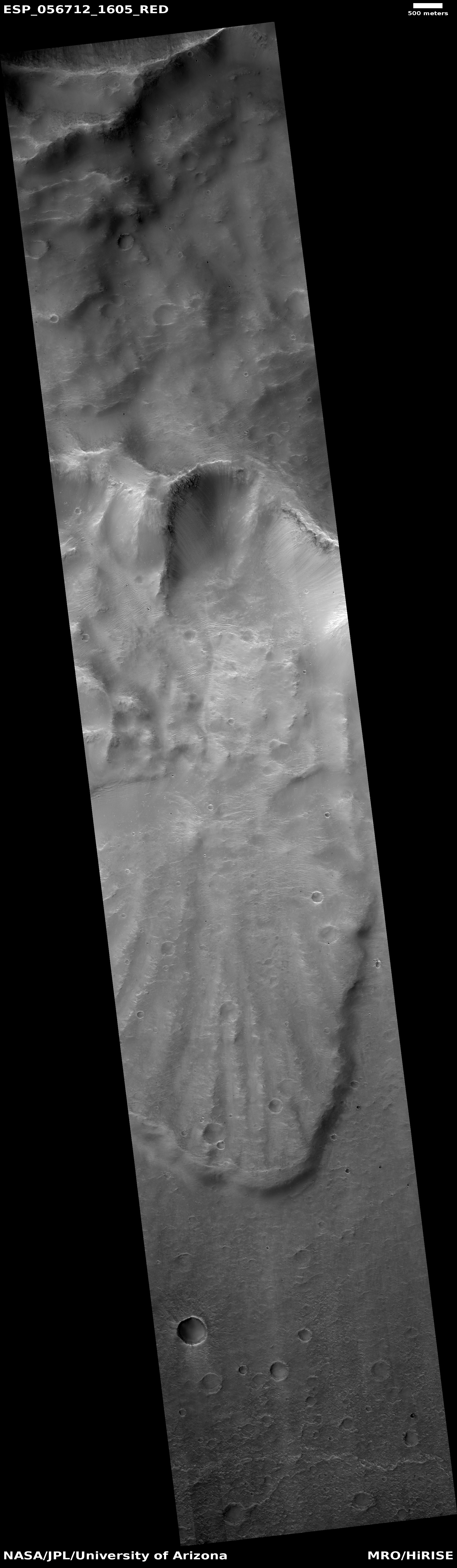
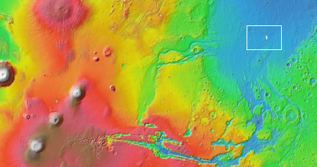
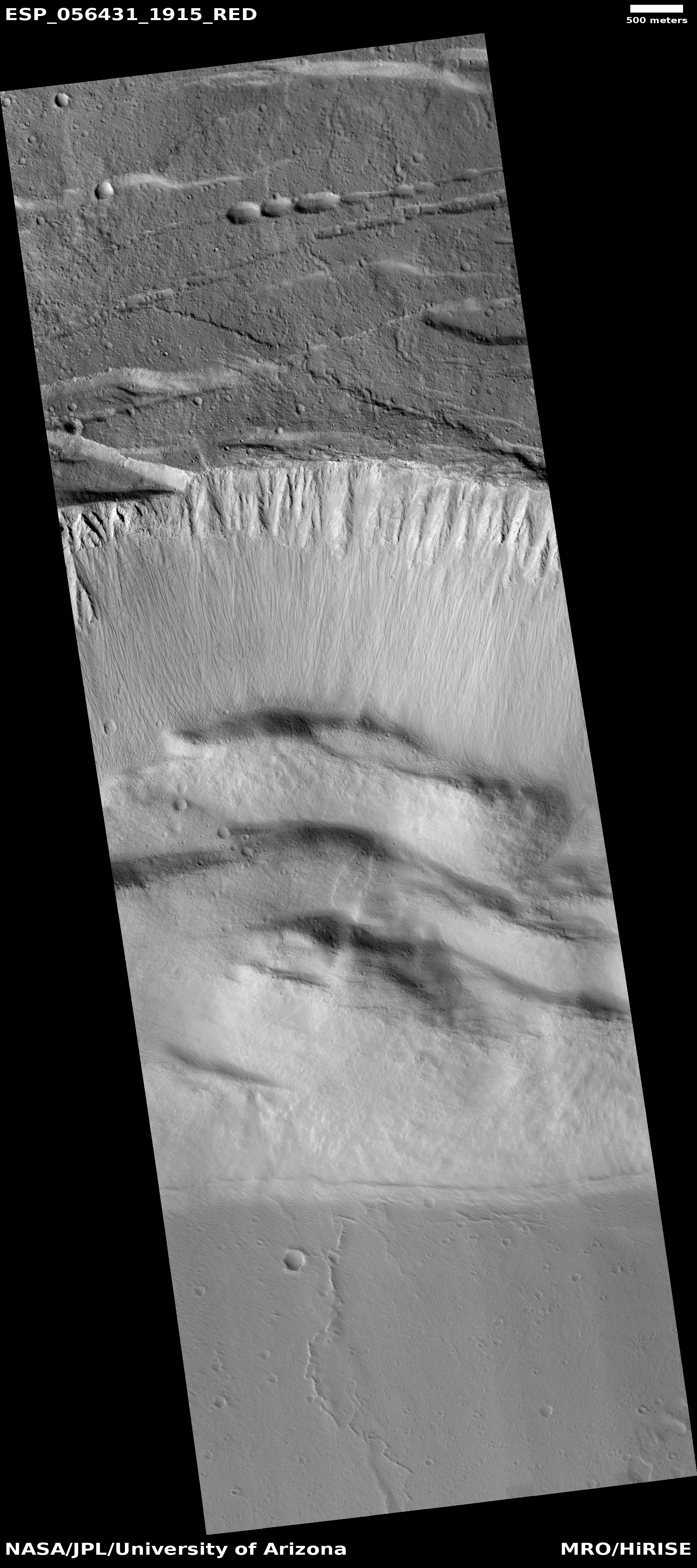
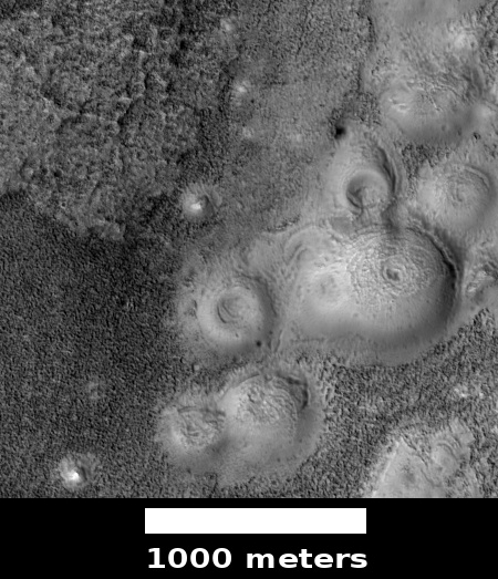
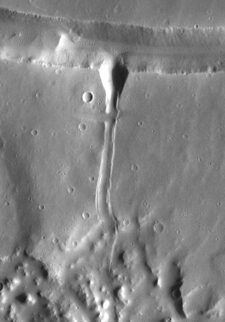
The image above, cropped and reduced to post here, was taken by the high resolution camera on Mars Reconnaissance Orbiter (MRO) and was one of the many uncaptioned images released in the November archive. If you click on the image you can see the full resolution version. It shows the tongue of a landslide inside a crater located in the planet’s southern highlands.
You can immediately see why I call it a soft landslide. The craters on its top are barely visible, as if they hit a soft surface that absorbed most of the impact. The grooves spreading southward in the slide suggest that this solid material flowed almost like mud. And the soft, smooth surface head of the slide suggests an almost liquid-like flow. As far as I can tell, this landslide had few large boulders. It was made up instead of small particles of about the same size.
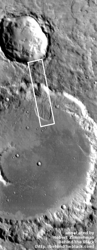
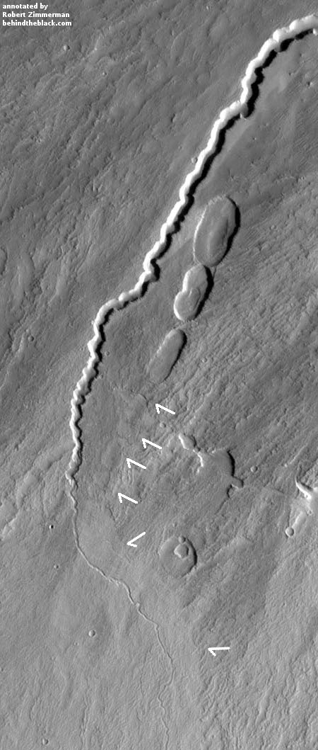
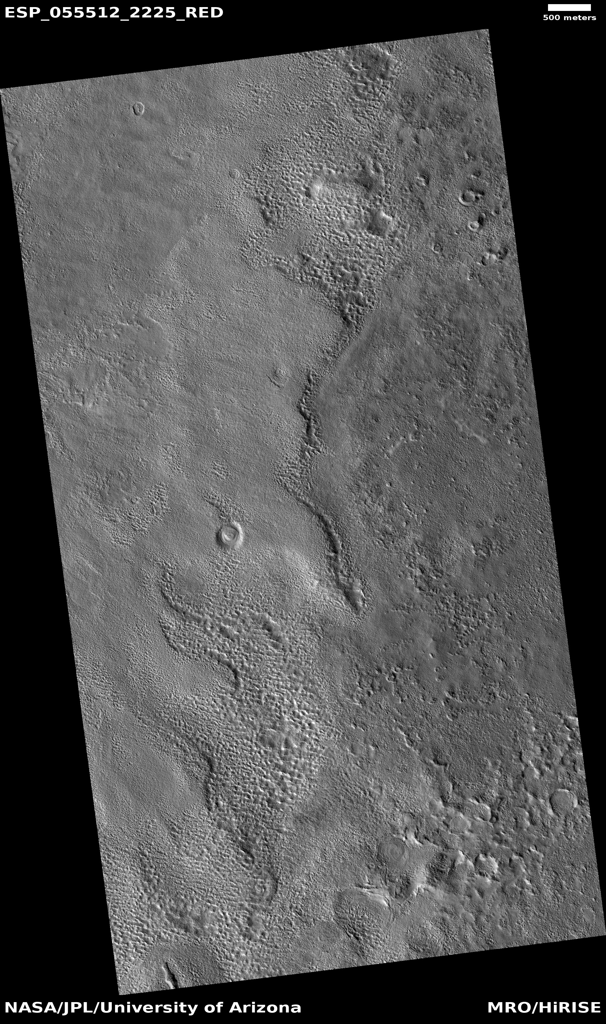
To the right is an image showing the wider context of the above image, taken by Mars Odyssey and cropped and annotated by me to post here. The white box shows the entire area photographed by the full resolution image of the landslide, with the tongue of the landslide at the bottom of the box. If you look at the floor of this crater, you can see what looks like the ghost of a past smaller impact, seemingly buried in either a field of lava or soft dusty regolith. The smoothness of the crater floor also suggests a material softness, allowing it to settle into a pondlike featureless flat plain.
» Read more
