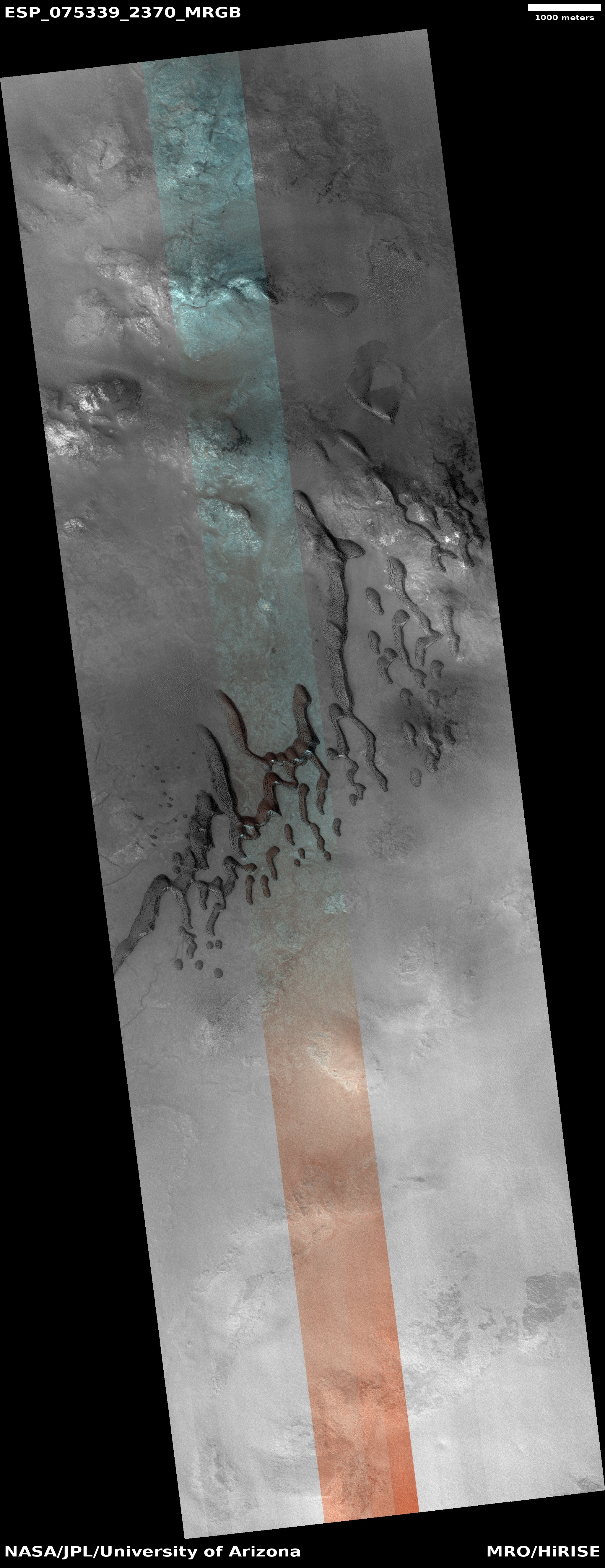
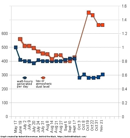
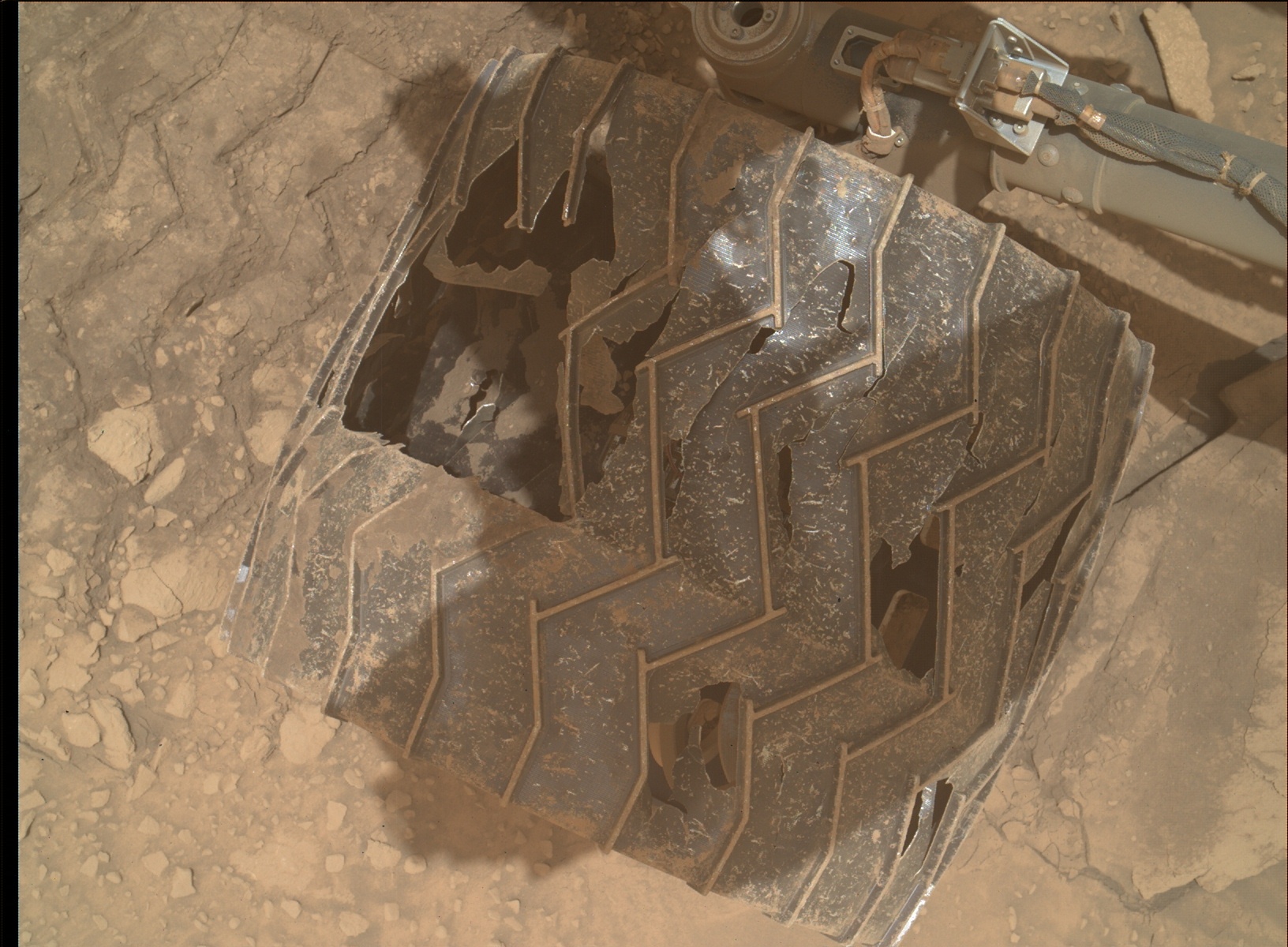
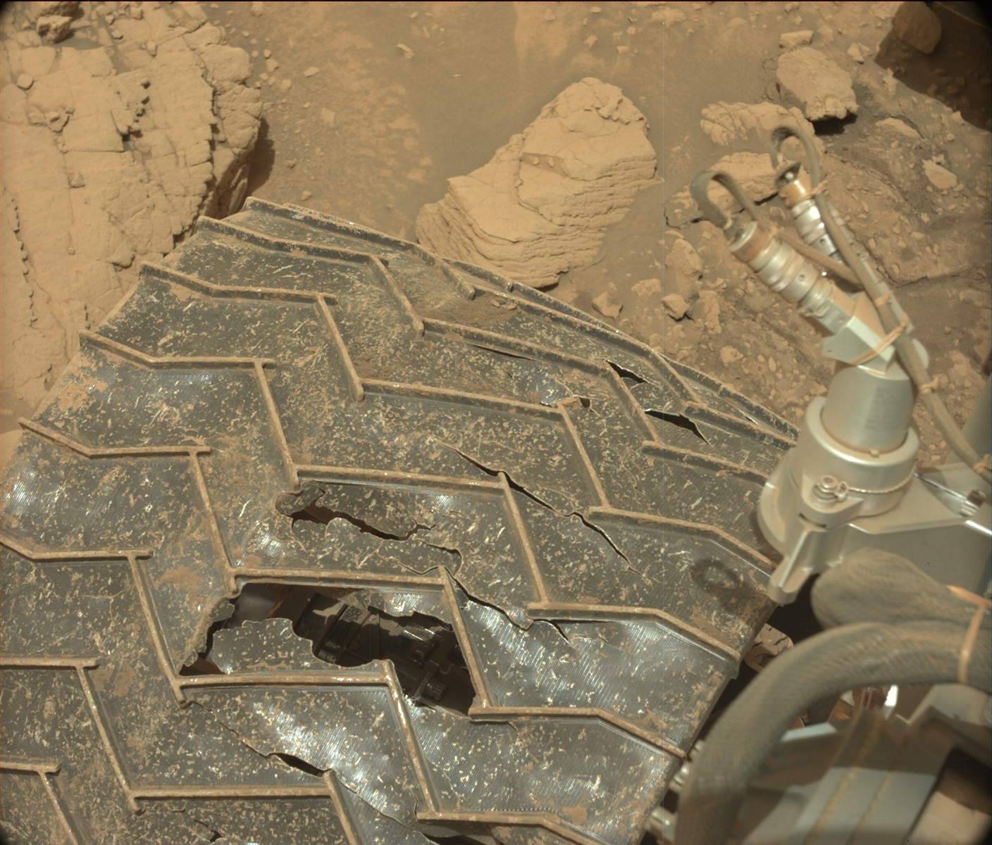
Click for original image.
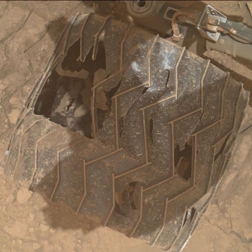
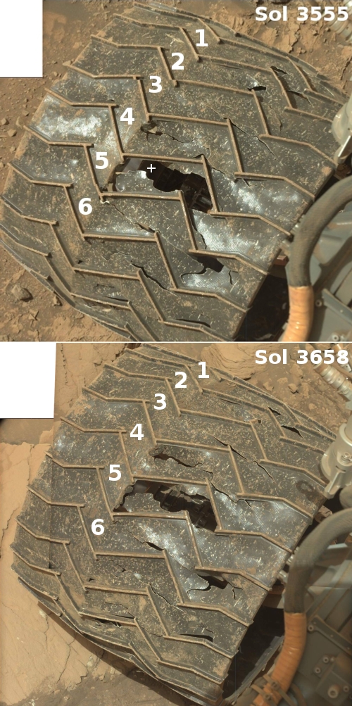
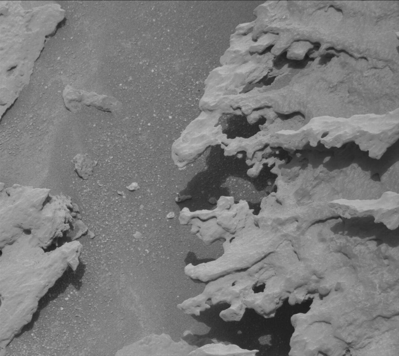
I must start this post with a strong caveat. The serious damage, as posted to the right, of the zig-zag growser treads on one of Curiosity’s wheels that was photographed by one of the rover’s cameras yesterday and downloaded today, could very well not be new damage. As noted in a report in June:
The team discovered that the left middle wheel had damaged one of its grousers, the zig-zagging treads along Curiosity’s wheels. This particular wheel already had four broken grousers, so now five of its 19 grousers are broken.
The damaged wheel to the right appears to be that left middle wheel. This photo thus might simply be documenting the damage noted in June, and not new damage. Since Curiosity has six wheels (three on each side), the middle wheels like this one are likely slightly less critical and can be worked around should it no longer function well.
Nonetheless, the damage to these growsers is of concern. Previously, the wheel damage has consistently involved breakage in the metal plates between the growsers. Though the science team noted in that June report that it has “proven through ground testing that we can safely drive on the wheel rims if necessary”, the team also said that it did not think that was going to happen soon.
Based on this image, however, it is happening, at least on one wheel. Fortunately, a review of all the images downloaded yesterday does not show any other broken growsers on any other wheel, though the image survey is not thorough and does not cover the entire surface of every wheel. For example, I could not identify any images of the damaged sections of the wheel that I have been tracking since 2017. It could be that the photo’s orientation this time was significantly different, making it difficult to find a match. It could also be that the damage had increased so much that no match with an earlier photo was easily possible. Or it could simply be that the same section on the wheel was not photographed this time.
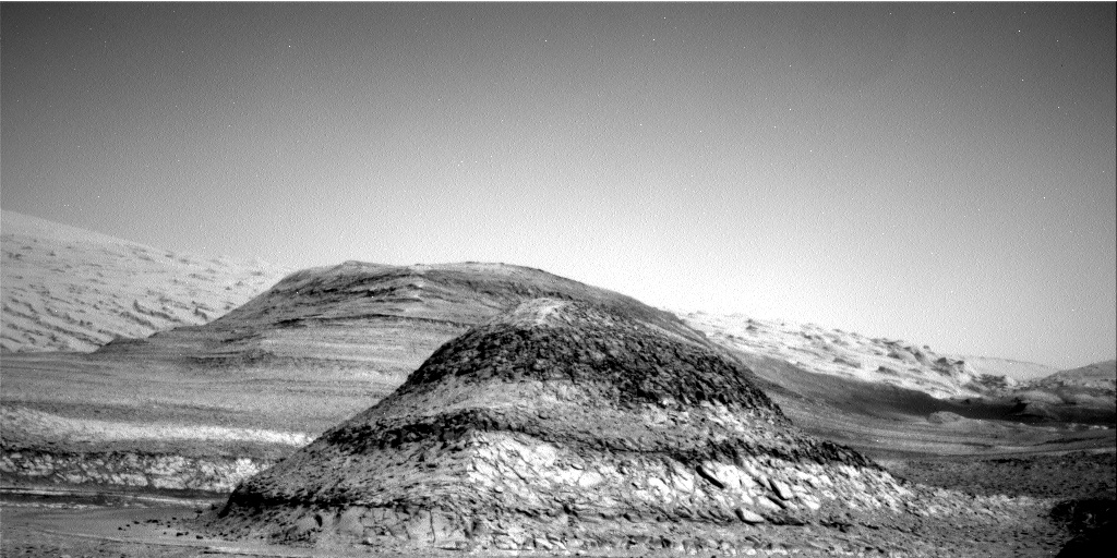
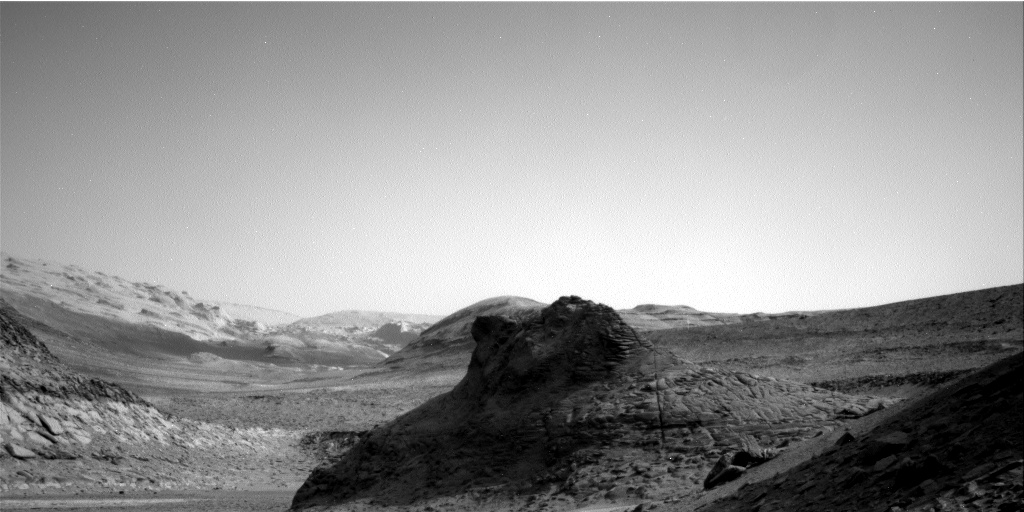
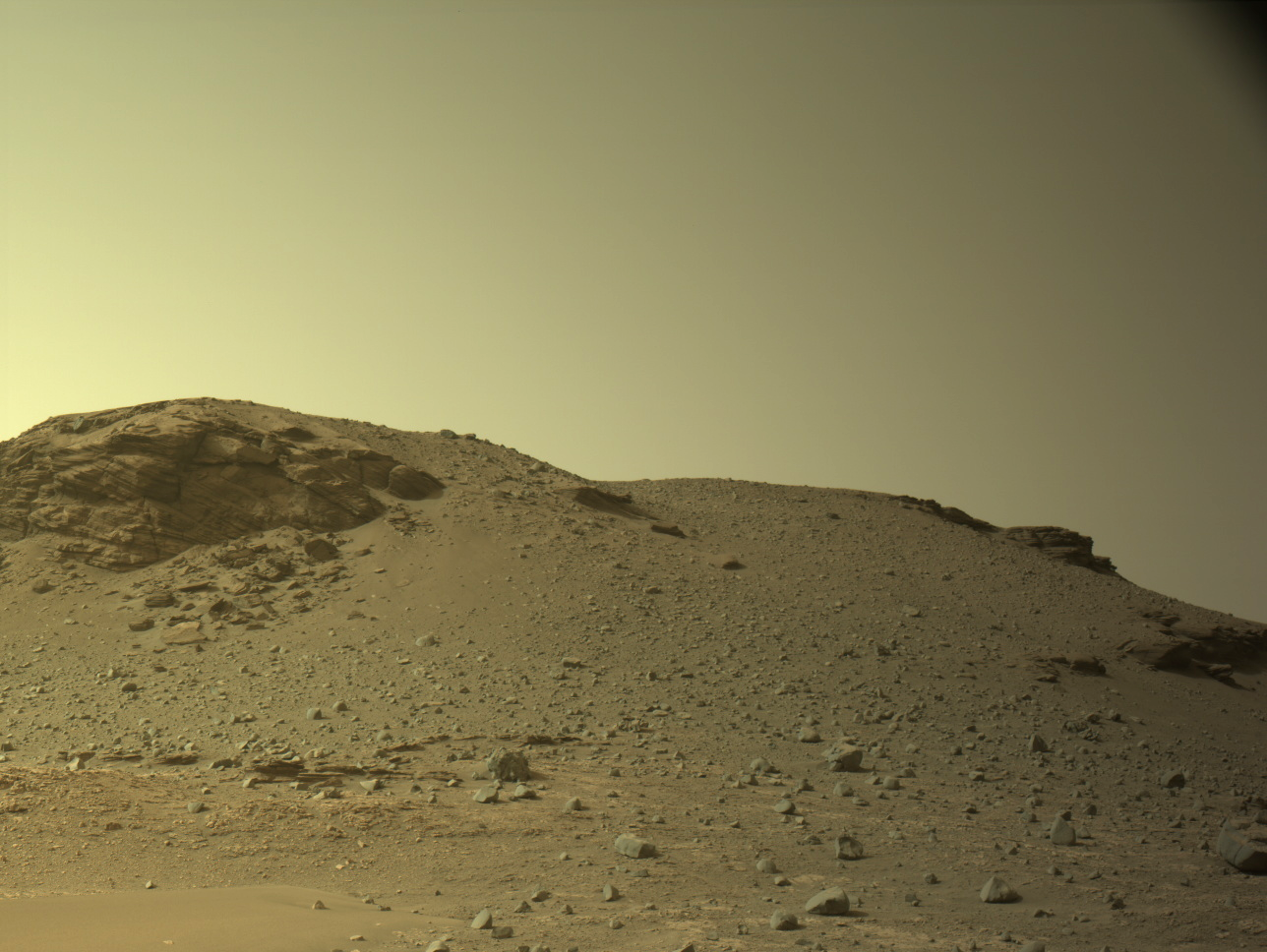
Either way, the damage on this middle wheel foreshadows the rover’s eventual future, a future that is likely getting closer because of the roughness of the mountain and rocky terrain that Curiosity is presently traveling, and appears to have no end as it now climbs Mount Sharp.


