Communications restored with Curiosity

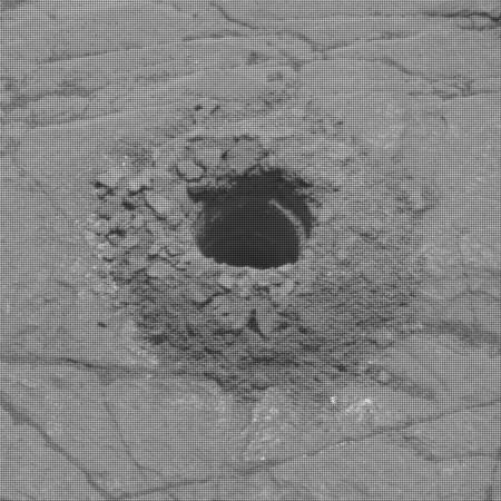
The most recent Curiosity drill hole
Click for full resolution image.

With Mars moving out from behind the Sun yesterday, the Curiosity science team has successfully reestablished communications with the rover.

The focus of Curiosity’s activities since returning to operations after conjunction, now that Mars has safely moved out from behind the sun, is to finish up the analyses associated with the drilling campaign at “Glen Etive 1.”

The image to the right, cropped and reduced to post here, was among the first images downloaded from the rover once communications were reestablished. It was taken by a camera at the end of the robot arm that the scientists had positioned above the hole in order to get a close-up.

Before continuing up the mountain they now plan a second drill hole close-by, to better constrain the data at this location obtained from this first hole.

0 comments

Curiosity’s future travels

Curiosity's planned route up Mt Sharp
Click for full image.

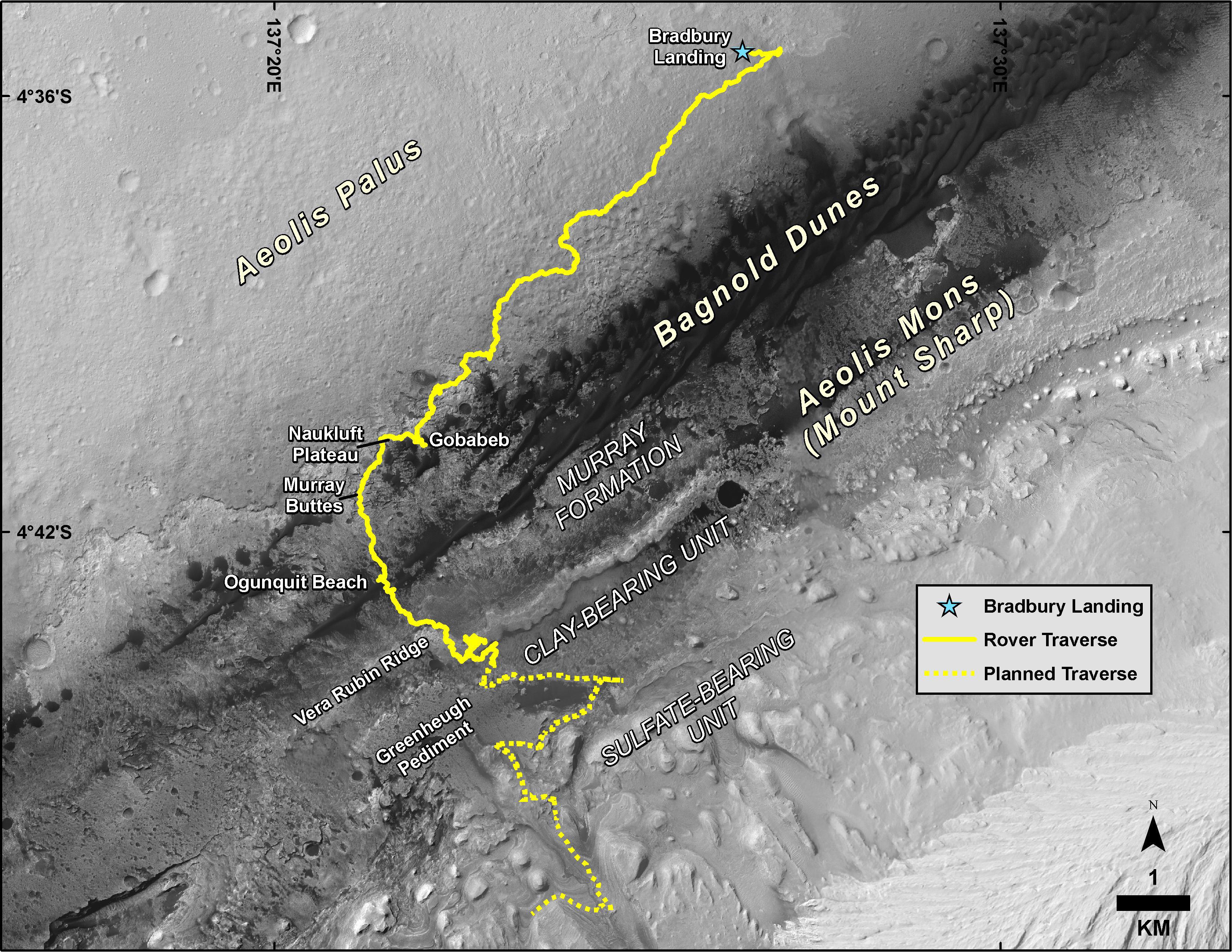
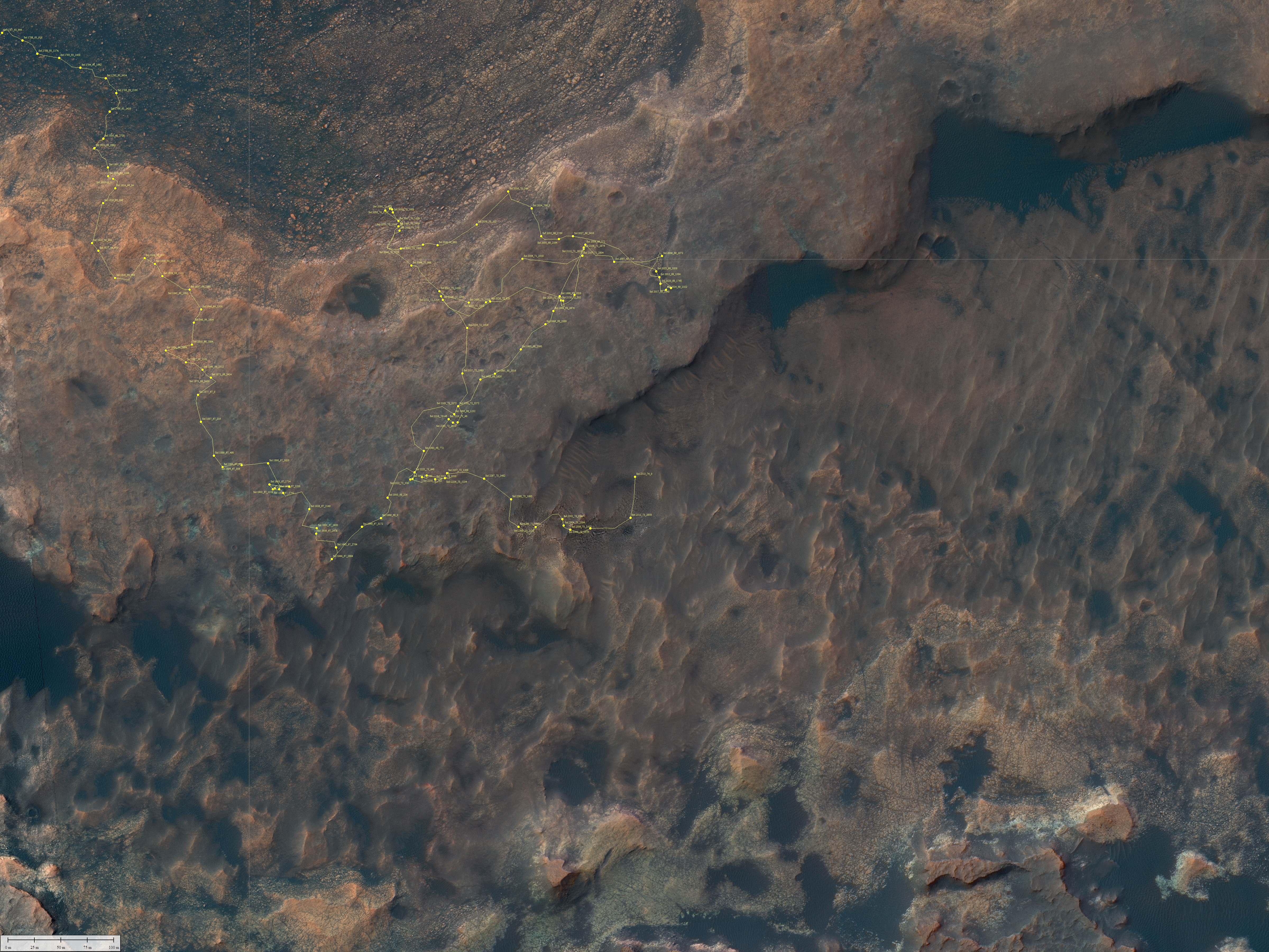
The Curiosity science team has released a new map showing an update of their planned route for Curiosity in the coming year or so, showing how they plan on leaving Gediz Vallis Channel after spending some time exploring the numerous geological layers exposed on its eroded surface.

The new information in this map is the route near the bottom of the image, showing more precisely the route up the canyon and then their retreat through the gap in the canyon’s western wall.

To get a better idea of what this means, I have updated my annotations on this Mars Reconnaissance Orbiter image of Gediz Vallis Channel, posted previously in my May 30, 2019 rover update.
» Read more

0 comments

Mars Reconnaissance Orbiter image of Curiosity

Curiosity as seen from orbit

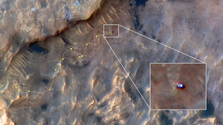
The Mars Reconnaissance Orbiter (MRO) science team today released an image taken on May 31, 2019 by the orbiter’s HiRISE high resolution camera of Curiosity when it was nestled against the cliff at the bottom of Vera Rubin Ridge.

The image above is that enhanced color image, reduced and annotated to post here. I have added the track of Curiosity’s route down from Vera Rubin Ridge leading up to the point where this picture was snapped.

In the image, Curiosity appears as a bluish speck. Vera Rubin Ridge cuts across the scene north of the rover, while a dark patch of sand lies to the northeast.

Look carefully at the inset image, and you can make out what it is likely Curiosity’s “head,” technically known as the remote sensing mast. A bright spot appears in the upper-left corner of the rover. At the time this image was acquired, the rover was facing 65 degrees counterclockwise from north, which would put the mast in about the right location to produce this bright spot.

Mirror-like reflections off smooth surfaces show up as especially bright spots in HiRISE images. For the camera to see these reflections on the rover, the Sun and MRO need to be in just the right locations. This enhanced-color image of Curiosity shows three or four distinct bright spots that are likely such reflections.

From this location Curiosity first continued along the cliff’s base to study that dark patch of sand to the northeast, then it turned almost due south in order to get back to its nominal route into Gediz Valles canyon, as shown in my May 30, 2019 rover update.

0 comments

Wheel update on Curiosity

Periodically, the Curiosity science team stops from its research to reassess the condition of the rover’s wheels. To do this they use the rover’s color camera, dubbed the Mast Camera (Mastcam), taking close-up pictures of the wheels to compare those with earlier photographs see if there has been any additional damage and deterioration over time.

Yesterday Mastcam took a new series of images of the rover’s wheels. Below are two pictures, the left taken on August 27, 2017, the right taken on July 7, 2019. I have annotated the images to help indicate where they match.
» Read more

0 comments

Spike in methane detection in Gale Crater

The uncertainty of science: In the past week Curiosity has suddenly discovered a spike, the largest ever, in the amount of methane in the local atmosphere.

The amount detected was still quite tiny, 21 parts per billion by volume.

Curiosity doesn’t have instruments that can definitively say what the source of the methane is, or even if it’s coming from a local source within Gale Crater or elsewhere on the planet.

“With our current measurements, we have no way of telling if the methane source is biology or geology, or even ancient or modern,” said SAM Principal Investigator Paul Mahaffy of NASA’s Goddard Spaceflight Center in Greenbelt, Maryland.

While there is going to be a lot of speculation in the press and among scientists who should know better, this detection remains a major mystery. We as yet have no idea what caused it. Nor is it likely to have been caused by biology, though that does remain a possibility.

What is most puzzling is that the terrain that Curiosity is presently traveling across, the clay unit at the foot of Mount Sharp, shows no likely source.

This past weekend the scientists focused the rover’s instruments on this topic, in the hope this could help narrow the problem.

0 comments

Rover update: May 30, 2019

Summary: Curiosity confirms clay in the clay unit. Yutu-2 begins its sixth day on the far side of the Moon. Three other rovers move towards completion and launch.

For the updates in 2018 go here. For a full list of updates before February 8, 2018, go here.
Clouds over Gale Crater

Curiosity

For the overall context of Curiosity’s travels, see my March 2016 post, Pinpointing Curiosity’s location in Gale Crater.

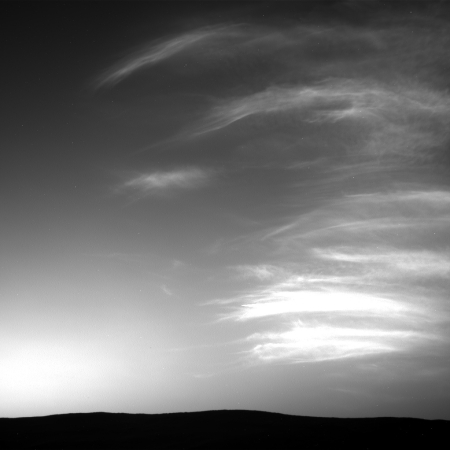
Curiosity’s journey up the slopes of Mount Sharp in Gale Crater goes on! On the right is one of a number taken by the rover in the past week, showing water clouds drifting over Gale Crater.

These are likely water-ice clouds about 19 miles (31 kilometers) above the surface. They are also “noctilucent” clouds, meaning they are so high that they are still illuminated by the Sun, even when it’s night at Mars’ surface. Scientists can watch when light leaves the clouds and use this information to infer their altitude.

While these clouds teach us something about Martian weather, the big rover news this week was that the data obtained from the two drill holes taken in April show that the clay formation that Curiosity is presently traversing is definitely made of clay, and in fact the clay there has the highest concentration yet found by the rover.

This clay-enriched region, located on the side of lower Mount Sharp, stood out to NASA orbiters before Curiosity landed in 2012. Clay often forms in water, which is essential for life; Curiosity is exploring Mount Sharp to see if it had the conditions to support life billions of years ago. The rover’s mineralogy instrument, called CheMin (Chemistry and Mineralogy), provided the first analyses of rock samples drilled in the clay-bearing unit. CheMin also found very little hematite, an iron oxide mineral that was abundant just to the north, on Vera Rubin Ridge. [emphasis mine]

That two geological units adjacent to each other are so different is significant for geologists, because the difference points to two very different geological histories. The formation process for both the clay unit and Vera Rubin Ridge must have occurred at different times under very different conditions. Figuring out how that happened will be difficult, but once done it will tell us much about both Gale Crater and Mars itself.

With the success of their clay unit drilling campaign, the Curiosity science team has had the rover begin its trek back from the base of the cliff below Vera Rubin Ridge to its planned travel route up the mountain.

An updated description of that route was released by the Curiosity science team last week, while I was in Wales. Below is their image showing that route, with additional annotations by me and reduced to post here.
» Read more

1 comment

Curiosity second drill hole in clay formation a success

two drill holes in clay formation
Click for full image.

The Curiosity science team has confirmed that their second drill hole in the clay formation that the rover is presently exploring was a success.

They have confirmed that enough material from the drill hole has been deposited in their chemical analysis hopper.

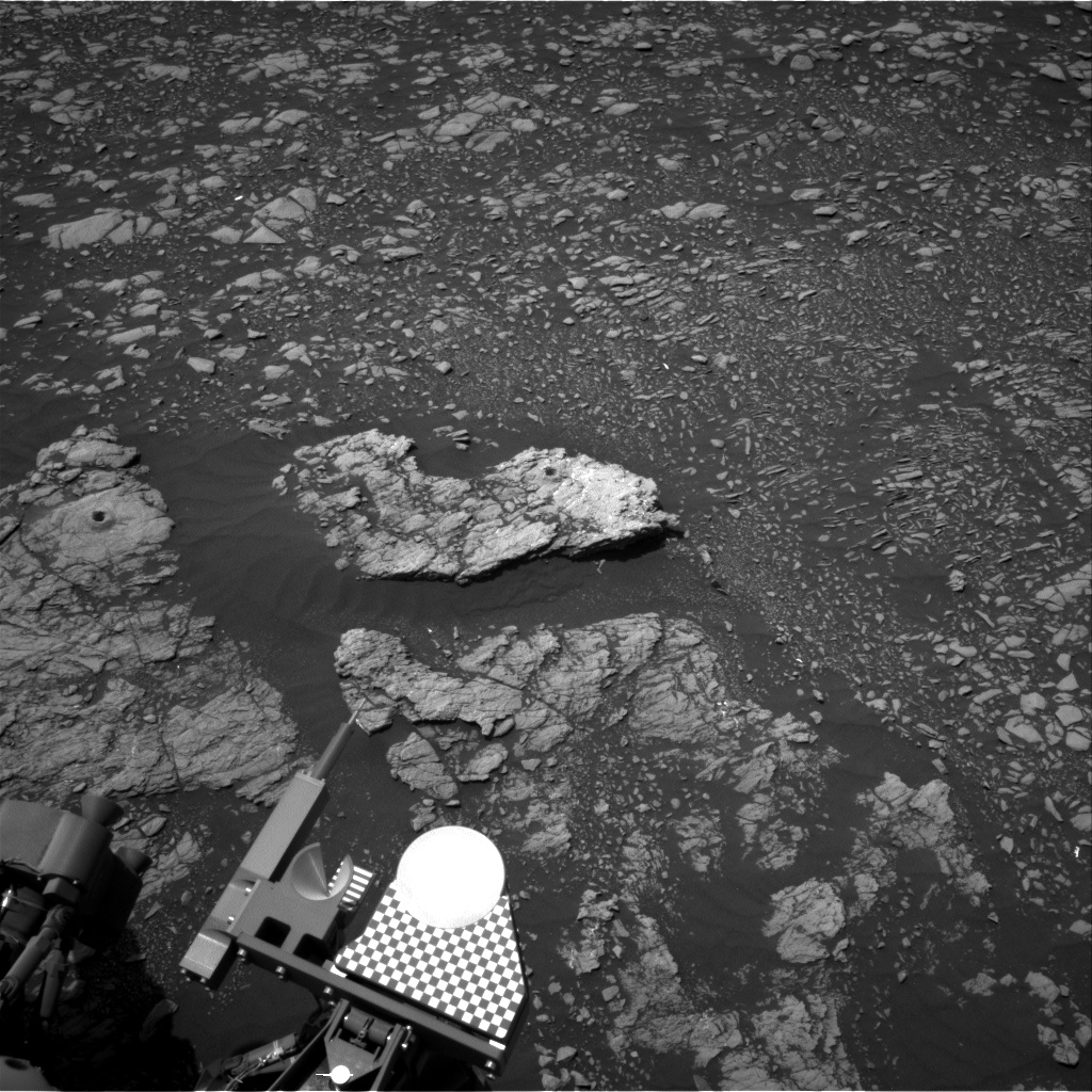
The image to the right, cropped and reduced to post here, shows both drill holes on the two different flat sections of bedrock near the top.

It seems that the science team wants to spend a lot of time in this location, as described in my last rover update. It is therefore unclear when they will move south to follow their long term travel plans.

2 comments

Rover update: April 11, 2019

Summary: Curiosity successfully drills into the clay unit. Yutu-2 continues its exploration on the far side of the Moon.

For the updates in 2018 go here. For a full list of updates before February 8, 2018, go here.

Curiosity drill hole in clay unit on slopes of Mount Sharp

Curiosity

For the overall context of Curiosity’s travels, see my March 2016 post, Pinpointing Curiosity’s location in Gale Crater.

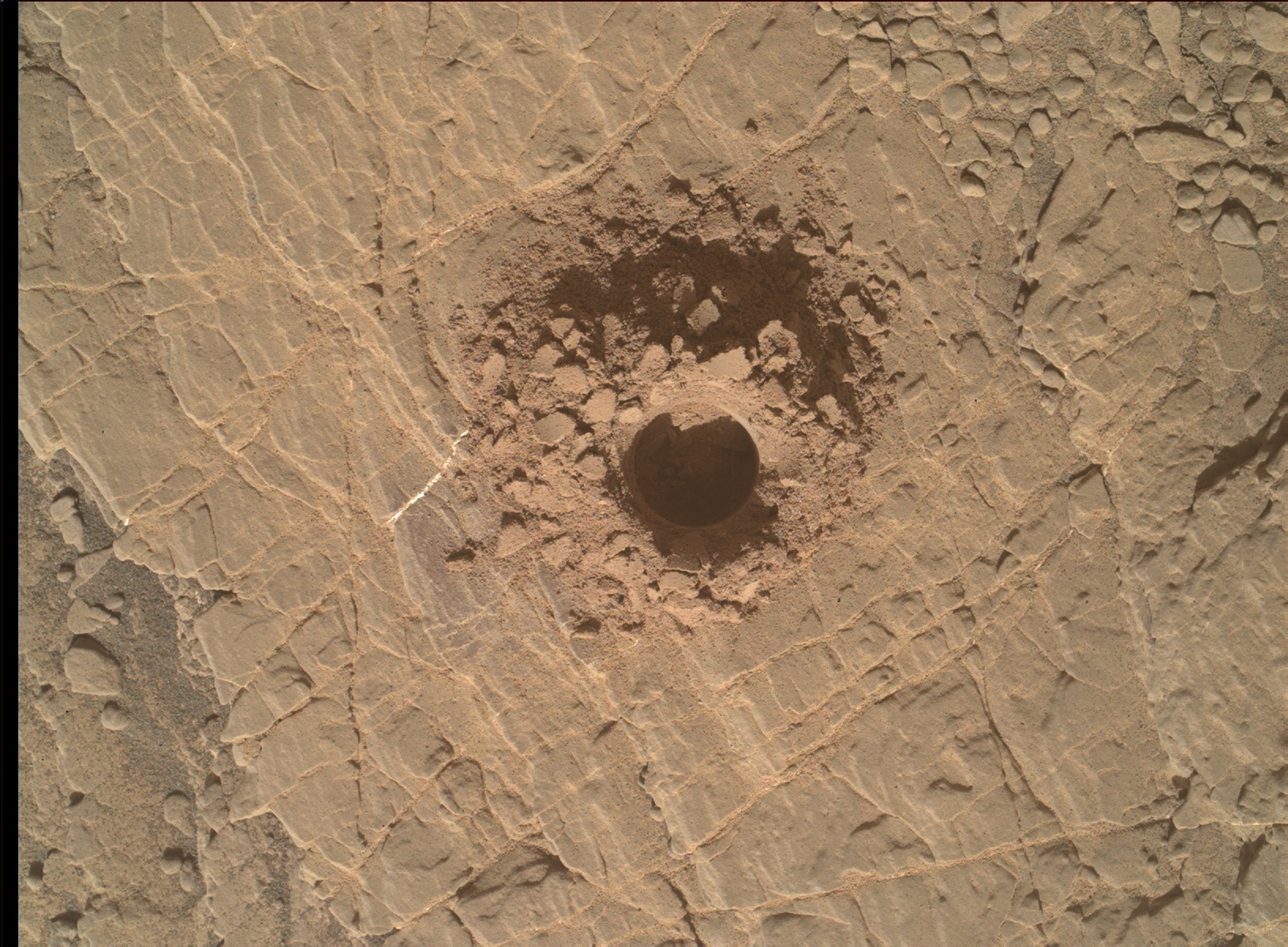
The news this week from Curiosity is that the rover has successfully drilled into the ground in the clay unit valley the rover is presently exploring betweent Vera Rubin Ridge and Mount Sharp’s higher slopes.

The image to the right shows is a close-up of that drill hole.

The rover’s drill chewed easily through the rock, unlike some of the tougher targets it faced nearby on Vera Rubin Ridge. It was so soft, in fact, that the drill didn’t need to use its percussive technique, which is helpful for snagging samples from harder rock. This was the mission’s first sample obtained using only rotation of the drill bit.

Since my last rover update on February 20, 2019, they have been traveling for several weeks to get to a spot where they can do this drilling. The clay unit seems very soft, and almost mudlike, which made finding a good surface to drill somewhat challenging. Most of the terrain seemed too soft to drill into. It almost would be better to have a scoop, as the Viking landers had. Curiosity doesn’t really have this however. It needs to use its drill, which really is a more efficient way to get down deeper into the ground anyway.

The map below shows their recent travels.
» Read more

0 comments

Curiosity films partial solar eclipses by both Phobos and Deimos

Phobos partial eclipse of Sun

Last week Curiosity successfully captured partial solar eclipses by both Phobos and Deimos as the Martian moons crossed the face of the Sun.

The movie on the right shows Phobos eclipsing the Sun. The speed is ten times faster than real time.

The press release can be seen here. It notes how these observations, of which 8 in total have been made since Curiosity arrived on Mars, have helped pin down the orbits of both moons.

3 comments

Mars Express confirms Curiosity 2013 methane detection

The uncertainty of science: The Mars Express science team today announced that a reanalysis of the orbiter’s data showed the same spike spike of methane detection as seen by Curiosity on June 15, 2013.

The study exploited a new observation technique, allowing the collection of several hundred measurements in one area over a short period of time. The teams also developed a refined analysis technique to get the best out of their data.

“In general we did not detect any methane, aside from one definite detection of about 15 parts per billion by volume of methane in the atmosphere, which turned out to be a day after Curiosity reported a spike of about six parts per billion,” says Marco Giuranna from the Institute for Space Astrophysics and Planetology in Rome, Italy, the principal investigator for the PFS experiment, and lead author of the paper reporting the results in Nature Geoscience today.

“Although parts per billion in general means a relatively small amount, it is quite remarkable for Mars – our measurement corresponds to an average of about 46 tonnes of methane that was present in the area of 49 000 square kilometres observed from our orbit.”

Ten other observations in the Mars Express study period that reported no detections at the limit of the spectrometer’s sensitivity corresponded to a period of low measurements reported by Curiosity.

The data, along with their estimate about the source location for the methane, suggests that this was a geological event, not the result of biological life. They think the methane was trapped in ice-filled fissures, and released when that ice either broke or melted. Whether the methane itself was formed by past microbial life sometime in the past remains completely unknown.

To put it mildly, there are a lot of uncertainties in this result.

0 comments

Curiosity has another computer crash

Since March 6 all activity from Curiosity seemed to stop, with no images and no science team updates. The reason? The rover had experienced another computer crash and reboot:

Curiosity experienced a computer reset on its Side-A computer on Wednesday, March 6, 2019 (Sol 2,339), that triggered the rover’s safe mode. This was the second computer reset in three weeks; both resets were related to the computer’s memory.

The mission team decided to switch from the Side-A computer back to the rover’s Side-B computer, which it operated on for most of the mission until November of 2018. Side-B recently experienced its own memory issue; the team has since further diagnosed the matter, reformatting the Side-B computer to isolate areas of “bad” memory. As of today, Curiosity is out of safe mode, and the team is configuring the rover for new science operations in the clay unit. Curiosity is expected to return to science operations as early as Wednesday.

This news is worrisome. The track record for spacecraft with increasing computer problems is that they never get better. Instead, the problem steadily worsens until operations become limited or even impossible. In the meantime engineers work wonders to extend the mission, but in the end this is a battle they appear to always lose.

We are beginning to see this pattern with Curiosity. Both of its computers have now experienced problems. It appears they have a better handle on the problems with the back-up computer (Side-B), so that is why they have switched back to it. Should its own memory issues continue to deteriorate however the rover will be in serious trouble, as the Side-A computer has proven to be very unreliable.

7 comments

Curiosity sends its first images in two weeks

The computer problems that caused Curiosity to cease science operations two weeks ago appears to have ended with the arrival of the first new images today.

The second link above goes to the images arriving today from Curiosity’s ChemCam camera, designed to take macro images of small features on the surface. The rover also sent down a small set of thumbnail images taken by one of its navigation cameras.

It appears they have figured out why the computer did an unexpected reboot in mid-February, and are now willing to let the rover resume science operations. There is no word on what they have learned, or whether it poses a future threat to the mission, but the fact that they are downloading new data is a good sign.

I must note again that this is news you will not see anywhere else. Most news sources today will wait for the NASA press release to report on Curiosity’s recovery, while I like to do some real journalism, reporting events as they happen. Consider this another reason to donate to Behind the Black during this month’s fund-raising drive.

0 comments

Curiosity recovering from safe mode

Last week Curiosity suddenly went into safe mode, halting science operations for four days while engineers analyzed the issue.

Curiosity encountered a hurdle last Friday, when a hiccup during boot-up interrupted its planned activities and triggered a protective safe mode. The rover was brought out of this mode on Tuesday, Feb. 19, and is otherwise operating normally, having successfully booted up over 30 times without further issues.

Throughout the weekend, Curiosity was sending and receiving technical data, communicating with the team in order to help them pinpoint the cause of the issue. “We’re still not sure of its exact cause and are gathering the relevant data for analysis,” said Steven Lee, Curiosity’s deputy project manager at NASA’s Jet Propulsion Laboratory in Pasadena, California. JPL leads the Curiosity mission. “The rover experienced a one-time computer reset but has operated normally ever since, which is a good sign,” he added. “We’re currently working to take a snapshot of its memory to better understand what might have happened.”

…”In the short term, we are limiting commands to the vehicle to minimize changes to its memory,” Lee said. “We don’t want to destroy any evidence of what might have caused the computer reset. As a result, we expect science operations will be suspended for a short period of time.”

As far as I could tell, images were being uploaded to their public image page through February 20, when I did my last rover update. Since then however no new images have appeared. I fear this might be related to the computer issues Curiosity experienced in September that shut down operations for about six weeks and was never quite resolved. Of Curiosity’s two main computers both have now experienced serious problems.

0 comments

Rover update: February 20, 2019

Summary: Curiosity in the clay unit valley. Opportunity’s long journey is over. Yutu-2 creeps to the northwest on the Moon’s far side.

For the overall context of Curiosity’s travels, see my March 2016 post, Pinpointing Curiosity’s location in Gale Crater.

For the updates in the past year go here. For a full list of updates before February 8, 2018, go here.

Curiosity

Curiosity's view to the east on Sol 2316
Click image for full resolution version

Overview of Curiosity's future travels
Click image for original image

Since my January 22, 2019 update, Curiosity finally drove down off of Vera Rubin Ridge into a valley between the ridge and the lower slopes of Mt Sharp. The Mars Reconnaissance Orbiter (MRO) overview on the right has been annotated by me to show the rover’s travels (shown by the yellow dotted line), with its proposed route indicated by the red dotted line. The yellow lines indicate approximately the terrain seen in the panorama above. The panorama was created from images taken on Sol 2016.

The valley that Curiosity is presently traversing is dubbed “the clay unit” or “the clay-bearing unit” by the geologists, based on its make-up determined from orbital data. So far they have found this terrain to be “some of the best driving terrain we’ve encountered in Gale Crater, with just some occasional sandy patches in the lee of small ridges.” Initially they had problems finding any rocks or pebbles large enough for the instruments to use for gathering geological data. For the past week or so, however, they have stopped at “bright exposure of rock” where some bedrock was visible, giving them much better material to work with.
» Read more

1 comment

The InSight Martian weather station

InSight’s weather station is now providing daily weather updates to the public.

Starting today, the public can get a daily weather report from NASA’s InSight lander.

This public tool includes stats on temperature, wind and air pressure recorded by InSight. Sunday’s weather was typical for the lander’s location during late northern winter: a high of 2 degrees Fahrenheit (-17 degrees Celsius) and low of -138 degrees Fahrenheit (-95 degrees Celsius), with a top wind speed of 37.8 mph (16.9 m/s) in a southwest direction.

This daily weather data can be found here. For the weather from Curiosity, go here. Weekly global weather reports from Mars Reconnaissance Orbiter are found here.

Comparing the weather at the two landers, you will notice that it is generally warmer at InSight. This is not surprising, as Curiosity is climbing a mountain, and is now at a much higher elevation.

1 comment

Curiosity has left Vera Rubin Ridge

The Curiosity science team today released an update on their results from the rover’s year-plus exploration of Vera Rubin Ridge, even as the rover has descended off the ridge into the lower clay-bearing area between the ridge and Mount Sharp.

Even though the rover has left the ridge, Curiosity’s team is still piecing together the story of its formation. While there have been a number of clues so far, none fully explains why the ridge has resisted erosion compared with the bedrock around it. But the rover’s investigation did find that the rocks of the ridge formed as sediment settled in an ancient lake, similar to rock layers below the ridge.

,,,A NASA orbiter studying the ridge had previously identified a strong signal from hematite, an iron-rich mineral that often forms in water. Curiosity confirmed the presence of hematite, along with other signs of ancient water, like crystals. These signs appeared in patches, leading the team to suspect that over time groundwater affected certain parts of the ridge differently than others. Another discovery was that the hematite signatures Curiosity mapped didn’t always match the view from space.

The link also includes a neat 360 degree video that allows you to scan around the rover, as it sat on Vera Rubin Ridge.

The journey into the clay unit below the ridge has been most interesting. I plan to post a rover update with some details next week.

0 comments

The base of Mt Sharp is less compacted than expected

The uncertainty of science: Using data from Curiosity in Gale Crater on Mars, scientists have found that the material making up the lower layers of Mount Sharp is less compacted that they would have expected.

Scientists still aren’t sure how this mountain grew inside of the crater, which has been a longstanding mystery.

One idea is that sediment once filled Gale Crater and was then worn away by millions of years of wind and erosion, excavating the mountain. However, if the crater had been filled to the brim, the material on the bottom, which now makes up the crater’s surface, would have been pressed down. But the new Science paper suggests Mount Sharp’s lower layers have much less compacted than this theory predicts, reigniting the debate about how full the crater once was.

“The lower levels of Mount Sharp are surprisingly porous,” said lead author Kevin Lewis of Johns Hopkins University. “We know the bottom layers of the mountain were buried over time. That compacts them, making them denser. But this finding suggests they weren’t buried by as much material as we thought.”

I can’t help wonder whether we don’t yet really understand the influence of Mars’ lower gravity on geology, and that might explain the porosity.

1 comment

Planetary rover update: January 22, 2019

Summary: Curiosity begins journey off of Vera Rubin Ridge. Opportunity’s silence is now more than seven months long, with new dust storms arriving. Yutu-2 begins roving the Moon’s far side.

Before providing today’s update, I have decided to provide links to all the updates that have taken place since I provided a full list in my February 8, 2018 update. As I noted then, this allows my new readers to catch up and have a better understanding of where each rover is, where each is heading, and what fascinating things they have seen in the past few years.

These updates began when I decided to figure out the overall context of Curiosity’s travels, which resulted in my March 2016 post, Pinpointing Curiosity’s location in Gale Crater. Then, when Curiosity started to travel through the fascinating and rough Murray Buttes terrain in the summer of 2016, I stated to post regular updates. To understand the press releases from NASA on the rover’s discoveries it is really necessary to understand the larger picture, which is what these updates provide. Soon, I added Opportunity to the updates, with the larger context of its recent travels along the rim of Endeavour Crater explained in my May 15, 2017 rover update.

Now an update of what has happened since November!
» Read more

1 comment

Gale Crater dunes: dry and volcanic in origin

Using data from orbit and from the rover Curiosity, scientists have determined that the material in the dunes in Gale Crater that Curiosity has visited are very dry and volcanic in origin.

This dryness is in contrast with the underlying ground, which shows evidence of water. The data also suggests that the material either came from multiple volcanic sources producing different compositions, or some of the sand was somehow changed at a later time.

In other words, the sand in the dunes came from elsewhere.

0 comments

Curiosity’s future travels

MRO image of Curiosity's future travels

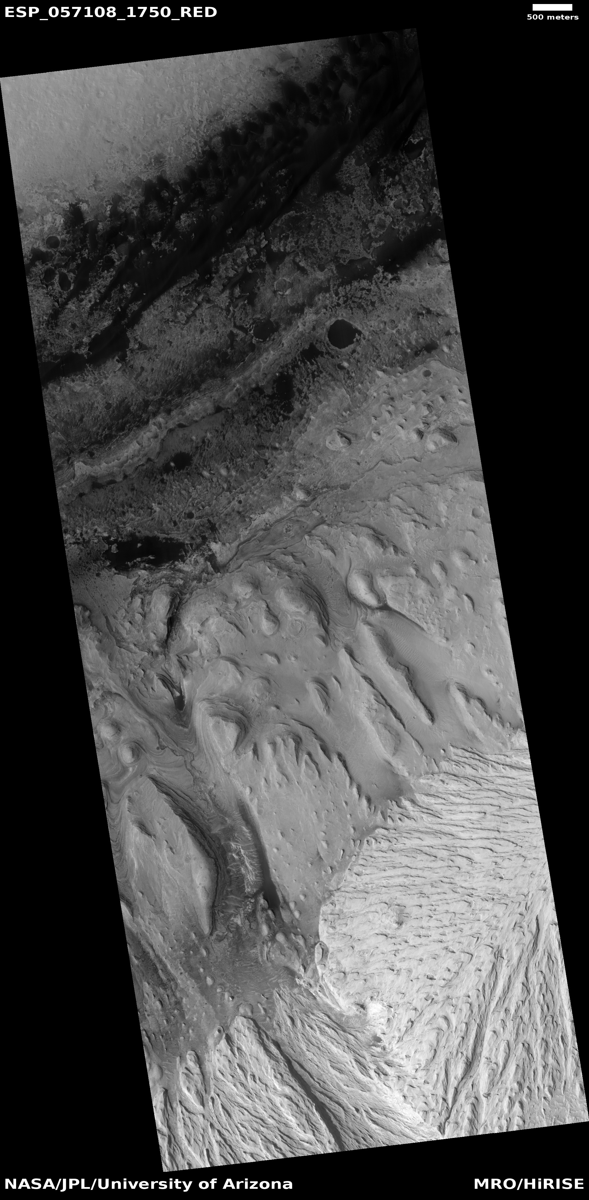
In the December release of images from the high resolution camera on Mars Reconnaissance Orbiter (MRO), there was one image entitled “Monitor Region Near Curiosity Rover.” To the right is a reduced, cropped, and rotated section of that image, annotated by me to show Curiosity’s future planned route (indicated by the yellow line). If you click on the image you can see the untouched full resolution version.

Curiosity’s journey has not yet brought it onto the terrain shown in this image. (For the overall context of Curiosity’s travels, see Pinpointing Curiosity’s location in Gale Crater.) The rover is right now just off the left edge of the photograph, on the white ridge dubbed Vera Rubin Ridge visible in the uppermost left. This week it completed the last planned drill sampling on that ridge, and it will soon descend off the ridge and begin heading along the yellow route up the mountain. The white dots along its future route are the locations of recurring slope lines, believed to be seasonal seeps of brine coming from below and causing gentle landslides that darken the surface. As you can see, they hope to get very close to the first seep, and will observe the second from across the canyon from a distance of about 1,200 feet.

The peak of Mount Sharp is quite a distance to the south, far beyond the bottom of the photograph. Even in these proposed travels the rover will remain in the mountain’s lowest foothills, though the terrain will be getting considerably more dramatic.

Below is a full resolution section of the image showing the spectacular canyon to the south of that second seep. This is where Curiosity will be going, a deep canyon about 1,500 feet across and probably as deep, its floor a smooth series of curved layers, reminiscent of The Wave in northern Arizona. The canyon appears to show evidence of water flow down its slopes, but that is unproven.
» Read more

0 comments
1 9 10 11 12 13 22