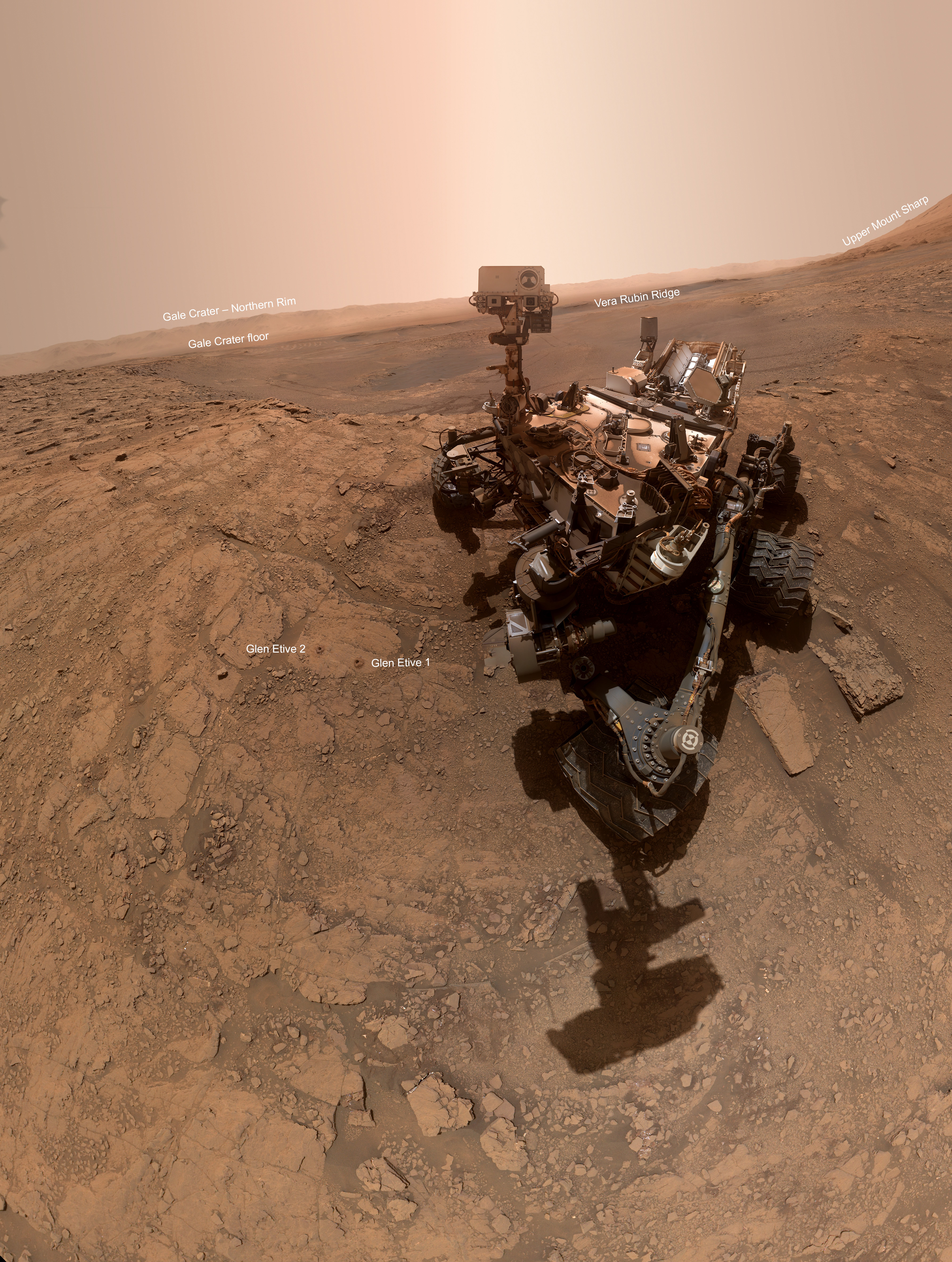
Ancient glacier flows on Mars

Ancient glacial flow in Euripus Mons
Click for full image.

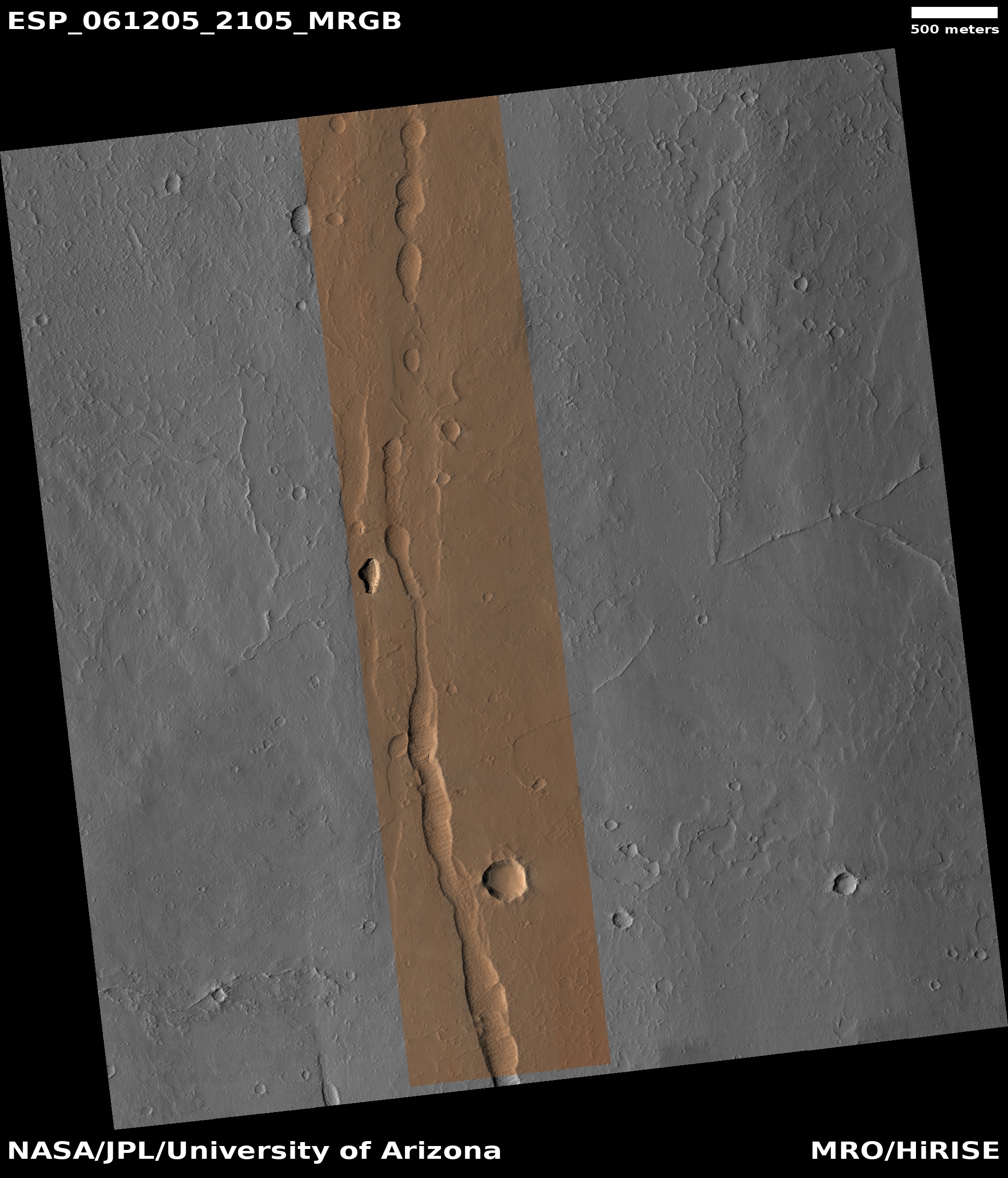
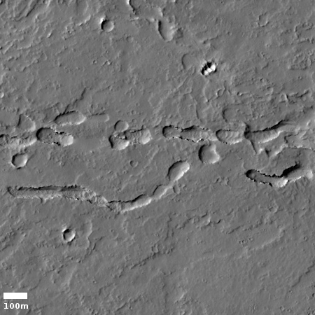
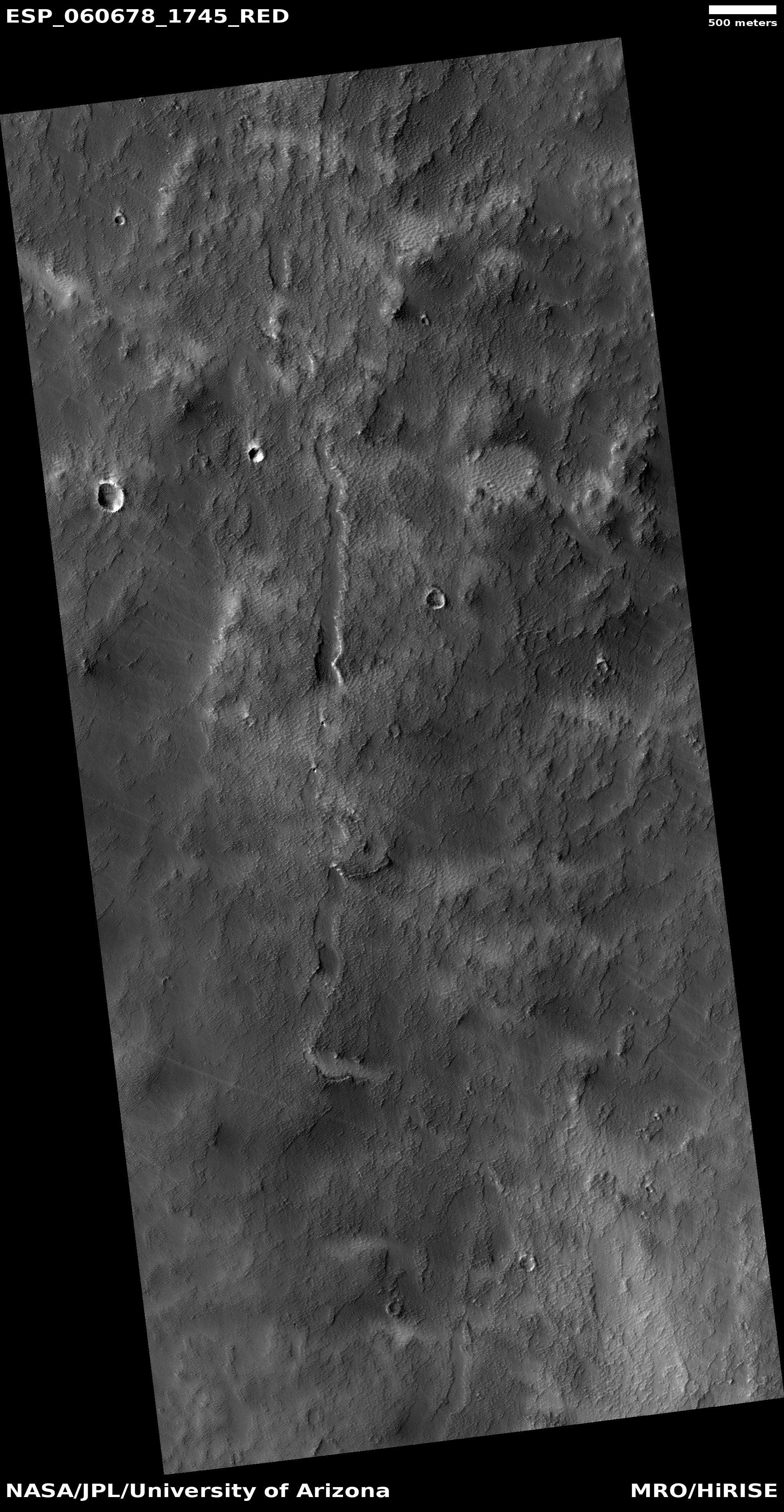
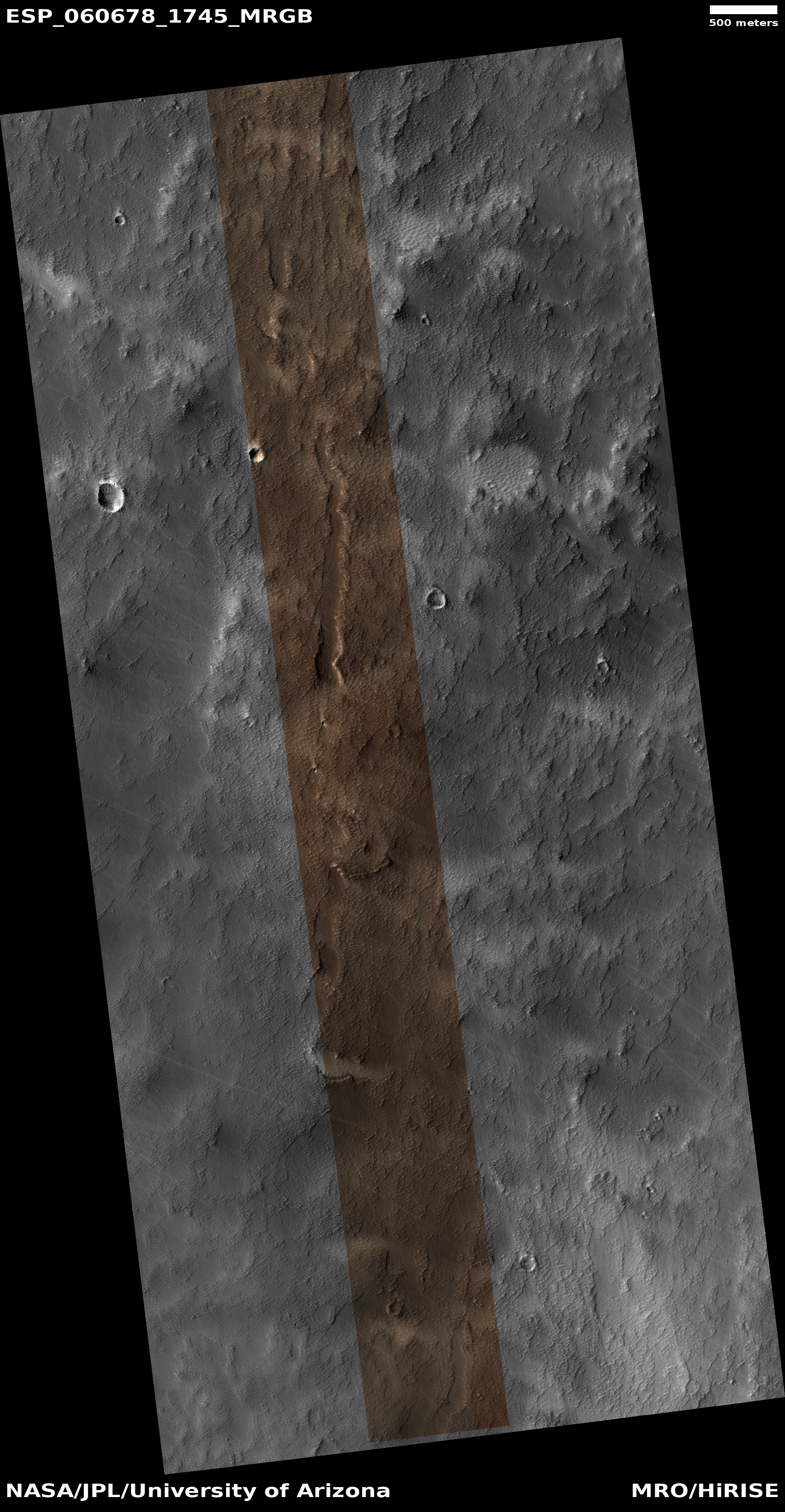
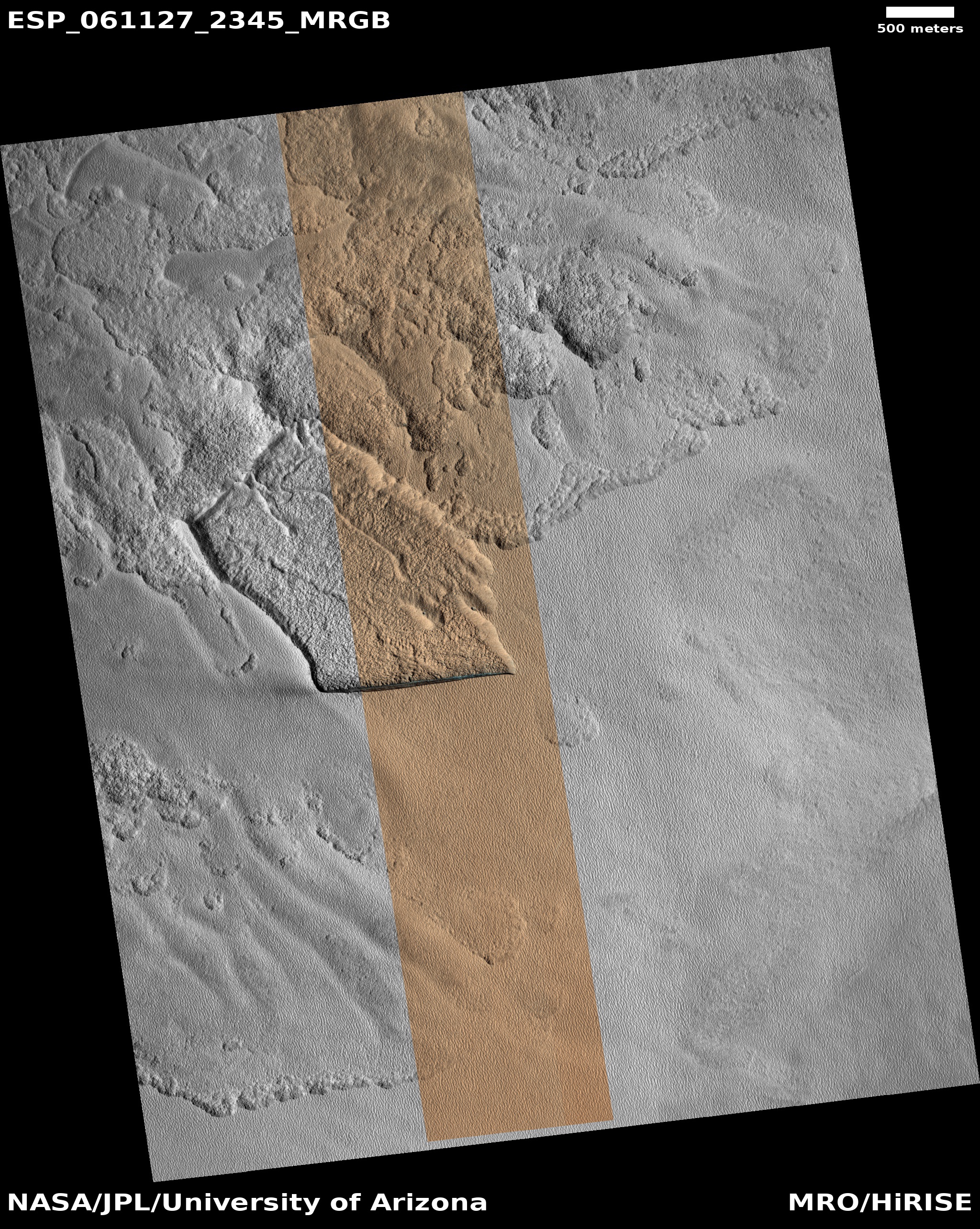
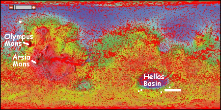
Cool image time! In the recent download of images from the high resolution camera of Mars Reconnaissance Orbiter (MRO), I found the image on the right, rotated, cropped, and reduced to post here. It shows an example of the many glacial flows coming off of the slopes of Euripus Mons, the sixteenth highest mountain on Mars.

We know these are glaciers because data from SHARAD, the ground-penetrating radar instrument MRO, has found significant clean ice below the surface, protected by a debris layer that insulates it. As planetary scientist Alfred McEwen of the Lunar & Planetary Laboratory in Arizona explained to me in a phone interview yesterday,

These are remnant glaciers. Basically they form like glaciers form. They are not active or if they are they are moving so extremely slowly that effectively they are not active.

If you look close, you can see that this particular glacier was made up of multiple flows, with the heads or moraines of each piled up where each flow ended. In addition, this overall glacier appears to have been a major conduit off the mountain, following a gap between more resistant ridges to the east and west.

The sequence of moraines suggest that when the glacier was active, it experienced alternating periods of growth and retreat, with the growth periods being shorter and shorter with time. As a result each new moraine was pushed less distance down the mountain as the previous one.

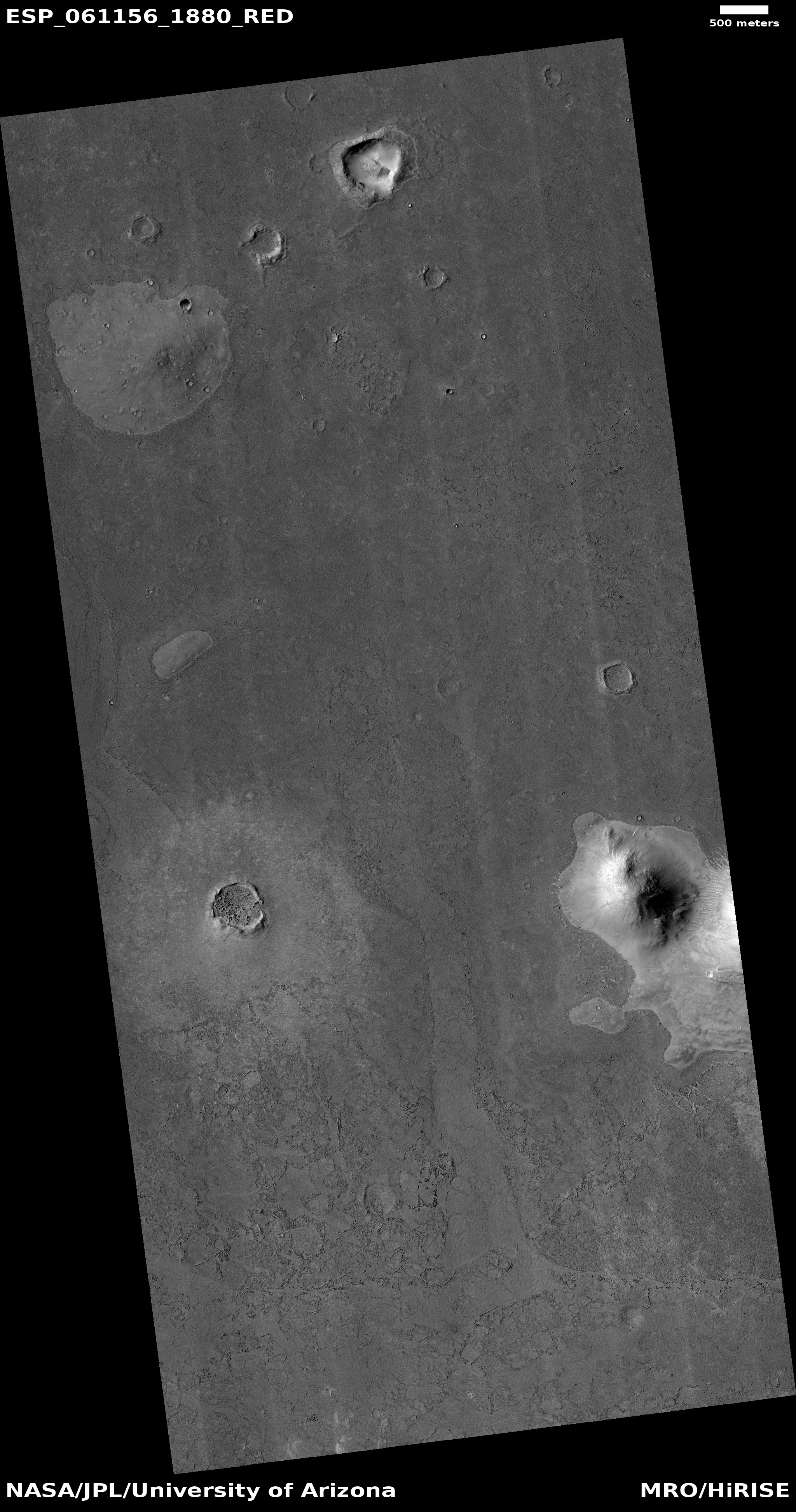
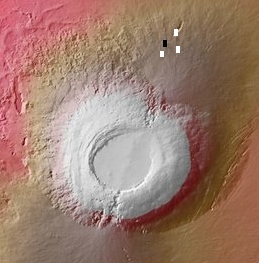
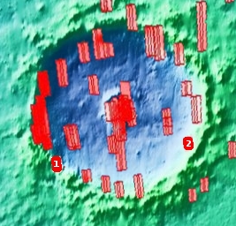
Euripus Mons is interesting in that it has a very large and distinct apron of material surrounding it, as shown in the overview image below.
» Read more

5 comments

Curiosity takes selfie next to two of its most important drill holes

Curiosity and its most recent drill holes
Click for full image.

The Curiosity science team today released a beautiful mosaic of the rover, stitched from 57 different images. The photo at the right, cropped and reduced to post here, is the annotated version of that image. It shows the rover’s two most recent drill holes to the left. As the view looks away from Mount Sharp, you can see in the distance Vera Rubin Ridge, the floor of the crater, and its rim on the far horizon.

The two drill holes are significant because of the chemical experiment that Curiosity is subjecting the material from those holes.

The special chemistry experiment occurred on Sept. 24, 2019, after the rover placed the powderized sample from Glen Etive 2 into SAM. The portable lab contains 74 small cups used for testing samples. Most of the cups function as miniature ovens that heat the samples; SAM then “sniffs” the gases that bake off, looking for chemicals that hold clues about the Martian environment billions of years ago, when the planet was friendlier to microbial life.

But nine of SAM’s 74 cups are filled with solvents the rover can use for special “wet chemistry” experiments. These chemicals make it easier for SAM to detect certain carbon-based molecules important to the formation of life, called organic compounds.

Because there’s a limited number of wet-chemistry cups, the science team has been saving them for just the right conditions. In fact, the experiment at Glen Etive is only the second time Curiosity has performed wet chemistry since touching down on Mars in August 2012.

This time however was the first time they had used a wet chemistry cup on material from a drill hole. That they were able to do this at all is a testament to the brilliant innovative skills of the rover’s engineers. They had been holding off doing a wet chemistry analysis from drill hole material until they got to this point, but on the way the rover’s drill feed mechanism failed. It took more than a year of tests and experimentation before they figured out a way to bypass the feed mechanism by using the arm itself to push the drill bit into the ground. That rescue made possible the wet chemistry experiment that they initiated on September 24.

The results, which are eagerly awaited, won’t be available until next year, as it will take time for the scientists to analyze and publish their results.

Curiosity meanwhile has moved on, leaving this location where it had remained for several months to march in the past week southward back towards its long planned route up Mount Sharp.

5 comments

Big landslides on Mars might not require ice

According to a new paper, scientists now think the biggest and longest landslides found on Mars might not require a base of ice on which it could slide such extensive distances.

The findings, published today in Nature Communications, show for the first time that the unique structures on Martian landslides from mountains several kilometres high could have formed at high speeds of up to 360 kilometres per hour due to underlying layers of unstable, fragmented rocks.

This challenges the idea that underlying layers of slippery ice can only explain such long vast ridges, which are found on landslides throughout the Solar System.

First author, PhD student Giulia Magnarini (UCL Earth Sciences), said: “Landslides on Earth, particularly those on top of glaciers, have been studied by scientists as a proxy for those on Mars because they show similarly shaped ridges and furrows, inferring that Martian landslides also depended on an icy substrate. “However, we’ve shown that ice is not a prerequisite for such geological structures on Mars, which can form on rough, rocky surfaces. This helps us better understand the shaping of Martian landscapes and has implications for how landslides form on other planetary bodies including Earth and the Moon.”

The lighter gravity of Mars, about one third of Earth’s, is part of the explanation, though many other factors are involved. Either way, this is one more data point in the evidence that the though geology on Mars might look like what we see on Earth, it is likely very different than we expect, due to the alien nature of Mars itself.

0 comments

Mars2020 budget overruns threatening other missions

The significant budget overruns for NASA’s Mars 2020 mission, now expected to exceed a billion dollars, could now pose a threat to other planetary projects.

The cost of Mars 2020 has been growing for a while. The initial proposed cost for the rover, when the mission was announced in 2012, was $1.5 billion. Six years on, a 2018 Government Accountability Office (GAO) report showed that the cost had soared to $2.46 billion. And in NASA’s latest budget, the overrun looks set to grow by as much as 15% (or about another $360 million) beyond that last 2018 estimate, although the latest numbers are yet to be confirmed.

The irony is that Mars 2020 was established by the Obama administration as part of its effort to significantly cut back on NASA’s entire planetary program. The idea was to save money by simply rebuilding Curiosity.

As is typical for these projects, the scientists pushed for cutting edge instruments, and it is these instruments that have caused the overages. Meanwhile, many of those 2012 cuts pushed by Obama never happened, or were simply funneled into different planetary projects that were approved later.

No one who is involved in any way with the U.S. government today knows anything about keeping their effort on budget and on time. No one. And the result is increasing debt and what will certainly be bankruptcy for everyone, at some point, thus causing everything to shut down.

0 comments

InSight’s digging problems reveal the alienness of Mars’ soil

Even as InSight’s mole shaft driller shows signs of working, its difficulties in digging into the Martian soil has revealed how truly alien that soil is from what we normally expect.

[U]nlike typical holes dug here on Earth, the one excavated by InSight’s mole has no lip of dirt around its rim, Hoffman said. “Where did the soil go?” he said. “Basically, it got pounded back into the ground, so it seems like it’s very cohesive, even though it’s very dusty.”

And this is a weird combination of characteristics, strongly suggesting that Mars dirt is alien in more ways than one. “The soil properties are very different than anything we’ve ever seen on Earth, which is already a very interesting result,” Hoffman said.

That the soil of Mars is alien should not be a surprise. The planet’s dusty nature, combined with its light gravity and lack of life, practically guaranteed that the soil would have different and unexpected properties. What is disturbing is that it appears this likelihood was not considered in the slightest by the German engineers who designed the mole for digging.

0 comments

Lava-draped terrain on Mars

Lava surrounding hill and partly covering crater
Click for full image.

Hill surrounded by lava flows
Click for full image.

Cool image time! Continuing this week’s series of lava-related images from Mars (previous posts here, here, and here), today’s post is ironically the first to actually show lava flows.

The two images to the right, reduced and cropped to post here, are sections taken from an uncaptioned picture, titled “Lava-Draped Surface in Cerberus Palus” and found in the most recent download from the high resolution camera on Mars Reconnaissance Orbiter (MRO).

It is obvious why the MRO scientists gave this image this title. The hills in both pictures clearly seem to stand up like islands in a surrounding sea of frozen lava. Older craters, created prior to the lava flow, are partly obscured by the lava flows, their interior floors filled and their rims broken as the lava flooded this region.

Nor are these the only high points captured in the image that this flood of lava inundated. If you look at the full image there is even a low mound where it appears the surrounding lava flood worked its way up the hill’s gently sloping flanks only to freeze just before it completely covered the top of the mound.

The location of this image, shown by the red box in the overview map below and to the right, gives us a hint where the lava came from, though the distances involved to the nearest giant volcano, Elysium Mons, are so large it is likely that this flow is not directly linked to that volcano.
» Read more

0 comments

Sinkholes on Mars

Collapse pit on Mars
Click for full image.

Cool image time! In this week’s exploration of Martian geology that is reminiscent of Earth-based lava geology, today’s image is of a collapse pit in Ceraunius Fossae, the vast region of north-south fissures found to the south of the volcano Alba Mons. The photo to the right, cropped to post here, zooms in on that pit.

The picture was part of the most recent image release from the high resolution camera on Mars Reconnaissance Orbiter (MRO). What makes it especially interesting is the sharpness of its rim, in comparison to the collapse channel to the east. This suggests the pit is younger and fresher than the channel, and happened more recently. This also implies that the voids below the ground in which the surface is sinking are either still there, or due to on-going processes might be still be forming (like caves are on Earth).

For example, if there is underground ice, temperature changes or even thermal heat from the nearby giant volcanoes could melt that underground ice periodically, allowing it to flow and erode the surrounding material, forming voids. That this pit is located at 30 degrees north latitude, just inside the northern hemisphere band where glaciers are found, adds weight to this possibility.

The image below, reduced and rotated so that north is to the left, shows the entire sequence of collapse channels, with the more distinct pit from above in the bottom center of the picture.
» Read more

0 comments

A discontinuous Martian channel

Discontinuous channel near Olympica Fossae
Click for full image.

Close-up of channel

Time for more strange Martian geology! As I said in my post yesterday of a cool image of skylights into what might be a Martian lava tube, this is lava week on Behind the Black. The image at the right, rotated, reduced, and cropped to post here, is similar to yesterday’s photograph, showing a line of sinks and depressions that strongly suggest the existence of an underground lava tube.

The problem with this theory is that at present we really have no idea what flowed here. It could have been lava, but it also could have been mud, water, ice, or some as yet unimagined Martian geological process.

The image was part of the most recent image release from the high resolution camera on Mars Reconnaissance Orbiter (MRO), and was uncaptioned. The top image shows the whole channel as captured by the photograph, with the white box indicating the area covered by the second image, posted here at full resolution.

Though the overall slope of the terrain here is downhill to the west, the grade is relatively shallow, so there is no guarantee that the local slope of this particular channel follows that trend. Downhill could be either to the west or the east.

The reason I favor lava (as an amateur geologist) is the location of this channel, as shown in the overview map below and to the right.
» Read more

0 comments

Europe schedules new parachute tests for ExoMars 2020

Following the failure on all previous tests of the parachutes for its ExoMars 2020 Mars lander, the European Space Agency has now made some design changes and is planning to do additional tests in the first quarter of 2020.

ESA has also requested support from NASA to benefit from their hands-on parachute experience. This cooperation gives access to special test equipment at NASA’s Jet Propulsion Laboratory that will enable ESA to conduct multiple dynamic extraction tests on the ground in order to validate any foreseen design adaptations prior to the upcoming high altitude drop tests.

The next opportunities for high altitude drop tests are at a range in Oregon, US, January–March. ESA is working to complete the tests of both the 15 m and 35 m parachute prior to the ExoMars project’s ‘qualification acceptance review’, which is planned for the end of April in order to meet the mission launch window (26 July–11 Aug 2020).

Their schedule is incredibly tight, since their launch window to Mars is in July 2020, and if they fail to meet it the launch will have to be delayed two years until the next launch window.

2 comments

InSight’s mole digs an inch

The InSight science team today tweeted that their attempt to use the lander’s robot arm to help the mole push downward in its effort to insert a heat sensor fifteen feet into the Martian interior has resulted in a gain of about an inch or three centimeters.

This success, small as it seems, is important in that it proves that the reason the drill had been stopped penetrating downward was not because of the presence of a rock, but because the drill hole had become so wide that the drill no longer had side friction to hold it in place. They are now using the arm to give the mole that friction.

The goal was to insert to heat sensor five meters or about sixteen feet into the ground. They are presently a little over a foot down. If this effort has really succeeded, they can then proceed to drill the remaining distance.

One issue however is whether the unexpected weak and porous nature of the soil, which allowed the hole to become so wide, might affect any data produced by the heat sensor. This is presently unknown, but it is a significant question that the scientists involved must ask. If the sensor ends up inside a very wide shaft that allows the surface environment to reach the sensor then it will not really be measuring the temperature of the Martian interior.

2 comments

Skylights into Martian lava tube?

Possibly connected skylights into lava tube
Click for full image.

Close-up of skylights
Click for full image.

Cool image time! In the archive of images from the high resolution camera on Mars Reconnaissance Orbiter (MRO) I came across the uncaptioned image on the right, dubbed “Possibly Connected Lava Tube Skylight Pair in Tharsis Region.”

The top image, cropped and reduced to post here, is a wide view, showing a narrow depression oriented in a north-south direction. Downhill is to the north, with the caldera of the giant volcano Arsia Mons to the south. The white box indicates the area covered by the bottom image, cropped and expanded to post here. Within this close-up are two dark spots, each about 150 feet across.

The two dark spots surely look like small pit openings. Their alignment with the north-south depression strongly suggests that an underground lava tube is below. That this depression is also aligned with the downhill slope further reinforces this supposition.

The depression itself also aligns with the gigantic fault that runs from the northeast to the southwest through all three of the giant Tharsis Bulge volcanoes. Arsia Mons is the southernmost of the three. It is also where that fault is most clearly expressed by two dramatic breaks in the volcano’s rim in the northeast and southwest, as seen in the overview image below. Scientists have taken of lot of images of these breaks in an effort to better understand the geology and how it fits in with the formation of the volcanoes.

Overview of Arsia Mons

However, a review of the entire image archive of MRO’s high resolution camera shows that scientists have taken very few close-up images in this region. The black box in the overview map on the right is the location of this image. As of now, only three other high resolution images, as indicated by the white boxes, have been taken by MRO of this part of the volcano’s north slope.

That the skylights and depression align with this giant fault is not evidence that this supposed lava tube is linked to that fault. Lava will flow down the mountain’s slopes, fault or no fault. At the same time, the fault’s existence is also going to encourage north-south cracks and fissures, which in turn could have served as a convenient flow route for the lava. Without a closer look, on site, it is hard to know one way or the other..

I’ve located a few more lava related cool images in the MRO archive, so I’m going to make this week lava week on Behind the Black. Stay tuned!

1 comment

Ice! Ice! Everywhere on Mars ice!

Ice scarp in Milankovic Crater
Click for full image.

In January 2018 scientists announced the discovery of exposed ice in a number scarp cliff faces found in the high-mid-latitudes of Mars.

These scarps, which have so far been found in one southern 50-55 degree latitude strip and in one crater, Milankovic, at the same latitude in the north, are important because they are one of the first places on Mars in its lower latitudes where we have found ice actually exposed and visible, not buried like the many buried glaciers very near the surface found in the 30 to 60 degree northern and southern latitude bands.

Since that press announcement, scientists have been monitoring these sites for changes, as well as expanding their survey to see if they can locate more of these scarps.

Overview map

My previous posts on this subject were mostly focused on that southern strip near Hellas Basin, as shown on the map on the right. In reviewing the most recent image download from the high resolution camera on Mars Reconnaissance Orbiter (MRO), I noticed that the only new images of ice scarps were taken in the northern location, in Milankovic Crater, as indicated by the white dot north of Olympus Mons. The first image above shows the north-facing scarp of one of these images, cropped to focus in on the color section where, if you look close, you will see a strip of blue across the base of the scarp. That’s the ice layer, exposed as the scarp sublimates away over time from the north to the south.

over view of all MRO images taken so far in Milankovic Crater

This scarp, labeled #2 on the overview map of Milankovic Crater on the right, is located inside the crater’s eastern rim. The second image, posted below and labeled #1 on the overview map, shows a wider area of several ice scarps located on the inside of the crater’s southwestern rim.

The red boxes in the overview map indicate all the images taken by MRO inside this crater. If you go to the camera’s archive and focus in on Milankovic Crater at 54.5 degrees north latitude and 213.3 degrees longitude, you can then click on each red box to see the high resolution image. In practically every image along the crater’s inside rim can be found numerous scarps.
» Read more

0 comments
1 132 133 134 135 136 212