Martian mesas made entirely of dry ice!

Dry ice mesas on Mars
Click for full image.

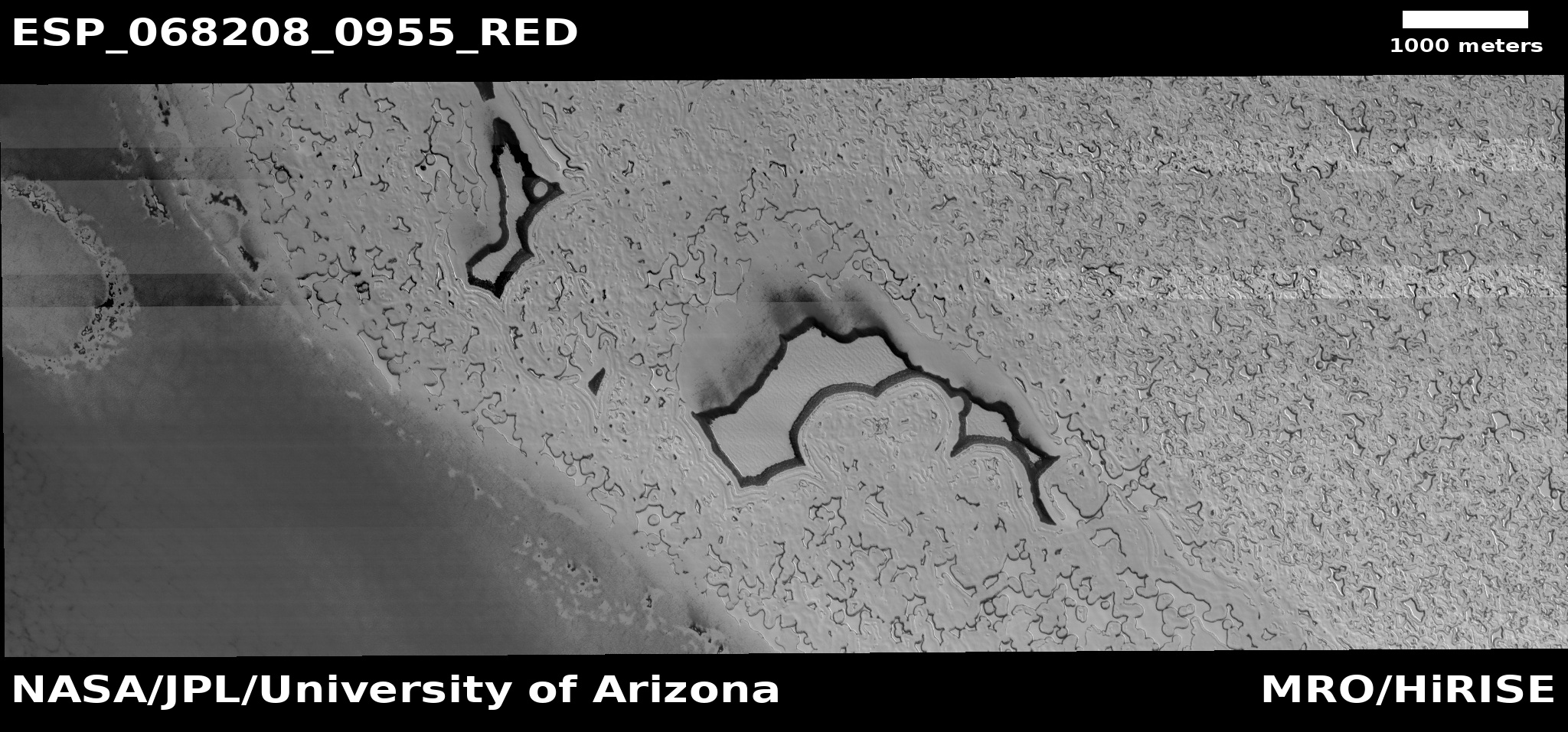
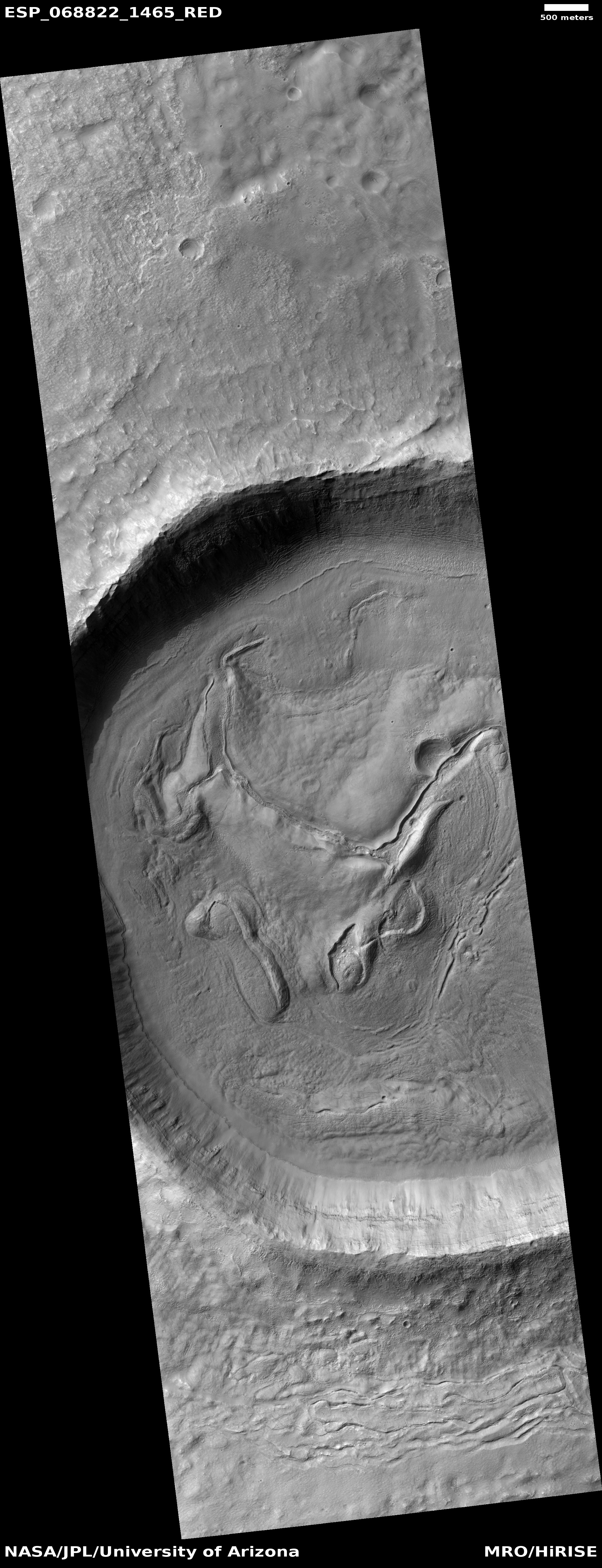
Time for an especially cool image! The photo to the right, taken on February 13, 2021 by the high resolution camera on Mars Reconnaissance Orbiter (MRO) and cropped and reduced to post here, shows some mesas on the south polar ice cap of Mars.

What makes those mesas cool (literally and figuratively) is that they are thought to be made up entirely of dry ice, part of the thin but permanent frozen carbon dioxide cap in the south. As explained to me by Shane Byrne of the Lunar and Planetary Lab University of Arizona, who requested this image from MRO,

[These mesas are] unusually thick compared to other dry ice mesas (a common landform in the residual ice cap). I only have the lower resolution laser altimeter data to go off for heights here (we may get a stereo pair next year), but from that it looks like 13 meters thick.

That’s about forty feet high, from base to top. In length, the largest mesa on the left is about a mile long and about 1,500 feet wide, on average. And it is made entirely of dry ice!

The red cross on the map below shows the location of these mesas on the south pole ice cap.
» Read more

1 comment

The flaking and cracked floor of a Martian crater

The flaking and cracked floor of a Martian crater
Click for full image.

Cool image time! The photo to the right, cropped and reduced to post here, was taken on April 1, 2021 by the high resolution camera of Mars Reconnaissance Orbiter (MRO). It shows the central portion of the floor of an unnamed 5-mile-wide crater in northeast corner of Hellas Basin, the deepest large depression on Mars.

The latitude is 33 degrees south, where many glacier features have been identified, especially inside craters.

In this case, the cracked and flaked surface of this crater floor suggests what geologists call exfoliation, “the breaking off of thin concentric shells, sheets, scales, plates, and so on.” On Earth exfoliation generally refers to an erosion process seen on rock faces, though you can see it on other types of materials.

In this Martian crater we appear to be seeing the exfoliation of different ice layers, sublimating away at different rates as they are exposed to the Sun. The layers probably suggest different periods on Mars when snow was falling here, causing the glaciers to grow. The sublimation we see now suggest periods when this region was warmer and the ice was shrinking. Whether we are in such a period now is not yet determined by scientists.

Either way, the photo suggests at least two such cycles, though if we could drill down into this material we would likely find evidence of many more.

Below the fold is a global map of Mars, showing the location of this crater with a red cross in Hellas. The regions surrounded by white borders are areas where many glacial features have been found.
» Read more

0 comments

Martian glacial run-off?

Mosaic of glacial runoff
For original images click here and here.

Today’s cool image provides us a glimpse at the carved canyons created when the mid-latitude glaciers on Mars were active in the past and slowly flowing downhill into the section of the northern lowland plains dubbed Acidalia Planitia.

The photo to the right is a mosaic of two images taken by the context camera on Mars Reconnaissance Orbiter and rotated, cropped, and reduced to post here. The mosaic shows a region at the very edge of Acidalia Planitia at latitude 43 degrees north.

Below is a close-up of the area in the white box, taken by MRO’s high resolution camera on February 28, 2021, as well as a global map marking the location of this image at the very edge of the glacier country found in the chaos terrain of Deuteronilus Mensae.
» Read more

1 comment

A crater with wings!

A crater with wings!
Click for full image.

Cool image time! The photo to the right, cropped and reduced to post here, was taken on April 5, 2021 by the high resolution camera on Mars Reconnaissance Orbiter (MRO), and shows a particularly unusual crater in the southern mid-latitudes on the eastern edge of Hellas Basin.

This region east of Hellas is where scientists have spotted many features that suggest buried glaciers. The terraced material inside this crater, as well as the splattered material surrounding it on three sides, are examples of such glacial material. You can also see similar glacial features, though less pronounced, inside the crater to the north.

The global map of Mars below marks the general location of this crater by a blue cross.
» Read more

3 comments

The layers of Mars’ north pole icecap

The layers of Mars' north pole icecap
Click for full image.

Cool image time! The photo to the right, rotated, cropped, and reduced to post here, was taken on April 1, 2021 by the high resolution camera on Mars Reconnaissance Orbiter (MRO). It shows the high cliff edge of the Martian north polar ice cap, and was taken as part of the springtime monitoring for the numerous avalanches that fall from the icecap’s steep edge every spring.

This particular cliff is probably about 1,000 feet high. I cannot tell if the image captured any avalanches on the very steep north-facing cliff. What struck me about this image however was the terraced layers so visible on the west-facing scarp. You can clearly count about eleven distinct and thick layers, each forming a wide ledge.

Each layer represents a different climate epoch on Mars when the ice cap was growing, with new snow being deposited.
» Read more

3 comments

A Martian mud volcano

A Martian mud volcano?
Click for full image.

Cool image time! The photo to the right, rotated, cropped, and reduced to post here, was taken on January 6, 2021 by the high resolution camera on Mars Reconnaissance Orbiter (MRO). It shows a distinct conelike knob in an area of the northern lowland plains of Mars dubbed Acidalia Mensa.

According to this paper [pdf], this is possibly a mud volcano.

Bright pitted cones are common in the northern plains of Mars and have been documented to occur in numerous locations including Acidalia Planitia. Various interpretations of these features have been
proposed but growing consensus in recent literature has favored mud volcanism as the most likely formation mechanism. Mud volcanoes are provocative targets for exploration because they bring to the surface sedimentary materials otherwise inaccessible by normal surface exploration and can aid in reconstructing the sedimentary history of the northern plains. Also, by sampling fluids and sediments from deep in the Martian crust, mud volcanoes may be among the best places to search for ancient and extant life.

A previous cool image post, “Baby volcanoes on Mars”, showed another example in the same general area of Mars.

Though this conclusion is not yet confirmed, the multi-layered apron that surrounds the cone certainly suggests repeated eruptions of muddy water over time.

Scientists have taken many images of this area and cone using MRO’s context camera. (See this image as and example.) All show a very rough terrain, with cracks, fissures, and many smaller cones and knobs. This particular knob however dominates the landscape as one of the largest features. The aprons around it are darker, and appear to have been overlain on top of the nearby rough ground.

If such cones are mud volcanoes, they represent a geological process that is pretty much unique to Mars. There are some comparable features on Earth, but they are rare and do not match exactly.

1 comment

Martian volcanic eruption thought to be only 50,000-210,000 years old

Overview map

Using Mars Reconnaissance Orbiter (MRO) images scientists now believe they have located a volcanic eruption on Mars that could have erupted violently as recently as only 50,000 years ago, and is located deep within Mars’ volcano country. The overview map to the right indicates the location of this volcanic with the blue cross. The red dots surrounded by white ovals are distinct quakes that InSight has detected. From their paper’s abstract:

Stratigraphic relationships indicate a relative age younger than the surrounding volcanic plains and the [nearby] Zunil impact crater (~0.1–1 [million years]), with crater counting suggesting that the deposit has an absolute model age of 53 Β± 7 to 210 Β± 12 [thousand years]. This young age implies that if this deposit is volcanic then the Cerberus Fossae region may not be extinct and that Mars may still be volcanically active. This interpretation is consistent with the identification of seismicity in this region by the [InSight] lander, and has additional implications for astrobiology.

The Cerberus Fossae region is a series of long fissures that scientists think were created when the underground magma pushed up, stretched the surface, and thus caused it to crack. This particular feature suggests that when the ground cracked it sometimes also did so in conjunction with a volcanic eruption.

Below is a zoomed-in context mosaic, taken from figure 1 of the above paper, showing the feature itself and the surrounding terrain.
» Read more

3 comments

Fresh washes on Mars?

Meandering fresh wash on Mars?
Click for full image.

Cool image time! The photo to the right, cropped and reduced to post here, was taken on January 29, 2021 by the high resolution camera on Mars Reconnaissance Orbiter (MRO). It shows what the science team labels as “Fresh Shallow Valleys”. The section I have focused on shows a particularly interesting meander next to a small crater. The full image shows additional similar channels to the north, with one draining into a larger 3.7 mile wide crater.

The location is in the southern cratered highlands, at about 41 degrees south latitude, where much evidence of buried glacial features are found. That certainly is what we appear to see here. In fact, the wider view afforded by MRO’s context camera reveals many more such channels. That wider view also shows a much larger 18-mile-wide crater just to the north that appears filled with buried ice.

That the scientists label these fresh suggests they think they are relatively young, probably dating from when the most recent cycle of glacial growth probably ended. This would make them about 6 million years ago, based on this paper [pdf] and the second figure from that paper below.
» Read more

0 comments

A river of lava on Mars as long as the Columbia

Lava flow in Kasei Valles
Click for full image.

I’ve said it before and I’ll say it again. Mars is strange, Mars is wonderful, but above all, Mars is alien. Today’s cool image illustrates this saying quite nicely.

The photo to the right, cropped and reduced to post here, was taken on February 1, 2021 by the high resolution camera on Mars Reconnaissance Orbiter (MRO) and was simply labeled “Sacra Sulci Lava”. Sacra Sulci is a section of the Kasei Valles canyon that runs from the north rim of Valles Marineris north about 600 miles where it turns east for about 400 miles to drain out into the northern lowlands plains of Mars. Sacra Sulci is the region where that valley narrows and then turns east.

Apparently the flat smoother areas on the east and south on this image that rise about 60 feet above the surrounding terrain and that also seem to flow around mesas and into canyons are believed to be the edge of a massive lava flow that occurred about 150 to 200 million years ago and drained through Kasei Valles, just like water.

What makes this puzzling, however, is that everything I had read previously about Kasei Valles said that it was thought to have been formed from catastrophic floods of water on early Mars, when the planet was warmer and wetter. In fact, I had posted previously about this theory, and included the map below, taken from figure 8 of this paper [pdf], showing part of the process that some scientists believe occurred.
» Read more

0 comments

The crack that splits the giant volcanoes on Mars

Source of Arsia Mons rille
Click for full image.

Cool image time! In the April download of new images from the high resolution camera on Mars Reconnaissance Orbiter (MRO) was the photo to the right, taken on February 23, 2021 and cropped and reduced to post here, of what was labeled as “Source Region of Possible Rille on South Flank of Arsia Mons.”

Arsia Mons is the southernmost of the string of three giant volcanoes that sit between Mars’ biggest volcano to the west, Olympus Mons, and Mars’ biggest canyon to the east, Valles Marineris. This depression is on the mountain’s lower southern flank, and likely shows an ancient resurgence point where lava once flowed out from beneath the ground to form a rill meandering to the southwest. Today there is no visible resurgence. The floor of the depression appears to be filled with sand and dust, with the surrounding slopes spotted with scattered boulders.

What makes this particular image more interesting is how, when we take a very wide view, it reveals one of the most dramatic geological features on Mars, the 3,500 mile-long crack that caused these three volcanoes, and is actually not obvious unless you know what to look for.

So we need to zoom out. Let us first begin with a mosaic of three wider MRO context camera images, showing the entire rille and the immediately surrounding terrain.
» Read more

4 comments

Twisted taffy in the basement of Mars

Taffy on Mars
Click for full image.

Cool image time! The photo to the right, taken on March 7, 2021 by the high resolution camera on Mars Reconnaissance Orbiter (MRO) and cropped and reduced to post here, shows us an example of one of Mars’ strangest and most puzzling geological features, dubbed banded or “taffy-pull” terrain by scientists.

Taffy-pull terrain has so far only been found within Hellas Basin, Mars’ deepest impact basin and what I like to call the basement of Mars. Because of the lower crater count in this terrain scientists consider it relatively young, no more than 3 billion years old, according to this 2014 paper, which also notes

The apparent sensitivity to local topography and preference for concentrating in localized depressions is compatible with deformation as a viscous fluid.

At the moment what that viscous fluid was remains a matter of debate. Many theories propose that ice and water acting in conjunction with salt caused their formation, similar to salt domes seen on Earth. Other propose that the terrain formed from some kind of volcanic or impact melt process.

Almost all of the taffy terrain on Mars has been found in the deepest parts of Hellas Basin in a curved trough along its western interior, as shown by the light blue areas in the overview map below.
» Read more

0 comments

Martian pit on top of Martian dome

Dome with pit
Click for full image.

Cool image time! The photo to the right, cropped and reduced to post here, was taken on March 7, 2021 by the high resolution camera on Mars Reconnaissance Orbiter (MRO) and was simply labeled “Pit on Top of Dome in Promethei Terra.”

The cropped section to the right shows one of two such pits visible on the entire image. Promethei Terra is a large 2,000 mile long cratered region due east from Hellas Basin, the deepest large region on Mars.

What caused these pits? The known facts provide clues, but do not really solve the mystery.

First, this image is located in the southern cratered highlands at 45 degrees south latitude. Thus, it is not surprising that it resembles similar terrain in the northern lowlands that suggests an ice layer very close to the surface.
» Read more

0 comments
1 56 57 58 59 60 90