Moving ripples on Mars

Using Mars Reconnaissance Orbiter (MRO) high resolution images, scientists have now determined that the giant ripples seen from space are actually moving, albeit very slowly.

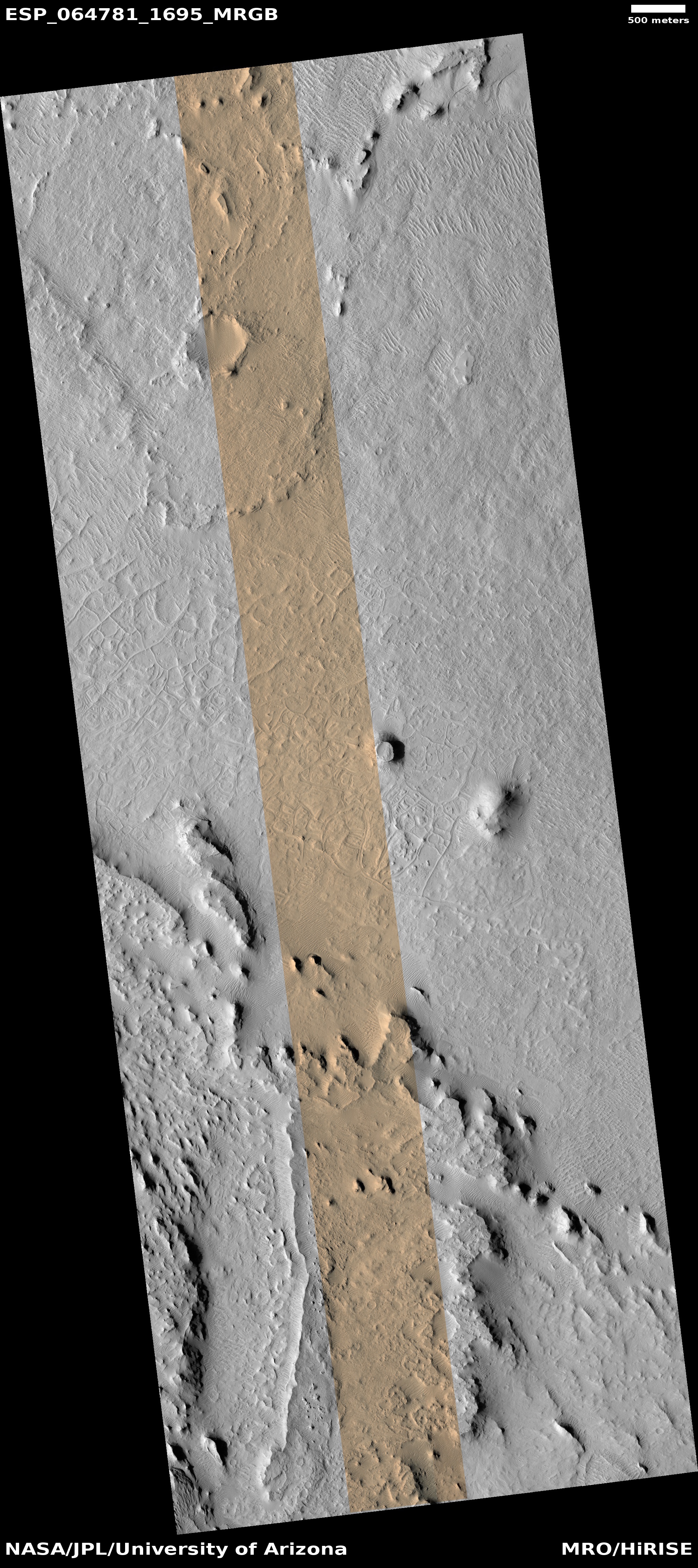
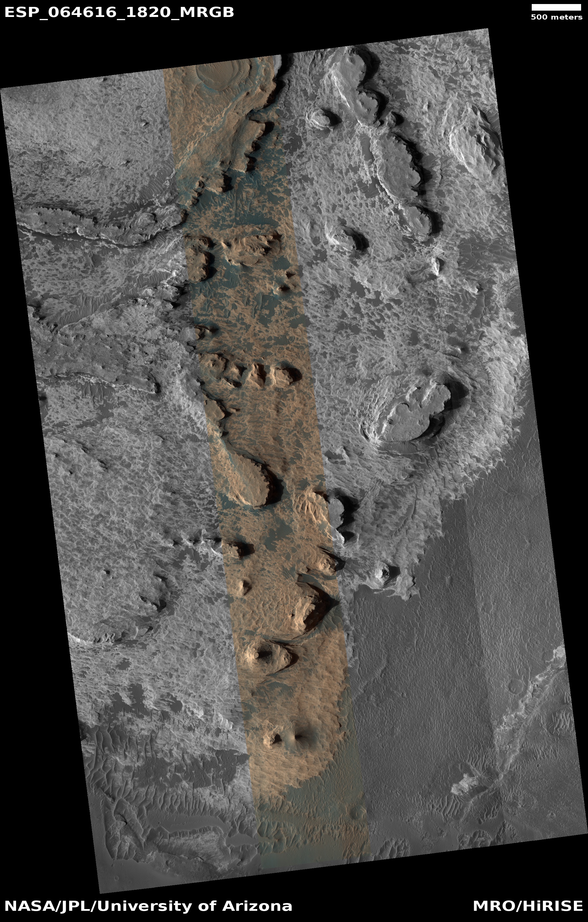
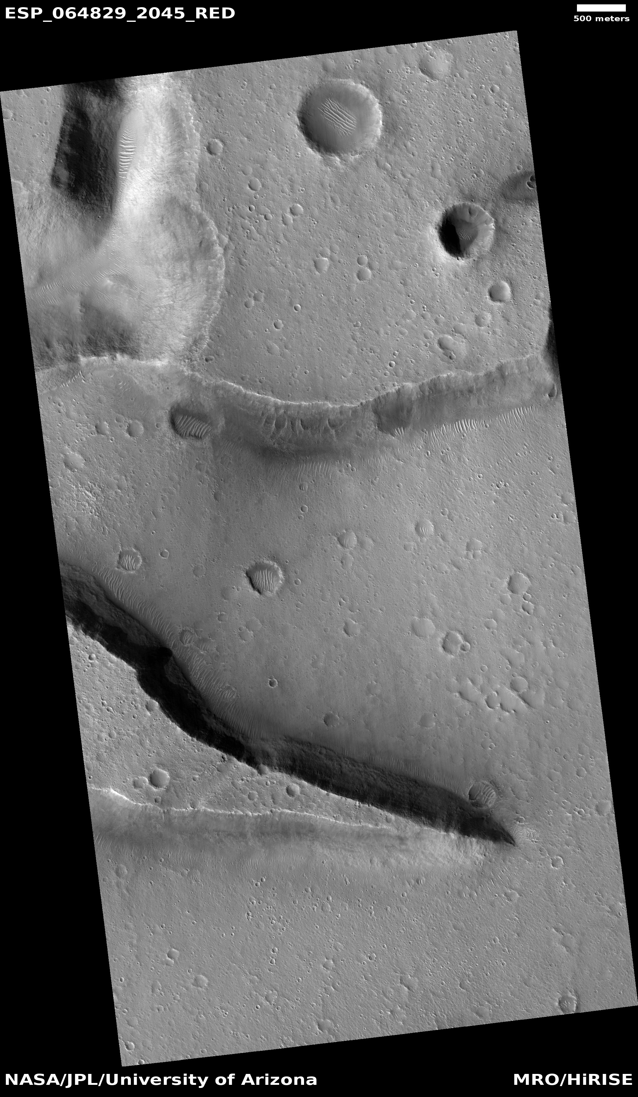
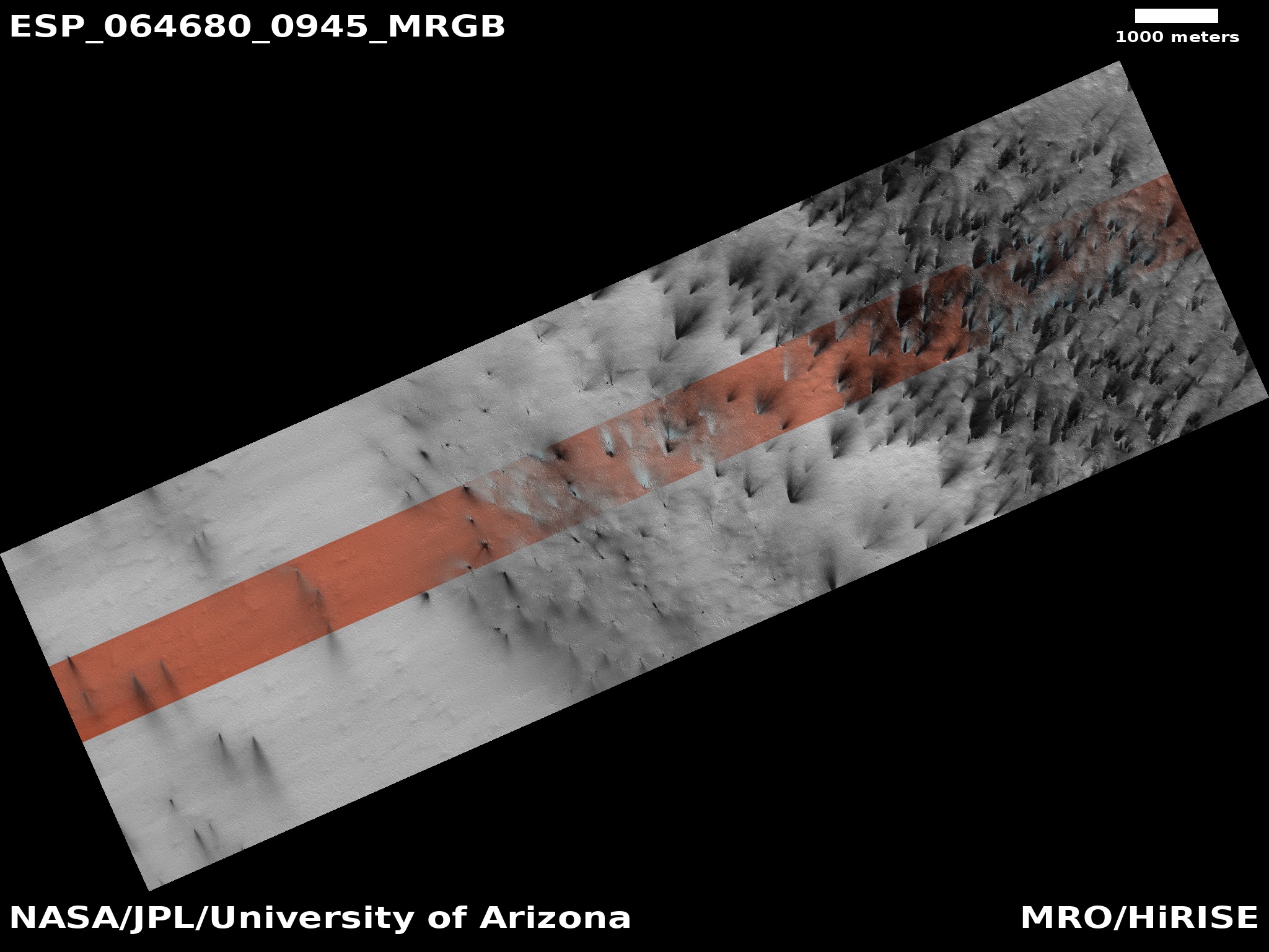
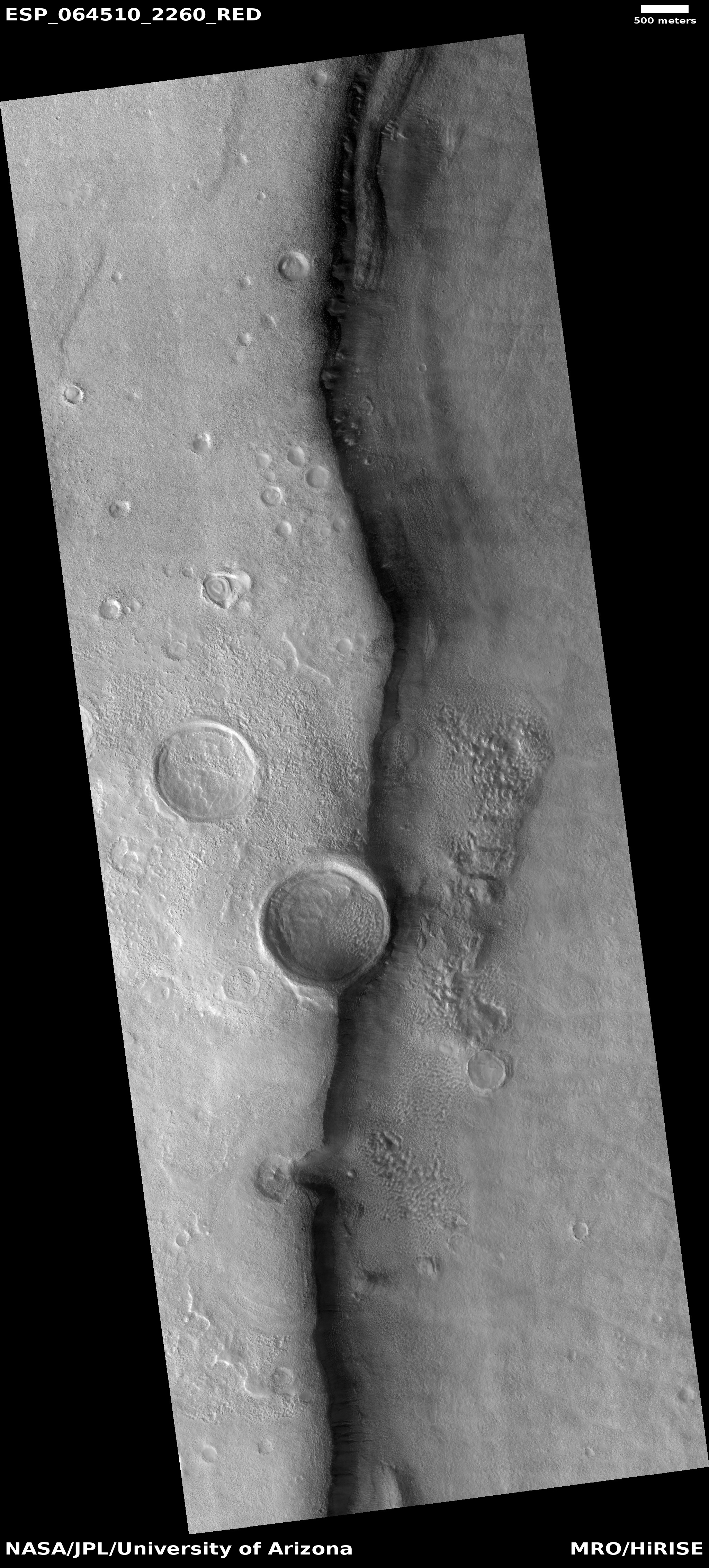
Megaripples are found in deserts on Earth, often between dunes. Waves in the sand spaced up to tens of meters apart, they’re a larger version of ripples that undulate every 10 centimeters or so on many sand dunes. But unlike dunes, megaripples are made up of two sizes of sand grains. Coarser, heavier grains cap the crests of megaripples, making it harder for wind to move these features around, says Simone Silvestro, a planetary scientist at Italy’s National Institute of Astrophysics in Naples.

Since the early 2000s, Mars rovers and orbiters have repeatedly spotted megaripples on the Red Planet. But they didn’t seem to change in any measurable way, which led some scientists to think they were relics from Mars’s past, when its thicker atmosphere permitted stronger winds.

Now, using images captured by NASA’s Mars Reconnaissance Orbiter, Silvestro and his colleagues have shown that some megaripples do creep along—just very slowly.

They found that the ripples shift position about four inches per year, which astonished them since they had not believed the winds of Mars were strong enough to move them at all.

0 comments

More polygons on Mars!

Lava polygons on Mars?
Click for full image.

Today’s cool image, rotated, cropped, and contrast-enhanced to post here, focuses on polygons found near the equator of Mars. It was taken by the high resolution camera on Mars Reconnaissance Orbiter (MRO) on May 22, 2020, and shows what the science team labels as “well-preserved polygons.”

Previously I have posted cool images showing polygons (here and here), but those images were located in the northern mid-latitudes, and were thought to have been formed in connection with some form of freeze-melt-drying water process in permafrost.

Today’s image however is likely not related to water. It is located in the equatorial regions, where little water is expected. It also has a more permanent nature, which suggests that it is the result of some sort of volcanic or tectonic process. That the polygons are depressions suggests the latter, since a volcanic process is more likely to have filled cracks and left ridges more resistant to erosion, as explained by this article.

In this case the topography suggests instead some form of spreading and cracking process that left behind these polygon-shaped cracks. In mud, such polygons are found when the mud dries, but once again, these are in a very dry region. If formed in that manner they must have formed a very very long time ago, when the climate here was very different, and were somehow preserved for eons since.

The location, as shown in the overview map below provides some context, though it really doesn’t answer any questions..
» Read more

0 comments

Martian acne?

Acne on Mars?
Click for full image.

Cool image time! The photo to the right, rotated, cropped, and reduced to post here, shows what the scientists from the high resolution camera on Mars Reconnaissance Orbiter (MRO) label “fretted terrain.” In an earlier post describing evidence found by Europe’s Mars Express orbiter of glaciers in the northern mid-latitudes of Mars, fretted terrain was described as follows:

As is common with fretted terrain, it contains a mix of cliffs, canyons, scarps, steep-sided and flat-topped mounds (mesa), furrows, fractured ridges and more, a selection of which can be seen dotted across the frame.

These features were created as flowing material dissected the area, cutting through the existing landscape and carving out a web of winding channels. In the case of Deuteronilus Mensae, flowing ice is the most likely culprit. Scientists believe that this terrain has experienced extensive past glacial activity across numerous martian epochs.

In that case the fretted terrain was in the transition zone between the northern lowland plains and the southern cratered highlands, and actually resembled chaos terrain. What we see here looks far different, a surface that resembles the bubbly surface of a vat of thick molten stew.

This image is also deep in the cratered southern highlands, though still in the mid-latitudes at 41 degrees south latitude. While the presence of ice close to the surface is possible at this latitude and could definitely explain what this image shows, it would be a big mistake to accept this explanation without skepticism. A lot is going on here, and much of it suggests volcanic-type processes. The volcanoes might have been spewing mud or ice instead of molten lava, but then again, all is uncertain.

What is certain is that I can’t help thinking of the pock-marked skin of an adolescent teenager when I look at this photo. And for all we know, the processes that produce both surfaces could be in many ways similar.

0 comments

Monument Valley on Mars

Monument Valley on Mars
Click for full image.

Today’s cool image is located near the Martian equator, in the middle of Arabia Terra, the most extensive region of the transition zone between the low northern plains and the southern cratered highlands. Taken on May 9, 2020 by the high resolution camera on Mars Reconnaissance Orbiter (MRO) and cropped to post here, the photo shows some layered mesas surrounded by a terraced and scalloped terrain with dust filling the low spots.

This is likely to be a very dry place on Mars. At only 2 degrees north of the equator, the evidence so far suggests that if there is a buried ice table (like the water table on Earth), it will be much deeper than at higher latitudes. The terrain reflects this, looking reminiscent of Monument Valley in the American southwest. In fact, the satellite image below, which I grabbed from MapQuest, shows a typical mesa in Monument Valley.
» Read more

6 comments

Martian swirls and curlicues

glacial features in depression on Mars
Click for full image.

Cool image time! The photo to the right, cropped and reduced to post here, is a great example of how a well known geological process on Earth, glaciers, can form features on Mars that appear most inexplicable.

The image was taken on May 13, 2020 and highlights the geology found in a depression, likely an eroded crater, on the northwest flanks of one of Mars’ largest basins, Argyre Planitia, located in the planet’s southern cratered highlands. The basin is thought to have been formed by a giant impact during the Late Heavy Bombardment around 3.9 billion years ago, when the inner terrestrial planets were sweeping up the last remnants of the Sun’s accretion disk, with that process causing the many craters we see on the Moon, Mercury, and Mars

This particular depression is at 41 degrees south latitude, in the mid-latitudes where scientists have found much evidence of buried glaciers. This is likely what we are looking at here. The section I’ve cropped has a dip to the south, which somewhat fits these flow features. If you look at the full image, you will see comparably weird flow features south of this section, flowing downhill in the opposite direction, to the north.

The problem is that not all the features fit the direction of flow, or any flow at all. I suspect we are seeing evidence of the waxing and waning of glaciers over this terrain over many eons. Disentangling that history however is confounding, especially when we are limited to only studying such objects from orbit.

I must also add that this image was labeled by the MRO science team a “terrain sample,” which means it wasn’t specifically requested by any scientist studying this geology. Instead, they needed to take an image to maintain the spacecraft’s camera temperature, and picked this spot for that snapshot. Their choice wasn’t random, but it also wasn’t based on any focused research.

5 comments

A great hike to do on Mars!

Knife Mesa at the exit from Kasei Valles
Click for full image.

Time to take a cool image and go sight-seeing. The photo to the right, cropped and reduced to post here, was taken by the high resolution camera on Mars Reconnaissance Orbiter (MRO) on May 25, 2020, and shows a spectacular knife-edge mesa, its cliffs more than 650 feet high on either side.

This knife mesa sits among a bunch of similar mesas, and appears to be in a region that could be called chaos terrain, formed by flowing water or ice along faults, cutting criss-crossing canyons with mesas between.

This mesa points east out from the Kasei Valley, the second largest canyon draining out from the Tharsis Bulge that contains Mars’ largest volcanoes. The overview map below provides some context, with the white cross indicating the location of today’s cool image.
» Read more

15 comments

Spring at the Martian South Pole

Geysers on Mars?
Click for full image.

Geysers on Mars
Click for full image.

It is now full spring at the Martian south pole, and as should be expected much has been happening there. Like the Martian north pole, when sunlight arrives after the dark winter it hits the seasonally-placed mantle or cap of carbon dioxide snow and begins to melt it, in the alien ways things like this occur on Mars.

The two images to the right illustrate this process for one particular place located in what are called the south polar layered deposits. The two images, just released on July 1, 2020 from the high resolution camera on Mars Reconnaissance Orbiter (MRO) and taken on May 14 and May 30 respectively, had immediately caught my attention because they were labeled “Active Geyser Locale Dubbed Macclesfield.” Active geysers?! I immediately contacted Candy Hansen of the Planetary Science Institute in Tucson, Arizona, whom I correctly guessed had requested these photos. She explained,

The name for this site is of course informal, and it dates back to when I first started picking sites to monitor. I was so certain we would see active geysers here! We see their deposits, the fans on the surface, but so far we have not caught an actual eruption in progress.

The overview map of the south pole below provides some context.
» Read more

5 comments

A hanging crater on Mars

Hanging crater
Click for full image.

Overview

Cool image time! The image to the right, cropped and reduced to post here, was taken by Mars Reconnaissance Orbiter (MRO) on May 1, 2020, and shows a truly intriguing crater that they dub a “Crater Hanging on Mesa Wall.”

Located in Deuteronilus Mensae, a chaos region of mesas and cross-crossing canyons in the transition zone between the northern lowland plains and the southern cratered highlands, the crater literally overhangs the edge of this canyon’s cliff. The overview map to the right, with this location indicated by the red box, illustrates what this region’s geology is like.

The most likely explanation is that the impact occurred prior to the creation of the canyon, and when the canyon eroded, the material in and of this crater was more resistant, probably because the impact had packed it together to increase its density.

At the same time, the features inside both craters in the photo, as well as below them on the floor of the canyon, suggest the presence of buried glaciers, something not unlikely at the 45 degree north latitude where this crater sits.

So, here’s a guess at the geological history. First we had the impact, then during the eons of glacial ebb and flow on Mars due to wide swings in the planet’s obliquity (its rotational tilt), the canyon was cut, with that erosion leaving the crater sitting high above the canyon floor below it.

One more curious detail: The material in the canyon seems asymmetric, suggesting that the crater actually dips down toward the canyon, as if it as a unit has tilted to the east as the canyon was worn out below it.

1 comment

Two wedding cakes on Mars

Tall wedding cake on Mars
Click for full image.

It it time for two cool Martian images from the high resolution camera on Mars Reconnaissance Orbiter (MRO). Though both show features that are similar and likely had some comparable geological origins, they are located in two very different places on Mars and thus also had very different histories.

What makes them fun is how much both resemble classic tall wedding cakes, though the second has unfortunately fallen down and is no longer eatable.

The first, cropped on the right to post here, was taken on May 18, 2020, and is described by the science team as a “Tall Layered Mesa in Crater in Deuteronilus Mensae.” Deuteronilus Mensae is in the transition zone between the northern lowland plains and the southern cratered highlands, and being in the high mid-latitudes (42 degrees north) shows a lot of evidence of buried and eroded glaciers. Many of these glaciers are found inside craters.

What caused this layered mesa however to form is beyond me. It is taller than the crater in which it sits, as well as the surrounding terrain. A glacier would settle into the lowest regions, and would not last if exposed above the rim like this is. Its height suggests that the surrounding terrain was once much higher, and has been eroded away. Yet if so, why does this mesa also sit inside a depression?

The second “wedding cake” is even more intriguing, though less baffling.
» Read more

2 comments

More strange terrain in the Martian “Death Valley”

More strange terrain in Hellas Basin
Click for full image.

Today’s cool image, rotated cropped, and reduced to post here, might show what the science team for the high resolution camera of Mars Reconnaissance Orbiter (MRO) have labeled “strange banded terrain”, but anyone who has spent any time perusing images of Hellas Basin, what I have labeled the basement of Mars because it has the lowest elevation on the planet, will recognize the features.

They might be inexplicable, but for Hellas Basin they are entirely familiar. Just take a look at some of my earlier posts:
» Read more

0 comments

Enigmatic layering and chasms on Mars

Enigmatic layering and chasms
Click for full image.

Overview map

Cool image time! The photo to the right, rotated, cropped, and reduced to post here, was taken on April 28, 2020 by the high resolution camera on Mars Reconnaissance Orbiter. (MRO). The science team entitled it “Enigmatic Uplifts in Echus Montes,” indicating a sense of bafflement on their part about this geology.

The features here are certainly somewhat puzzling. At first glance the terrain is reminiscent of Martian chaos terrain, mesas cut by canyons in an almost random pattern. As I explained at the link,

Chaos terrain is typically a collection of mesas separated by straight-lined canyons. It is found in many places on Mars, most often in the transition zone between the southern highlands and the northern lowlands where an intermittent ocean might once have existed. It is believed to form by erosion, possibly caused by either flowing water or ice, moving along fault lines. As the erosion widened the faults, they turned into canyons separating closely packed mesas. With time, the canyons widened and the mesas turned into a collection of hills.

What makes this particular image puzzling however is that there seem to be multiple layers of mesas and canyons. Look at the top of the rectangular mesa in the upper middle of the image. It appears to have its own miniature chaos terrain on its plateau. Somehow that first layer of chaos was abandoned when the more prominent larger canyons started to form around it.

The location of this feature is indicated by the black cross on the overview map to the right. It is in the middle of the large and wide northward trending part of the giant valley dubbed Kasei Valles. And as usual, knowing the location helps explain what we are seeing.
» Read more

2 comments

Deciphering the strange geology of Mars — or anything!

Eroding Medusae Fossae Formation ash deposits
Click for full image.

Today’s cool image is for once not taken by the high resolution camera on Mars Reconnaissance Orbiter (MRO). Instead, the image to the right, cropped and reduced to post here, was taken by Mars Odyssey on April 5, 2020, and shows the scouring and erosion caused by winds over many eons in a region dubbed Zephyria Planum. (Note that the image might fool your eye. Sunlight is coming from the east, and the rough terrain at the top is higher than the smooth plain at the bottom.)

Years ago, when I first started to rummage through the archives of images from the various Mars orbiters, I would have seen this image and posted it because I was completely baffled by what I saw, and thought that mystery made it worth showing to the public. Since then my incessant probing of research papers as well as asking a lot of questions of scientists has taught me a lot more about what scientists now surmise of the Martian geology. This greater knowledge in turn makes it possible for me to look at an image like this and immediately make a reasonable guess as to an explanation. This photo, while still containing much that is mysterious, is no longer completely baffling to me.

This willingness to ask questions and dig deeper is fundamental to all things. To have a deeper understanding and not simply guess about any subject, you always have to recognize that your assumptions are likely wrong, and that to learn anything you have to repeatedly ask what I call “the next question.” The first answer will force you to recognize that your first guesses are wrong, raise more questions, which in turn will lead to more questions, and then more questions, and so forth.

Whether I am researching Mars or early space history or politics, this rule always applies. Don’t leap to a conclusion. Think it possible you could be wrong. Ask the next question. And the next. You will repeatedly find that what you thought you knew was not correct, and in the end you will gain a deeper understanding of what is actually known about any subject, as well as what is unknown. And knowing the unknowns is probably the most important thing you can learn.

To gain a better understanding of today’s particular image, our first questions must start with context. Where is this feature on Mars? What is the surrounding history of that location? And what is already known about this place?

The location immediately reveals a great deal, as shown in the overview map below.
» Read more

4 comments
1 68 69 70 71 72 90