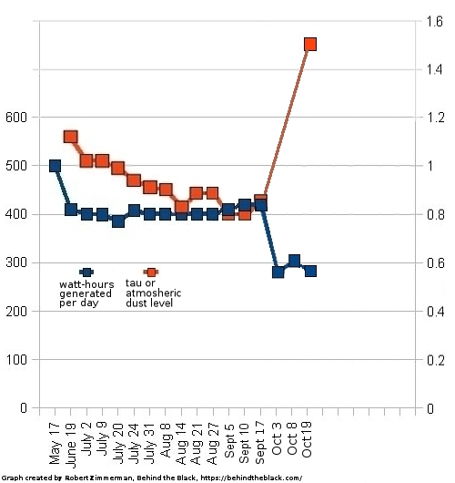
Lucy’s view of the Earth-Moon system during its October fly-by

Click for original image.
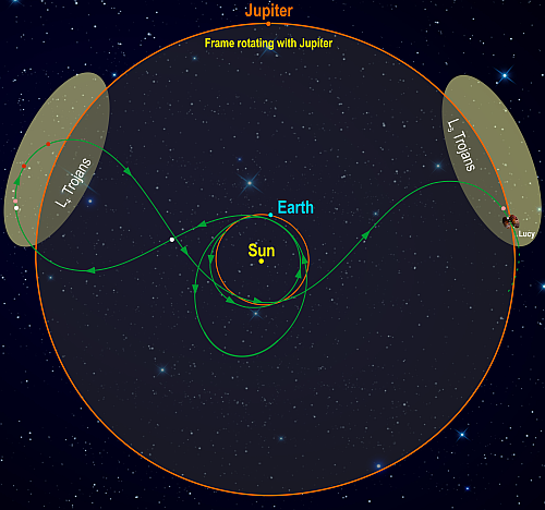
Lucy’s planned route to explore the Trojan asteroids
In the days prior to its October 16, 2022 fly-by of the Earth, the Lucy asteroid probe took several calibration images of the Earth and the Moon. The photo above, cropped, reduced, and enhanced to post here, shows both the Earth and the Moon together. From the caption:
On October 13, 2022, NASA’s Lucy spacecraft captured this image of the Earth and the Moon from a distance of 890,000 miles (1.4 million km). The image was taken as part of an instrument calibration sequence as the spacecraft approached Earth for its first of three Earth gravity assists. These Earth flybys provide Lucy with the speed required to reach the Trojan asteroids — small bodies that orbit the Sun at the same distance as Jupiter.
In the original, the Moon is so dim, compared to the Earth, that it was hard to find in the picture. I therefore brightened it considerably more than the Earth to make it easily seen above.