
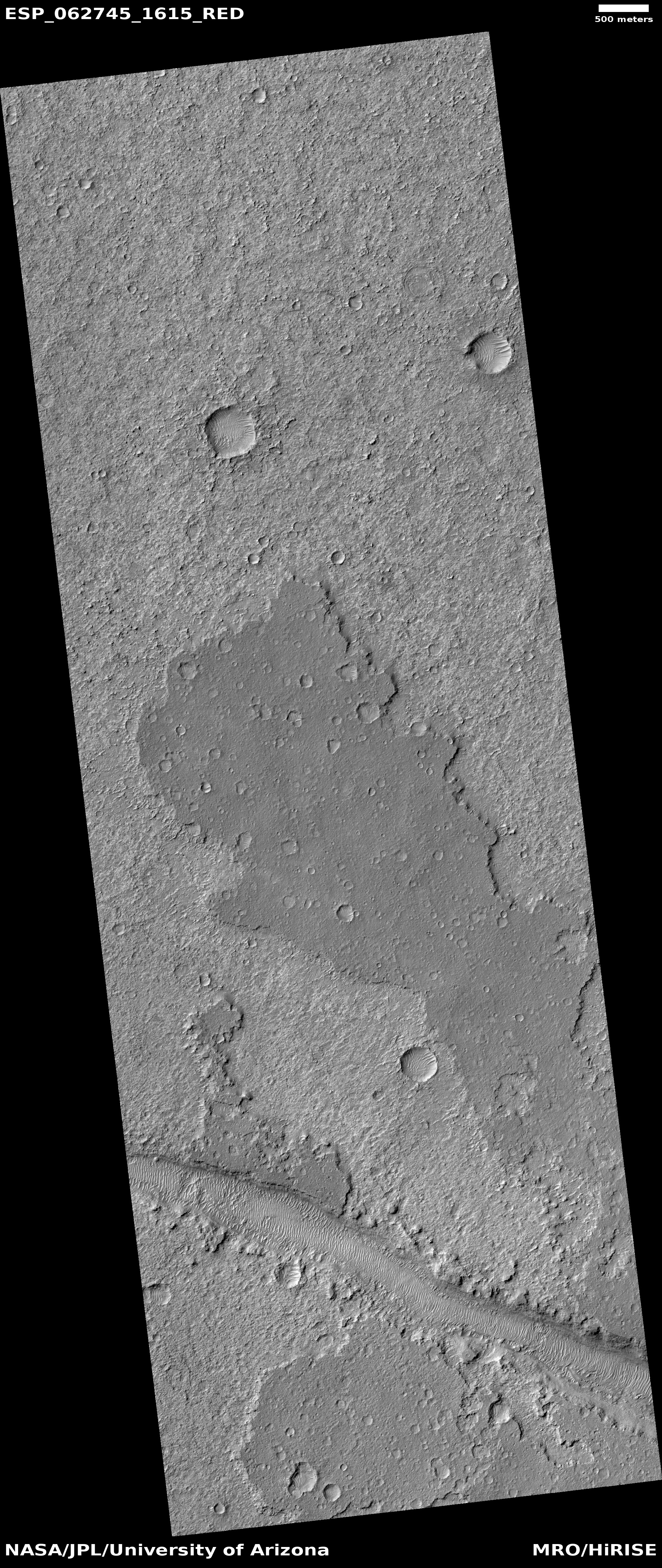
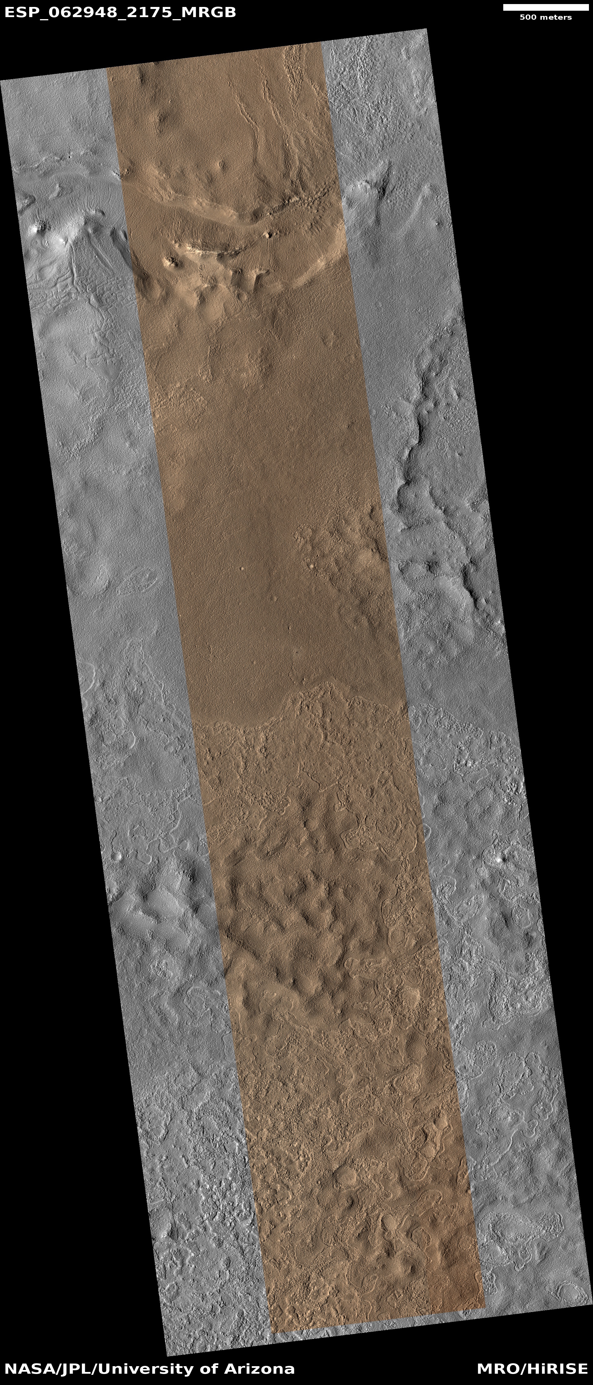
Weird flat plateau on Mars
Click for full image.
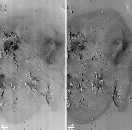
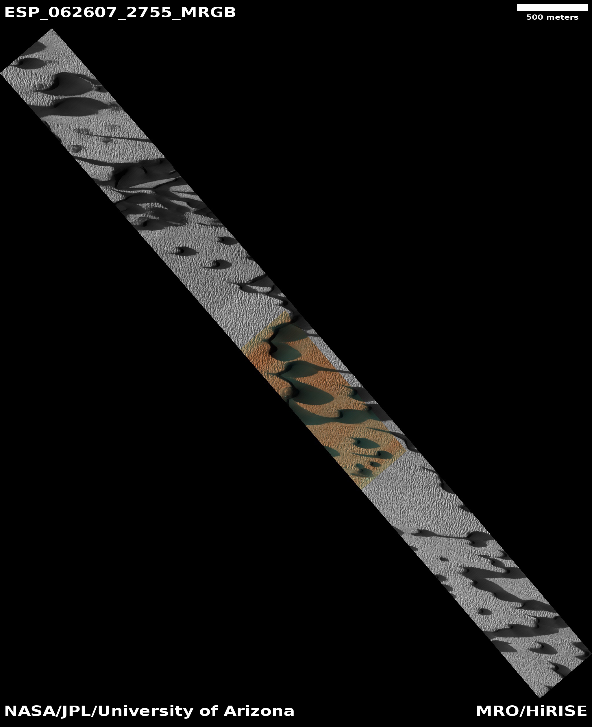
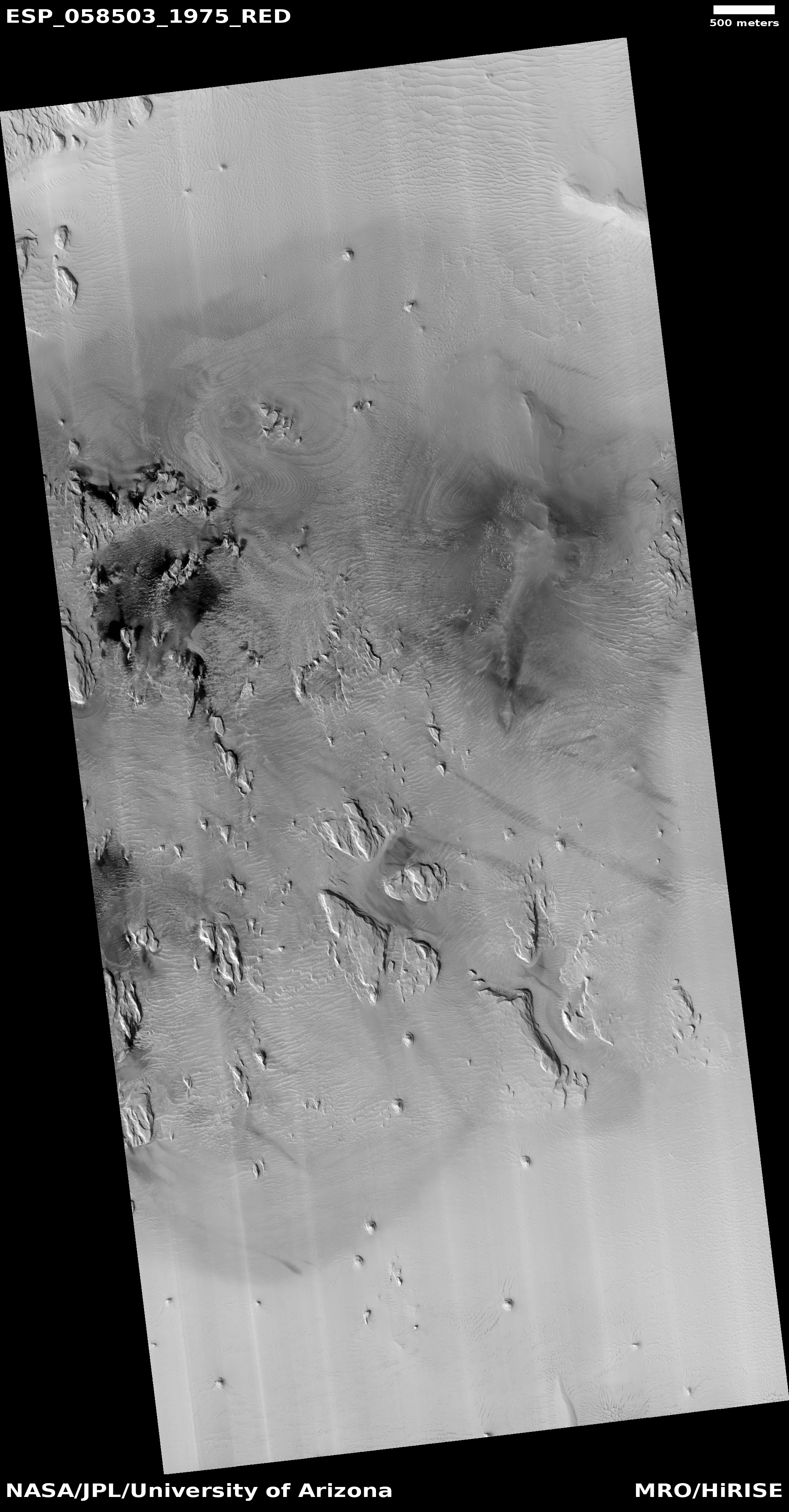
Cool image time! The image to the right, rotated, cropped, and reduced to post here, was taken by the high resolution camera on Mars Reconnaissance Orbiter (MRO) on December 15, 2020, and was actually a follow-up observation from an earlier image taken by the camera on Europe’s Trace Gas Orbiter (TGO), according to Dr. Livio Tornabene of the University of Western Ontario. As he explained in an email:
The team is rather polarized with their verdict on what exactly the feature is… while at first glance it appears to be a lava flow, it very well could be that these deposits eroded to yield this flow/lobate like appearance and isn’t lava at all. So as someone that is both involved with [TGO] and [MRO], I noticed that the lobate feature causing quite the debate had no coverage from [MRO].
It appears that some scientists think that instead of lava, this is a mud flow. Research presented [pdf] during the 2019 Lunar & Planetary Conference in Texas found evidence that mud could flow like lava under the right conditions.
At this point neither Tornabene nor anyone working on the TGO team have yet analyzed this new MRO image to see if they can answer this question. That this feature is located in a region just to the southeast of Marineris Valles where there is evidence both of volcanic activity and sedimentary deposition, makes answering the question even more challenging.
The data from TGO indicated [pdf] that the plateau was about 30 to 65 feet thick. Based on crater counts the age is thought to be between 1.6 to 1.9 billion years old.
What struck me about the plateau is that though it really does look like a flow, it also appears remarkably flat and smooth. Even more puzzling is that, according to the TGO paper, the plateau slopes downhill very gently (a 1% grade) to the south, not to the north as suggested by the shape of the flow. Maybe later geological events tilted the entire feature after it solidified, thus changing the grade?
Meanwhile that channel near the bottom of the image crosses through the grade and the flow, as if it was cut after the flow was placed. In other words, the flow and channel were formed separately, at different times.
Ah, the mysteries of planetary geology. If only we could just go there with a geologist’s hammer. These questions would then be so much more simple to answer.
