The eye of a storm on Jupiter

Storm on Jupiter

The image on the right, cropped to post here, was taken by Juno on February 12, 2019 as the spacecraft made its 17th close approach of Jupiter. The Juno science team today has highlighted this version, processed by citizen scientists Gerald Eichstädt and Seán Doran to enhance the details therein. They note how the white clouds can clear be seen sitting above the colored clouds below.

I cropped it to show the center of the storm. The full image is equally spectacular, as it shows the full storm. Unfortunately, there is no scale, but I suspect you could probably fit the entire Earth several times across the diameter of the storm.

Fragment of a long dead planet’s iron core found orbiting white dwarf

Astronomers have identified the fragment of a long dead planet’s iron core orbiting a white dwarf star 410 light years away.

The [data] suggested its source was a solid object some 600 kilometers across—a suspected planetary core, with a density between 7.7 and 39 grams per cubic meter, comparable to the pure iron found within Earth’s core. “The density of the piece of rock is consistent with what we think the cores of planets [are],” says Luca Fossati of the Austrian Academy of Sciences, who was not involved in the paper.

It orbits the star every two hours, the fastest exoplanet orbit yet found. This alone should rip it apart, providing further evidence that the object’s density is very high.

The astronomers theorize that this object is likely the remains of a planet that existed when this star was young, and was destroyed as the star aged to become a red giant, expanding to swallow it. Later, when the star collapsed to become a tiny white dwarf, the core remained, its density allowing it survive as the planet’s outer crust was torn away.

Hayabusa-2’s successfully bombs Ryugu

impact on Ryugu

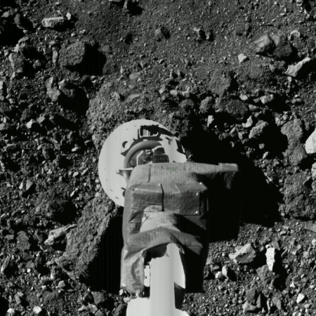
Japan’s Hayabusa-2 probe yesterday successfully impacted an explosive charge on the surface of the asteroid Ryugu, creating a crater for observing the interior geology.

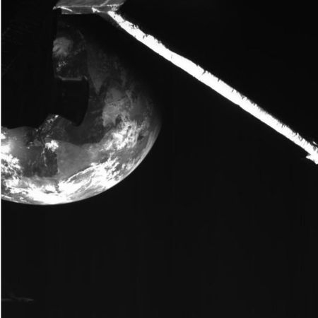
The image to the right was taken by a camera that has separated from Hayabusa-2 and stayed closer to the impact. It shows material flying off the asteroid’s surface, at the horizon line.

Hayabusa-2 — which moved to the other side of the asteroid to stay clear of any ejecta — will next arc around and get close to this impact site to study it. They first need to make sure the ejecta has cleared.

Monitoring the ice scarps on Mars for changes

Scarp #1 in 2011
Click for full image.

Scarp #1 in 2018
Click for full image.

Back in January 2018 planetary scientists released a paper announcing the discovery of a number of Martian cliff faces, or scarps as they called them, that all appeared to expose an underground layer of ice.

Those cliffs were mostly located to the southeast of Hellas Basin, the basement of Mars that is also advantageous for human colonization because its lower elevation means its atmosphere is thicker. (For example, that thicker atmosphere would make air transportation more practical.)

The two images to the right show what they listed as scarp #1 in their paper, rotated, cropped, and reduced to post here. The first image was taken in May 2011, with the second taken in December 2018, and was part of the March image release from the high resolution camera of Mars Reconnaissance Orbiter (MRO).

The December 2018 image was taken almost a year after the paper release, and was titled “Scarp Monitoring.” I therefore wondered whether the scientists had identified any changes. They theorize that these scarps form when the exposed ice slowly sublimates to gas into the atmosphere, causing the cliff face to collapse and retreat, which in the case of scarp #1 would be a retreat to the north. The terraces below the scarp suggest previous cliff locations. In their paper they noted evidence of some changes in the studied scarps, including some fallen boulders, as well as color changes that suggest some evolution.

The rate of that retreat is not known with precision, but based on the facts presently at hand, the scientists have estimated that it took about a million years to form this scarp. Whether any evidence of this retreat would be visible in only seven years is the purpose of these scarp monitoring images.

Do you see any difference? I don’t, but because I also don’t trust my expertise I decided to email the paper’s lead author, Colin Dundas of the U.S. Geological Survey’s Astrogeology Science Center. His emailed comments are most interesting.
» Read more

Scientists in Japan claim that cats can learn their name!

Science does important research! Scientists in Japan now claim that cats can learn their name!

Japanese scientists played recordings of a cat’s owner saying four words with lengths and accents similar to its name before saying the feline’s actual name. The word hihu (Japanese for “skin”), for example, might proceed the name “Kari.” As the random words—all nouns—played, the cats became less and less interested. But as soon as they heard their name, most moved their ears and heads; a few even got up (above). The scientists saw similar responses when the cat’s name came after the names of other felines he lived with, or when a stranger spoke the words.

Any cat owner could have told these scientists this. More significant is the fact that cats in the wild normally do not use meowing as a communications tool. Only with humans do they meow, indicating that they learn that humans respond to sound, and they then adapt to use the knowledge to gain what they want from their human staff.

A decade of changes at the Martian south pole

A decade of changes at the Martian south pole
Click for full image.

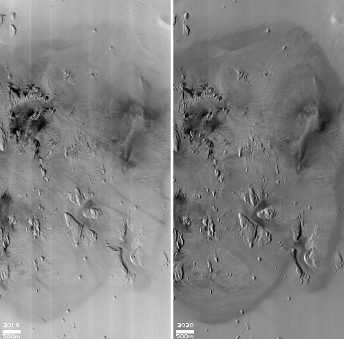
The image above, cropped, reduced, and annotated to post here, was released this week by the Mars Reconnaissance Orbiter (MRO) team. It shows the changes that have occurred at one location at the Martian south polar cap in the past decade. As planetary geologist Alfred McEwen wrote,

The south polar residual cap of carbon dioxide ice rapidly changes. This image was planned as an almost exact match to the illumination and viewing angles of a previous one we took in August 2009.

The pits have all expanded and merged, and we can just barely see the patterns in the 2009 image compared to this January 2019 picture. The 2009 image is also brighter and bluer, with more seasonal frost and/or less dust over the surface. These images were both taken in late southern summer, but our 2019 picture is slightly later in the Martian season by about two weeks.

You can get a better idea how much is changed by seeing the full image from which the above small area was cropped.
» Read more

Global map of Bennu

Global map of Bennu

The OSIRIS-REx science team today released a global map of Bennu, compiled from images taken in December.

The map is above. It was released with no commentary. In comparing it with this global map of Ryugu, created by the Japanese probe Hayabusa-2, I am struck by how much both asteroids resemble each other.

This fact is in many ways a first. Since the first planetary probes left Earth in the 1960s the one reliable expectation that has consistently proven true is that no planetary object, be it planet, dwarf planet, moon, asteroid, or comet, was going to resemble any other planetary object. Each has been entirely unique, and unique in very startling and obvious ways.

Ryugu and Bennu represent the first planetary objects that actually look pretty much the same. Scientist will of course be able to note differences, but overall these objects clearly belong to a specific class of asteroids, which in this case is the rubble pile.

In a sense, this similarity marks a significant advancement in our knowledge. Up until now, we had observed so few objects that our knowledge base wasn’t large enough to start seeing patterns within our general classifications of planet, asteroid, or comets. That is now finally changing.

Mars Express confirms Curiosity 2013 methane detection

The uncertainty of science: The Mars Express science team today announced that a reanalysis of the orbiter’s data showed the same spike spike of methane detection as seen by Curiosity on June 15, 2013.

The study exploited a new observation technique, allowing the collection of several hundred measurements in one area over a short period of time. The teams also developed a refined analysis technique to get the best out of their data.

“In general we did not detect any methane, aside from one definite detection of about 15 parts per billion by volume of methane in the atmosphere, which turned out to be a day after Curiosity reported a spike of about six parts per billion,” says Marco Giuranna from the Institute for Space Astrophysics and Planetology in Rome, Italy, the principal investigator for the PFS experiment, and lead author of the paper reporting the results in Nature Geoscience today.

“Although parts per billion in general means a relatively small amount, it is quite remarkable for Mars – our measurement corresponds to an average of about 46 tonnes of methane that was present in the area of 49 000 square kilometres observed from our orbit.”

Ten other observations in the Mars Express study period that reported no detections at the limit of the spectrometer’s sensitivity corresponded to a period of low measurements reported by Curiosity.

The data, along with their estimate about the source location for the methane, suggests that this was a geological event, not the result of biological life. They think the methane was trapped in ice-filled fissures, and released when that ice either broke or melted. Whether the methane itself was formed by past microbial life sometime in the past remains completely unknown.

To put it mildly, there are a lot of uncertainties in this result.

Circular feature on Mars?

A circular feature on Mars?
Click for full resolution image.

Today’s cool image is cool for two reasons. First and foremost, the image, found in the archive of the high resolution camera of Mars Reconnaissance Orbiter (MRO), is titled “Circular Feature.” On the right is the full image, reduced to post here. I have searched it high and low, at low resolution as well as full resolution, and can find nothing, nothing at all, that invokes a circular feature to me.

This strange terrain is located very close to the southern icecap. If anything, the knobs and features that fill this image remind me of brain terrain, partly obscured by a layer of partly melted snow or frost. Nothing however seems circular in the slightest.

The second reason this image is cool is that it is very representative of its very large surrounding region. For what appears to be several hundred miles in all directions this is all that one can see, in a variety of MRO images, here, here, here, here, here, and here, to show only a few. Ever so often a craterlike feature pops out, like in the last example, but generally the surface continues in this undulating bland manner, endlessly. The only changing aspect is the dark streaks that cut across, likely dust devil tracks made over a long period of time.

Below the fold is a section of the full resolution image, at full resolution. It doesn’t really matter where I took the crop, as anywhere in the full image everything looks pretty much the same. The only slow change that I can perceive is that the surface seems to be descending to the north, with the lighter areas implying the existence of terraces.

Take a look, and try to figure out for yourself what is going on here.
» Read more

Scientists propose widespread deep groundwater on Mars

In a new study, scientists are now suggesting that widespread deep groundwater exists on Mars, and is the cause of the recurring slope lineae seen on many Martian slopes.

Previous theories for the cause of lineae proposed both dry and wet processes, all related to either near surface or atmospheric phenomenon. This new hypothesis is different, as it proposes deep groundwater as the source.

“We propose an alternative hypothesis that they originate from a deep pressurized groundwater source which comes to the surface moving upward along ground cracks,” Heggy says. “The experience we gained from our research in desert hydrology was the cornerstone in reaching this conclusion. We have seen the same mechanisms in the North African Sahara and in the Arabian Peninsula, and it helped us explore the same mechanism on Mars,” said Abotalib Z. Abotalib, the paper’s first author.

The two scientists concluded that fractures within some of Mars’ craters, enabled water springs to rise up to the surface as a result of pressure deep below. These springs leaked onto the surface, generating the sharp and distinct linear features found on the walls of these craters. The scientists also provide an explanation on how these water features fluctuate with seasonality on Mars.

This conclusion is most intriguing, but it is far from certain. Scientists have found a lot of lineae. For all of them to come from deep groundwater rising under pressure through fractures seems unlikely.

Nonetheless, this research indicates the growing belief among Mars researchers that water exists everywhere on Mars, and is accessible.

Parker about to do its second close fly-by of Sun

The Parker Solar Probe is now approaching its second close fly-by of the Sun, set to occur on April 4.

During this solar encounter phase, which lasts until April 10, the spacecraft’s four suites of science instruments are fully operational and storing science data collected from within the Sun’s corona. As designed, Parker Solar Probe will be out of contact with Earth for several days during the solar encounter. This allows the spacecraft to prioritize keeping its heat shield, called the Thermal Protection System, oriented towards the Sun, rather than pointing its transmitter towards Earth. Science data from this second solar encounter phase will downlink to Earth over several weeks later in spring 2019.

This fly-by the spacecraft will match the record of 15 million miles set during the first orbit as the closest any human spacecraft has ever gotten to the Sun. Future orbits however will get closer.

Saturn’s rings desposit material on its tiny nearest moons

Pan

A new analysis of data from Cassini has confirmed that the tiny moons orbiting close to Saturn’s rings are repeatedly coated by material from those rings.

The new research, from data gathered by six of Cassini’s instruments before its mission ended in 2017, is a clear confirmation that dust and ice from the rings accretes onto the moons embedded within and near the rings.

Scientists also found the moon surfaces to be highly porous, further confirming that they were formed in multiple stages as ring material settled onto denser cores that might be remnants of a larger object that broke apart. The porosity also helps explain their shape: Rather than being spherical, they are blobby and ravioli-like, with material stuck around their equators. “We found these moons are scooping up particles of ice and dust from the rings to form the little skirts around their equators,” Buratti said. “A denser body would be more ball-shaped because gravity would pull the material in.”

This result is not a surprise. It has been hypothesized since the first images of these weirdly shaped moons (as illustrated by the picture of Pan from March 2017 above) were first beamed back by Cassini. This new analysis just helps confirm it.

I will add that searching through Behind the Black for that image of Pan made me realize how much I miss Cassini. I used to post lots of its images, always spectacular and breath-taking. With it gone, the images from Saturn have stopped, and will not resume for decades to come.

Rivers on Mars?

The uncertainty of science: A new study of Martian geology suggests that rivers ran on the surface are longer and later in the planet’s history than previously thought.

Seeking a better understanding of Martian precipitation, Kite and his colleagues analyzed photographs and elevation models for more than 200 ancient Martian riverbeds spanning over a billion years. These riverbeds are a rich source of clues about the water running through them and the climate that produced it. For example, the width and steepness of the riverbeds and the size of the gravel tell scientists about the force of the water flow, and the quantity of the gravel constrains the volume of water coming through.

Their analysis shows clear evidence for persistent, strong runoff that occurred well into the last stage of the wet climate, Kite said.

The results provide guidance for those trying to reconstruct the Martian climate, Kite said. For example, the size of the rivers implies the water was flowing continuously, not just at high noon, so climate modelers need to account for a strong greenhouse effect to keep the planet warm enough for average daytime temperatures above the freezing point of water.

The rivers also show strong flow up to the last geological minute before the wet climate dries up. “You would expect them to wane gradually over time, but that’s not what we see,” Kite said. The rivers get shorter—hundreds of kilometers rather than thousands—but discharge is still strong. “The wettest day of the year is still very wet.”

They also found that these rivers had been wider than those seen on Earth, which would make sense if there were few if any plant life to fix the banks in place, as on Earth. The lower Martian gravity probably plays an even larger role in this.

You can read the paper here. The study confirms many other previous studies of Martian surface features, which have repeatedly found evidence that liquid water once existed on Mars. That it found the water flowed later and more extensively only makes more difficult the deeper and probably biggest mystery of Martian geology, however, which is that scientists have not been able to come up with a historic atmospheric model that would allow that liquid water to exist. Mars today is too cold and its atmosphere is too thin for liquid water to flow, and the evidence from the past does not suggest an atmosphere different enough to change that.

It must have been different, but we don’t know how that was possible, based on the data we presently have. And this study makes solving that mystery even more difficult.

Fresh crater in Martian northern lowlands

Fresh impact crater in northern lowlands
Click for full image.

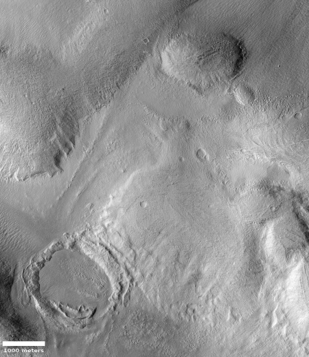
Today’s cool image could be a sequel to yesterday’s. The image on the right, cropped to post here, was one of the many images released from Mars Reconnaissance Orbiter’s (MRO) high resolution camera in March. The release, uncaptioned, calls this a “fresh impact crater.”

In many ways it resembles the craters I posted yesterday, with a splashed look and a crater floor with features that favor the north. Why that divot exists in the northern half of the floor is to me a mystery. The crater floor looks like a sinkhole to me, with material slowly leaking downward at that divot to cause this surface depression. Yet the rim screams impact. And yet, why the double rim? Was this caused by ripples in wet mud when the bolide hit?

Location of fresh impact crater

The crater itself is all by itself deep in those northern plains. You can see its location as the tiny white rectangle slightly to the left of the center in the overview image to the right. The giant Martian volcanoes can be seen at the image’s right edge, almost a quarter of a planet away. This is at a very low elevation on Mars, almost as deep as Hellas Basin.

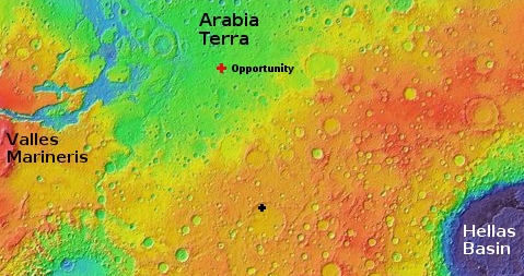
For some fun context, this location is very close to where Viking 2 landed in 1976. The Mars 2020 rover meanwhile will land at this overview image’s left edge, on the western shore of the oval cut into southern highlands at about the same latitude as Olympus Mons, the largest volcano on the right. And InSight and Curiosity sit almost due south, with Curiosity in the yellow in the transition from green to orange, and InSight to the north in the green.

Strange craters in the Martian northern lowlands

Strange crater in the northern lowlands
Click for full image.

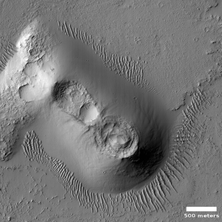
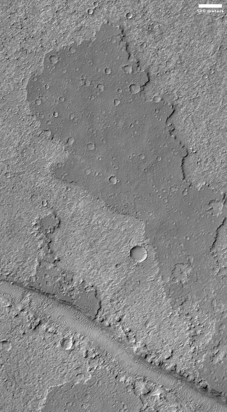
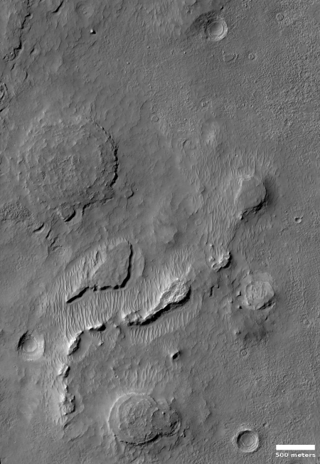
Cool image time! The image on the right, cropped and rotated to post here, was taken by the high resolution camera on Mars Reconnaissance Orbiter (MRO) and released in the monthly image dump provided by the science team. The release had no caption. It merely described this as a “Layered mound in crater.”

That is certainly what is is. However, layering suggests a regionwide process. The crater to the immediate northeast (the rim of which can be seen in the upper corner of this image), does not have the same kind of layering. (Be sure to click on the image to see that other crater.) Its crater floor is instead a blob of chaotic knobs, with the only layering scattered in spots along its north interior rim.

That the layering of both craters favors the north suggests a relationship, but what that is is beyond me. Prevailing winds? Maybe, but I don’t have the knowledge to explain how that process would work.

It is not even certain that these two craters were formed by impact. They are located in the northern lowlands where an intermittent ocean is believed to have once existed, and thus might be remnants of that ocean’s floor. That they both have a muddy appearance reinforces this hypothesis, but once again, I would not bet much money on this theory. The features here could also be expressing the effect of an impact on a muddy seafloor.

In either case the craters imply that the ocean that might have once been here existed a long enough time ago for these craters to form (either by impact or some other process) and then evolve. This has been a relatively dry place for a very long time.

The layering at the Martian poles

Layering in the east side of Burroughs Crater
Click for full image.

Layering in the west side of Burroughs Crater
Click for full image.

In the past month the science teams of both Mars Reconnaissance Orbiter (MRO) and Trace Gas Orbiter (TGO) have released images showing the strange layering found in Burroughs Crater, located near the Martian south pole.

The top image above is the MRO image, rotated and cropped to post here. To the right is a cropped and reduced section of the TGO image.

Though both images look at the inside rim of the crater, they cover sections at opposite ends of the crater. The MRO image of the crater’s east interior rim, with the lowest areas to the right, while the TGO image shows the crater’s northwest interior rim, with the lowest areas on the bottom. As noted at the TGO image site:
» Read more

Jezero Crater: The landing site for the Mars 2020 rover

Jezero Crater delta
Jezero Crater delta

At this week’s 50th Lunar and Planetary Science Conference in Texas, there were many papers detailing the geological, topographical, chemical, meteorology and biological circumstances at the landing sites for the 2020 Martian rovers, Jezero Crater for the U.S.’s Mars 2020 and Oxia Planum for Europe’s Rosalind Franklin.

Most of these papers are a bit too esoteric for the general public (though if you like to delve into this stuff like I do, go to the conference program and search for “Jezero” and “Oxia” and you can delve to your heart’s content).

Oxia Planum drainages

These papers do make it possible to understand why each site was chosen. I have already done this analysis for Rosalind Franklin, which you can read here and here. Oxia Planum is in the transition between the southern highlands and the northern lowlands (where an intermittent ocean might have once existed). Here can be found many shoreline features. In fact, one of the papers at this week’s conference mapped [pdf] the drainage patterns surrounding the landing ellipse, including the water catchment areas, as shown by the figure from that paper on the right.

With this post I want to focus on Jezero Crater, the Mars 2020 landing site. The image above shows the crater’s most interesting feature, an impressive delta of material that apparently flowed out of the break in the western wall of the crater.

This image however does not tell us much about where exactly the rover will land, or go. To do that, we must zoom out a bit.
» Read more

The changing surface of Comet 67P/C-G

Changes on Comet 67P/C-G after outburst

More results from this week’s 50th Lunar and Planetary Science Conference in Texas! Two presentations today focused on showing the dramatic changes on the surface of Comet 67P/C-G that were documented by Rosetta. The first focused on the changes produced after massive outbursts during the comet’s closest approach to the Sun. The second documented several more evolutionary changes that changed more slowly.

The image to the right comes from the first paper, and shows the changes that took place on the surface following one massive outburst, with the numbers in red indicating unchanged features between the two photographs.

It appears an entire cliff section has disappeared, replaced by a single large giant boulder. Interestingly there is no obvious vent opening for the outburst. Instead, it appears that the eruption occurred below ground, and merely blasted part of the surface into space. As noted in the paper:

We report here on a third cliff collapse that occurred in the southern hemisphere in the Sobek region [7], which corresponds to the neck region in the 67P’s southern hemisphere. Due to the close alignment of the 67P’s
southern summer solstice with perihelion passage, the southern hemisphere is subjected to higher solar input, resulting in higher levels of activity and more intensive erosion. The location of the collapsing cliff in Sobek is consistent with the inferred source region of one of the strong outbursts [previously reported].

The paper also showed evidence of a large boulder more than a 100 feet across moving several hundred feet over a period of seven months.

The second paper showed various changes in a number of depressions and scarps on the smooth flat surfaces near the narrow neck that connected the comet’s two lobes. Examples of this terrain can be seen in high resolution pictures here and here and here and here.

From this data scientist suggest that the neck region is slowly dissolving away, its material in these flat areas flying away because the neck happens to be a region of low gravity.

Lava tubes on Alba Mons

Lava tubes on the western slope of Alba Mons

During oral presentations today at this week’s 50th Lunar and Planetary Science Conference in Texas, scientists revealed [pdf] a map showing what they believe are numerous lava tubes flowing down the western slope of the giant Martian volcano Alba Mons.

The image on the right is taken from their paper. The red lines indicate collapsed tube sections, maroon collapsed sections on a ridge, and yellow volcanic ridges, which I assume are external surface flows. From their paper:

Lava tube systems … occur throughout the western flank, are concentrated in some locations, and are generally radial in orientation to Alba Mons’ summit. Lava tubes are typically discontinuous and delineated by sinuous chains of elongate depressions, which in many cases are located along the crests of prominent sinuous ridges. Lava tube systems occur as both these ridged forms with lateral flow textures and more subtle features denoted by a central distributary feature within the flat-lying flow field surface. Significant parts of the sinuous volcanic ridges show no collapse features, indicating a distinctive topographic signature for Alba Mons’ lava tubes.

Alba Mons is in some ways the forgotten giant volcano on Mars.
» Read more

Yutu-2 heads west!

LRO images of Yutu-2 on the Moon
Click for full image.

A new image from Lunar Reconnaissance Orbiter (LRO) shows the path taken by the Chinese lunar rover Yutu-2 during its second lunar day of travel on the Moon. The LRO images on the right, cropped and reduced in resolution to show here, compares the rovers position at the start and end of February. The white arrow indicates the rover, with its Chang’e-4 lander visible between the three craters to the east. As noted by the LRO science team:

LRO passes over any given place on the Moon at least once every month (in the daylight), allowing the westward progress of the Yutu-2 rover to be seen. At the end of February, Yutu-2 was 69 meters from it’s home base, the Chang’e 4 lander; LROC images show Yutu-2 made 46 meters of westward progress during the month of February.

It appears from these orbital images that they are taking the smoothest route, with the fewest obstacles, away from the lander.

Hayabusa-2 to take close look at planned explosive impact point on Ryugu

Flight plan for Hayabusa-2's rehearsal

Beginning today Hayabusa-2 will do a two-day close approach of Ryugu in order to get good baseline images of the point on the surface where they will fire an explosive projectile in the first week in April. As they note:

Currently, we have scheduled the small carry-on impactor operation (SCI operation) for the first week in April. The purpose of the SCI operation is to create a crater on the surface of Ryugu, and it is important to be able to compare the asteroid surface before and after the SCI operation.

The graph on the right shows the flight plan. I expect they will do the same for this maneuver as they have done with previous close approaches, and provide real-time images as they happen.

Streaky Mars: Slope streaks and recurring slope lineae

New recurring lineae on Mars
Click for source paper [pdf].

Numerous presentations at this week’s 50th Lunar and Planetary Science Conference in Texas have focused on two different changing features on the Martian surface, dubbed slope streaks and recurring slope lineae (or RSLs, an example of an unnecessary and unwieldy acronym that I avoid like the plague).

These apparently are considered two different phenomenon (with some overlap), something I had not recognized previously. For example, one presentation [pdf] this week described slope streaks as:

…gravity-driven dark or light-toned features that form throughout the martian year in high-albedo and low-thermal-inertia equatorial regions of Mars. The distinctive features originate from point sources on slopes steeper than ~20°, follow the topographic gradient, extend or divert around small obstacles, and propagate up to maximum lengths of a few kilometers. The streaks brighten with time, sometimes become brighter than their surroundings, and fade away over timescales of decades. [emphasis mine]

An example can be seen here. This is in contrast to the recurring slope lineae, shown in the image above, which another paper [pdf] described as:

…dark linear features that occur on the surface of steep slopes in the mid-latitudes of Mars. These areas are warm, occasionally exceeding temperatures of 273-320 K. [Lineae] recur over multiple years, growing during warm seasons and fading away during colder seasons. Their apparent temperature dependency raises the possibility that liquid water is involved in their formation. [emphasis mine]

I have highlighted the key differences. While slope streaks are long lived and change slowly, lineae change with the Martian seasons. And the slope streaks appear to exist at lower latitudes. These difference means that the formation process of each must be also different.

The problem is that scientists still don’t know what causes either, though they have many theories, involving both wet and dry processes.

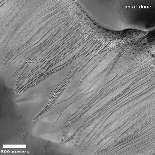
Most of the presentations at the conference this week focused on the recurring lineae, which I suspect is because of their seasonal aspect. This feature strongly suggests a water-related source for the lineae, and everyone who studies Mars is always focused on finding sources on Mars where liquid water might be found. Also, slope streaks appear more often in dunes, which also strongly suggests a dry process. One paper, however, did a comparison study of lineae with one specific kind of dune slope streak to see if the freatures might be related.

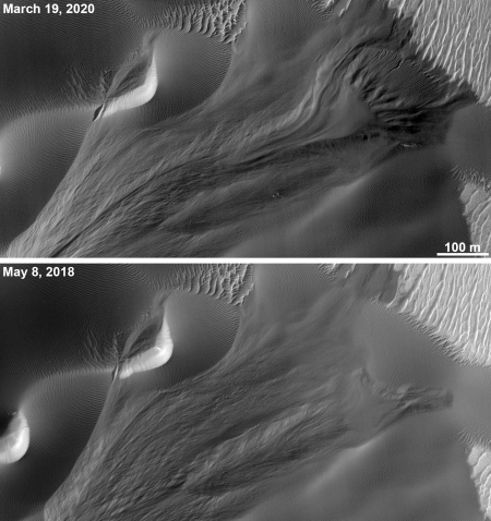
The most interesting result [pdf] for all these papers documented the apparent increase in recurring lineae following the global dust storm last year. The image at the top of that post is from this paper, and shows a fresh lineae where none had been prior to the storm. From the paper’s abstract:
» Read more

Land of mesas

Ariadnes Colles
Click for full image.

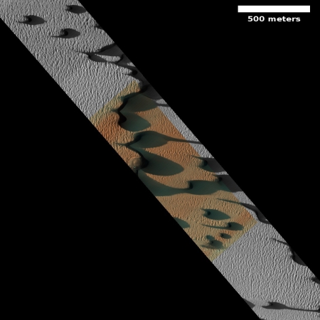
Cool image time! The Mars Odyssey science team today released the image on the right, cropped and rotated to show here, of a region on Mars named “Ariadnes Colles.”

The term colles means hills or knobs. The hills appear brighter than the surrounding lowlands, likely due to relatively less dust cover.

This is certainly a place with lots of hills, or to be more precise, mesas, as many of them seem to be flat topped.

The lack of dust cover on the tops is probably because, like on Earth, the winds blow much better once you get a bit above the surface. (This is why sailing ship builders kept adding higher and higher sails to their ships, until the top sails of clipper ships rose a hundred-plus feet above the deck.) These better winds clean off the mesa tops, just as they did to the solar panels on the rovers Opportunity and Spirit several times during their long missions.

Ariadnes Colles is another example of Martian chaotic terrain. Since this region is located deep in the cratered and rough southern highlands of Mars, the erosion that created these mesas was likely not water-flows. Was it wind? Ice?

Your guess is as good as anyone’s.

Confirmed: Ryugu is a rubble pile

Close-up of Ryugu's surface
Click for source paper [pdf].

At a special session today dedicated to results from the Hayabusa-2 probe to the asteroid Ryugu at the 50th Lunar and Planetary Science Conference in Texas, scientists confirmed from numerous data and images that the asteroid has a low density, is covered with boulders and pebbles, is very porous, and is thus a rubble pile that is held together by gravity, barely.

From their lead presentation [pdf]:

The estimated total porosity is even higher than that of rubble-pile asteroid Itokawa (44 ± 4%), indicating that asteroid Ryugu is also a rubble pile. This is consistent with a theory arguing that all Solar System bodies with diameter of ~1 km should be rubble piles and might have formed from reaccumulation of fragments generated by catastrophic disruption events of ~100-km sized parent bodies.

They also posit that the asteroid’s diamond shape is caused by the asteroid’s 3.5 hour rotation, which causes its weak rubble pile structure to be easily pulled to the equator, and then outward.

Another paper [pdf] did crater counts, and found that there are fewer large craters than one would expect.

The density of large craters (D>100 m) on Ryugu is lower than the empirical saturation level and its slope is steeper than that of the saturated distribution, suggesting that craters larger than 100 m are not saturated and the size distribution reflects the crater production function. However, craters smaller than 100 m are significantly under-saturated, suggesting that some crater erasure processes such as seismic shaking and armoring effect are active on the Ryugu surface. Based on cratering chronology model for the main belt, the surface age of Ryugu is estimated to be 5–200 [million years] from the size–frequency distribution of craters larger than 100 m.

In other words, this rubble pile is constantly being shaken by its rotation and time and later impacts, which steadily rewrites the surface.

If this asteroid was headed to Earth, I imagine the only safe solution to prevent disaster would be to slowly and gently deflect it so it only flies past. To do this will require an arrival far in advance of the schedule impact, to give time for the deflection process to work.

Snow on Mars?

Snow on Mars?
Click to see full image.

At today’s presentations at the 50th Lunar and Planetary Science Conference in Texas, scientists showed images and data [pdf] suggesting that many of the Martian gullies found on cliff faces are formed when the dust layer protecting underlying snow gets blown away and the exposed snow/ice then melts.

The image on the right was taken by the high resolution camera of Mars Reconnaissance Orbiter (MRO) in 2009, and has been cropped to post here. The white streaks are what they suggest is exposed ice/snow.

From their paper [pdf]
» Read more

Hayabusa-2 schedules explosion on Ryugu

The Hayabusa-2 science team has scheduled April 5 for when it will use the spacecraft to fire an explosive device into Ryugu to create a crater and debris cloud.

The probe is scheduled to detach a device loaded with explosives some 500 meters away from Ryugu. The device will set off the explosives using a timer some 40 minutes later and launch a copper “impactor” weighing about 2 kilograms into the asteroid’s surface.

The target point is several hundreds of meters away from where the space probe first touched down. The mission will require the spacecraft to move quickly to the other side of the asteroid so it won’t get hit by flying shards from the blast. A detached camera will shoot the moment of impact.

JAXA will analyze the size and shape of the crater, and how rocks fly off in a bid to collect underground samples for possible clues to the origin of the solar system.

This is different than the touchdown last month, as the spacecraft itself will not get close to the asteroid.

A pond on Bennu

Pond on Bennu
Click for full resolution.

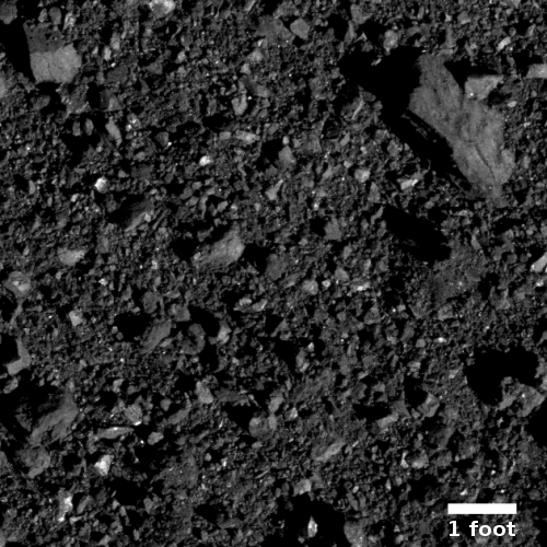
The OSIRIS-REx science team has released new high resolution images of one particular area on Bennu’s northern hemisphere. The image on the right, cropped and reduced to post here, shows what they label a “pond of regolith,” seen as the relatively smooth area in the upper left.

This is not literally a pond, but instead is a low-lying spot where smaller particles have settled over time, producing a flattish area that looks, and in some ways, resembles a pond or puddle, only in this case the material isn’t water but fine-grained dust or pebbles.

On March 19 the science team will be presenting their initial results at a special session at the 50th Lunar and Planetary Science Conference in Texas. That same day they will hold a press conference summarizing the most interesting aspects of those results. Stay tuned.

New analysis supports catastrophic floods and intermittent ocean on Mars

The intermittent ocean at the outlet to Marineris Valles

A new analysis of Martian data once again suggests that an intermittent ocean once existed in the planet’s northern hemisphere, and that it was fed by catastrophic floods coming down from the volcanoes through Marineris Valles.

“Our simulation shows that the presence of the sea would have attenuated cataclysmic floods, leading to shallow spillovers that reached the Pathfinder landing site and produced the bedforms detected by the spacecraft,” said [lead scientist Alexis Rodriguez].

The team’s results indicate that marine spillover deposits contributed to the landscape that the spacecraft detected nearly 22 years ago, and reconcile the mission’s in situ geologic observations and decades of remote-sensing outflow channel investigations.

The sea bears an uncanny resemblance to the Aral Sea on Earth in that in both instances they lack distinct shoreline terraces. Its rapid regression over shallow submerged slopes resulted in rates of shoreline front retreat too fast for the terraces to form. The same process could partly account for the long-recognized lack of northern plains shorelines.

“Our numerical simulations indicate that the sea rapidly became ice-covered and disappeared within a few thousand years due to its rapid evaporation and sublimation. During this time, however, it remained liquid below its ice cover,” said PSI Senior Scientist Bryan Travis, a co-author in the paper.

The map above shows the outlet region to the west and north of Marineris Valles. (The paper from which it is adapted is available on line here.) It shows that inland sea, created by the catastrophic floods. Because it sits at a lower elevation than the plains to the north, the floods that entered it ponded there, where they dried up. Only when the floods were at their highest did the water spill out into the northern plains.

In reading the paper, it confirms many of the suppositions I myself have made in my frequent posts analyzing numerous Mars Reconnaissance Orbiter (MRO) images, such as the lack of a clear shoreline because the ocean was short-lived. As it dried up its edge left patches of shoreline, at different elevations and in pondlike patterns, almost like the beach debris left behind by the tide.

The paper also shows that some of my guesses were not quite correct. For example, this new analysis says that the catastrophic floods only partly carved out the chaos terrain of Hydraotes Chaos, rather than do it all as I supposed here. Instead, the floods contributed, but much of the erosion occurred when the short-lived inland sea existed here, eroding away at the mesas from all sides.

Read it all. Though this remains a simulation based on what is presently very incomplete data and thus has many uncertainties, it will give you a much deeper understanding of what we presently theorize about the past geological history of Mars.

A gathering of dust devils

Dust devil tracks
Click for full resolution image.

A bunch of cool images! The European Space Agency (ESA) today released more than a dozen Martian images taken by the camera on its Trace Gas Orbiter spacecraft.

In addition to a snapshot of InSight and its landing area, “The images selected include detailed views of layered deposits in the polar regions, the dynamic nature of Mars dunes, and the surface effects of converging dust devils.” The release also included images showing details of two of Mars’ giant volcanoes, Olympus Mons and Ascraeus Mons.

The image I have highlighted to the right, reduced to post here, shows a spot on Mars where for some unknown reason dust devils love to congregate.

This mysterious pattern sits on the crest of a ridge, and is thought to be the result of dust devil activity – essentially the convergence of hundreds or maybe even thousands of smaller martian tornadoes.

Below is a side-by-side comparison of this image (on the right) with a Mars Reconnaissance Orbiter (MRO) image taken in 2009 (on the left).
» Read more

Trump’s budget will not “destroy” or “gut” science

Our terrible press does it again. Yesterday the Trump administration released its proposed 2020 federal budget [pdf], and as usual the pro-government propagandists in the media got to work to lobby against it.

This proposed budget will do none of these things.

These articles all fail to apply even the slightest and tiniest bit of context to their analysis. The budget numbers proposed by the Trump administration might reduce the budgets of some science agencies from what they had gotten the year before, but overall the proposed budgets remain gigantic, far more than received by these same agencies only a few years before.

You don’t believe me? Let me open your eyes.
» Read more

1 108 109 110 111 112 271