Curiosity faces the mountains

A cropped section from Perseverance's 1st panorama
A cropped section from Perserverance’s 1st panorama.
Click for full image.

Though the present excitement over the spectacular images and sounds coming down from Perseverance is certainly warranted, what must be understood is that this rover is presently only at the beginning of its journey, and is thus sitting on relatively boring terrain, from a merely visual perspective. The scientists might be excited, but to the general public, all we really are seeing is a flat dusty desert with some scattered rocks on the floor. In the far distance can be seen some hills and mountains (Jezero Crater’s rim), but they are very far away.

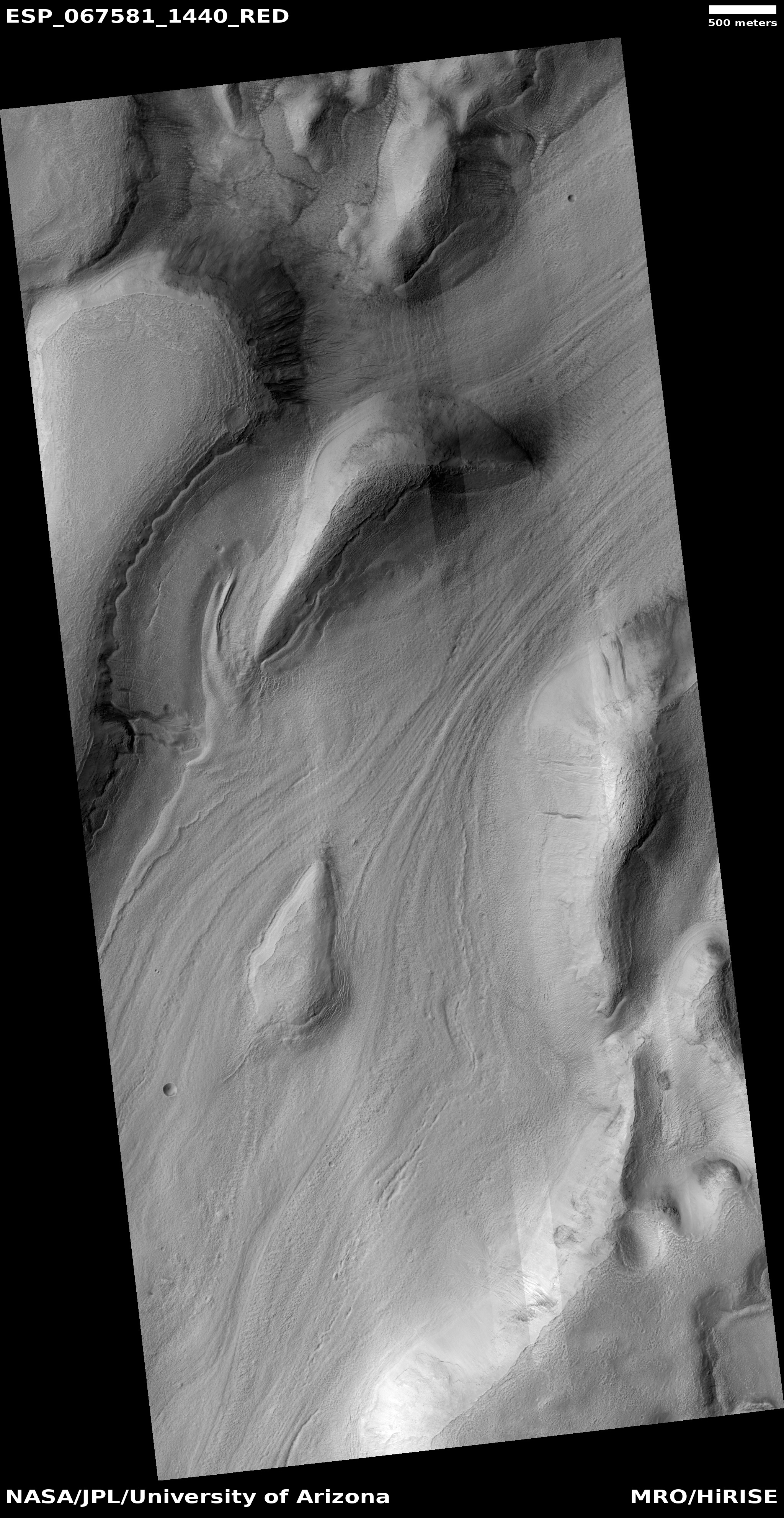
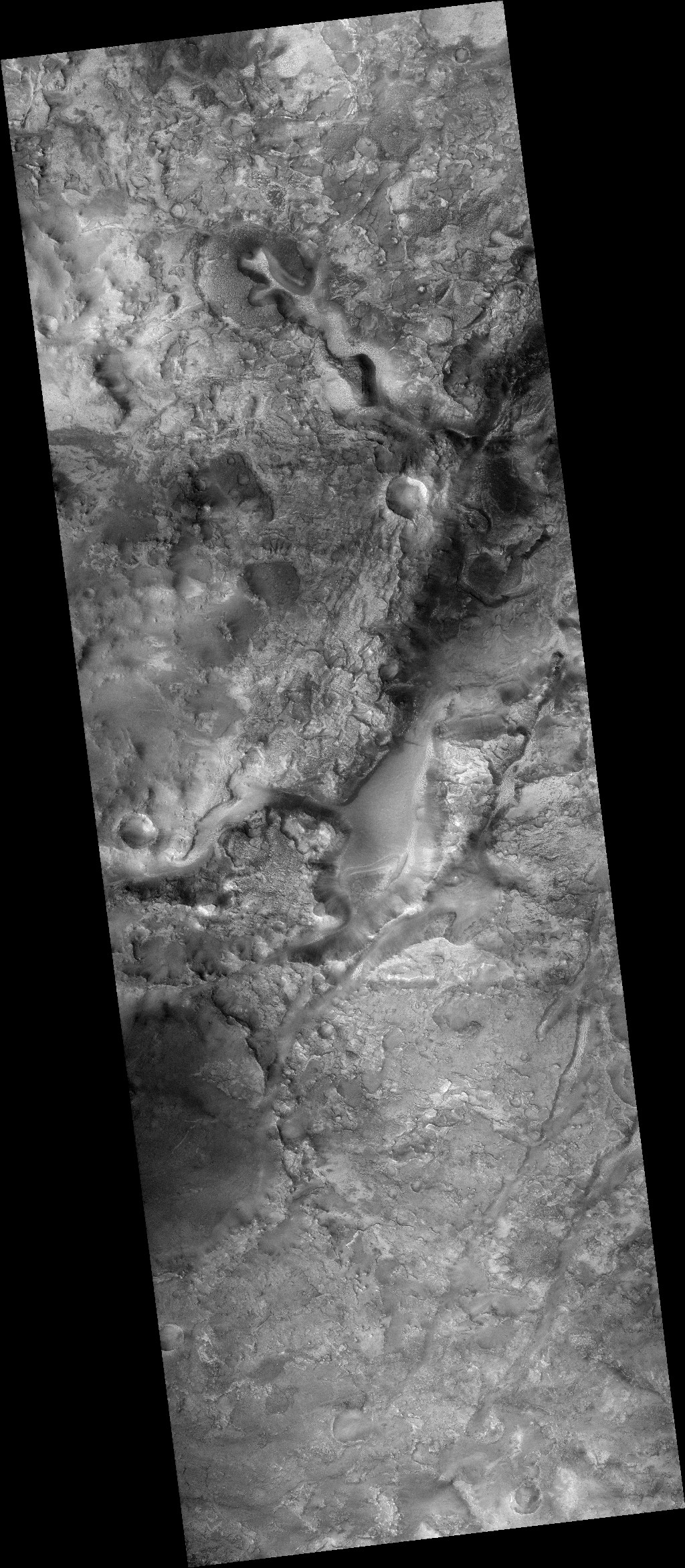
Curiosity, which the press and the public has largely forgotten about, is actually just beginning what will likely be the most breath-taking part of its journey. As I noted in my last rover update last week, Curiosity is now at the very base of Mount Sharp, and is about to enter the mountain’s canyons and initial slopes. For its past eight-plus years of roving it has been on the flat floor of Gale Crater, followed by some weaving among the smallest foothills of Mount Sharp. The views have been intriguing and exciting from a research perspective, but hardly breath-taking from a picture-taking point of view.

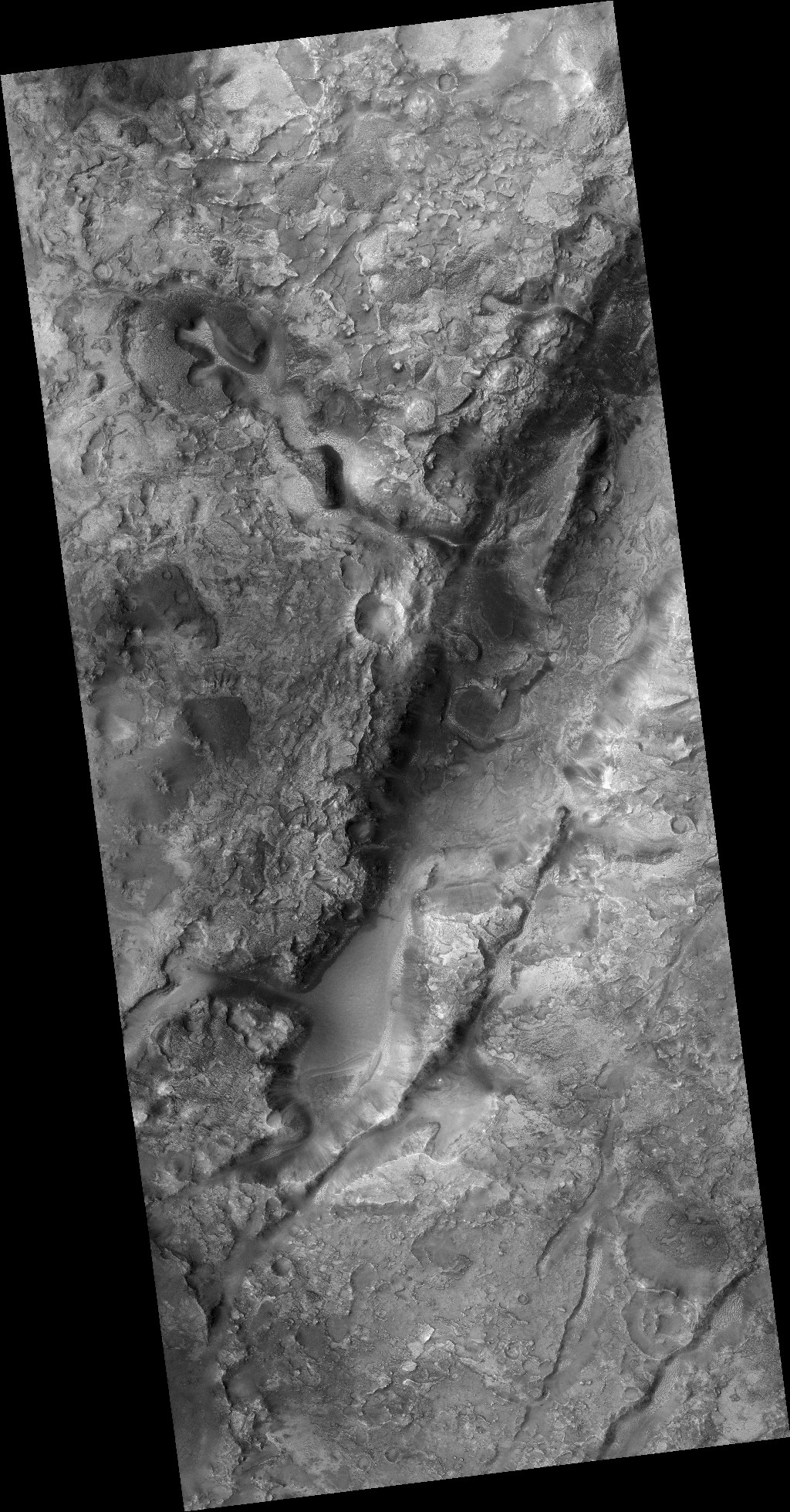
That is now changing. The picture below, taken by Curiosity just this week, gives us a taste of what is to come.
» Read more

11 comments

Strange ridge ripples on the windswept plateau above Mars’ biggest canyon

Strange ridges on Mars
Click for full image.

Today’s cool image is once again another of what I dub a “what the heck?” photo. The picture to the right, cropped to post here, was taken on December 17, 2020 by the high resolution camera on Mars Reconnaissance Orbiter (MRO) and captures some very strange ridges on the plateau above Mars’ biggest canyon, Valles Marineris.

The image, labeled merely as a “terrain sample,” was taken not as part of any specific research project but scheduled by MRO’s science team in order to maintain the camera’s temperature. When they do this they try to take pictures covering something interesting, but often it is a potshot that sometimes shows little of interest.

In this case the photo shows something very strange. The ridges in the sample are packed into one area only, but if you look at the full image you will see that they are also scattered about randomly and sometimes isolated on the flat plains surrounding this spot.

Interestingly, these ridges resemble the first “What the heck?” image I ever posted in 2019. That photo was located at about the same elevation as these ridges, but due west in the volcanic plains near Mars’s giant volcanoes and just off the western edge of the overview map below.
» Read more

2 comments

A iceberg of water ice floating on a Martian dry ice sea

Ice mesa near Mars' south pole
Click for full image.

British biologist John Haldane once once wrote, “The universe is not only queerer than we suppose, but queerer than we can suppose.”

Today’s cool image to the right, cropped to post here, is a fine example of Haldane’s words. It was taken on January 15, 2021 by the high resolution camera on Mars Reconnaissance Orbiter of a single lone mesalike feature sticking up in a flat expanse of Mars’ south polar dry ice/water ice cap.

I emailed Shane Byrne of the Lunar and Planetary Lab University of Arizona, who had requested the photo, to ask him what he thinks we are looking at. His response:

This region has a thick layer of CO2 ice sandwiched between water ice that’s above and below. CO2 ice is denser than water ice so I think a fragment of water ice of the underlying layer has risen up through the denser CO2 ice that covers this area (what geologists call a diapir).

Byrne also admits this remains merely “just a wild theory,” not yet confirmed.

Assuming this theory to be right, in a sense then this mesa is not really a mesa at all but an iceberg of water, floating not in a saltwater liquid ocean as on Earth but on a frozen sea of dry ice. Talk about queer! The wider shot below, taken by MRO’s context camera, illustrates how isolated this water iceberg is on that dry ice sea.
» Read more

4 comments

Mars: Planet of many glaciers

Moraines on Mars
Click for full image.

Today’s cool image more than simply cool, it reveals a wider picture of Mars that should be quite exciting to future colonists. The photo to the right, rotated, cropped, and reduced to post here, was taken on January 30, 2021 by the high resolution camera on Mars Reconnaissance Orbiter (MRO). What drew my attention to it was the title given to this uncaptioned photo: “Moraine-Like Ridges in Nereidum Montes.”

Moraines are the debris pile pushed ahead of any glacier. The picture shows what appear to be a series of moraines, likely caused by different periods of glacier activity when the glacier was growing. It also suggests that past active periods were more active than later ones, as with each active period the moraine did not get pushed out quite as far.

The location, Nereidum Montes, intrigued me, as I am not that familiar with it. I emailed the scientist who requested the image, Dan Berman, senior scientist at the Planetary Science Institute in Arizona, and asked him for more information. He suggested I read a very recent paper he co-wrote entitled “Ice-rich landforms of the southern mid-latitudes of Mars: A case study in Nereidum Montes.” From that paper I was able to produce the map of Mars below that shows the regions on the planet where scientists now think hold the greatest concentrations of glaciers.
» Read more

0 comments

Perseverance begins journey with 1st test drive

Perseverance's future planned route
Click for full image.

On March 4th the engineers on the Perseverance science team successfully completed the rover’s first test drive.

Ground teams commanded the rover to drive forward, turn in place, and then back up. The first 33-minute test drive covered just 21 feet, or 6.5 meters,but Perseverance will soon travel much farther. โ€œOur first drive went incredibly well,โ€ said Anais Zarifian, a Perseverance mobility test engineer at JPL.

Perseverance has six aluminum wheels, each with titanium spokes for support, and a suspension capable of traveling over rocks as big as the wheels themselves. The one-ton rover is based on the design of NASAโ€™s Curiosity rover, which landed on Mars in 2012, but with some improvements.

The wheels on Perseverance are sightly narrower, have a larger diameter, and are made of thicker materials, Zarifian said. Engineers also changed the tread pattern on the wheels to reduce the risk of damage from sharp rocks, which created dings and cuts in Curiosityโ€™s wheels.

The map above shows the route the science team has presently chosen for Perseverance, a revision from earlier routes created prior to landing. The white dot on the right is the rover’s present position, the blue and purple lines are two alternative routes they are considering for their route to the delta coming out of Neretva Vallis. The yellow route up the delta is especially exciting in that it gets them onto it much sooner than previous plans.

Which route they choose for the initial journey I think will partly depend on which provides the best location to test fly Ingenuity, the experimental helicopter on the rover. Scientists and engineers I am sure are presently poring over high resolution images from Mars Reconnaissance Orbiter (MRO) in order to make that choice. At this link, centered on Perseverance’s present location, you can take a look at all those images by MRO by selecting the arrow icon at the top and then clicking on any red box. Because so many photos have been taken there is a lot of overlap, so each click will give you many pictures to look at.

5 comments

Ice-filled Martian sinkhole

Ice-filled pit on Mars
Click for full image.

Cool image time! The pit shown in the high resolution photo to the right (image rotated, cropped, and reduced to post here) was taken on January 25, 2021 and labeled by the Mars Reconnaissance Orbiter (MRO) “Collapse Pit in Graben with Ice Fill.”

There is a lot of information in that title. First, a graben is a geological feature where a section of terrain drops relative to the surrounding terrain, producing a depression. Second, it appears the graben in this region is mostly filled with debris, probably wind-blown dust or sand or volcanic ash.

Third, at this particular spot the filling material sank, like a sinkhole on Earth, creating the pit.

And fourth, and maybe most intriguing, the scientists think that this pit is now filled with ice. At 47 degrees north latitude, the location is prime for such ice, and the interior material resembles similar glacial features seen in many other mid-latitude craters.
» Read more

2 comments

Dao Vallis: A giant river of ice on Mars

The glacier in Dao Vallis
Click for full image.

Cool image time! The photo to the right, rotated, cropped, and reduced to post here, was taken on December 26, 2020 by the high resolution camera on Mars Reconnaissance Orbiter (MRO). It shows an apparent glacial flow in a canyon heading downhill to the southwest, with evidence of a gully on its western wall whose collapse apparently squeezed into that glacial flow, pushing it to the east.

What makes this particular image interesting is not its uniqueness but just the opposite. Almost every high resolution picture along the length of this 750 mile long canyon, dubbed Dao Vallis, shows the same thing, an ice-filled ravine with that ice flowing like a river downhill.

The overview map below provides some spectacular context.
» Read more

4 comments

China releases first Tianwen-1 images of rover landing site

The rover landing site for Tianwen-1's rover

The new colonial movement: China yesterday released the first two images taken by its Mars orbiter Tianwen-1 of its planned rover landing site in the northern lowland plains of Mars.

The image to the right is a mosaic of two wide angle photos from the context camera on Mars Reconnaissance Orbiter (MRO). The white cross is the spot of the latitude and longitude that had previously been leaked to the Chinese press as the landing site. The white box shows the area covered by the only high resolution MRO photo, as of October 2020. Since then MRO has taken a number of additional high resolution images of this area.

The red boxes mark the areas covered by Tianwen-1’s two new images. Below is a reduced version of the larger of these two photos.
» Read more

4 comments

Mining country on Mars?

The southern end of Nili Fossae

Today’s cool image might very well be giving us a glimpse of one of the most promising regions on Mars for future mining. The photo to the right, rotated, cropped, and reduced, is made up of two context camera images from Mars Reconnaissance Orbiter (MRO), found here and here. I chose to begin with this wider context camera mosaic because this is one of the rare times the context camera is more exciting an image than the close-up high resolution photo.

This photo covers the southern end of the one of the two curved fissures dubbed Nili Fossae and are thought to be left over evidence of the giant impact that created Isidis Basin to the southeast. These two fissures are about 300 miles long, and can be as much as 1,600 feet deep in places. At this southern end, we can see what look like at least two different drainage channels feeding into the fissure.

The overview map below provides the context of this location on Mars, including its relationship to Jezero Crater where Perseverance now sits.
» Read more

1 comment

Cave boxwork on the Martian surface

Boxwork in Wind Cave on Earth
Boxwork inside Wind Cave, South Dakota, mere inches across.

Anyone who has ever visited either Wind or Jewel caves in South Dakota has likely seen some wonderful examples of the cave formation boxwork, formed when the material in cracks is more resistant to erosion that the surrounding bedrock, which once eroded away leaves behind the criss-crossing ridges seen in the picture to the right.

Today’s cool image provides us what appears to be an example of boxwork on Mars. However, unlike on Earth it is not in a cave but on the surface. It is also much larger. Instead of the ridges being almost paper thin and stretching for inches or feet, this Martian boxwork is feet wide with ridges extending hundreds of feet in size, as shown by today’s cool image below.
» Read more

1 comment

A deep south Martian dune with bright patches

Dune with bright patches
Click for full image.

Cool image time! Last week the MRO science team posted a new captioned image entitled “Bright and Dark Dunes” featuring a particularly large single dune in the floor of a 25-mile-wide unnamed crater located at about 68 degrees south latitude. The photo to the right, rotated, cropped, reduced, and color enhanced to post here, shows that dune. According to the caption, written by Colin Dundas of the U.S. Geological Surveyโ€™s Astrogeology Science Center in Arizona,

This image shows a large sand dune with bright patches. Martian dunes near the poles often have bright patches in the spring, when seasonal frost is lingering. However, this image is from late summer, when frost is long gone. What is going on here?

A close-up look with [MRO’s high resolution camera] provides some clues. The bright patches are made up of large ridges that look like wind-blown bedforms. Additionally, the bright patches are yellowish in the infrared-red-blue image. In enhanced color, most sand on Mars is blue but dust is yellow. This suggests that the bright bedforms are either built from, or covered by, dust or material with a different composition.

Thus, the bright patches reveal either aspect of the dune’s underlying structure, either inherent in the bedrock itself, or the texture of its surface that allows it to hold more dust. As Dundas adds, “I think more study would be needed to determine the answer in this particular case.”

There are other aspects of this dune that can be seen by a look at the wider view afforded by MRO’s context camera below.
» Read more

0 comments

Skiing dry ice boulders on Mars, captured in action!

Grooves in dune created by sliding dry ice blocks
Click for full image.

Today’s cool image is an update on a previous cool image published in April 2020 about how scientists believe the grooves seen on the slope of a giant dune in Russell Crater on Mars are believed to be formed by frozen blocks of carbon dioxide sliding down the slope when spring arrives. The photo to the right, taken on March 3, 2020 by the high resolution camera on Mars Reconnaissance Orbiter (MRO) and rotated and cropped to post here, shows these grooves. As I wrote then,

Because the block is sublimating away, the gas acts as a lubricant so that it can slide down the hill. If large enough, the dry ice block will stop at the base of the hill to disappear in a small pit. If small enough, it actually might completely vaporize as it slides, explaining the grooves that appear to gradually fade away.

The scientists actually did a test on Earth, buying a dry ice block at a grocery store and releasing it at the top of a desert dune. Go to my April 2020 link above to see the very cool video.

Several planetary scientists did further combing through many MRO photos of this dune and now think they have spotted examples where the camera actually captured a block as it was sliding downhill.
» Read more

1 comment
1 98 99 100 101 102 157