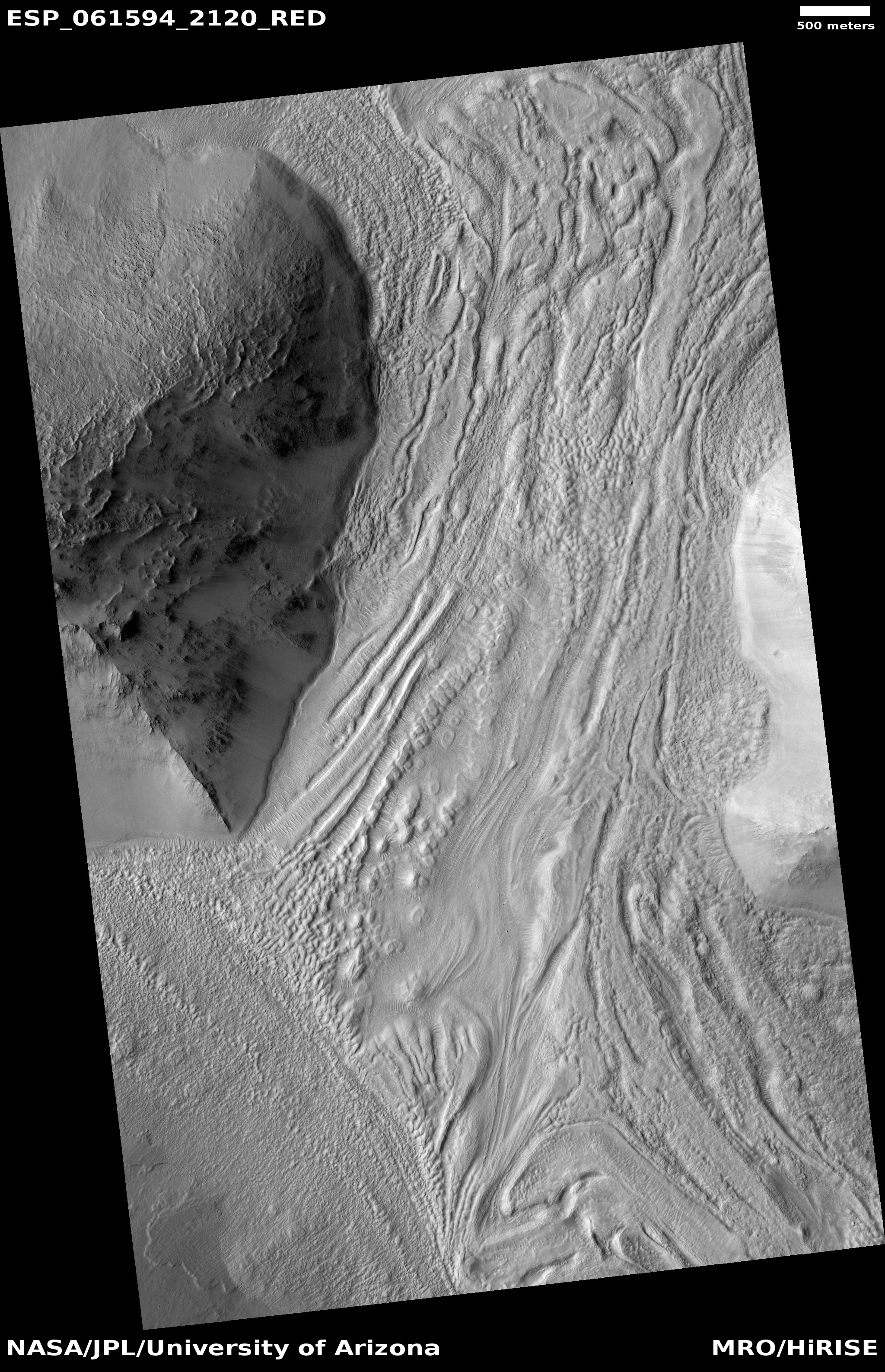
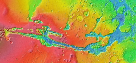
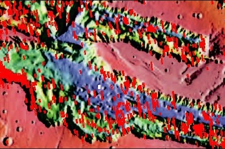
Megadunes in the giant canyon of Mars’ north polar icecap

Martian megadunes at the beginning of summer
Click for full image.

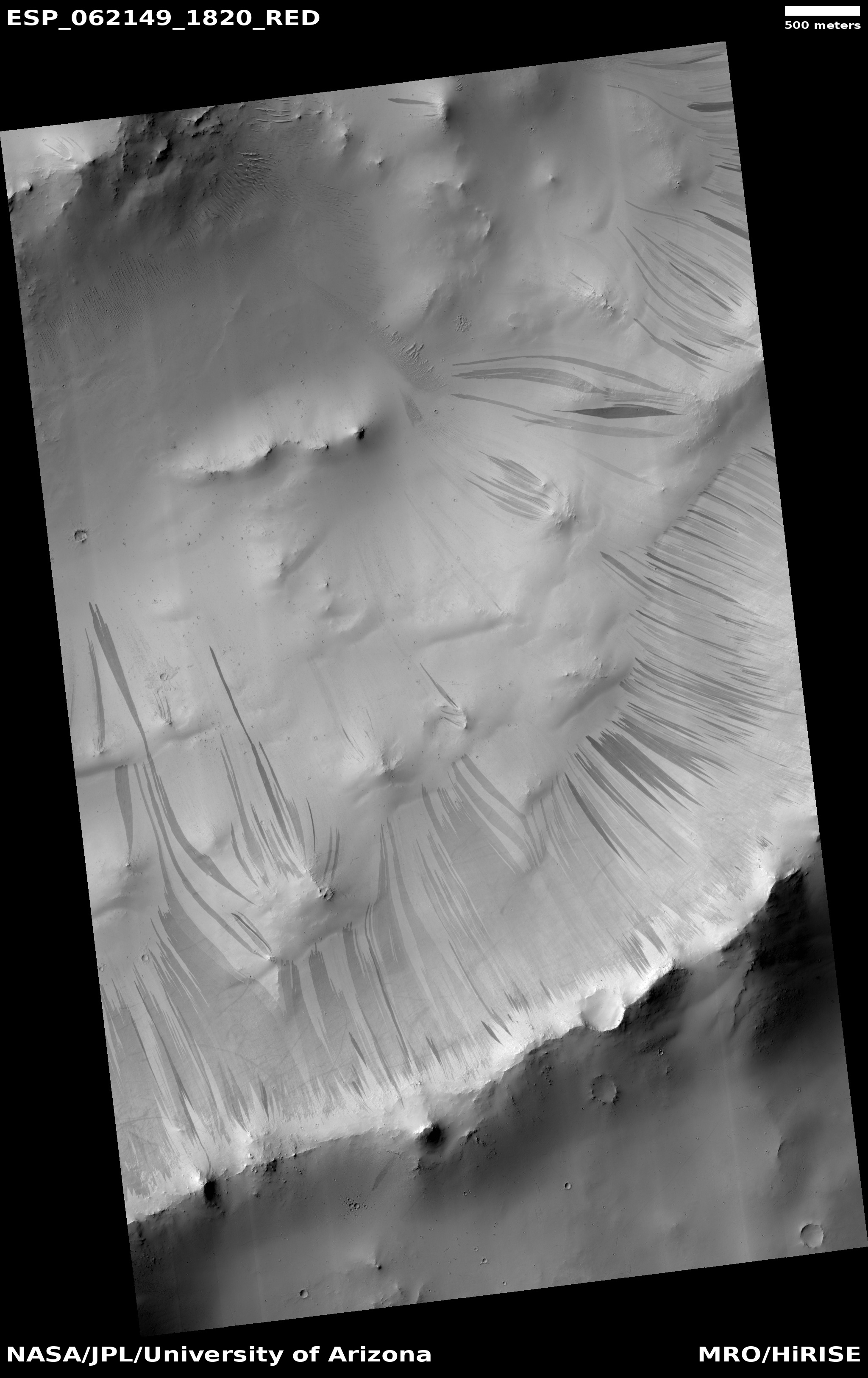
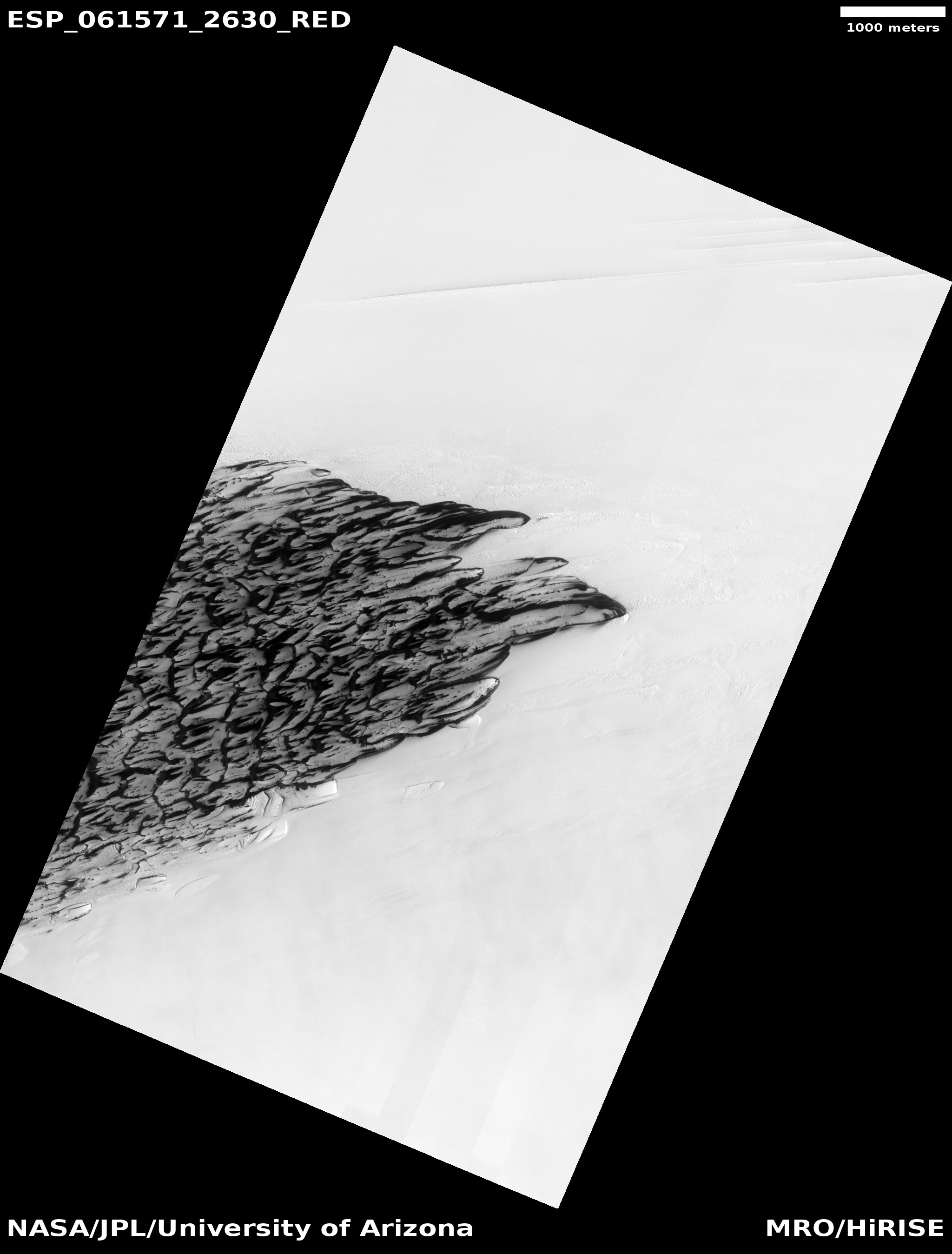
Cool image time! The photo to the right, cropped and reduced to post here, was taken by the high resolution camera of Mars Reconnaissance Orbiter (MRO) on September 15, 2019, right at the beginning of summer at the north polar icecap of Mars.

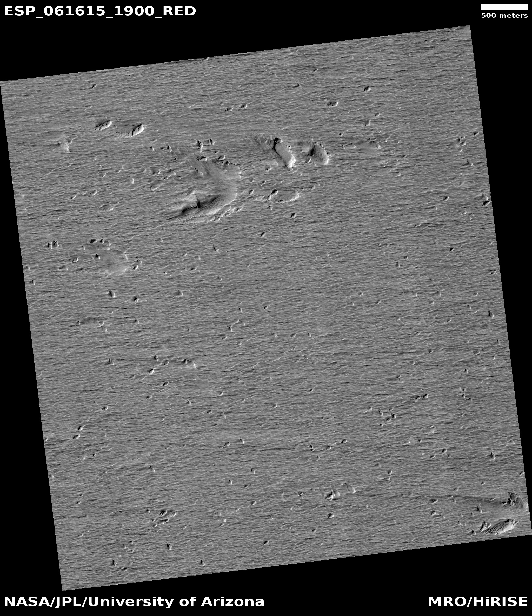
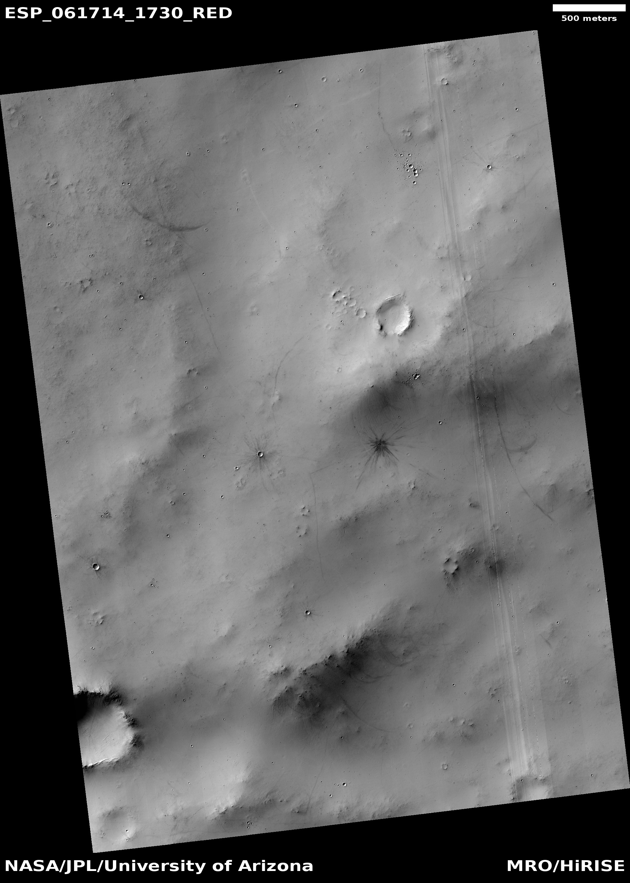
Without a larger context it is very difficult to figure out what this image shows. The image title, “Seasonal Changes of Chasma Boreale Megadunes,” gives us some basic clues. The streaks of black and dark grey are giant dunes, with this image showing their trailing edge. The darkest streaks are likely places where the thin winter mantle of dry ice has begun to sublimate away with the coming of spring, exposing the darker sand dunes below. The surrounding flat white areas are either the permanent water ice of the icecap or the surface of the lowland northern plains that surround that icecap.

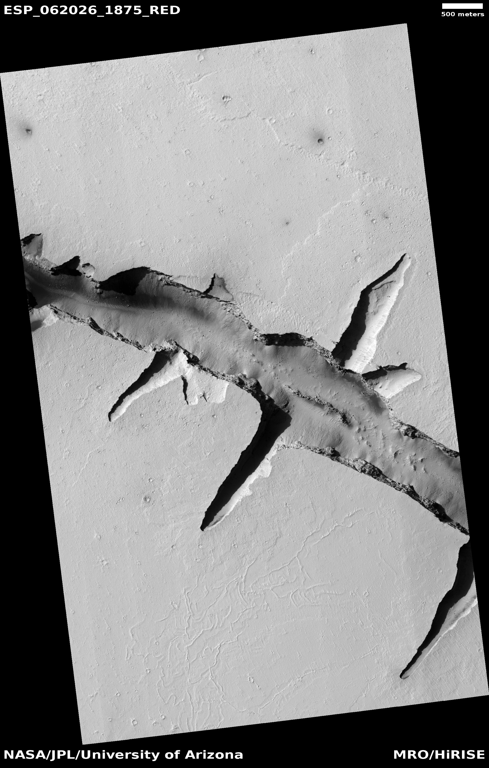
The montage below shows a series of monitoring photos, beginning in 2018 during the last Martian summer and continuing through the start and middle of the spring and ending with the photo above. It shows the seasonal evolution of that upper carbon dioxide dry ice mantle, which reveals the darker dunes below as that dry ice mantle sublimates away.
» Read more

3 comments

Martian impacts and streaks

Slope-streaked crater on Mars
Click for full image.

In the most recent image download from the high resolution camera on Mars Reconnaissance Orbiter (MRO), there was the cool image to the right, reduced and cropped to post here, of a crater that appeared to have hundreds and hundreds of slope streaks along its inner slopes.

Slope streaks are quite mysterious. They are found in the equatorial regions as dark (though sometimes light) streaks on steep slopes, appearing throughout the year and slowly fading over time. They also appear to be a geological phenomenon unique to Mars. Nothing on Earth or any other planet appears to correspond.

As such, their nature and cause remains unknown, though there are a bunch of theories, with the most popular being that these are a kind of dust avalanche. They are always found in connection with dust-covered terrain, but they also make no significant topological change to the surface, other than brightness.

The slope streaks in this crater are especially intriguing, because of the number of streaks. In digging further into the MRO archive I found a number of images of this crater and its surrounding terrain. It appears that sometime before 2012 there was a relatively recent impact close to the exterior of the eastern rim of this crater. The image below, taken in 2014 by MRO, shows this impact as the large dark splotch, with the new crater indicated by the arrow..
» Read more

1 comment

The dark splotches on Mars: Magnets for dust devils

Olympus Maculae, land of dark splotches

One of the numerous geological mysteries that planetary scientists have discovered among the many high resolution images taken by the various Martian orbiters are a series of dark splotches, ranging in diameter from one to fifteen miles, running in an east-west line on the lower western slopes of the giant volcano Olympus Mons.

Scientists have dubbed this string of splotches Olympus Maculae and, because of their superficial resemblance to the islands of Hawaii, have labeled each splotch, or macula, after those islands, as shown in the overview map above, created by geologist Kirby Runyon of the Applied Physics Lab in Maryland as part of a presentation [pdf] given at a science conference in September 2019.

Prior to the 2018 global dust storm on Mars scientists were not quite sure what caused these dark patches. The data suggested the maculae were less dusty than the surrounding terrain, but why this was so was not clear.

The advent of that storm however gave them a chance to get before and after photos. In October 2018 I found several images in monthly download of new images from the high resolution camera of Mars Reconnaissance Orbiter (MRO) and posted them, making a vain attempt to locate what had changed. As I wrote,

I found that MRO has taken images of this location twice before, in 2007 and in 2009. I spent about fifteen minutes trying to find something that had changed, but was unable to locate anything, other than what look like a few wind-blown streaks probably caused by dust devils. I suspect I do not know what to look for.

I then made some guesses about what caused these splotches, all wrong I have since learned.

Since then more images of these splotches have been downloaded from MRO, all once again indicating that changes have been detected. Below is a sequence of images of the splotch dubbed Kaโ€™ula, the first taken in 2008, the second in 2018 just after the global dust storm, and the third in 2019, one year after the storm. Set side-by-side the changes are more obvious.
» Read more

2 comments

A crack in the Martian crust

Crack in the Martian crust
Click for full image.

Cerberus Fossae

The photograph to the right, reduced and cropped to post here, was imaged on October 20, 2019 by the high resolution camera on Mars Reconnaissance Orbiter (MRO). It shows a spectacular thousand-foot-deep canyon in the region of Cerberus Fossae, an area of Mars crossed by numerous deep east-west fissures and depressions.

Hidden in the small white box on the eastern end of that canyon are Martian geological features, small and at first glance not that interesting, that are of great significance and the focus of intense research.

The map to the right shows an overview of the region. The yellow cross shows the location of this particular crack.

In my previous post about Cerberus Fossae, I had incorrectly assumed that these cracks and similar lines of pits or depressions were caused by the sinking of surface material into underground lava tubes. While this is possible in some cases, it is not the main cause of these cracks. Instead, they were formed due to the pressure from below caused by the rise of the surrounding giant volcanoes, Elysium Mons to the north and Olympus Mons to the east. That pressure stretched the crust until it cracked in numerous places. In Cerberus Fossae this produced a series of parallel east-west fissures, some more than seven hundred miles long.

The young age of Cerberus Fossae is dramatically illustrated by the wider mosaic below, showing the entire crack.
» Read more

0 comments

Martian “What the heck?” formations

What the heck caused these?
Click for full image.

Cool image time! In digging through the new images that come down from the high resolution camera on Mars Reconnaissance Orbiter (MRO), my reaction sometimes is “What the heck caused that?”

That was my reaction when I looked at the image to the right, cropped to post here.

The full image, taken on October 6, 2019, shows the floor of one of the many north-south fissures found in the volcanic Tharsis Bulge west of Valles Marineris and east of Olympus Mons. The fissures are caused when the crust is pushed upward by volcanic pressure, causing the surface to crack.

In this case the mystery is that patch of east-west ridges at the bottom of this somewhat wide fissure. While they might be dunes, they do not resemble dunes, as they have a rigid and somewhat sharp appearance. More puzzling is their somewhat abrupt appearance and disappearance. Except for its northern end, the edges of the patch are so sharply defined. If these were dunes you’d think they’d fade away more gradually.

Could the ridges be a more resistant subsurface feature slowly being revealed as surface material erodes away? Sure, but their orientation is completely opposite to the north-south fissures that dominate this region. One would expect deeper features to reflect that same general orientation. These ridges do not.

This image was dubbed a “Terrain Sample,” which means it was taken not because of any specific research goal, but because the scientists who run MRO’s high resolution camera had a gap in their schedule and needed to take a picture to maintain the camera’s proper temperature. In such cases they often take somewhat random images, not knowing what they will find. In this case they struck geological gold, a mystery that some postdoc student could spend a lot of time analyzing.

3 comments

More Martian pits, filled and unfilled!

Pit in Ceraunius Fossae
Click for full image.

Overview of Ceraunius Fossae

Time for what has almost become a monthly pit report from Mars Reconnaissance Orbiter (MRO). The November image download from the spacecraft’s high resolution camera included two pit-related photographs, both very different. To the right is the first, cropped to focus on the pit and the immediate surrounding terrain. Below that is a wider overview map to provide the context.

This pit’s location is indicated by the white box at the southern end of a region dubbed Ceraunius Fossae, made of hundreds and hundreds of parallel north-south fissures extending more than seven hundred miles south of the giant volcano Alba Mons and caused when the ground was stretched from below, causing it to crack.

This surrounding terrain helps to explain the pit’s origin. First it is located in a north-south depression with a number of other less pronounced depressions. While these do not line up precisely, they still suggest that they are sinkholes where the surface material is draining downward into voids below. Normally the assumption would be the existence of a lava tube, but here the downward grade is very small. Instead, what is likely happening is that the ground is being stretched, causing cracks to form into which surface material slips downward.

The Ceraunius Fossae fractures are extensional features produced when the crust is stretched apart…. Mechanical studies indicate that a regional pattern of radiating graben and rifts is consistent with stresses caused by loading of the lithosphere by the enormous weight of the Tharsis bulge….Several generations of grabens with slightly different orientations are present in Ceraunius Fossae, indicating that stress fields have changed somewhat over time.

In addition to producing normal faults and graben, extensional stresses can produce dilatant fractures or tension cracks that can open up subsurface voids. When surface material slides into the void, a pit crater may form. Pit craters are distinguishable from impact craters in lacking raised rims and surrounding ejecta blankets. On Mars, individual pit craters can coalesce to form crater chains (catenae) or troughs with scalloped edges.

That’s what we see here. The pit is suggestive of a void below, but it is likely not going to be a long coherent underground passage but a serious of random gaps, aligned roughly along the larger crack and producing the various depressions on the surface.

Today’s second pit is of an entire different nature.
» Read more

1 comment

Mid-latitude Martian glacier?

Glacier on Mars?
Click for full image.

Cool image time! I have posted a lot of Mars photographs in the past few months showing possible glaciers in the mid-latitudes of Mars, where scientists think they have identified a lot of such features. Today is another, but unlike many of the previous examples, this particular feature more closely resembles a typical Earth glacier than almost any I have so far posted.

Based on the image’s title, “Lineated Valley Fill in Northern Mid-Latitudes,” given by the science team for the high resolution camera on Mars Reconnaissance Orbiter (MRO), I suspect that it remains unproven that these are features of buried glacial ice. Thus, they use a more vague descriptive term, lineated, to avoid pre-judging what these features are.

Nonetheless, a glacier is sure what this lineated valley fill looks like. See for example the Concordia confluence of two glaciers in the Karakoram Mountains of Pakistan, near the world’s second highest mountain, K2. Though obviously not the same, you can see many similarities between this Martian feature and Concordia.

MRO has taken only three photographs of this particular valley, with one image useless because it was taken during a dust storm. Yet, the other good image, farther downstream in this valley, shows very similar features.

The valley itself is formed from chaos terrain, located in the transition zone between the southern cratered highlands and the flat northern lowlands where a possible intermittent ocean might have once existed. Thus, for buried ice to be here is quite possible.

0 comments

Unearthly pit in Martian northern icecap

Giant pit in Martian North polar icecap
Click for full image.

Cool image time! It is spring in the Martian north, and thus the Sun has risen and remains in the sky for most if not all of each day, circling the horizon. As such, it illuminates polar icecap features that are strange and weird and hard to decipher based on our expectations here on Earth.

The photograph to the right, cropped and reduced to post here, is a good example. It was taken on September 20, 2019 by the high resolution camera on Mars Reconnaissance Orbiter (MRO), and shows a pit in the outer regions of the polar icecap, an area where that water icecap remains relatively stable, but that is also at a low enough latitude that summer sunlight can cause some erosion and sublimation of the ice.

The bottom of the pit is the center of the bullseye, with the layered features in the surrounding walls showing the many layers inside the icecap, built up over centuries, then slowly revealed as the ice in this pit slowly sublimated away.

You can get a better sense of what you are looking at by the overview map below.
» Read more

0 comments

Sinkholes galore!

Sinkholes galore south of Olympus Mons
Click for full image.

Cool image time! The photograph to the left, cropped to post here, was part of the November image dump from the high resolution camera on Mars Reconnaissance Orbiter (MRO). It shows a wind-swept dusty plain trending downhill to the west that is filled with more than a hundred depressions or sinkholes.

Unlike other pit images I have posted previously, this one is not focused on one particular pit or a string of pits. Instead, what makes it interesting is the large number of pits, scattered across the terrain in a random pattern. Their random distribution suggests that they are unrelated to any specific underground feature, such as a lava tube. Instead, some aspect of the underground geology here is causing the ground to sink at random points.

Below is an overview map showing where this dusty pit-strewn plain is located, indicated by the blue cross.
» Read more

1 comment

Recent impact on Mars

Recent impact on Mars
Click for full image.

Cool image time! While finding recent impacts on Mars is not that unusual, the image to the right, found among the November image download from the high resolution camera on Mars Reconnaissance Orbiter (MRO), was dramatic enough that I decided that more people besides planetary scientists should see it. For scale the photograph is exactly 500 meters wide.

The photograph, taken September 26, 2019, also illustrates all the typical aspects of impact craters, and how they change the landscape.

This impact took place sometime between July 17, 2012 and January 4, 2018. We know this because it wasn’t there in a low-resolution image taken by the wide angle survey camera on MRO on the first date but was there when that same camera took another picture on the second date. Below is a side-by-side comparison of that July 17, 2012 image with the high resolution 2019 image above.
» Read more

1 comment

A journey into the depths of Valles Marineris

Valles Marineris

Cool image time! Rather than start with the cool image, let’s begin with the long view. To the right is a wide mosaic of Valles Marineris on Mars, the largest known canyon in the solar system. About 2,500 miles long and 400 miles wide, this canyon is so large that it would cover most of the United States if put on Earth. The Grand Canyon, 500 miles long by 19 miles wide, could easily fit within it and not be noticed. In depth Valles Marineris is equally impressive, with a depth of more than four miles, about four times deeper than the Grand Canyon.

A closer view of the central regions of Valles Marineris

The white cross in the mosaic above is where we are heading. You can see it as the white box in the zoomed in overview to the right. This central part of Valles Marineris is named East Melas Chasma, and the red boxes indicate locations where the high resolution camera of Mars Reconnaissance Orbiter (MRO) has already taken images.

As you can see, we do not yet have many high resolution images of this part of the canyon floor. The white box is the most recent image, and is the subject of today’s post.
» Read more

3 comments

Polygons on Mars

Scallops and polygons on Mars
Click for full image.

Cool image time! The photograph on the right, cropped to post here, was taken on September 25, 2019 by the high resolution camera on Mars Reconnaissance Orbiter (MRO) and made public in its November image release. It shows the weird but very typical scalloped terrain, with its adjacent polygon pattern of fractures, found routinely in the northern lowland plains of Utopia Planitia on Mars. From an earlier captioned image from 2006 of these same features:

The scalloped depressions are typical features; a smooth layered terrain located between 40 and 60 degrees in both hemispheres. Scalloped depressions probably form by removal of ice-rich subsurface material by sublimation (ice transforming directly from a solid to a gaseous state), a process that may still be active today. Isolated scalloped depressions generally have a steep pole-facing scarp and a gentler equator-facing slope. This asymmetry is interpreted as being the result of difference in solar heating. Scalloped depressions may coalesce, leading to the formation of large areas of pitted terrain.

The polygonal pattern of fractures resembles permafrost polygons that form in terrestrial polar and high alpine regions by seasonal-to-annual contraction of the permafrost (permanently frozen ground). On Earth, such polygons indicate the presence of ground ice.

On Earth these polygons are most often seen in mud, usually suggesting a drying process where the ground contracts with the lose of fluid. On Mars the cracks probably also form from contraction, but not by the lose of fluid but the lose of water ice as it sublimates into a gas.

These polygons and scallops illustrate an important feature of Mars’ vast northern plains. On large scales these plains appear flat and featureless. Up close however many many strange features, like the polygons and scallops in this image, come into view.
» Read more

3 comments
1 75 76 77 78 79 90