Gil Levin, a instrument project scientist for one of the science experiments on the Mars Viking landers in the 1970s, has passed away at 97.
Levin deserves special mention because he believed for years that his experiment, called “labeled release,” had possibly found evidence of life.
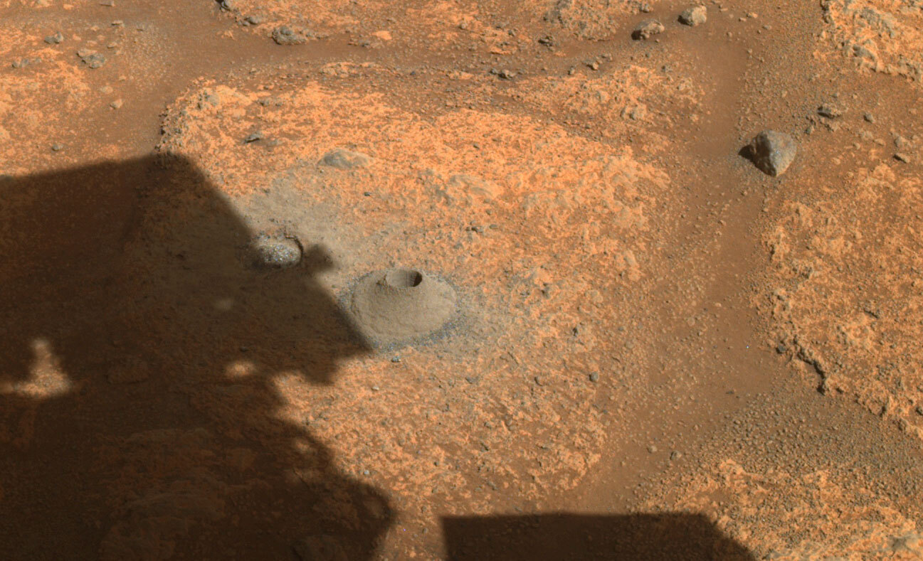
Dr. Levin’s experiment employed a nine-foot arm to scoop Martian soil into a container, where it was treated with a solution containing radioactive carbon nutrients. Monitors detected the release of radioactive gas, which Dr. Levin interpreted as evidence of metabolism.
“Gil, that’s life,” Straat said when they saw the results.
The findings held true for both Viking 1 and Viking 2, which took samples from different regions of the planet. Other experiments aboard the Viking, however, used different methods to conclude that Martian soil did not contain carbon, an element found in all living things.
Dr. Levin stood by his findings, but top NASA scientists disagreed, saying that the response he observed was the result of inorganic chemical responses, not biological processes. “Soon thereafter,” Dr. Levin told the Johns Hopkins University School of Engineering Magazine last year, “I gave a talk at the National Academy of Sciences saying we detected life, and there was an uproar. Attendees shouted invectives at me. They were ready to throw shrimp at me from the shrimp bowl. One former adviser said, ‘You’ve disgraced yourself, and you’ve disgraced science.’”
I met Levin once and interviewed him several times. With amazing grace and cheerfulness he always emphasized that his results needed to be confirmed, and there was certainly room for skepticism, but to reject them outright was not how the scientific method worked.
Levin however was never awarded another NASA project, essentially blackballed because of his 1970s claims, even though later research hinted at the possibility that he may have been right.
R.I.P. Gil Levin. Though the overall data we have gotten from Mars in the half century since still favors a non-life explanation for his experiment, the uncertainty remains quite large. He could have been right.
More important than his uncertain result, however, was his dedication to the proper scientific method, where you let the data speak for itself and never dismiss any possibility if that is what the data shows you.


