A great hike to do on Mars!

Knife Mesa at the exit from Kasei Valles
Click for full image.

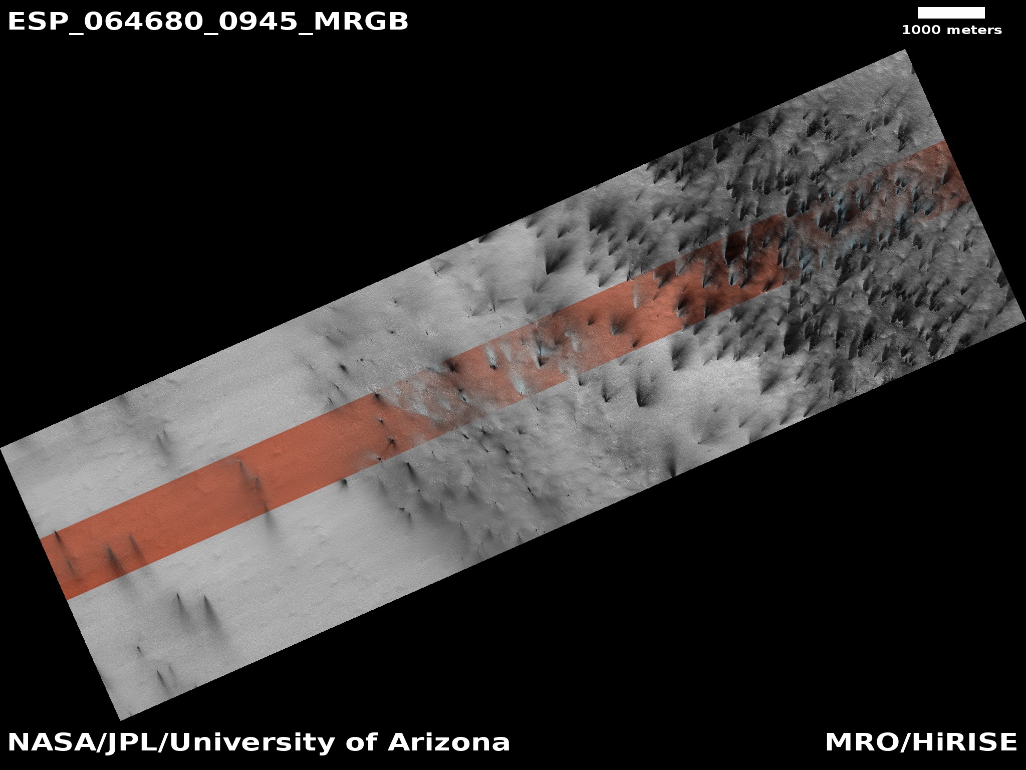
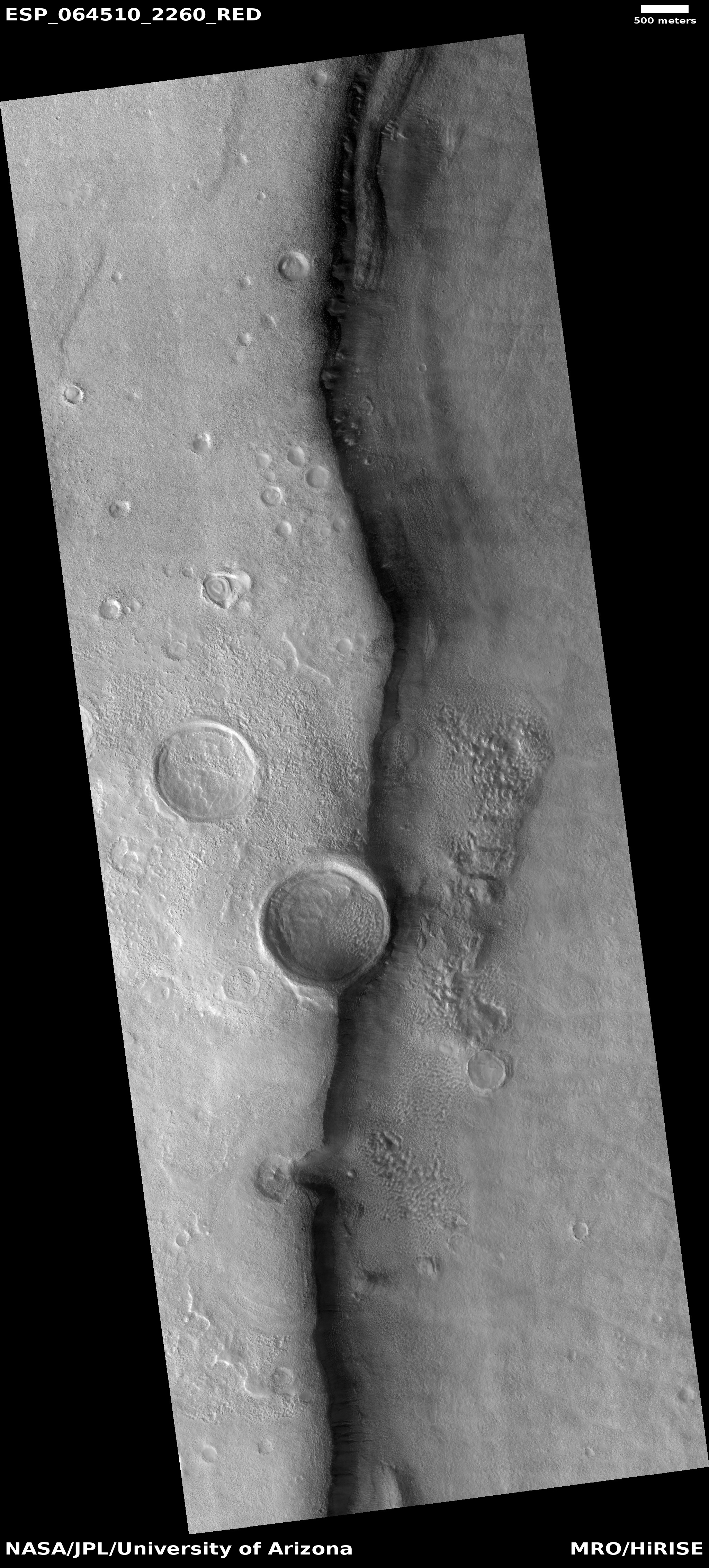
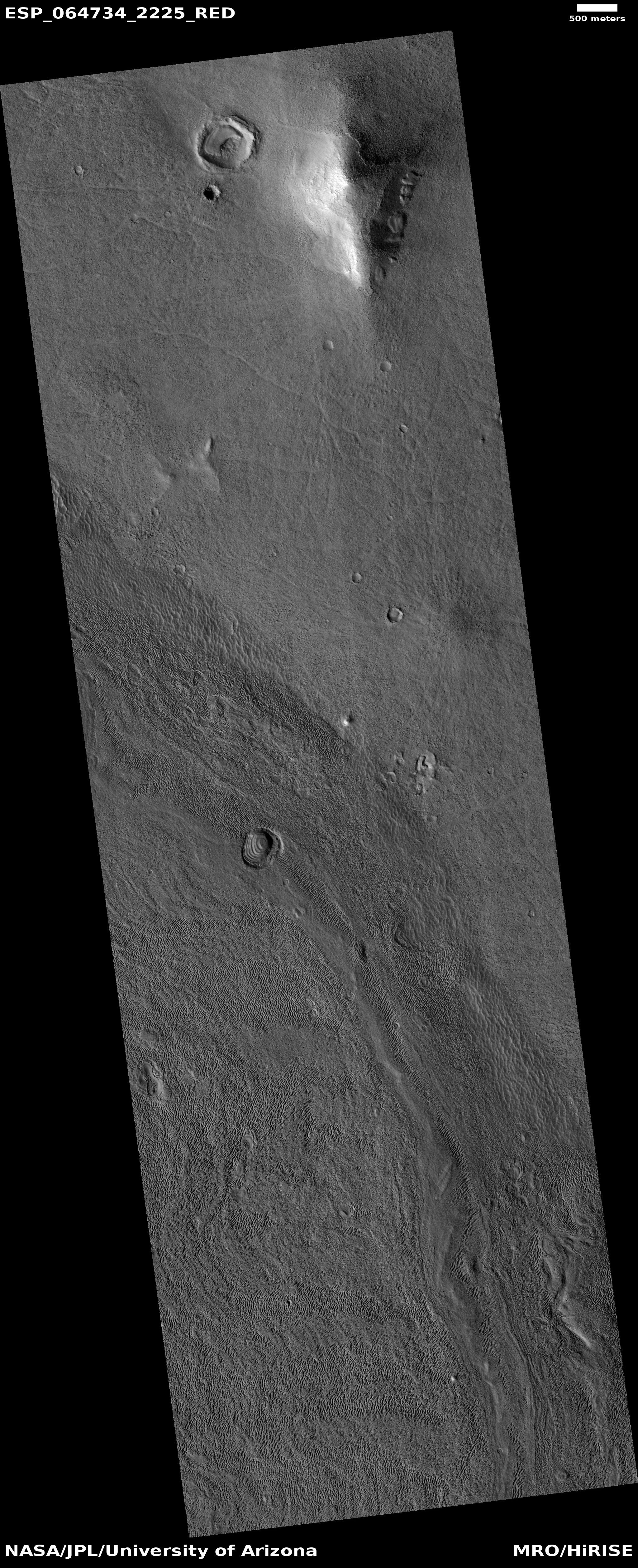
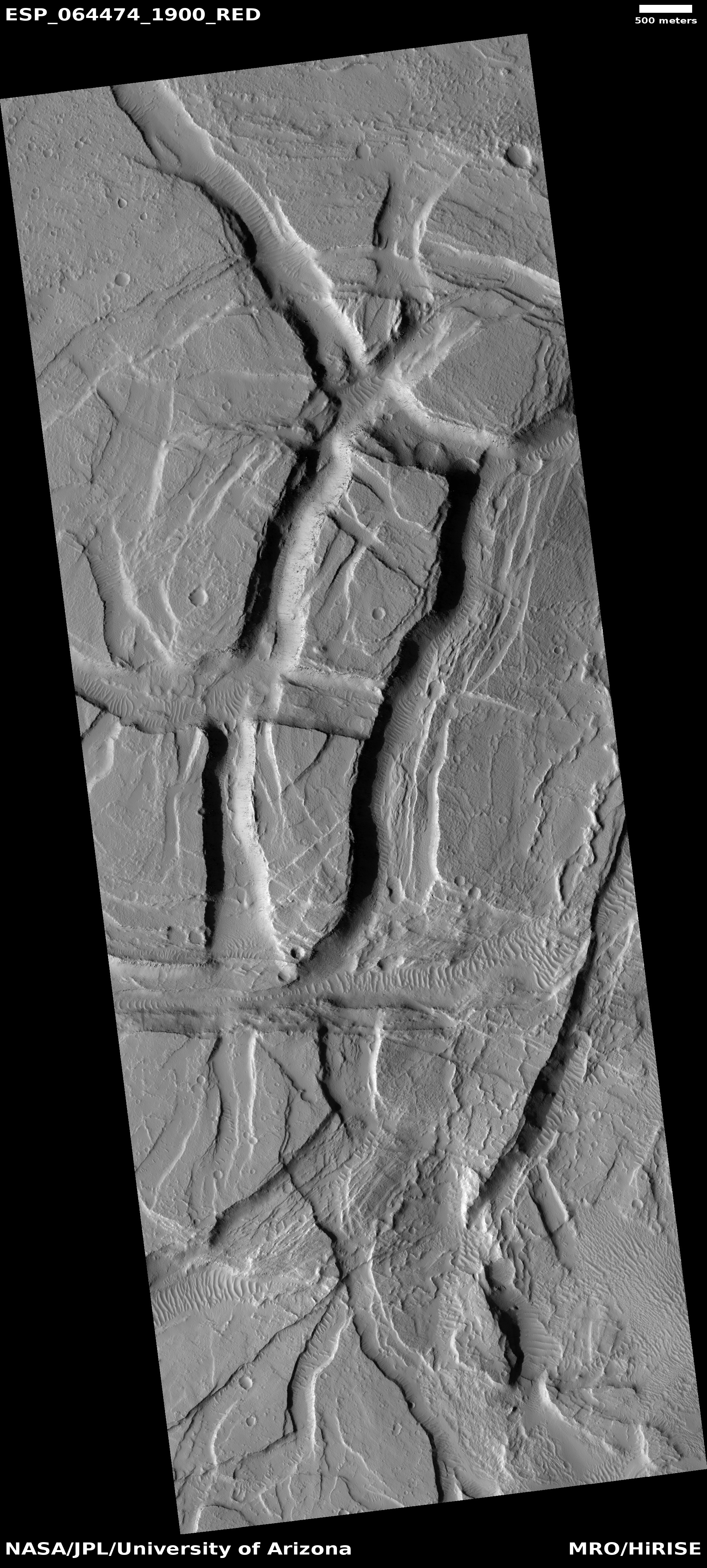
Time to take a cool image and go sight-seeing. The photo to the right, cropped and reduced to post here, was taken by the high resolution camera on Mars Reconnaissance Orbiter (MRO) on May 25, 2020, and shows a spectacular knife-edge mesa, its cliffs more than 650 feet high on either side.

This knife mesa sits among a bunch of similar mesas, and appears to be in a region that could be called chaos terrain, formed by flowing water or ice along faults, cutting criss-crossing canyons with mesas between.

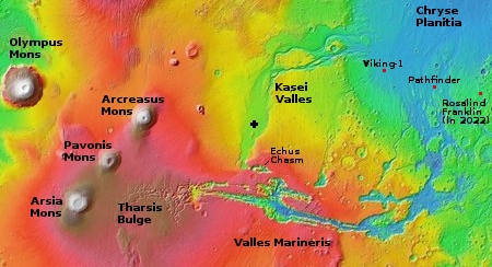
This mesa points east out from the Kasei Valley, the second largest canyon draining out from the Tharsis Bulge that contains Mars’ largest volcanoes. The overview map below provides some context, with the white cross indicating the location of today’s cool image.
» Read more

15 comments

Midnight repost: Mars!

The tenth anniversary retrospective of Behind the Black continues: Despite my many essays on culture and politics, Behind the Black remains mostly a site reporting on space and science. Since the modern exploration of Mars is probably the most significant on-going event now in space, it seemed unsatisfactory to only repost one or two of my past articles on this subject, when I have probably have posted hundreds. Instead, this midnight repost will provide links to a bunch, divided into several topics.

Martian geology, shown in cool images

First, we have the many cool images I have posted on Mars, often tied to detailed descriptions of what scientists are now beginning to learn about the red planet’s mysterious geological history. The following are the most important, and will help readers better understand future cool images.

Future colonization

Next, two posts, both focused on the future exploration and colonization of Mars.
» Read more

0 comments

Spring at the Martian South Pole

Geysers on Mars?
Click for full image.

Geysers on Mars
Click for full image.

It is now full spring at the Martian south pole, and as should be expected much has been happening there. Like the Martian north pole, when sunlight arrives after the dark winter it hits the seasonally-placed mantle or cap of carbon dioxide snow and begins to melt it, in the alien ways things like this occur on Mars.

The two images to the right illustrate this process for one particular place located in what are called the south polar layered deposits. The two images, just released on July 1, 2020 from the high resolution camera on Mars Reconnaissance Orbiter (MRO) and taken on May 14 and May 30 respectively, had immediately caught my attention because they were labeled “Active Geyser Locale Dubbed Macclesfield.” Active geysers?! I immediately contacted Candy Hansen of the Planetary Science Institute in Tucson, Arizona, whom I correctly guessed had requested these photos. She explained,

The name for this site is of course informal, and it dates back to when I first started picking sites to monitor. I was so certain we would see active geysers here! We see their deposits, the fans on the surface, but so far we have not caught an actual eruption in progress.

The overview map of the south pole below provides some context.
» Read more

5 comments

InSight’s mole is bouncing again

Plan of action for InSight's mole

The engineering team for InSight’s German-built digging tool, dubbed the mole, yesterday reported that it is once again no longer driving into the ground.

Previously they had been able to make progress by having InSight’s scoop press down on the mole. Once the top of the mole however was below ground, the scoop could no longer provide that support, and at that point the mole began bouncing again with each hammer-stroke, the surrounding Martian dirt unable to provide the friction to hold the mole down.

As shown by the illustration above, they are now going to try using the scoop to fill the hole and then use the scoop to press down on the dirt, with the hope this will provide the structural friction required to hold the mole in place after each hammer stroke. This effort will take time, and will prevent the scoop from doing its other work. They are therefore taking a pause until August before beginning the hole-filling operation.

0 comments

Rover update: Curiosity’s future journey

Mount Sharp, with Curiosity's future travels
Click for full image.

[For the overall context of Curiosity’s travels, see my March 2016 post, Pinpointing Curiosity’s location in Gale Crater. For the updates in 2018 go here. For a full list of updates before February 8, 2018, go here.]

Today the science team of Curiosity issued a press release outlining their travel plans for the rover over the next year. In conjunction, they also released a mosaic of 116 images taken by the rover showing that route, a reduced in resolution version shown above.

The rover’s next stop is a part of the mountain called the “sulfate-bearing unit.” Sulfates, like gypsum and Epsom salts, usually form around water as it evaporates, and they are yet another clue to how the climate and prospects for life changed nearly 3 billion years ago.

But between the rover and those sulfates lies a vast patch of sand that Curiosity must drive around to avoid getting stuck. Hence the mile-long road trip: Rover planners, who are commanding Curiosity from home rather than their offices at NASA’s Jet Propulsion Laboratory in Southern California, expect to reach the area in early fall, although the science team could decide to stop along the way to drill a sample or study any surprises they come across.

Overview map sol 2804 of Curiosity's route

This journey actually began in late May, at about the time of my last rover update. The overview map to the right shows in red their approximate planned route to avoid that large dune field to the south. The meandering yellow line indicates Curiosity’s actual route. The straight yellow lines indicates I think the area covered by the mosaic above. As you can see, since the end of May they have quickly returned to their planned route. Note also that the dune field extends about twice the distance beyond the eastern edge of this overview map.

The next big goal when they reach that sulfate-bearing unit will be to not only study it but to also study a recurring slope lineae on the slopes of that unit, a streak that darkens and lightens seasonally that might be caused by seeping brine from below. Because the sulfate unit and the linneae are both major geological goals, they are going to be moving fast to get there. I am sure they will periodically stop to do geology, but I think the travel will be, as it has been for the past month, quick-paced.

Once the rover gets to the sulfate unit, Curiosity will at last have actually reached the base of Mount Sharp. Up until now it has been traveling first in the surrounding plains, then in the mountain’s foothills. The terrain will get much rougher and be far more spectacular, as Curiosity will be entering canyons as it begins to climb the mountain itself.

1 comment

A hanging crater on Mars

Hanging crater
Click for full image.

Overview

Cool image time! The image to the right, cropped and reduced to post here, was taken by Mars Reconnaissance Orbiter (MRO) on May 1, 2020, and shows a truly intriguing crater that they dub a “Crater Hanging on Mesa Wall.”

Located in Deuteronilus Mensae, a chaos region of mesas and cross-crossing canyons in the transition zone between the northern lowland plains and the southern cratered highlands, the crater literally overhangs the edge of this canyon’s cliff. The overview map to the right, with this location indicated by the red box, illustrates what this region’s geology is like.

The most likely explanation is that the impact occurred prior to the creation of the canyon, and when the canyon eroded, the material in and of this crater was more resistant, probably because the impact had packed it together to increase its density.

At the same time, the features inside both craters in the photo, as well as below them on the floor of the canyon, suggest the presence of buried glaciers, something not unlikely at the 45 degree north latitude where this crater sits.

So, here’s a guess at the geological history. First we had the impact, then during the eons of glacial ebb and flow on Mars due to wide swings in the planet’s obliquity (its rotational tilt), the canyon was cut, with that erosion leaving the crater sitting high above the canyon floor below it.

One more curious detail: The material in the canyon seems asymmetric, suggesting that the crater actually dips down toward the canyon, as if it as a unit has tilted to the east as the canyon was worn out below it.

1 comment

Two wedding cakes on Mars

Tall wedding cake on Mars
Click for full image.

It it time for two cool Martian images from the high resolution camera on Mars Reconnaissance Orbiter (MRO). Though both show features that are similar and likely had some comparable geological origins, they are located in two very different places on Mars and thus also had very different histories.

What makes them fun is how much both resemble classic tall wedding cakes, though the second has unfortunately fallen down and is no longer eatable.

The first, cropped on the right to post here, was taken on May 18, 2020, and is described by the science team as a “Tall Layered Mesa in Crater in Deuteronilus Mensae.” Deuteronilus Mensae is in the transition zone between the northern lowland plains and the southern cratered highlands, and being in the high mid-latitudes (42 degrees north) shows a lot of evidence of buried and eroded glaciers. Many of these glaciers are found inside craters.

What caused this layered mesa however to form is beyond me. It is taller than the crater in which it sits, as well as the surrounding terrain. A glacier would settle into the lowest regions, and would not last if exposed above the rim like this is. Its height suggests that the surrounding terrain was once much higher, and has been eroded away. Yet if so, why does this mesa also sit inside a depression?

The second “wedding cake” is even more intriguing, though less baffling.
» Read more

2 comments

A minor rill on the Moon

Kathleen, a rill on the Moon
Click for full image.

Cool image time! The image above, reduced to post here, is a colorized digital terrain model produced from Lunar Reconnaissance Orbiter (LRO) data. On top of the original mosaic of photos the LRO science team has overlaid the elevation data obtained by LRO’s laser altimeter. It shows a tadpole shaped pit dubbed Kathleen, with its tail trailing off to the southeast. As they note:

Kathleen is a pyroclastic vent with a sinuous rille (colloquially known as Rima Mozart [Not IAU confirmed]) that extends from the southeast end of the vent. Rilles are large channels formed by sustained channelized lava flows. This vent is a great location to investigate ancient volcanism on the Moon.

The elevation data reveals one interesting feature: The lowest part of the vent pit is not at its western end, where one would think at first glance, based on the general dip that produced the rill flowing to the east. That the lowest point is at the widest section of the pit instead suggests that this pit no longer looks as it did when it was venting. In the almost four billion years since it is thought all volcanic activity here ceased, there has been plenty of time for the slow erosion processes on the Moon, caused by radiation, micrometeorites, and the solar wind, to partly fill this pit and round out its cliff walls.

The two overview maps below provide some context.
» Read more

3 comments

More strange terrain in the Martian “Death Valley”

More strange terrain in Hellas Basin
Click for full image.

Today’s cool image, rotated cropped, and reduced to post here, might show what the science team for the high resolution camera of Mars Reconnaissance Orbiter (MRO) have labeled “strange banded terrain”, but anyone who has spent any time perusing images of Hellas Basin, what I have labeled the basement of Mars because it has the lowest elevation on the planet, will recognize the features.

They might be inexplicable, but for Hellas Basin they are entirely familiar. Just take a look at some of my earlier posts:
» Read more

0 comments

A gravel pile floating in space that might hit the Earth

flat rock near Osprey
Click for full image.

Come October the probe OSIRIS-REx will attempt a quick touchdown on the asteroid Bennu to grab some tiny particles, all smaller than 0.8 inches across.

Bennu is what scientists have described as a “rubble-pile” asteroid. They use that name because it is simply a conglomeration of a lot of rocks, pebbles, boulders, and stones, all jagged and of all sizes. The overall gravity has never been strong enough to squeeze them together, at least as far as we can see, and so they are piled up loosely across the asteroid’s surface wherever we look.

I think a better name for this asteroid would a floating gravel pile, since the material on it, as clearly shown in the image to the right (reduced and rotated to post here), more resembles the tailings one finds at a mine or quarry. This photo was taken by OSIRIS-REx on May 26, 2020 during its first dress rehearsal over its back-up touch-and-go sample grab site, Osprey. As the release caption notes,

The field of view is 12 ft (3.8 m). For reference, the bright rock [near] the tip of the boulder is 1 ft (0.3 m) across, which is about the size of a loaf of bread.

I have rotated the image 90 degrees so that east is up, because the full mosaic of the entire Osprey landing site, shown below, is oriented that way, and by rotating it to match it is easier to locate this image within it.
» Read more

9 comments

Enigmatic layering and chasms on Mars

Enigmatic layering and chasms
Click for full image.

Overview map

Cool image time! The photo to the right, rotated, cropped, and reduced to post here, was taken on April 28, 2020 by the high resolution camera on Mars Reconnaissance Orbiter. (MRO). The science team entitled it “Enigmatic Uplifts in Echus Montes,” indicating a sense of bafflement on their part about this geology.

The features here are certainly somewhat puzzling. At first glance the terrain is reminiscent of Martian chaos terrain, mesas cut by canyons in an almost random pattern. As I explained at the link,

Chaos terrain is typically a collection of mesas separated by straight-lined canyons. It is found in many places on Mars, most often in the transition zone between the southern highlands and the northern lowlands where an intermittent ocean might once have existed. It is believed to form by erosion, possibly caused by either flowing water or ice, moving along fault lines. As the erosion widened the faults, they turned into canyons separating closely packed mesas. With time, the canyons widened and the mesas turned into a collection of hills.

What makes this particular image puzzling however is that there seem to be multiple layers of mesas and canyons. Look at the top of the rectangular mesa in the upper middle of the image. It appears to have its own miniature chaos terrain on its plateau. Somehow that first layer of chaos was abandoned when the more prominent larger canyons started to form around it.

The location of this feature is indicated by the black cross on the overview map to the right. It is in the middle of the large and wide northward trending part of the giant valley dubbed Kasei Valles. And as usual, knowing the location helps explain what we are seeing.
» Read more

2 comments

Cassini evidence suggests volcanoes on Titan

Scientists are now proposing that. based on a close look at data and imagery of Titan from the Cassini mission archive, that this moon of Saturn might have volcanoes, and that they might even be active today.

Volcano-like features seen in polar regions of Saturn’s moon Titan by NASA’s Cassini spacecraft could be evidence of explosive eruptions that may continue today, according to a new paper by Planetary Science Institute Senior Scientist Charles A. Wood and coauthor Jani Radebaugh of Brigham Young University.

Morphological features such as nested collapses, elevated ramparts, halos, and islands indicate that some of the abundant small depressions in the north polar region of Titan are volcanic collapse craters, according to “Morphologic Evidence for Volcanic Craters near Titan’s North Polar Region” that appears in the Journal of Geophysical Research: Planets. A few similar depressions occur near the south pole of Titan. “The close association of the proposed volcanic craters with polar lakes is consistent with a volcanic origin through explosive eruptions followed by collapse, as either maars or calderas,” Wood said. “The apparent freshness of some craters may mean that volcanism has been relatively recently active on Titan or even continues today.”

The data being somewhat think, there is a great deal of uncertainty with this theory. Nonetheless, it makes perfect sense, and in fact it would be a surprise if some sort of volcanic activity was not occurring on Titan.

1 comment
1 110 111 112 113 114 157