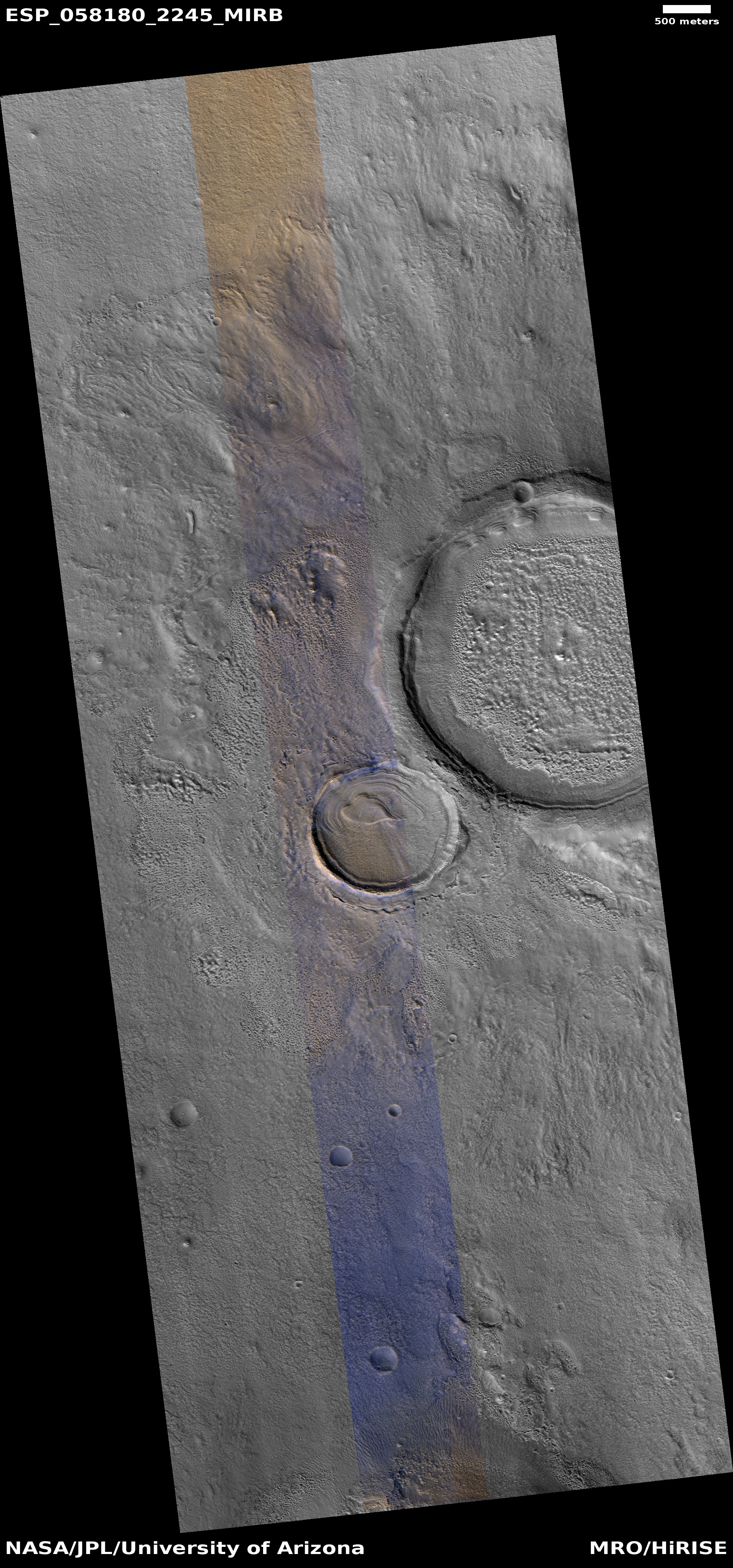
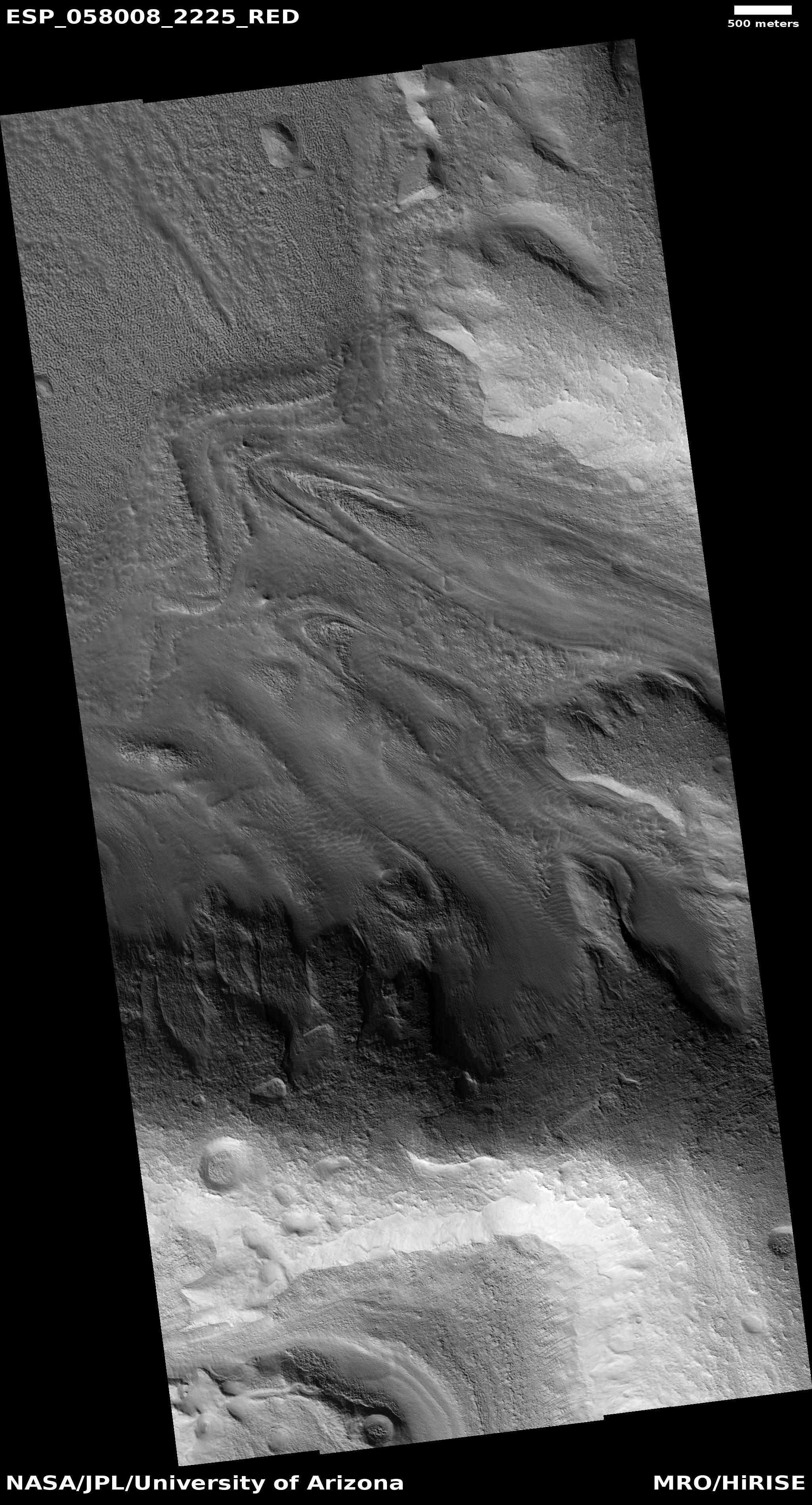
Circular feature on Mars?

A circular feature on Mars?
Click for full resolution image.

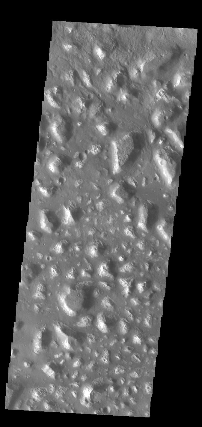
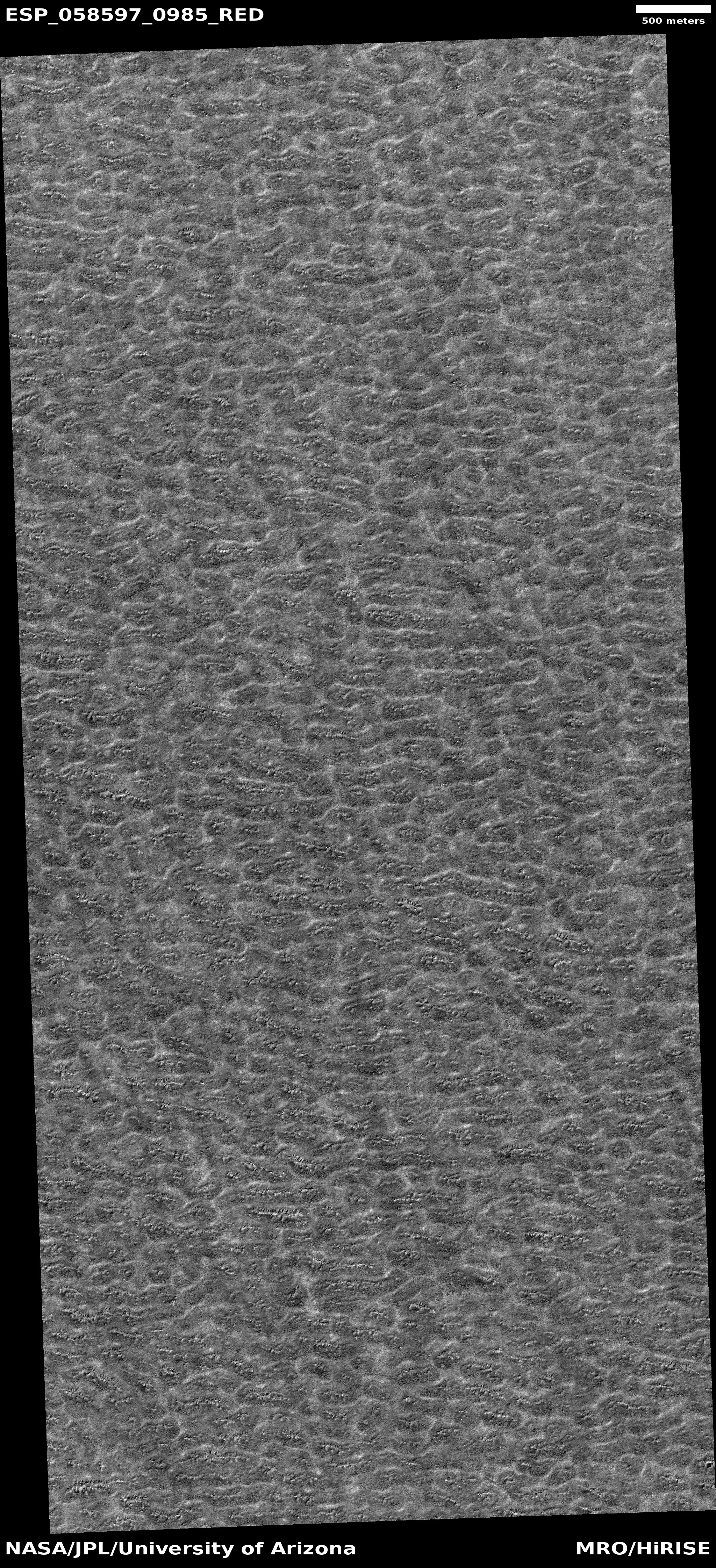
Today’s cool image is cool for two reasons. First and foremost, the image, found in the archive of the high resolution camera of Mars Reconnaissance Orbiter (MRO), is titled “Circular Feature.” On the right is the full image, reduced to post here. I have searched it high and low, at low resolution as well as full resolution, and can find nothing, nothing at all, that invokes a circular feature to me.

This strange terrain is located very close to the southern icecap. If anything, the knobs and features that fill this image remind me of brain terrain, partly obscured by a layer of partly melted snow or frost. Nothing however seems circular in the slightest.

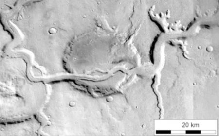
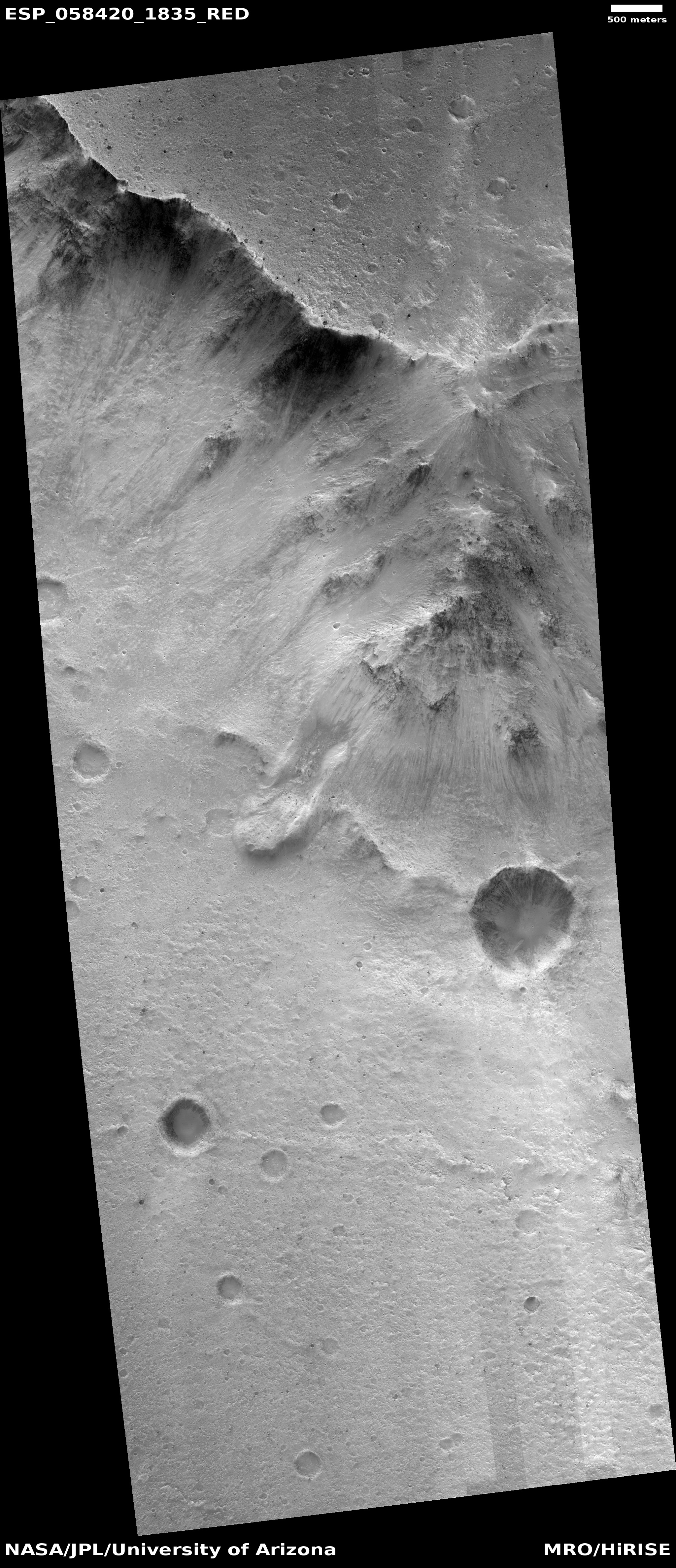
The second reason this image is cool is that it is very representative of its very large surrounding region. For what appears to be several hundred miles in all directions this is all that one can see, in a variety of MRO images, here, here, here, here, here, and here, to show only a few. Ever so often a craterlike feature pops out, like in the last example, but generally the surface continues in this undulating bland manner, endlessly. The only changing aspect is the dark streaks that cut across, likely dust devil tracks made over a long period of time.

Below the fold is a section of the full resolution image, at full resolution. It doesn’t really matter where I took the crop, as anywhere in the full image everything looks pretty much the same. The only slow change that I can perceive is that the surface seems to be descending to the north, with the lighter areas implying the existence of terraces.

Take a look, and try to figure out for yourself what is going on here.
» Read more

4 comments

Strange craters in the Martian northern lowlands

Strange crater in the northern lowlands
Click for full image.

Cool image time! The image on the right, cropped and rotated to post here, was taken by the high resolution camera on Mars Reconnaissance Orbiter (MRO) and released in the monthly image dump provided by the science team. The release had no caption. It merely described this as a “Layered mound in crater.”

That is certainly what is is. However, layering suggests a regionwide process. The crater to the immediate northeast (the rim of which can be seen in the upper corner of this image), does not have the same kind of layering. (Be sure to click on the image to see that other crater.) Its crater floor is instead a blob of chaotic knobs, with the only layering scattered in spots along its north interior rim.

That the layering of both craters favors the north suggests a relationship, but what that is is beyond me. Prevailing winds? Maybe, but I don’t have the knowledge to explain how that process would work.

It is not even certain that these two craters were formed by impact. They are located in the northern lowlands where an intermittent ocean is believed to have once existed, and thus might be remnants of that ocean’s floor. That they both have a muddy appearance reinforces this hypothesis, but once again, I would not bet much money on this theory. The features here could also be expressing the effect of an impact on a muddy seafloor.

In either case the craters imply that the ocean that might have once been here existed a long enough time ago for these craters to form (either by impact or some other process) and then evolve. This has been a relatively dry place for a very long time.

2 comments

The layering at the Martian poles

Layering in the east side of Burroughs Crater
Click for full image.

Layering in the west side of Burroughs Crater
Click for full image.

In the past month the science teams of both Mars Reconnaissance Orbiter (MRO) and Trace Gas Orbiter (TGO) have released images showing the strange layering found in Burroughs Crater, located near the Martian south pole.

The top image above is the MRO image, rotated and cropped to post here. To the right is a cropped and reduced section of the TGO image.

Though both images look at the inside rim of the crater, they cover sections at opposite ends of the crater. The MRO image of the crater’s east interior rim, with the lowest areas to the right, while the TGO image shows the crater’s northwest interior rim, with the lowest areas on the bottom. As noted at the TGO image site:
» Read more

0 comments

Jezero Crater: The landing site for the Mars 2020 rover

Jezero Crater delta
Jezero Crater delta

At this week’s 50th Lunar and Planetary Science Conference in Texas, there were many papers detailing the geological, topographical, chemical, meteorology and biological circumstances at the landing sites for the 2020 Martian rovers, Jezero Crater for the U.S.’s Mars 2020 and Oxia Planum for Europe’s Rosalind Franklin.

Most of these papers are a bit too esoteric for the general public (though if you like to delve into this stuff like I do, go to the conference program and search for “Jezero” and “Oxia” and you can delve to your heart’s content).

Oxia Planum drainages

These papers do make it possible to understand why each site was chosen. I have already done this analysis for Rosalind Franklin, which you can read here and here. Oxia Planum is in the transition between the southern highlands and the northern lowlands (where an intermittent ocean might have once existed). Here can be found many shoreline features. In fact, one of the papers at this week’s conference mapped [pdf] the drainage patterns surrounding the landing ellipse, including the water catchment areas, as shown by the figure from that paper on the right.

With this post I want to focus on Jezero Crater, the Mars 2020 landing site. The image above shows the crater’s most interesting feature, an impressive delta of material that apparently flowed out of the break in the western wall of the crater.

This image however does not tell us much about where exactly the rover will land, or go. To do that, we must zoom out a bit.
» Read more

3 comments

Lava tubes on Alba Mons

Lava tubes on the western slope of Alba Mons

During oral presentations today at this week’s 50th Lunar and Planetary Science Conference in Texas, scientists revealed [pdf] a map showing what they believe are numerous lava tubes flowing down the western slope of the giant Martian volcano Alba Mons.

The image on the right is taken from their paper. The red lines indicate collapsed tube sections, maroon collapsed sections on a ridge, and yellow volcanic ridges, which I assume are external surface flows. From their paper:

Lava tube systems … occur throughout the western flank, are concentrated in some locations, and are generally radial in orientation to Alba Monsโ€™ summit. Lava tubes are typically discontinuous and delineated by sinuous chains of elongate depressions, which in many cases are located along the crests of prominent sinuous ridges. Lava tube systems occur as both these ridged forms with lateral flow textures and more subtle features denoted by a central distributary feature within the flat-lying flow field surface. Significant parts of the sinuous volcanic ridges show no collapse features, indicating a distinctive topographic signature for Alba Monsโ€™ lava tubes.

Alba Mons is in some ways the forgotten giant volcano on Mars.
» Read more

1 comment

Streaky Mars: Slope streaks and recurring slope lineae

New recurring lineae on Mars
Click for source paper [pdf].

Numerous presentations at this week’s 50th Lunar and Planetary Science Conference in Texas have focused on two different changing features on the Martian surface, dubbed slope streaks and recurring slope lineae (or RSLs, an example of an unnecessary and unwieldy acronym that I avoid like the plague).

These apparently are considered two different phenomenon (with some overlap), something I had not recognized previously. For example, one presentation [pdf] this week described slope streaks as:

…gravity-driven dark or light-toned features that form throughout the martian year in high-albedo and low-thermal-inertia equatorial regions of Mars. The distinctive features originate from point sources on slopes steeper than ~20ยฐ, follow the topographic gradient, extend or divert around small obstacles, and propagate up to maximum lengths of a few kilometers. The streaks brighten with time, sometimes become brighter than their surroundings, and fade away over timescales of decades. [emphasis mine]

An example can be seen here. This is in contrast to the recurring slope lineae, shown in the image above, which another paper [pdf] described as:

…dark linear features that occur on the surface of steep slopes in the mid-latitudes of Mars. These areas are warm, occasionally exceeding temperatures of 273-320 K. [Lineae] recur over multiple years, growing during warm seasons and fading away during colder seasons. Their apparent temperature dependency raises the possibility that liquid water is involved in their formation. [emphasis mine]

I have highlighted the key differences. While slope streaks are long lived and change slowly, lineae change with the Martian seasons. And the slope streaks appear to exist at lower latitudes. These difference means that the formation process of each must be also different.

The problem is that scientists still don’t know what causes either, though they have many theories, involving both wet and dry processes.

Most of the presentations at the conference this week focused on the recurring lineae, which I suspect is because of their seasonal aspect. This feature strongly suggests a water-related source for the lineae, and everyone who studies Mars is always focused on finding sources on Mars where liquid water might be found. Also, slope streaks appear more often in dunes, which also strongly suggests a dry process. One paper, however, did a comparison study of lineae with one specific kind of dune slope streak to see if the freatures might be related.

The most interesting result [pdf] for all these papers documented the apparent increase in recurring lineae following the global dust storm last year. The image at the top of that post is from this paper, and shows a fresh lineae where none had been prior to the storm. From the paper’s abstract:
» Read more

0 comments

Land of mesas

Ariadnes Colles
Click for full image.

Cool image time! The Mars Odyssey science team today released the image on the right, cropped and rotated to show here, of a region on Mars named “Ariadnes Colles.”

The term colles means hills or knobs. The hills appear brighter than the surrounding lowlands, likely due to relatively less dust cover.

This is certainly a place with lots of hills, or to be more precise, mesas, as many of them seem to be flat topped.

The lack of dust cover on the tops is probably because, like on Earth, the winds blow much better once you get a bit above the surface. (This is why sailing ship builders kept adding higher and higher sails to their ships, until the top sails of clipper ships rose a hundred-plus feet above the deck.) These better winds clean off the mesa tops, just as they did to the solar panels on the rovers Opportunity and Spirit several times during their long missions.

Ariadnes Colles is another example of Martian chaotic terrain. Since this region is located deep in the cratered and rough southern highlands of Mars, the erosion that created these mesas was likely not water-flows. Was it wind? Ice?

Your guess is as good as anyone’s.

0 comments

Mars likely has many large and extensive cave systems

Mamers Valles

More caves on Mars! This week the Lunar and Planetary Institute and the Johnson Space Center are jointly holding the 50th Lunar and Planetary Science Conference in Texas. I have been going over the program, and will be posting reviews of some of the more interesting results all this week.

We begin with caves, which should not be surprising to my regular readers. As a caver who also knows their value for future space colonists, I am always attracted to new discoveries of cave passages on other worlds. Today’s however is a doozy.

The image to the right is of Mamers Valles on Mars, what scientists have dubbed a fretted valley, a common feature in the transition zone between the low altitude northern plains and the southern highlands. It comes from a paper [pdf] with the typically unexciting scientific title, “Fretted channels and closed depressions in northern Arabia Terra, Mars: Origins and implications for subsurface hydrologic activity.”

What the scientists really means here is that their research strongly suggests that Mars has a very large and very extensive number of underground drainage systems, which have caused collapses on the surface that often resemble meandering river canyons, such as seen above. As they explain:
» Read more

3 comments

Martian massive landslides

Though scientists have found some evidence of slow erosion and change on the Martian surface, it is today generally inactive. While the weak wind of Mars’ thin atmosphere continues to work its will, and the likely presence of underground frozen water acts to shift the surface shape as the seasons come and go, none of this happens quickly.

Essentially, Mars is a quiet place.

Once however catastrophic events took place, gigantic floods flowing down to the east from the planet’s huge volcanoes to carve out Marineris Valles, the solar system’s largest known canyon. As that water rushed eastward it ripped the terrain apart quickly, creating deep side canyons, drainage valleys, and chopped up regions now dubbed as chaos terrain, multiple mesas separated by numerous fissure-like canyons.

Overview of Marineris Valles and landslide

The overview map on the right shows Valles Marineris and its drainage to the east and north into the vast northern plains of Mars. It also shows the location of one of the largest regions on Mars of chaos terrain, dubbed Hydraotes Chaos, located close to the mouth of this gigantic drainage system more than 2,500 miles long.

Massive Martian landslide
Click for full image.

Recently scientists have used the high resolution camera on Mars Reconnaissance Orbiter (MRO) to begin taking images of the massive landslides on the face of the mesa north of Hydraotes Chaos that was hit directly by these floods. The location of the most immediately interesting of these landslide images is also indicated on this overview image.

To the right is that image, rotated, cropped, reduced, and annotated to post here. The white boxes indicate two full resolution sections that I highlight below at full resolution.

This image shows that full cliff. The total drop from the plateau at the top to the floor where Hydraotes Chaos is located to the south is approximately 8,200 feet, almost exactly comparable to the depth of the north rim of the Grand Canyon.

The image shows numerous evidence of avalanches and erosion, both at its base and at its rim. None of these avalanches likely occurred during those catastrophic floods, but long afterward.
» Read more

0 comments

Brain Terrain on Mars

Brain terrain on Mars
Click for full image.

Cool image time! This week the Mars Reconnaissance Orbiter (MRO) science team featured four new captioned images taken by the spacecraft and released as part of the March image dump. The first, dubbed “The Slow Charm of Brain Terrain,” deserves an immediate post on Behind the Black. To the right is only a small section cropped from the full image. From the caption:

You are staring at one of the unsolved mysteries on Mars. This surface texture of interconnected ridges and troughs, referred to as โ€œbrain terrainโ€ is found throughout the mid-latitude regions of Mars. (This image is in Protonilus Mensae.)

This bizarrely textured terrain may be directly related to the water-ice that lies beneath the surface. One hypothesis is that when the buried water-ice sublimates (changes from a solid to a gas), it forms the troughs in the ice. The formation of these features might be an active process that is slowly occurring since HiRISE [MRO’s high resolution camera] has yet to detect significant changes in these terrains.

Below is a cropped section of the full image, rotated and reduced to post here.
» Read more

1 comment

Another batch of caves/pits found on Mars

Four new pits on Mars

Overview of February 2019 pits

In the past year the monthly image releases from the high resolution camera on Mars Reconnaissance Orbiter (MRO) archive have frequently included newly discovered pit entrances. Each time I have written posts highlighting these new pits, in June, July, November 2018 and January 2019. In fact, this is happening so frequently I could almost label it a monthly update!

The November release imaged three pits found on the southern flanks of Arsia Mons. The January 2019 release found several north of the volcano, two of which are very close to the two middle new pits highlighted above. The February release, which is the focus of this post, included four more pits, shown above, all located north and west of Arsia Mons, as shown in the overview map to the right.

Pits 2 and 3 above appear to belong to a cluster of pits all located in the general area between Arsia and Pavonis Mons. (You can see their uncaptioned releases here and here.) Most sit alone on a flat somewhat featureless plain. Sometimes there are flow features nearby, but each pit usually seems to sit unique and unrelated to these other faint features.

Pit 1 is very intriguing in that it sits amid a very long chain of pits and canyons, all aligned, as shown in the image below and to the right.
» Read more

0 comments

Monitoring a fresh-looking Martian landslide

2012 image of Martian landslide
Click for full image

2018 image of Martian landslide
Click for full image

Time for two cool images! To the right are two images taken by the high resolution camera on Mars Reconnaissance Orbiter (MRO), the top one taken in April 2012, and the bottom taken in December 2018. Both have been cropped and reduced slightly in resolution to post here.

The second image is trying to answer, in only a small way, one of the most fundamental questions of the Martian environment: How fast does it change? The images from orbit have periodically seen evidence of new impacts. MRO images have tracked dust devil tracks. And we know that somehow water, ice, wind and volcanic activity have eroded and reshaped the surface over eons.

What we don’t know truly and with detail is the pace of these changes, with any accuracy. The pace of some things over time seems obvious. For example, Mars’s inactive but gigantic volcanoes suggest that once volcanism was very active, but over time has ceased so that today it is unclear if any is occurring. Similarly, the geological evidence suggests that in the far past water flowed on the surface, producing catastrophic floods. Now that liquid water is all but gone, and this erosion process as ceased.
» Read more

0 comments
1 124 125 126 127 128 157