
More weird features and changes on Mars

Click for full 2020 photo.
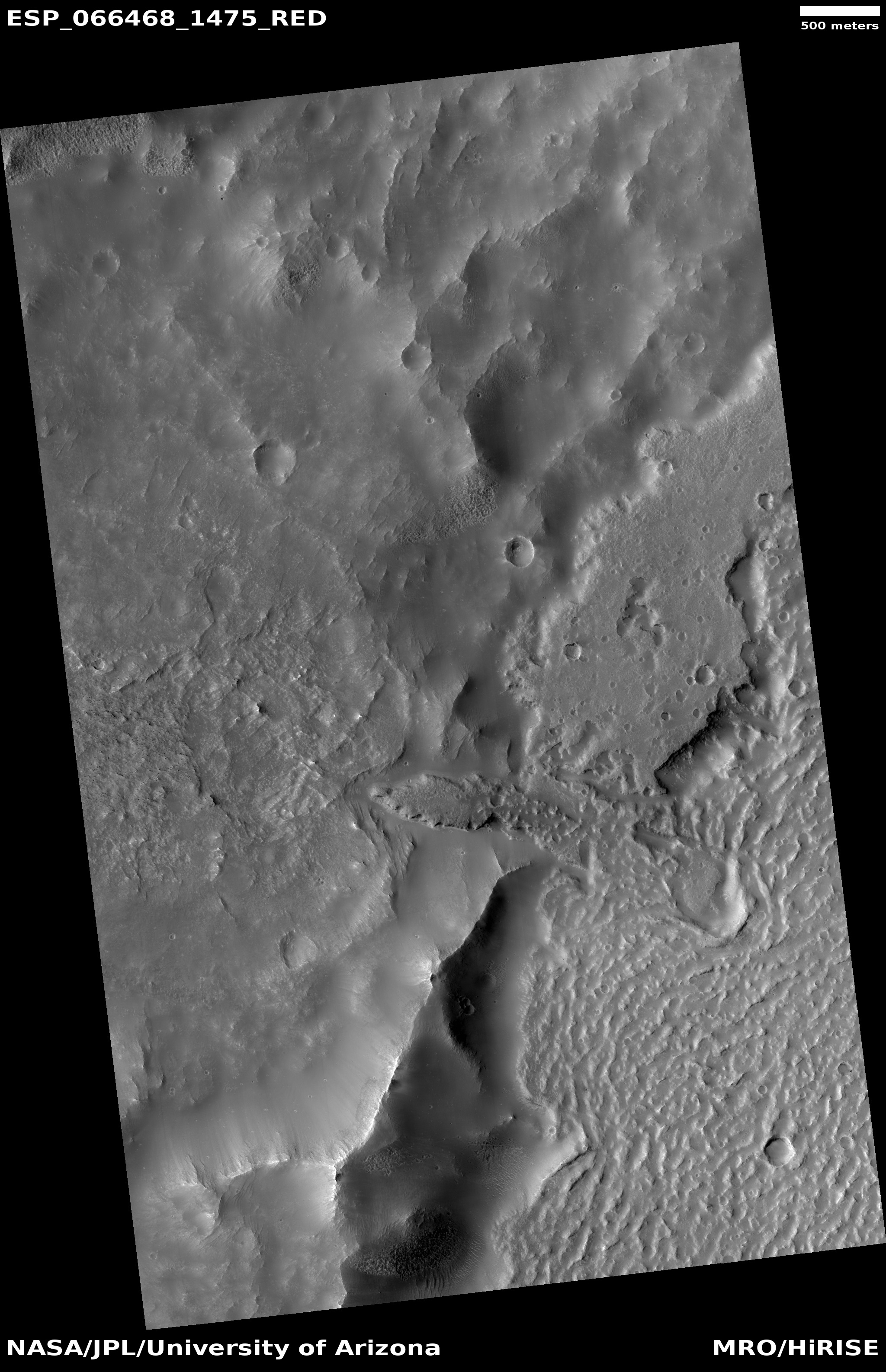
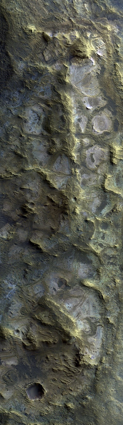
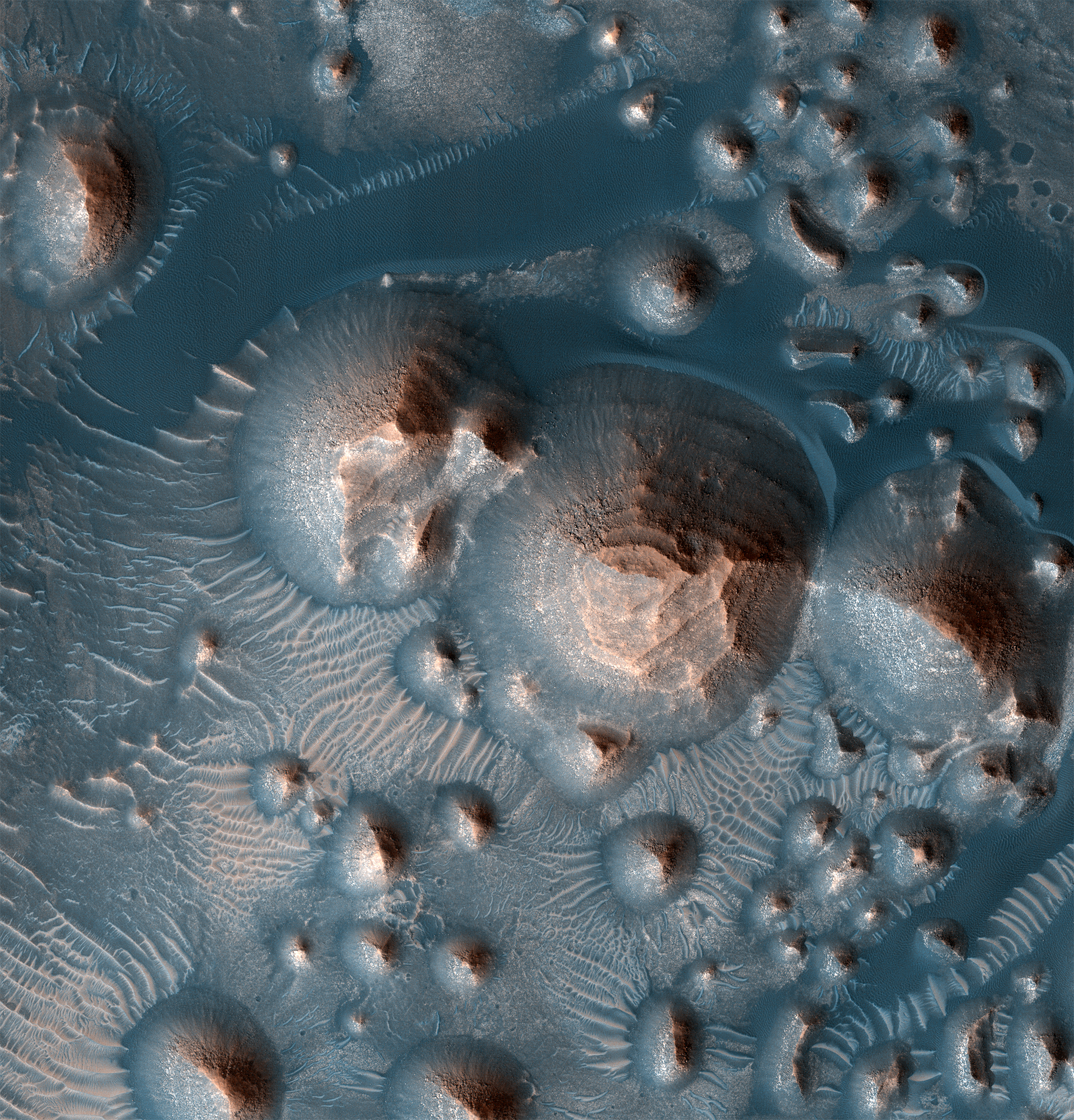
Cool image time! The photo to the right, rotated, cropped, reduced, and annotated to post here, was taken on September 28, 2020 by the high resolution camera on Mars Reconnaissance Orbiter (MRO). Uncaptioned and labeled “Reticulate Bedform Change Detection on Arsia Mons West Flank,” it shows a whole bunch of strange features in addition to a change that occurred sometime in the past two years.
I think it also well illustrates in one image how alien Mars is.
The main features in this photo are what scientists have dubbed reticulate bedforms. These features, found mostly in the high elevations on the flanks of the giant volcanoes in the Tharsis Bulge to the west of Valles Marineris, are thought to be ancient dunes made of volcanic dust and debris that has solidified into an aggregate. These dunes are found with a variety of patterns.
Aggregates on the flanks are transported downslope by katabatic winds and form linear and “accordion” morphologies. Materials within the calderas and other depressions remain trapped and are subjected to multidirectional winds, forming an interlinked “honeycomb” texture. In many places on and near the volcanoes, light-toned, low thermal inertia yardangs and indurated surfaces are present.
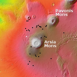
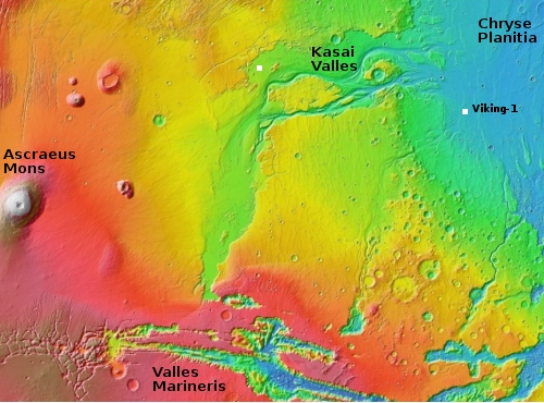
The photo to the right appears to show all three patterns, even though it is located on the northwestern slopes of of Arsia Mons, the southernmost of the string of three giant volcanoes in the Tharsis Bulge. On the overview map to the right, this photo’s location is indicated by the white box. The black boxes indicate the location of all the pits caves that surround Arsia Mons which I have previously posted about on Behind the Black.
It is intriguing that, at least at this point, these particular reticulate bedforms on the slopes of Arsia Mons happen to be in a region where few cave pits have so far been identified. It could be that the conditions that form each are mutually exclusive. If you get pits on the slopes of Martian volcano you can’t have reticulate bedforms. Or maybe not all the pits have yet been located, or the flanks of the volcano has many more reticulate bedforms that I simply have not documented.
Either way, this particular cool image has two areas of interest, as noted by the white boxes above.
» Read more


