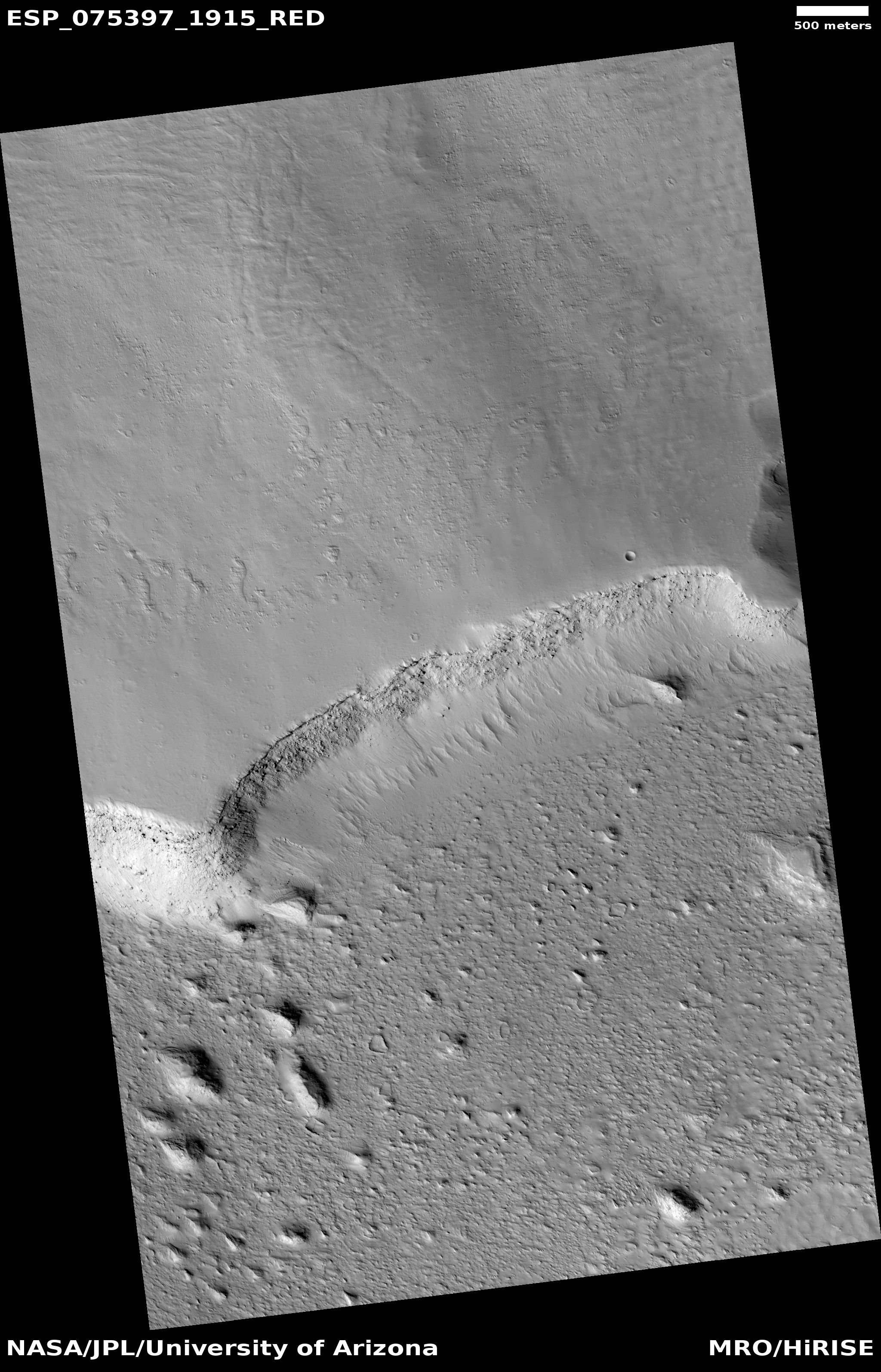
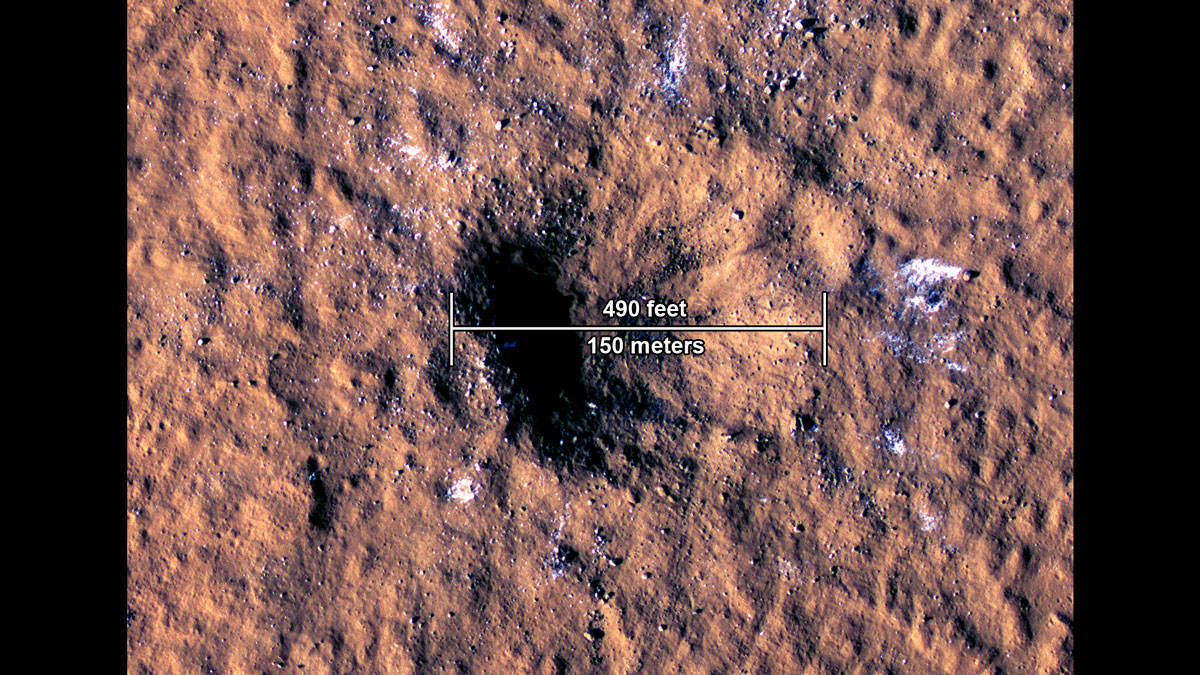
What a Martian impact looks like on a sheet of slushy ice
Click for full image.
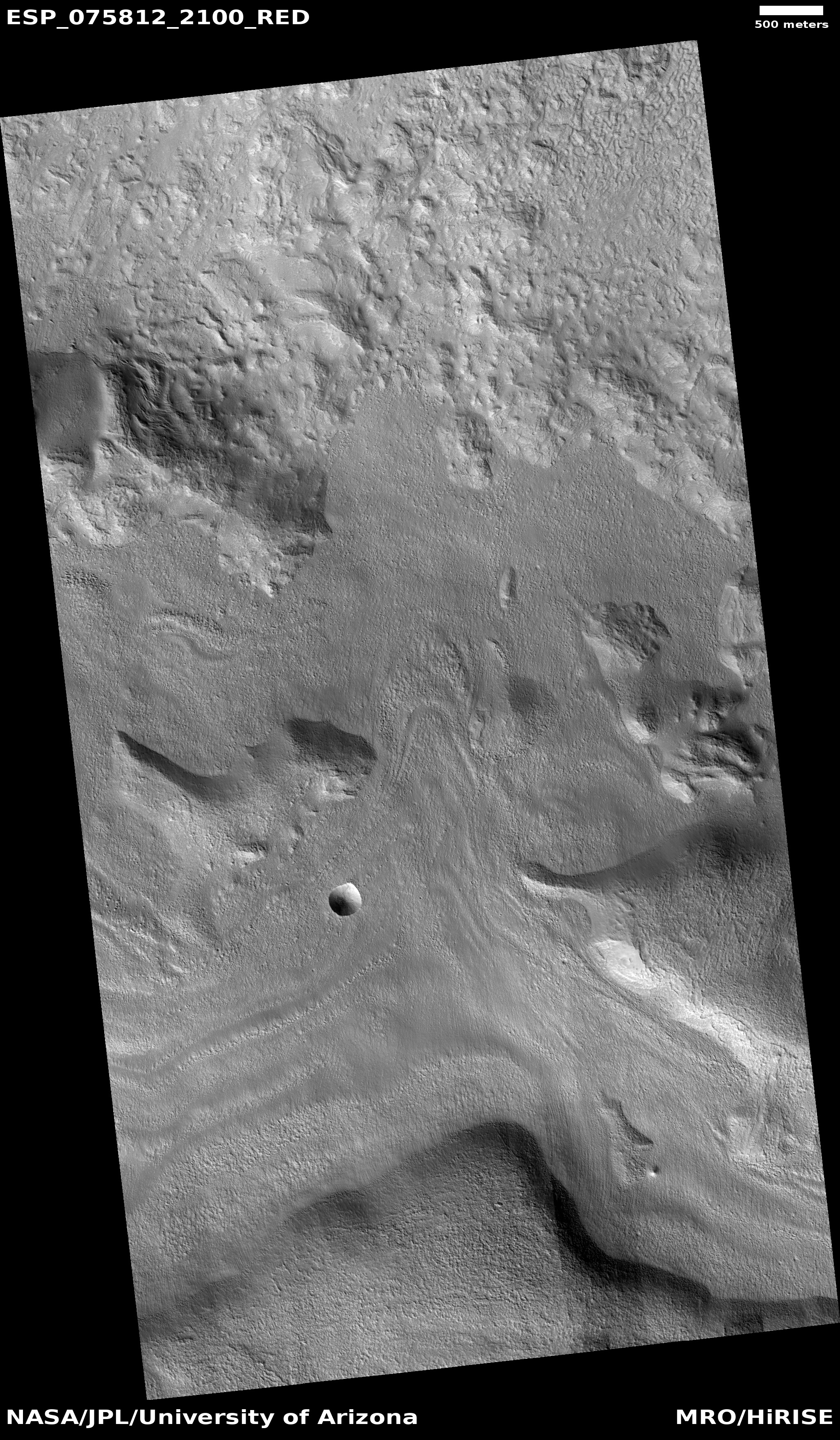
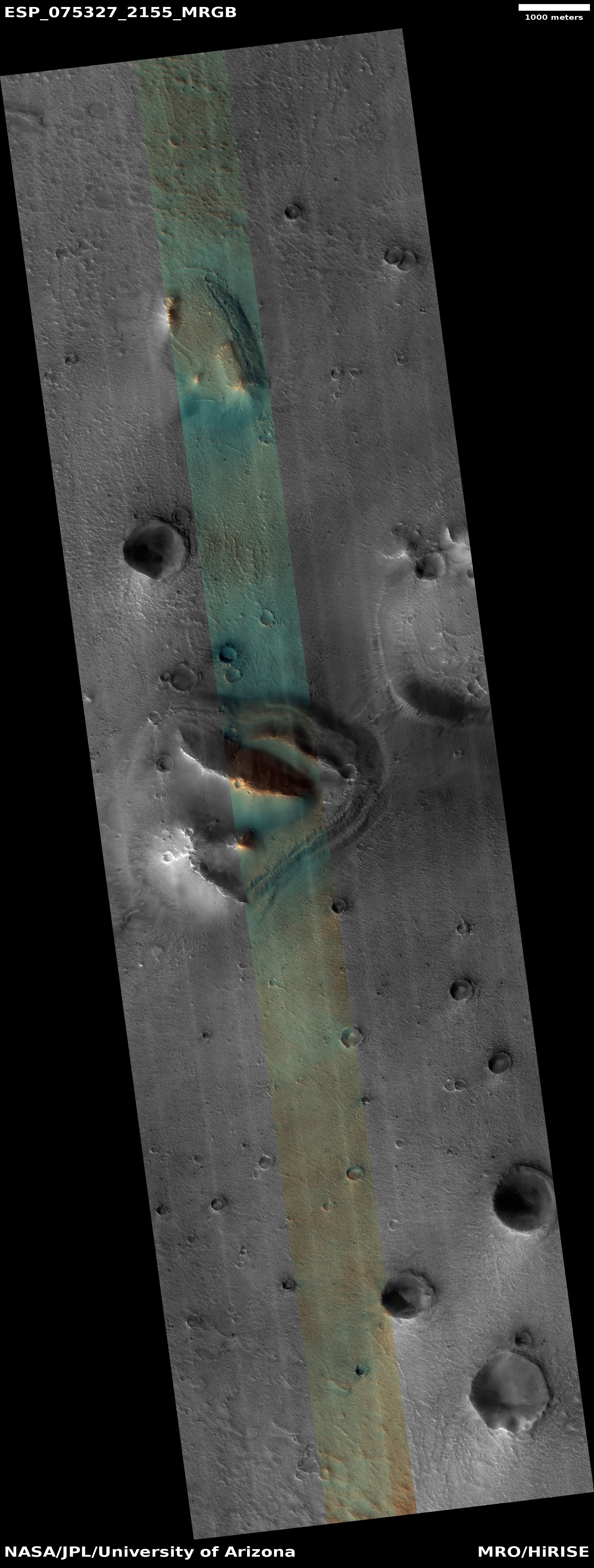
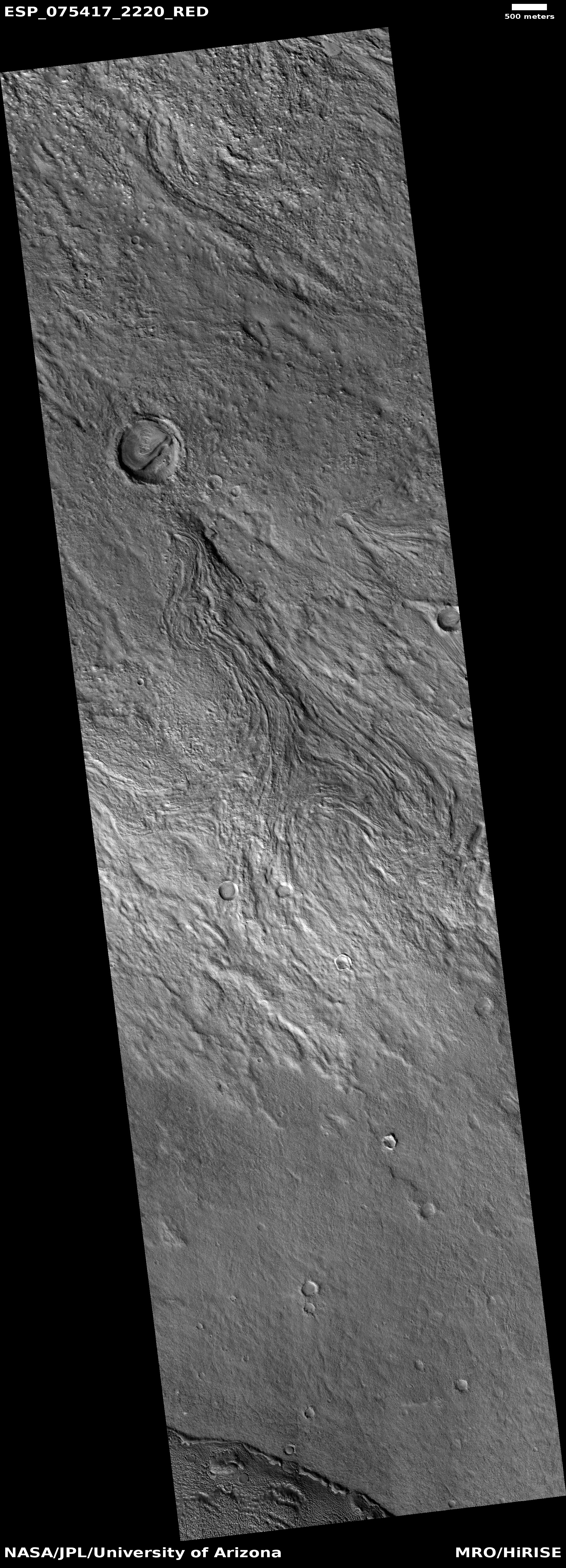
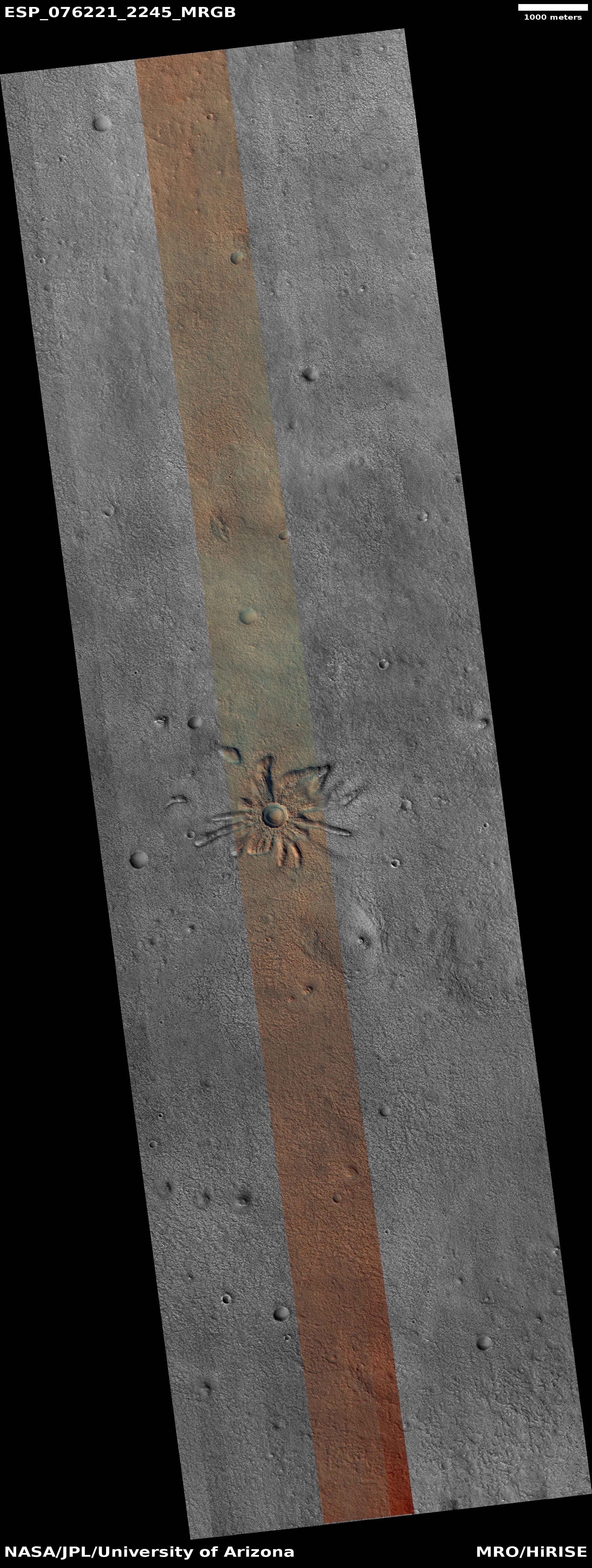
My headline is a bit of a guess, but it is an educated guess for today’s cool image. The photo to the right, cropped, reduced, and sharpened to post here, was taken on October 30, 2022 by the high resolution camera on Mars Reconnaissance Orbiter (MRO).
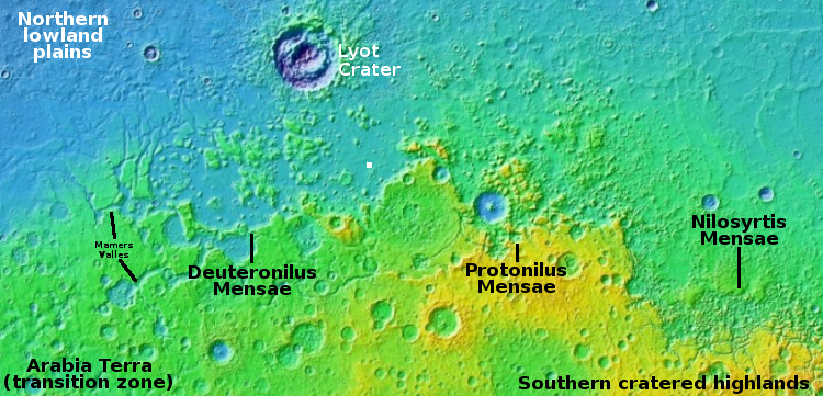
The location, as indicated by the white dot in the overview map above, puts this impact in a relatively flat area of Deuteronilus Mensae, the westernmost chaos region of the 2,000 mile long mid-latitude strip I call glacier country.
In other words, there is likely a lot of near surface ice here, as this impact makes very plain. If you imagine dropping a pebble into a thick layer of soft ice cream, you might get a crater reminiscent of this. I use for comparison ice cream on Earth because the lighter Martian gravity probably makes Martian ice softer and more slushy.
As I have said many times before, Mars is strange, Mars is mysterious, and above all Mars is alien.