
Perseverance’s upcoming travel plans
Click for interactive map.
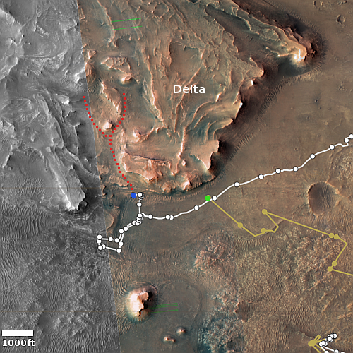
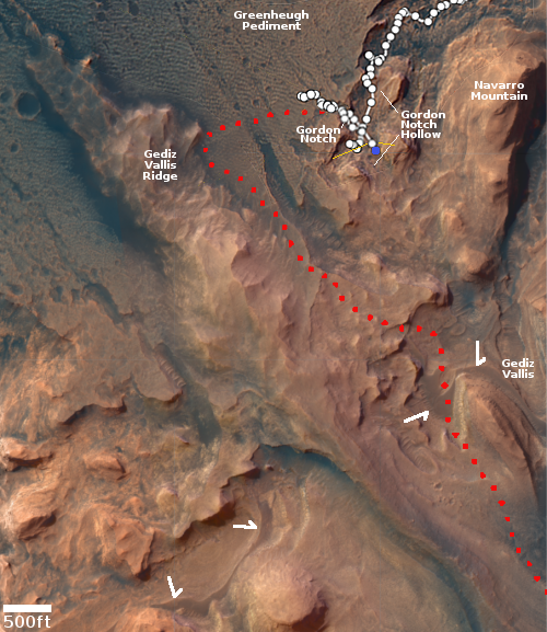
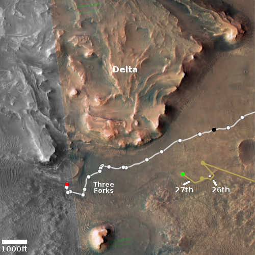
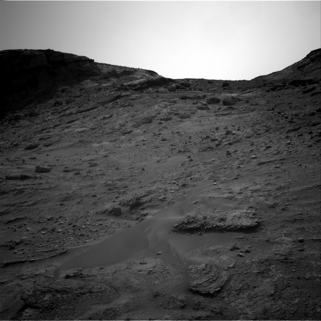
Today’s update from the Perseverance’s science team provided a rough outline of their travel and drill-sampling plans for the Mars rover in Jezero Crater as it begins its climb up onto the delta that once poured into the crater. The route they plan to travel initially is dubbed Hawksbill Gap.
At Hawksbill Gap, however, we may instead carry out the first portion of the sampling sol path (which includes abrasion and collecting observations using our proximity science instruments) at up to 5 locations along our ascent. After that, we’ll turn around and begin a descent back down Hawksbill Gap and collect rock core samples at 3 of our abrasion locations.
This modified sampling strategy is intended to provide the team with valuable contextual information as we climb Hawksbill Gap and interpret the delta stratigraphy around us. With proximity science data in-hand, we can down-select our sampling sites to ensure we’ll be collecting the most scientifically valuable cores along our descent. Of course, we still maintain the option of collecting sample cores at any point during our ascent, if the team decides a particular abrasion site warrants immediate sampling.
The map above shows my guess (the red dotted lines) as to their potential routes uphill. As the science team has so far not published a map indicating exactly where Hawksbill Gap is, I can only guess at this point. The blue dot indicates Perseverance’s present position, the green dot Ingenuity.
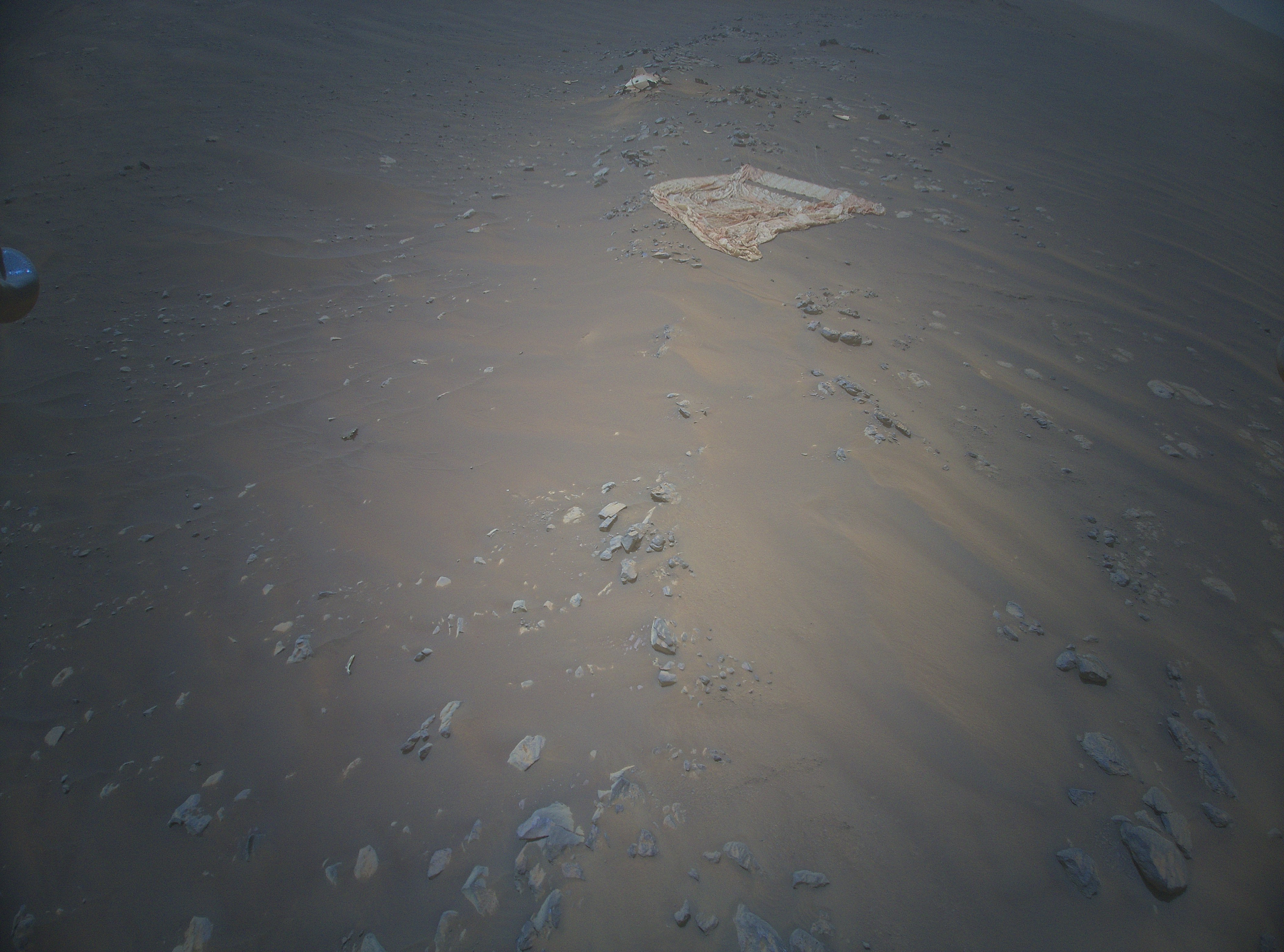
As for the helicopter, there is no word yet whether the engineers have successfully gotten its batteries back to full charge. Until then, it cannot fly, and is also at risk of freezing up in the cold Martian winter.


