
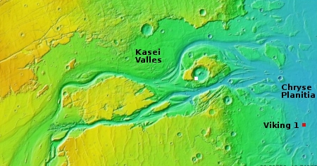
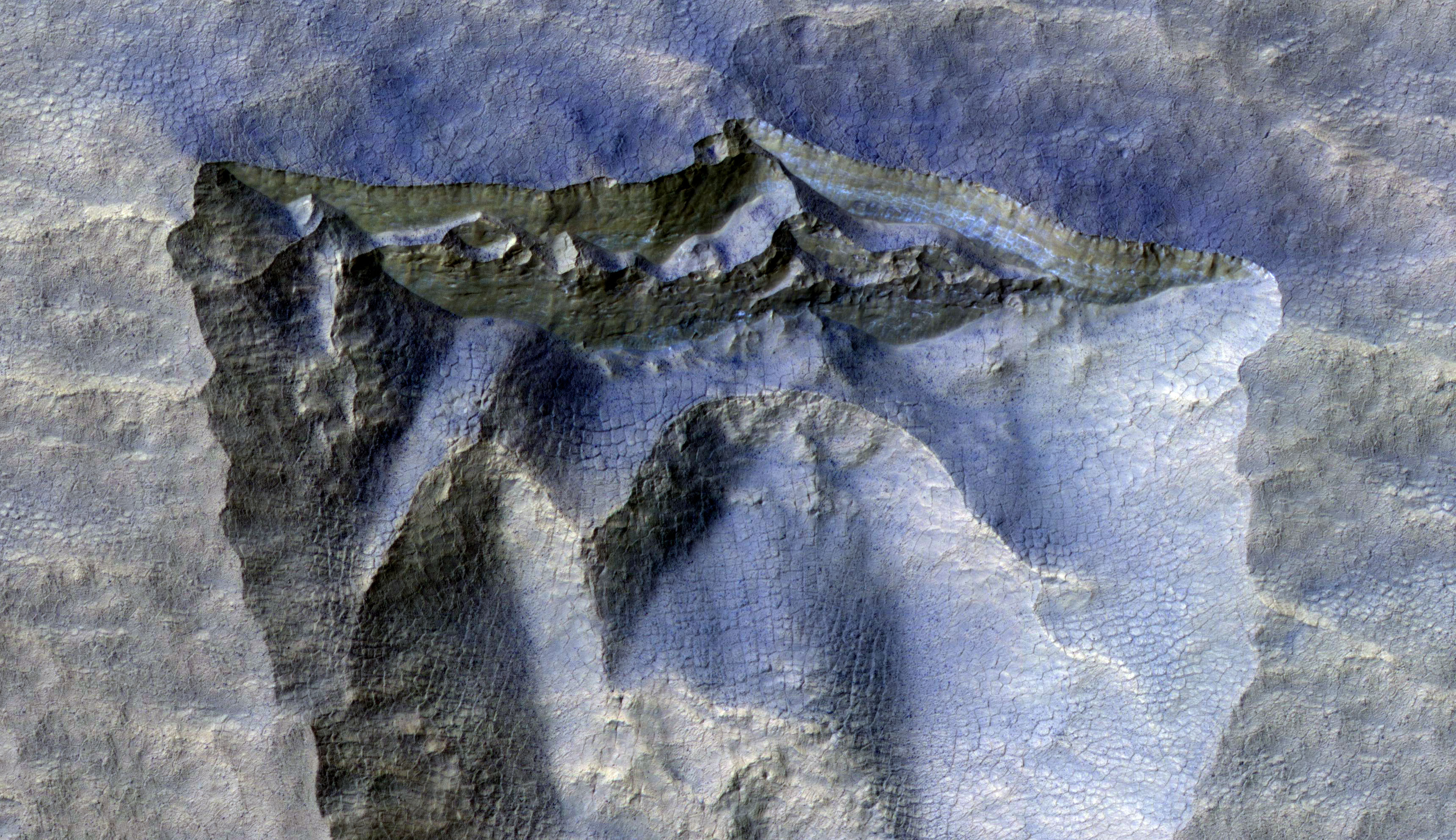
Buried mountain on Mars
Click for full image.
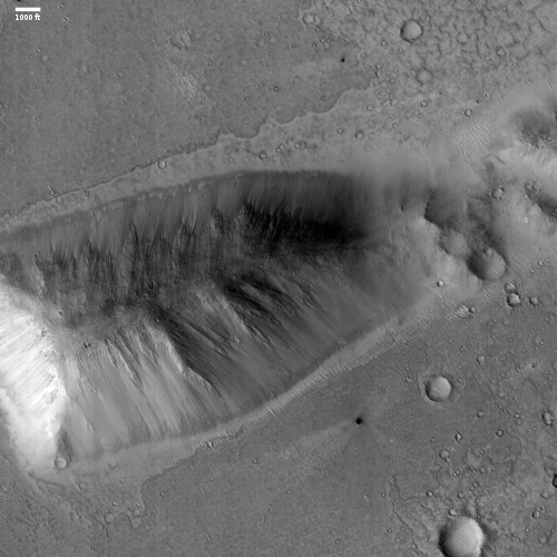
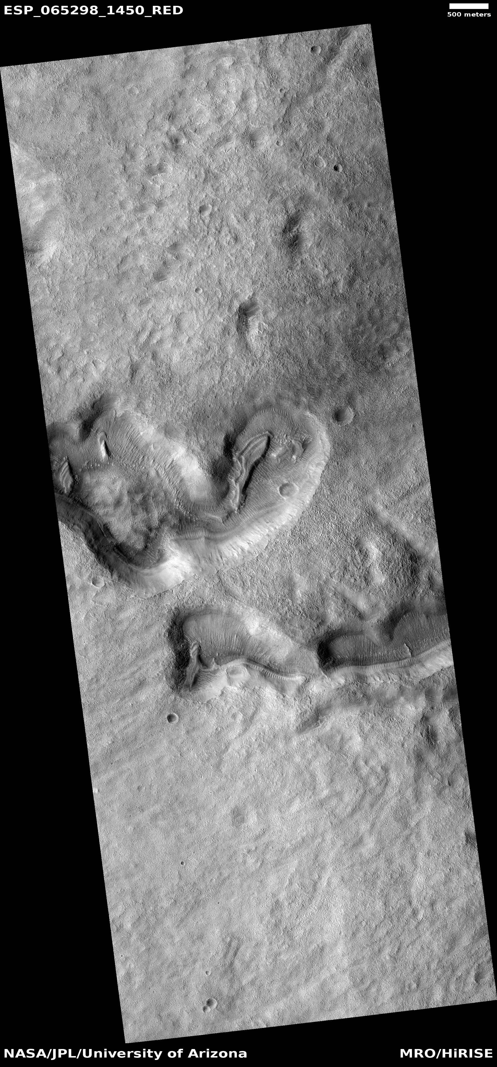
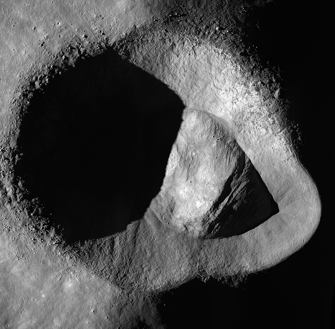
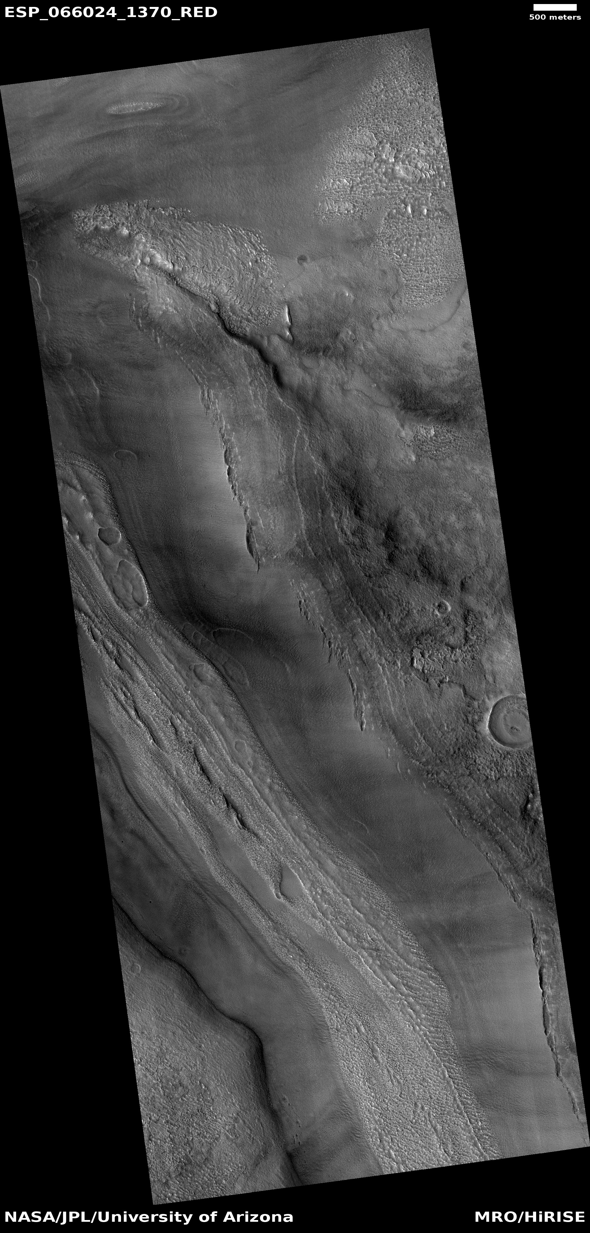
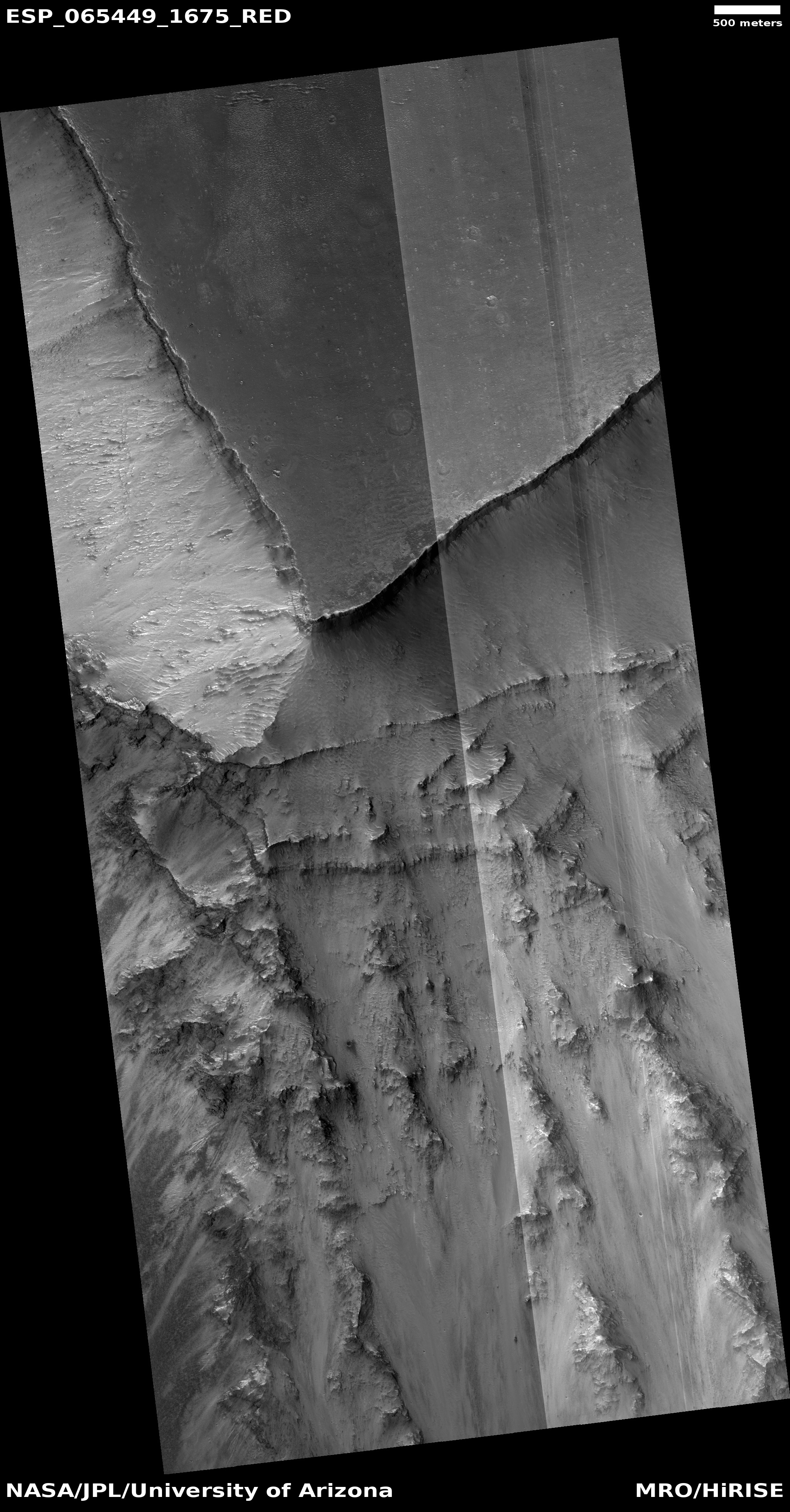
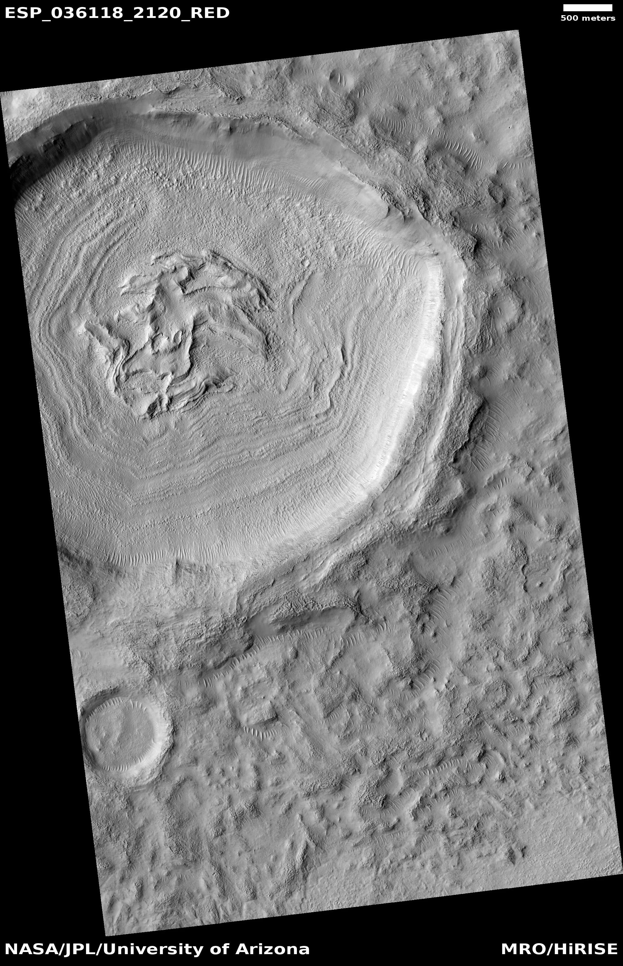
Cool image time! The photo to the right, rotated, cropped, and reduced to post here, was taken on August 8, 2020 by the high resolution camera on Mars Reconnaissance Orbiter (MRO). Labeled merely as a “terrain sample,” it is an example of an image taken more for engineering than scientific reasons. No research scientist specifically requested it. Instead, the scientists operating the camera took it because they need to use MRO regularly to maintain the camera’s proper temperature. To do this they periodically take almost random images, but never without trying to pick a location that might have some scientific value.
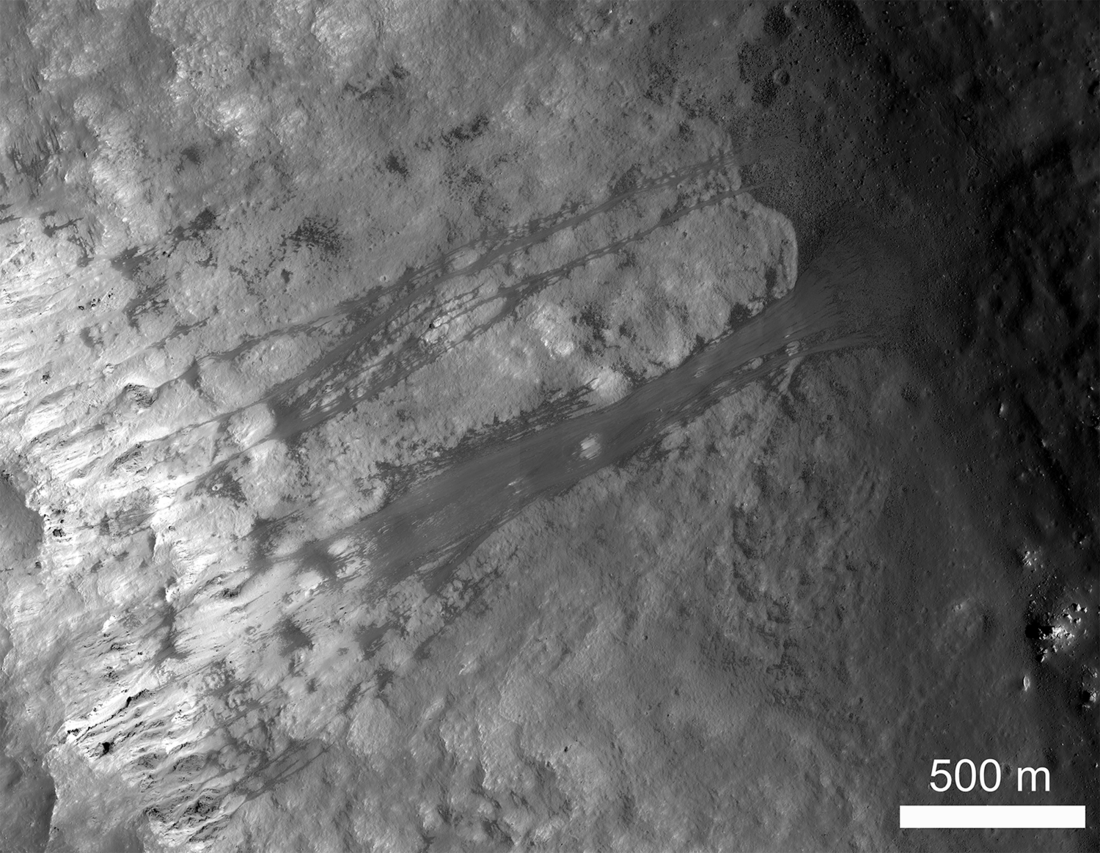
In this case we get what appears to be an isolated sloping hill. Located at about 15 degrees north latitude, this is not a place where one would expect visible evidence of water, though the gullies on the slopes are intriguing. They almost look like the kind of hillside erosion you see in places where rain falls on desert mountainsides.
Rain can’t be the cause, but nonetheless monitoring these gullies for changes over time would be worthwhile science research. Since it appears no one is presently focused on doing it, anyone interested out there?
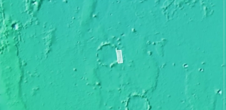
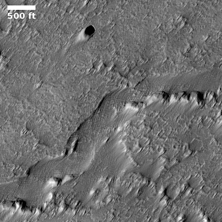
This mountain is actually far more isolated than this high resolution image suggests.
» Read more
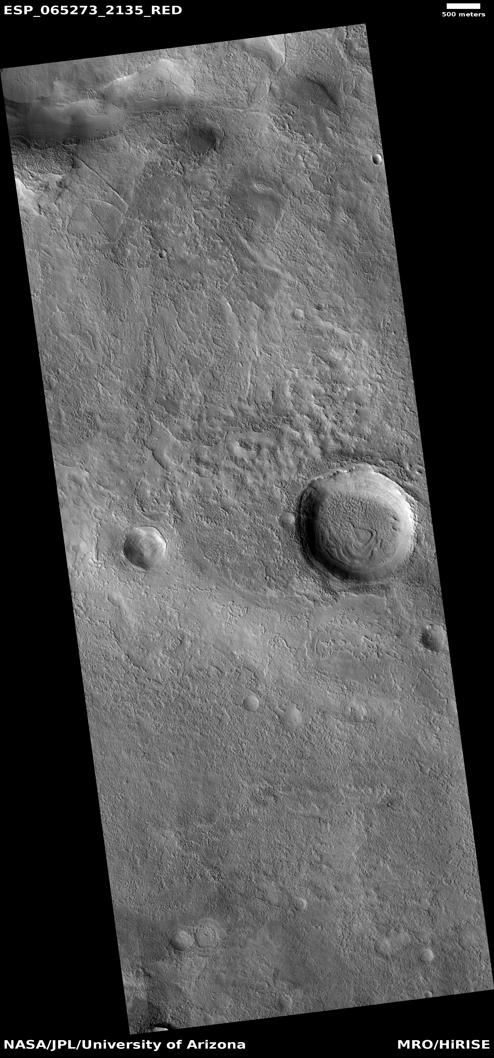
Click for full image.
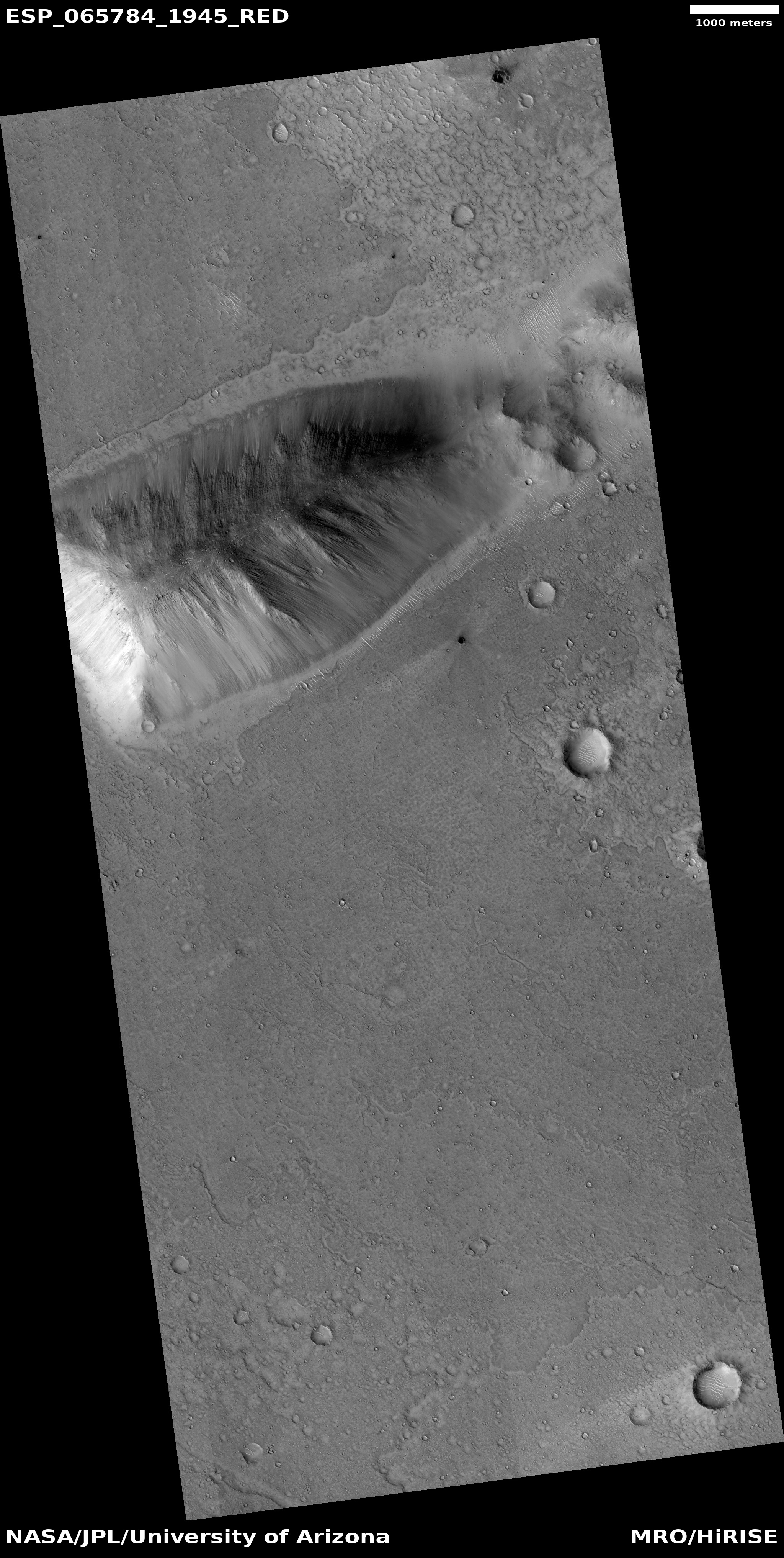
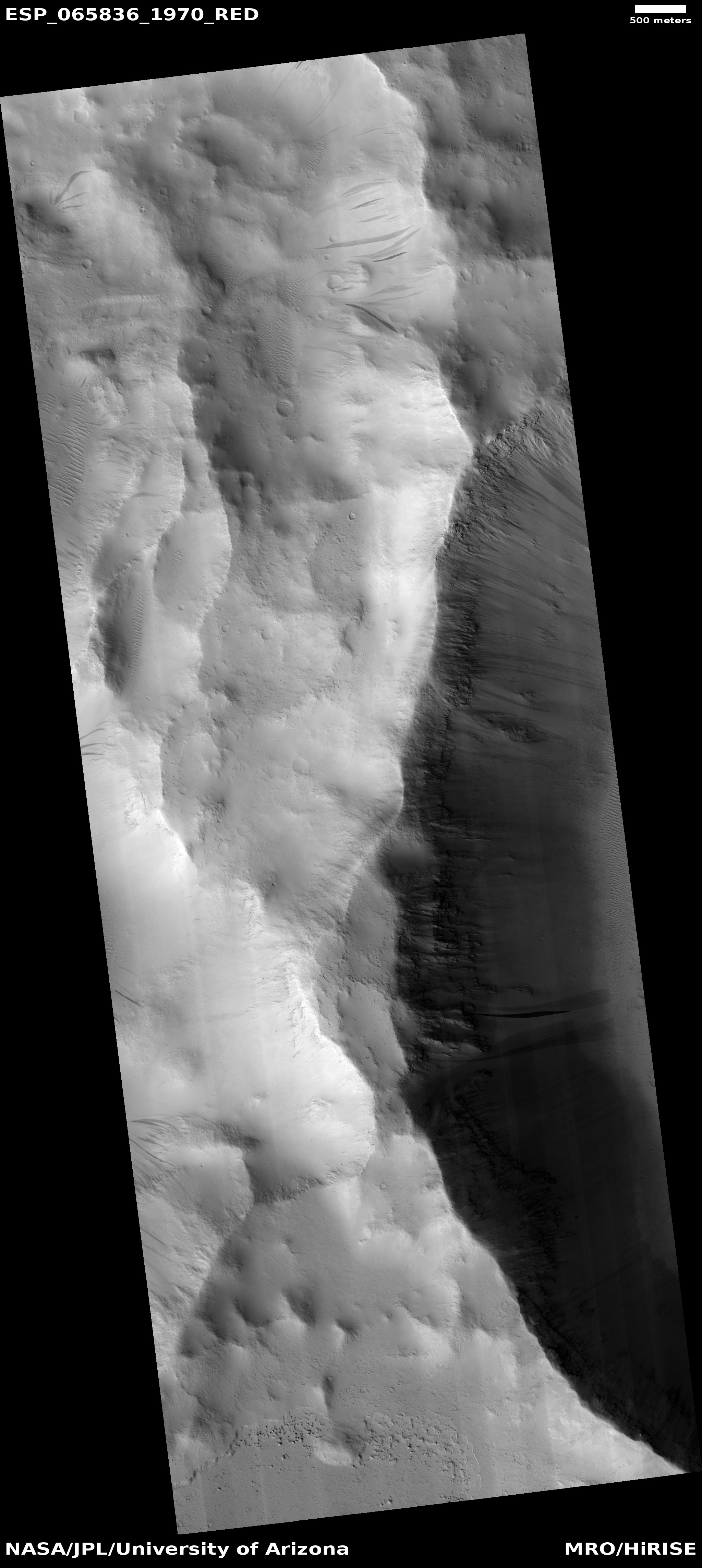
Cool image time! The photo to the right, rotated, cropped, and reduced to post here, was taken on August 8, 2020 by the high resolution camera on Mars Reconnaissance Orbiter (MRO). Labeled merely as a “terrain sample,” it is an example of an image taken more for engineering than scientific reasons. No research scientist specifically requested it. Instead, the scientists operating the camera took it because they need to use MRO regularly to maintain the camera’s proper temperature. To do this they periodically take almost random images, but never without trying to pick a location that might have some scientific value.
In this case we get what appears to be an isolated sloping hill. Located at about 15 degrees north latitude, this is not a place where one would expect visible evidence of water, though the gullies on the slopes are intriguing. They almost look like the kind of hillside erosion you see in places where rain falls on desert mountainsides.
Rain can’t be the cause, but nonetheless monitoring these gullies for changes over time would be worthwhile science research. Since it appears no one is presently focused on doing it, anyone interested out there?
This mountain is actually far more isolated than this high resolution image suggests.
» Read more


