
Inactive volcano vent on Mars
Click for full image.
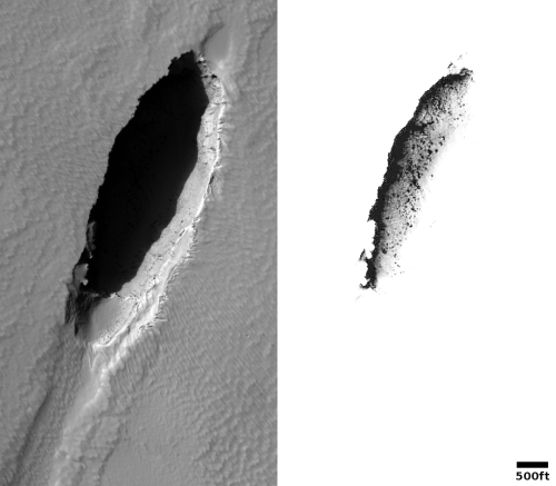
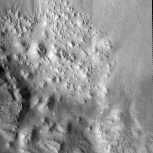
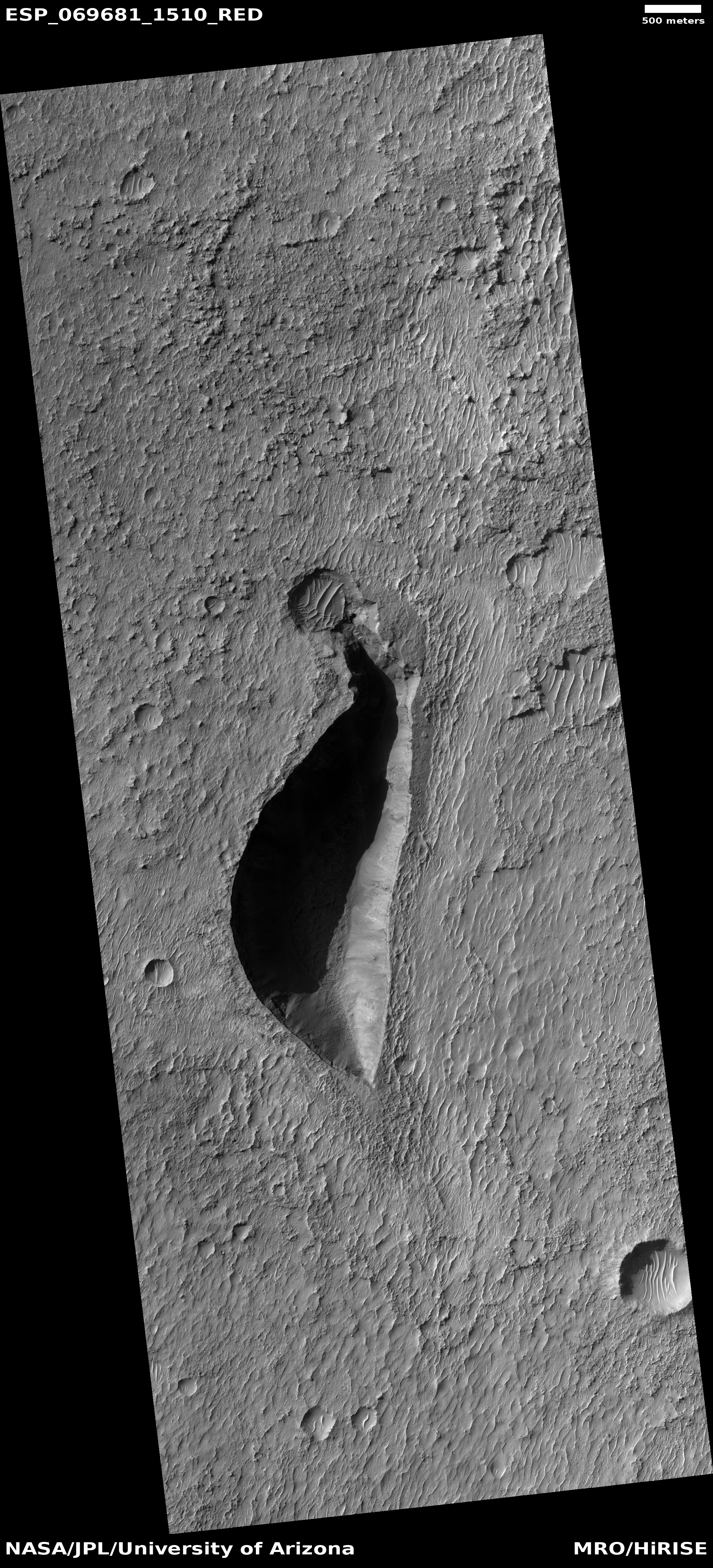
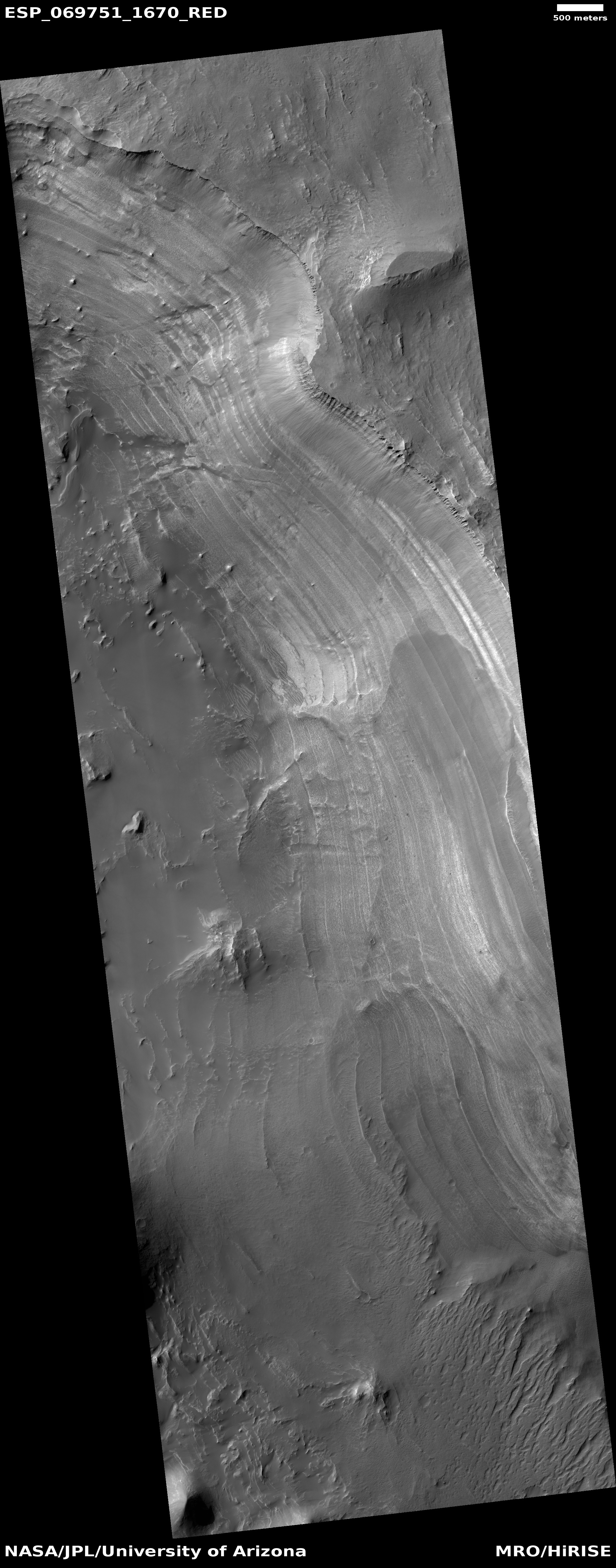
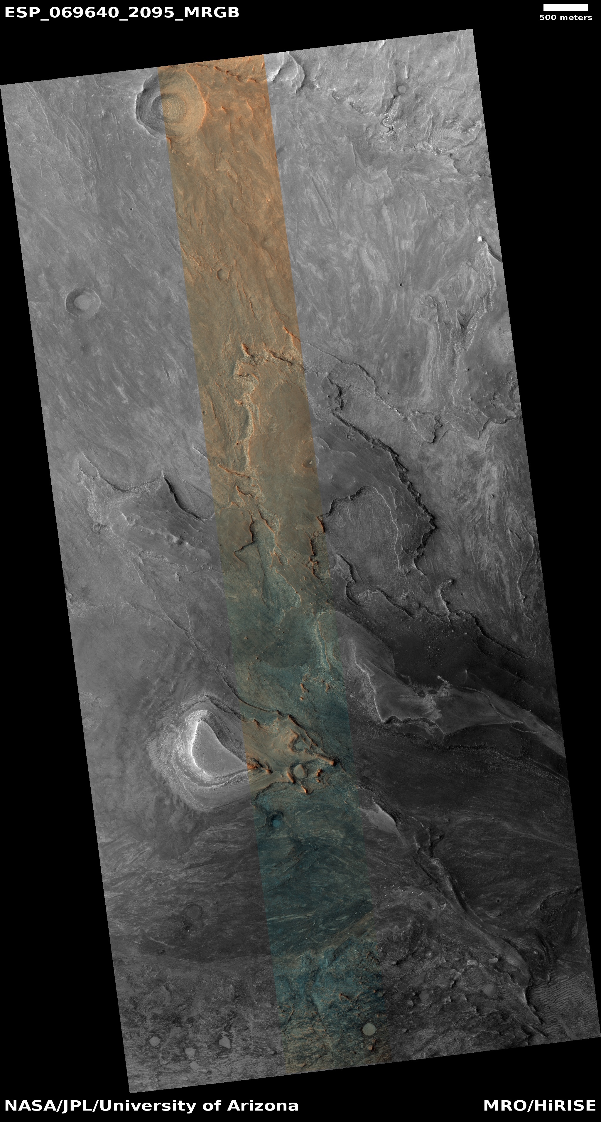
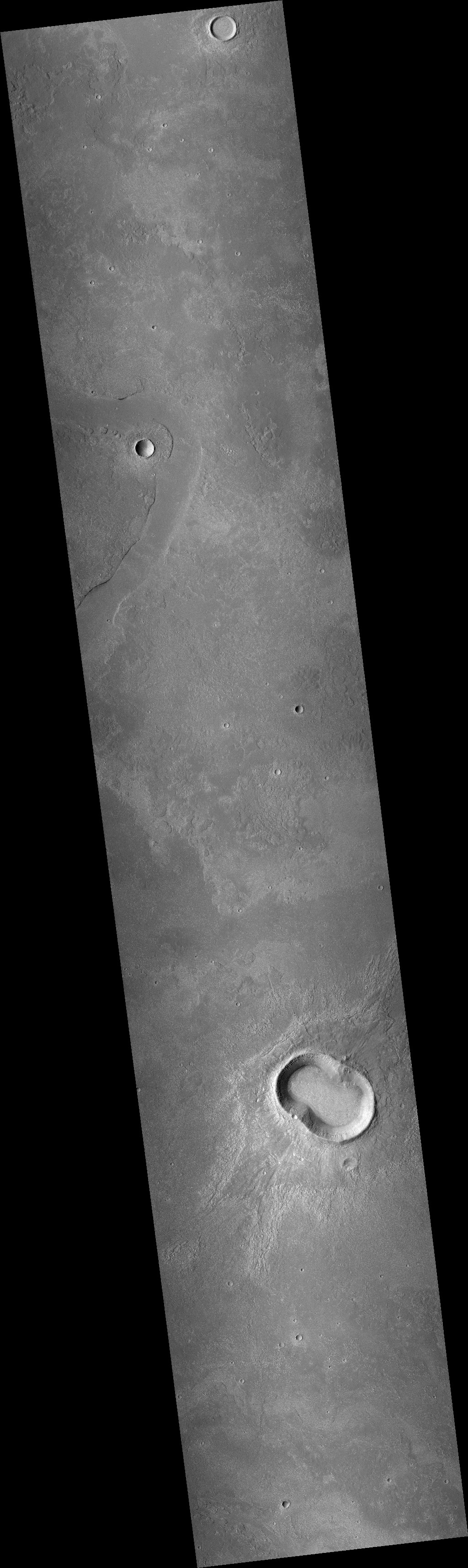
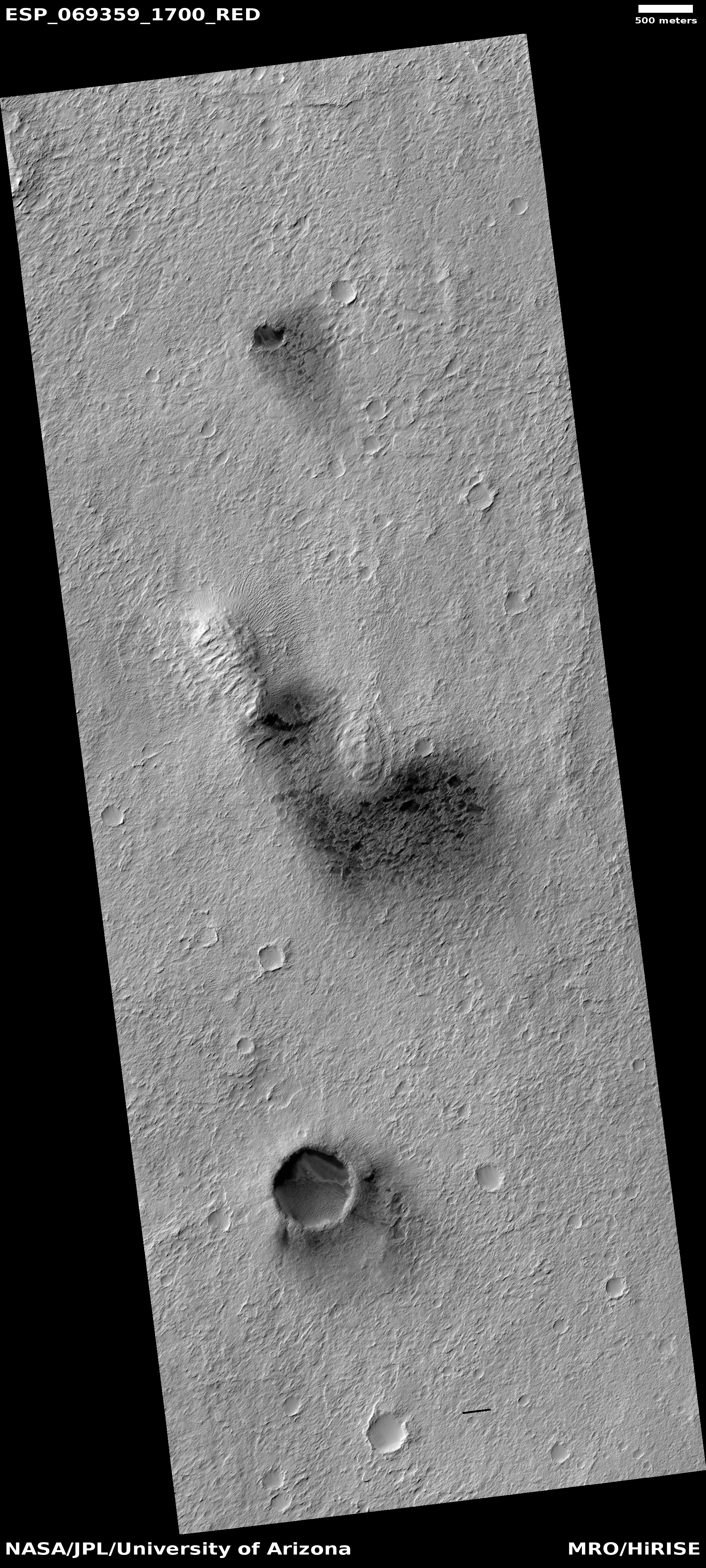
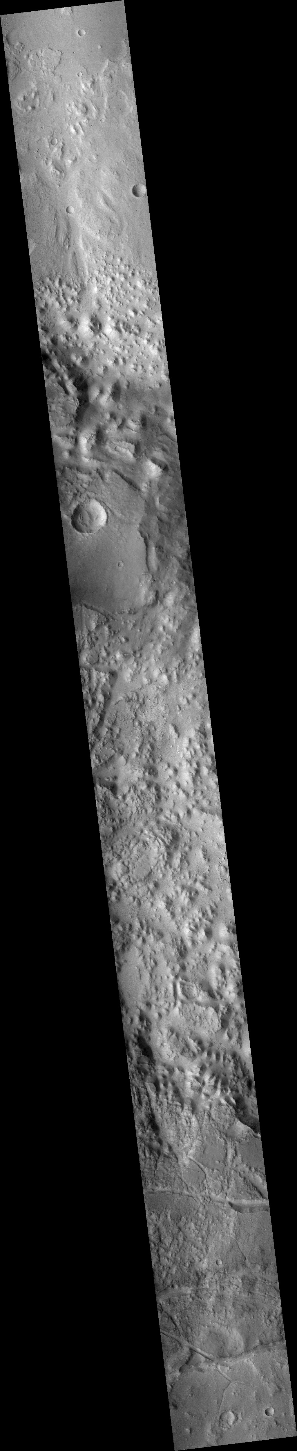
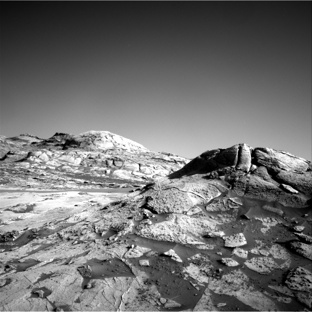
Cool image time! The photo to the right, cropped, reduced and annotated to post here, was taken on July 30, 2021 by the high resolution camera on Mars Reconnaissance Orbiter (MRO). The left image shows a pit that the scientists label a “vent” near the giant volcano Pavonis Mons. The right image is identical, except that I have brightened it considerably to bring out the details in the shadowed area.
As you can see, this pit is filled, and does not appear to have any existing openings into more extensive underground passages.
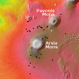
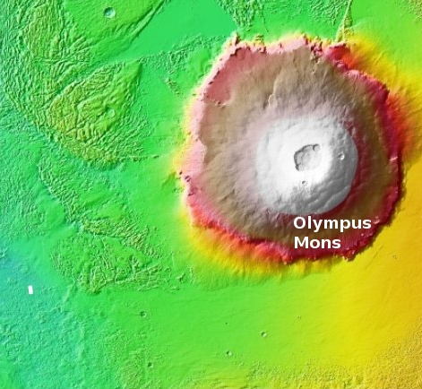
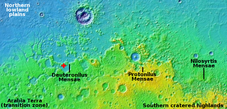
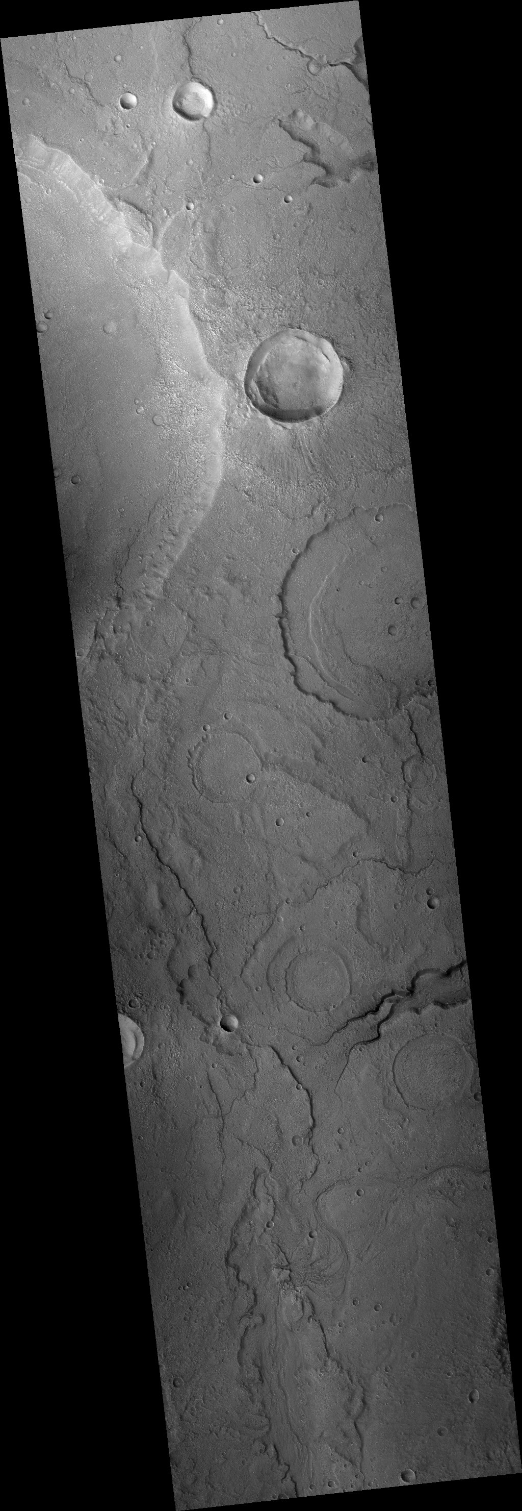
The white dot on the overview map on the right shows this vent’s location, to the south of Pavonis Mons, and in line with the giant crack that splits three of Mars’ four largest volcanoes. The vent is even aligned the same as that crack, from the northeast to the southwest. The black dots mark the locations of the many cave pits found in this region.
Was this a volcanic vent? If you look at the full image you will see that this pit aligns with a shallower pit to the southwest, with a depression linking the two. Visually this suggests this is a faultline which in turn makes for a good outlet point for lava flow.
Though the data suggests this is a volcanic vent, that supposition is as yet unproven. The full image does not show much evidence of a flow from the pit, which suggests instead that we are merely looking at a spot where the ground cracked along fault lines.

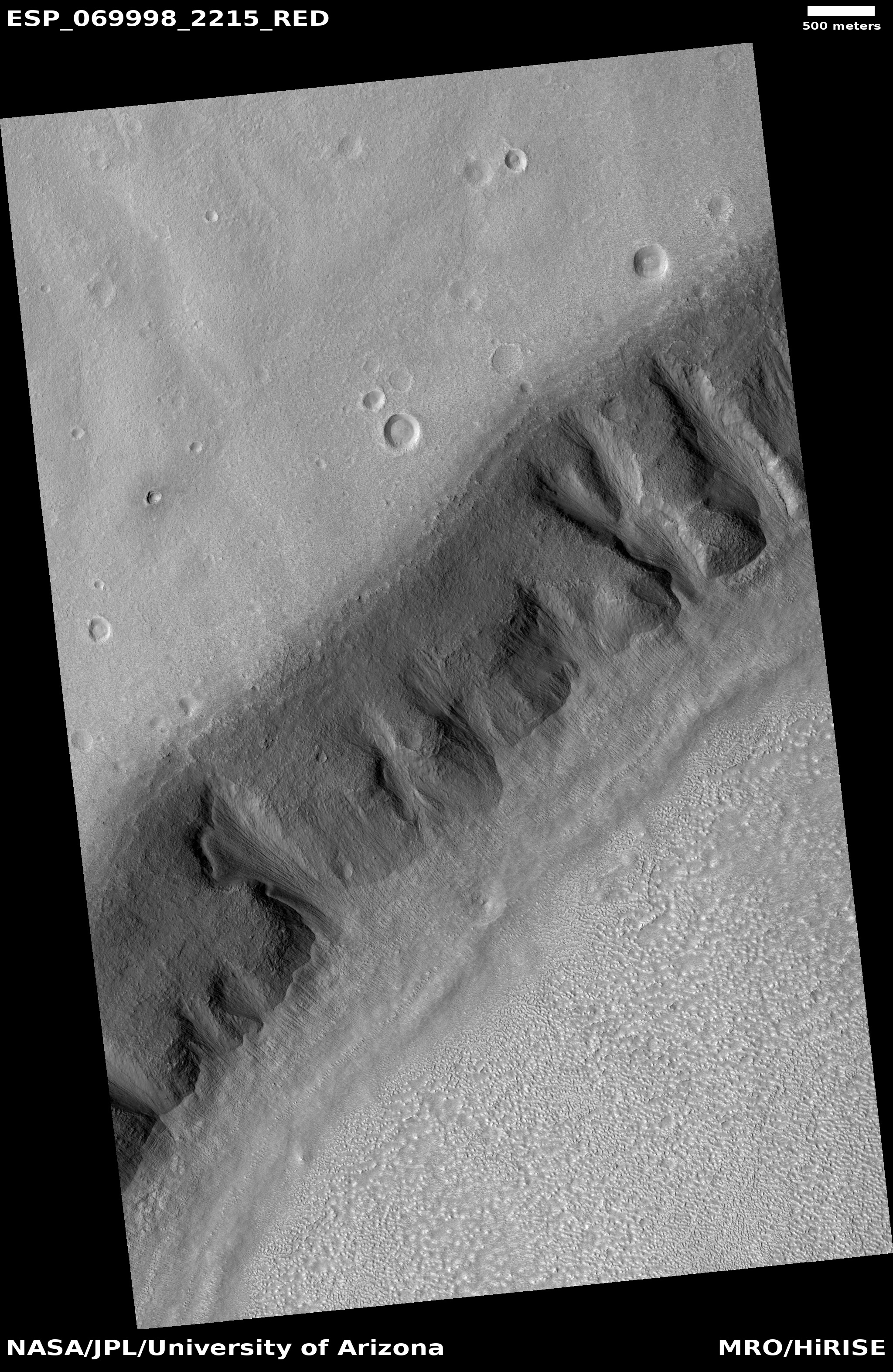
Click for full image.
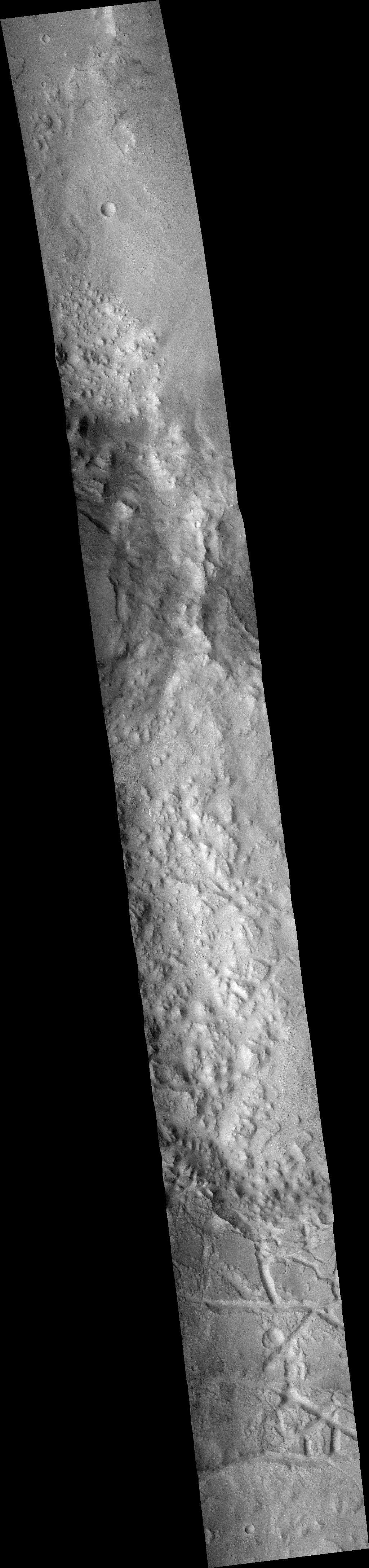
Cool image time! The photo to the right, cropped, reduced and annotated to post here, was taken on July 30, 2021 by the high resolution camera on Mars Reconnaissance Orbiter (MRO). The left image shows a pit that the scientists label a “vent” near the giant volcano Pavonis Mons. The right image is identical, except that I have brightened it considerably to bring out the details in the shadowed area.
As you can see, this pit is filled, and does not appear to have any existing openings into more extensive underground passages.
The white dot on the overview map on the right shows this vent’s location, to the south of Pavonis Mons, and in line with the giant crack that splits three of Mars’ four largest volcanoes. The vent is even aligned the same as that crack, from the northeast to the southwest. The black dots mark the locations of the many cave pits found in this region.
Was this a volcanic vent? If you look at the full image you will see that this pit aligns with a shallower pit to the southwest, with a depression linking the two. Visually this suggests this is a faultline which in turn makes for a good outlet point for lava flow.
Though the data suggests this is a volcanic vent, that supposition is as yet unproven. The full image does not show much evidence of a flow from the pit, which suggests instead that we are merely looking at a spot where the ground cracked along fault lines.


