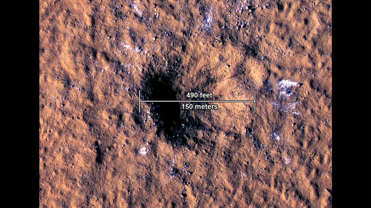
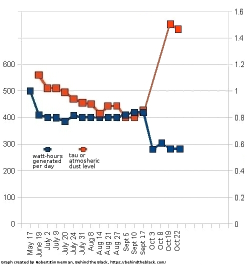
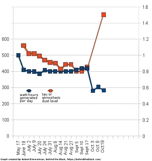
Expanded craters in Martian ice
Click for full image.
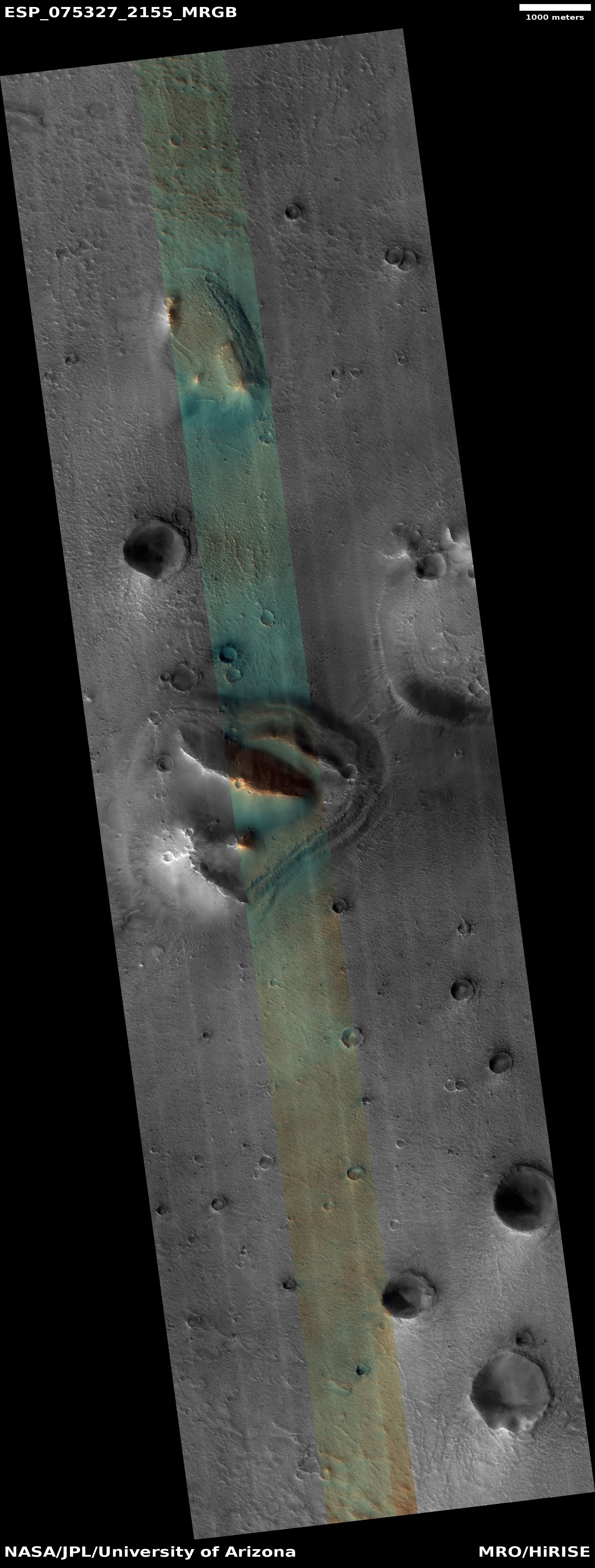
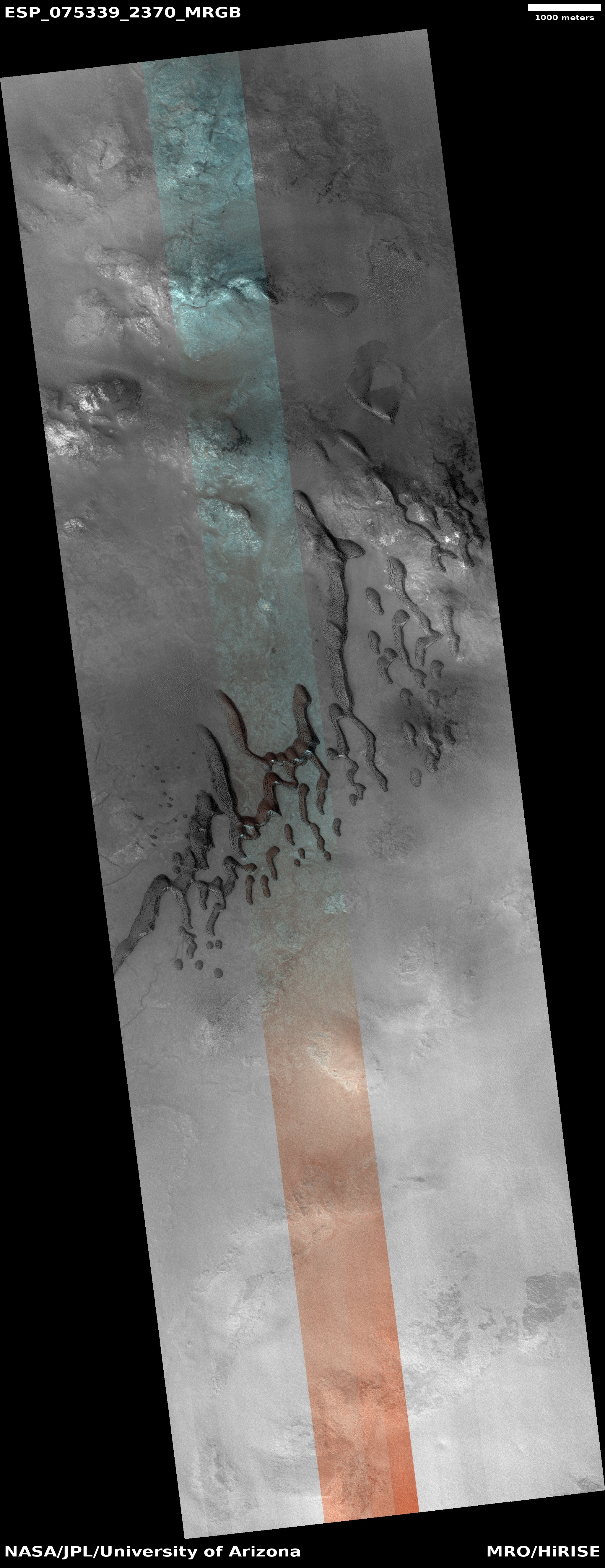
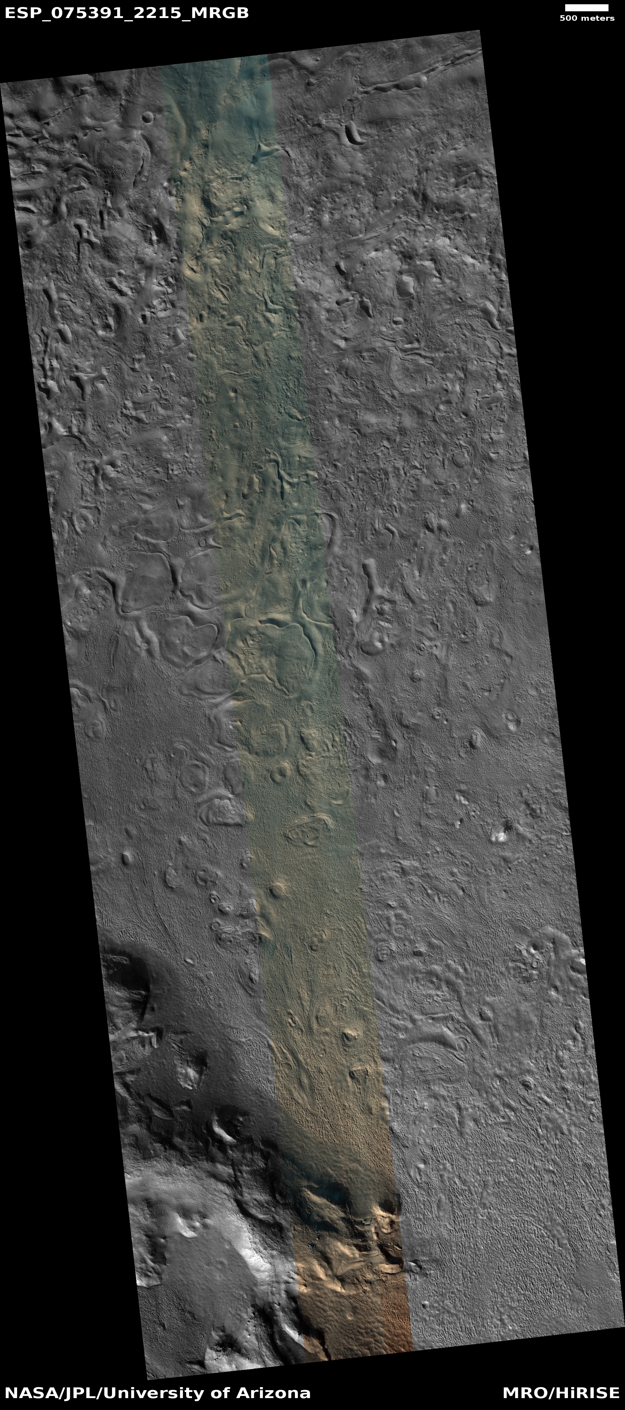
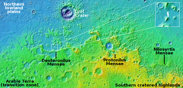
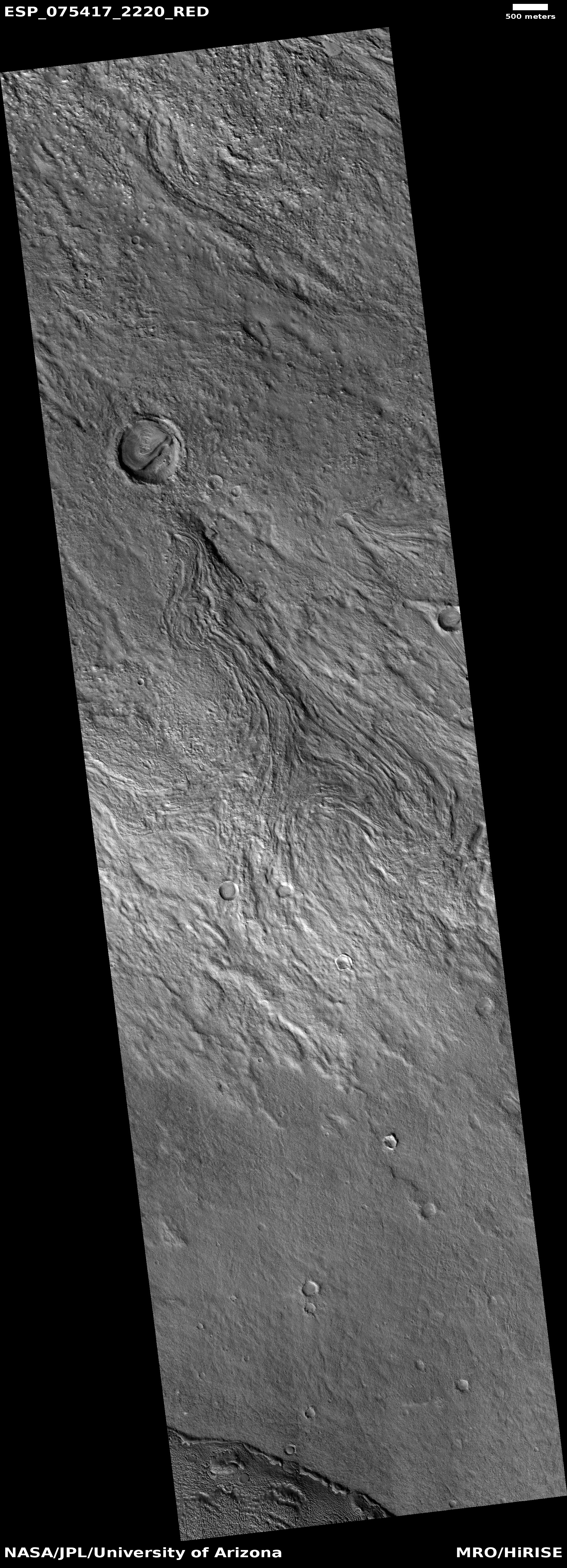
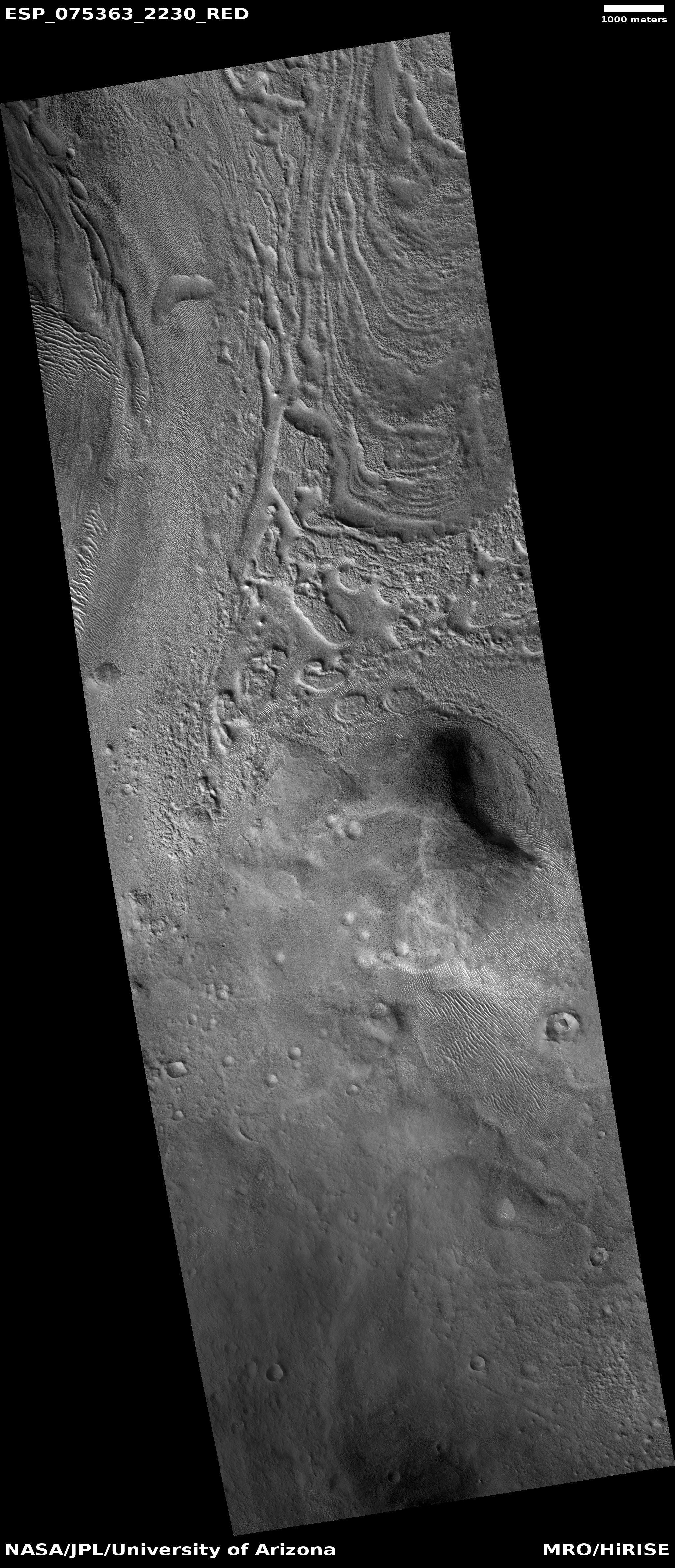
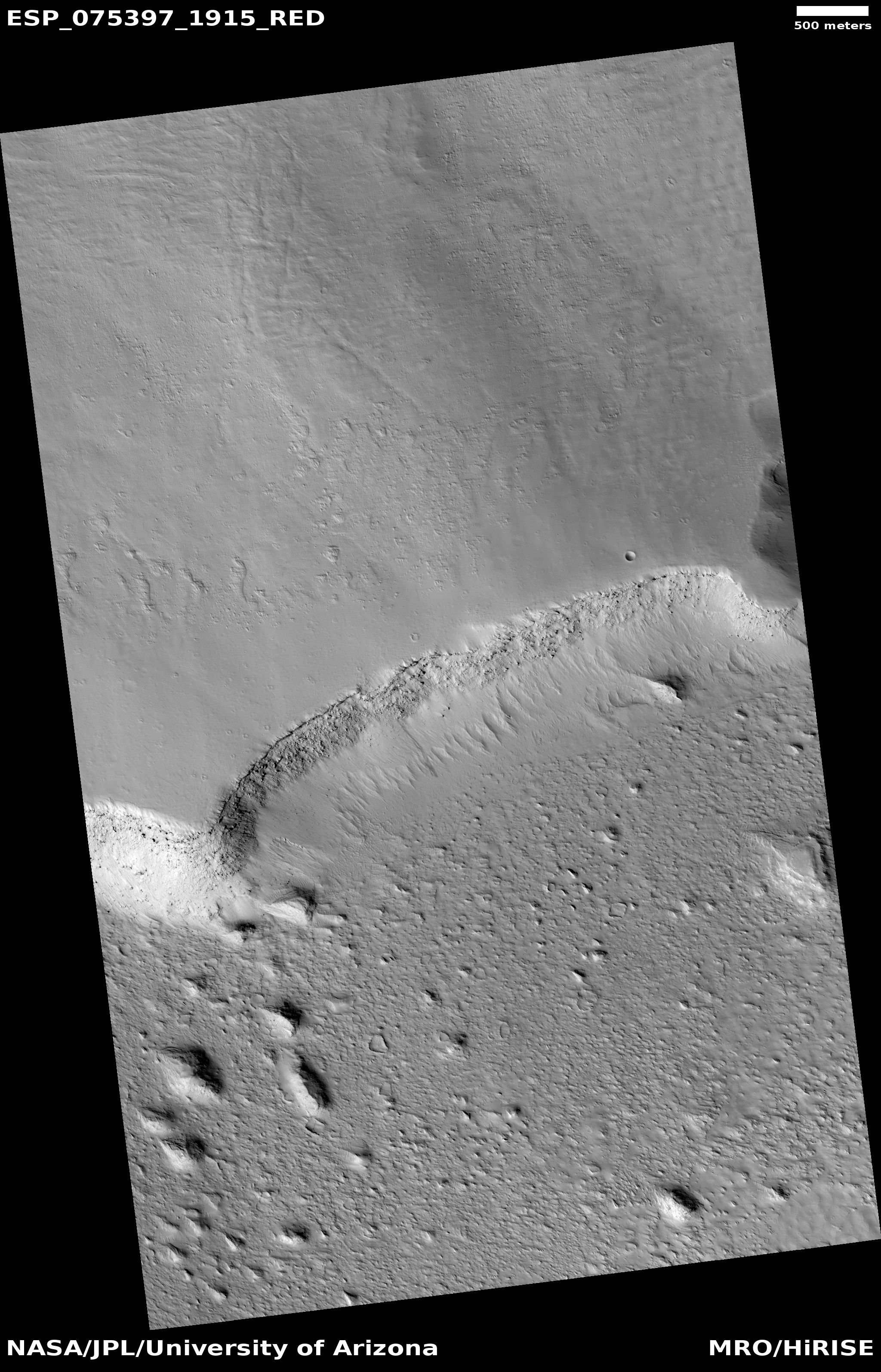
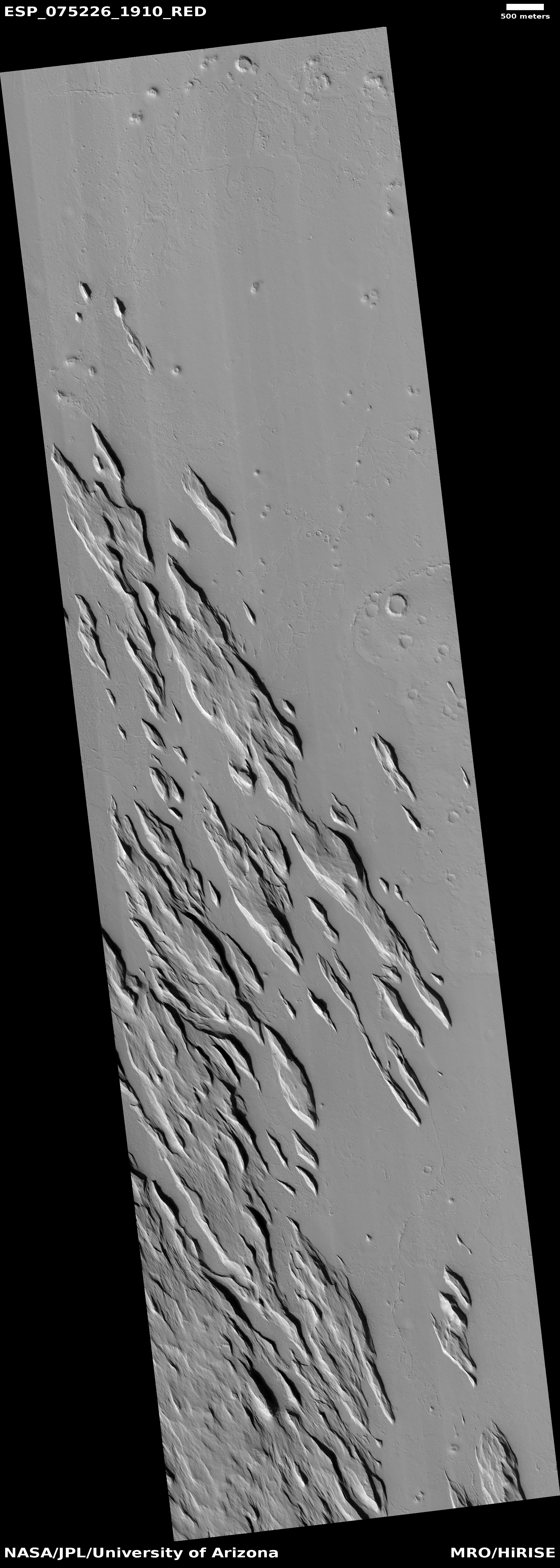
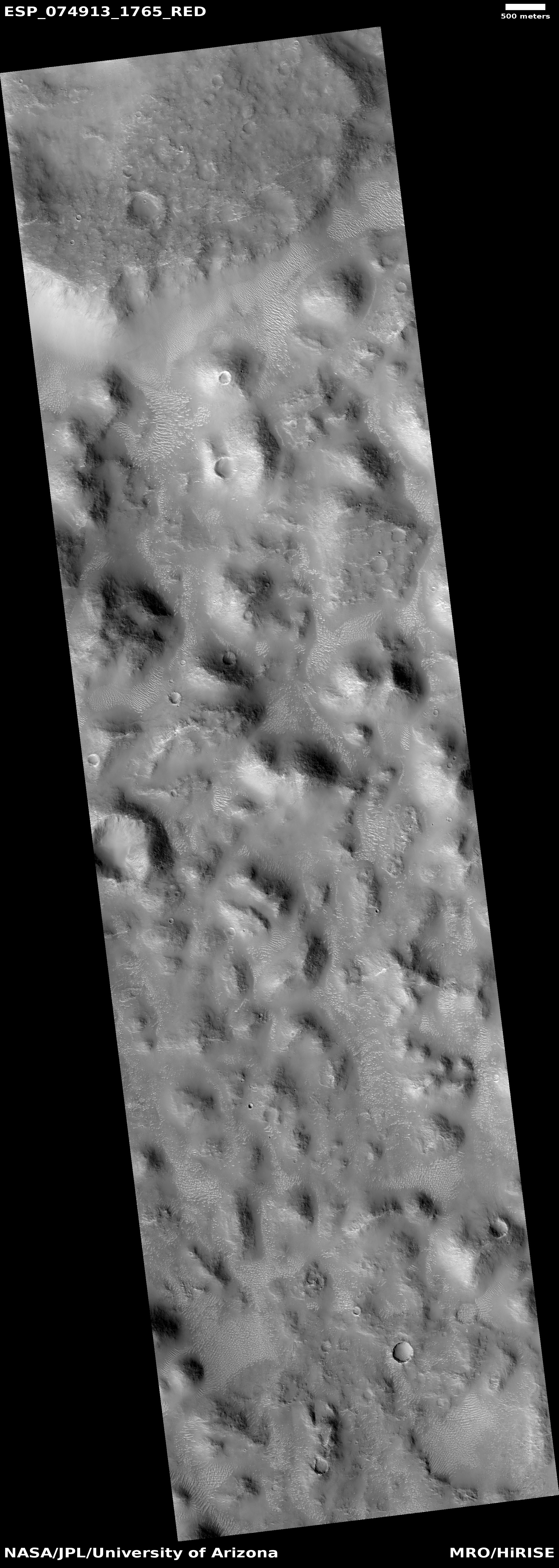
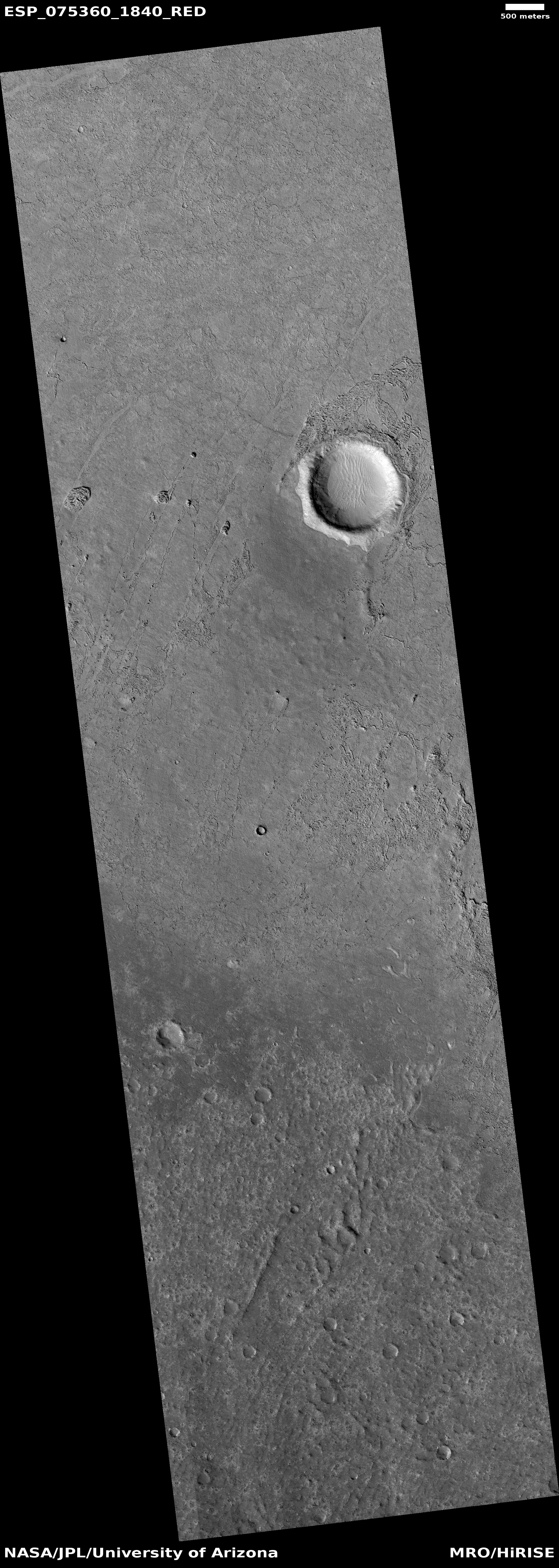
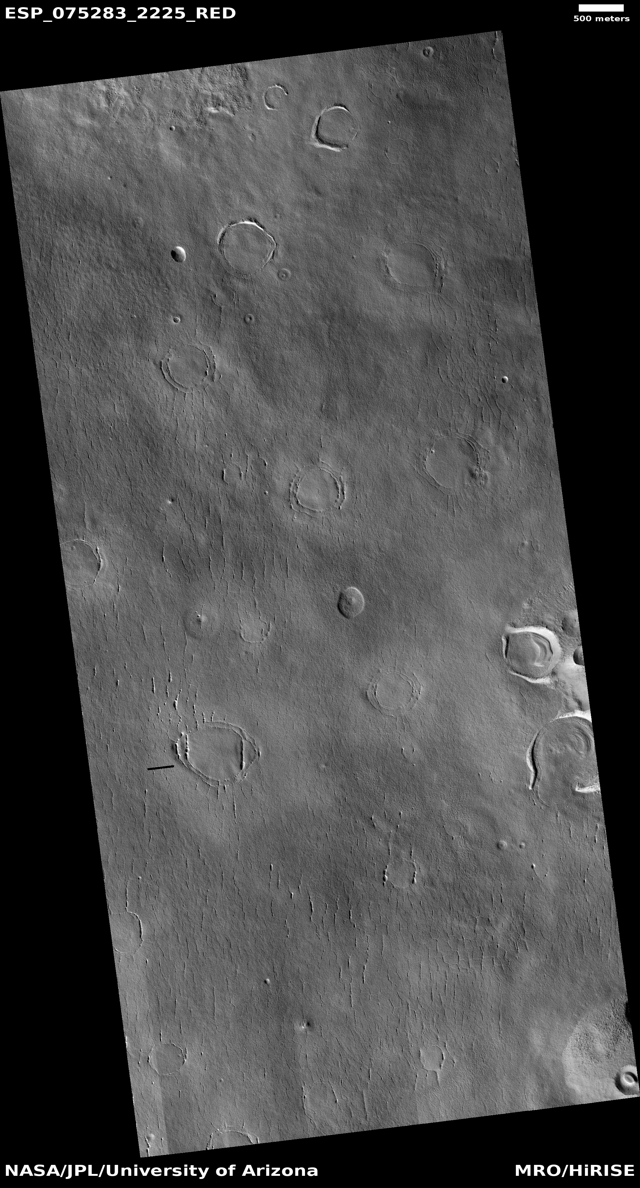
Cool image time! The photo to the right, rotated, cropped, reduced, and sharpened to post here, was taken on August 18, 2022 by the high resolution camera on Mars Reconnaissance Orbiter (MRO). It includes a wide variety of geology related to sublimating ice, including expansion cracks as well as several different examples of what scientists call “expanded craters,” impacts that occurred in near surface ice and have been reshaped by the ice’s melting and sublimation at impact and then later. It also shows some obvious glacial fill in the two distorted craters at the center right.
A 2017 dissertation [pdf] by Donna Viola of the University of Arizona outlines nicely what we know of Martian expanded craters. As she notes in her conclusion:
» Read more