
Ice in the Martian equatorial region?
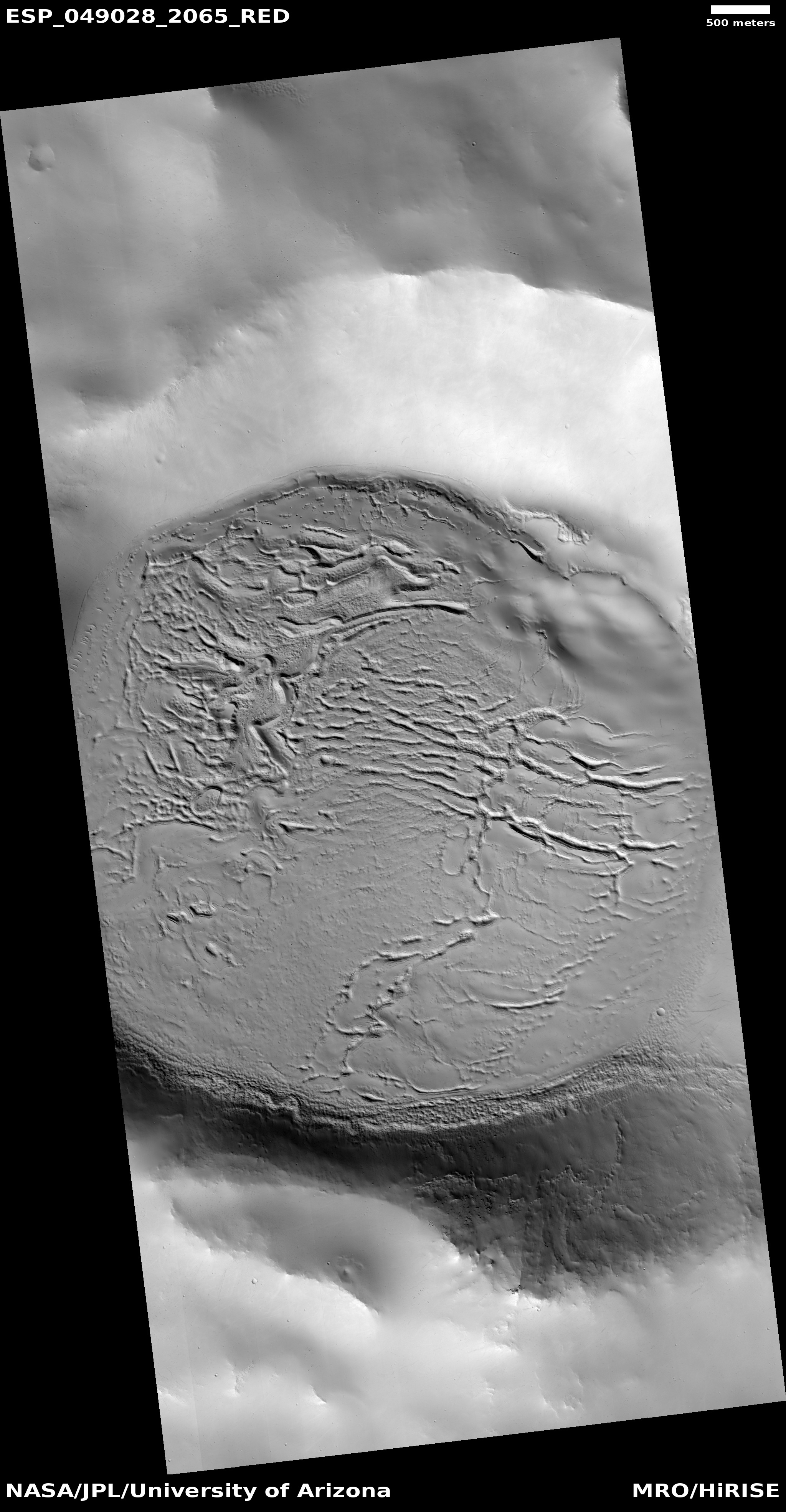
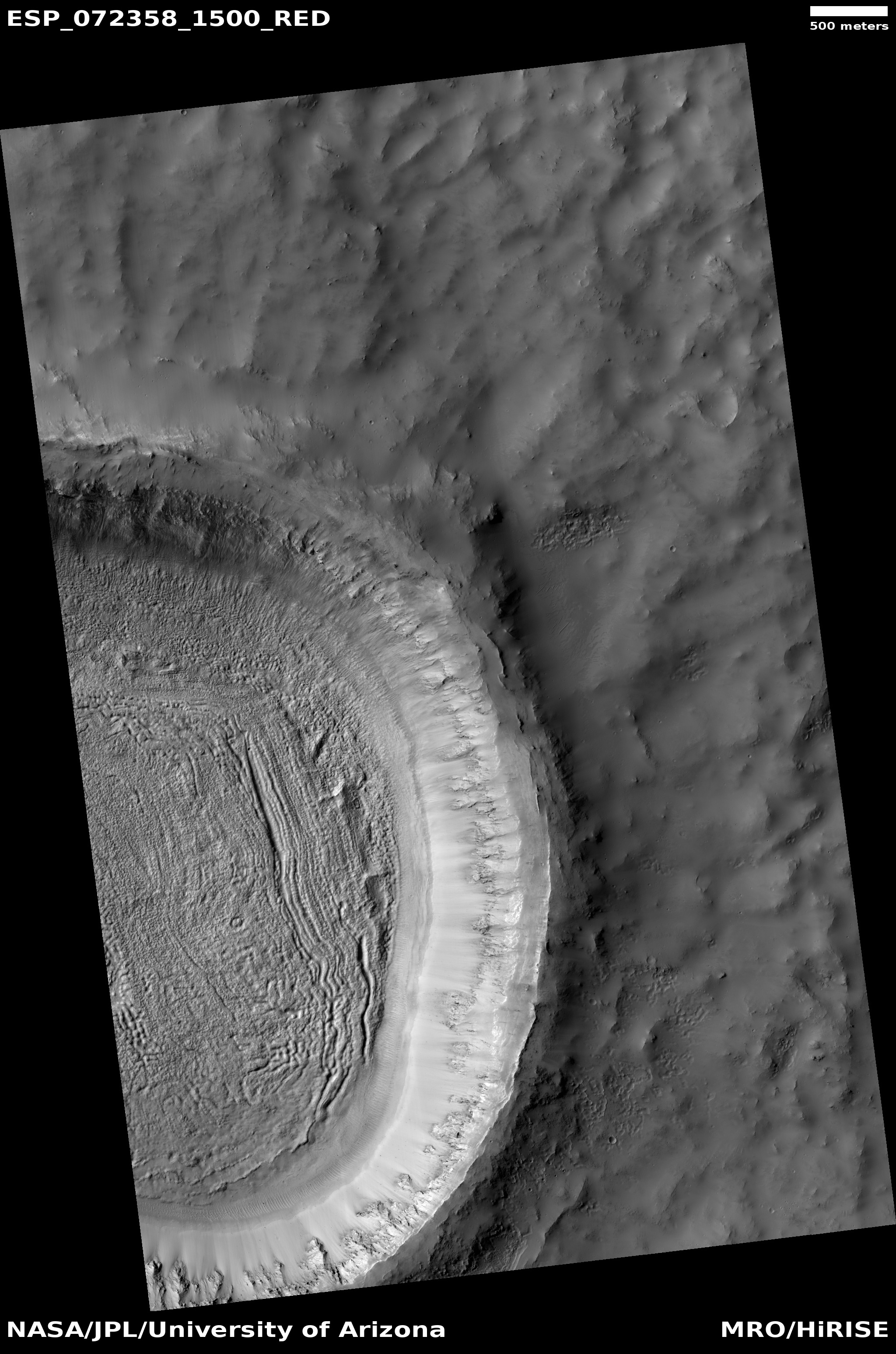
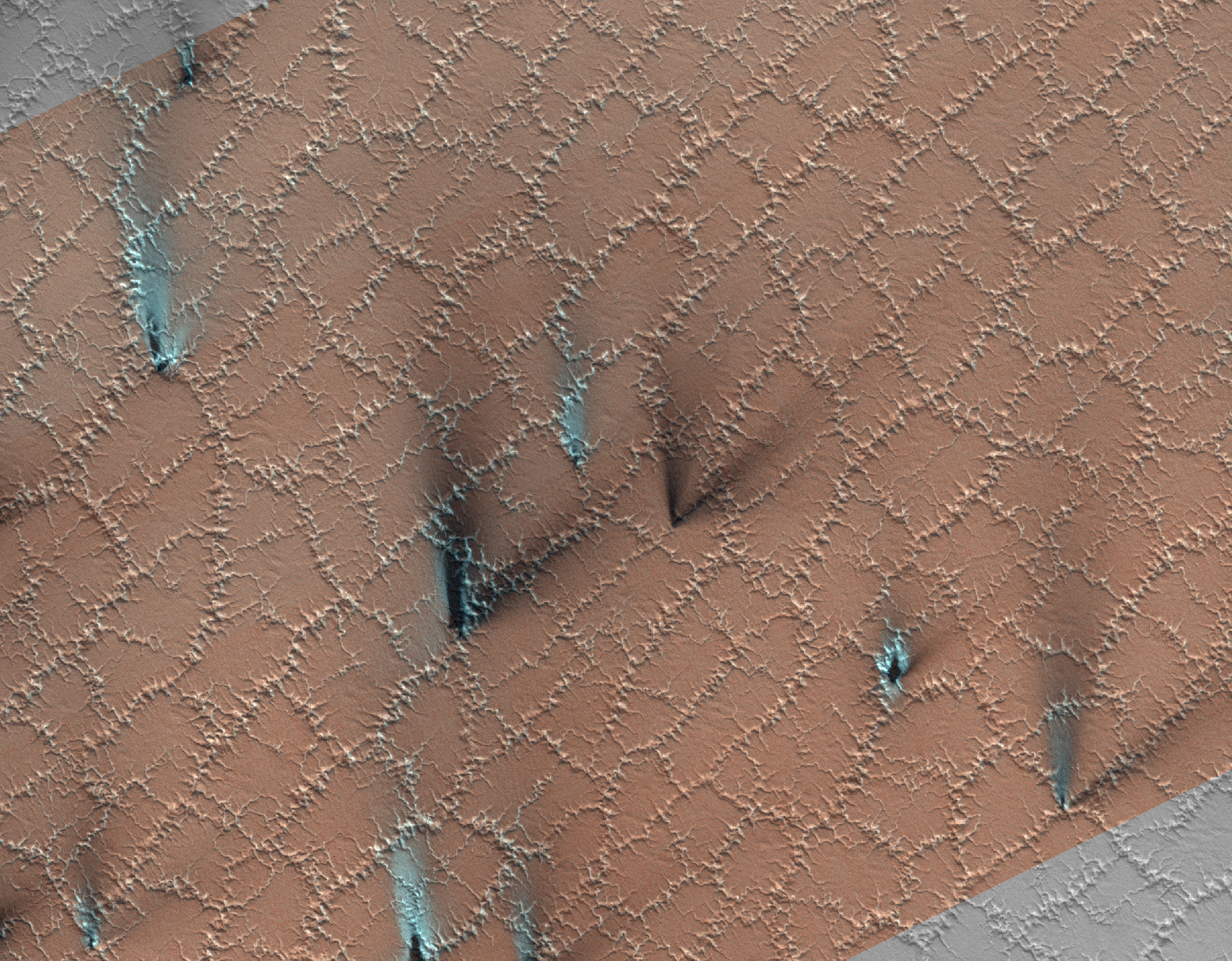
Today’s cool image to the right, rotated, cropped, and reduced to post here, is actually an older captioned image, published in 2017 by the science team for the high resolution camera on Mars Reconnaissance Orbiter (MRO). I missed its significance when it was first released. From the caption by Alfred McEwen of the Lunar & Planetary Laboratory in Arizona:
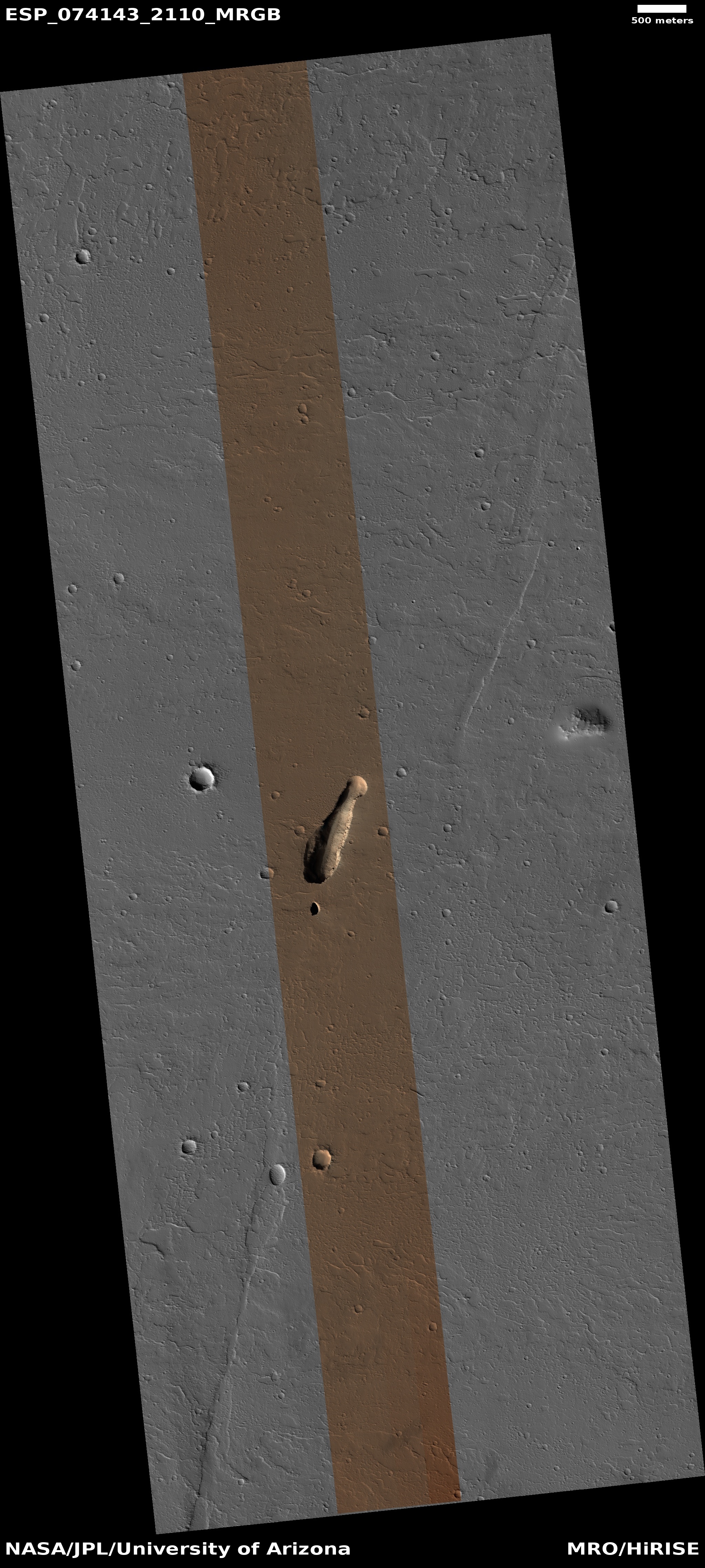
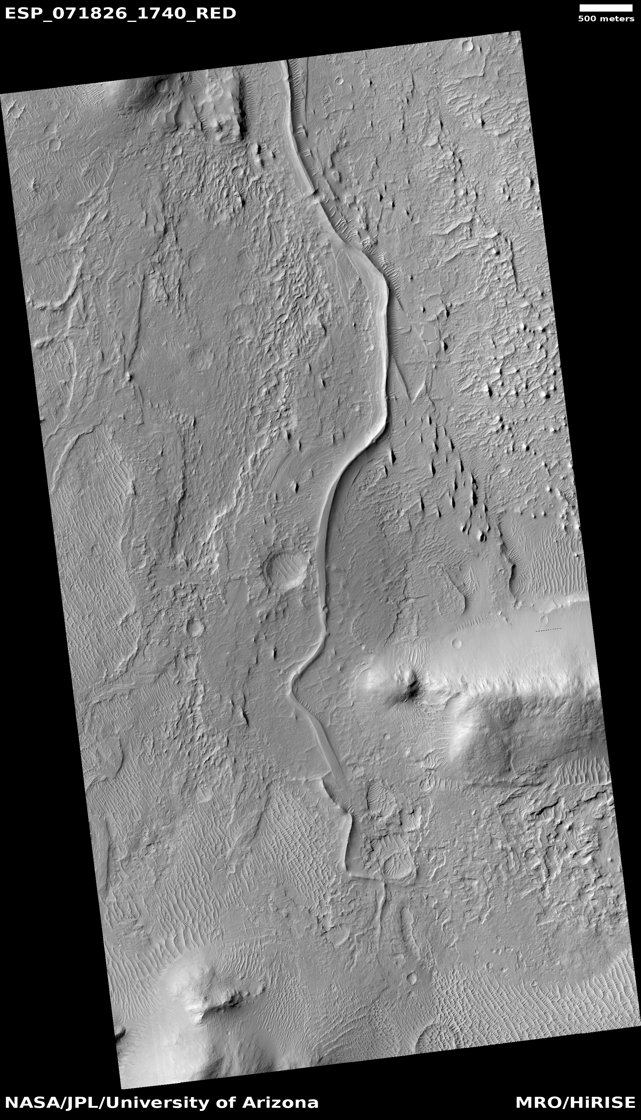
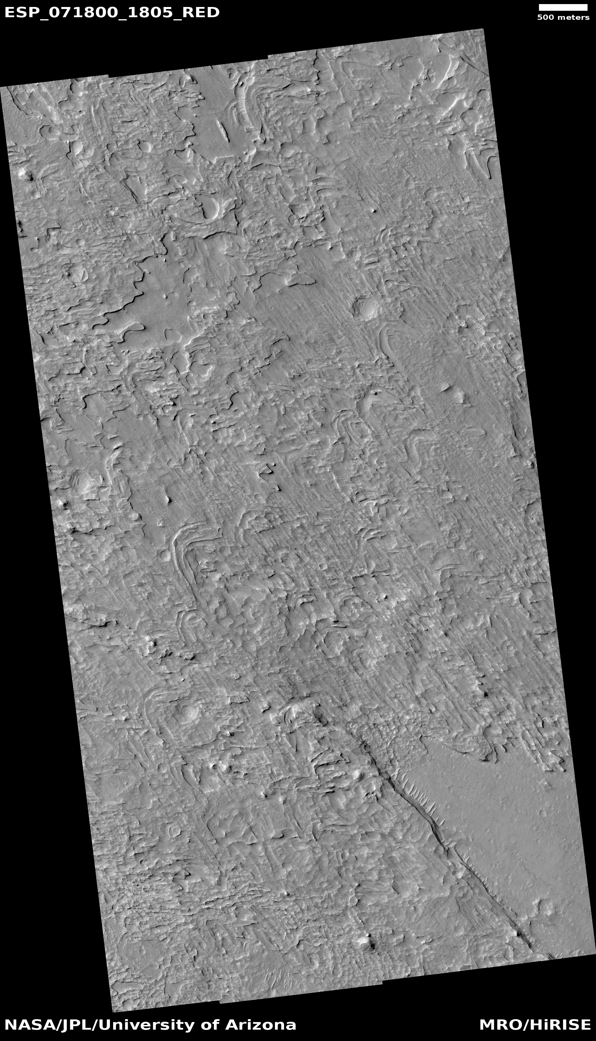
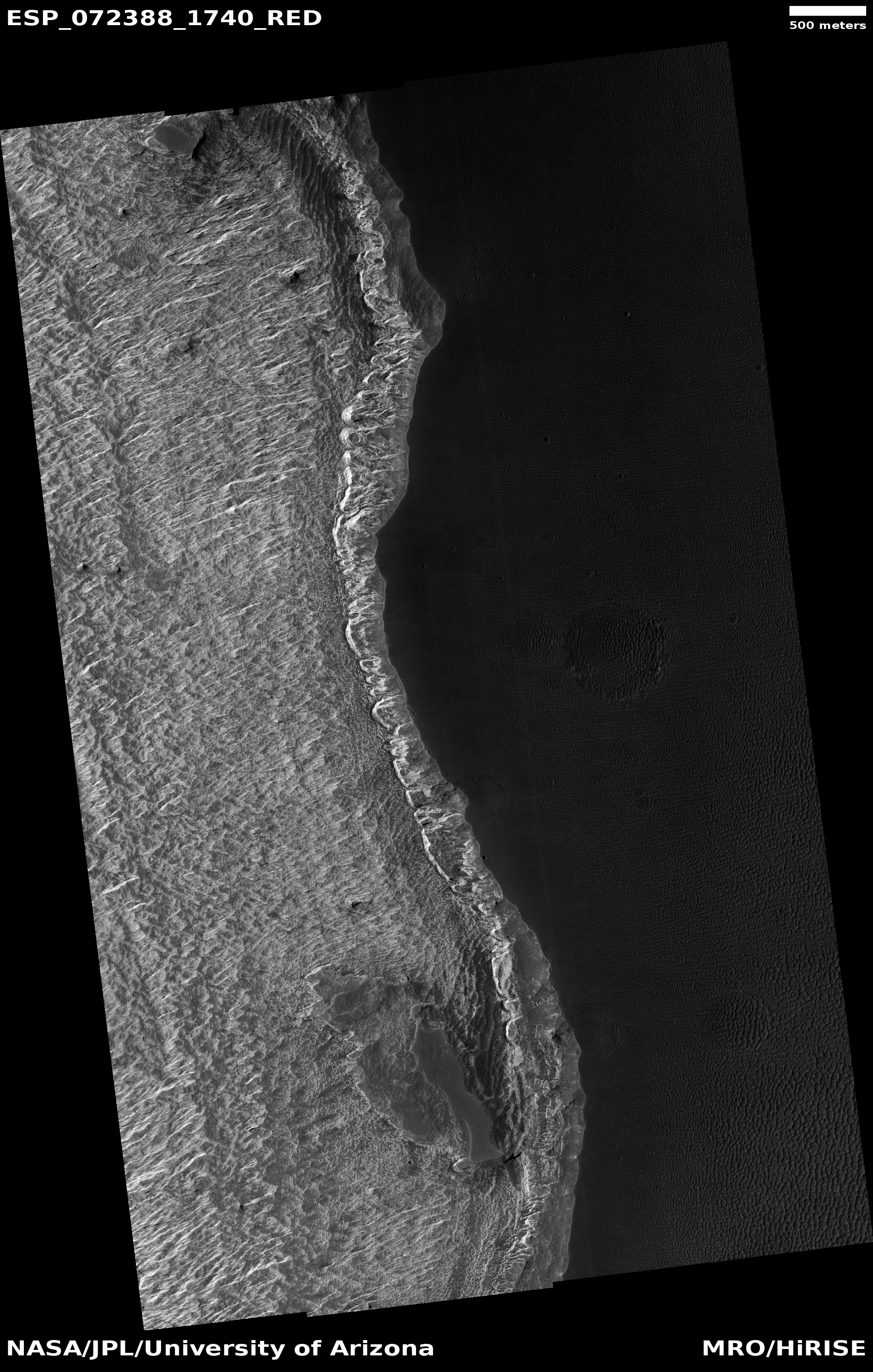
The material on the floor of this crater appears to have flowed like ice, and contains pits that might result from sublimation of subsurface ice. The surface is entirely dust-covered today. There probably was ice here sometime in the past, but could it persist at some depth?
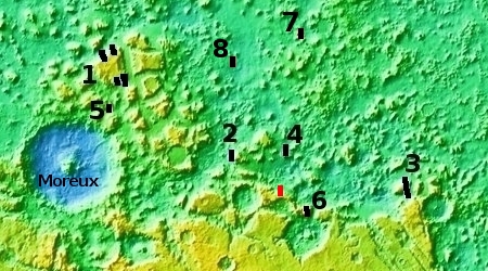
This crater is at latitude 26 degrees north, and near-surface ice at this latitude (rather than further toward one of the poles) could be a valuable resource for future human exploration.
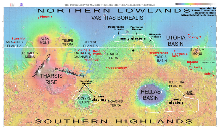
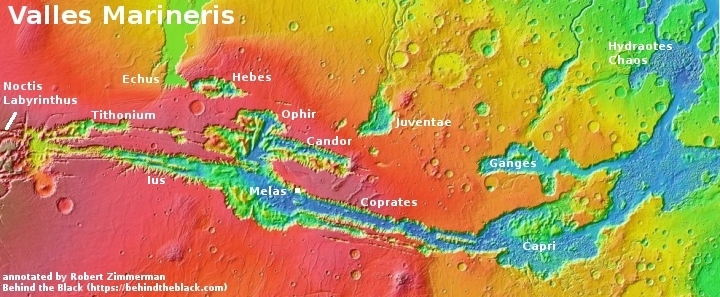
As shown in the global map of Mars above, this 26-mile-wide unnamed crater, marked by the black cross, is well inside the equatorial region 30 degrees north and south from the equator where almost no evidence of near surface ice has been found. Whenever I look at an image from MRO, if the picture appears to show ice or glacial features, its latitude is always 30 degrees or higher. If it does not, it is almost always in this equatorial region.
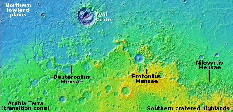
This crater however shows evidence of glacial features in its interior, but is far closer to the equator than normal. How could this be? It is possible that its high altitude, sitting in the southern cratered highlands, might have helped preserve its buried but near surface glacial features.
Regardless, as McEwen notes, its location closer to the equator is tantalizing, because it suggests that such ice could exist even in the equatorial regions, though buried and thus not detected by the instruments presently available in Mars orbit.

