The colors of Mars
Click for full image.
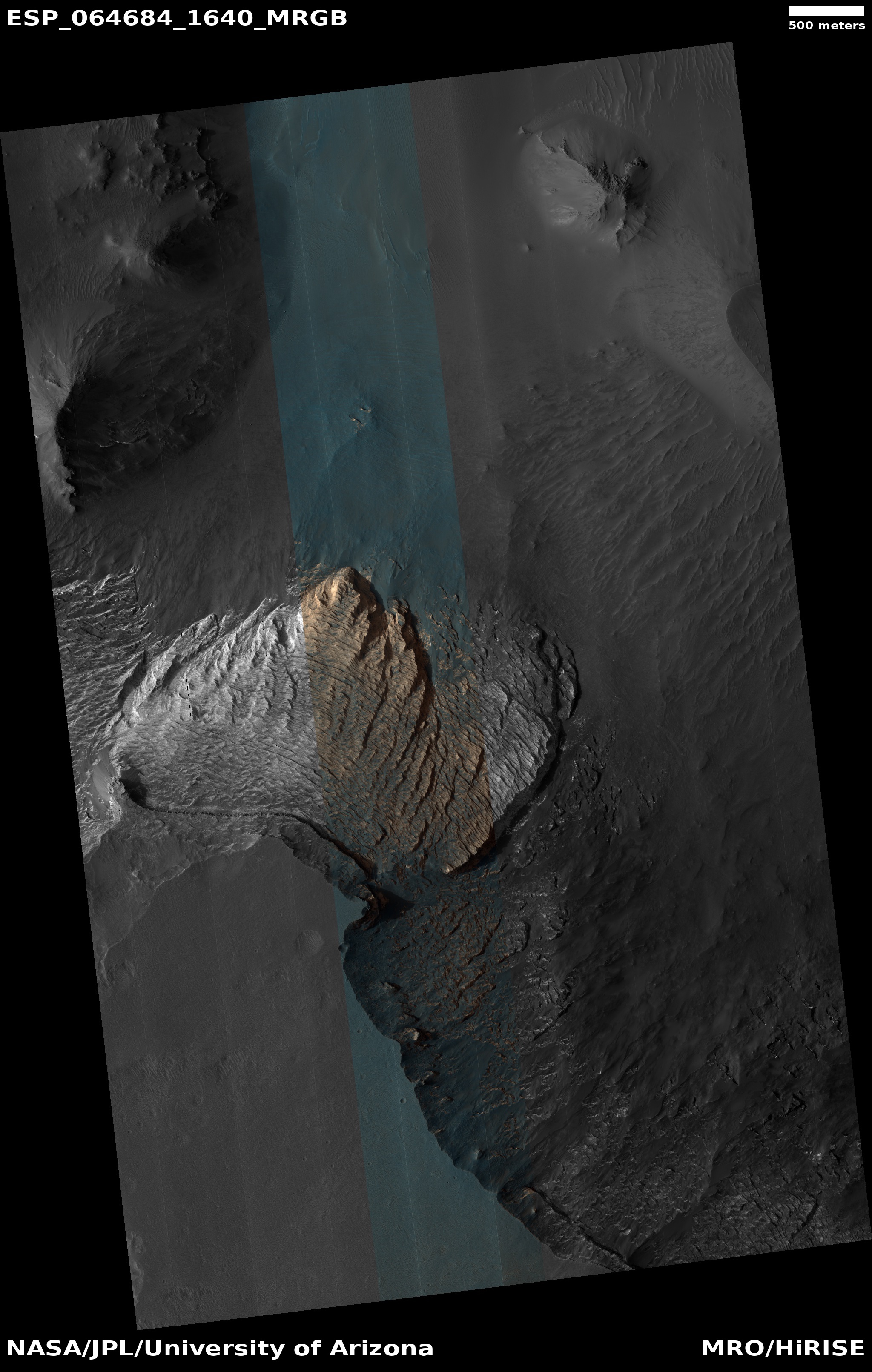
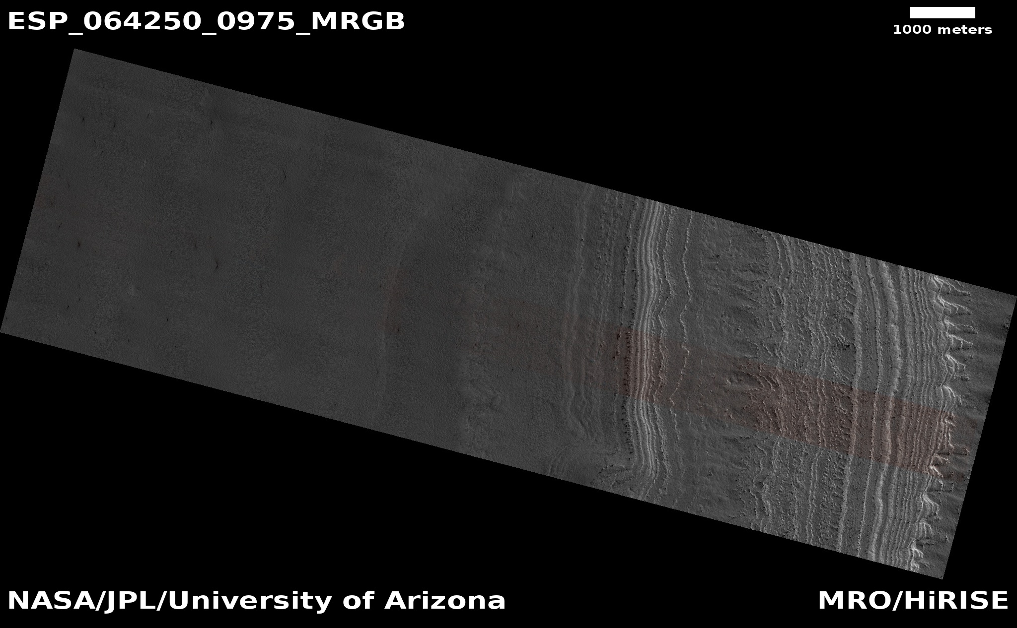
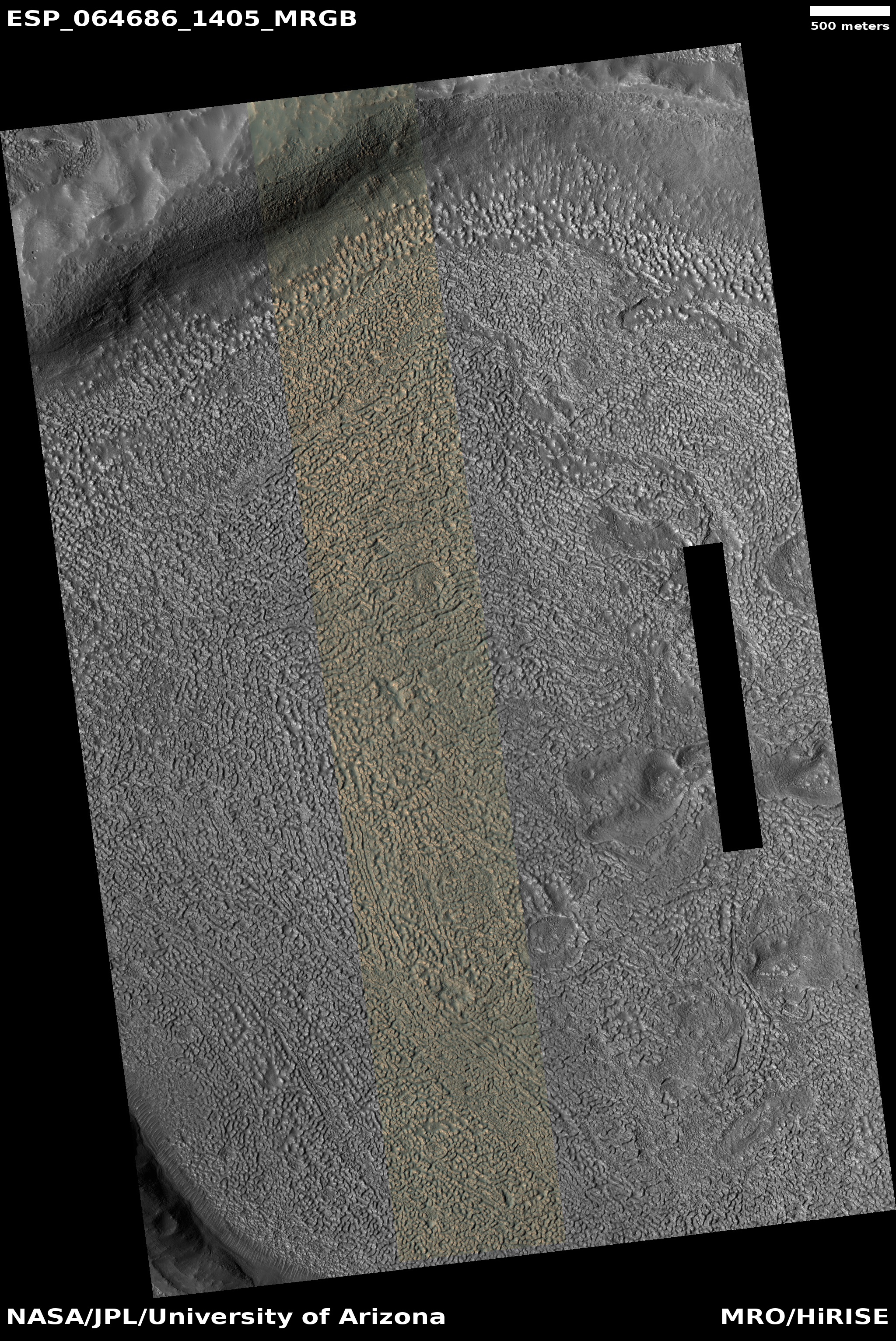
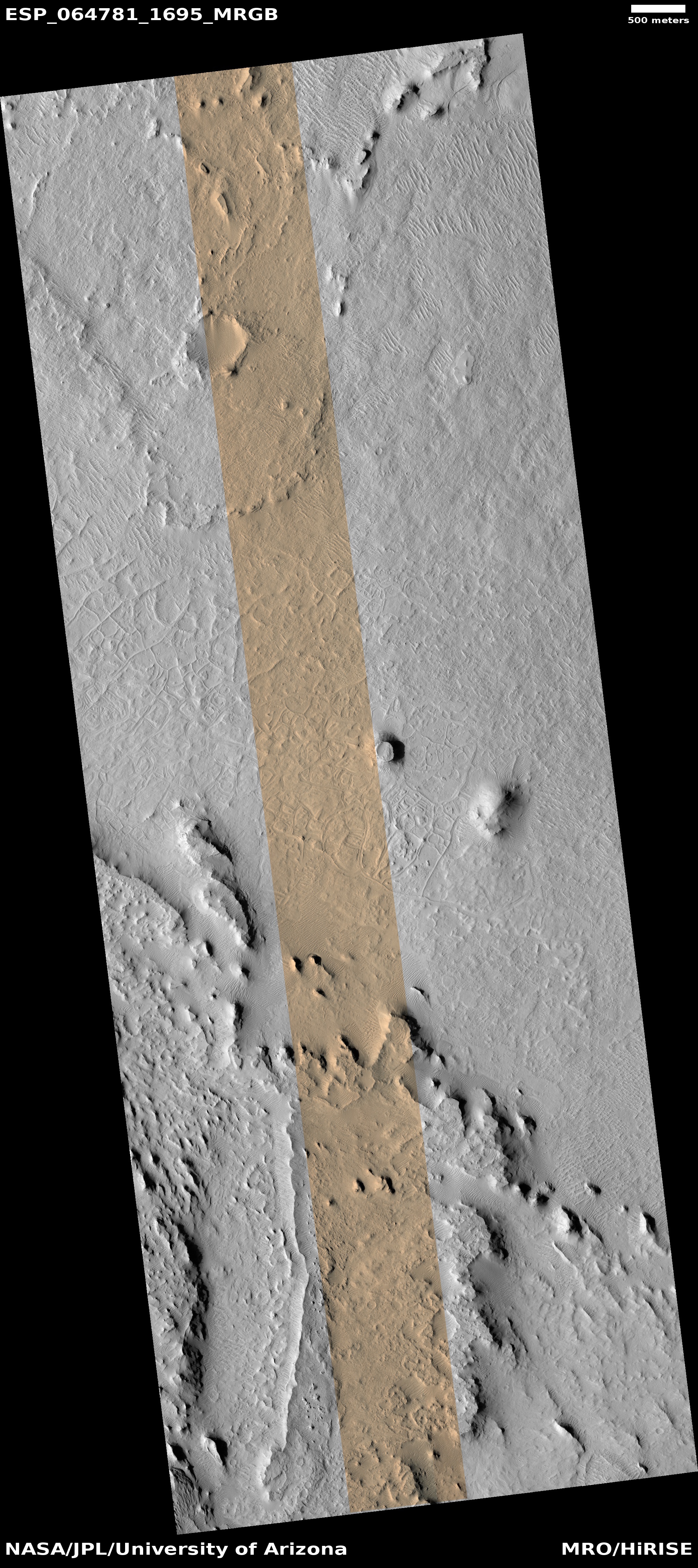
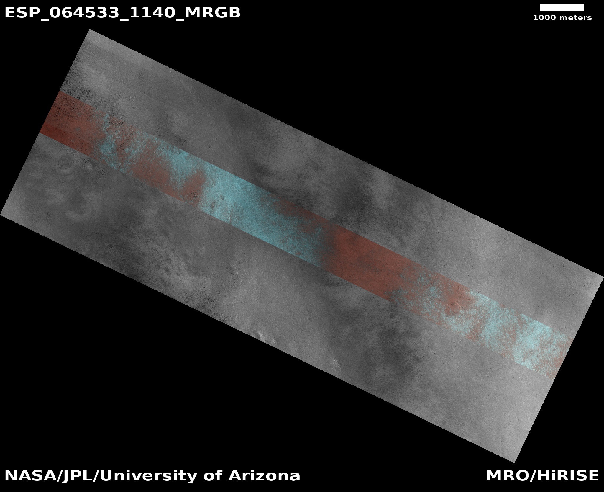
Actually today’s cool image tells us less about the real colors on Mars and much about the colors captured by the high resolution camera on Mars Reconnaissance Orbiter (MRO). The photo on the right was taken on May 2, 2020, and shows a relatively featureless area to the east of 80-mile wide Byrd Crater in the high southern latitude of Mars.
The only major features seen on this photo are a series of rounded ridges that in the larger context map at the image site look almost like drainage hollows coming down from the crater’s rim about twenty miles away.
The colors, though exaggerated and not entirely as the eye would see them, still tell us something very real about the surface. As explained here [pdf]:
In spite of the variable level of color enhancement for the Extras products, we can make some generalizations to better understand what the stretched color images are showing. Dust (or indurated dust) is generally the reddest material present and looks reddish in the RGB color. … Coarser-grained materials (sand and rocks) are generally bluer … but also relatively dark, except where coated by dust. Frost and ice are also relatively blue, but bright, and often concentrated at the poles or on pole-facing slopes. Some bedrock is also relatively bright and blue, but not as much as frost or ice, and it has distinctive morphologies.
Thus, this photo is telling us that the lower areas are covered with dust (the red), while the rounded ridgelines are covered with coarser and bigger rocks. The brightest blue, which is facing towards the south pole, might also indicate frost or ice.
» Read more