
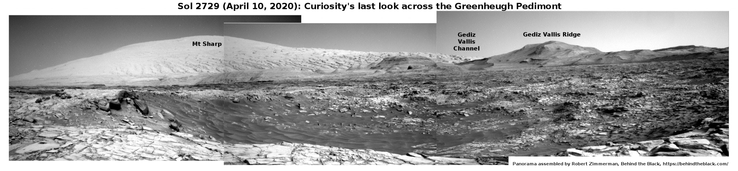
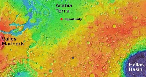
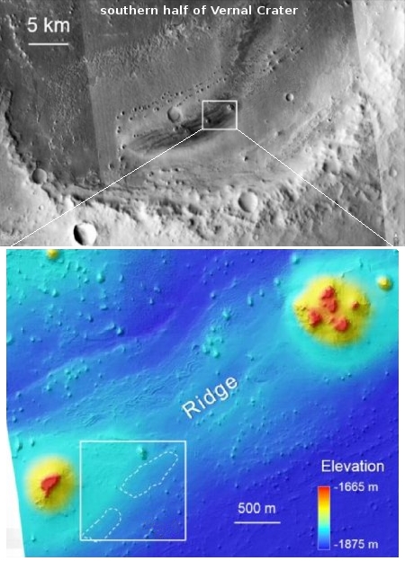
The first complete geologic map of Moon
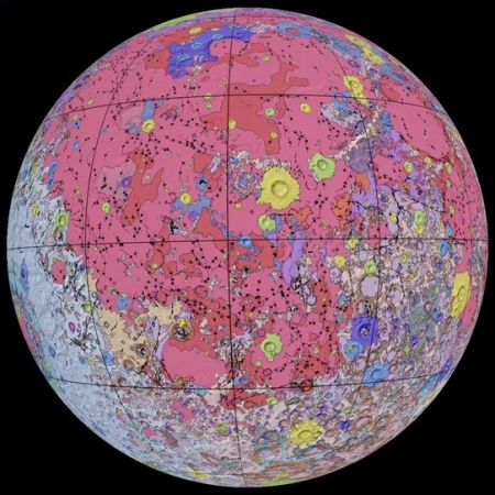
Using data from several recent lunar orbiters, scientists have compiled and now released the first comprehensive geologic map of the Moon.
To create the new digital map, scientists used information from six Apollo-era regional maps along with updated information from recent satellite missions to the moon. The existing historical maps were redrawn to align them with the modern data sets, thus preserving previous observations and interpretations. Along with merging new and old data, USGS researchers also developed a unified description of the stratigraphy, or rock layers, of the moon. This resolved issues from previous maps where rock names, descriptions and ages were sometimes inconsistent.
“This map is a culmination of a decades-long project,” said Corey Fortezzo, USGS geologist and lead author. “It provides vital information for new scientific studies by connecting the exploration of specific sites on the moon with the rest of the lunar surface.”
The image to the right shows the Moon’s near side.
The complete map file is free to download, and I guarantee that scientists and engineers in China are downloading it even as I type, planning to use it to establish their ownership to the Moon’s most valuable real estate that we scouted for them.


