Rolling boulders on Mars

Boulder tracks on Mars
Click for full image.

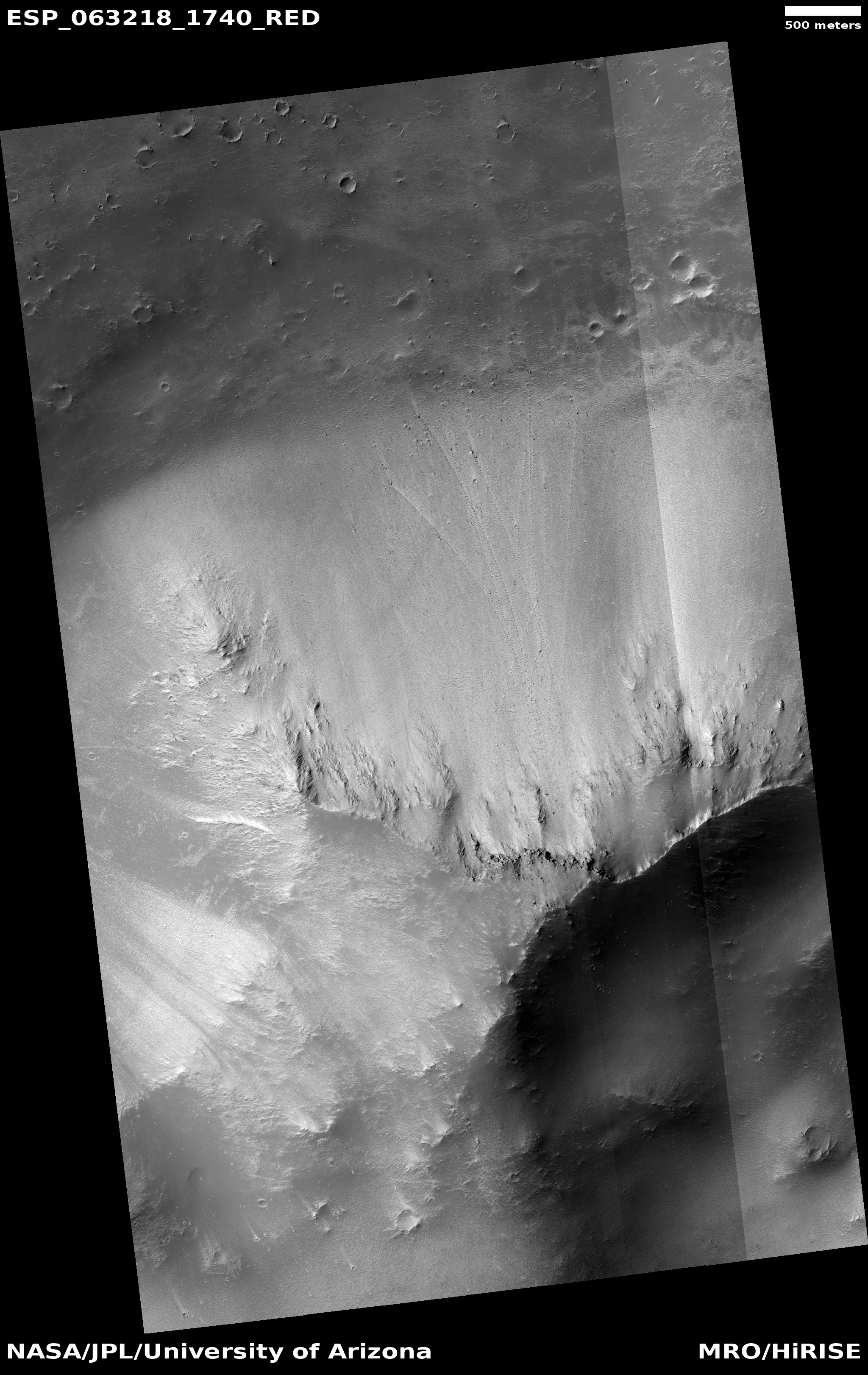
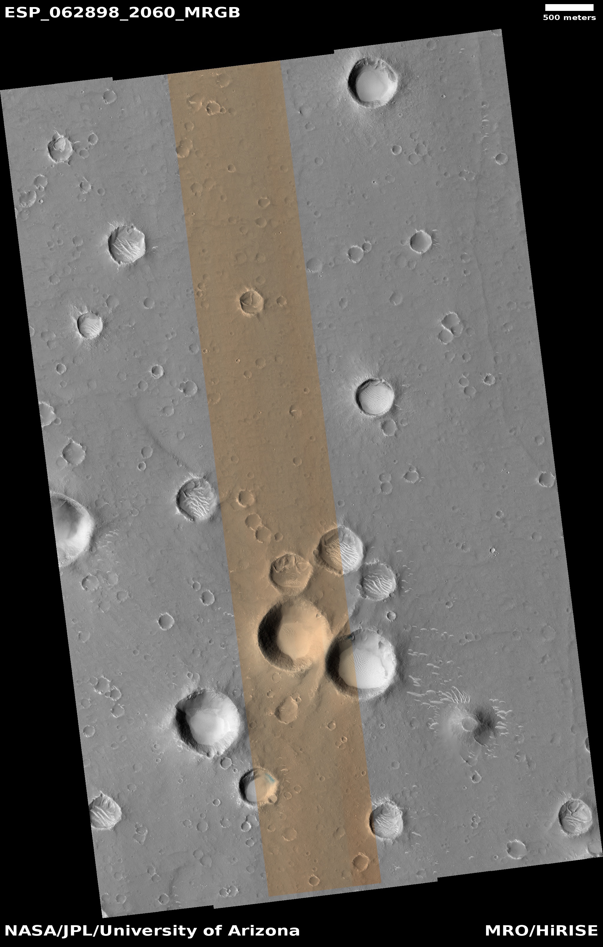
Cool image time! The photo to the left, cropped to post here, was taken by the high resolution camera on Mars Reconnaissance Orbiter (MRO) on January 21, 2020, and shows several boulders at the bottom of a slope, along with the tracks those boulders made as they rolled downhill sometime in the far past.

Uphill is to the south. We know the dark spots at the end of these tracks are large boulders partly because of the wind streaks emanating away from them to the north. As the wind goes around each rock it produces eddies that produce the tracks. Based on the scale and the image resolution (about 10 inches per pixel), these boulders range in size from about one to five feet in diameter.

This image has two points of interest. First, the tracks left by the boulders seem to have a repeating pattern. My guess is that the pattern most likely formed because the boulders are not spherical in shape, and as they rolled each roll repeated a certain pattern reflecting that shape. This theory is reinforced by a close look at each boulder. Though the resolution is insufficient to resolve the boulders themselves, the pixel distribution for each strongly suggests an asymmetric shape.

Second, this image, when compared with an earlier MRO image of the same spot, taken fourteen years ago in December 2006, shows no obvious change. These tracks, and their boulders, have therefore probably sat here, as we see them, for a long time. Since there appear to be two sets of tracks, with one overlying the other, this suggests that two separate events (an earthquake or nearby impact) each time caused a bunch of boulders to break free and roll downward together, with the second set of boulder tracks crossing over the earlier set.

Establishing when those two events occurred, however, will require some on-site data, something that will likely not occur until humans roam the surface of Mars in large numbers.

0 comments

NASA dubs next Mars rover “Perseverance”

NASA today announced that they have named their next Mars rover, due to launch in July, “Perseverance.”

The name was announced Thursday by Thomas Zurbuchen, associate administrator of the Science Mission Directorate, during a celebration at Lake Braddock Secondary School in Burke, Virginia. Zurbuchen was at the school to congratulate seventh grader Alexander Mather, who submitted the winning entry to the agency’s “Name the Rover” essay contest, which received 28,000 entries fromK-12 students from every U.S. state and territory.

“Alex’s entry captured the spirit of exploration,” said Zurbuchen. “Like every exploration mission before, our rover is going to face challenges, and it’s going to make amazing discoveries. It’s already surmounted many obstacles to get us to the point where we are today – processing for launch. Alex and his classmates are the Artemis Generation, and they’re going to be taking the next steps into space that lead to Mars. That inspiring work will always require perseverance. We can’t wait to see that nameplate on Mars.”

I truly hope that the rover is well-named, and lives a very long life on Mars, long enough that it is still in use the day an human arrives to touch it again.

6 comments

Upgrades to Deep Space Network to block commands to Voyager 2

A scheduled eleven month upgrade to one of the three Deep Space Network antennas used to communicate with planetary missions will prevent scientists from sending commands to Voyager 2 during that time period.

Data will still be downloaded, but if anything should go wrong, such as happened in January, it will be impossible to do anything about it. In January engineers were able to troubleshoot the problem and upload corrections. During these upgrades a fix will have to wait. To reduce the chance of serious issue, engineers will put Voyager 2 into a more dormant state during this time period.

The repairs are essential however, even if it means we lose Voyager 2. This network must work for all the other Moon and Mars missions planned for the next few decades, and an upgrade has been desperately needed for years.

1 comment

Mars rover Update: March 4, 2020

Panorama looking south and uphill
Click for full resolution.

Curiosity

[For the overall context of Curiosity’s travels, see my March 2016 post, Pinpointing Curiosity’s location in Gale Crater.

For the updates in 2018 go here. For a full list of updates before February 8, 2018, go here.]

Map of Curiosity's travels

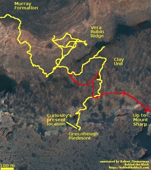
Since my last rover update on January 13, 2020, Curiosity has finally moved on from the base of Western butte, where it spent more than a month drilling a hole and gathering a great deal of geological data. Rather than head downhill and around the plateau and back to its planned route (as indicated by the red line in the map to the right), the Curiosity science team decided to push upward and onto the Greenheugh Piedmont (as indicated by the yellow line).

They had always planned to reach the top of this plateau, but not for several years. First they were going to head east to study a recurring slope lineae (see my October 2019 update), an example of a dark streak that darkens and fades seasonally and could provide evidence of water seepage from below ground.

Instead, they decided the close proximity of the top of the piedmont and its geology was too tempting. The piedmont is apparently made up of a layer that is very structurally weak, and breaks up easily, as you can see by the panorama above. It also appears to sit on softer, more easily eroded material, which thus accentuates this break up. If you look at the left part of the panorama you can see what I mean. The piedmont layer there is the thin unbroken layer sitting on what looks like sand. As that sand erodes away the layer quickly breaks into small pieces, as shown in the rest of panorama.

Traveling on the piedmont will likely be difficult and threaten Curiosity’s wheels. I suspect this reality prompted them to choose to get to the top and obtain data now, rather than wait several more years of rough travel that might have made access to the piedmont difficult if not impossible.

They presently sit just below the top, and are studying their options before making that last push.
» Read more

3 comments

Summer at the Martian North Pole

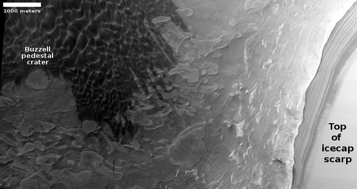
Buzzell pedestal crater in context with polar icecap scarp
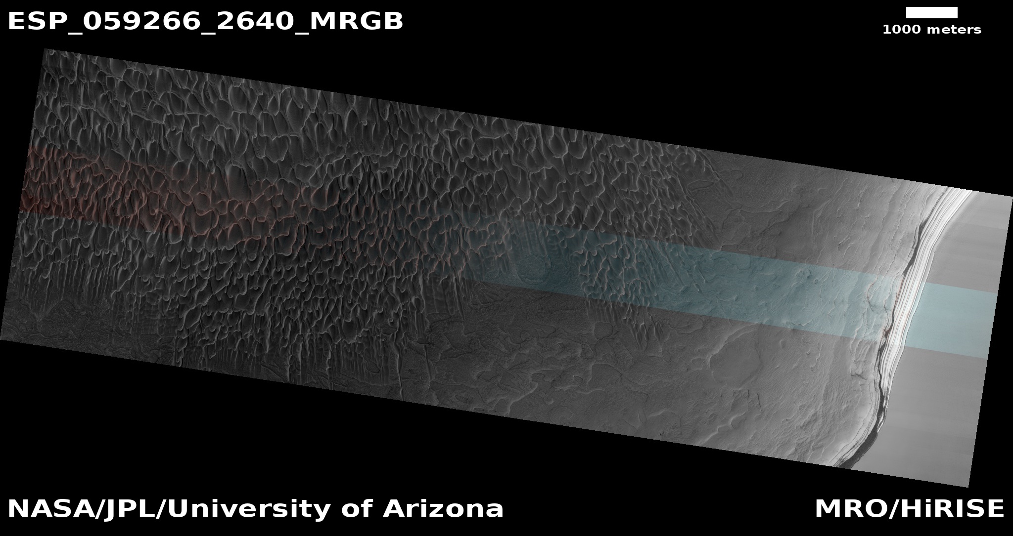
Cool image time! The image above, cropped, reduced, and brighten-enhanced to post here, was taken by the high resolution camera of Mars Reconnaissance Orbiter (MRO) on December 26, 2019 of the dunes just below the 1,500 to 3,000 foot high scarp that marks the edge of the Martian north polar icecap. I have brought up the brightness of the dune area to bring out the details.

This one image shows a range a very active features at the Martian north pole. At this scarp scientists have routinely photographed avalanches every Martian spring, as they have been occurring, caused by the warmth of sunlight hitting this cliff wall and causing large sections to break off. As Shane Byrne of the Lunar and Planetary Lab University of Arizona explained in my September 2019 article,

On Mars half of the images we take in the right season contain an avalanche. There’s one image that has four avalanches going off simultaneously at different parts of the scarp. There must be hundreds to thousands of these events each day.

Buzzell dunes, March 19, 2019
Click for full image.

On the left side of the image is an area of dunes that Candice Hansen of the Planetary Science Institute in Arizona has dubbed “Buzzell.” As spring arrives here, she has MRO regularly take images of this site (as well as about a dozen others) to monitor the changes that occur with the arrival of sunlight on the vast dune seas that surround that polar icecap.

The image to the right zooms in on one particular distinct feature, a pedestal crater, surrounded by dunes, that I have labeled on the image above. This image was taken just as spring began, with the Sun only five degrees above the horizon. At that time the dunes and pedestal crater were mantled by a frozen layer of translucent carbon dioxide that had fallen as dry ice snow during the sunless winter and then sublimates away each Martian summer.

Since March I have periodically posted updates to monitor the disappearance of that CO2 layer. (See for example the posts on August 2019 and November 2019.) Below are two more images, showing the ongoing changes to this area from early to late summer.
» Read more

2 comments

ExoMars2020 parachute tests delayed until late March

The European Space Agency (ESA) has decided to delay until late March the next high altitude tests of the revamped ExoMars2020 parachutes, despite the success of recent ground tests.

The tests of the 15-meter-diameter supersonic and 35-meter-wide subsonic parachutes—an essential part of the entry, descent and landing phase of the mission—had been scheduled for December and February. The delay comes despite six ground tests demonstrating successful parachute extraction – the point at which damage was caused in earlier, failed high altitude tests.

Both tests need to be successful for the go-ahead for launch of 300-kilogram Rosalind Franklin rover during the July 25 to Aug. 13 Mars launch window. Any failure would mean a wait of 26 months for the next launch window, opening late 2022.

There will be a meeting next week of the project’s top management, from both Russia and Europe, and I strongly suspect that they are going to decide to delay launch to the 2022 launch window. Not only have the parachutes not been tested successfully at high altitude, they recently discovered an issue with the glue holding the solar panel hinges on the ExoMars Rosalind Franklin rover.

1 comment

Glacial breakup on Mars

glacial breakup on Mars
Click for full image.

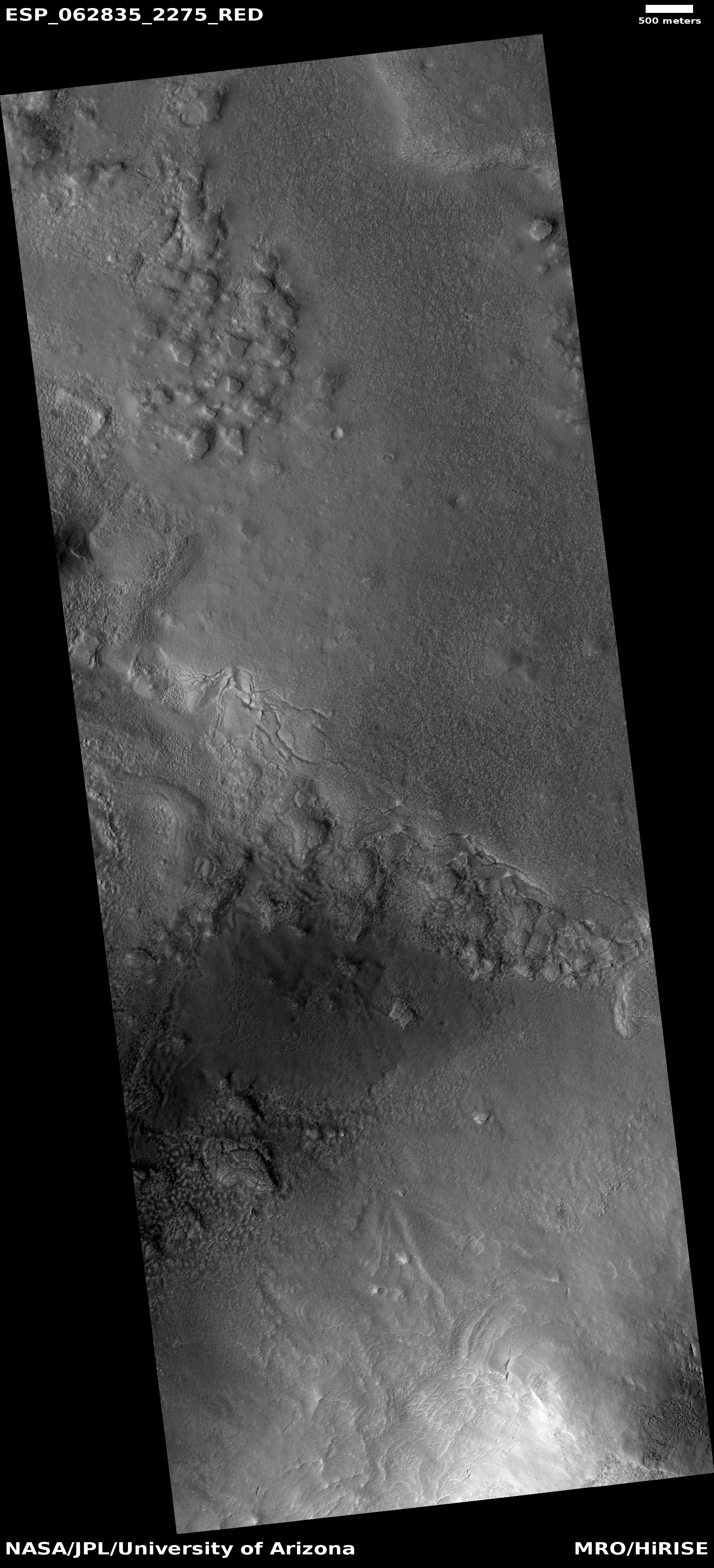
Cool image time! The photograph to the right, cropped and reduced to post here, was taken by the high resolution camera on Mars Reconnaissance Orbiter on December 22, 2019 and was titled “Contact Between Debris Apron and Upper Plains in Deuteronilus Mensae”.

The section of the full image that I have focused on shows what appears to be the downhill break-up of the surface debris covering an underlying water ice glacier. The grade is downhill to the south.

I am confident that this is buried glacial material based on recent research:

Both of these reports found lots of evidence of shallow ice in Deuteronilus Mensae, a region of chaos terrain in the transition zone between the Martian northern lowlands and the southern highlands.

With this image we see what appears to be the slippage of that ice downslope, causing breakage and cracks on the surface, with much of that surface made up of the dust and debris that covers the ice and protects it. Towards the bottom of the image it even appears that the disappearing ice is unveiling the existence of a bunch of buried bedrock mesas, typical of chaos terrain, previously hidden by the ice because it filled the surrounding canyons.

Below is a close-up of the photograph’s most interesting area of break-up.
» Read more

1 comment

Peering into a Martian pit

Peering into a pit
Click for full image.

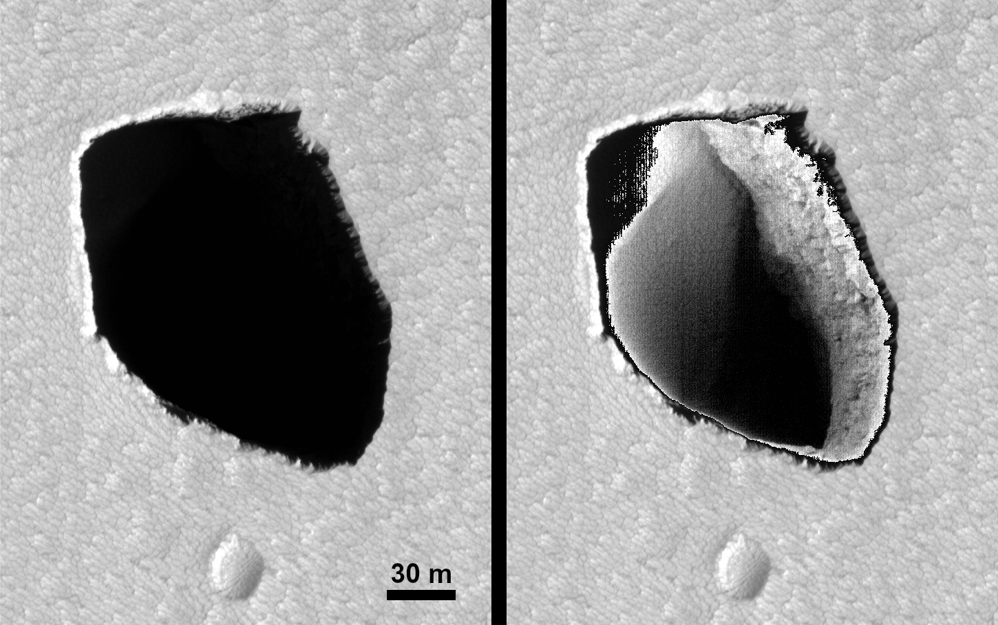
Cool image time! The science team for the high resolution camera on Mars Reconnaissance Orbiter last week released the above image of a pit to the west of the giant volcanoes Arsia and Pavonis Mons. The left image is without any adjustments in exposure. The right image has brightened the pit’s interior to bring out details in order to see what’s there. As planetary scientist Ross Beyer of Ames Research Center noted in his caption:

The floor of the pit appears to be smooth sand and slopes down to the southeast. The hope was to determine if this was an isolated pit, or if it was a skylight into a tunnel, much like skylights in the lava tubes of Hawai’i. We can’t obviously see any tunnels in the visible walls, but they could be in the other walls that aren’t visible.

Wider view of pit
Click for full image.

Because the image has been rotated 180 degrees, north is down. The northern wall of the pit appears to be either very vertical, or overhung. A tunnel might head north from here, but because of the angle of the photograph, this cannot be confirmed.

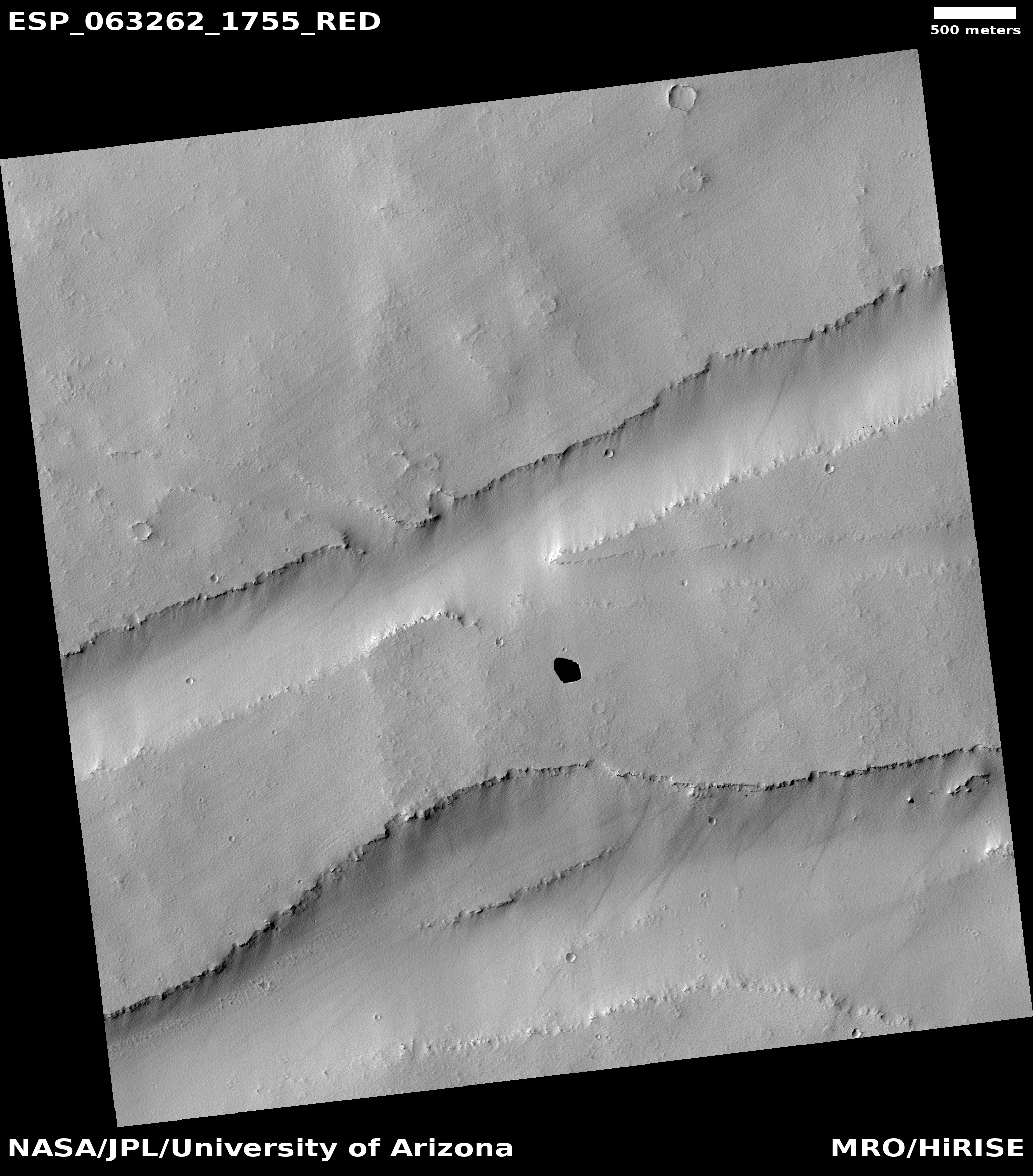
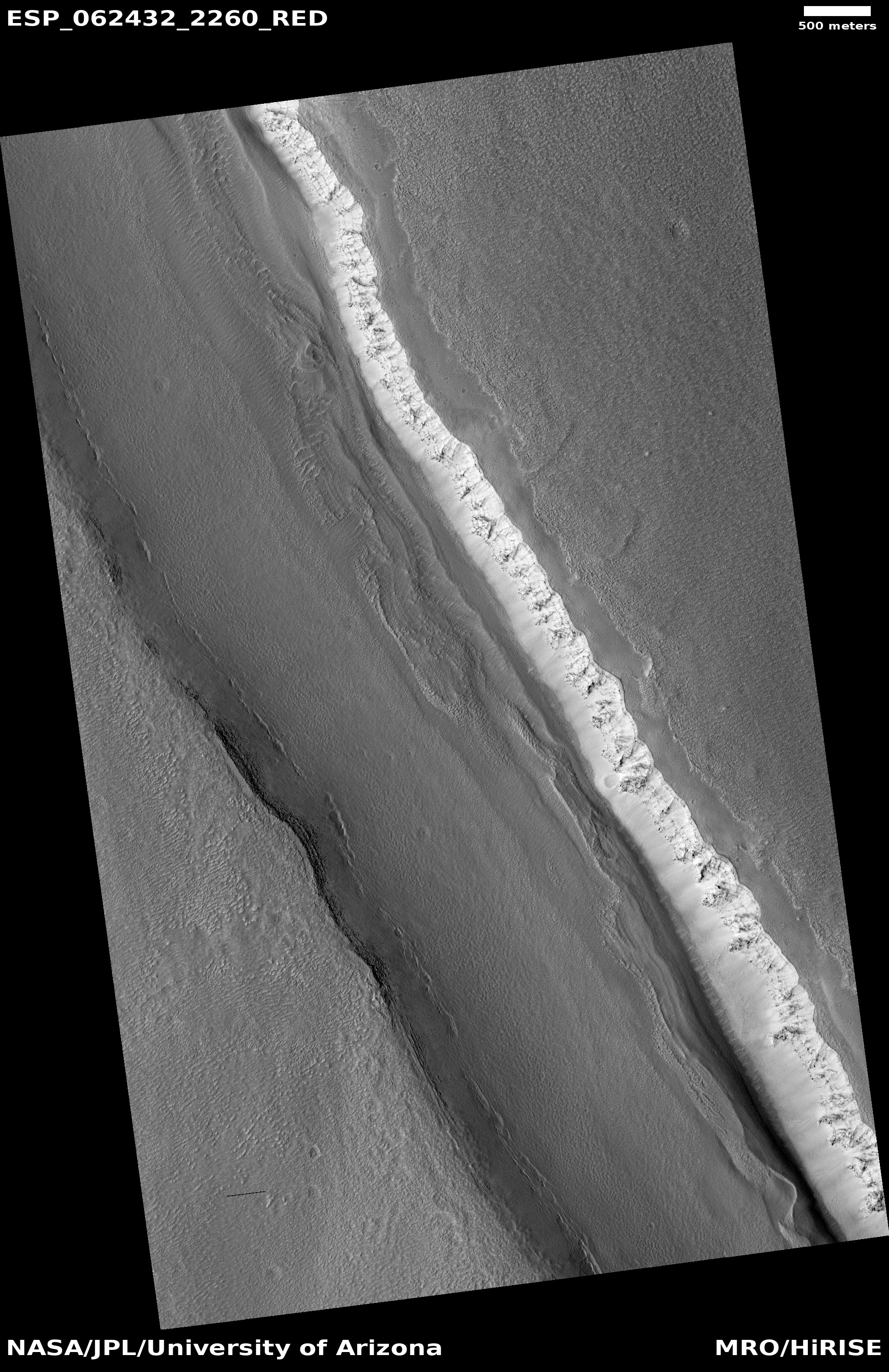
To the right is a wider look from the full photograph, showing the surrounding terrain, with north now to the top. In line with this pit is a depression that crosses the east-west canyon to the north. This alignment strongly suggests that a fault or fissure exists here, and that an underground void along this fissure line could exist. It also suggests that a deeper and larger void could exist below that larger canyon.

This pit, and the accompanying fissures, were likely caused by crack-widening along these faults, produced as this volcanic region bulged upward.

Map of knowns pits surrounding Arsia Mons

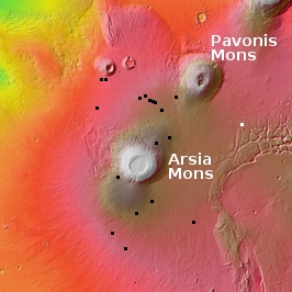
This pit is also one of the many many pits found near these volcanoes. The map to the right shows by the black boxes all the pits documented by the high resolution camera on MRO in the past few years, with this new pit indicated by the white box.

Beginning in November 2018 until November 2019 I was almost doing a monthly post reporting the new pits photographed by MRO. Since November however the number of new pit images dropped. This is not because every pit has been imaged, but because it appears they have completed their initial survey.

Below is a list of all those previous pit posts:
» Read more

2 comments

Europe considering delaying ExoMars2020 two years

The Europe Space Agency (ESA) is considering delaying the launch of its ExoMars2020 Mars rover two years because of continuing problems with its parachutes.

According to a spokesperson for the European Space Agency (ESA), a “working-level review” for the project was held among ESA and Roscosmos officials in late January, and a preliminary assessment was forwarded to the respective heads of the space agencies, Jan Wörner of ESA and Dmitry Rogozin of Roscosmos, on February 3. “They instructed the respective inspectors general and program chiefs to submit an updated plan and schedule covering all the remaining activities necessary for an authorization to launch,” the ESA spokesperson said. “This plan will be examined by the two agency heads who will meet on 12 March to jointly agree the next steps.”

It appears that the European and Russian officials will make a public announcement about ExoMars next month. Their options include pressing ahead with a launch this year or delaying two years until the next favorable window for a launch to Mars opens. Given multiple issues with the mission, a source said a delay is the most likely option.

The parachutes are not the only problem. They have just discovered during thermal testing that the glue used in the the hinges of the rover’s solar panels comes unstuck.

In August 2019, when the parachute issues were first revealed (after much hemming and hawing by ESA officials), I predicted a 50-50 chance they’d delay. When in September 2019 the problems were found to be more serious than first admitted, I lowered the chances of meeting the 2020 launch date to less than 25%.

Right now I predict that the launch of ExoMars2020 will not occur this summer, but will be delayed until the next Martian launch window in 2022. You heard it here first.

13 comments

Enclosed Martian canyon, filled with ice

Ice-filled canyon on Mars
Click for full image.

Cool image time! The photo on the right, rotated, cropped, and reduced to post here, was taken by the high resolution camera on Mars Reconnaissance Orbiter on November 21, 2019. The uncaptioned image was simply entitled “Ice-filled Graben.”

The location is on the lower flanks of the giant volcano Alba Mons, which in itself sits north of Olympus Mons and the volcanic Tharsis Bulge. The canyon is called a graben because it was formed when a section of the crust slips downward along parallel faults. It does not have the features of a rill, or lava flow, as it starts and stops suddenly. It probably formed due to the rise of the volcano, pulling apart its flanks along faults, causing some sections then to slip downward.

How do the scientists know this is ice-filled? I suspect they have other data that indicates the presence of water, but there are also clear features inside this canyon that resemble the glacial features found elsewhere on Mars. For example, note the parallel lines near the canyon walls. These indicate past surface levels as well as layers within the ice from cyclic climate processes. The line of pits along the southwest wall, where the surface gets more sunlight, also suggests that this sunlight is causing more ice to sublimate away.

Finally, the graben is located at 46 degrees north latitude, definitely far enough north for such ice to exist, based on ample other research.

8 comments

Quakes by InSight indicate Mars’ interior is active

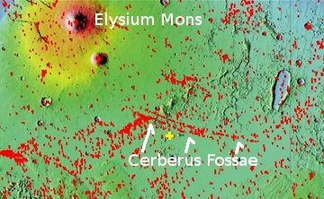
Cerberus Fossae

The first seismic results from InSight’s seismometer now show that the interior of Mars is active, with regular moderately-sized quakes.

The Seismic Experiment for Interior Structure (SEIS) instrument – a seismometer developed by an international consortium under the leadership of the French space agency CNES – recorded a total of 174 seismic events between February and September 2019. Twenty of these marsquakes had a magnitude of between three and four. Quakes of this intensity correspond to weak seismic activity of the kind that occurs repeatedly on Earth in the middle of continental plates, for example in Germany on the southern edge of the Swabian Jura hills.

Although only one measurement station is available, models of wave propagation in the Martian soil have been used to determine the probable source of two of these quakes. It is located in the Cerberus Fossae region, a young volcanic area approximately 1700 kilometres east of the landing site.

Cerberus Fossae is a land of cracks and linear depressions located between the giant volcanoes, Elysium Mons to the north and Olympus Mons to the east. It is believed those fissures were caused by the rise of those volcanoes, stretching the crust and cracking it.

This new data from InSight strengthens this theory.

2 comments

Engineers to use InSight’s scoop to help digging process

Insight’s engineers, having failed to get its mole pile driver to dig down as planned, now plan to use the lander’s scoop to push on the mole in the hope this will prevent it from popping up with each hammer drive.

[T]he mole is a 16-inch-long (40-centimeter-long) spike equipped with an internal hammering mechanism. While burrowing into the soil, it is designed to drag with it a ribbonlike tether that extends from the spacecraft. Temperature sensors are embedded along the tether to measure heat coming deep from within the planet’s interior.

…The team has avoided pushing on the back cap [at the top of the mole] until now to avoid any potential damage to the tether.

It appears to me that they are running out of options. This new attempt carries risks. It could damage the tether required to obtain underground temperature readings, the prime purpose of the experiment. However, if they don’t get the tether into the ground, this will also prevent the experiment from functioning. Thus, this attempt could essentially be a Hail Mary pass, gambling all on one last all-or-nothing gambit.

14 comments

Ice-filled canyon on Mars?

The ice-filled head of Mamers Valles
Click for full image.

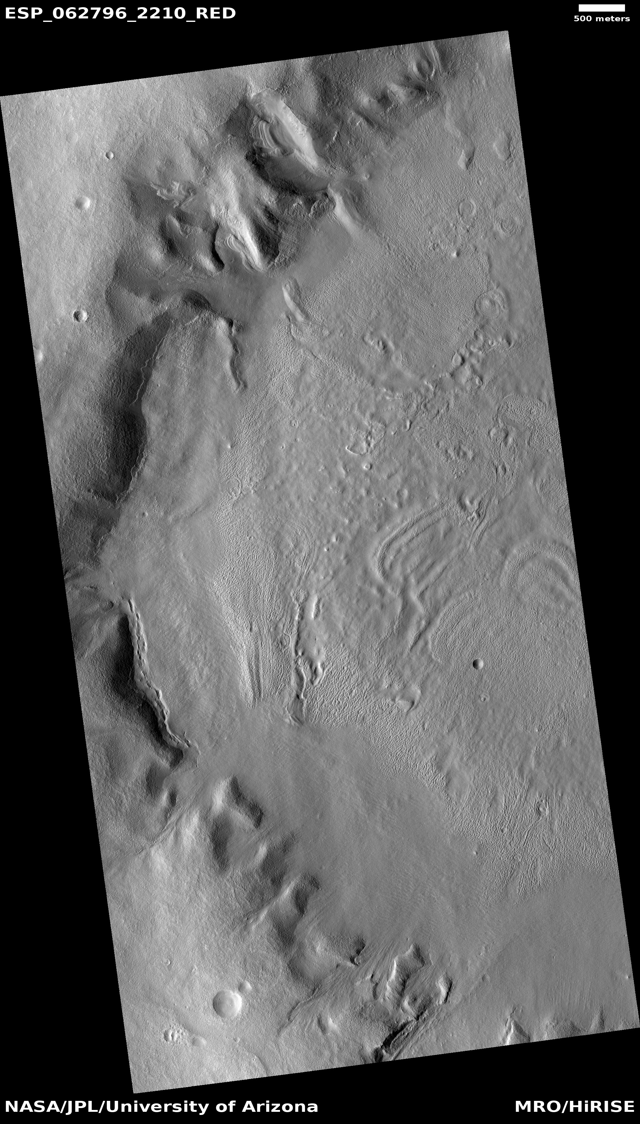
The image to the right, rotated, cropped and reduced to post here, was taken on December 19, 2019 by the high resolution camera on Mars Reconnaissance Orbiter (MRO). Labeled “Head of Mamers Valles”, it shows the very end of one side canyon to this very extensive canyon system made up of the fractured fissures and mesas of chaos terrain.

Mamers Valles itself sits in the transition zone between the northern lowland plains and the southern cratered highlands. This specific canyon is close to those lowlands, at a latitude of 40 degrees north, where scientists believe there are many buried inactive glaciers of ice.

The image reinforces this belief. The entire canyon appears practically filled with what looks like ice. In fact, it almost looks like we are looking down at a frozen lake with a layer of snow on top of it. In this case, the layer is not snow, but dust and dirt and debris that covers the ice to protect it and prevent it from sublimating away.

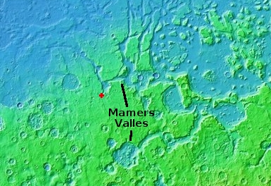
The overview map below shows the location of this canyon, by the red cross, within Mamers Valles.

Mamers Valles

Mamers Valles is actually a very large collection of miscellaneous canyons, flowing into the lowlands. In some areas it looks like very old chaos terrain, with the canyons so eroded that all we see are scattered mesas. In other places the canyons more resemble meandering river canyons sometimes interspersed with crater impacts.

Scientists have analyzed the canyons in Mamers Valles, and from this concluded that they were likely formed from “subsurface hydrologic activity”. which in plain English means that flowing water below ground washed out large underground passages, which eventually grew large enough for their ceilings to collapse and form the canyons we see today.

Yesterday I posted an image of a string of pits that could very well be evidence of this same process in its early stages of canyon formation. In Mamers Valles the process is far more advanced, and the canyons have existed for a long time, long enough for the planet’s inclination to go through several cycles of change, from a low of 25 degrees tilt (what it is now) to has high as 60 degrees. At that high inclination the mid-latitudes were colder than the poles, so that ice would sublimate from the poles to fall as snow in the mid-latitudes, forming active glaciers within canyons such as this.

Now that the planet’s inclination is similar to Earth’s, 25 degrees, the poles are slightly colder than the mid-latitudes, and the glaciers in this canyon are either inactive (if buried) or slowly sublimating away so that the water can return to the poles.

Here however the surface debris appears to be protecting the glaciers, leaving the canyon filled mostly with ice. For future settlers this ice would likely be relatively accessible, and at a latitude where the environment is also relatively mild, for Mars.

5 comments

Pits indicating a Martian underground river?

A string of pits suggesting a past underground river system on Mars
Click for full image.

Cool image time! As my regular readers well know, I am a caver, and am thus always interested when the high resolution camera on Mars Reconnaissance Orbiter (MRO) takes a close-up of a pit that might also be an entrance to a cave.

The photo to the right, cropped and reduced to post here, was part of the most recent image release from MRO, but was boringly labeled “Arabia Terra” after the region where it is located, one of the largest transition zones on Mars between the northern lowland plains and the southern cratered highlands. When I took a close look, what I found was an intriguing string of pits whose arrangement is strikingly reminiscent of a river tributary system.

The white box indicates one section that I have zoomed into, as shown below.
» Read more

10 comments

Martian wind-swept buried depressions

Wind-swept Martian depressions
Click for full image.

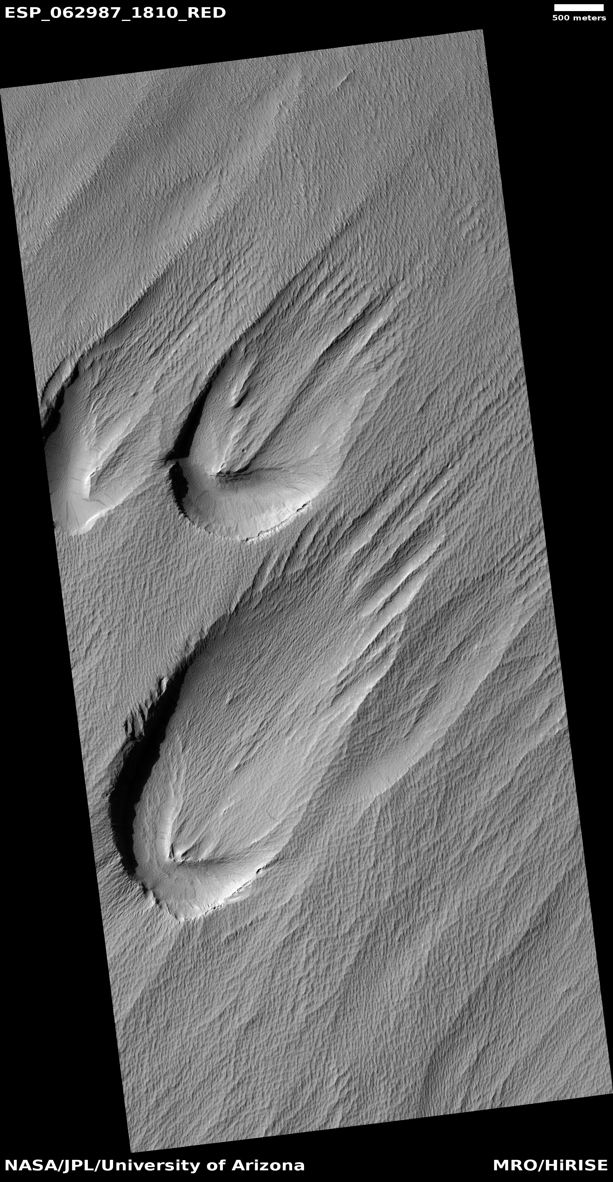
Cool image time! The photo to the right, rotated, cropped and reduced to post here, was taken on January 3, 2020 by the high resolution camera on Mars Reconnaissance Orbiter (MRO). It shows three strange teardrop-shaped depressions, clearly wind-swept and partly buried by dust and sand.

The location on Mars of these depressions is in the transition zone between the southern cratered highlands and the northern lowlands. This is also a region dubbed the Medusae Fossae Formation, a region where it appears a great deal of volcanic material was laid down during one or more eruptive events 3 to 3.8 billion years ago.

Whether these depressions were formed during those events is impossible to tell from the available data, especially because the underlying bedrock is buried in dust.

Their shape appears to have been caused as the wind slowly exposed three buried peaks of hard rock. The wind, blowing from the southwest to the northeast, would hit the peaks, producing an downward eddy that would churn out dust from the windward side. The wind and dust would then blow around the peaks, creating the teardrop tail on the leeward side to the northeast.

0 comments

MRO undergoing maintenance and software upgrade

NASA’s Mars Reconnaissance Orbiter, in space now for fifteen years, will undergo a two week computer software upgrade.

The maintenance work involves updating battery parameters in the spacecraft’s flash memory – a rare step that’s been done only twice before in the orbiter’s 15 years of flight. This special update is necessary because it was recently determined that the battery parameters in flash were out of date and if used, would not charge MRO’s batteries to the desired levels.

In addition to the battery parameters, engineers will use this opportunity to update planetary position tables that also reside in flash. The spacecraft will go into a precautionary standby mode, called safe mode, three times over the course of the update. It will also swap from its primary computer, called its Side-A computer, to its redundant one, called Side-B.

During these two weeks the spacecraft will suspend its science and communications operations.

0 comments

China’s candidate landing site on Mars

One candidate landing site for China's first Mars lander/rover
Click for full image.

The image to the right, reduced to post here, was taken by the high resolution camera on Mars Reconnaissance Orbiter (MRO), and provides a close-up of the relative smooth terrain found in the region on Mars that the Chinese have said is one of their prime landing sites for their 2020 Mars rover and lander. According to planetary scientist Alfred McEwen of the Lunar & Planetary Laboratory in Arizona,

There was a presentation at the European planetary & science conference in Geneva last fall, and a Chinese scientist gave an update on their plans and showed this area with the lat-long coordinates. That’s what I’m going on.

McEwen also admits that “there might have been a change since then. I’m not in the loop.” No one outside China really is, as that government remains quite opaque on these matters. They will likely only reveal their final landing site choice as we get closer to launch.

Overview

This location, on the northern lowlands plains of Utopia Planitia, makes great sense however for a first attempt by anyone to soft land on Mars. In fact, in 1976 these plains were the same location that NASA chose for Viking 2, for the same reasons. (The Viking 2 landing site was to the northeast of the Chinese site, just beyond the right edge of the overview map) While there are plenty of craters and rough features, compared to most of Mars’s surface, Utopia could be considered as smooth as a bowling ball.

Even so, a look at the full image shows that there are numerous features nearby that would be a threat for any robotic lander. McEwen notes,
» Read more

0 comments

Large glacier-filled crater/depression on Mars?

Glacier-filled depression?
Click for full image.

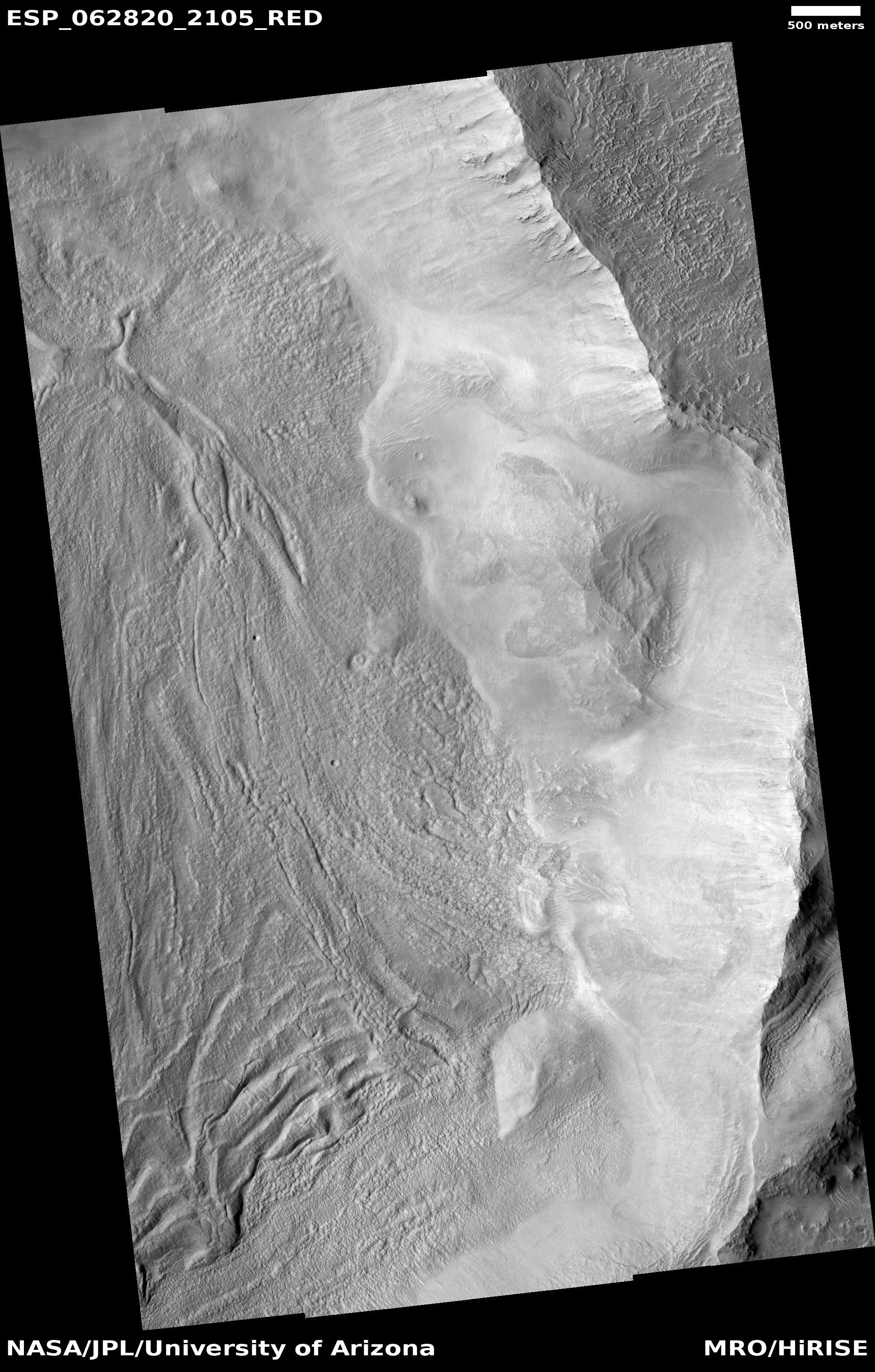
Cool image time! The photograph on the right, rotated, cropped, and reduced to post here, was taken by the high resolution camera on Mars Reconnaissance Orbiter (MRO) on December 21, 2019. It shows the eastern half of the floor and interior rim of a large squarish-shaped crater or depression in what seems to be an unnamed region of chaos terrain located in the transition zone between the Martian southern highlands and the northern lowland plains.

The floor of this depression has many of the features that indicate the presence of a buried ice glacier, including flow features on the depression floor, linear parallel grooves, and repeating moraine features at the slope base. In fact, all these features give the strong impression that this crater is ice-filled, to an unknown depth.

Chaos terrain, a jumble of mesas cut by straight canyons, are generally found in this transition zone, and could be an erosion feature produced by the intermittent ocean that some believe once existed in the northern lowlands. Whether or not an ocean lapped against these mesas and created them, this chaos terrain is believed to have been caused by some form of erosion, either wind, water, or ice.

Wide context view

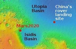
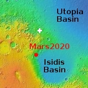
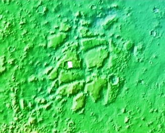
The location is of this chaos terrain in that transition zone is illustrated by the context map to the right. It sits on the edge of the vast Utopia Basin, one of the largest and deepest northern lowland plains. It also sits several hundred miles due north of the planned landing site of the Mars2020 rover in Jezero Crater. There is a lot of chaos terrain in this region, with lots of evidence of buried glaciers flowing off the sides of mesas.

Today’s image, with its numerous features suggesting the presence of a buried glacier filling the depression, reinforces this evidence.

Closer context view, showing the chaos terrain region

What impresses me most about this particular depression — should it be ice-filled — is its size. I estimate from the scale of the image that the depression is about six miles across, somewhat comparable though slightly smaller than the width of the Grand Canyon. And yet, unlike the Canyon it appears to have a wide flat floor across its entire width. The second context map to the right zooms in on this chaos region to show how relatively large the depression is. It would not be hard to spot it from orbit. We don’t know the depth, but even if relatively shallow this depression still holds a heck of a lot of water ice.

While the depression appears like a crater in lower resolution wider photographs, higher resolution images suggest it is not round but squarish. Why is not clear, and unfortunately MRO’s high resolution camera has taken no other images of it. This image was also one of their terrain sample photographs, taken not because of any specific research request, but because they need to use the camera regularly to maintain its temperature. This location, having few previous images, fit this schedule and made sense photographing.

Thus, no one appears to be specifically studying this location, making it a ripe subject for some postdoc student who wants to put their name on some Martian geology.

0 comments

The range for exposed ice scarps on Mars keeps growing

Overview of ice scarp locations on Mars

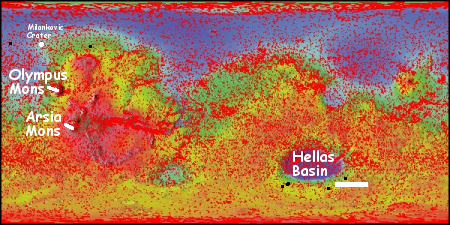
In January 2018 scientists announced the discovery of eight cliffs with visible exposed ice layers in the high mid-latitudes of Mars. At the time, those eight ice scarps were limited to a single crater in the northern hemisphere (Milankovic Crater) and a strip of land in the southern highlands at around latitude 55 degrees south.

In the past two years scientists have been using the high resolution camera on Mars Reconnaissance Orbiter (MRO) to monitor these scarps for changes. So far they have seen none, likely because the changes are below the resolution of the camera.

They have also been able to find more scarps in the southern hemisphere strip beyond that strip at 55 degrees south.

Now they have found more scarps in the northern hemisphere as well, and these are outside Milankovic Crater. As in the south, the new scarps are still all along a latitude strip at about 55 degrees.

The map above shows with the black dots the newer scarps located in the past two years. The scarp to the east of Milankovic Crater is typical of all the other scarps, a steep, pole-facing cliff that seems to be retreating away from the pole..

The scarp to the west of Milankovic Crater is striking in that it is actually a cluster of scarps, all inside a crater in the northern lowland plains. Moreover, these scarps are more indistinct, making them more difficult to identify. According to Colin Dundas of the U.S. Geological Survey’s Astrogeology Science Center in Arizona,
» Read more

1 comment
1 76 77 78 79 80 128