
New cracks across old Martian lava flows
Click for full image.
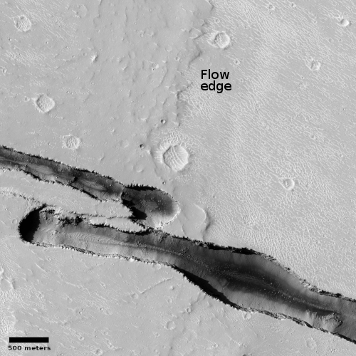
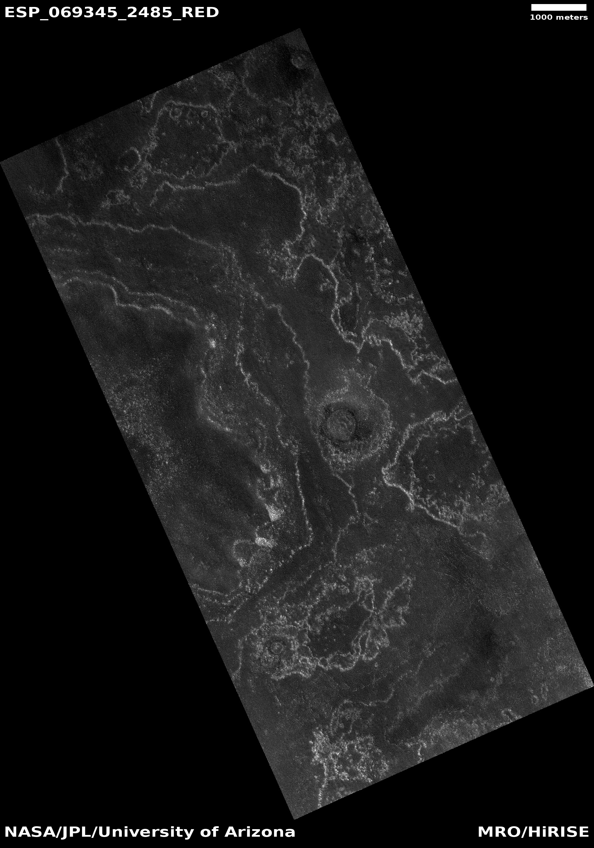
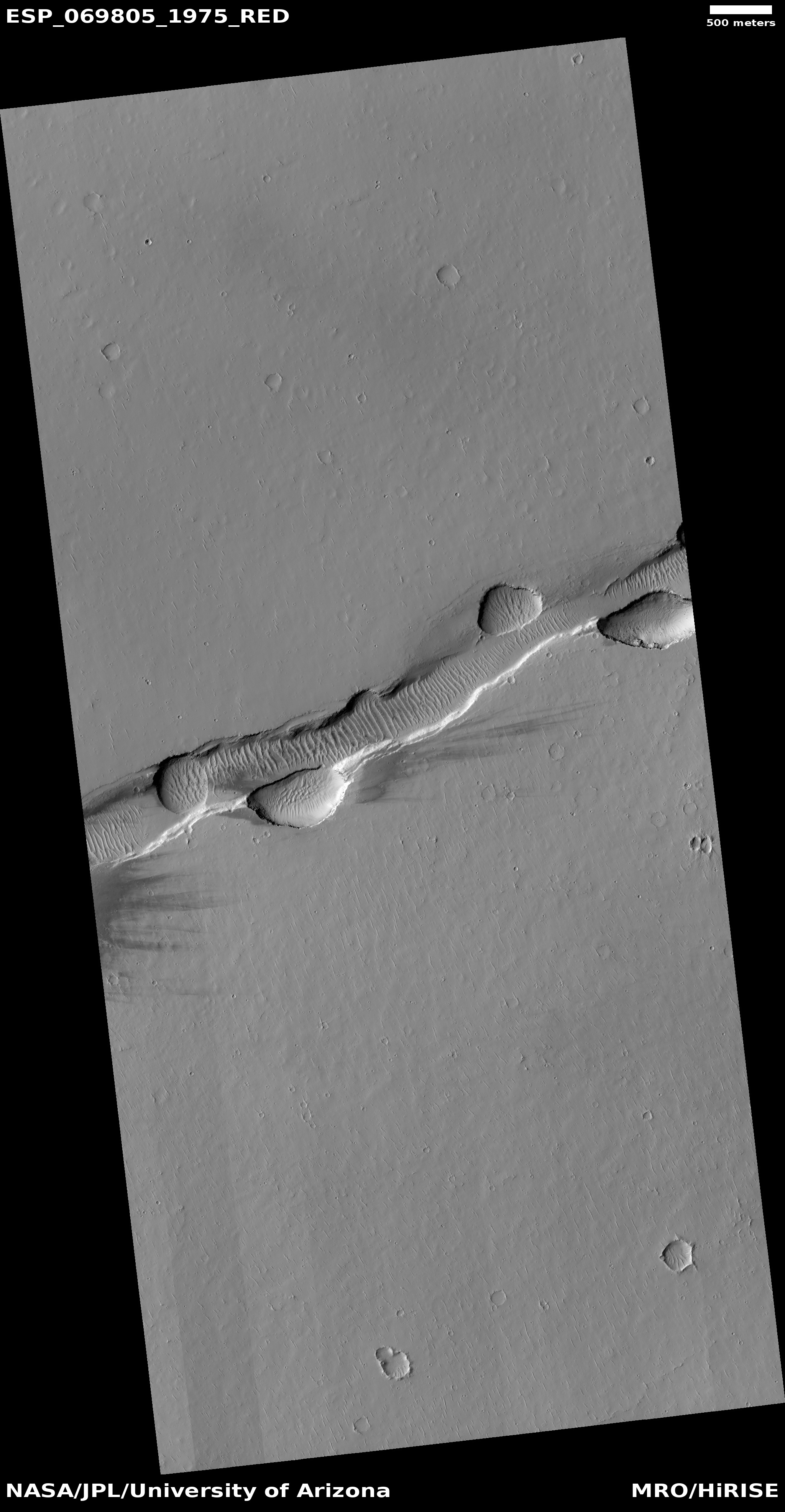
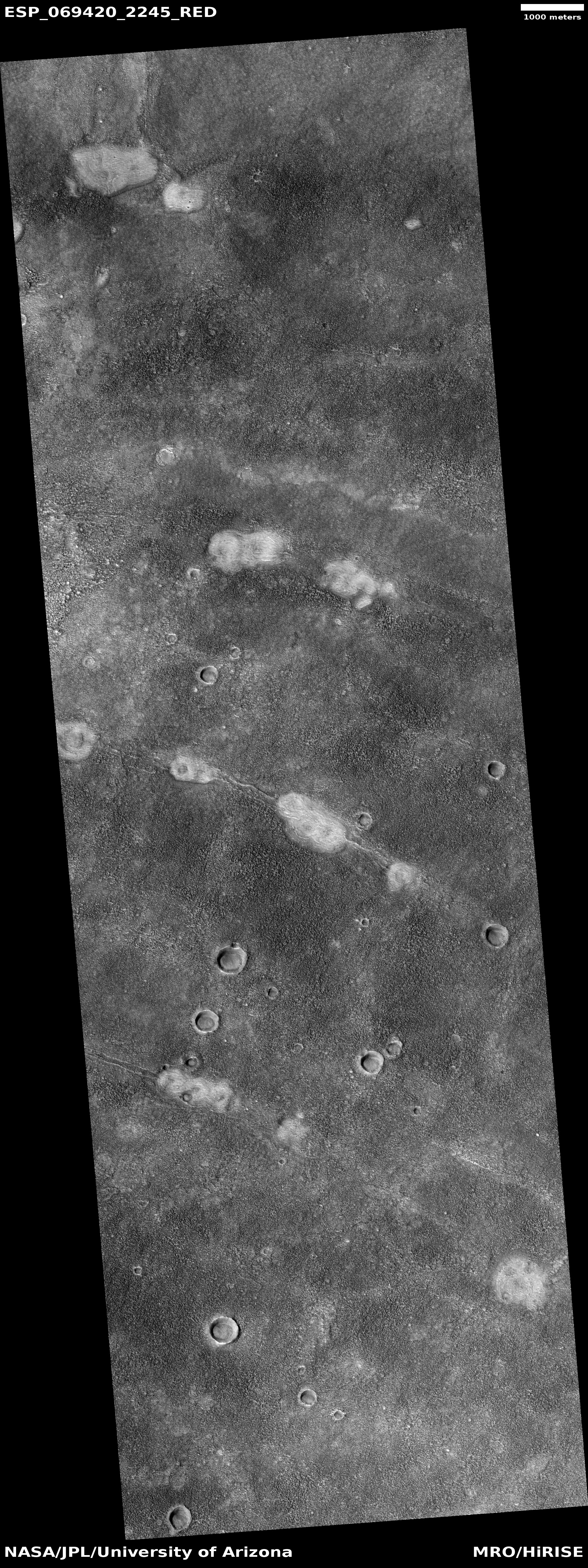
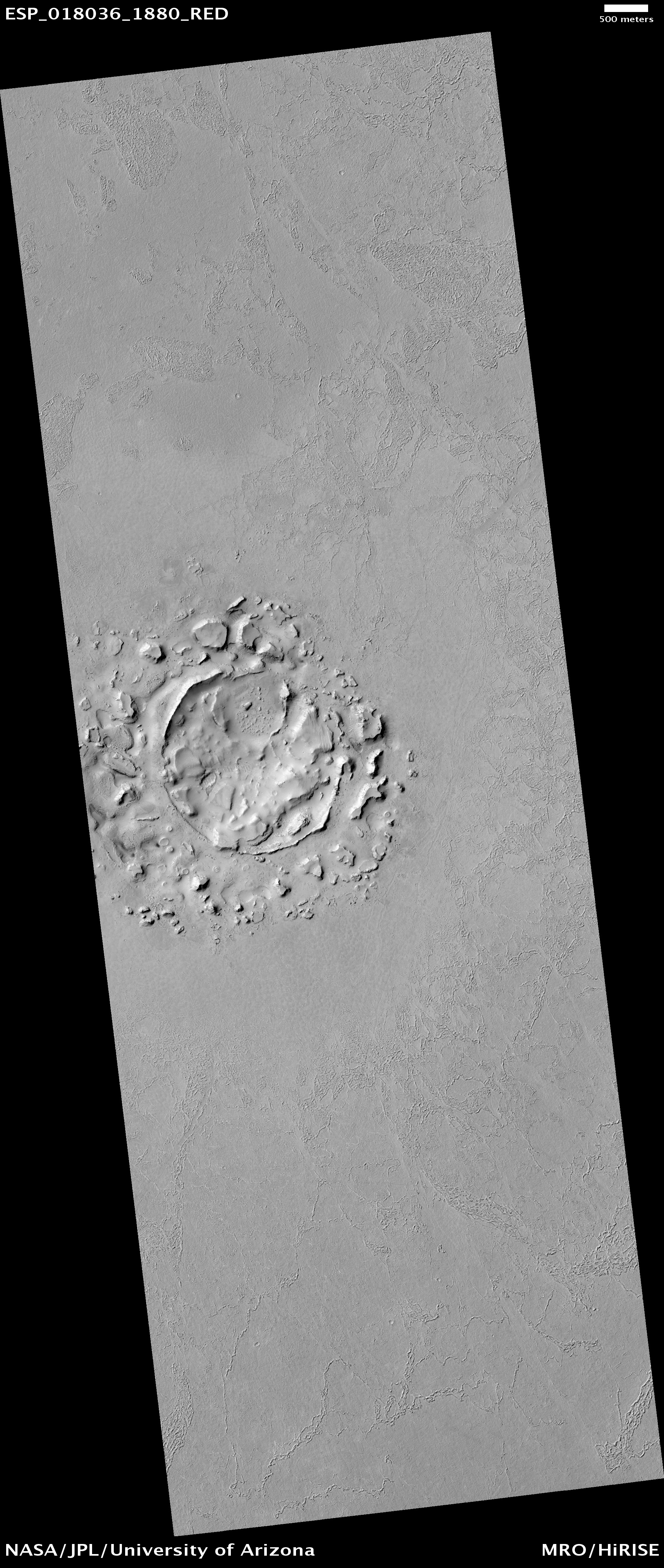
Cool image time! The photo to the right, cropped and reduced to post here, was taken on June 4, 2021 by the high resolution camera on Mars Reconnaissance Orbiter (MRO). It captures one of the many deep straight fissure canyons that make up the feature dubbed Cerberus Fossae in the center of Mars’ volcano country.
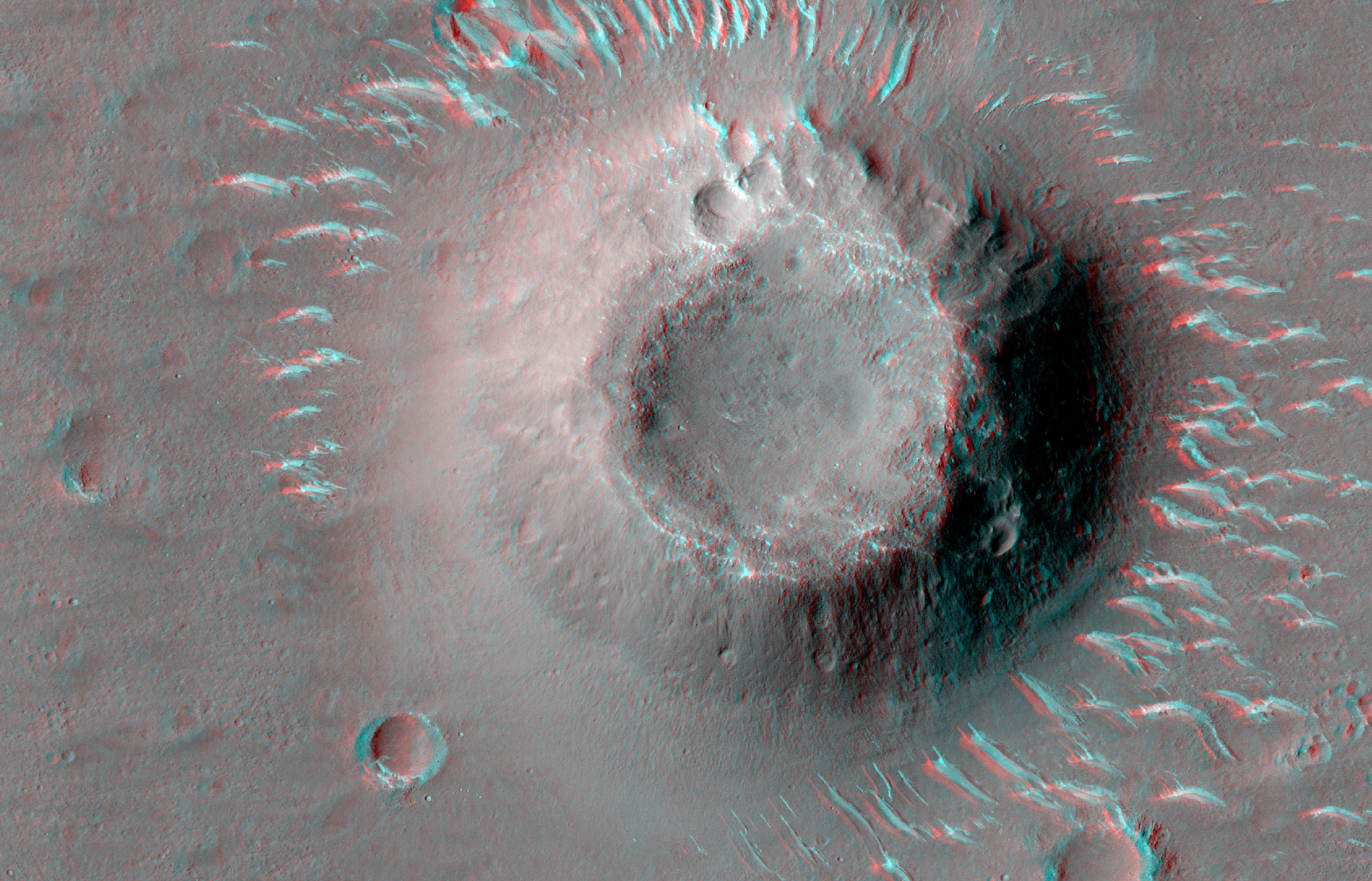
The crack is called a graben, and happens when the ground is either stretched from pressure from below, or when two adjacent large blocks of material move sideways relative to each other.
What makes this particular graben interesting are two features. First, the overlapping break suggests something complex took place at this spot when the crack separated. Second, the crack cut across the foot of an older frozen lava flow, meaning it has to be younger than that flow.
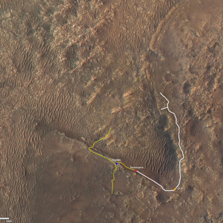
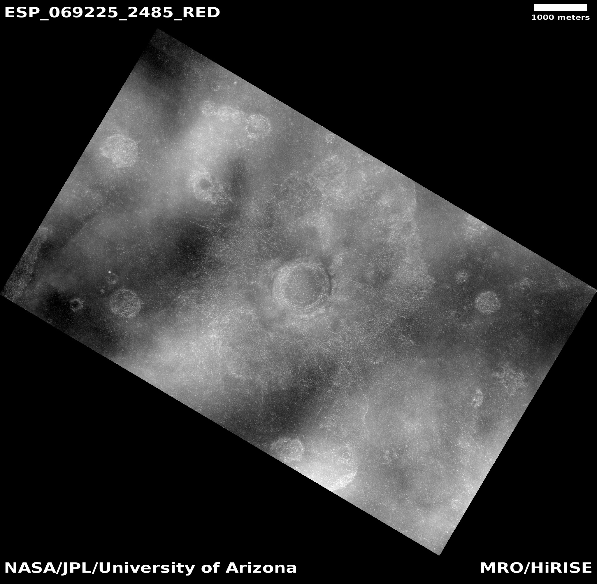
The overview map below provides a clue when that lava flow might have occurred, while also suggesting this crack in Cerberus Fossae might be much younger than expected.
» Read more
Click for full image.
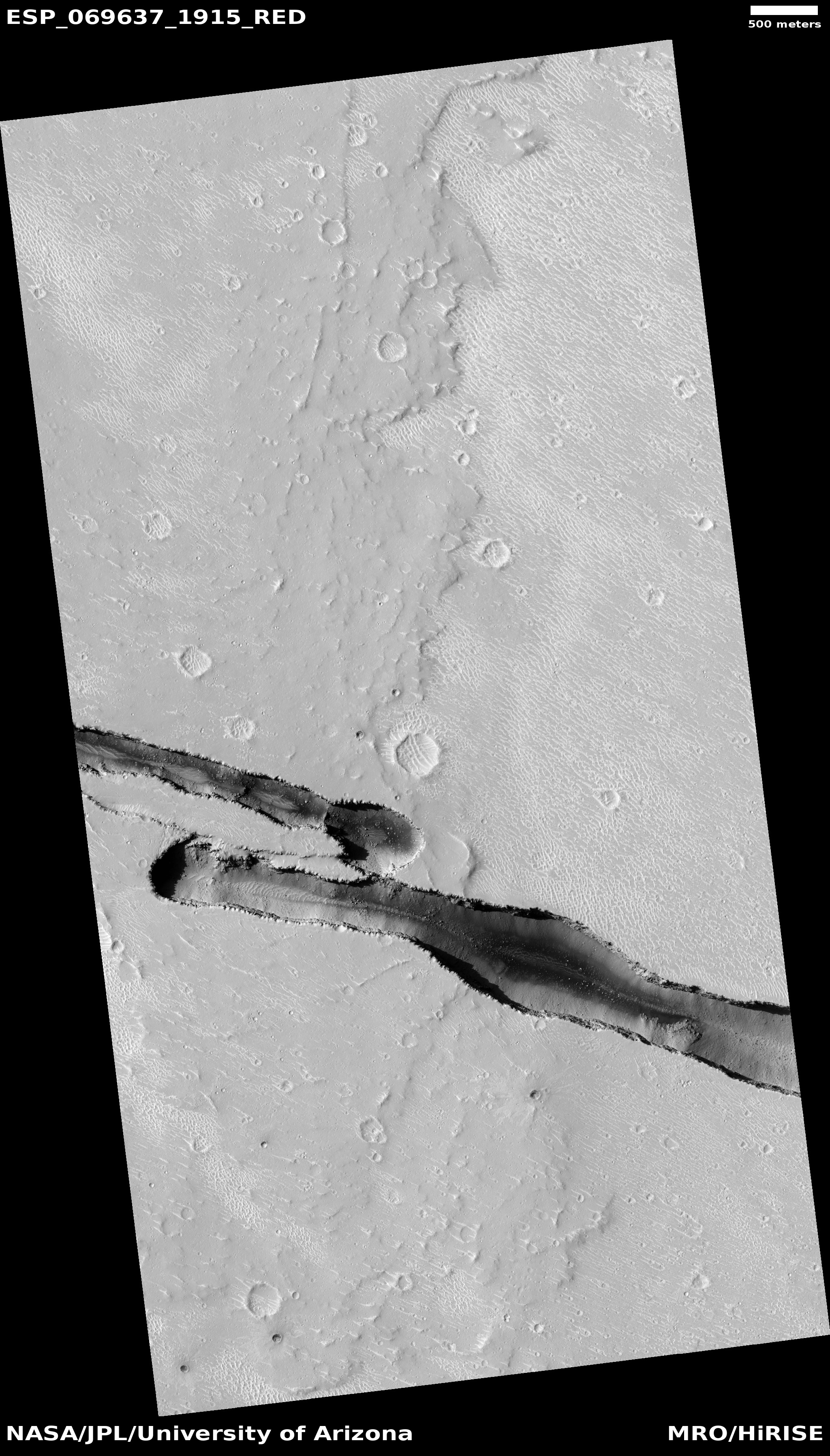
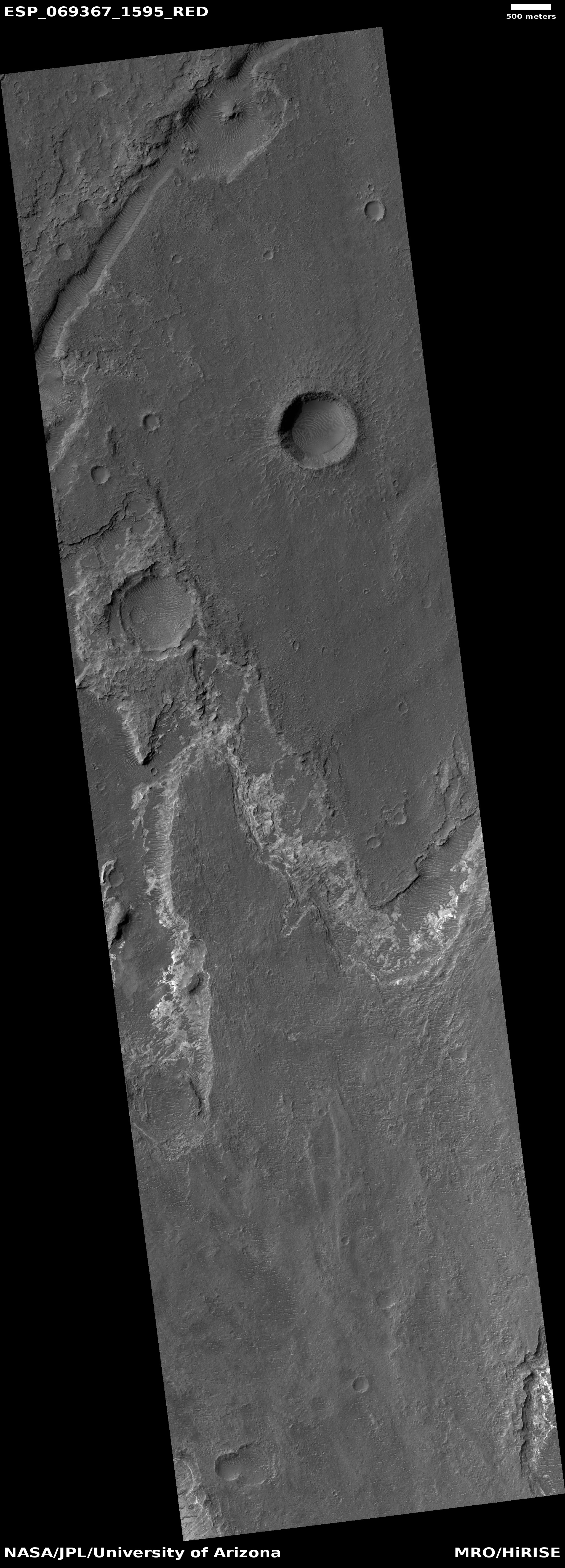
Cool image time! The photo to the right, cropped and reduced to post here, was taken on June 4, 2021 by the high resolution camera on Mars Reconnaissance Orbiter (MRO). It captures one of the many deep straight fissure canyons that make up the feature dubbed Cerberus Fossae in the center of Mars’ volcano country.
The crack is called a graben, and happens when the ground is either stretched from pressure from below, or when two adjacent large blocks of material move sideways relative to each other.
What makes this particular graben interesting are two features. First, the overlapping break suggests something complex took place at this spot when the crack separated. Second, the crack cut across the foot of an older frozen lava flow, meaning it has to be younger than that flow.
The overview map below provides a clue when that lava flow might have occurred, while also suggesting this crack in Cerberus Fossae might be much younger than expected.
» Read more


