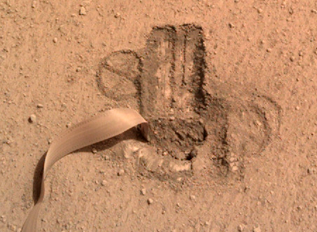
InSight detects and dates large impact on Mars

InSight's Christmas Eve impact
Click for full image.

Using the data from InSight’s seismometer of a 4 magnitude earthquake on Mars on December 24, 2021, scientists were able to use the high resolution camera on Mars Reconnaissance Orbiter (MRO) to find the meteorite impact that produced that quake, the largest detected since spacecraft have been visiting Mars. The picture to the right, cropped and reduced to post here and unveiled at yesterday’s press conference, shows the new crater.

The meteoroid is estimated to have spanned 16 to 39 feet (5 to 12 meters) – small enough that it would have burned up in Earth’s atmosphere, but not in Mars’ thin atmosphere, which is just 1% as dense as our planet’s. The impact, in a region called Amazonis Planitia, blasted a crater roughly 492 feet (150 meters) across and 70 feet (21 meters) deep. Some of the ejecta thrown by the impact flew as far as 23 miles (37 kilometers) away.

With images and seismic data documenting the event, this is believed to be one of the largest craters ever witnessed forming any place in the solar system.

This is not the first such impact identified from InSight seismic data, but it is the largest. The white streaks surrounding the crater are thought to be near-surface ice ejected at impact.

The overview map below provides further context, as well as showing us the proximity of this impact to the proposed Starship landing sites on Mars.
» Read more

2 comments

Past tree ring spikes in carbon-14 were likely not caused by solar flares

The uncertainty of science: According to researchers, past tree ring spikes in carbon-14 found in found at five different times going back seven thousand years were likely not caused by solar flares, as previously thought.

The team behind the new research created software to analyse every available piece of data on tree rings, producing the most comprehensive research on Miyake events to date. They found that the events didn’t show a consistent relationship to the 11-year solar cycle, which is the cycle that the Sun’s magnetic field goes through. (Currently we’re heading towards the solar maximum which means more sunspots and solar flares.)

This lack of relationship to the solar cycle means that Miyake events probably aren’t due to a solar flare, as flares occur more during the solar maximum.

The scientists also found that the events lasted years, not days as one would expect by a solar flare.

You can read their paper here. The bottom line is that the cause of these spikes remains unknown.

0 comments

A glacier sea on Mars

A glacier sea on Mars
Click for full image.

Cool image time! The photo to the right, rotated, cropped, and reduced to post here, should at first glance be one of my “What the heck!?” images. However, a little detective work quickly provides us some understanding of the inexplicable geology seen at this particular location on Mars.

The picture was taken on August 29, 2022 by the high resolution camera on Mars Reconnaissance Orbiter (MRO) and was labeled by the science team a “Lobate Debris Apron in Deuteronilus Mensae.” This mensae region is the western part of the 2,000-mile-long strip in the northern mid-latitudes of Mars that I label glacier country, since almost every high resolution picture taken in this strip shows extensive glacial features.

This picture is no different, showing what appears to be glaciers, but by itself it is still difficult to make sense of it. Glaciers flow downhill, like rivers. In this high resolution image the direction of flow is somewhat unclear.

As always, a wider view clarifies the picture.
» Read more

0 comments

Martian rectilinear ridges

Martian rectilinear ridges
Click for original image.

Today’s cool image is also a bafflement. The photo to the right, cropped, reduced, and enhanced to post here, was taken on July 25, 2022 by the high resolution camera on Mars Reconnaissance Orbiter (MRO). The ridges in this picture are labeled by the scientists “Rectilinear Ridges,” but they really do not resemble any of the Martian rectilinear ridge types outlined in this paper [pdf], all of which appear to have a much more pronounced criss-cross pattern.

These ridges however are more meandering, and instead to my eye seem more like inverted channels, ancient channels whose beds became compacted and then became ridges when the less dense surrounding material eroded away. The problem with this conclusion however is the lack of any obvious tributary pattern. If these were once channels where either liquid water or glaciers once flowed, none of them seem to exhibit any drainage pattern. The ridges go in all directions.

The context map below only increases the mystery.
» Read more

0 comments

InSight still hangs in, barely

InSight's power status as of October 22, 2022

A new update on the status of the Mars lander InSight was released today, showing its power output daily through October 22, 2022. The graph to the right shows this update. From the report:

As of October 22, 2022, InSight’s seismometer is collecting data again after being switched off to conserve energy after a recent dust storm. The lander was generating an average of 280 watt-hours of energy per Martian day, or sol. The tau, or level of dust cover in the atmosphere, was estimated at 1.45 (typical tau levels outside of dust season range from 0.6-0.7).

These power levels are very low, so low I am surprised the science team thought it was able to start the seismometer again. It could be they expect the lander to fail any moment, and decided to maximize the data it can get in the little time it has left.

A press conference is planned for Thursday, October 27, 2022 to provide an update on InSight’s future, as well it appears to describe a recent discovery (likely the exact moment some recent impacts took place) based on data from InSight and images from Mars Reconnaissance Orbiter (MRO). This was already reported in mid-September, but more impacts might have been identified.

It is also possible the MRO images detected some other change on the surface (not an impact) that InSight’s seismometer picked up. If so, the briefing will be far more interesting.

0 comments

Bedrock layers in Terby Crater on Mars

Bedrock layers in Terby Crater on Mars
Click for full image.

Cool image to end the week! The picture to the right, rotated, cropped, reduced, and enhanced to post here, was taken by on July 18, 2022 by the high resolution camera on Mars Reconnaissance Orbiter (MRO). It shows the bedrock layers on one of two very large mesas that jut out into the floor of 108-mile-wide Terby Crater.

I want to focus your eye on the spoon-shaped mesa near the top right of the photo. Note how the layers can be seen on both sides, even though the top of the mesa seems to be concave. This is strange and complex geology, made even more fascinating in that the two mesas almost reach the center of the crater floor. Why are they here? Why were they not flattened during impact, like the rest of the crater floor? Or maybe the original crater floor is the mesa top, but if so, why did the rest of the crater interior get eroded away.

The overview map below provides some context, and helps fill in some details, even if it fails to answer any of these questions.
» Read more

1 comment

Frozen lava flows around Martian hills

Martian lava flowing around hills
Click for full image.

Cool image time! The photo to the right, rotated, cropped, reduced, and enhanced to post here, was taken on August 24, 2022 by the high resolution camera on Mars Reconnaissance Orbiter (MRO). It shows the westernmost edge of the Athabasca flood lava plain, thought to be the youngest lava flow on Mars, having covered the area of Great Britain in a matter of weeks 600 million years ago.

This image was a captioned feature yesterday by the MRO science team. As they note:

Although you can’t sail a boat on a sea of lava, hills and craters that stick up higher than the lava flow act like barriers. When a boat is driven through the water, there is a bow wave at the front of the boat, and a wake that trails off behind that indicates which way the boat is moving. In a lava flow, when a hill sticks up, the lava piles up on the upstream side (just like a bow wave) and can leave a wake on the downstream side, so we can tell which way the lava was moving against the stationary hill.

As you can see, every hill has a pile of lava on its northeast slopes, and a wake to its southeast. As the main vent of the Athabasca eruption is to the northeast, about 500 miles away (as shown on the overview map below), the flow direction suggested by the wakes fit the general geography.
» Read more

2 comments

Inverted river on Mars

Inverted river on Mars

Cool image time! The photo to the right, rotated, cropped, reduced, and enhanced to post here, was taken on May 30, 2022 by the high resolution camera on Mars Reconnaissance Orbiter (MRO). It shows what the scientists label as a “inverted fluvial system”.

Such features are not unusual on Mars. The theory explaining their formation is that this was once a channel where either water or ice flowed, packing the streambed down so that it was more dense than the surrounding terrain. After the flowing material disappeared, the less dense surrounding terrain eroded away, leaving the channel as a meandering ridge.

The location of this inverted channel, as shown in the overview map below, lends some weight to the flowing material being water or ice.
» Read more

0 comments

Perseverance spots Phobos

Phobos, as seen by Perseverance on Mars
Click for full image.

Cool image time! The photo to the right, cropped to post here, was taken on January 12, 2022 by one of the high resolution cameras on the Mars rover Perseverance, and shows the Martian moon Phobos.

As noted in an update today by Claire Newman, one of the members of the science team,

This provides a measurement, using visible light, of the amount of dust in the nighttime atmosphere, which can be compared to similar measurements made by looking at the sun during the daytime, and to nighttime measurements of dust abundance made in the infrared by MEDA [another Perseverance instrument].

There have been three attempts to land on Phobos, all by the Russians, all of which failed. At present a Japanese mission to Phobos, dubbed Mars Moons eXploration or MMX, is scheduled to launch in 2024. This is a planned sample return mission, and will also include a rover.

6 comments

Changing slope streaks on Mars

Overview map

Changing slope streaks on Mars
Click for full image.

Cool image time! The photo to the right, cropped and reduced to post here, was taken on July 20, 2022 by the high resolution camera on Mars Reconnaissance Orbiter (MRO). It shows what the scientists have labeled a “Splitting Slope Streak” on a mound/hill near the equator and located almost midpoint between the giant volcano Olympus Mons about 2,000 miles to the east and the almost as big volcano Elysium Mons about 2,500 miles to the west. The white cross on the overview map above marks this location, north of the Medusae Fossae volcanic ash deposit.

The slope streak in question is the biggest and darkest at about 7 o’clock. Slope streaks are a feature unique to Mars that remain as yet unexplained. They are not ordinary avalanches, despite their appearance. They seem to have no effect on the topography, and thus are more a stain on the surface. Moreover, some are bright, some dark, and all happen randomly and fade with time. Some think they may be brine-related, while others link them to dust. No theory explains them completely.

What makes this slope streak interesting is that it is relatively new. Compare it with the picture taken in 2016 below.
» Read more

0 comments

An icy hollow on Mars

A icy hollow on Mars
Click for full image.

Cool image time! The photo to the right, cropped, reduced, and enhanced to post here, was taken on August 20, 2022 by the high resolution camera on Mars Reconnaissance Orbiter (MRO). It shows a somewhat typical example of the many ice scarps that scientists have identified in MRO pictures.

Though this is not a hard fast rule, most of the ice scarps so far found tend to have the steep cliff on the pole-facing side, with the scarp very slowly retreating towards the equator. In today’s example, the scarp where an ice layer in the cliff wall has been identified is indicated by the white arrow, though three sides of the hollow, on the east, north, and west sides, could all also have exposed ice.

Nor is that the only likely ice at this location at 56 degrees south latitude. The stippled plain surrounding the hollow clearly looks like an eroded ice layer, likely covered with a thin protective coat of dust to protect if from quickly sublimating away. The dark streaks across this surface are likely dust devil tracks.

As documented by the global map below, Mars is like Antarctica, a desert with water ice everywhere.
» Read more

0 comments

DART’s impact shortened Dimorphus’s orbit around Didymos by 32 minutes

LICIACube Explorer image of DART impact
LICIACube Explorer image just after the DART
impact. Dimorphus is the blob near the top.

After two weeks of analyzing the orbit of Dimorphus around its parent asteroid Didymos, astronomers have determined that the impact of DART on Dimorphus shortened its orbit by 32 minutes.

Prior to DART’s impact, it took Dimorphos 11 hours and 55 minutes to orbit its larger parent asteroid, Didymos. Since DART’s intentional collision with Dimorphos on Sept. 26, astronomers have been using telescopes on Earth to measure how much that time has changed. Now, the investigation team has confirmed the spacecraft’s impact altered Dimorphos’ orbit around Didymos by 32 minutes, shortening the 11 hour and 55-minute orbit to 11 hours and 23 minutes. This measurement has a margin of uncertainty of approximately plus or minus 2 minutes.

Before its encounter, NASA had defined a minimum successful orbit period change of Dimorphos as change of 73 seconds or more. This early data show DART surpassed this minimum benchmark by more than 25 times.

It also appears the ejecta from the impact — much greater than expected — helped propel Dimorphus, a result that I think was also not expected.

Researchers are now shifting to studying the debris and asteroid itself, to better understand what happened as well as the nature of Dimorphus itself. This will also include a European probe dubbed Hera that will launch in 2024 an dvisit both asteroids in 2026.

14 comments
1 64 65 66 67 68 157