
Ice-filled Martian sinkhole
Click for full image.
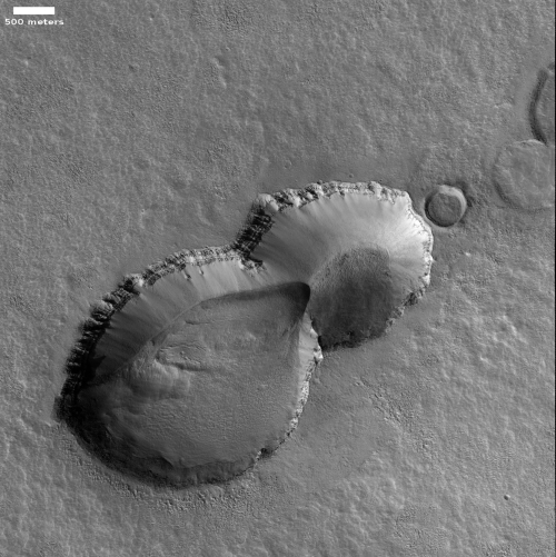
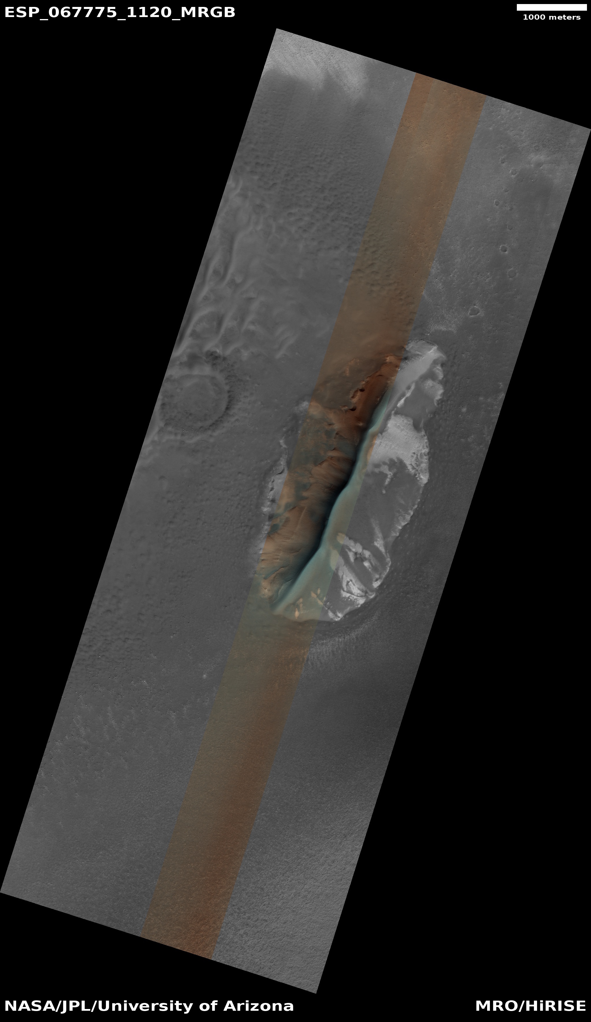
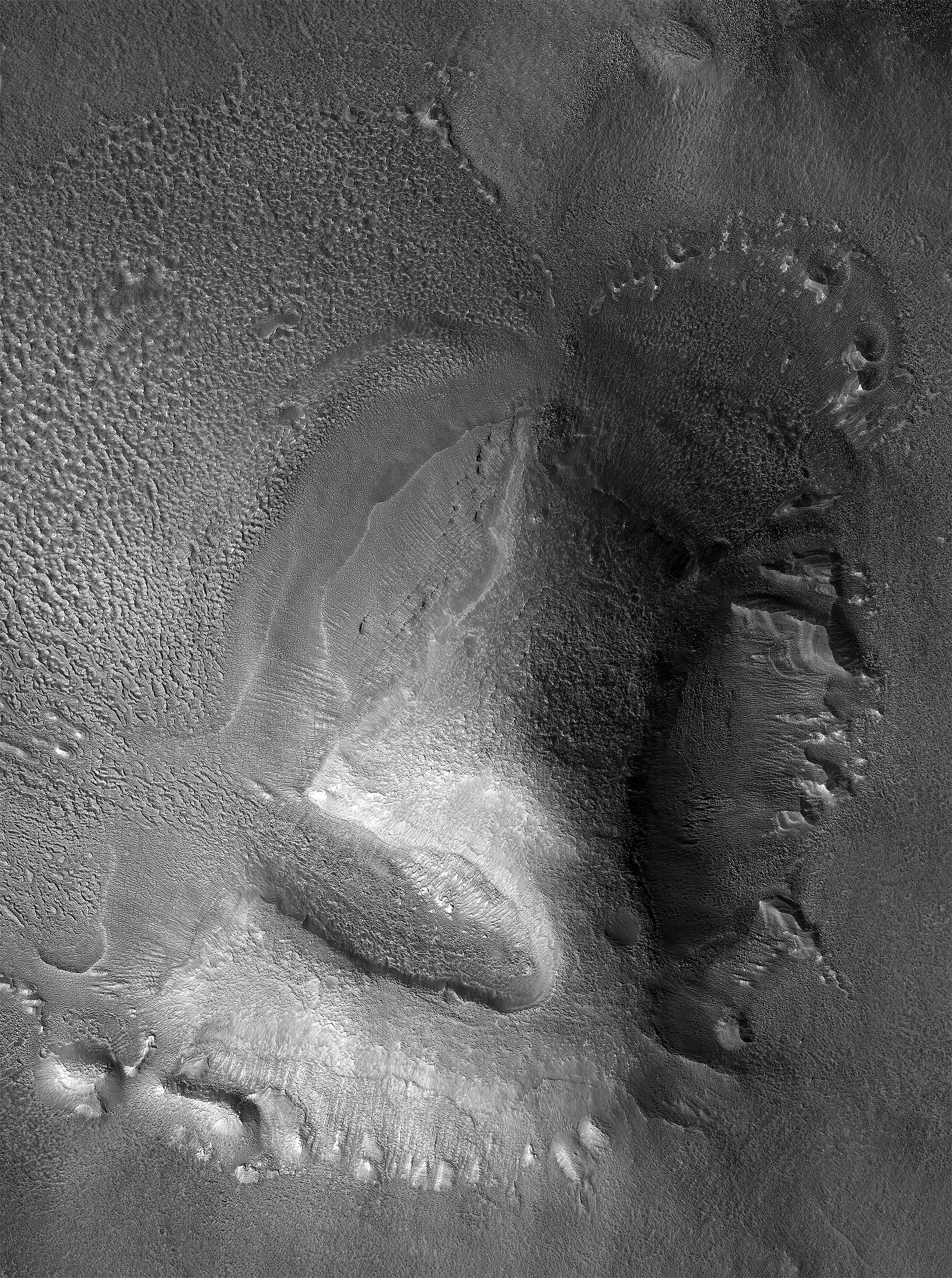
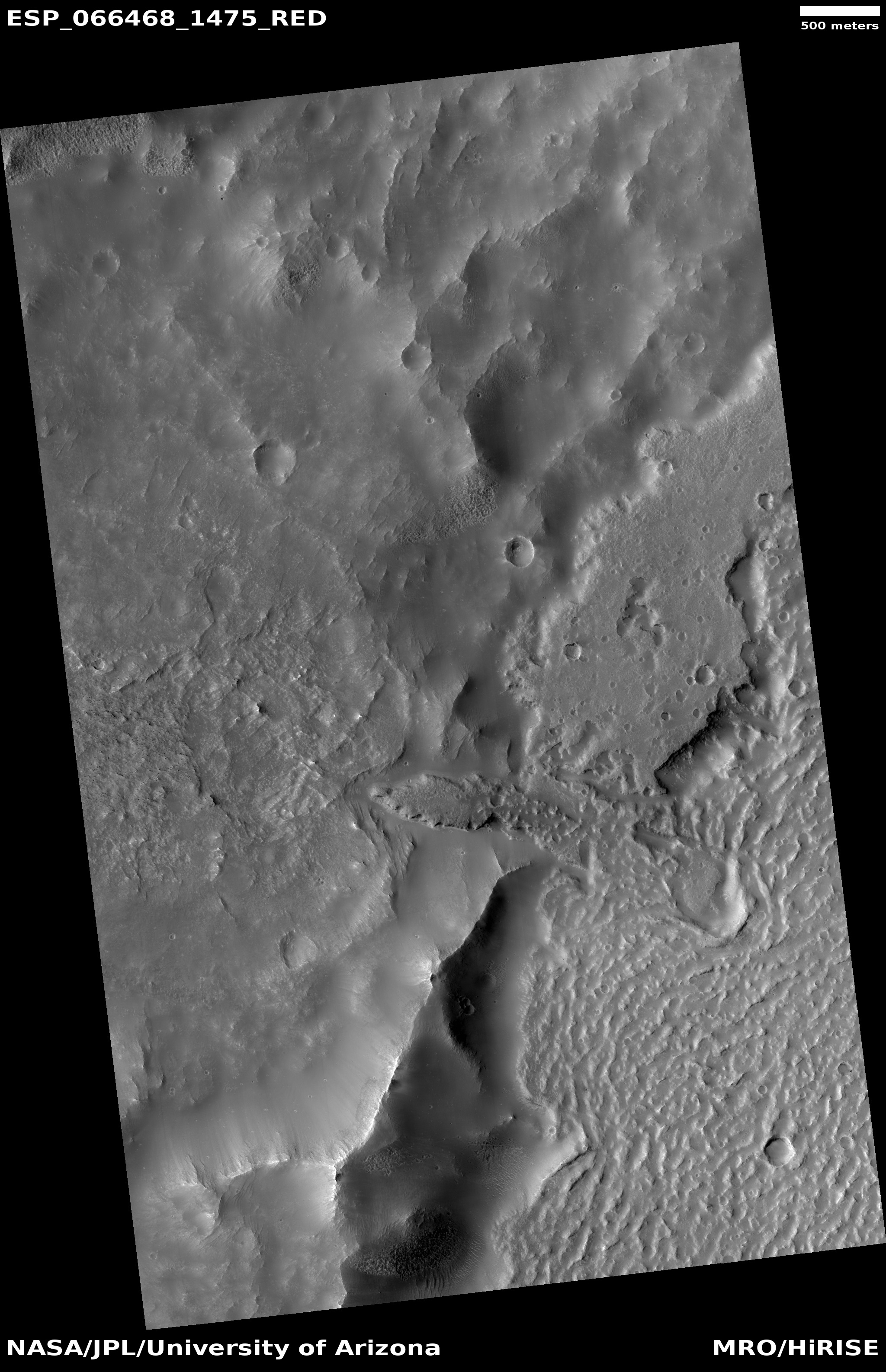
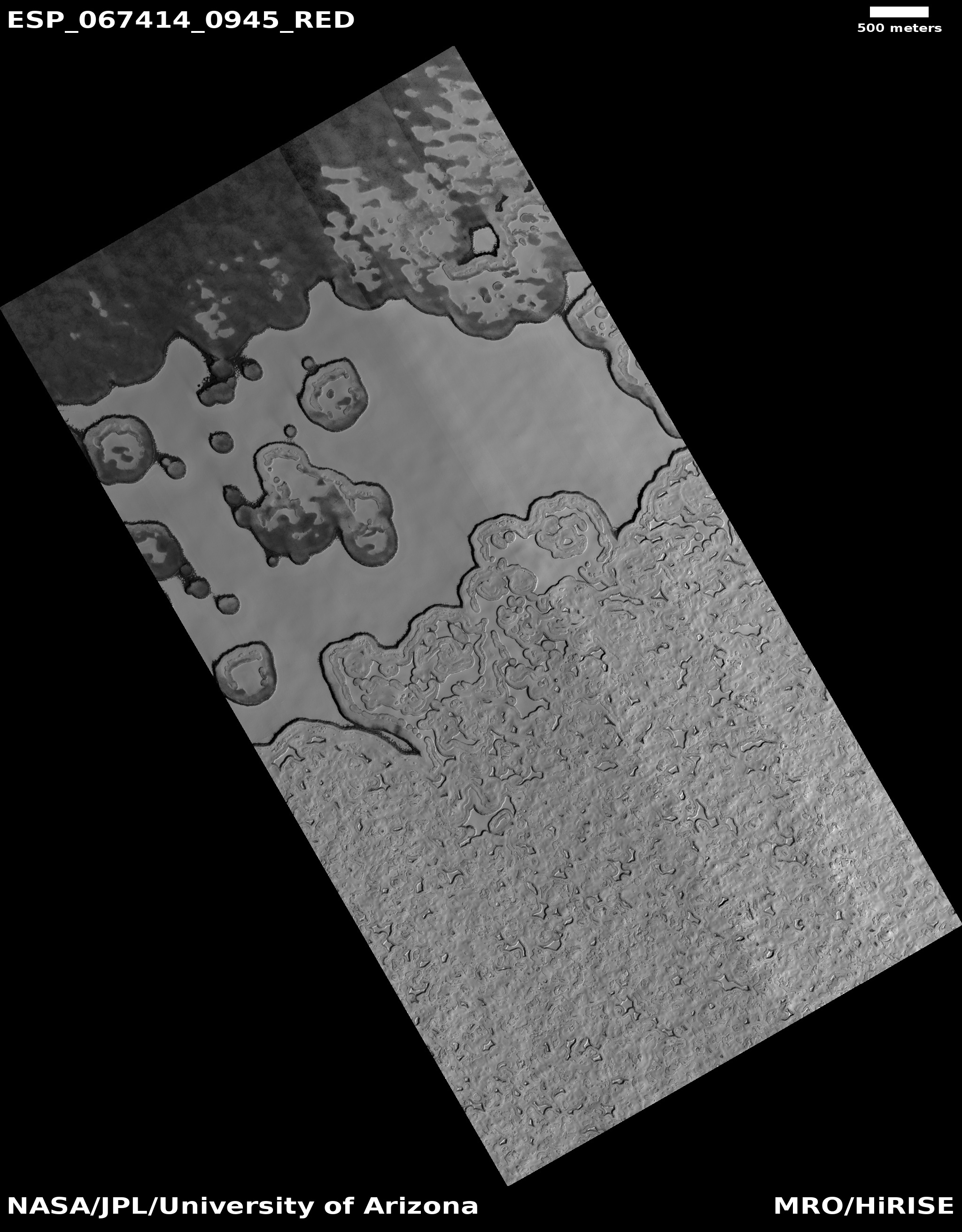
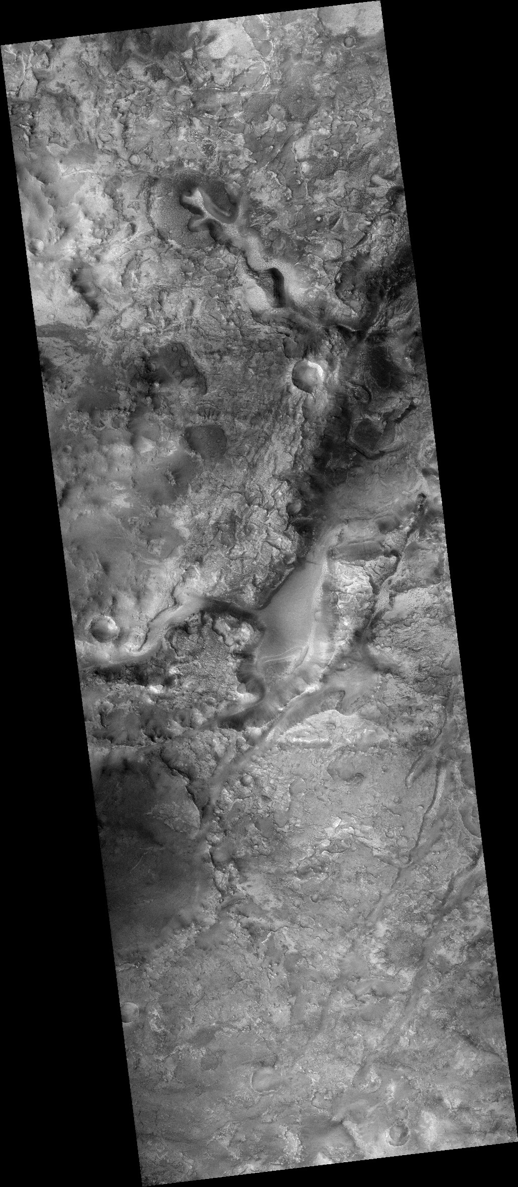
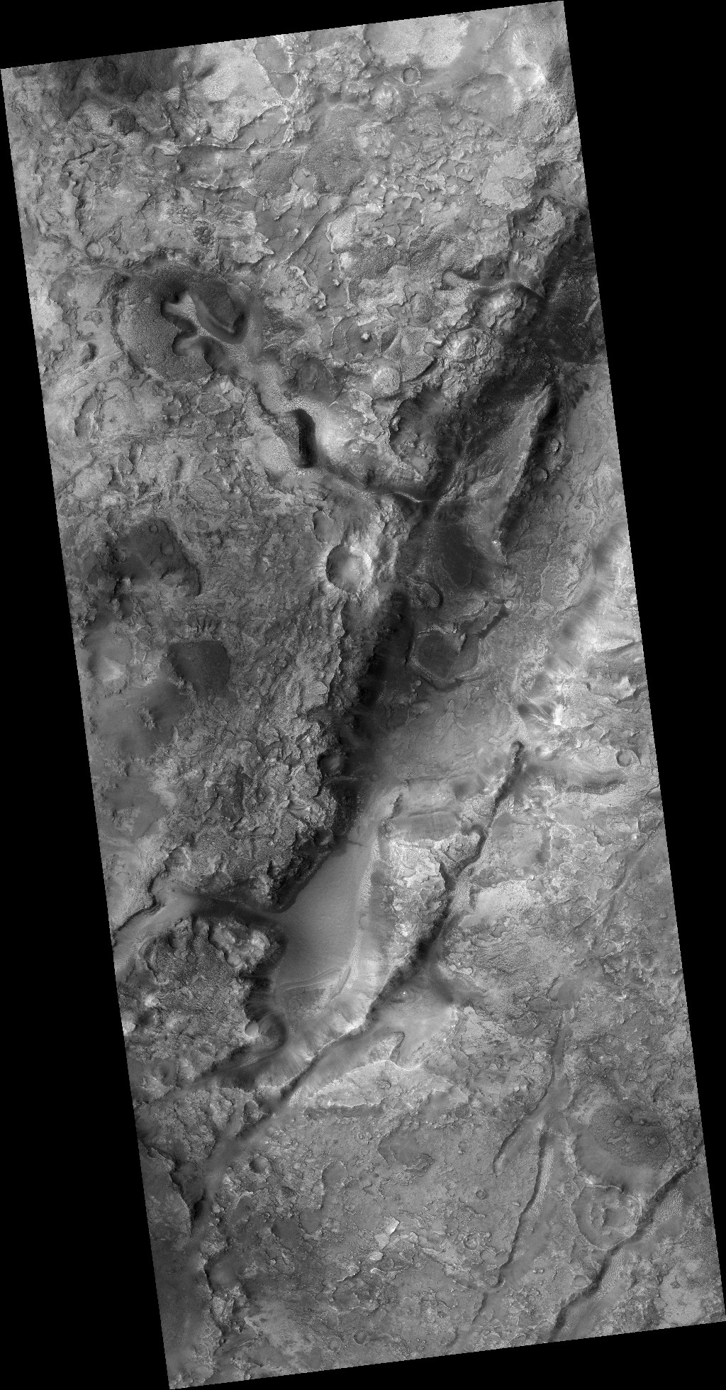
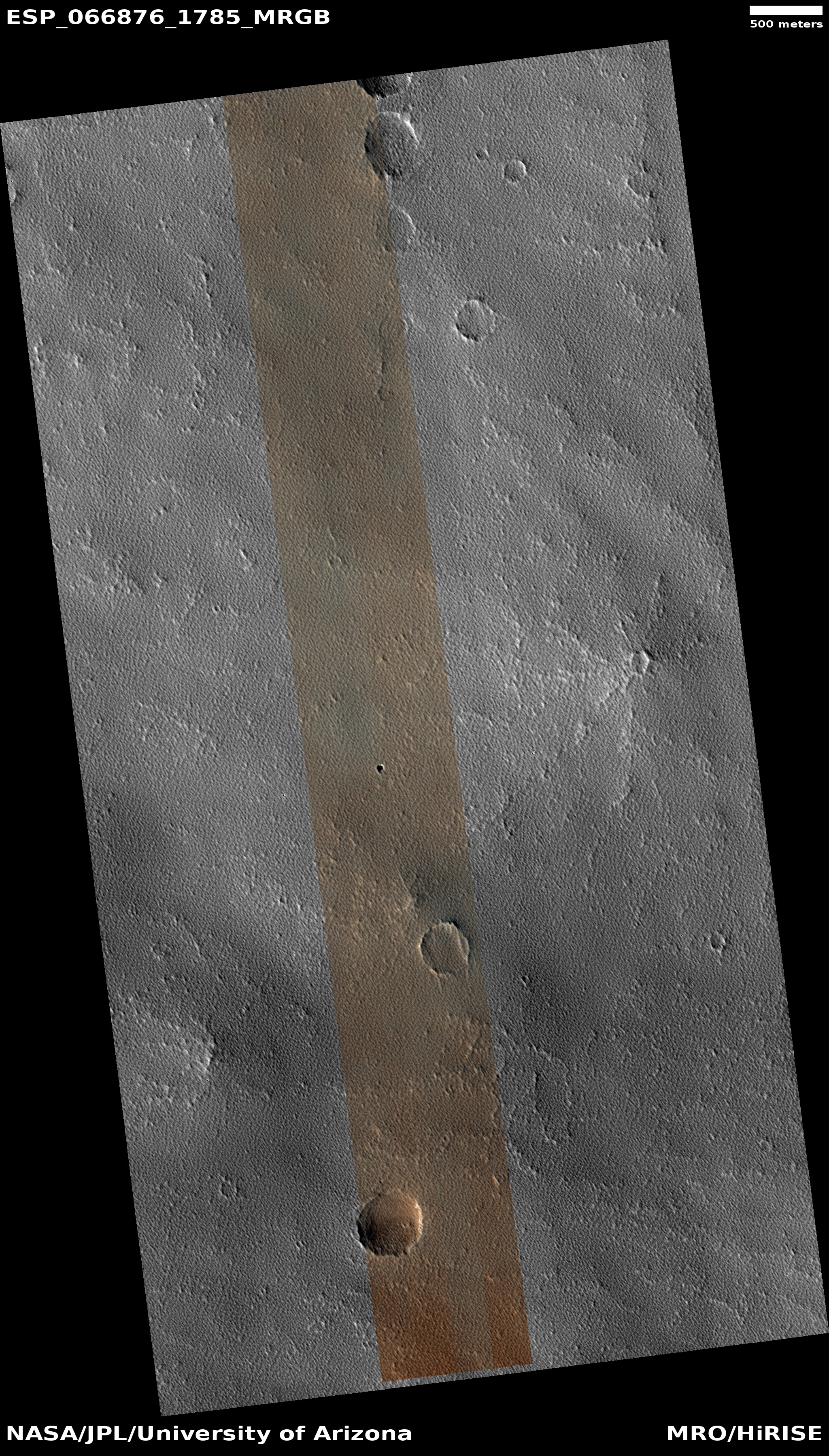
Cool image time! The pit shown in the high resolution photo to the right (image rotated, cropped, and reduced to post here) was taken on January 25, 2021 and labeled by the Mars Reconnaissance Orbiter (MRO) “Collapse Pit in Graben with Ice Fill.”
There is a lot of information in that title. First, a graben is a geological feature where a section of terrain drops relative to the surrounding terrain, producing a depression. Second, it appears the graben in this region is mostly filled with debris, probably wind-blown dust or sand or volcanic ash.
Third, at this particular spot the filling material sank, like a sinkhole on Earth, creating the pit.
And fourth, and maybe most intriguing, the scientists think that this pit is now filled with ice. At 47 degrees north latitude, the location is prime for such ice, and the interior material resembles similar glacial features seen in many other mid-latitude craters.
» Read more
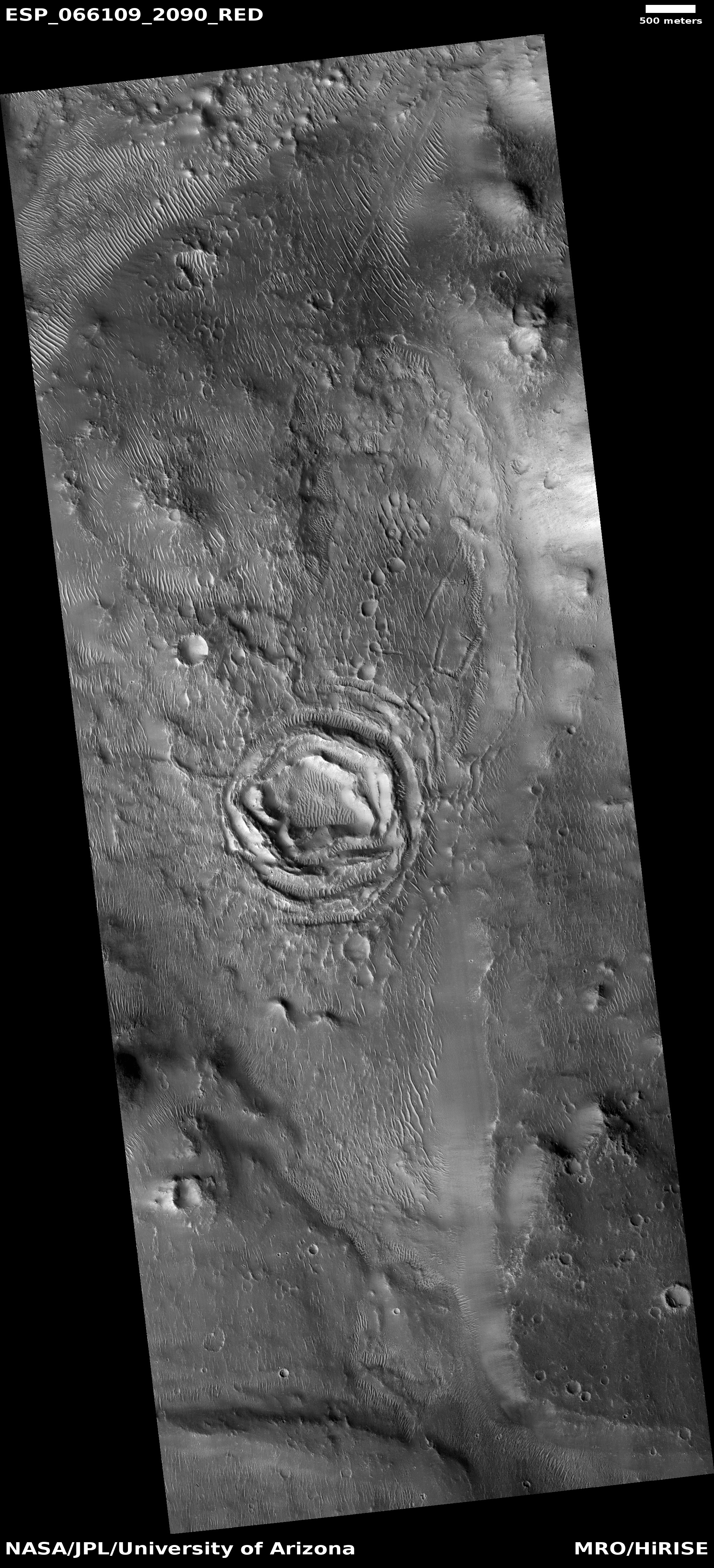
Click for full image.
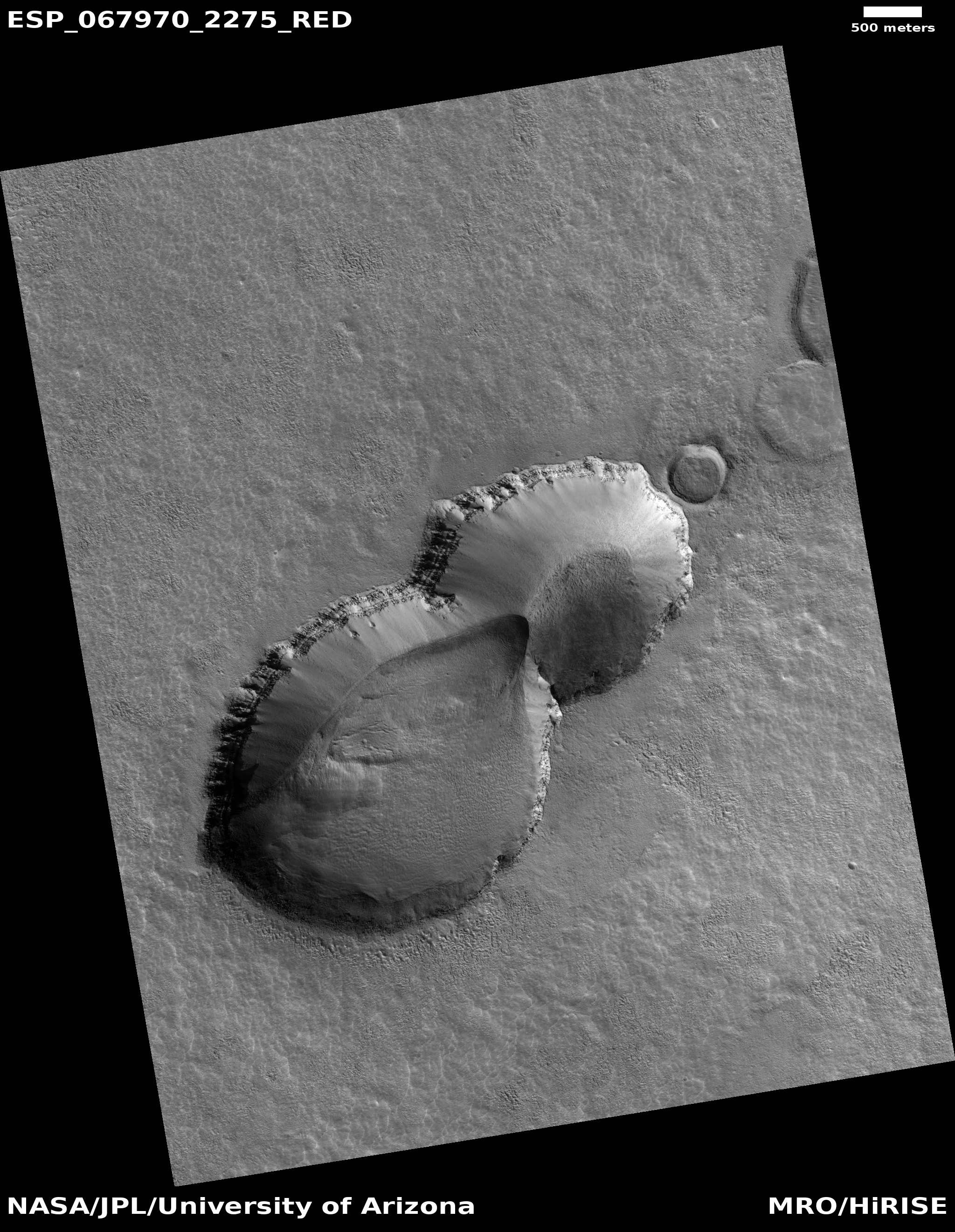
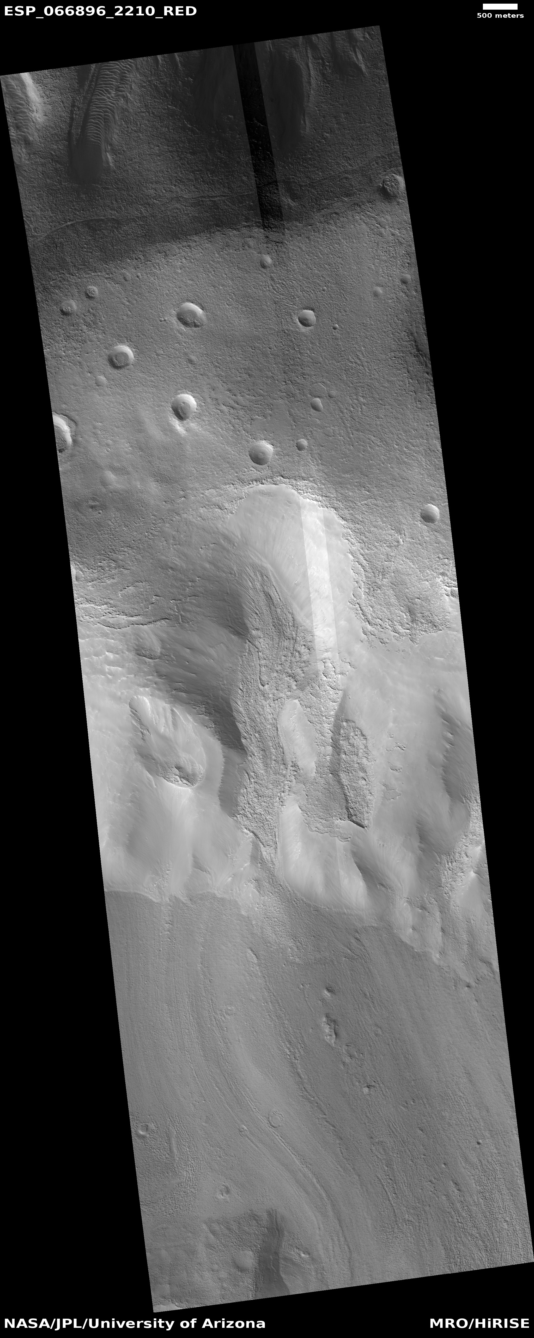
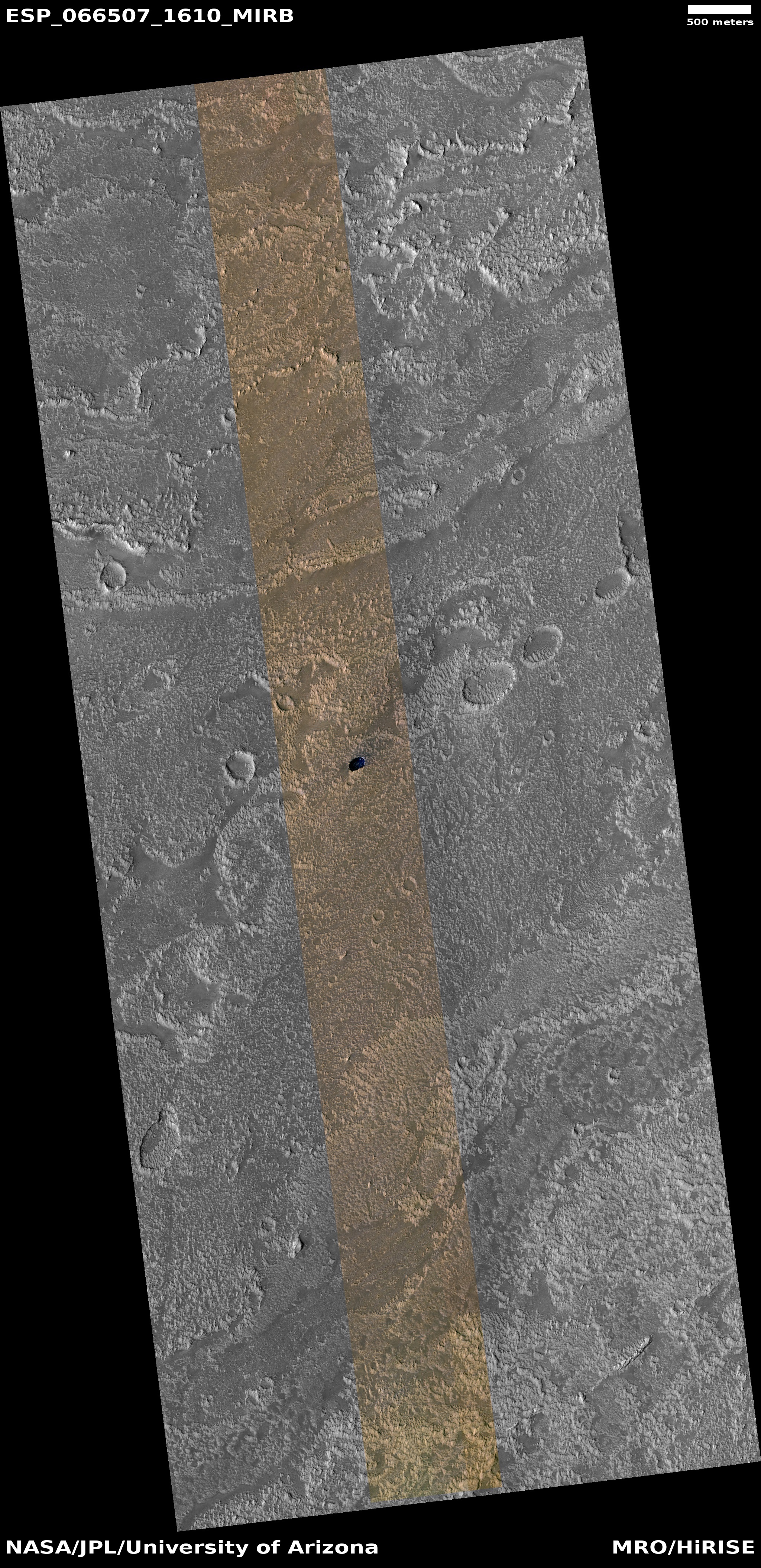
Cool image time! The pit shown in the high resolution photo to the right (image rotated, cropped, and reduced to post here) was taken on January 25, 2021 and labeled by the Mars Reconnaissance Orbiter (MRO) “Collapse Pit in Graben with Ice Fill.”
There is a lot of information in that title. First, a graben is a geological feature where a section of terrain drops relative to the surrounding terrain, producing a depression. Second, it appears the graben in this region is mostly filled with debris, probably wind-blown dust or sand or volcanic ash.
Third, at this particular spot the filling material sank, like a sinkhole on Earth, creating the pit.
And fourth, and maybe most intriguing, the scientists think that this pit is now filled with ice. At 47 degrees north latitude, the location is prime for such ice, and the interior material resembles similar glacial features seen in many other mid-latitude craters.
» Read more


