
A gravel pile floating in space that might hit the Earth
Click for full image.
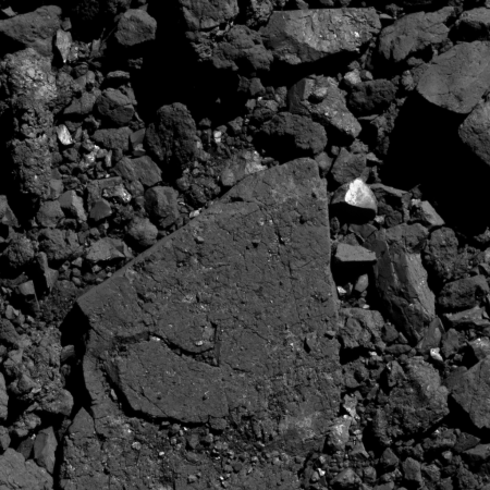
Come October the probe OSIRIS-REx will attempt a quick touchdown on the asteroid Bennu to grab some tiny particles, all smaller than 0.8 inches across.
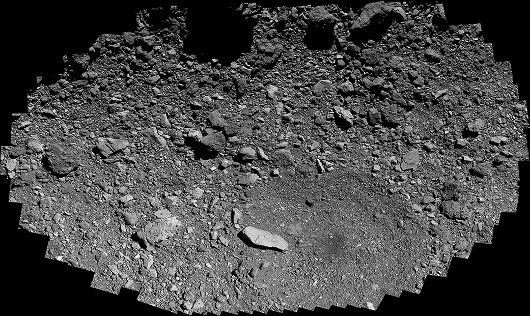
Bennu is what scientists have described as a “rubble-pile” asteroid. They use that name because it is simply a conglomeration of a lot of rocks, pebbles, boulders, and stones, all jagged and of all sizes. The overall gravity has never been strong enough to squeeze them together, at least as far as we can see, and so they are piled up loosely across the asteroid’s surface wherever we look.
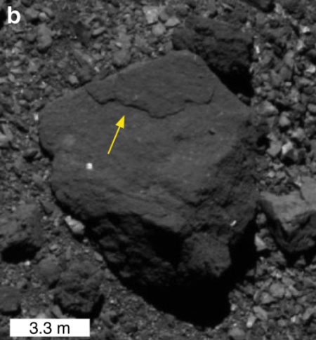
I think a better name for this asteroid would a floating gravel pile, since the material on it, as clearly shown in the image to the right (reduced and rotated to post here), more resembles the tailings one finds at a mine or quarry. This photo was taken by OSIRIS-REx on May 26, 2020 during its first dress rehearsal over its back-up touch-and-go sample grab site, Osprey. As the release caption notes,
The field of view is 12 ft (3.8 m). For reference, the bright rock [near] the tip of the boulder is 1 ft (0.3 m) across, which is about the size of a loaf of bread.
I have rotated the image 90 degrees so that east is up, because the full mosaic of the entire Osprey landing site, shown below, is oriented that way, and by rotating it to match it is easier to locate this image within it.
» Read more

Click for full image.
Come October the probe OSIRIS-REx will attempt a quick touchdown on the asteroid Bennu to grab some tiny particles, all smaller than 0.8 inches across.
Bennu is what scientists have described as a “rubble-pile” asteroid. They use that name because it is simply a conglomeration of a lot of rocks, pebbles, boulders, and stones, all jagged and of all sizes. The overall gravity has never been strong enough to squeeze them together, at least as far as we can see, and so they are piled up loosely across the asteroid’s surface wherever we look.
I think a better name for this asteroid would a floating gravel pile, since the material on it, as clearly shown in the image to the right (reduced and rotated to post here), more resembles the tailings one finds at a mine or quarry. This photo was taken by OSIRIS-REx on May 26, 2020 during its first dress rehearsal over its back-up touch-and-go sample grab site, Osprey. As the release caption notes,
The field of view is 12 ft (3.8 m). For reference, the bright rock [near] the tip of the boulder is 1 ft (0.3 m) across, which is about the size of a loaf of bread.
I have rotated the image 90 degrees so that east is up, because the full mosaic of the entire Osprey landing site, shown below, is oriented that way, and by rotating it to match it is easier to locate this image within it.
» Read more
