Click for full image.
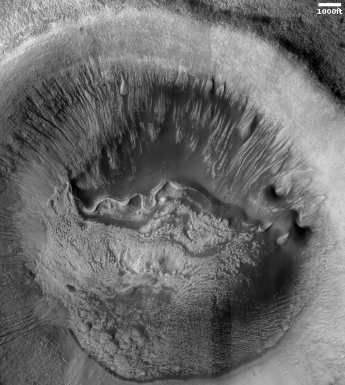
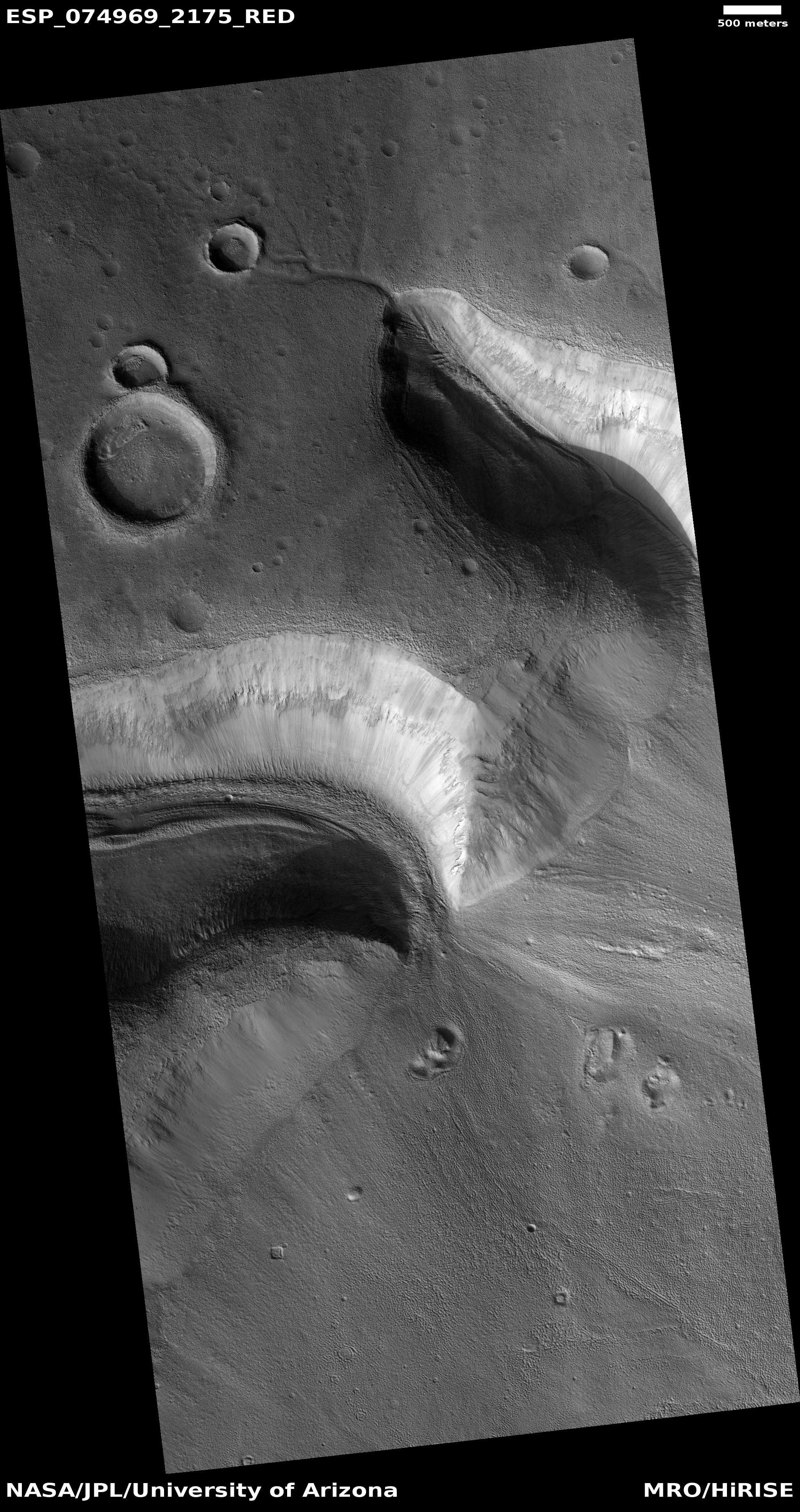
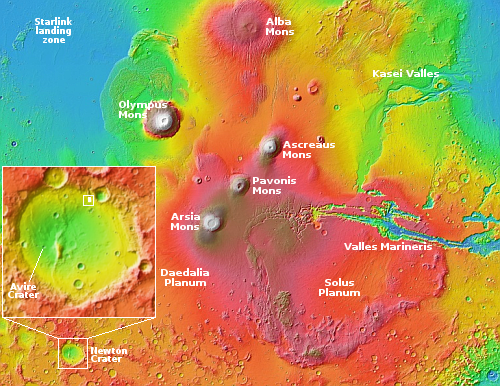
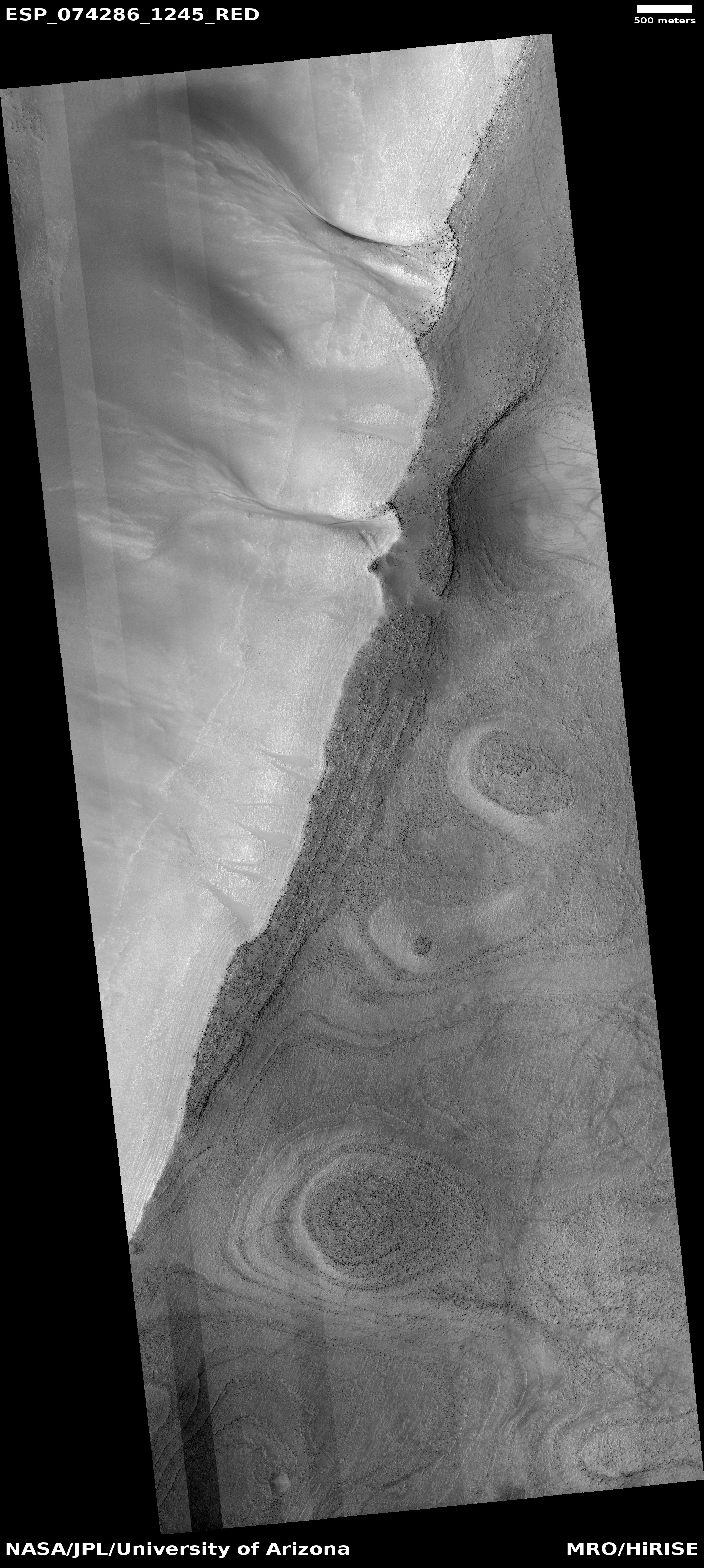
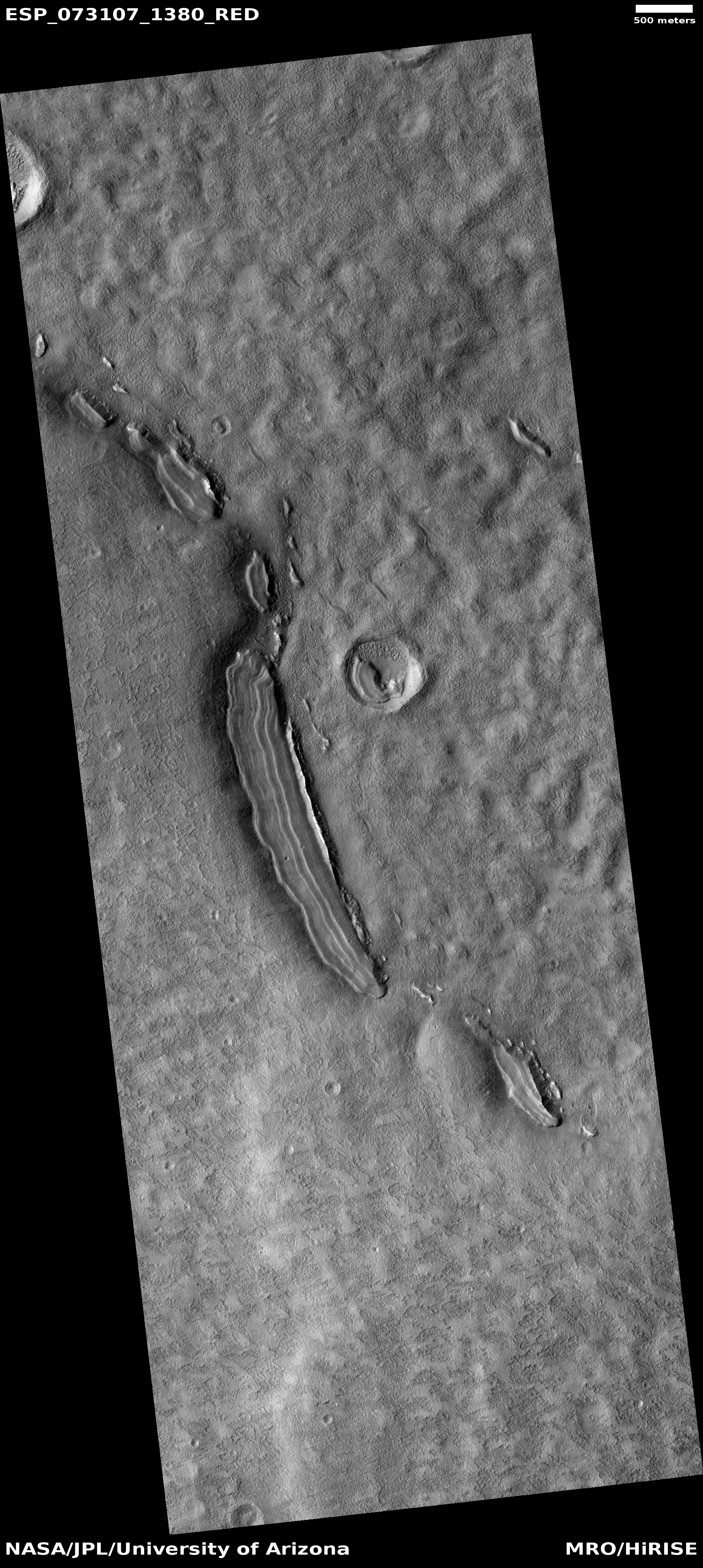
Cool image time! The photo to the right, rotated, cropped, and reduced to post here, was taken on July 10, 2022 by the high resolution camera on Mars Reconnaissance Orbiter (MRO). It shows the floor of 4-mile-wide Avire Crater, located at about 41 degrees south latitude inside the much larger 185-mile wide Newton Crater.
This picture was taken as part of a long term monitoring program of the many gullies that flow down the slopes of the crater’s interior rim. In fact, the gullies of this crater have so interested scientists that one even proposed [pdf] this location as a potential future rover landing site.
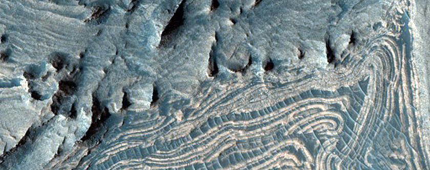
Avire Crater, a small … gullied crater within Newton Crater, provides many aspects ideal to a future rover mission. It has been previously hypothesized to be the location of a former paleolake with multiple episodes of ponding and deposition. Gullies occur almost continuously on the southwest wall clockwise to the northeastern wall. Dark-toned dunes are present in the northern portion of the crater, in some places obscuring gullies while cut by gullies in others. No changes in the extent or appearance of the dunes have been observed since they were first imaged … in January of 2000. The dunes lack superimposed craters, indicating that the gullies that cut through them are geologically very youthful. Layered lobate features are present at the base of the gullies on the northern wall, seen in many other craters on Mars (not always in association with gullies), which have been suggested to have formed as terminal moraines of ice-rich flows; in Avire, these features have also been suggested to be paleolake deposits. The crater floor is obscured by mid-latitude “fill” material, hypothesized to be partially comprised of ice based on morphologic evidence that the material has been partially removed.
As gullies, dunes, and “fill” material occur in many places on Mars, a single rover mission to a site containing these features would provide valuable information applicable to thousands of other locations across the planet.
The curved ridgeline in the crater floor is thought to be a moraine. The “fill” material to the south is essentially glacial in nature. Both, as well as the gullies, appear to have been shaped either a paleolake that once existed in the crater or by cyclical glacier activity. By going to this one crater, scientists could study all these different geological features at one time.
» Read more


