Since the very beginning of telescopic astronomy, the Martian poles have fascinated. Their changing sizes as the seasons progressed suggested to the early astronomers that Mars might be similar to Earth. Since the advent of the space age we have learned that no, Mars is not similar to Earth, and that its poles only resemble Earth’s in a very superficial way.
Yet, understanding the geology and seasonal evolution of the Martian poles is critical to understanding the planet itself.
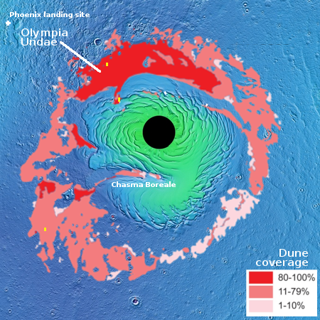
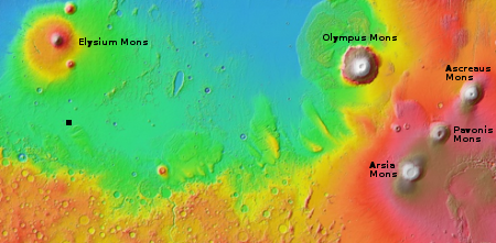
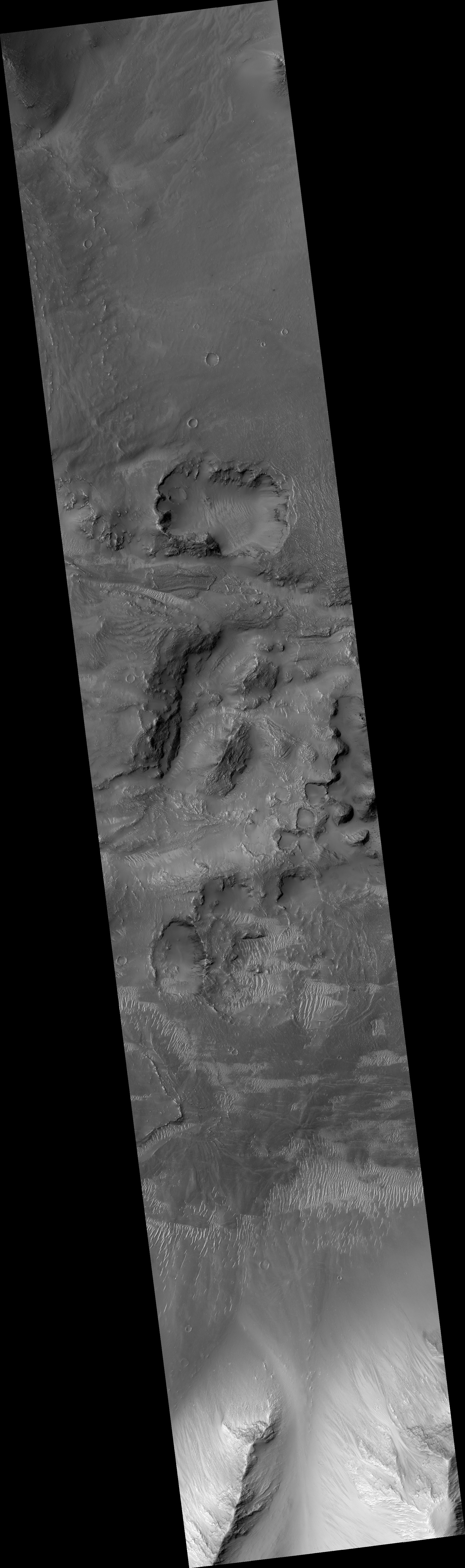
This post will focus on the Martian north pole. The map on the right of the north polar regions is based on many satellite images supplemented by a lot of research by planetary scientists. The black circle in the middle is an area with relatively poor image coverage. The green areas are regions of higher elevation where the bulk of the permanent ice cap is located, surrounded by the blue northern lowlands that cover much of Mars’s northern hemisphere and are thought to have once harbored an intermittent ocean.
Click for full image.
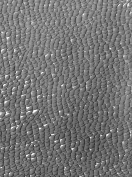
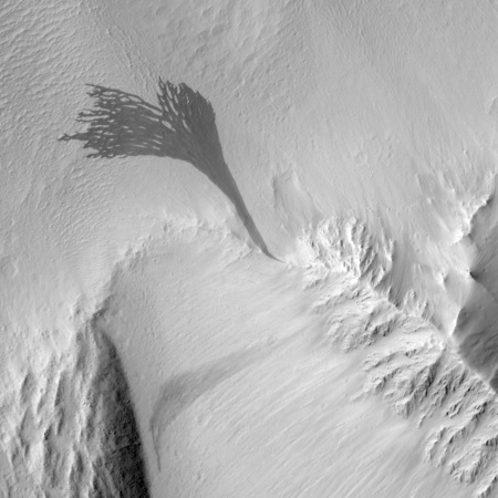
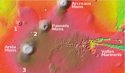
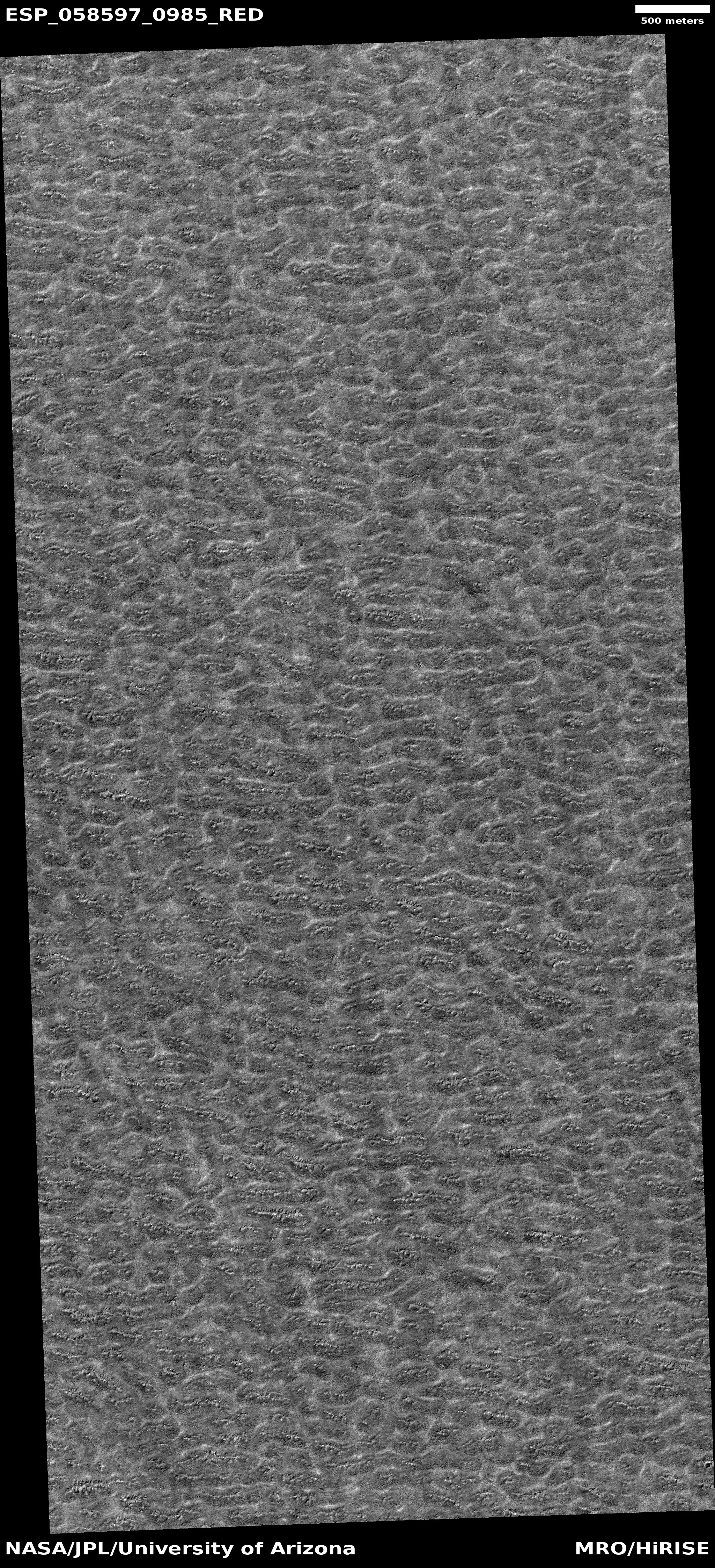
The reddish regions encircling the permanent ice cap are large seas of sand dunes, with Olympia Undae the largest and most sand-dune-packed. The image on the right, posted initially here on March 25, 2016, was taken by Mars Odyssey and shows the endlessness of this dune sea. Olympia Undae, spanning 120 degrees of longitude, is about 700 miles long, making it bigger than the Grand Canyon. As I noted in that post, “Just imagine trying to travel though this area. It is the epitome of a trackless waste. And without some form of GPS system getting lost forever would be incredibly easy.”
The polar cap itself, surrounded by those sand seas, is 600 miles across and a little less than 7,000 feet deep. It is made up of many seasonal layers, like the icecaps on Earth, with the bulk a mixture of water ice and cemented dust and sand. The very top layers, dubbed the residual icecap, is about three to six feet thick made up of frozen water having a volume about half of Greenland’s icecap. While this water could sublimate away, data suggests it is, like the icecaps on Earth, in a steady state, neither gaining or losing volume with each Martian year.
Above the residual icecap of water is the seasonal icecap made up of carbon dioxide. Unlike the other layers, this seasonal cap of dry ice, also less than six feet thick, comes and goes with the seasons. During the Martian summer it is gone, the carbon dioxide having sublimated away into the atmosphere. As the weather chills however that carbon dioxide begins to freeze again, falling as CO2 snow on the surface at the poles to create a thin cap of dry ice extending down to about 60 degrees latitude and covering practically everything seen in the first map above.
These facts suggest that future Martian colonists will have an interest in this region. While harsher than the rest of the planet, the conditions at the poles are not so much different that it will be impossible to work here. And here they will find a ready supply of carbon dioxide to help their plants grow, as well as a ready supply of water, all easily mined and near the surface.
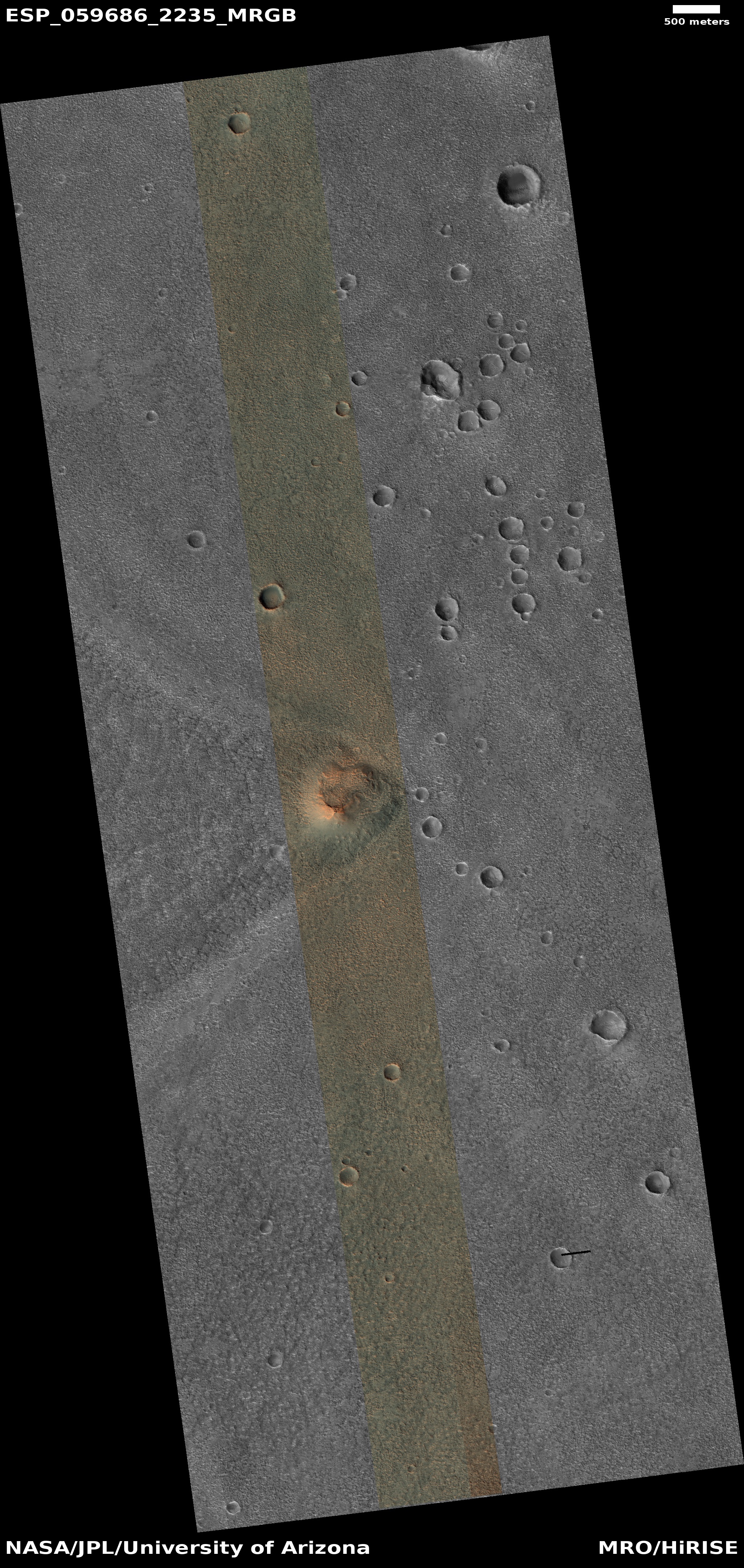
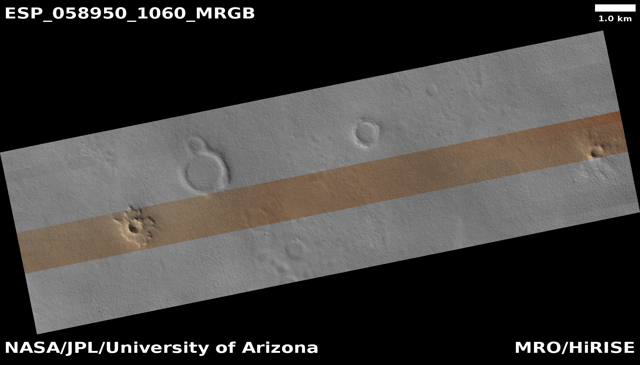
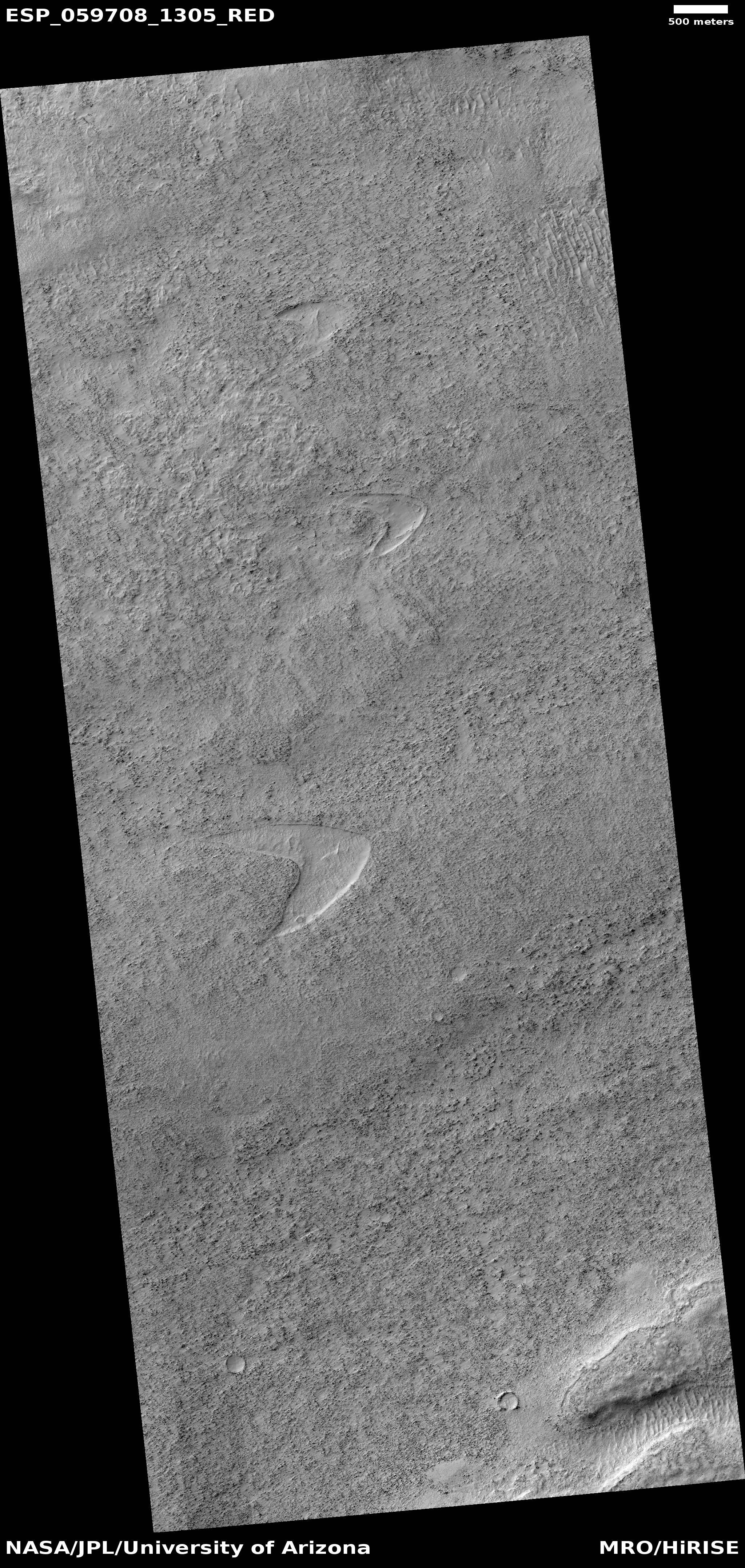
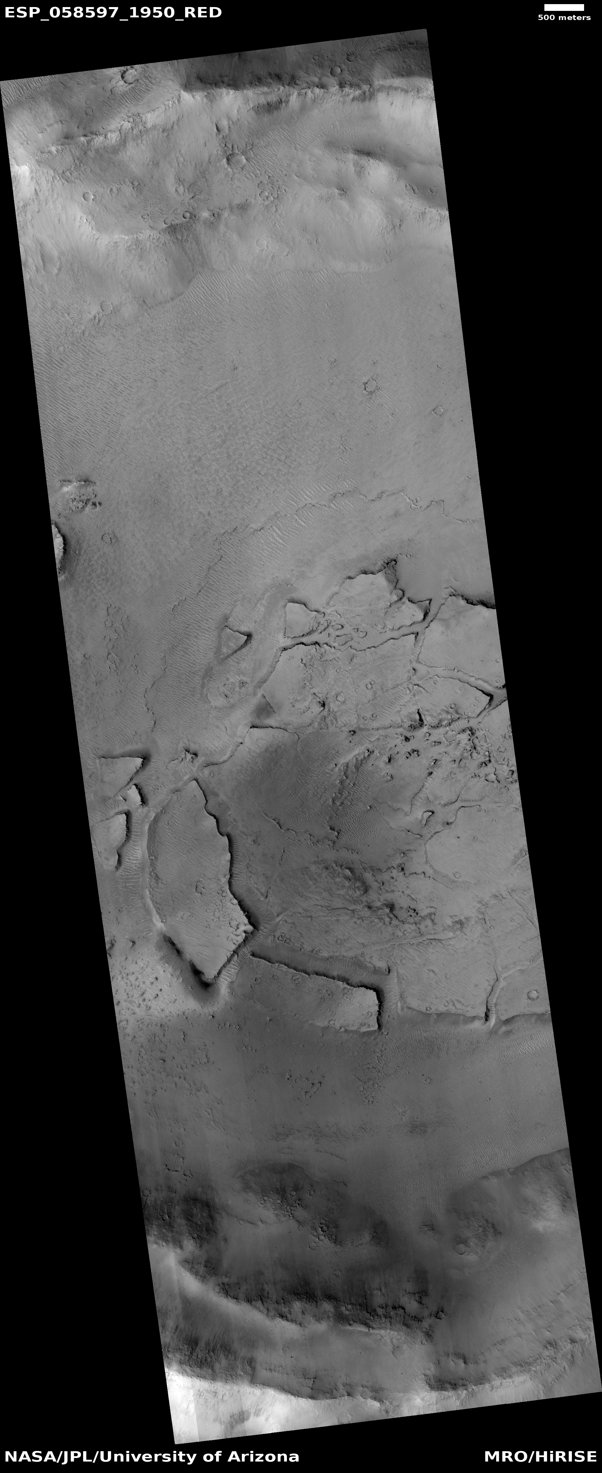
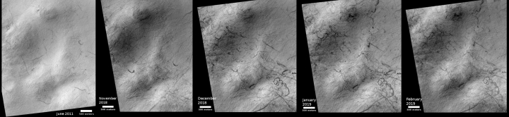
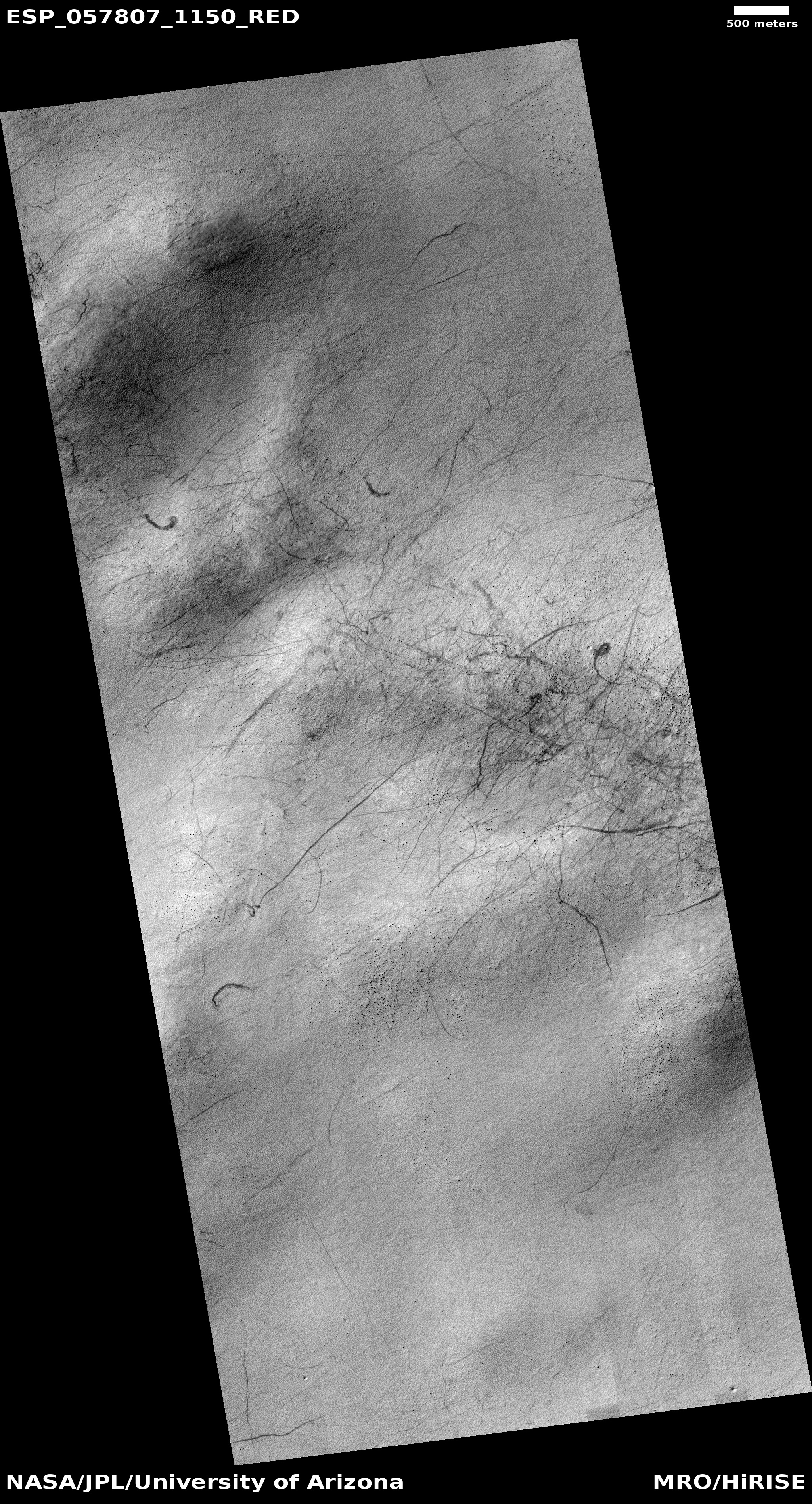
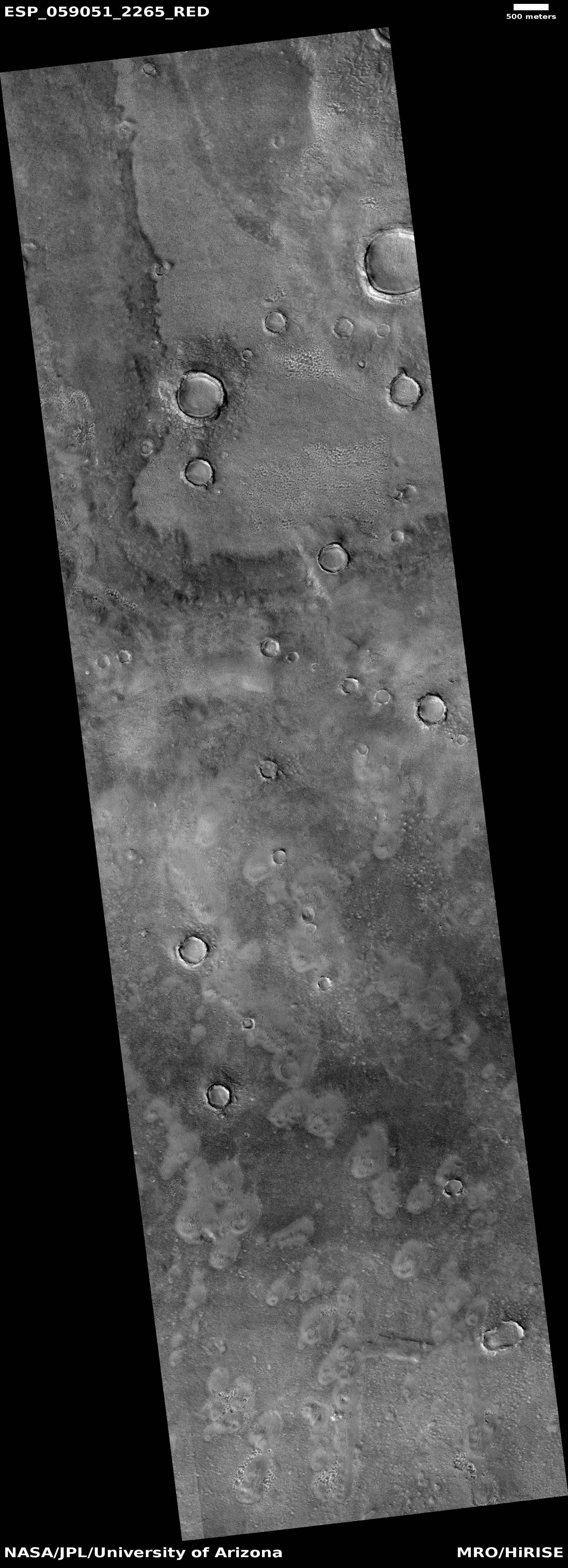
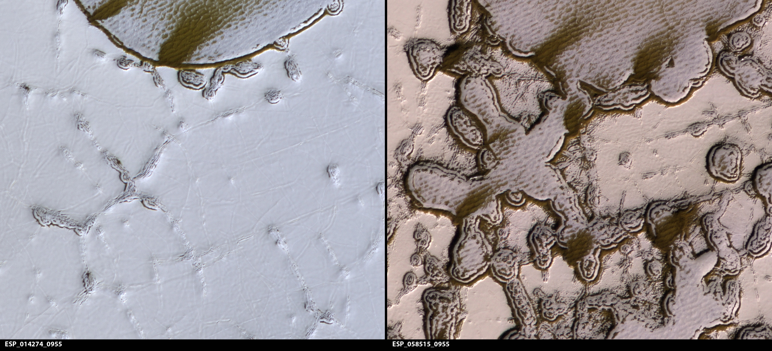
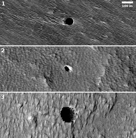
In order to understand how this dry ice cap comes and goes, scientists have been using the high resolution camera of Mars Reconnaissance Orbiter (MRO) to repeatedly monitor some of the same locations in these sand seas to track the seasonal changes. In my routine review of the new images downloaded from MRO in May, I came across more than a dozen such images, all of which had been requested by Dr. Candice Hansen of the Planetary Science Institute in Tucson, Arizona, and taken just as the Martian winter was ending and spring was beginning. As she explained to me, “The images I’m requesting now follow-up on many of our earlier study sites so that we can study interannual variability. We’re also looking at more places to get a sense of what is similar/different depending on where you are.”
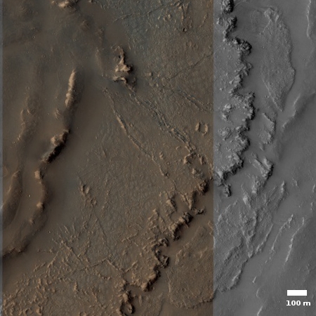
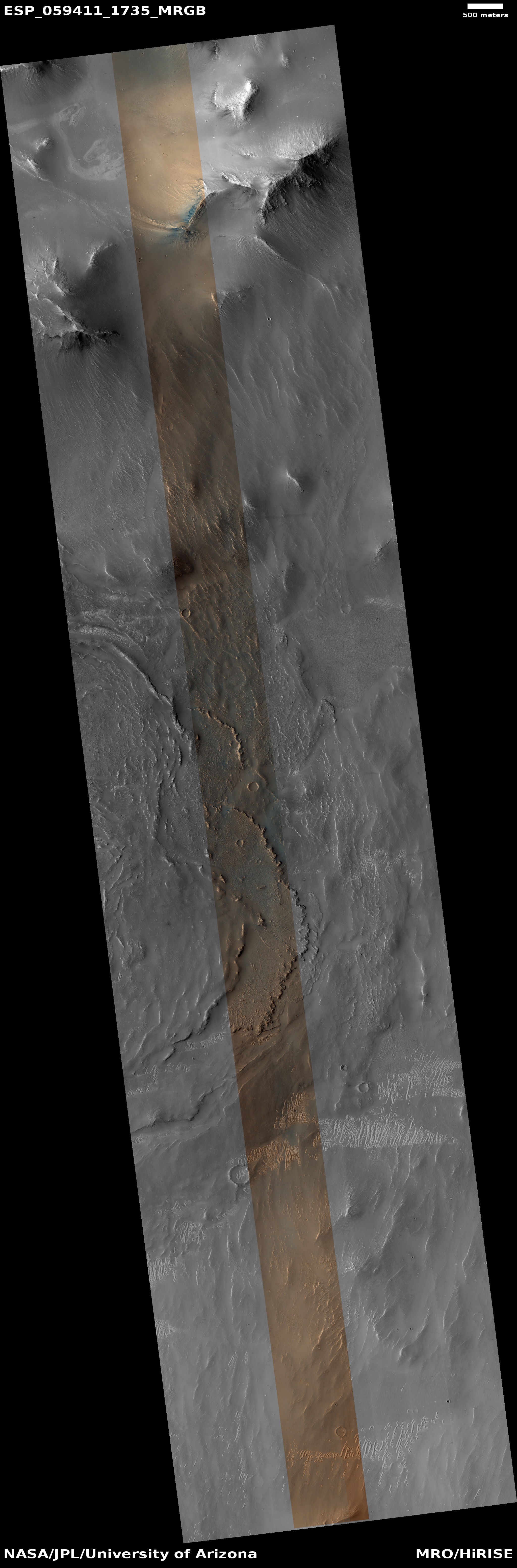
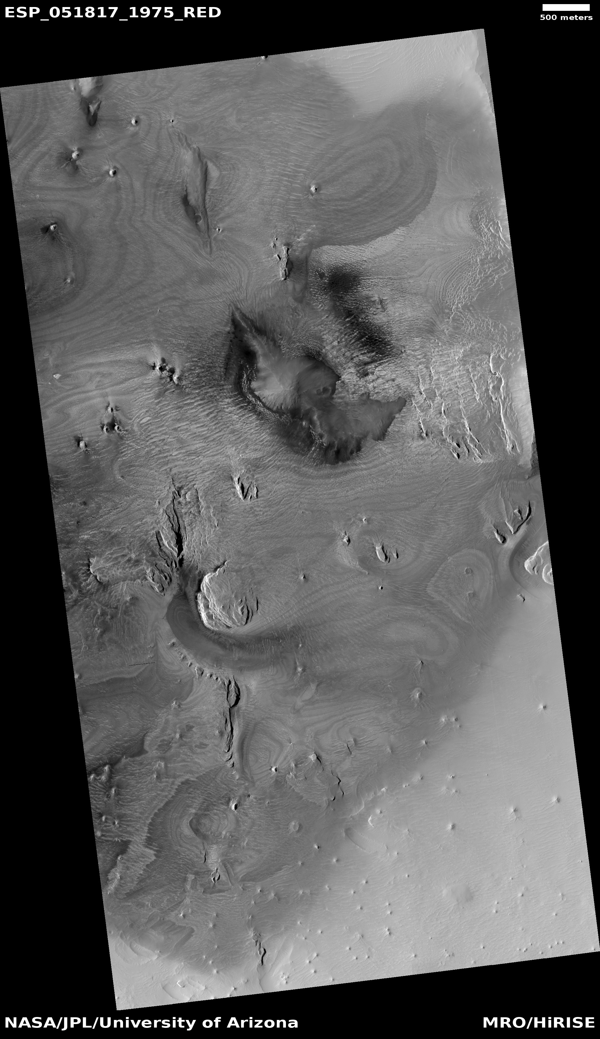
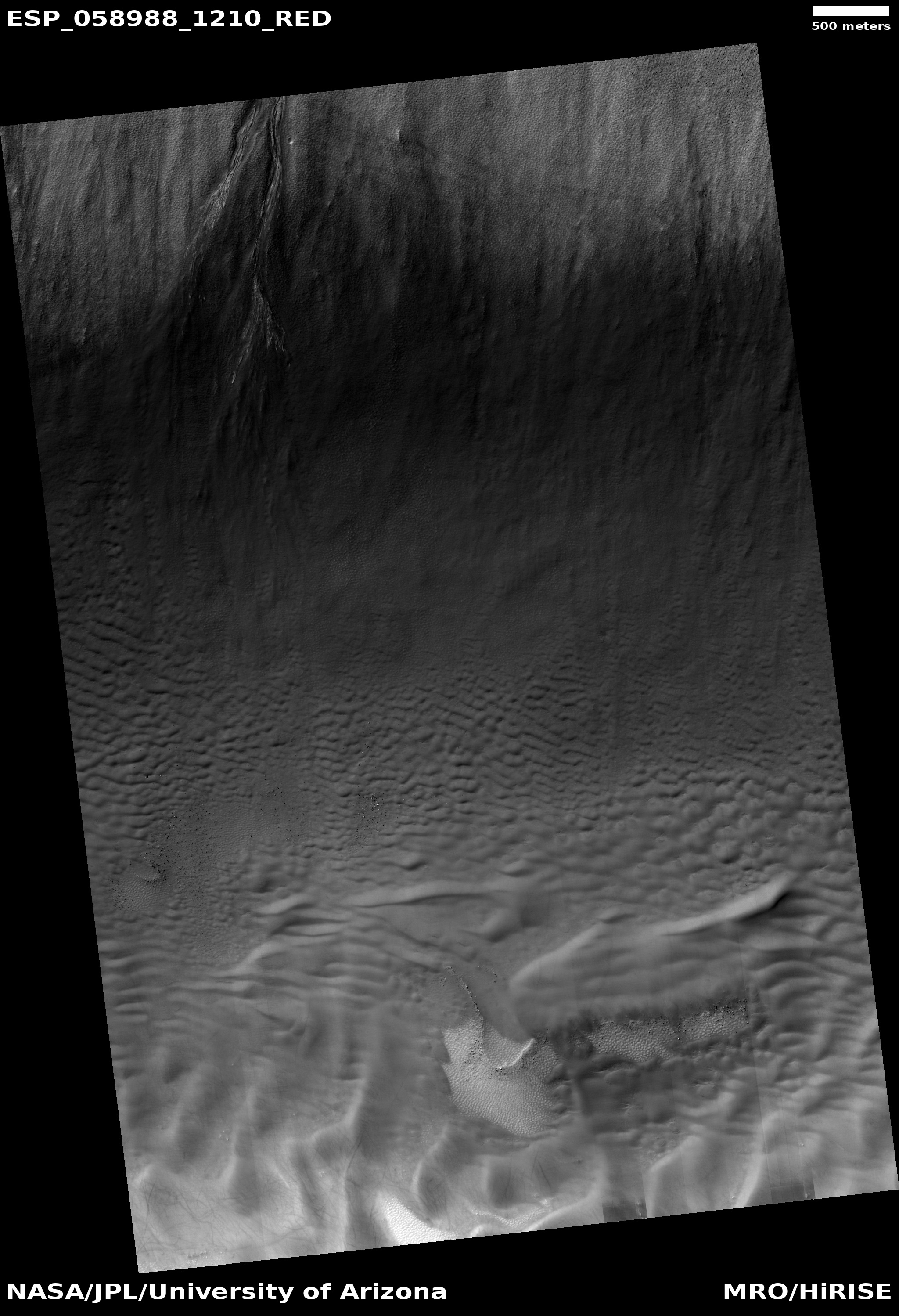
Below are two of these recent images, showing one example of the springtime changes that can be seen on these dunes.
» Read more


